Narrow Results By
Boundary Road and Hastings Street vicinity
https://search.heritageburnaby.ca/link/archivedescription35447
- Repository
- City of Burnaby Archives
- Date
- 1915 (date of original), copied 1986
- Collection/Fonds
- Burnaby Historical Society fonds
- Description Level
- Item
- Physical Description
- 1 photograph : b&w ; 12.7 x 17.8 cm print
- Scope and Content
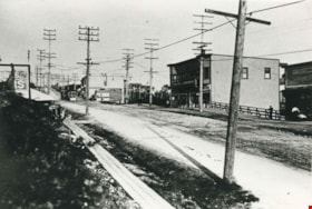
- Photograph taken in Vancouver on Hastings Street looking east toward Burnaby and Boundary Road. The Hastings Street British Columbia Electric Railway (BCER) cars can be seen labouring up the hill.
- Repository
- City of Burnaby Archives
- Date
- 1915 (date of original), copied 1986
- Collection/Fonds
- Burnaby Historical Society fonds
- Subseries
- Pioneer Tales subseries
- Physical Description
- 1 photograph : b&w ; 12.7 x 17.8 cm print
- Description Level
- Item
- Record No.
- 204-305
- Access Restriction
- No restrictions
- Reproduction Restriction
- No restrictions
- Accession Number
- BHS1988-03
- Scope and Content
- Photograph taken in Vancouver on Hastings Street looking east toward Burnaby and Boundary Road. The Hastings Street British Columbia Electric Railway (BCER) cars can be seen labouring up the hill.
- Media Type
- Photograph
- Photographer
- Eaton, Dr. Carl
- Notes
- Title based on contents of photograph
- Geographic Access
- Boundary Road
- Hastings Street
- Historic Neighbourhood
- Vancouver Heights (Historic Neighbourhood)
- Planning Study Area
- Willingdon Heights Area
Images
Esmond and Hastings Vicinity
https://search.heritageburnaby.ca/link/archivedescription35448
- Repository
- City of Burnaby Archives
- Date
- [1915] (date of original), copied 1986
- Collection/Fonds
- Burnaby Historical Society fonds
- Description Level
- Item
- Physical Description
- 1 photograph : b&w ; 12.7 x 17.8 cm print
- Scope and Content
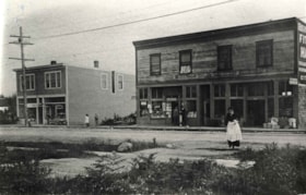
- Photograph of the Arthur Wall Block (right), 3722 Hastings Street, at the corner of Hastings Street and Boundary Road, and the Matheson Block (left), 3730 Hastings Street. The British Columbia Electric Railway (BCER) Hastings car can be seen.
- Repository
- City of Burnaby Archives
- Date
- [1915] (date of original), copied 1986
- Collection/Fonds
- Burnaby Historical Society fonds
- Subseries
- Pioneer Tales subseries
- Physical Description
- 1 photograph : b&w ; 12.7 x 17.8 cm print
- Description Level
- Item
- Record No.
- 204-306
- Access Restriction
- No restrictions
- Reproduction Restriction
- No restrictions
- Accession Number
- BHS1988-03
- Scope and Content
- Photograph of the Arthur Wall Block (right), 3722 Hastings Street, at the corner of Hastings Street and Boundary Road, and the Matheson Block (left), 3730 Hastings Street. The British Columbia Electric Railway (BCER) Hastings car can be seen.
- Media Type
- Photograph
- Photographer
- Eaton, Dr. Carl
- Notes
- Title based on contents of photograph
- Geographic Access
- Hastings Street
- Street Address
- 3722 Hastings Street
- 3730 Hastings Street
- Historic Neighbourhood
- Vancouver Heights (Historic Neighbourhood)
- Planning Study Area
- Willingdon Heights Area
Images
Hastings Street
https://search.heritageburnaby.ca/link/archivedescription35429
- Repository
- City of Burnaby Archives
- Date
- 1915 (date of original), copied 1986
- Collection/Fonds
- Burnaby Historical Society fonds
- Description Level
- Item
- Physical Description
- 1 photograph : b&w ; 12.7 x 17.8 cm print
- Scope and Content
- Photograph of the south side of Hastings Street at MacDonald Avenue; business blocks located at 3986 and 3952 Hastings Street.
- Repository
- City of Burnaby Archives
- Date
- 1915 (date of original), copied 1986
- Collection/Fonds
- Burnaby Historical Society fonds
- Subseries
- Pioneer Tales subseries
- Physical Description
- 1 photograph : b&w ; 12.7 x 17.8 cm print
- Description Level
- Item
- Record No.
- 204-287
- Access Restriction
- No restrictions
- Reproduction Restriction
- No restrictions
- Accession Number
- BHS1988-03
- Scope and Content
- Photograph of the south side of Hastings Street at MacDonald Avenue; business blocks located at 3986 and 3952 Hastings Street.
- Subjects
- Buildings - Commercial - Stores
- Media Type
- Photograph
- Photographer
- Eaton, Dr. Carl
- Notes
- Title based on contents of photograph
- Geographic Access
- Hastings Street
- Street Address
- 3952 Hastings Street
- 3986 Hastings Street
- Historic Neighbourhood
- Vancouver Heights (Historic Neighbourhood)
- Planning Study Area
- Willingdon Heights Area
Images
Pioneer home
https://search.heritageburnaby.ca/link/museumdescription9713
- Repository
- Burnaby Village Museum
- Date
- [September 1969]
- Collection/Fonds
- Burnaby Village Museum Photograph collection
- Description Level
- Item
- Physical Description
- 1 photograph : col. ; 9.0 x 9.0 cm
- Scope and Content
- Photograph of a pioneer home, built in 1910 at the corner of Gilmore Avenue and Parker Street.
- Repository
- Burnaby Village Museum
- Collection/Fonds
- Burnaby Village Museum Photograph collection
- Description Level
- Item
- Physical Description
- 1 photograph : col. ; 9.0 x 9.0 cm
- Material Details
- Handwritten text in black ink on back of photograph reads: "Pioneer Home. built in 1910. / corner of Gilmour Ave & Parker st / - Burnaby. 2. B.C. / This picture was taken in Sept. / 1969. Resident at that time / Bill Lambe. auto-worker." Handwritten text in blue ink on back of photograph reads: "(A Bingham / March 11 1971)".
- Scope and Content
- Photograph of a pioneer home, built in 1910 at the corner of Gilmore Avenue and Parker Street.
- Other Title Information
- Title based on contents of photograph.
- Accession Code
- HV976.46.6
- Access Restriction
- No restrictions
- Reproduction Restriction
- May be restricted by third party rights
- Date
- [September 1969]
- Media Type
- Photograph
- Historic Neighbourhood
- Vancouver Heights (Historic Neighbourhood)
- Planning Study Area
- Willingdon Heights Area
- Scan Resolution
- 600
- Scan Date
- 2023-06-20
- Photographer
- Bingham, Alfred "Alf"
- Notes
- Title based on contents of photograph
Images
Toothpick stump at Gilmore Ave and Parker St
https://search.heritageburnaby.ca/link/museumdescription737
- Repository
- Burnaby Village Museum
- Date
- [1924]
- Collection/Fonds
- Burnaby Village Museum Photograph collection
- Description Level
- Item
- Physical Description
- 1 photograph : b&w ; 11.5 x 6.9 cm
- Scope and Content
- Photograph of a man sitting near the top of a giant tree stump at Willingdon Heights. According to an accompanying note prepared by Burnaby Village Museum and supported by the inscription on the photograph, the stump was at the southeast corner of Parker Street and Gilmore Avenue in the Willingdon…
- Repository
- Burnaby Village Museum
- Collection/Fonds
- Burnaby Village Museum Photograph collection
- Description Level
- Item
- Physical Description
- 1 photograph : b&w ; 11.5 x 6.9 cm
- Material Details
- Annotations on the front of the photograph read: "Gilmour & Parker. South. 1924" and "Toothpick Stump." An annotation on the back of the photograph reads, "Wide - 98 inch at TOB [sic - top] / Ground level 25 feet / SE corner of Parker & Gilmour / March 11 1971 / A Bingham."
- Scope and Content
- Photograph of a man sitting near the top of a giant tree stump at Willingdon Heights. According to an accompanying note prepared by Burnaby Village Museum and supported by the inscription on the photograph, the stump was at the southeast corner of Parker Street and Gilmore Avenue in the Willingdon Heights district.
- Subjects
- Plants - Trees
- Names
- Bingham, Alfred "Alf"
- Geographic Access
- Parker Street
- Gilmore Avenue
- Accession Code
- HV976.46.3
- Access Restriction
- No restrictions
- Reproduction Restriction
- No known restrictions
- Date
- [1924]
- Media Type
- Photograph
- Historic Neighbourhood
- Vancouver Heights (Historic Neighbourhood)
- Planning Study Area
- Willingdon Heights Area
- Scan Resolution
- 600
- Scan Date
- 2023-06-20
- Photographer
- Bingham, Alfred "Alf"
- Notes
- Title based on caption of photograph
Images
Tree stump at Willingdon Heights
https://search.heritageburnaby.ca/link/museumdescription736
- Repository
- Burnaby Village Museum
- Date
- [1924]
- Collection/Fonds
- Burnaby Village Museum Photograph collection
- Description Level
- Item
- Physical Description
- 1 photograph : sepia ; 6.9 x 11.5 cm
- Scope and Content
- Photograph of a woman standing by a giant tree stump in Willingdon Heights. According to an accompanying note prepared by BVM and supported by the inscription on the photograph, the stump was at the southeast corner of Parker Street and Gilmore Avenue in the Willingdon Heights district. It is likel…
- Repository
- Burnaby Village Museum
- Collection/Fonds
- Burnaby Village Museum Photograph collection
- Description Level
- Item
- Physical Description
- 1 photograph : sepia ; 6.9 x 11.5 cm
- Material Details
- Annotations on the front of the photograph read: "Gilmour & Parker St South 1924" and "Willingdon Heights." An annotation on the back of the photograph reads, "25 feet at ground level / (A Bingham) March 11 1971." Stamped on the back of the photo: "457."
- Scope and Content
- Photograph of a woman standing by a giant tree stump in Willingdon Heights. According to an accompanying note prepared by BVM and supported by the inscription on the photograph, the stump was at the southeast corner of Parker Street and Gilmore Avenue in the Willingdon Heights district. It is likely that the woman in the picture is Ada Bingham, wife of Alfred Bingham who took the picture.
- Subjects
- Plants - Trees
- Names
- Bingham, Mary Ada "Ada"
- Geographic Access
- Parker Street
- Gilmore Avenue
- Accession Code
- HV976.46.2
- Access Restriction
- No restrictions
- Reproduction Restriction
- No known restrictions
- Date
- [1924]
- Media Type
- Photograph
- Historic Neighbourhood
- Vancouver Heights (Historic Neighbourhood)
- Planning Study Area
- Willingdon Heights Area
- Scan Resolution
- 600
- Scan Date
- 2023-06-20
- Photographer
- Bingham, Alfred "Alf"
- Notes
- Title based on contents of photograph
Images
Vancouver Heights
https://search.heritageburnaby.ca/link/archivedescription35426
- Repository
- City of Burnaby Archives
- Date
- 1913 (date of original), copied 1986
- Collection/Fonds
- Burnaby Historical Society fonds
- Description Level
- Item
- Physical Description
- 1 photograph : b&w ; 12.7 x 17.8 cm print
- Scope and Content
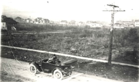
- Photograph of a general view of Vancouver Heights. The car is on Ingleton Avenue near the corner of Triumph Street, looking east to MacDonald Avenue and Gilmore Avenue. Vancouver Heights Presbyterian Church and Gilmore Avenue School can be seen in the background at the right. The photograph is by D…
- Repository
- City of Burnaby Archives
- Date
- 1913 (date of original), copied 1986
- Collection/Fonds
- Burnaby Historical Society fonds
- Subseries
- Pioneer Tales subseries
- Physical Description
- 1 photograph : b&w ; 12.7 x 17.8 cm print
- Description Level
- Item
- Record No.
- 204-284
- Access Restriction
- No restrictions
- Reproduction Restriction
- No restrictions
- Accession Number
- BHS1988-03
- Scope and Content
- Photograph of a general view of Vancouver Heights. The car is on Ingleton Avenue near the corner of Triumph Street, looking east to MacDonald Avenue and Gilmore Avenue. Vancouver Heights Presbyterian Church and Gilmore Avenue School can be seen in the background at the right. The photograph is by Dr. Carl Eaton, teacher, principal and later family physician.
- Media Type
- Photograph
- Photographer
- Eaton, Dr. Carl
- Notes
- Title based on contents of photograph
- Geographic Access
- Ingleton Avenue
- MacDonald Avenue
- Triumph Street
- Historic Neighbourhood
- Vancouver Heights (Historic Neighbourhood)
- Planning Study Area
- Willingdon Heights Area

![Esmond and Hastings Vicinity, [1915] (date of original), copied 1986 thumbnail](/media/hpo/_Data/_Archives_Images/_Unrestricted/204/204-306.jpg?width=280)

![Pioneer home, [September 1969] thumbnail](/media/hpo/_Data/_BVM_Images/1976/1976_0046_0006_001.jpg?width=280)
![Toothpick stump at Gilmore Ave and Parker St, [1924] thumbnail](/media/hpo/_Data/_BVM_Images/1976/1976_0046_0003_001.jpg?width=280)
![Tree stump at Willingdon Heights, [1924] thumbnail](/media/hpo/_Data/_BVM_Images/1976/1976_0046_0002_001.jpg?width=280)
