Narrow Results By

D.C. Patterson House
https://search.heritageburnaby.ca/link/landmark517
- Repository
- Burnaby Heritage Planning
- Description
- The D.C. Patterson House is a one and one-half storey plus basement wood-frame Edwardian era residence with a full-width front verandah and symmetrical saddlebag dormers. It is located adjacent to a ravine park and is part of the Winston Gate development.
- Associated Dates
- 1910
- Formal Recognition
- Heritage Designation, Community Heritage Register
- Other Names
- Dugald & Frances Patterson House
- Street View URL
- Google Maps Street View
- Repository
- Burnaby Heritage Planning
- Other Names
- Dugald & Frances Patterson House
- Geographic Access
- 12th Avenue
- Associated Dates
- 1910
- Formal Recognition
- Heritage Designation, Community Heritage Register
- Enactment Type
- Bylaw No. 10062
- Enactment Date
- 11/07/1994
- Description
- The D.C. Patterson House is a one and one-half storey plus basement wood-frame Edwardian era residence with a full-width front verandah and symmetrical saddlebag dormers. It is located adjacent to a ravine park and is part of the Winston Gate development.
- Heritage Value
- This house is significant for its associations with the Patterson family, who were early Burnaby pioneers. Dugald Campbell Patterson (1860-1931) and Frances Mabel Patterson (1872-1960) arrived in 1894 and settled in the Central Park district. In 1910, they relocated to the Edmonds District and built this family residence on Edmonds Street near Kingsway. The Pattersons were community minded citizens who served Burnaby through their involvement with local municipal affairs and politics. Dugald Patterson served as a School Trustee in 1912-13 and was one of the first residents to lobby council to preserve the local ravines as parks. The family name is remembered and honoured by the naming of Patterson Avenue and the Patterson SkyTrain Station located in the Metrotown area. Additionally, the D.C. Patterson House is significant as a fine example of a vernacular Edwardian era family house. The typical design of the Patterson House was taken from an Edwardian era pattern book, and demonstrates how standardized plans were commonly used by local owners and builders to expedite the construction process. This house has survived in an excellent state of preservation. Although moved from its original site, it remains as an intact representation of a middle-class Burnaby residence of the Edwardian era.
- Defining Elements
- Key elements that define the heritage character of the D.C. Patterson House include its: - vernacular residential form, scale and massing as exemplified by its one and one-half storey plus basement height, front gabled roof with hipped return over front verandah, symmetrical saddlebag dormers and rectangular, side hall plan with an asymmetrical front entry - typical Edwardian era construction features such as the deep boxed eaves, lapped wooden siding and cedar shingle roofing - projecting front gable peak, clad in decorative random-coursed square shingles, with eave brackets under and a louvered attic vent - projecting elements on the main floor including a square bay on the east side and a semi-octagonal bay to the west side - full-width open front verandah with irregularly-spaced square columns - closed balustrades with drainage scuppers on the front verandah and rear side porch - regular fenestration, including double hung 1-over-1 wooden-sash windows with proportionately smaller upper sash, triple assembly of windows in the front gable, and leaded glass in main floor front window - original front door with inset bevelled glass light
- Historic Neighbourhood
- Edmonds (Historic Neighbourhood)
- Planning Study Area
- Stride Hill Area
- Function
- Primary Historic--Single Dwelling
- Primary Current--Single Dwelling
- Community
- Burnaby
- Cadastral Identifier
- 003-008-321
- Boundaries
- The D.C. Patterson House is comprised of a single residential lot located at 7106 Eighteenth Avenue, Burnaby.
- Area
- 5176
- Contributing Resource
- Building
- Ownership
- Private
- Street Address
- 7106 18th Avenue
- Street View URL
- Google Maps Street View
Images


Murphy Residence
https://search.heritageburnaby.ca/link/landmark623
- Repository
- Burnaby Heritage Planning
- Description
- Residential building.
- Associated Dates
- 1913
- Street View URL
- Google Maps Street View
- Repository
- Burnaby Heritage Planning
- Geographic Access
- Gilley Avenue
- Associated Dates
- 1913
- Description
- Residential building.
- Heritage Value
- This bungalow was built for Joshua Robert Murphy (1861-1920), a mill superintendent, and his wife Elizabeth Ann (née Delby, 1871-1956). The Murphys lived in the house at least until Joshua’s death in 1920. A bellcast side gabled roof and central bellcast dormer accentuate the sophisticated construction. A full width verandah supported by tapered columns on tapered granite piers graces the front of the house. Originally, the dormer held an open sleeping porch with a segmental arch supported by short tapered columns matching those below. Despite this alteration, the house is otherwise in substantially original condition.
- Locality
- Alta Vista
- Historic Neighbourhood
- Alta Vista (Historic Neighbourhood)
- Planning Study Area
- Stride Hill Area
- Area
- 1567.37
- Contributing Resource
- Building
- Ownership
- Private
- Street Address
- 8610 Gilley Avenue
- Street View URL
- Google Maps Street View
Images


Stride Hill Neighbourhood
https://search.heritageburnaby.ca/link/landmark846
- Repository
- Burnaby Heritage Planning
- Associated Dates
- 1955-2008
- Heritage Value
- The residential areas that are located within the Stride Hill Neighbourhood were primarily developed in the 1950s during Burnaby's post-war building boom. The area lying to the south of Byrne Creek Ravine Park was used as a municipal garbage dump until the 1960s and as a landfill site for yard waste disposal until the early 1990s at which point the area was incorporated into the Edmonds Town Centre Plan and the land was made into park and open space.
- Historic Neighbourhood
- Edmonds (Historic Neighbourhood)
- Planning Study Area
- Stride Hill Area
Images

Middlegate
https://search.heritageburnaby.ca/link/archivedescription36164
- Repository
- City of Burnaby Archives
- Date
- 1912
- Collection/Fonds
- Burnaby Historical Society fonds
- Description Level
- Item
- Physical Description
- 1 photograph : sepia ; 8 x 14 cm
- Scope and Content
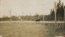
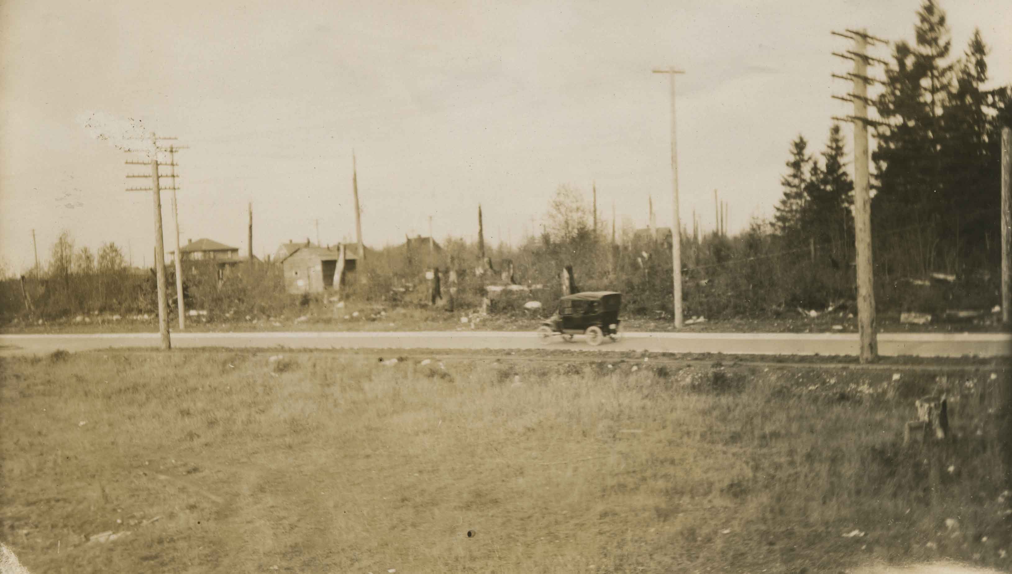
- Photograph of a touring car driving along Kingsway between the Edmonds junction and Royal Oak Avenue, in the area known as Middlegate.
- Repository
- City of Burnaby Archives
- Date
- 1912
- Collection/Fonds
- Burnaby Historical Society fonds
- Physical Description
- 1 photograph : sepia ; 8 x 14 cm
- Description Level
- Item
- Record No.
- 230-009
- Access Restriction
- No restrictions
- Reproduction Restriction
- No known restrictions
- Accession Number
- BHS1989-22
- Scope and Content
- Photograph of a touring car driving along Kingsway between the Edmonds junction and Royal Oak Avenue, in the area known as Middlegate.
- Subjects
- Geographic Features - Roads
- Media Type
- Photograph
- Notes
- Title based on contents of photograph
- Geographic Access
- Kingsway
- Historic Neighbourhood
- Edmonds (Historic Neighbourhood)
- Planning Study Area
- Stride Avenue Area
- Stride Hill Area
Images
Ron McLean Park
https://search.heritageburnaby.ca/link/archivedescription79722
- Repository
- City of Burnaby Archives
- Date
- September 16, 1976
- Collection/Fonds
- Burnaby Public Library Contemporary Visual Archive Project
- Description Level
- Item
- Physical Description
- 1 photograph : b&w ; 11 x 16 cm mounted on cardboard
- Scope and Content
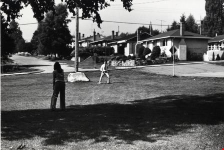
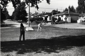
- Photograph shows two people playing with a frisbee in Ron McLean Park near the corner of Hedley Avenue and Clinton Street.
- Repository
- City of Burnaby Archives
- Date
- September 16, 1976
- Collection/Fonds
- Burnaby Public Library Contemporary Visual Archive Project
- Physical Description
- 1 photograph : b&w ; 11 x 16 cm mounted on cardboard
- Description Level
- Item
- Record No.
- 556-402
- Access Restriction
- No restrictions
- Reproduction Restriction
- Reproduce for fair dealing purposes only
- Accession Number
- 2013-13
- Scope and Content
- Photograph shows two people playing with a frisbee in Ron McLean Park near the corner of Hedley Avenue and Clinton Street.
- Media Type
- Photograph
- Photographer
- Ross, Martha
- Notes
- Scope note taken directly from BPL photograph description.
- 1 b&w copy negative : 10 x 12.5 cm accompanying
- Geographic Access
- Hedley Avenue
- Street Address
- 7820 Hedley Avenue
- Planning Study Area
- Stride Hill Area
Images