Narrow Results By
Subject
- Advertising Medium - Signs and Signboards 2
- Aerial Photographs 2
- Animals - Cats 1
- Animals - Dogs 3
- Animals - Horses 1
- Arts - Paintings 1
- Buildings 1
- Buildings - Civic 1
- Buildings - Civic - Fire Halls 1
- Buildings - Commercial 6
- Buildings - Commercial - Drive-In Theatres 1
- Buildings - Commercial - General Stores 2
Creator
- Barrowclough, G.A. 1
- Barrowclough, George Alfred 1
- Brown, William Thomas 3
- Burnaby Village Museum 1
- Code, Norah 1
- Digney, Andy 5
- Digney, Ernest Frank "Dig" 5
- Hill, Albert James 1
- Joesph Henry Bowman 1
- King, Basil 1
- Libby, Ralph 2
- Printed on back of postcard: "Pub. by Living Colour Advertising Agencies, 809 21st St., New West'r, BC - 526-6612" and "Made in Canada / Dexter Color, Canada Ltd., Cornwall, Ontario" 1

Central Park Neighbourhood
https://search.heritageburnaby.ca/link/landmark723
- Repository
- Burnaby Heritage Planning
- Associated Dates
- 1891-1904
- Heritage Value
- Central Park was one of the first and fastest-growing communities in Burnaby. Located along the electric tram line and the Vancouver Road (Kingsway), it was also chosen for a government settlement project referred to as the Central Park Small Holdings. The lands held by the Provincial Government were subdivided and sold around 1894 and by 1899 the settlement was large enough to warrant the construction of an Anglican Church there.
- Historic Neighbourhood
- Central Park (Historic Neighbourhood)
- Planning Study Area
- Maywood Area
Images


Central Park Neighbourhood
https://search.heritageburnaby.ca/link/landmark751
- Repository
- Burnaby Heritage Planning
- Associated Dates
- 1905-1924
- Heritage Value
- In 1906, Maxwell Smith, President of the Central Park Farmer's Institute gave a speech in which he commented on the growth of this district and its ideal location during the boom years after 1905. He said: "Central Park is destined to become the epicentre of a great commercial metropolis, when Vancouver and New Westminster will have both expanded and prospered until they meet and fill up the intervening distances with residences of a new city, greater than few can now imagine, even in their wildest flights of fancy...we are proud of the two cities that lie on either side of us but they are, but mere hamlets compared with the great city that is to be on this peninsula. The time is coming when there will be one vast city, one commercial metropolis, and Central Park will be the heart of it."
- Historic Neighbourhood
- Central Park (Historic Neighbourhood)
- Planning Study Area
- Maywood Area
Images


Garden Village Neighbourhood
https://search.heritageburnaby.ca/link/landmark800
- Repository
- Burnaby Heritage Planning
- Associated Dates
- 1955-2008
- Heritage Value
- Bounded by Moscrop Street to the north, Kingsway and Grange to the south, Willingdon to the east and Boundary Road to the west, the Garden Village Neighbourhood is characterised as a primarily residential area that is well-served due to its proximity to commercial, park and business centres. The north-east corner of the neighbourhood is a typical 1950s subdivision of mostly single family homes located on an irregular street pattern, while the remaining areas saw some transition to multi-family housing types throughout the 1970s and up to the current time.
- Historic Neighbourhood
- Central Park (Historic Neighbourhood)
- Planning Study Area
- Garden Village Area
Images


Maywood Neighbourhood
https://search.heritageburnaby.ca/link/landmark801
- Repository
- Burnaby Heritage Planning
- Associated Dates
- 1955-2008
- Heritage Value
- Burnaby's Maywood Neighbourhood consists of the Metrotown Town Centre - one of four Town Centres in the City. Metrotown is one of the region's most developed and fastest growing centres. It is served by the first SkyTrain line developed in the mid-1980s and anchored by B.C.'s largest shopping and entertainment complex. As an older centre that has progressively added new developments over the years, Metrotown offers a range of housing types and tenures from three-storey walk-up apartments to modern residential towers.
- Historic Neighbourhood
- Central Park (Historic Neighbourhood)
- Planning Study Area
- Maywood Area
Images


Marlborough Neighbourhood
https://search.heritageburnaby.ca/link/landmark802
- Repository
- Burnaby Heritage Planning
- Associated Dates
- 1955-2008
- Heritage Value
- The Marlborough Neighbourhood is another residential area that was witness to rapid growth and subdivision during the 1950s and 1960s, creating primarily single-family housing stock. In the 1970s and 1980s, as the commercial district around Kingsway grew, so too did higher density housing projects such as townhomes and condominiums.
- Historic Neighbourhood
- Central Park (Historic Neighbourhood)
- Planning Study Area
- Marlborough Area
Images


Oakalla Neighbourhood
https://search.heritageburnaby.ca/link/landmark804
- Repository
- Burnaby Heritage Planning
- Associated Dates
- 1955-2008
- Heritage Value
- The phasing out and demolition of the Oakalla Prison farm allowed for the planned development of the Oakalla Neighbourhood in the 1980s. By 1991, the City of Burnaby had adopted the Oakalla Development Plan which called for the transfer of land to the Deer Lake Park reserve as well as the creation of a new residential area consisting of multi-family housing types.
- Historic Neighbourhood
- Central Park (Historic Neighbourhood)
- Planning Study Area
- Oakalla Area
Images

![Dallamore Family Home, [1900] (date of original), copied 1986 thumbnail](/media/hpo/_Data/_Archives_Images/_Unrestricted/204/204-130.jpg?width=280)
Dallamore Family Home
https://search.heritageburnaby.ca/link/archivedescription35273
- Repository
- City of Burnaby Archives
- Date
- [1900] (date of original), copied 1986
- Collection/Fonds
- Burnaby Historical Society fonds
- Description Level
- Item
- Physical Description
- 1 photograph : b&w ; 12.7 x 17.8 cm print
- Scope and Content
- Photograph of the Dallamore family home on Silver Avenue near the B.C. Electric interurban tracks. Grace Dallamore's grandparents, the Harmers, and her parents, the Dallamores, owned this entire block of land. This house was built ca. 1896 by F.L. Harmer, a carpenter who settled in Burnaby in 189…
- Repository
- City of Burnaby Archives
- Date
- [1900] (date of original), copied 1986
- Collection/Fonds
- Burnaby Historical Society fonds
- Subseries
- Pioneer Tales subseries
- Physical Description
- 1 photograph : b&w ; 12.7 x 17.8 cm print
- Description Level
- Item
- Record No.
- 204-130
- Access Restriction
- No restrictions
- Reproduction Restriction
- No known restrictions
- Accession Number
- BHS1988-03
- Scope and Content
- Photograph of the Dallamore family home on Silver Avenue near the B.C. Electric interurban tracks. Grace Dallamore's grandparents, the Harmers, and her parents, the Dallamores, owned this entire block of land. This house was built ca. 1896 by F.L. Harmer, a carpenter who settled in Burnaby in 1894.
- Media Type
- Photograph
- Notes
- Title based on contents of photograph
- Geographic Access
- Silver Avenue
- Street Address
- 6380 Silver Avenue
- Historic Neighbourhood
- Central Park (Historic Neighbourhood)
- Planning Study Area
- Maywood Area
Images
![Dallamore Family Home, [1900] (date of original), copied 1986 thumbnail](/media/hpo/_Data/_Archives_Images/_Unrestricted/204/204-130.jpg)
![Wilson family home, [190-] (date of original), copied 1986 thumbnail](/media/hpo/_Data/_Archives_Images/_Unrestricted/204/204-641.jpg?width=280)
Wilson family home
https://search.heritageburnaby.ca/link/archivedescription35783
- Repository
- City of Burnaby Archives
- Date
- [190-] (date of original), copied 1986
- Collection/Fonds
- Burnaby Historical Society fonds
- Description Level
- Item
- Physical Description
- 1 photograph : b&w ; 12.7 x 17.8 cm print
- Scope and Content
- Photograph of the Wilson family home on Westminster Road (now 4330 Kingsway) and Wilson Avenue (named after the family) near Central Park. Left to right: unidentified friend, Mrs. Annie Walmsley Wilson (mother), Annie Walmsley (half-sister, born to Annie Wilson and first husband, Samuel Walmsley),…
- Repository
- City of Burnaby Archives
- Date
- [190-] (date of original), copied 1986
- Collection/Fonds
- Burnaby Historical Society fonds
- Subseries
- Pioneer Tales subseries
- Physical Description
- 1 photograph : b&w ; 12.7 x 17.8 cm print
- Description Level
- Item
- Record No.
- 204-641
- Access Restriction
- No restrictions
- Reproduction Restriction
- No restrictions
- Accession Number
- BHS1988-03
- Scope and Content
- Photograph of the Wilson family home on Westminster Road (now 4330 Kingsway) and Wilson Avenue (named after the family) near Central Park. Left to right: unidentified friend, Mrs. Annie Walmsley Wilson (mother), Annie Walmsley (half-sister, born to Annie Wilson and first husband, Samuel Walmsley), and Elsie Wilson (half-sister).
- Subjects
- Buildings - Residential - Houses
- Media Type
- Photograph
- Notes
- Title based on contents of photograph
- Geographic Access
- Westminster Avenue
- Kingsway
- Street Address
- 4330 Kingsway
- Historic Neighbourhood
- Central Park (Historic Neighbourhood)
- Planning Study Area
- Maywood Area
Images
![Wilson family home, [190-] (date of original), copied 1986 thumbnail](/media/hpo/_Data/_Archives_Images/_Unrestricted/204/204-641.jpg)

Kingsway
https://search.heritageburnaby.ca/link/archivedescription35874
- Repository
- City of Burnaby Archives
- Date
- 1900 (date of original), copied 1986
- Collection/Fonds
- Burnaby Historical Society fonds
- Description Level
- Item
- Physical Description
- 1 photograph : b&w ; 12.7 x 17.8 cm print
- Scope and Content
- Photograph of Kingsway (then Westminster Road), looking east from Boundary Road near Central Park. Included in the photograph; Central Park Presbyterian Church, Masonic Hall and Reid's Hall.
- Repository
- City of Burnaby Archives
- Date
- 1900 (date of original), copied 1986
- Collection/Fonds
- Burnaby Historical Society fonds
- Subseries
- Pioneer Tales subseries
- Physical Description
- 1 photograph : b&w ; 12.7 x 17.8 cm print
- Description Level
- Item
- Record No.
- 204-733
- Access Restriction
- No restrictions
- Reproduction Restriction
- No known restrictions
- Accession Number
- BHS1988-03
- Scope and Content
- Photograph of Kingsway (then Westminster Road), looking east from Boundary Road near Central Park. Included in the photograph; Central Park Presbyterian Church, Masonic Hall and Reid's Hall.
- Subjects
- Buildings - Recreational - Community Halls
- Buildings - Religious - Churches
- Geographic Features - Roads
- Media Type
- Photograph
- Notes
- Title based on contents of photograph
- Geographic Access
- Westminster Avenue
- Kingsway
- Street Address
- 3777 Kingsway
- Historic Neighbourhood
- Central Park (Historic Neighbourhood)
- Planning Study Area
- Garden Village Area
Images

![Dow, Fraser and Company Limited, [1900] (date of original), copied 1992 thumbnail](/media/hpo/_Data/_Archives_Images/_Unrestricted/315/315-072.jpg?width=280)
Dow, Fraser and Company Limited
https://search.heritageburnaby.ca/link/archivedescription36717
- Repository
- City of Burnaby Archives
- Date
- [1900] (date of original), copied 1992
- Collection/Fonds
- Burnaby Historical Society fonds
- Description Level
- Item
- Physical Description
- 1 photograph : b&w ; 7.7 x 10.6 cm print
- Scope and Content
- Photograph of the exterior of the Dow, Fraser & Co. Ltd. branch building on McKay Avenue with a man standing outside. Signs on the building state that it is a trust company and advertise real estate, loans, and fire insurance.
- Repository
- City of Burnaby Archives
- Date
- [1900] (date of original), copied 1992
- Collection/Fonds
- Burnaby Historical Society fonds
- Subseries
- Burnaby Centennial Anthology subseries
- Physical Description
- 1 photograph : b&w ; 7.7 x 10.6 cm print
- Description Level
- Item
- Record No.
- 315-072
- Access Restriction
- No restrictions
- Reproduction Restriction
- No known restrictions
- Accession Number
- BHS1994-04
- Scope and Content
- Photograph of the exterior of the Dow, Fraser & Co. Ltd. branch building on McKay Avenue with a man standing outside. Signs on the building state that it is a trust company and advertise real estate, loans, and fire insurance.
- Media Type
- Photograph
- Notes
- Title based on contents of photograph
- Item no. 315-071 is a closeup of this photograph
- Geographic Access
- McKay Avenue
- Willingdon Avenue
- Street Address
- 6100 Willingdon Avenue
- Historic Neighbourhood
- Central Park (Historic Neighbourhood)
- Planning Study Area
- Maywood Area
Images
![Dow, Fraser and Company Limited, [1900] (date of original), copied 1992 thumbnail](/media/hpo/_Data/_Archives_Images/_Unrestricted/315/315-072.jpg)
![Interior of a Kingsway Store, [190-] (date of original), copied 1976 thumbnail](/media/hpo/_Data/_BVM_Images/1976/1976_0153_0001_001.jpg?width=280)
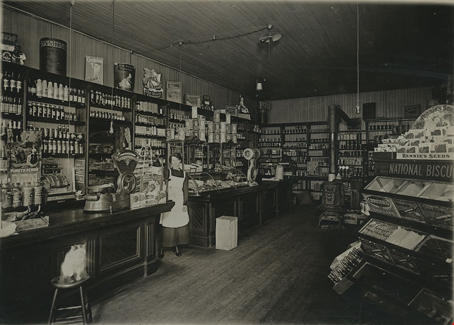
Interior of a Kingsway Store
https://search.heritageburnaby.ca/link/museumdescription842
- Repository
- Burnaby Village Museum
- Date
- [190-] (date of original), copied 1976
- Collection/Fonds
- Burnaby Village Museum Photograph collection
- Description Level
- Item
- Physical Description
- 1 photograph : b&w ; 11.5 x 16.5 cm, mounted on card 17.5 x 22.5 cm
- Scope and Content
- Photograph of the interior of what has been identified by the accession register as a Kingsway Store. Inside the store, there is a woman wearing an apron standing by the counters who has been identified as Mrs. C.B. Button. Behind the counter, a large cash register can be seen. There are weights…
- Repository
- Burnaby Village Museum
- Collection/Fonds
- Burnaby Village Museum Photograph collection
- Description Level
- Item
- Physical Description
- 1 photograph : b&w ; 11.5 x 16.5 cm, mounted on card 17.5 x 22.5 cm
- Scope and Content
- Photograph of the interior of what has been identified by the accession register as a Kingsway Store. Inside the store, there is a woman wearing an apron standing by the counters who has been identified as Mrs. C.B. Button. Behind the counter, a large cash register can be seen. There are weights, various tin cans, Rennie's seeds, Christie's biscuits, etc. on display. There is a cat sitting on a stool in front of the counter. The interior has hardwood finishing on the floor, walls and ceiling.
- Geographic Access
- Kingsway
- Nelson Avenue
- Street Address
- 4920 Kingsway
- Accession Code
- HV976.153.1
- Access Restriction
- No restrictions
- Reproduction Restriction
- May be restricted by third party rights
- Date
- [190-] (date of original), copied 1976
- Media Type
- Photograph
- Historic Neighbourhood
- Central Park (Historic Neighbourhood)
- Planning Study Area
- Marlborough Area
- Scan Resolution
- 600
- Scan Date
- 2023-06-27
- Notes
- Title based on contents of photograph
Images
![Interior of a Kingsway Store, [190-] (date of original), copied 1976 thumbnail](/media/hpo/_Data/_BVM_Images/1976/1976_0153_0001_001.jpg)
![West Burnaby Public School, [between 1900 and 1915] thumbnail](/media/hpo/_Data/_BVM_Images/1990/199900020047.jpg?width=280)
West Burnaby Public School
https://search.heritageburnaby.ca/link/museumdescription1357
- Repository
- Burnaby Village Museum
- Date
- [between 1900 and 1915]
- Collection/Fonds
- Burnaby Village Museum Photograph collection
- Description Level
- Item
- Physical Description
- 1 photograph : b&w ; 9 x 14 cm
- Scope and Content
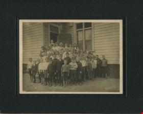
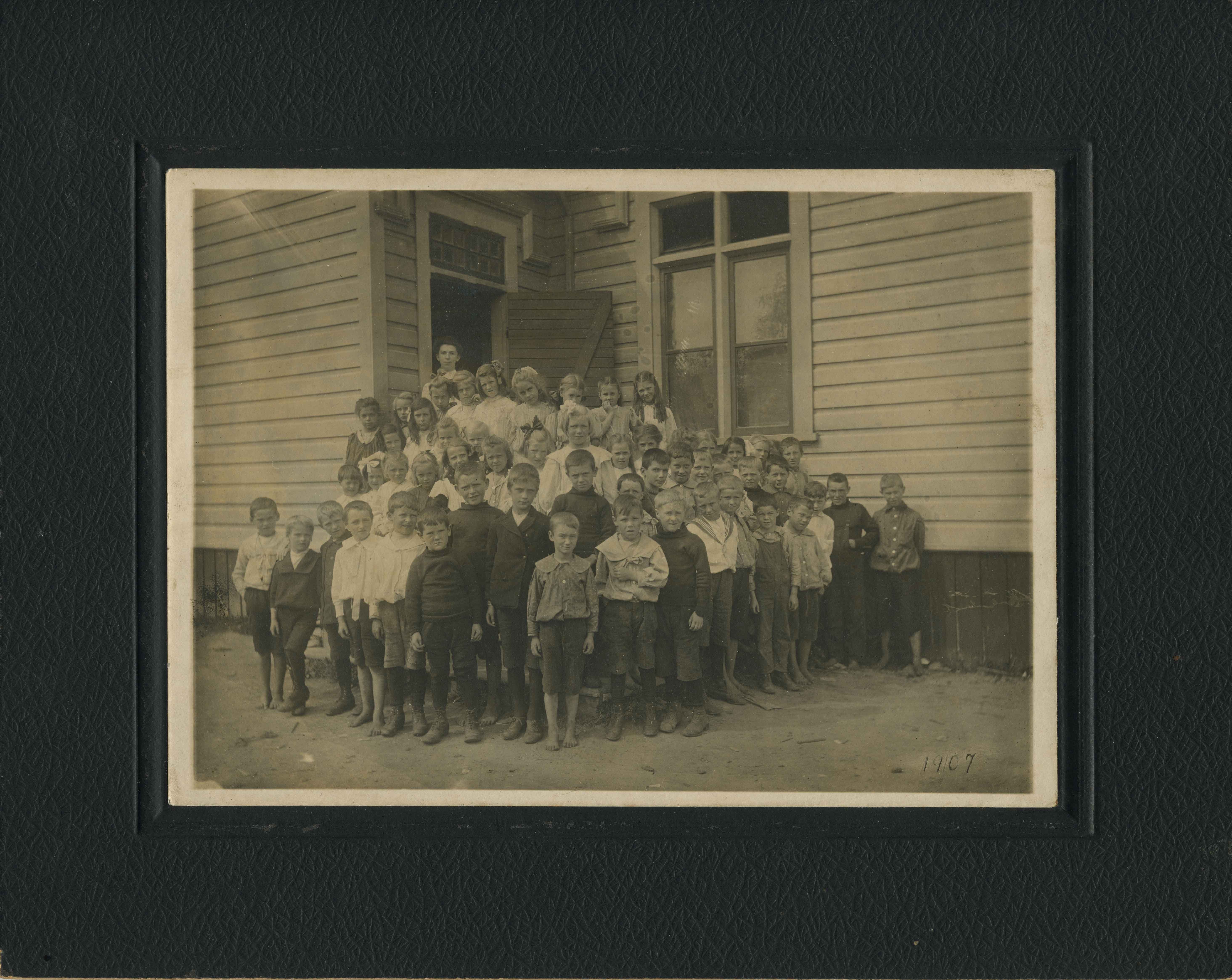
- Photograph of a class at West Burnaby School (later renamed Kingsway West School). There are thirty boys and nineteen girls sitting and standing in four rows in front of the school building.
- Repository
- Burnaby Village Museum
- Collection/Fonds
- Burnaby Village Museum Photograph collection
- Description Level
- Item
- Physical Description
- 1 photograph : b&w ; 9 x 14 cm
- Scope and Content
- Photograph of a class at West Burnaby School (later renamed Kingsway West School). There are thirty boys and nineteen girls sitting and standing in four rows in front of the school building.
- Names
- Kingsway West School
- Geographic Access
- Kingsway
- Street Address
- 4800 Kingsway
- Accession Code
- BV999.2.47
- Access Restriction
- No restrictions
- Reproduction Restriction
- May be restricted by third party rights
- Date
- [between 1900 and 1915]
- Media Type
- Photograph
- Historic Neighbourhood
- Central Park (Historic Neighbourhood)
- Planning Study Area
- Maywood Area
- Scan Resolution
- 600
- Scan Date
- 08-Jun-09
- Scale
- 100
- Photographer
- Brown, William Thomas
- Notes
- Stamp on recto of photograph reads: " WEST BURNABY PUBLIC SCHOOL / W. BROWN. Photo."
Images
![West Burnaby Public School, [between 1900 and 1915] thumbnail](/media/hpo/_Data/_BVM_Images/1990/199900020047.jpg)
![Teaching staff at West Burnaby School, [190-] thumbnail](/media/hpo/_Data/_BVM_Images/2012/2012_0020_0006_001.jpg?width=280)
Teaching staff at West Burnaby School
https://search.heritageburnaby.ca/link/museumdescription2943
- Repository
- Burnaby Village Museum
- Date
- [190-]
- Collection/Fonds
- Burnaby Village Museum Photograph collection
- Description Level
- Item
- Physical Description
- 1 photograph : b&w ; 15 x 10 cm
- Scope and Content
- Photograph of teaching staff at West Burnaby School (later renamed Kingsway West School). The group is standing in front of a stone wall at the school. Woman standing in the centre is identified as Miss Annie Forrest and the man on the far left is identified as Mr. Brown.
- Repository
- Burnaby Village Museum
- Collection/Fonds
- Burnaby Village Museum Photograph collection
- Description Level
- Item
- Physical Description
- 1 photograph : b&w ; 15 x 10 cm
- Scope and Content
- Photograph of teaching staff at West Burnaby School (later renamed Kingsway West School). The group is standing in front of a stone wall at the school. Woman standing in the centre is identified as Miss Annie Forrest and the man on the far left is identified as Mr. Brown.
- Subjects
- Occupations - Teachers
- Geographic Access
- Kingsway
- Street Address
- 4800 Kingsway
- Accession Code
- BV012.20.6
- Access Restriction
- No restrictions
- Reproduction Restriction
- No known restrictions
- Date
- [190-]
- Media Type
- Photograph
- Historic Neighbourhood
- Central Park (Historic Neighbourhood)
- Planning Study Area
- Maywood Area
- Scan Resolution
- 600
- Scan Date
- 13-Mar-2018
- Notes
- Title based on contents of photograph
Images
![Teaching staff at West Burnaby School, [190-] thumbnail](/media/hpo/_Data/_BVM_Images/2012/2012_0020_0006_001.jpg)
![Teachers at Burnaby West School, [between 1900 and 1910] thumbnail](/media/hpo/_Data/_BVM_Images/2012/2012_0020_0007_001.jpg?width=280)
Teachers at Burnaby West School
https://search.heritageburnaby.ca/link/museumdescription2944
- Repository
- Burnaby Village Museum
- Date
- [between 1900 and 1910]
- Collection/Fonds
- Burnaby Village Museum Photograph collection
- Description Level
- Item
- Physical Description
- 1 photograph : b&w oval ; 16 x 10 cm in decorative oval paper frame
- Scope and Content
- Photograph of five female teachers at West Burnaby School (renamed Kingsway West School). The group is standing in front of a stone wall.
- Repository
- Burnaby Village Museum
- Collection/Fonds
- Burnaby Village Museum Photograph collection
- Description Level
- Item
- Physical Description
- 1 photograph : b&w oval ; 16 x 10 cm in decorative oval paper frame
- Material Details
- Oval image of the five women surrounded by a white oval frame and then a black paper frame with plant silhouettes
- Scope and Content
- Photograph of five female teachers at West Burnaby School (renamed Kingsway West School). The group is standing in front of a stone wall.
- Subjects
- Occupations - Teachers
- Names
- Kingsway West School
- Geographic Access
- Kingsway
- Street Address
- 4800 Kingsway
- Accession Code
- BV012.20.7
- Date
- [between 1900 and 1910]
- Media Type
- Photograph
- Historic Neighbourhood
- Central Park (Historic Neighbourhood)
- Planning Study Area
- Maywood Area
- Related Material
- Another copy of the same image is accessioned as BV999.2.43.
- Scan Resolution
- 600
- Scan Date
- 13-Mar-2018
- Notes
- Title based on contents of photograph.
Images
![Teachers at Burnaby West School, [between 1900 and 1910] thumbnail](/media/hpo/_Data/_BVM_Images/2012/2012_0020_0007_001.jpg)
![Fern Brown, [between 1901 and 1920] thumbnail](/media/hpo/_Data/_Archives_Images/_Unrestricted/205/228-006.jpg?width=280)
Fern Brown
https://search.heritageburnaby.ca/link/archivedescription36145
- Repository
- City of Burnaby Archives
- Date
- [between 1901 and 1920]
- Collection/Fonds
- Burnaby Historical Society fonds
- Description Level
- Item
- Physical Description
- 1 photograph : sepia ; 7.5 x 10 cm + 1 p.
- Scope and Content
- Photograph of Fern Brown (nee Ablitt) sitting on the grass of her parent's property at the northeast corner of Kingsway and Nelson Avenue. She has a doll in a baby carriage with her and ribbons in her hair. The Hutton grocery store can be seen in the distance.
- Repository
- City of Burnaby Archives
- Date
- [between 1901 and 1920]
- Collection/Fonds
- Burnaby Historical Society fonds
- Physical Description
- 1 photograph : sepia ; 7.5 x 10 cm + 1 p.
- Description Level
- Item
- Record No.
- 228-006
- Access Restriction
- No restrictions
- Reproduction Restriction
- No known restrictions
- Accession Number
- BHS1989-22
- Scope and Content
- Photograph of Fern Brown (nee Ablitt) sitting on the grass of her parent's property at the northeast corner of Kingsway and Nelson Avenue. She has a doll in a baby carriage with her and ribbons in her hair. The Hutton grocery store can be seen in the distance.
- Subjects
- Toys - Dolls
- Names
- Brown, Fern
- Media Type
- Photograph
- Notes
- Title based on contents of photograph
- Page attached to verso of photograph gives a short history of Fern Brown
- Geographic Access
- Kingsway
- Nelson Avenue
- Historic Neighbourhood
- Central Park (Historic Neighbourhood)
- Planning Study Area
- Marlborough Area
Images
![Fern Brown, [between 1901 and 1920] thumbnail](/media/hpo/_Data/_Archives_Images/_Unrestricted/205/228-006.jpg)
West Burnaby School Class
https://search.heritageburnaby.ca/link/archivedescription34519
- Repository
- City of Burnaby Archives
- Date
- 1904
- Collection/Fonds
- Burnaby Historical Society fonds
- Description Level
- Item
- Physical Description
- 1 photograph : b&w ; 12.8 x 17.8 cm mounted on cardboard 20.0 x 25.0 cm
- Scope and Content
- Photograph of a West Burnaby School (later renamed Kingsway West School) class standing outside of the school. Identified, back row, left to right: [unidentified], Georgina Bell, [first name unknown] Creamer, Gladys Bisset, Bernadette McNeil, Elsie Wilson, and Mabel Rowlinson. 2nd row, 5th from le…
- Repository
- City of Burnaby Archives
- Date
- 1904
- Collection/Fonds
- Burnaby Historical Society fonds
- Subseries
- Elsie B. Wilson subseries
- Physical Description
- 1 photograph : b&w ; 12.8 x 17.8 cm mounted on cardboard 20.0 x 25.0 cm
- Description Level
- Item
- Record No.
- 034-001
- Access Restriction
- No restrictions
- Reproduction Restriction
- No known restrictions
- Accession Number
- BHS2007-04
- Scope and Content
- Photograph of a West Burnaby School (later renamed Kingsway West School) class standing outside of the school. Identified, back row, left to right: [unidentified], Georgina Bell, [first name unknown] Creamer, Gladys Bisset, Bernadette McNeil, Elsie Wilson, and Mabel Rowlinson. 2nd row, 5th from left: Edith Marten. 3rd row, left to right: [first name unknown] McMaster, [unidentified], Jean Ross, [unidentified], Goldie Ralph, Mabel Ralph, Grace Marten, [3 unidentified children], Lois Rumble (later Wilson), [unidentified], and George Robertson. From row, left to right, starting at 7th child: Wilson Bailey, [first name unknown] Bond, [2 unidentified children], Bill Smith, Elgin Robertson, [2 unidentified children], Gordon Bailey, [2 unidentified children], [first name unknown] Bramble. The teacher, standing at the back left, is Miss Annie Theresa Forrest.
- Subjects
- Occupations - Teachers
- Names
- Bailey, Gordon
- Bailey, Wilson
- Bell, Georgina
- Bisset, Gladys
- Forrest, Annie Theresa
- Marten, Edith
- Marten, Grace
- McNeil, Bernadette
- Ralph, Mabel
- Robertson, Elgin
- Robertson, George
- Ross, Jean
- Rowlinson, Mabel
- Wilson, Lois Rumble
- Smith, Bill
- Kingsway West School
- Wilson, Elsie
- Media Type
- Photograph
- Notes
- Title based on contents of photograph
- Geographic Access
- Kingsway
- Street Address
- 4800 Kingsway
- Historic Neighbourhood
- Central Park (Historic Neighbourhood)
- Planning Study Area
- Maywood Area
Images

Topping a tree near Central Park
https://search.heritageburnaby.ca/link/archivedescription37280
- Repository
- City of Burnaby Archives
- Date
- 1904
- Collection/Fonds
- Burnaby Historical Society fonds
- Description Level
- Item
- Physical Description
- 1 photograph : sepia toned ; 21 x 26.5 cm
- Scope and Content
- Photograph of a man "topping" a large tree in the area near Central Park and Boundary Road.
- Repository
- City of Burnaby Archives
- Date
- 1904
- Collection/Fonds
- Burnaby Historical Society fonds
- Subseries
- Norah Code subseries
- Physical Description
- 1 photograph : sepia toned ; 21 x 26.5 cm
- Description Level
- Item
- Record No.
- 345-001
- Access Restriction
- No restrictions
- Reproduction Restriction
- No known restrictions
- Accession Number
- BHS1997-05
- Scope and Content
- Photograph of a man "topping" a large tree in the area near Central Park and Boundary Road.
- Media Type
- Photograph
- Photographer
- Code, Norah
- Notes
- Title based on contents of photograph
- Photographs in this collection were taken and compiled by Norah Code, former editor of the "Burnaby Courier" newspaper during the course of her work for the newspaper. A note with the file indicates that the man in the tree may be Ms. Code's father but his name is not provided.
- Geographic Access
- Boundary Road
- Central Park
- Historic Neighbourhood
- Central Park (Historic Neighbourhood)
- Planning Study Area
- Maywood Area
Images


Survey and Subdivision plans in New Westminster District Group 1 – Burnaby
https://search.heritageburnaby.ca/link/museumdescription6971
- Repository
- Burnaby Village Museum
- Date
- 1904-1908
- Collection/Fonds
- Burnaby Village Museum Map collection
- Description Level
- File
- Physical Description
- 7 plans : blueprint ink on paper mounted on 2 sides of cardboard 76 cm x 101.5 cm
- Scope and Content
- Item consists of a large board of four New Westminster District Gp 1 -subdivision plans mounted on one side and three New Westminster District Gp 1 - subdivision plans mounted on the other side. Side A: 1. Blueprint "Plan / of Subdivision of / Lot 28A / in Subdivision of / Lot 97, Group 1 / Ne…
- Repository
- Burnaby Village Museum
- Collection/Fonds
- Burnaby Village Museum Map collection
- Description Level
- File
- Physical Description
- 7 plans : blueprint ink on paper mounted on 2 sides of cardboard 76 cm x 101.5 cm
- Material Details
- Scales [between1:120 and 1:3960]
- Index number on edge of board reads: "3"
- Scope and Content
- Item consists of a large board of four New Westminster District Gp 1 -subdivision plans mounted on one side and three New Westminster District Gp 1 - subdivision plans mounted on the other side. Side A: 1. Blueprint "Plan / of Subdivision of / Lot 28A / in Subdivision of / Lot 97, Group 1 / New Westminster District". The B.C.E.R. is identified running through the subdivision of XXVIIIA (Lot 28A). Plan is dated "Sept. 21st, 08" (Geographic location: Burnaby) 2. Blueprint "Measurements / of Discharge / in Ditches / Lots 155A, G.One" / "Scale, Twentieths. / 17/12/04" (Geographic location: Burnaby) 3. Blueprint "Plan / of Subdivision / of a portion of / Lot 95 / Group One / New Westminster District" B.C. Electric Railway runs through the top of the plan. The plan is dated May 23, 1906. (Geographic location: Burnaby) 4. Blueprint " Profile / on Water Surface / in / Holland Road Ditch / Woollard's Ditch / Dec. 3rd 1904 / Scales Hor. 200'=1" / Vert. 10'=1"" (Geographic location: Burnaby) Side B: 1. Blueprint " "Sunnyside Park" / plan of Subdivision / of / the East Half / of / Lot 39, GR.One, / New Westminster District / Scale 100'=1" (Geographic location: Burnaby) 2. Blueprint " "Sunnyside Park"/ plan of Subdivi..n / of / Lot 39, Gr.1. / New Westminster District" Index in upper left corner of plan shows location of Lot 39 in relation to Central Park and surrounding Lots. (Geographic location: Burnaby) 3. Blueprint "Plan / of Subdivision / of / Lot 163 and 165 / Group One / New Westminster District / Scale 5 chs=1 in." Streets within subdivision plan are identified as; North Arm Road, Ingram Street, Blair Street, Kennedy Street, Murray Street, Wiggins Road, Byrne Road, South Road along with North Arm Fraser River and B.C. Electric Railway. (Geographic location: Burnaby)
- Geographic Access
- Central Park
- Accession Code
- HV977.93.3
- Access Restriction
- No restrictions
- Reproduction Restriction
- No known restrictions
- Date
- 1904-1908
- Media Type
- Cartographic Material
- Historic Neighbourhood
- Central Park (Historic Neighbourhood)
- Scan Resolution
- 300
- Scale
- 72
- Notes
- Title based on contents of file
- Scale is measured in chains and feet. (One chain equals 792 inches)
- The term "Lot" can also refer to a "District Lot”
Images


![Lancelot Grimmer house, [1905] thumbnail](/media/hpo/_Data/_Archives_Images/_Unrestricted/251/290-001.jpg?width=280)
Lancelot Grimmer house
https://search.heritageburnaby.ca/link/archivedescription36531
- Repository
- City of Burnaby Archives
- Date
- [1905]
- Collection/Fonds
- Burnaby Historical Society fonds
- Description Level
- Item
- Physical Description
- 1 photograph : b&w ; 9 x 13 cm print
- Scope and Content
- Photograph of Martha Jane, Irene & Cynthia (Martha Jane's sister) Grimmer standing on the front porch of the Lancelot and Martha Jane Grimmer House.
- Repository
- City of Burnaby Archives
- Date
- [1905]
- Collection/Fonds
- Burnaby Historical Society fonds
- Subseries
- Grimmer family subseries
- Physical Description
- 1 photograph : b&w ; 9 x 13 cm print
- Description Level
- Item
- Record No.
- 290-001
- Access Restriction
- No restrictions
- Reproduction Restriction
- No known restrictions
- Accession Number
- BHS1992-26
- Scope and Content
- Photograph of Martha Jane, Irene & Cynthia (Martha Jane's sister) Grimmer standing on the front porch of the Lancelot and Martha Jane Grimmer House.
- Subjects
- Buildings - Residential - Houses
- Media Type
- Photograph
- Notes
- Title based on contents of photograph
- Geographic Access
- Grimmer Street
- Historic Neighbourhood
- Central Park (Historic Neighbourhood)
- Planning Study Area
- Windsor Area
Images
![Lancelot Grimmer house, [1905] thumbnail](/media/hpo/_Data/_Archives_Images/_Unrestricted/251/290-001.jpg)
![Phillips-Hoyt Lumber Company, [1905] (date of original), copied 1992 thumbnail](/media/hpo/_Data/_Archives_Images/_Unrestricted/315/315-070.jpg?width=280)
Phillips-Hoyt Lumber Company
https://search.heritageburnaby.ca/link/archivedescription36715
- Repository
- City of Burnaby Archives
- Date
- [1905] (date of original), copied 1992
- Collection/Fonds
- Burnaby Historical Society fonds
- Description Level
- Item
- Physical Description
- 1 photograph : b&w ; 8.3 x 12.0 cm print
- Scope and Content
- Photograph of the exterior of the building housing the Phillips, Hoyt Lumber Co. office with three men standing outside. The building was located at 2730 McKay Avenue (old street numbering system) and the site is now a part of the Burnaby Public Library site.
- Repository
- City of Burnaby Archives
- Date
- [1905] (date of original), copied 1992
- Collection/Fonds
- Burnaby Historical Society fonds
- Subseries
- Burnaby Centennial Anthology subseries
- Physical Description
- 1 photograph : b&w ; 8.3 x 12.0 cm print
- Description Level
- Item
- Record No.
- 315-070
- Access Restriction
- No restrictions
- Reproduction Restriction
- No known restrictions
- Accession Number
- BHS1994-04
- Scope and Content
- Photograph of the exterior of the building housing the Phillips, Hoyt Lumber Co. office with three men standing outside. The building was located at 2730 McKay Avenue (old street numbering system) and the site is now a part of the Burnaby Public Library site.
- Subjects
- Buildings - Commercial
- Media Type
- Photograph
- Notes
- Title based on contents of photograph
- Geographic Access
- Willingdon Avenue
- Street Address
- 6100 Willingdon Avenue
- Historic Neighbourhood
- Central Park (Historic Neighbourhood)
- Planning Study Area
- Maywood Area
Images
![Phillips-Hoyt Lumber Company, [1905] (date of original), copied 1992 thumbnail](/media/hpo/_Data/_Archives_Images/_Unrestricted/315/315-070.jpg)