Narrow Results By
Creator
- Bartel, Mario 13
- British Columbia Underwriters' Association 1
- Burnett, Geoffrey K. 3
- Burnett & McGugan, Engineers and Surveyors
- Cooksley, William Thomas 1
- Davy, Gerald 11
- Disney, John Harold "Jack" 2
- Hodge, Craig 1
- Jones, Charles Spurgeon "Chuck" 1
- King, Basil 3
- Langdeau, Brian
- Leibly & Blumer Realty Co. Incorporated 1

Armstrong Street School site
https://search.heritageburnaby.ca/link/museumdescription11133
- Repository
- Burnaby Village Museum
- Date
- 1915
- Collection/Fonds
- Ronald G. Scobbie collection
- Description Level
- Item
- Physical Description
- 1 survey plan : blueprint on paper ; 56 x 54 cm
- Scope and Content
- Survey plan of "Armstrong Street School Site / Burnaby Municipality" "Being a 2 acre portion of Lot 13 Group 1, & according to map 1722 which shows this as Lot E. Block 2 of subdivision of a portion, of Lot 13, Group 1, New Westminster District".
- Repository
- Burnaby Village Museum
- Collection/Fonds
- Ronald G. Scobbie collection
- Description Level
- Item
- Physical Description
- 1 survey plan : blueprint on paper ; 56 x 54 cm
- Material Details
- Scale 40 feet = 1 inch
- Scope and Content
- Survey plan of "Armstrong Street School Site / Burnaby Municipality" "Being a 2 acre portion of Lot 13 Group 1, & according to map 1722 which shows this as Lot E. Block 2 of subdivision of a portion, of Lot 13, Group 1, New Westminster District".
- Creator
- Burnett, Geoffrey K.
- Subjects
- Buildings - Schools
- Names
- Armstrong Avenue School
- Responsibility
- Burnett & McGugan, Engineers and Surveyors
- Geographic Access
- Armstrong Avenue
- Street Address
- 8757 Armstrong Avenue
- Accession Code
- BV003.83.12
- Access Restriction
- No restrictions
- Reproduction Restriction
- No known restrictions
- Date
- 1915
- Media Type
- Cartographic Material
- Historic Neighbourhood
- East Burnaby (Historic Neighbourhood)
- Planning Study Area
- Cariboo-Armstrong Area
- Scan Resolution
- 440
- Scan Date
- 22-Dec-2020
- Scale
- 100
- Notes
- Title based on contents of plan
- Note in black ink on verso of plan reads: "1746"
- Oath on plan reads: "I, Geoffrey K. Burnett...and did personally superintend the survey represented..." "Completed on the 18th day of March 1915"; signed by Geoffrey K. Burnett and notarized by "K.A. Eastman", sworn "...19th day of April 1915"; "Burnett and McGugan., B.C. Land Surveyors. Etc.. New Westminster, B.C.."
Zoomable Images

Elmer Rudolph fishing
https://search.heritageburnaby.ca/link/archivedescription78562
- Repository
- City of Burnaby Archives
- Date
- October 1, 1995
- Collection/Fonds
- Burnaby NewsLeader photograph collection
- Description Level
- Item
- Physical Description
- 1 photograph : b&w ; 16.5 x 23.5 cm
- Scope and Content
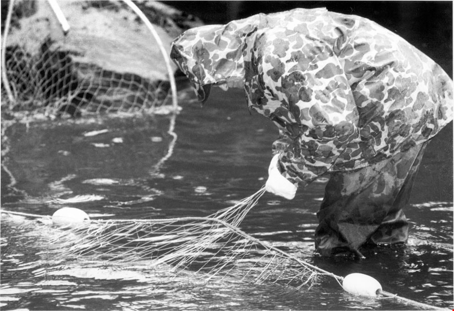
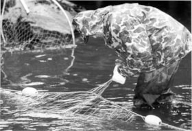
- Photograph of a Elmer Rudolph of the Sapperton Fish and Game club fishing for coho.
- Repository
- City of Burnaby Archives
- Date
- October 1, 1995
- Collection/Fonds
- Burnaby NewsLeader photograph collection
- Physical Description
- 1 photograph : b&w ; 16.5 x 23.5 cm
- Description Level
- Item
- Record No.
- 535-0006
- Access Restriction
- No restrictions
- Reproduction Restriction
- No reproduction permitted
- Accession Number
- 2012-11
- Scope and Content
- Photograph of a Elmer Rudolph of the Sapperton Fish and Game club fishing for coho.
- Subjects
- Geographic Features - Rivers
- Names
- Rudolph, Elmer
- Media Type
- Photograph
- Photographer
- Langdeau, Brian
- Notes
- Title based on contents of photograph
- Note in black ink on recto of photograph reads: "3954A Bby Brian"
- Trim marks and/or reproduction instructions on recto (scan is cropped)
- Geographic Access
- Brunette River
- Planning Study Area
- Burnaby Lake Area
- Cariboo-Armstrong Area
Images