Narrow Results By
Decade
- 2020s 5
- 2010s 9
- 2000s 11
- 1990s 29
- 1980s 26
- 1970s 31
- 1960s 29
- 1950s 36
- 1940s 61
- 1930s 162
- 1920s 97
- 1910s 49
- 1900s 24
- 1890s 14
- 1880s 2
- 1870s 2
- 1860s 3
- 1850s 2
- 1840s 1
- 1830s 1
- 1820s 1
- 1810s 1
- 1800s 1
- 1790s 1
- 1780s 1
- 1770s 1
- 1760s 1
- 1750s 1
- 1740s 1
- 1730s 1
- 1720s 1
- 1710s 1
- 1700s 1
- 1690s 1
- 1680s 1
- 1670s 1
- 1660s 1
- 1650s 1
- 1640s 1
- 1630s 1
- 1620s 1
- 1610s 1
- 1600s 1
Subject
- Agriculture 1
- Agriculture - Farms 1
- Agriculture - Fruit and Berries 2
- Artifacts 1
- Arts 1
- Buildings 1
- Buildings - Commercial 2
- Buildings - Commercial - General Stores 1
- Buildings - Commercial - Grocery Stores 6
- Buildings - Commercial - Hardware Stores 3
- Buildings - Commercial - Stores 3
- Buildings - Heritage 1
Person / Organization
- Army of Common Good 1
- Barnet Lumber Company 3
- Barnet Mill 5
- Belcastro, Arlene 1
- Bingham, Alfred "Alf" 27
- Bradbury, Dr. Bettina 104
- British Columbia Electric Railway Company 1
- Brown, Charles B. "Charlie" 8
- Burnaby Arts Centre 1
- Burnaby Fire Department 1
- Burnaby Lawn Bowling Club 1
- Burnaby Monumental Works 1
The collectors [sic] guide to depression glass
https://search.heritageburnaby.ca/link/museumlibrary1055
- Repository
- Burnaby Village Museum
- Author
- Klamkin, Marian
- Publication Date
- 1973
- Call Number
- 748.29 KLA
- Repository
- Burnaby Village Museum
- Collection
- Reference Collection
- Material Type
- Book
- ISBN
- 0801513995
- Call Number
- 748.29 KLA
- Author
- Klamkin, Marian
- Contributor
- Klamkin, Charles
- Place of Publication
- New York
- Publisher
- Hawthorn Books
- Publication Date
- 1973
- Physical Description
- 225 p. : ill. ; 28 cm.
- Library Subject (LOC)
- Depression glass
- Glassware--Collectors and collecting
- Notes
- Contains bibliographical references (p. 214) and index.
Growing up in the Great Depression
https://search.heritageburnaby.ca/link/archivedescription65814
- Repository
- City of Burnaby Archives
- Date
- 1997
- Collection/Fonds
- Burnaby Historical Society fonds
- Description Level
- Item
- Physical Description
- 6 p. (typewritten)
- Scope and Content
- Item is an essay written by Muriel Davis (later Jean Skelhorne) entitled "Growing up in the Great Depression."
- Repository
- City of Burnaby Archives
- Date
- 1997
- Collection/Fonds
- Burnaby Historical Society fonds
- Subseries
- Muriel Davis subseries
- Physical Description
- 6 p. (typewritten)
- Description Level
- Item
- Record No.
- MSS149-001
- Accession Number
- BHS1997-22
- Scope and Content
- Item is an essay written by Muriel Davis (later Jean Skelhorne) entitled "Growing up in the Great Depression."
- Media Type
- Textual Record
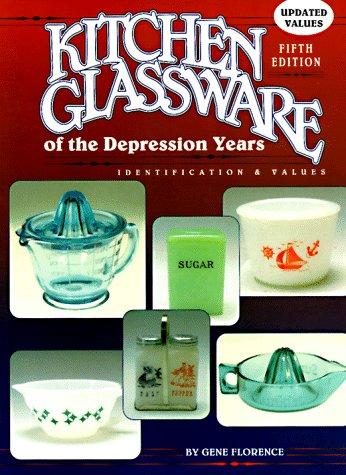
Kitchen glassware of the Depression years
https://search.heritageburnaby.ca/link/museumlibrary1216
- Repository
- Burnaby Village Museum
- Author
- Florence, Gene, 1944-
- Publication Date
- c1995
- Call Number
- 748.29 FLO
- Repository
- Burnaby Village Museum
- Collection
- Reference Collection
- Material Type
- Book
- ISBN
- 0891456163
- 9780891456162
- Call Number
- 748.29 FLO
- Author
- Florence, Gene, 1944-
- Place of Publication
- Kentucky
- Publisher
- Collector Books
- Publication Date
- c1995
- Physical Description
- 239 p. : col. ill. ; 29 cm.
- Library Subject (LOC)
- Depression glass
- Kitchen utensils--United States
- Catalogs
Crabtown
https://search.heritageburnaby.ca/link/landmark674
- Repository
- Burnaby Heritage Planning
- Associated Dates
- 1912-1957
- Heritage Value
- North Burnaby's waterfront was the location of a unique squatter's community known as Crabtown. Although its origins are obscure, it is believed that the first shacks were built before 1912. When the depression of 1913-1917 began, the shacks became permanent homes for impoverished workers. During the Great Depression of the 1930s, the community grew larger. Crabtown was not a slum, but a neighbourhood - the community even rallied together to build a water supply system and trails up the steep bluff with steps and banisters so children could go to school safely. In 1957, the National Harbours Board decided that Crabtown was encroaching on Federal property and evicted all 130 residents. Within a few months, residents were relocated and 114 homes were levelled.
- Historic Neighbourhood
- Vancouver Heights (Historic Neighbourhood)
- Planning Study Area
- Burnaby Heights Area
Images
Ocean View Burial Park - Mausoleum
https://search.heritageburnaby.ca/link/landmark630
- Repository
- Burnaby Heritage Planning
- Geographic Access
- Imperial Street
- Associated Dates
- 1928
- Description
- Cemetery site.
- Heritage Value
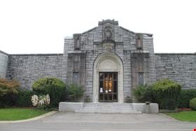
- In 1928, the design for the Ocean View Abbey was provided by San Francisco architect Wallace H. Hubbert, who specialized in the design of mausoleums. This was the first large-scale mausoleum and columbarium constructed in British Columbia. Although planned to be a much larger structure initially, only one wing was completed in 1931 before the Great Depression halted further additions. Hubbert was born in San Francisco in 1891 and attended the San Francisco Architectural Club. From 1914-15, he worked for famed architect Bernard Maybeck, and during the Depression years he temporarily closed his solo practice and worked for Miller & Pflueger from 1935-1939. He died in San Francisco in 1948. Hubbert was responsible for the designs of the Sunset Mausoleums in Berkeley and Eureka, Evergreen Mausoleum in Oakland and others in Merced and Santa Monica.
- Locality
- Alta Vista
- Historic Neighbourhood
- Alta Vista (Historic Neighbourhood)
- Planning Study Area
- Suncrest Area
- Architect
- Wallace H. Hubbert
- Area
- 359280.00
- Contributing Resource
- Building
- Ownership
- Private
- Street Address
- 4000 Imperial Street
Images
Vancouver Heights Presbyterian Church
https://search.heritageburnaby.ca/link/landmark649
- Repository
- Burnaby Heritage Planning
- Description
- Church building.
- Associated Dates
- 1930
- Street View URL
- Google Maps Street View
- Repository
- Burnaby Heritage Planning
- Geographic Access
- Esmond Avenue
- Associated Dates
- 1930
- Description
- Church building.
- Heritage Value
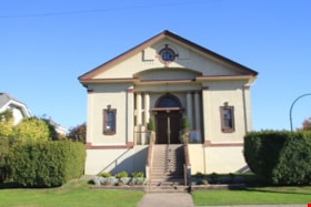
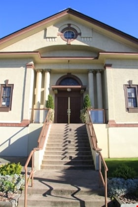
- This church replaced the first Vancouver Heights Presbyterian Church, which opened in 1911 and later became the Masonic Hall. This site was purchased in 1928, but the new church was not completed until 1930, due to the financial constraints of the Depression era. B.C. Lieutenant-Governor Bruce dedicated the church on Feb. 16, 1931. The building has retained its Classical Revival form and detailing, including its symmetrical design, columns flanking the recessed main entrance and arched windows with keystone detailing. The Vancouver Heights Presbyterian Church was designed by Australian-born architect H.H. Simmonds (1883-1954). After serving in the First World War, Simmonds resumed his local practice, and even during the Depression, his output remained prolific. In the 1920s and 30s, Simmonds was commissioned by the City of Vancouver to replace several pavilions at the Pacific National Exhibition with a consistent grouping of Art Deco buildings including the surviving Livestock Building (1929), Women and Fine Arts Building (1931) and Forum (1933).
- Locality
- Vancouver Heights
- Historic Neighbourhood
- Vancouver Heights (Historic Neighbourhood)
- Planning Study Area
- Burnaby Heights Area
- Architect
- H.H. Simmonds
- Area
- 566.79
- Contributing Resource
- Building
- Ownership
- Private
- Street Address
- 140 Esmond Avenue
- Street View URL
- Google Maps Street View
Images
Barnet Neighbourhood
https://search.heritageburnaby.ca/link/landmark681
- Repository
- Burnaby Heritage Planning
- Associated Dates
- 1925-1954
- Heritage Value
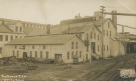
- In 1925, the mill at Barnet was under new ownership and was known as the Barnet Lumber Company. It was one of the most successful local employers in Burnaby until the 1930s, when the economic crisis of the Great Depression resulted in a strike at the mill. The City of Burnaby eventually assumed control of the site - including all of the homes - when the company failed to pay its taxes. The City then dismantled the mill and resold the property in two parts - the eastern section would become the Kapoor sawmill and the western portion, the McColl-Frontenac Oil Company.
- Historic Neighbourhood
- Barnet (Historic Neighbourhood)
- Planning Study Area
- Burnaby Mountain Area
Images
Burnaby Lake Neighbourhood
https://search.heritageburnaby.ca/link/landmark700
- Repository
- Burnaby Heritage Planning
- Associated Dates
- 1925-1954
- Heritage Value
- After World War I and the Great Depression of the 1930s, more homes were constructed and subdivisions created in the Burnaby Lake district. The area around Deer Lake gained a reputation for being an "artistic development of commodious homes with park-like grounds."
- Historic Neighbourhood
- Burnaby Lake (Historic Neighbourhood)
- Planning Study Area
- Burnaby Lake Area
Images
Central Park Neighbourhood
https://search.heritageburnaby.ca/link/landmark688
- Repository
- Burnaby Heritage Planning
- Associated Dates
- 1925-1954
- Heritage Value
- Although still largely a rural area during the 1920s, subdivisions began appearing in the Central Park neighbourhood at this time. Development was slowed by the Great Depression of the 1930s but the influx of commercial buildings and new housing initiatives in the post-war boom led to a period of rapid growth especially in the Garden Village subdivision which was undertaken in 1953 with the plan to build 500 modern homes in the 140-acre site. Despite the closure of the interurban line in 1953, the neighbourhood remained an active commercial and residential centre.
- Historic Neighbourhood
- Central Park (Historic Neighbourhood)
- Planning Study Area
- Maywood Area
Images
Floden House
https://search.heritageburnaby.ca/link/landmark524
- Repository
- Burnaby Heritage Planning
- Description
- The Floden House is a gambrel roofed, one and one-half storey plus basement wood-frame Dutch Colonial Revival residence, located at the head of the T-intersection of Fourth Street and Edmonds Street in a residential area of East Burnaby.
- Associated Dates
- 1929
- Formal Recognition
- Heritage Designation, Community Heritage Register
- Other Names
- Eric B. & Carrie Floden House
- Street View URL
- Google Maps Street View
- Repository
- Burnaby Heritage Planning
- Other Names
- Eric B. & Carrie Floden House
- Geographic Access
- 4th Street
- Associated Dates
- 1929
- Formal Recognition
- Heritage Designation, Community Heritage Register
- Enactment Type
- Bylaw No. 11358
- Enactment Date
- 27/05/2002
- Description
- The Floden House is a gambrel roofed, one and one-half storey plus basement wood-frame Dutch Colonial Revival residence, located at the head of the T-intersection of Fourth Street and Edmonds Street in a residential area of East Burnaby.
- Heritage Value
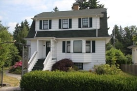
- Built in 1929 for Swedish emigrant Eric Birger Floden (1896-1971) and his Norwegian wife, Carrie (1899-1943), the Floden House is a valued representation of local middle-class housing from the 1920s, at a time of increasing prosperity just prior to the onset of the Great Depression. Eric Birger Floden was the head sawyer at Shook Mills in New Westminster, and his family occupied the house until 1964. Additionally, the Floden House is significant as an example of a residential pattern book design from the 1920s. With a reviving economy after the First World War, pattern books were widely used to expedite residential design and construction. It was built by Floden's brother in-law, Nels Olund, a talented contractor of the Fraser Valley who was experienced in building gambrel roof barns. The Floden House is also valued as an example of the Dutch Colonial Revival style, and is typical of period revival houses built in the 1920s that reflected the modern ideals of economy and good design as well as an ongoing pride in past traditions. It was presumed at the time that a well-built house would display a traditional and readily-identifiable style as a hallmark of good taste. The use of the various Colonial Revival styles had gained new popularity during the late 1920s at the time of the American Sesquicentennial. A local landmark, the house originally stood at 7997 18th Avenue and was moved two blocks to its current location by the City of Burnaby when it purchased and rehabilitated the house to save it from demolition, indicating the City's commitment to heritage conservation.
- Defining Elements
- Key elements that define the heritage character of the Floden House include its: - residential form, scale and massing as expressed by its one and one-half storey plus basement height, rectangular plan and distinctive roof form - Dutch Colonial Revival style details such as its side gambrel roof, front and rear shed dormers, attic fanlights, decorative shutters and regular fenestration - roof configuration, with overhanging eaves on the front facade with returns on the side facades, and clipped eaves on the side facades - asymmetrical front entry with small entry porch with lattice surrounds - front projecting bay window - wide lapped horizontal cedar siding - irregular fenestration, with original double-hung 6-over-1 wooden-sash windows - secondary side entry with balcony over - internal red brick chimney with concrete chimney caps
- Historic Neighbourhood
- East Burnaby (Historic Neighbourhood)
- Planning Study Area
- Edmonds Area
- Builder
- Nels Olund
- Function
- Primary Historic--Single Dwelling
- Primary Current--Single Dwelling
- Community
- Burnaby
- Cadastral Identifier
- 009-931-490
- Boundaries
- The Floden House is comprised of a single residential lot located at 7244 Fourth Street, Burnaby.
- Area
- 804.13
- Contributing Resource
- Building
- Ownership
- Private
- Street Address
- 7244 4th Street
- Street View URL
- Google Maps Street View
Images
Jubilee Grove Arch
https://search.heritageburnaby.ca/link/landmark533
- Repository
- Burnaby Heritage Planning
- Description
- The Jubilee Grove Arch sits at the corner of Kingsway and Patterson Avenue. Located within Central Park, the ceremonial arch and its decorative plantings provide a visual anchor to the northeast corner and entry point to the park.
- Associated Dates
- 1939
- Formal Recognition
- Heritage Designation, Community Heritage Register
- Street View URL
- Google Maps Street View
- Repository
- Burnaby Heritage Planning
- Geographic Access
- Imperial Street
- Associated Dates
- 1939
- Formal Recognition
- Heritage Designation, Community Heritage Register
- Enactment Type
- Bylaw No. 9807
- Enactment Date
- 23/11/1992
- Description
- The Jubilee Grove Arch sits at the corner of Kingsway and Patterson Avenue. Located within Central Park, the ceremonial arch and its decorative plantings provide a visual anchor to the northeast corner and entry point to the park.
- Heritage Value
- Jubilee Grove Arch was dedicated as part of the municipality’s celebration of the Jubilee of the coronation of King George V and was dedicated during Burnaby’s annual May Day celebrations in 1935. Much of the construction work was carried out by local citizens under the direction of the Burnaby Engineering Department through a Depression era work relief program that provided a way for local residents to pay their taxes. The garden was also chosen as the site for the ceremonial planting of an oak tree from the Royal Forest at Windsor, in honor of the Coronation of King George VI and Queen Elizabeth in 1937. The original bronze garden dedication plaque and oak tree remain at the site today. The decorative stone arch was erected in 1939 as a symbol of Burnaby's, and the Lower Mainland of British Columbia’s, strong ties to the English monarchy at the time, and the arch’s unveiling during May Day ceremonies shows the social role that such a commemorative feature played both to the local government and people of Burnaby. It was erected just prior to the Royal Visit of 1939, the first time that reigning British monarchs had travelled to Canada. Built of Haddington Island sandstone, the arch itself was reconstructed from a salvaged architectural element of a historic Vancouver landmark. The arch originally framed the entrance door to the Vancouver Club building in Vancouver, built in 1893-94 on West Hastings Street and designed by architect C.O. Wickenden. The building was demolished in 1930, however the arch was stored and rebuilt as the focal point of the Jubilee Grove after being bought by the Municipality of Burnaby. The work was undertaken by Italian-born stone mason Rizieri Stefanini (1879-1954), the owner of Burnaby Monumental Works. The re-use of the arch symbolizes the close tie between Vancouver and Burnaby and the joint evolution of the neighbouring cities.
- Defining Elements
- The Jubilee Grove Arch has character-defining elements that recognize it both as a remnant of a past building and as a new and individual structure. These include its: - axial diagonal placement and prominent corner location marking one of the entries to Central Park - visibility and accessibility as a public monument - hand carved stone blocks of Haddington Island sandstone - decorative twisted-rope motif carved to outline the arch - supporting rusticated sidewalls with planting urns - original bronze dedication plaque - flanking ornamental gardens - Royal Oak tree and plaque
- Historic Neighbourhood
- Central Park (Historic Neighbourhood)
- Planning Study Area
- Maywood Area
- Organization
- City of Burnaby
- Architect
- C.O. Wickenden
- Function
- Primary Current--Park Fixture
- Primary Historic--Park Fixture
- Community
- Burnaby
- Cadastral Identifier
- P.I.D. No. 017-767-172 Legal Description: Block B of Lot 2 Except Firstly: Part on Plan 8669 and Secondly: Part on Plan LMP4689 District Lot 151, Group 1, New Westminster District, Plan 3443
- Boundaries
- The property (Central Park) is a municipally-owned park that lies at the western edge of Burnaby, between 49th Avenue to the south, Kingsway to the north, Boundary Road to the west and Patterson Avenue to the east.
- Area
- 853,403.82
- Contributing Resource
- Structure
- Landscape Feature
- Ownership
- Public (local)
- Documentation
- Heritage Site Files: PC77000 20. City of Burnaby Planning and Building Department, 4949 Canada Way, Burnaby, B.C., V5G 1M2
- Names
- Burnaby Monumental Works
- Street Address
- 3883 Imperial Street
- Street View URL
- Google Maps Street View
Images
North Pacific Lumber Company Ruins
https://search.heritageburnaby.ca/link/landmark627
- Repository
- Burnaby Heritage Planning
- Geographic Access
- Barnet Road
- Associated Dates
- 1909
- Description
- Industrial building.
- Heritage Value
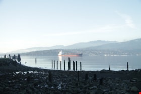
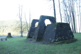
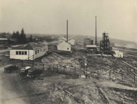
- Located on the shore of Burrard Inlet, these poured concrete piers of the smokestack burner and the former boiler and plant of the North Pacific Lumber Company are among the only remains of the once-thriving industrial site located on the waterfront on the south shore of Burrard Inlet. The sawmill and the Village of Barnet were initiated by David MacLaren, a wealthy lumberman from Buckingham, Quebec, who had previously established the Fraser Mills in Coquitlam in 1889. McLaren gambled that a sawmill on the main line of the C.P.R near Vancouver would serve the Canadian domestic market and be a profitable venture. The North Pacific Lumber Company established itself on this peninsula on Burrard Inlet and was fully operational in 1900. In 1909, the mill was completely burned out by a fire starting in the boiler room. Immediately the plant was rebuilt, modern in every respect and absolutely fireproof, as the entire power plant and boiler room was built of reinforced concrete and steel, of which these ruins are the last remains. The plant closed during the First World War and reopened as the Barnet Lumber Company in 1925 only to close forever in 1931 after a strike during the Great Depression.
- Locality
- Barnet
- Historic Neighbourhood
- Barnet (Historic Neighbourhood)
- Planning Study Area
- Burnaby Mountain Area
Images
Shell Oil Company
https://search.heritageburnaby.ca/link/landmark675
- Repository
- Burnaby Heritage Planning
- Geographic Access
- Kensington Avenue
- Associated Dates
- ca. 1930-1993
- Heritage Value
- After considering several sites in the Greater Vancouver area, the Shell Oil Company chose 70 acres in North Burnaby with frontage of one third of a mile on Burrard Inlet. Shell proposed to build a four-million dollar plant that would employ up to 2000 - providing some relief in the middle of Burnaby's economic crisis of the Depression years. The site became known as the Shellburn Refinery and was in operation until 1993.
- Historic Neighbourhood
- Lochdale (Historic Neighbourhood)
- Planning Study Area
- Westridge Area
Images
Standard Oil Company / Chevron
https://search.heritageburnaby.ca/link/landmark673
- Repository
- Burnaby Heritage Planning
- Geographic Access
- Willingdon Avenue North
- Associated Dates
- 1935
- Heritage Value
- In 1935 the announcement that the California-based Standard Oil Company was going to build a huge "million dollar" refinery in Burnaby was greeted with cheers by residents who were eager for employment and good news during the Great Depression. The refinery, named Stanovan (aka: Standard Oil - Vancouver) was officially opened in 1936 with the ability to produce 2000 barrels per day. During World War Two, the capacity of the refinery doubled to assist in the war effort. In 1976, the company's name was changed to Chevron Canada Limited.
- Historic Neighbourhood
- Vancouver Heights (Historic Neighbourhood)
- Planning Study Area
- Burnaby Heights Area
- Street Address
- 355 Willingdon Avenue North
Images
Stowe Residence
https://search.heritageburnaby.ca/link/landmark642
- Repository
- Burnaby Heritage Planning
- Description
- Residential building.
- Associated Dates
- 1930
- Street View URL
- Google Maps Street View
- Repository
- Burnaby Heritage Planning
- Geographic Access
- Burris Street
- Associated Dates
- 1930
- Description
- Residential building.
- Heritage Value
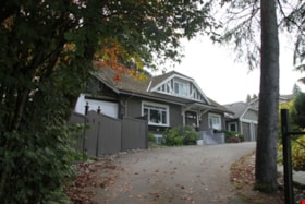
- This charming home was built for George Norman Stowe (1885-1955) and his wife Lillian (née Ross) Stowe after they purchased this property from the Municipality of Burnaby in a Depression-era tax sale. George Stowe was a civil engineer with the Provincial Department of Public Works from 1905 until 1950. Inspired by the British Arts and Crafts movement, this stuccoed cottage is notable for its picturesque side gabled roof with sloped eaves, and a jerkin-headed dormer with half-timbering. Multi-paned casement windows are used throughout the house, adding to the picturesque effect. A verandah with a colonnade of pillars on the east side of the home overlooks a ravine.
- Locality
- Burnaby Lake
- Historic Neighbourhood
- Burnaby Lake (Historic Neighbourhood)
- Planning Study Area
- Morley-Buckingham Area
- Area
- 1963.96
- Contributing Resource
- Building
- Ownership
- Private
- Street Address
- 7484 Burris Street
- Street View URL
- Google Maps Street View
Images
Ocean View Burial Park - Landscape
https://search.heritageburnaby.ca/link/landmark629
- Repository
- Burnaby Heritage Planning
- Description
- Cemetery site.
- Associated Dates
- 1919
- Street View URL
- Google Maps Street View
- Repository
- Burnaby Heritage Planning
- Geographic Access
- Imperial Street
- Associated Dates
- 1919
- Description
- Cemetery site.
- Heritage Value
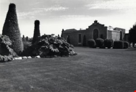
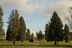
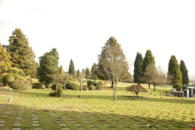
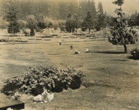
- Burnaby’s landmark Ocean View Burial Park was British Columbia’s first non-sectarian cemetery created as a for-profit business enterprise. Organized by a group of local investors headed by Lieut. Col. G.H. Dorrell, the Ocean View Cemetery Company offered a place for burials that was not owned or associated with a civic government, religious or fraternal organization. The cemetery’s design was the vision of Albert F. Arnold, an officer of the Canadian Financiers Trust Company, who was “...always depressed by the lack of beauty in so many places of internment and inevitable neglect that finally reduced them to long-grassed places of unhappy memories.” One local newspaper described the landscape of the cemetery: "The design includes ornamental trees and shrubs, beautiful flower beds and smooth winding walks and drives, with a total absence of the usual somewhat ostentatious reminders of the harvest garnered by the grim reaper."
- Locality
- Alta Vista
- Historic Neighbourhood
- Alta Vista (Historic Neighbourhood)
- Planning Study Area
- Suncrest Area
- Architect
- Albert F. Arnold
- Area
- 359280.00
- Contributing Resource
- Landscape Feature
- Ownership
- Private
- Street Address
- 4000 Imperial Street
- Street View URL
- Google Maps Street View
Images
Pioneer tales of Burnaby
https://search.heritageburnaby.ca/link/museumlibrary5860
- Repository
- Burnaby Village Museum
- Collection
- Digital Reference Collection
- Reference Collection
- Material Type
- Book
- ISBN
- 096928280x
- Call Number
- 971.133 SON COPY 4
- Contributor
- Sone, Michael
- Place of Publication
- Burnaby, B.C.
- Publisher
- Corporation of the District of Burnaby
- Publication Date
- c1987
- Physical Description
- 495 p. : ill. ; 31 cm.
- Inscription
- "TR687 - Bryburgh" / handprinted in pencil on frontend page
- Library Subject (LOC)
- Pioneers--British Columbia--Burnaby
- Frontier and pioneer life
- Biography
- Object History
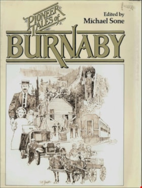
- Early Burnaby as recalled by the settlers themselves who arrived from every corner of the world between 1888 and 1930, some witnessing incorporation of the district in 1892, all seeking a better life for themselves and especially for their children, all helping transform the wilderness into the modern municipality of today.
- Notes
- "Editor Michael Sone".
- Includes index.
- 4 copies held: copy 4
Images
Digital Books
Burnaby centennial anthology : stories of early Burnaby
https://search.heritageburnaby.ca/link/museumlibrary5472
- Repository
- Burnaby Village Museum
- Edition
- Rev. ed.
- Publication Date
- 1994
- Call Number
- 971.133 BUR COPY 3
- Repository
- Burnaby Village Museum
- Collection
- Digital Reference Collection
- Material Type
- Book
- ISBN
- 0969282826
- Call Number
- 971.133 BUR COPY 3
- Edition
- Rev. ed.
- Place of Publication
- Burnaby, B.C.
- Publisher
- City of Burnaby
- Publication Date
- 1994
- Physical Description
- 531 p. : ill. ; 28 cm.
- Library Subject (LOC)
- Burnaby (B.C.)--History
- Burnaby (B.C.)
- Biography
- Notes
- Includes index.
- 3 copies held: copy 3.
Digital Books
In the shadow by the sea : recollections of Burnaby's Barnet Village
https://search.heritageburnaby.ca/link/museumlibrary5173
- Repository
- Burnaby Village Museum
- Publication Date
- c2004
- Call Number
- 971.133 PRI Copy 2
water. It is
expected that the mill will be completed and running early next summer."
Soon after its completion the mill was moth-balled by Ross and Maclaren who had
not calculated falling lumber prices and a worldwide depression which took hold
in 1893. The economy was particularly devastating
- Repository
- Burnaby Village Museum
- Collection
- Digital Reference Collection
- Reference Collection
- Material Type
- Book
- ISBN
- 0969282885
- Call Number
- 971.133 PRI Copy 2
- Contributor
- Wolf, Jim
- Pride, Harry, 1925-
- Place of Publication
- Burnaby, B.C.
- Publisher
- City of Burnaby
- Publication Date
- c2004
- Physical Description
- 246 p. : ill., maps, ports. ; 28 cm.
- Library Subject (LOC)
- Burnaby (B.C.)--History
- Industries--British Columbia--Burnaby--History
- Barnet Marine Park--Burnaby, B.C.
- Geographic Access
- Barnet Road
- Burrard Inlet
- Notes
- Includes bibliographical references (p. 246) and index.
- "edited by Harry Pride and Jim Wolf"
- Copy 2 of 2
Digital Books
Inkwells to Internet: A History of Burnaby Schools
https://search.heritageburnaby.ca/link/museumlibrary7551
- Repository
- Burnaby Village Museum
- Publication Date
- 2020
- Call Number
- 371 CAR
how she had the stamina
to come to school every day. During the
depression years women postponed marriage
to be able to earn a salary and support their
families. They also taught without pay for a
number of months when the district could
not pay them. They believed the children
still had to get
- Repository
- Burnaby Village Museum
- Collection
- Reference Collection
- Digital Reference Collection
- Material Type
- Book
- ISBN
- 978-0-9781979-2-6
- Call Number
- 371 CAR
- Place of Publication
- Burnaby
- Publisher
- City of Burnaby
- Publication Date
- 2020
- Physical Description
- vii, 35 p. : ill. ; 29 cm.
- Library Subject (LOC)
- Burnaby (B.C.)--History
- Schools--British Columbia--Burnaby
- Subjects
- Education
- Notes
- "Includes index"
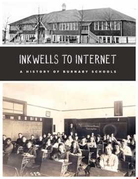
- A history of the Burnaby school district and individual school buildings in Burnaby, BC, between 1893 and 2013.
- The “First Nations cemetery” described on page 109 in Mary Johnson’s recollections was originally written as “Indian” and may refer to the Khalsa Diwan Society’s Sikh cremations at the Vancouver Cemetery.

