Narrow Results By
Interurban 1231 on the track between Science World and Granville Island
https://search.heritageburnaby.ca/link/museumdescription2887
- Repository
- Burnaby Village Museum
- Date
- [between 1998 and 2011]
- Collection/Fonds
- Burnaby Village Museum Photograph collection
- Description Level
- Item
- Physical Description
- 1 photograph : col. inkjet print ; 20.5 x 25 cm
- Scope and Content
- Photograph of British Columbia Electric Railway Interurban car 1231 "Burnaby Lake Line" on the tram tracks between Science World and Granville Island. The Vancouver Downtown Historic Railway was a heritage electric railway that was in operation between 1998 and 2011 which ran two restored interurba…
- Repository
- Burnaby Village Museum
- Collection/Fonds
- Burnaby Village Museum Photograph collection
- Description Level
- Item
- Physical Description
- 1 photograph : col. inkjet print ; 20.5 x 25 cm
- Material Details
- Inkjet print of a digital image on white photocopy paper.
- Scope and Content
- Photograph of British Columbia Electric Railway Interurban car 1231 "Burnaby Lake Line" on the tram tracks between Science World and Granville Island. The Vancouver Downtown Historic Railway was a heritage electric railway that was in operation between 1998 and 2011 which ran two restored interurban trams on the line between Science World and Granville Island. These tracks were formerly used as a frieght railway right-of-way.
- Subjects
- Transportation - Electric Railroads
- Geographic Access
- Vancouver
- Accession Code
- BV012.18.11
- Access Restriction
- No restrictions
- Reproduction Restriction
- May be restricted by third party rights
- Date
- [between 1998 and 2011]
- Media Type
- Photograph
- Scan Resolution
- 300
- Scan Date
- 13-Mar-2018
- Notes
- Title based on contents of photograph
Images
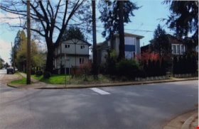
Looking southwest from corner of Douglas Road and Dominion Street
https://search.heritageburnaby.ca/link/archivedescription91878
- Repository
- City of Burnaby Archives
- Date
- April 2015
- Collection/Fonds
- Small family fonds
- Description Level
- Item
- Physical Description
- 1 photograph : col. copy print ; 10 cm x 15 cm
- Scope and Content
- Photograph of the houses and trees situated on the southwest corner of Douglas Road and Dominion Street. The large oak, hemlock, and fir were planted as part of the original landscaping of the Roberts' property in the 1920s. The photograph was taken from the Douglas Road and Dominion Street inter…
- Repository
- City of Burnaby Archives
- Date
- April 2015
- Collection/Fonds
- Small family fonds
- Physical Description
- 1 photograph : col. copy print ; 10 cm x 15 cm
- Description Level
- Item
- Record No.
- 620-059
- Access Restriction
- No restrictions
- Reproduction Restriction
- No reproduction permitted
- Accession Number
- 2017-01
- Scope and Content
- Photograph of the houses and trees situated on the southwest corner of Douglas Road and Dominion Street. The large oak, hemlock, and fir were planted as part of the original landscaping of the Roberts' property in the 1920s. The photograph was taken from the Douglas Road and Dominion Street intersection.
- Media Type
- Photograph
- Notes
- Transcribed title
- Title transcribed from donor's notes
- Note in blue ink on verso of photograph reads: "P.21"
- Note in blue ink on verso of photograph reads: "Looking southwest from corner of Douglas Rd. and Dominion St. / Oak Tree Hemlock Tree Fir Tree / planted in late 1920's"
- Note in black ink on verso of photograph reads: "April 2015"
- The oak tree is the same tree as in photographs 620-007, 620-014, 620-015, and 620-016
- Geographic Access
- Dominion Street
- Douglas Road
- Historic Neighbourhood
- Burnaby Lake (Historic Neighbourhood)
- Planning Study Area
- Ardingley-Sprott Area
![Interurban 1231 on the track between Science World and Granville Island, [between 1998 and 2011] thumbnail](/media/hpo/_Data/_BVM_Images/2012/2012_0018_0011_001.jpg?width=280)
