Narrow Results By
Subject
- Academic Disciplines 1
- Accidents 1
- Accidents - Train Accidents 6
- Adminstrative Groups - Committees 4
- Adornment - Jewelry 1
- Advertising Medium 1
- Advertising Medium - Flyer 4
- Advertising Medium - Poster 15
- Advertising Medium - Signs and Signboards
- Aerial Photographs 46
- Agriculture 3
- Agriculture - Farms 62
Interview with Jiro Kamiya, 2015
https://search.heritageburnaby.ca/link/museumdescription4476
- Repository
- Burnaby Village Museum
- Date
- [2015]
- Collection/Fonds
- Burnaby Village Museum fonds
- Description Level
- Item
- Physical Description
- 1 sound recording (mp3) (01:11:02 min)
- Scope and Content
- Recording of a interview with Jiro Kamiya about the ofuro he built as an exhibit for display at Burnaby Village Museum, and his work in Canada generally. When he speaks in Japanese, his son Frank Kamiya does the English translation. Frank recalls how his father, a Japanese-trained carpenter, came …
- Repository
- Burnaby Village Museum
- Collection/Fonds
- Burnaby Village Museum fonds
- Series
- Museum Oral Histories series
- Subseries
- Museum research interviews subseries
- Description Level
- Item
- Physical Description
- 1 sound recording (mp3) (01:11:02 min)
- Material Details
- Interviewer: Lisa Codd Interviewees: Jiro Kamiya and his son Frank Kamiya Location of Interview: Nikkei Home, Burnaby Interview Date: [2015] Total Number of Tracks: 1 Total Length of all Tracks: 1:11:02
- Scope and Content
- Recording of a interview with Jiro Kamiya about the ofuro he built as an exhibit for display at Burnaby Village Museum, and his work in Canada generally. When he speaks in Japanese, his son Frank Kamiya does the English translation. Frank recalls how his father, a Japanese-trained carpenter, came to be involved in the project, which was donated to the Museum by the Japanese Canadian Citizens Association. An unidentified woman is also present and contributes to the discussion. 0:00 – 6:38: Frank Kamiya recalls the museum’s ofuro project, describing how his father became involved with it. He talks about the ofuro in Canada, speaking of their importance to Japanese Canadians but noting that they have been superseded by newer products. Frank also mentions that ofuros are now subject to modern building regulations. 6:38 – 20:30: Jiro Kamiya describes the construction of the ofuro. He explains the technique of water-proofing and talks about the different sizes of baths, discussing the differences in Japanese and Canadian styles and in the way water was supplied. 20:30 – 28:27: This portion of the recording pertains to Jiro Kamiya’s background as a carpenter in Shizuoka, Japan, in the family’s business, and how he came to immigrate to Canada. Frank talks about his father’s innovations and skills. He discusses the differences between Japanese and Canadian tools. Lisa Codd asks about the tools Jiro donated to the museum. 28:27 – 36:00: Frank talks about his father’s involvement in the building of the Museum’s ofuro. He notes that he himself drew up the plans and submitted them to City Hall. He asks about the ofuro’s plaque and the building’s condition. Lisa explains how the classification of buildings as replica or heritage determines how conservation choices are made. 36:00 – 45:47: Frank describes the purpose and use of the ofuro and the kind of accessories which should be included in the Museum’s display. The exact meaning of ‘ofuro’ is discussed with Jiro, as is bathing protocol for the larger and smaller kinds. 45:47 – 59:13: Jiro recalls New Year and other traditions and Lisa and Frank remark on the differences between the established infrastructures of Japan and those of rural Canada. Frank describes his father’s work in Canada. Jiro talks of being unable to join the carpenters union, but advancing in his profession through his ability and experience with Japanese techniques. 59:13 – 1:11:02: Jiro talks about the work that he did during internment during World War II and his choice to go to Winnipeg with his family. Frank relates how his father adapted to shipyard work, and Jiro tells anecdotes about his working years.
- History
- Interviewee: Jiro Kamiya (ne Tsuneki) was born on August 29, 1910 in Shizuoka Ken, Japan to parents Torakichi Tsuneki and Sono Ssuneki. In 1936, Jiro married Toneko Kamiya. The Tsuneki family were Master Carpenters for over 500 years and the family business, Torakichi Tsuneki Construction Co was the largest and best known construction company in Shizuoka Ken. Jiro also became a master carpenter working for his father's company. In 1933, Jiro immigrated to Canada and in 1936, he returned to Japan to marry. In 1937 he got work at the Hammond Cedar Mill leading a crew of six men and worked there for about three or four years. In 1942 along with over 21,000 Japanese Canadians, Jiro and his family were forcibly removed from the coastal area of British Columbia. Jiro and his family were relocated to Oak Bluff, Manitoba to work on the beet farms. JIro chose this location of internment so that he could keep his family together. While living in Manitoba, Jiro also found work as a carpenter. In 1948 when he was permitted to return to British Columbia, Jiro and his family relocated to Kamloops. In 1951, he began working as a carpenter for Matsumoto Shipyard in North Vancouver and between 1961 and 1974, he worked for Grimwood Construction. From 1975, he worked for Dawson Hall Construction until his retirement at the age of 68. Following his retirement he built a house for his nephew on Mayne Island and a summer house for himself which he completed in 1988. In 2001, Jiro and his wife, Toneko moved to Nikkei Home. While living at Nikkei Home, Jiro made chopsticks out of hardwood, creating over a thousand pairs up until he was 99 years old. Jiro passed away in 2015. Interviewer: Lisa Codd has worked in the museum sector since 2000 and between 2005 and 2019, she worked as the curator at the Burnaby Village Museum. In 2019, Lisa began her work as the City of Burnaby Heritage Planner.
- Creator
- Burnaby Village Museum
- Subjects
- Persons - Japanese Canadians
- Names
- Kamiya, Jiro
- Kamiya, Frank
- Accession Code
- BV019.13.1
- Access Restriction
- No restrictions
- Reproduction Restriction
- No known restrictions
- Date
- [2015]
- Media Type
- Sound Recording
- Notes
- Audio is only available to listen at the Burnaby Village Museum
Audio Tracks
Interview with Jiro Kamiya, 2015, [2015]
Interview with Jiro Kamiya, 2015, [2015]
https://search.heritageburnaby.ca/media/hpo/_Data/_BVM_Sound_Recordings/Oral_Histories/2019_0013_0001_001.mp3123 Cinema sign
https://search.heritageburnaby.ca/link/archivedescription46283
- Repository
- City of Burnaby Archives
- Date
- November 15, 1979
- Collection/Fonds
- Columbian Newspaper collection
- Description Level
- Item
- Physical Description
- 1 photograph : b&w ; 24 x 9.5 cm
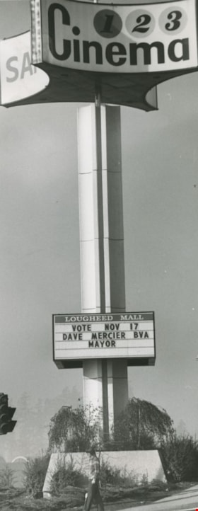
- Scope and Content
- Photograph of the 123 Cinema sign at Lougheed Mall which reads; "VOTE NOV 17 / DAVE MERCIER BVA / MAYOR".
- Repository
- City of Burnaby Archives
- Date
- November 15, 1979
- Collection/Fonds
- Columbian Newspaper collection
- Physical Description
- 1 photograph : b&w ; 24 x 9.5 cm
- Description Level
- Item
- Record No.
- 480-1171
- Access Restriction
- No restrictions
- Reproduction Restriction
- No restrictions
- Accession Number
- 2003-02
- Scope and Content
- Photograph of the 123 Cinema sign at Lougheed Mall which reads; "VOTE NOV 17 / DAVE MERCIER BVA / MAYOR".
- Names
- Lougheed Town Centre
- Media Type
- Photograph
- Photographer
- Hodge, Craig
- Notes
- Title based on contents of photograph
- Newspaper clipping attached to verso of photograph reads: "Now showing: Strong support for Mercier."
- Geographic Access
- Austin Road
- Historic Neighbourhood
- Burquitlam (Historic Neighbourhood)
- Planning Study Area
- Cameron Area
Images
Crossing Royal Oak & Rumble Street
https://search.heritageburnaby.ca/link/archivedescription93686
- Repository
- City of Burnaby Archives
- Date
- May 19, 1978
- Collection/Fonds
- Burnaby Public Library Contemporary Visual Archive Project
- Description Level
- Item
- Physical Description
- 1 photograph : b&w ; 12.5 x 17.5 cm
- Scope and Content
- Photograph of the intersection of Royal Oak Avenue and Rumble Street. Cars and pedestrians are crossing the intersection, and the signs for businesses TD Bank, Standard Oil/Chevron gas station, Gulf gas station, and Baxter's Market are visible. The photograph is taken from a corner of the intersect…
- Repository
- City of Burnaby Archives
- Date
- May 19, 1978
- Collection/Fonds
- Burnaby Public Library Contemporary Visual Archive Project
- Physical Description
- 1 photograph : b&w ; 12.5 x 17.5 cm
- Description Level
- Item
- Record No.
- 556-643
- Access Restriction
- No restrictions
- Reproduction Restriction
- Reproduce for fair dealing purposes only
- Accession Number
- 2017-57
- Scope and Content
- Photograph of the intersection of Royal Oak Avenue and Rumble Street. Cars and pedestrians are crossing the intersection, and the signs for businesses TD Bank, Standard Oil/Chevron gas station, Gulf gas station, and Baxter's Market are visible. The photograph is taken from a corner of the intersection, facing southeast.
- Subjects
- Geographic Features - Roads
- Advertising Medium - Signs and Signboards
- Buildings - Commercial - Service Stations
- Transportation - Automobiles
- Buildings - Commercial
- Media Type
- Photograph
- Photographer
- van Mannen, Mark
- Notes
- Title taken from project information form
- Accompanied by a project information form and 1 photograph (b&w negative ; 9.5 x 12.5 cm)
- BPL no. 91
- Geographic Access
- Royal Oak Avenue
- Rumble Street
- Historic Neighbourhood
- Alta Vista (Historic Neighbourhood)
- Planning Study Area
- Sussex-Nelson Area
Images
Crossing Royal Oak & Rumble Street
https://search.heritageburnaby.ca/link/archivedescription93687
- Repository
- City of Burnaby Archives
- Date
- May 19, 1978
- Collection/Fonds
- Burnaby Public Library Contemporary Visual Archive Project
- Description Level
- Item
- Physical Description
- 1 photograph : b&w ; 12.5 x 17.5 cm
- Scope and Content
- Photograph of the intersection of Royal Oak Avenue and Rumble Street. Cars and pedestrians are crossing the intersection, and the signs for businesses Grace United Pharmacy, Standard Oil/Chevron gas station, Gulf gas station, and Royal Meats are visible. The photograph is taken from the Gulf gas st…
- Repository
- City of Burnaby Archives
- Date
- May 19, 1978
- Collection/Fonds
- Burnaby Public Library Contemporary Visual Archive Project
- Physical Description
- 1 photograph : b&w ; 12.5 x 17.5 cm
- Description Level
- Item
- Record No.
- 556-644
- Access Restriction
- No restrictions
- Reproduction Restriction
- Reproduce for fair dealing purposes only
- Accession Number
- 2017-57
- Scope and Content
- Photograph of the intersection of Royal Oak Avenue and Rumble Street. Cars and pedestrians are crossing the intersection, and the signs for businesses Grace United Pharmacy, Standard Oil/Chevron gas station, Gulf gas station, and Royal Meats are visible. The photograph is taken from the Gulf gas station parking lot, facing northwest.
- Subjects
- Advertising Medium - Signs and Signboards
- Geographic Features - Roads
- Transportation - Automobiles
- Buildings - Commercial
- Buildings - Commercial - Service Stations
- Media Type
- Photograph
- Photographer
- van Mannen, Mark
- Notes
- Title taken from project information form
- Accompanied by a project information form and 1 photograph (b&w negative ; 9.5 x 12.5 cm)
- BPL no. 92
- Geographic Access
- Royal Oak Avenue
- Rumble Street
- Historic Neighbourhood
- Alta Vista (Historic Neighbourhood)
- Planning Study Area
- Sussex-Nelson Area
Images
Old Orchard Shopping Centre
https://search.heritageburnaby.ca/link/archivedescription93603
- Repository
- City of Burnaby Archives
- Date
- October 9, 1977
- Collection/Fonds
- Burnaby Public Library Contemporary Visual Archive Project
- Description Level
- Item
- Physical Description
- 1 photograph : b&w ; 12.5 x 17.5 cm
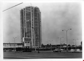
- Scope and Content
- Photograph of the Old Orchard Shopping Centre, located at Kingsway and Willingdon. The photograph is taken from across the road, facing northwest, and focuses on the shopping centre sign. The other stores' signs, including Shoppers Drug Mart and Autoplan, and a high-rise apartment building are visi…
- Repository
- City of Burnaby Archives
- Date
- October 9, 1977
- Collection/Fonds
- Burnaby Public Library Contemporary Visual Archive Project
- Physical Description
- 1 photograph : b&w ; 12.5 x 17.5 cm
- Description Level
- Item
- Record No.
- 556-560
- Access Restriction
- No restrictions
- Reproduction Restriction
- Reproduce for fair dealing purposes only
- Accession Number
- 2017-57
- Scope and Content
- Photograph of the Old Orchard Shopping Centre, located at Kingsway and Willingdon. The photograph is taken from across the road, facing northwest, and focuses on the shopping centre sign. The other stores' signs, including Shoppers Drug Mart and Autoplan, and a high-rise apartment building are visible in the background.
- Subjects
- Buildings - Commercial - Malls
- Advertising Medium - Signs and Signboards
- Buildings - Residential - Apartments
- Media Type
- Photograph
- Photographer
- Chapman, Fred
- Notes
- Title taken from project information form
- Accompanied by a project information form and 1 photograph (b&w negative ; 9.5 x 12.5 cm)
- BPL no. 4
- Geographic Access
- Kingsway
- Street Address
- 4469 Kingsway
- Historic Neighbourhood
- Central Park (Historic Neighbourhood)
- Planning Study Area
- Maywood Area
Images
Royal Oak Plaza
https://search.heritageburnaby.ca/link/archivedescription93605
- Repository
- City of Burnaby Archives
- Date
- October 9, 1977
- Collection/Fonds
- Burnaby Public Library Contemporary Visual Archive Project
- Description Level
- Item
- Physical Description
- 1 photograph : b&w ; 12.5 x 17.5 cm
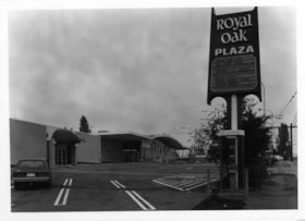
- Scope and Content
- Photograph of Royal Oak Plaza's parking lot and sign, located at Royal Oak and Rumble Street. The photograph is taken facing north. A Safeway is visible in the background.
- Repository
- City of Burnaby Archives
- Date
- October 9, 1977
- Collection/Fonds
- Burnaby Public Library Contemporary Visual Archive Project
- Physical Description
- 1 photograph : b&w ; 12.5 x 17.5 cm
- Description Level
- Item
- Record No.
- 556-562
- Access Restriction
- No restrictions
- Reproduction Restriction
- Reproduce for fair dealing purposes only
- Accession Number
- 2017-57
- Scope and Content
- Photograph of Royal Oak Plaza's parking lot and sign, located at Royal Oak and Rumble Street. The photograph is taken facing north. A Safeway is visible in the background.
- Subjects
- Advertising Medium - Signs and Signboards
- Buildings - Commercial - Grocery Stores
- Buildings - Commercial - Malls
- Media Type
- Photograph
- Photographer
- Chapman, Fred
- Notes
- Title taken from project information form
- Accompanied by a project information form and 1 photograph (b&w negative ; 9.5 x 12.5 cm)
- BPL no. 6
- Geographic Access
- Royal Oak Avenue
- Rumble Street
- Historic Neighbourhood
- Central Park (Historic Neighbourhood)
- Planning Study Area
- Clinton-Glenwood Area
Images
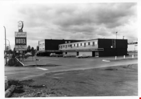
Lougheed Hotel
https://search.heritageburnaby.ca/link/archivedescription93625
- Repository
- City of Burnaby Archives
- Date
- October 23, 1977
- Collection/Fonds
- Burnaby Public Library Contemporary Visual Archive Project
- Description Level
- Item
- Physical Description
- 1 photograph : b&w ; 12.5 x 17.5 cm
- Scope and Content
- Photograph of the Lougheed Hotel on Lougheed Highway near Willingdon Avenue. The photograph is taken facing west and shows the hotel's sign, parking lot, and main hotel building.
- Repository
- City of Burnaby Archives
- Date
- October 23, 1977
- Collection/Fonds
- Burnaby Public Library Contemporary Visual Archive Project
- Physical Description
- 1 photograph : b&w ; 12.5 x 17.5 cm
- Description Level
- Item
- Record No.
- 556-582
- Access Restriction
- No restrictions
- Reproduction Restriction
- Reproduce for fair dealing purposes only
- Accession Number
- 2017-57
- Scope and Content
- Photograph of the Lougheed Hotel on Lougheed Highway near Willingdon Avenue. The photograph is taken facing west and shows the hotel's sign, parking lot, and main hotel building.
- Names
- Lougheed Hotel
- Media Type
- Photograph
- Photographer
- Surridge, Jack
- Notes
- Title taken from project information form
- Accompanied by a project information form and 1 photograph (b&w negative ; 9.5 x 12.5 cm)
- BPL no. 29
- Street Address
- 4343 Lougheed Highway
- Historic Neighbourhood
- Vancouver Heights (Historic Neighbourhood)
- Planning Study Area
- Willingdon Heights Area
Images
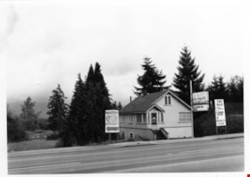
Hallett's Eggs
https://search.heritageburnaby.ca/link/archivedescription93656
- Repository
- City of Burnaby Archives
- Date
- November 13, 1977
- Collection/Fonds
- Burnaby Public Library Contemporary Visual Archive Project
- Description Level
- Item
- Physical Description
- 1 photograph : b&w ; 12.5 x 17.5 cm
- Scope and Content
- Photograph of a house surrounded by trees at 6947 Hastings Street. There is a sign in front of the home advertising "Hallett's Eggs & Poultry" and a "For Sale" sign. The photograph is taken from across the street, facing northeast.
- Repository
- City of Burnaby Archives
- Date
- November 13, 1977
- Collection/Fonds
- Burnaby Public Library Contemporary Visual Archive Project
- Physical Description
- 1 photograph : b&w ; 12.5 x 17.5 cm
- Description Level
- Item
- Record No.
- 556-613
- Access Restriction
- No restrictions
- Reproduction Restriction
- Reproduce for fair dealing purposes only
- Accession Number
- 2017-57
- Scope and Content
- Photograph of a house surrounded by trees at 6947 Hastings Street. There is a sign in front of the home advertising "Hallett's Eggs & Poultry" and a "For Sale" sign. The photograph is taken from across the street, facing northeast.
- Subjects
- Agriculture - Poultry
- Buildings - Commercial - Grocery Stores
- Advertising Medium - Signs and Signboards
- Media Type
- Photograph
- Photographer
- Chapman, Fred
- Notes
- Title taken from project information form
- Accompanied by a project information form and 1 photograph (b&w negative ; 9.5 x 12.5 cm)
- BPL no. 63
- Geographic Access
- Hastings Street
- Street Address
- 6947 Hastings Street
- Historic Neighbourhood
- Lochdale (Historic Neighbourhood)
- Planning Study Area
- Westridge Area
Images
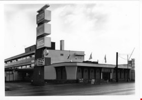
Astor Hotel
https://search.heritageburnaby.ca/link/archivedescription93657
- Repository
- City of Burnaby Archives
- Date
- November 13, 1977
- Collection/Fonds
- Burnaby Public Library Contemporary Visual Archive Project
- Description Level
- Item
- Physical Description
- 1 photograph : b&w ; 12.5 x 17.5 cm
- Scope and Content
- Photograph of the exterior of the Astor Motor Hotel and its hotel sign, located on the 4500 block of Kingsway. The photograph is taken facing northeast.
- Repository
- City of Burnaby Archives
- Date
- November 13, 1977
- Collection/Fonds
- Burnaby Public Library Contemporary Visual Archive Project
- Physical Description
- 1 photograph : b&w ; 12.5 x 17.5 cm
- Description Level
- Item
- Record No.
- 556-614
- Access Restriction
- No restrictions
- Reproduction Restriction
- Reproduce for fair dealing purposes only
- Accession Number
- 2017-57
- Scope and Content
- Photograph of the exterior of the Astor Motor Hotel and its hotel sign, located on the 4500 block of Kingsway. The photograph is taken facing northeast.
- Names
- Astor Hotel
- Media Type
- Photograph
- Photographer
- Chapman, Fred
- Notes
- Title taken from project information form
- Accompanied by a project information form and 1 photograph (b&w negative ; 9.5 x 12.5 cm)
- BPL no. 64
- Geographic Access
- Kingsway
- Street Address
- 4561 Kingsway
- Historic Neighbourhood
- Central Park (Historic Neighbourhood)
- Planning Study Area
- Marlborough Area
Images
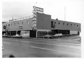
Admiral Hotel
https://search.heritageburnaby.ca/link/archivedescription93660
- Repository
- City of Burnaby Archives
- Date
- November 13, 1977
- Collection/Fonds
- Burnaby Public Library Contemporary Visual Archive Project
- Description Level
- Item
- Physical Description
- 1 photograph : b&w ; 12.5 x 17.5 cm
- Scope and Content
- Photograph of the front exterior of the Admiral Hotel, located on the 4100 block of Hastings Street. The photograph is taken from across the street, facing northwest, and shows the mural on the front of the hotel and the hotel's sign.
- Repository
- City of Burnaby Archives
- Date
- November 13, 1977
- Collection/Fonds
- Burnaby Public Library Contemporary Visual Archive Project
- Physical Description
- 1 photograph : b&w ; 12.5 x 17.5 cm
- Description Level
- Item
- Record No.
- 556-617
- Access Restriction
- No restrictions
- Reproduction Restriction
- Reproduce for fair dealing purposes only
- Accession Number
- 2017-57
- Scope and Content
- Photograph of the front exterior of the Admiral Hotel, located on the 4100 block of Hastings Street. The photograph is taken from across the street, facing northwest, and shows the mural on the front of the hotel and the hotel's sign.
- Names
- Admiral Hotel
- Media Type
- Photograph
- Photographer
- Chapman, Fred
- Notes
- Title taken from project information form
- Accompanied by a project information form and 1 photograph (b&w negative ; 9.5 x 12.5 cm)
- BPL no. 67
- Geographic Access
- Hastings Street
- Street Address
- 4125 Hastings Street
- Historic Neighbourhood
- Vancouver Heights (Historic Neighbourhood)
- Planning Study Area
- Burnaby Heights Area
Images
Burnaby General Hospital
https://search.heritageburnaby.ca/link/archivedescription45332
- Repository
- City of Burnaby Archives
- Date
- [1977]
- Collection/Fonds
- Columbian Newspaper collection
- Description Level
- Item
- Physical Description
- 1 photograph : b&w ; 15.5 x 24.5 cm
- Scope and Content
- Photograph of a large directional sign for the Burnaby General Hospital, with an ambulance parked in the background, just in front of the hospital.
- Repository
- City of Burnaby Archives
- Date
- [1977]
- Collection/Fonds
- Columbian Newspaper collection
- Physical Description
- 1 photograph : b&w ; 15.5 x 24.5 cm
- Description Level
- Item
- Record No.
- 480-227
- Access Restriction
- No restrictions
- Reproduction Restriction
- Reproduce for fair dealing purposes only
- Accession Number
- 2003-02
- Scope and Content
- Photograph of a large directional sign for the Burnaby General Hospital, with an ambulance parked in the background, just in front of the hospital.
- Subjects
- Buildings - Civic - Hospitals
- Advertising Medium - Signs and Signboards
- Transportation - Ambulances
- Names
- Burnaby General Hospital
- Media Type
- Photograph
- Notes
- Title based on contents of photograph
- Geographic Access
- Kincaid Street
- Street Address
- 3935 Kincaid Street
- Historic Neighbourhood
- Broadview (Historic Neighbourhood)
- Planning Study Area
- Cascade-Schou Area
Images
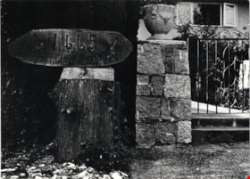
Exterior of 1665 Sherlock Avenue
https://search.heritageburnaby.ca/link/archivedescription78949
- Repository
- City of Burnaby Archives
- Date
- October 12,1976
- Collection/Fonds
- Burnaby Public Library Contemporary Visual Archive Project
- Description Level
- Item
- Physical Description
- 1 photograph : b&w ; 11 x 16 cm mounted on cardboard
- Scope and Content
- Photograph shows the homemade sign and garden ornament at 1665 Sherlock Avenue.
- Repository
- City of Burnaby Archives
- Date
- October 12,1976
- Collection/Fonds
- Burnaby Public Library Contemporary Visual Archive Project
- Physical Description
- 1 photograph : b&w ; 11 x 16 cm mounted on cardboard
- Description Level
- Item
- Record No.
- 556-044
- Access Restriction
- No restrictions
- Reproduction Restriction
- Reproduce for fair dealing purposes only
- Accession Number
- 2013-13
- Scope and Content
- Photograph shows the homemade sign and garden ornament at 1665 Sherlock Avenue.
- Media Type
- Photograph
- Photographer
- Born, A. J.
- Notes
- Scope note taken directly from BPL photograph description.
- 1 b&w copy negative : 10 x 12.5 cm accompanying
- Geographic Access
- Sherlock Avenue
- Street Address
- 1665 Sherlock Avenue
- Historic Neighbourhood
- Lochdale (Historic Neighbourhood)
- Planning Study Area
- Lochdale Area
Images
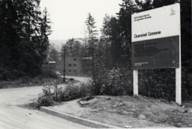
Quesnel Greene Construction
https://search.heritageburnaby.ca/link/archivedescription79014
- Repository
- City of Burnaby Archives
- Date
- October 23, 1976
- Collection/Fonds
- Burnaby Public Library Contemporary Visual Archive Project
- Description Level
- Item
- Physical Description
- 1 photograph : b&w ; 11 x 16 cm mounted on cardboard
- Scope and Content
- Photograph shows Quesnel Greene construction sign located at the corner of Aquarius Drive and Centaurus Circle. The Quesnel Green Co-operative Housing project was designed by Neinhaker/Irwin Associates and was built by Dunhill Development Corporation Ltd. It was owned by the Government of British…
- Repository
- City of Burnaby Archives
- Date
- October 23, 1976
- Collection/Fonds
- Burnaby Public Library Contemporary Visual Archive Project
- Physical Description
- 1 photograph : b&w ; 11 x 16 cm mounted on cardboard
- Description Level
- Item
- Record No.
- 556-091
- Access Restriction
- No restrictions
- Reproduction Restriction
- Reproduce for fair dealing purposes only
- Accession Number
- 2013-13
- Scope and Content
- Photograph shows Quesnel Greene construction sign located at the corner of Aquarius Drive and Centaurus Circle. The Quesnel Green Co-operative Housing project was designed by Neinhaker/Irwin Associates and was built by Dunhill Development Corporation Ltd. It was owned by the Government of British Columbia.
- Media Type
- Photograph
- Photographer
- Campbell, Peg
- Notes
- Scope note taken directly from BPL photograph description.
- 1 b&w copy negative : 10 x 12.5 cm accompanying
- Geographic Access
- Centaurus Circle
- Aquarius Drive
- Historic Neighbourhood
- Burquitlam (Historic Neighbourhood)
- Planning Study Area
- Lyndhurst Area
Images
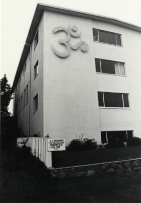
Apartment at Albert and Ingleton
https://search.heritageburnaby.ca/link/archivedescription79031
- Repository
- City of Burnaby Archives
- Date
- September 12, 1976
- Collection/Fonds
- Burnaby Public Library Contemporary Visual Archive Project
- Description Level
- Item
- Physical Description
- 1 photograph : b&w ; 11 x 16 cm mounted on cardboard
- Scope and Content
- Photograph shows a sign on an apartment building on Albert Street near Ingleton Avenue.
- Repository
- City of Burnaby Archives
- Date
- September 12, 1976
- Collection/Fonds
- Burnaby Public Library Contemporary Visual Archive Project
- Physical Description
- 1 photograph : b&w ; 11 x 16 cm mounted on cardboard
- Description Level
- Item
- Record No.
- 556-102
- Access Restriction
- No restrictions
- Reproduction Restriction
- Reproduce for fair dealing purposes only
- Accession Number
- 2013-13
- Scope and Content
- Photograph shows a sign on an apartment building on Albert Street near Ingleton Avenue.
- Media Type
- Photograph
- Notes
- Scope note taken directly from BPL photograph description.
- 1 b&w copy negative : 10 x 12.5 cm accompanying
- Photographers identified by surnames only: Carr and Vardeman
- Geographic Access
- Albert Street
- Ingleton Avenue
- Historic Neighbourhood
- Vancouver Heights (Historic Neighbourhood)
- Planning Study Area
- Burnaby Heights Area
Images
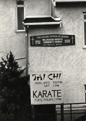
Signs at the Willingdon Heights Community Church
https://search.heritageburnaby.ca/link/archivedescription79050
- Repository
- City of Burnaby Archives
- Date
- October, 1976
- Collection/Fonds
- Burnaby Public Library Contemporary Visual Archive Project
- Description Level
- Item
- Physical Description
- 1 photograph : b&w ; 11 x 16 cm mounted on cardboard
- Scope and Content
- Photograph shows signs at the Willingdon Heights Community Church, advertising activities at the Church.
- Repository
- City of Burnaby Archives
- Date
- October, 1976
- Collection/Fonds
- Burnaby Public Library Contemporary Visual Archive Project
- Physical Description
- 1 photograph : b&w ; 11 x 16 cm mounted on cardboard
- Description Level
- Item
- Record No.
- 556-117
- Access Restriction
- No restrictions
- Reproduction Restriction
- Reproduce for fair dealing purposes only
- Accession Number
- 2013-13
- Scope and Content
- Photograph shows signs at the Willingdon Heights Community Church, advertising activities at the Church.
- Media Type
- Photograph
- Photographer
- Cook, Alan
- Notes
- Scope note taken directly from BPL photograph description.
- 1 b&w copy negative : 10 x 12.5 cm accompanying
- Geographic Access
- Parker Street
- Street Address
- 4304 Parker Street
- Historic Neighbourhood
- Vancouver Heights (Historic Neighbourhood)
- Planning Study Area
- Willingdon Heights Area
Images
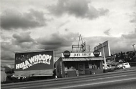
Advertising adjacent Jan's Grocery Store
https://search.heritageburnaby.ca/link/archivedescription79082
- Repository
- City of Burnaby Archives
- Date
- October, 1976
- Collection/Fonds
- Burnaby Public Library Contemporary Visual Archive Project
- Description Level
- Item
- Physical Description
- 1 photograph : b&w ; 11 x 16 cm mounted on cardboard
- Scope and Content
- Photograph shows large billboard advertising the PNE, beside Jan's Grocery store located at 4759 Hastings Street.
- Repository
- City of Burnaby Archives
- Date
- October, 1976
- Collection/Fonds
- Burnaby Public Library Contemporary Visual Archive Project
- Physical Description
- 1 photograph : b&w ; 11 x 16 cm mounted on cardboard
- Description Level
- Item
- Record No.
- 556-141
- Access Restriction
- No restrictions
- Reproduction Restriction
- Reproduce for fair dealing purposes only
- Accession Number
- 2013-13
- Scope and Content
- Photograph shows large billboard advertising the PNE, beside Jan's Grocery store located at 4759 Hastings Street.
- Media Type
- Photograph
- Photographer
- Cook, Alan
- Notes
- Scope note taken directly from BPL photograph description.
- 1 b&w copy negative : 10 x 12.5 cm accompanying
- Geographic Access
- Hastings Street
- Street Address
- 4759 Hastings Street
- Historic Neighbourhood
- Capitol Hill (Historic Neighbourhood)
- Planning Study Area
- Capitol Hill Area
Images
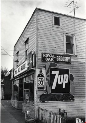
Royal Oak Grocery
https://search.heritageburnaby.ca/link/archivedescription79092
- Repository
- City of Burnaby Archives
- Date
- September 13, 1976
- Collection/Fonds
- Burnaby Public Library Contemporary Visual Archive Project
- Description Level
- Item
- Physical Description
- 1 photograph : b&w ; 11 x 16 cm mounted on cardboard
- Scope and Content
- Photograph shows Royal Oak Grocery located at 6537 Royal Oak Avenue. The store was built in approximately 1946 and has living quarters above.
- Repository
- City of Burnaby Archives
- Date
- September 13, 1976
- Collection/Fonds
- Burnaby Public Library Contemporary Visual Archive Project
- Physical Description
- 1 photograph : b&w ; 11 x 16 cm mounted on cardboard
- Description Level
- Item
- Record No.
- 556-146
- Access Restriction
- No restrictions
- Reproduction Restriction
- Reproduce for fair dealing purposes only
- Accession Number
- 2013-13
- Scope and Content
- Photograph shows Royal Oak Grocery located at 6537 Royal Oak Avenue. The store was built in approximately 1946 and has living quarters above.
- Names
- Royal Oak Grocery
- Media Type
- Photograph
- Photographer
- McCarron, John
- Notes
- Scope note taken directly from BPL photograph description.
- 1 b&w copy negative : 10 x 12.5 cm accompanying
- Geographic Access
- Royal Oak Avenue
- Street Address
- 6537 Royal Oak Avenue
- Historic Neighbourhood
- Central Park (Historic Neighbourhood)
- Planning Study Area
- Marlborough Area
Images
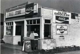
G & L Store
https://search.heritageburnaby.ca/link/archivedescription79113
- Repository
- City of Burnaby Archives
- Date
- September 20, 1976
- Collection/Fonds
- Burnaby Public Library Contemporary Visual Archive Project
- Description Level
- Item
- Physical Description
- 1 photograph : b&w ; 11 x 16 cm mounted on cardboard
- Scope and Content
- Photograph shows numerous signs on the wall of the G & L Store built around 1945 on MacPherson Avenue near Beresford Street.
- Repository
- City of Burnaby Archives
- Date
- September 20, 1976
- Collection/Fonds
- Burnaby Public Library Contemporary Visual Archive Project
- Physical Description
- 1 photograph : b&w ; 11 x 16 cm mounted on cardboard
- Description Level
- Item
- Record No.
- 556-161
- Access Restriction
- No restrictions
- Reproduction Restriction
- Reproduce for fair dealing purposes only
- Accession Number
- 2013-13
- Scope and Content
- Photograph shows numerous signs on the wall of the G & L Store built around 1945 on MacPherson Avenue near Beresford Street.
- Media Type
- Photograph
- Photographer
- McCarron, John
- Notes
- Scope note taken directly from BPL photograph description.
- 1 b&w copy negative : 10 x 12.5 cm accompanying
- Geographic Access
- MacPherson Avenue
- Beresford Street
- Planning Study Area
- Windsor Area
Images
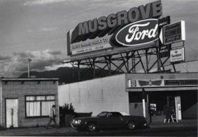
Advertising Signs
https://search.heritageburnaby.ca/link/archivedescription79154
- Repository
- City of Burnaby Archives
- Date
- November 1, 1976
- Collection/Fonds
- Burnaby Public Library Contemporary Visual Archive Project
- Description Level
- Item
- Physical Description
- 1 photograph : b&w ; 11 x 16 cm mounted on cardboard
- Scope and Content
- Photograph shows signs advertising Musgrove Ford Ltd. and Burnaby Cleaners on top of the building which housed Burnaby Cleaners at 4429 Hastings Street.
- Repository
- City of Burnaby Archives
- Date
- November 1, 1976
- Collection/Fonds
- Burnaby Public Library Contemporary Visual Archive Project
- Physical Description
- 1 photograph : b&w ; 11 x 16 cm mounted on cardboard
- Description Level
- Item
- Record No.
- 556-178
- Access Restriction
- No restrictions
- Reproduction Restriction
- Reproduce for fair dealing purposes only
- Accession Number
- 2013-13
- Scope and Content
- Photograph shows signs advertising Musgrove Ford Ltd. and Burnaby Cleaners on top of the building which housed Burnaby Cleaners at 4429 Hastings Street.
- Names
- Burnaby Cleaners
- Media Type
- Photograph
- Notes
- Scope note taken directly from BPL photograph description.
- 1 b&w copy negative : 10 x 12.5 cm accompanying
- Photographers identified by surnames only: Carr and Vardeman
- Geographic Access
- Hastings Street
- Street Address
- 4429 Hastings Street
- Historic Neighbourhood
- Vancouver Heights (Historic Neighbourhood)
- Planning Study Area
- Burnaby Heights Area
Images
Billboards at Hastings and Boundary
https://search.heritageburnaby.ca/link/archivedescription79163
- Repository
- City of Burnaby Archives
- Date
- November 1, 1976
- Collection/Fonds
- Burnaby Public Library Contemporary Visual Archive Project
- Description Level
- Item
- Physical Description
- 1 photograph : b&w ; 11 x 16 cm mounted on cardboard
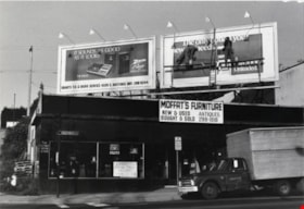
- Scope and Content
- Photograph shows men working on billboards above Moffat's Furniture at the corner of Hastings Street and Boundary Road.
- Repository
- City of Burnaby Archives
- Date
- November 1, 1976
- Collection/Fonds
- Burnaby Public Library Contemporary Visual Archive Project
- Physical Description
- 1 photograph : b&w ; 11 x 16 cm mounted on cardboard
- Description Level
- Item
- Record No.
- 556-182
- Access Restriction
- No restrictions
- Reproduction Restriction
- Reproduce for fair dealing purposes only
- Accession Number
- 2013-13
- Scope and Content
- Photograph shows men working on billboards above Moffat's Furniture at the corner of Hastings Street and Boundary Road.
- Names
- Moffat's Furniture
- Media Type
- Photograph
- Notes
- Scope note taken directly from BPL photograph description.
- 1 b&w copy negative : 10 x 12.5 cm accompanying
- Photographers identified by surnames only: Carr and Vardeman
- Geographic Access
- Hastings Street
- Boundary Road
- Historic Neighbourhood
- Vancouver Heights (Historic Neighbourhood)
- Planning Study Area
- Willingdon Heights Area


![Burnaby General Hospital, [1977] thumbnail](/media/hpo/_Data/_Archives_Images/_Unrestricted/480/480-227.jpg?width=280)
