Narrow Results By
Ocean View Burial Park
https://search.heritageburnaby.ca/link/archivedescription36598
- Repository
- City of Burnaby Archives
- Date
- 1930
- Collection/Fonds
- Burnaby Historical Society fonds
- Description Level
- Item
- Physical Description
- 1 photograph : sepia ; 19 x 24 cm
- Scope and Content
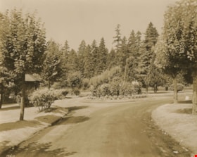
- Photograph of the roundabout at Ocean View Burial Park.
- Repository
- City of Burnaby Archives
- Date
- 1930
- Collection/Fonds
- Burnaby Historical Society fonds
- Subseries
- Photographs subseries
- Physical Description
- 1 photograph : sepia ; 19 x 24 cm
- Description Level
- Item
- Record No.
- 306-001
- Access Restriction
- No restrictions
- Reproduction Restriction
- No known restrictions
- Accession Number
- BHS1992-48
- Scope and Content
- Photograph of the roundabout at Ocean View Burial Park.
- Subjects
- Cemeteries
- Names
- Ocean View Burial Park
- Media Type
- Photograph
- Photographer
- Frank, Leonard
- Notes
- Title based on contents of photograph
- Photographer identifies item as no. 19610
- Geographic Access
- Imperial Street
- Street Address
- 4000 Imperial Street
- Historic Neighbourhood
- Alta-Vista (Historic Neighbourhood)
- Planning Study Area
- Suncrest Area
Images

Ocean View Burial Park
https://search.heritageburnaby.ca/link/archivedescription36599
- Repository
- City of Burnaby Archives
- Date
- 1930
- Collection/Fonds
- Burnaby Historical Society fonds
- Description Level
- Item
- Physical Description
- 1 photograph : sepia ; 19 x 24 cm
- Scope and Content
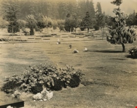
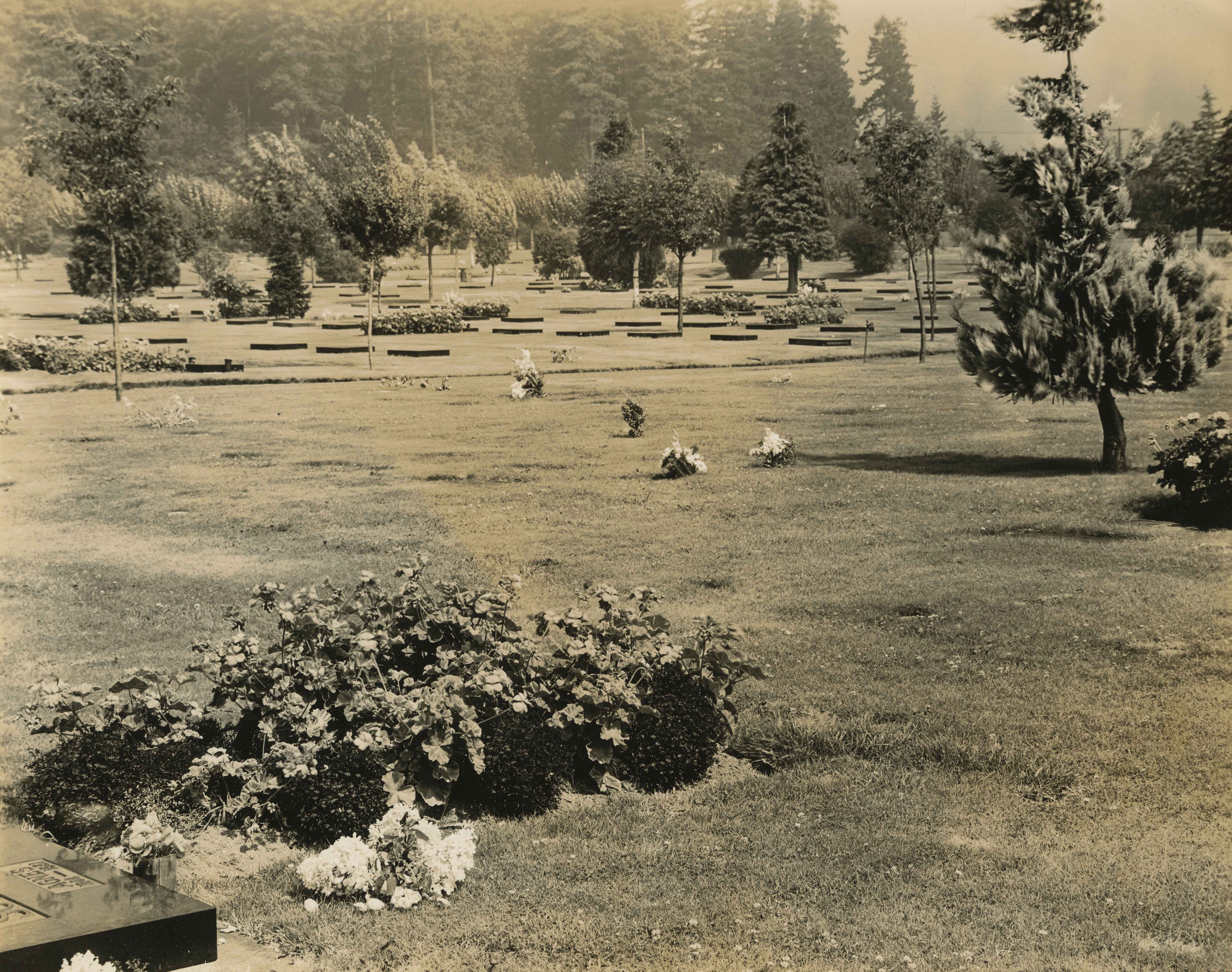
- Photograph of a grave site and the surrounding cemetery land at Ocean View Burial Park.
- Repository
- City of Burnaby Archives
- Date
- 1930
- Collection/Fonds
- Burnaby Historical Society fonds
- Subseries
- Photographs subseries
- Physical Description
- 1 photograph : sepia ; 19 x 24 cm
- Description Level
- Item
- Record No.
- 306-002
- Access Restriction
- No restrictions
- Reproduction Restriction
- No known restrictions
- Accession Number
- BHS1992-48
- Scope and Content
- Photograph of a grave site and the surrounding cemetery land at Ocean View Burial Park.
- Subjects
- Cemeteries
- Names
- Ocean View Burial Park
- Media Type
- Photograph
- Photographer
- Frank, Leonard
- Notes
- Title based on contents of photograph
- Photographer identifies item as no. 19652
- Geographic Access
- Imperial Street
- Street Address
- 4000 Imperial Street
- Historic Neighbourhood
- Alta-Vista (Historic Neighbourhood)
- Planning Study Area
- Suncrest Area
Images

Plan of Subdivision of Lot 14 of North part of NW 1/4 of D.L. 150 GR.1 N.W.D
https://search.heritageburnaby.ca/link/museumdescription11117
- Repository
- Burnaby Village Museum
- Date
- 1912
- Collection/Fonds
- Ronald G. Scobbie collection
- Description Level
- Item
- Physical Description
- 2 plans : ink on linen + blueprint ; 21.5 x 27.5 cm
- Scope and Content
- File consists of "Plan of Subdivision of Lot 14 of North / Part of N.W. 1/4 of D.L. 150, GR.1. / N.W.D." and blueprint of same.
- Repository
- Burnaby Village Museum
- Collection/Fonds
- Ronald G. Scobbie collection
- Description Level
- Item
- Physical Description
- 2 plans : ink on linen + blueprint ; 21.5 x 27.5 cm
- Material Details
- Scale [1:1200]
- Scope and Content
- File consists of "Plan of Subdivision of Lot 14 of North / Part of N.W. 1/4 of D.L. 150, GR.1. / N.W.D." and blueprint of same.
- Creator
- Hill & Burnett
- Geographic Access
- Jubilee Avenue
- Accession Code
- HV984.57.10
- Access Restriction
- No restrictions
- Reproduction Restriction
- No known restrictions
- Date
- 1912
- Media Type
- Cartographic Material
- Planning Study Area
- Suncrest Area
- Scan Resolution
- 600
- Scan Date
- 2-Oct-19
- Scale
- 100
- Notes
- Transcribed title
- Notes in red crayon on verso of both plans read: "00079"
- Oval shaped stamp in blue ink on front of blueprint plan reads: "Corporation of Burnaby / Feb. 2 1912 / Engineering Department"
- Stamp in red ink on verso of Blueprint plan reads: "Hill & Burnett / Civil Engineers / B.C. Land Surveyors / New Westminster B.C."
- Handwritten note on front of blueprint plan reads: "T... [sic] approved / subject to 20' Laws [sic] / being given. / Fred L. Macpherson / Engineer / Feb. 6th 1912"
Images

