Barnet Neighbourhood
https://search.heritageburnaby.ca/link/landmark681
- Repository
- Burnaby Heritage Planning
- Associated Dates
- 1925-1954
- Heritage Value
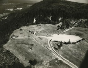
- In 1925, the mill at Barnet was under new ownership and was known as the Barnet Lumber Company. It was one of the most successful local employers in Burnaby until the 1930s, when the economic crisis of the Great Depression resulted in a strike at the mill. The City of Burnaby eventually assumed control of the site - including all of the homes - when the company failed to pay its taxes. The City then dismantled the mill and resold the property in two parts - the eastern section would become the Kapoor sawmill and the western portion, the McColl-Frontenac Oil Company.
- Historic Neighbourhood
- Barnet (Historic Neighbourhood)
- Planning Study Area
- Burnaby Mountain Area
Images
Burnaby Mountain Neighbourhood
https://search.heritageburnaby.ca/link/landmark792
- Repository
- Burnaby Heritage Planning
- Associated Dates
- 1955-2008
- Heritage Value
- Burnaby Mountain had been dedicated as park in 1942, however the original park boundaries were reconsidered in 1952 with the development of the Trans Mountain Pipeline. Although the boundaries were adjusted to accommodate this project, significant conservation and park lands were left untouched. When, in 1962, the government of British Columbia determined the need for additional post-secondary facilities, Burnaby Mountain was chosen as the site for the new Simon Fraser University which opened in 1965. As early as 1964, the idea of establishing a townsite around the university had been discussed by Burnaby, but it was not until the mid-1990s that the idea came to fruition and by the early 2000s, a new housing development know as the UniverCity took shape on the mountain adjacent to the university.
- Historic Neighbourhood
- Barnet (Historic Neighbourhood)
- Planning Study Area
- Burnaby Mountain Area
Images
Burnaby Mountain Park & Centennial Pavilion
https://search.heritageburnaby.ca/link/landmark794
- Repository
- Burnaby Heritage Planning
- Geographic Access
- Centennial Way
- Associated Dates
- 1958
- Heritage Value
- The first formal park dedication bylaw covering Burnaby Mountain was passed in 1942, but the boundaries were re-adjusted in 1952 with the creation of the Trans Mountain Pipeline site. Significant portions of the mountain remained as dedicated park, however, and in 1957, the site was chosen to house Burnaby's contribution to the celebration of British Columbia's centennial - the Centennial Pavilion. The grounds around the pavilion became a favourite picnic site that provided for the first time a formal viewpoint and public access to other mountain trails. In the 1980s, the Pavilion underwent major renovations and opened in 1986 as Horizons restaurant.
- Historic Neighbourhood
- Barnet (Historic Neighbourhood)
- Planning Study Area
- Burnaby Mountain Area
- Street Address
- 100 Centennial Way
- Street View URL
- Google Maps Street View


