Narrow Results By
Decade
- 2020s 56
- 2010s 52
- 2000s 65
- 1990s 98
- 1980s 77
- 1970s 100
- 1960s 138
- 1950s 165
- 1940s 96
- 1930s 126
- 1920s 152
- 1910s 259
- 1900s 116
- 1890s 40
- 1880s 8
- 1870s 3
- 1860s 6
- 1850s 2
- 1840s 1
- 1830s 1
- 1820s 1
- 1810s 1
- 1800s 1
- 1790s 1
- 1780s 1
- 1770s 1
- 1760s 1
- 1750s 1
- 1740s 1
- 1730s 1
- 1720s 1
- 1710s 1
- 1700s 1
- 1690s 1
- 1680s 1
- 1670s 1
- 1660s 1
- 1650s 1
- 1640s 1
- 1630s 1
- 1620s 1
- 1610s 1
- 1600s 1
6th Street continuation north
https://search.heritageburnaby.ca/link/archivedescription499
- Repository
- City of Burnaby Archives
- Date
- 1911-1913
- Collection/Fonds
- City Council and Office of the City Clerk fonds
- Description Level
- File
- Physical Description
- Textual record and cartographic material
- Scope and Content
- File contains correspondence and reports pertaining to the extension of 6th Street subdivision and road. File also includes blueprint plans of Lot 11 in south part of DL 28, group 1, NWD.
- Repository
- City of Burnaby Archives
- Date
- 1911-1913
- Collection/Fonds
- City Council and Office of the City Clerk fonds
- Physical Description
- Textual record and cartographic material
- Description Level
- File
- Record No.
- 2206
- Accession Number
- 2001-02
- Scope and Content
- File contains correspondence and reports pertaining to the extension of 6th Street subdivision and road. File also includes blueprint plans of Lot 11 in south part of DL 28, group 1, NWD.
- Media Type
- Textual Record
- Cartographic Material
- Notes
- Plans/maps are located in file and have not been moved to map case.
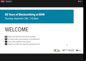
50 Years of Blacksmithing at BVM
https://search.heritageburnaby.ca/link/museumdescription18879
- Repository
- Burnaby Village Museum
- Date
- 29 Sep. 2022
- Collection/Fonds
- Burnaby Village Museum fonds
- Description Level
- Item
- Physical Description
- 1 video recording (mp4) (94 min., 55 sec.) : digital, col., sd., stereo ; 29 fps
- Scope and Content
- Item consists of a video recording of a live Zoom webinar hosted by Burnaby Village Museum Program Education Coordinator Ashley Jones and presented by Museum Interpreter and blacksmiths, Eric Damer ad Lorne Gray. The webinar is titled "50 Years of Blacksmithing at BVM". The webinar is the sixth in …
- Repository
- Burnaby Village Museum
- Collection/Fonds
- Burnaby Village Museum fonds
- Description Level
- Item
- Physical Description
- 1 video recording (mp4) (94 min., 55 sec.) : digital, col., sd., stereo ; 29 fps
- Material Details
- Host: Ashely Jones
- Presenters: Eric Damer; Lorne Gray
- Videographer: Peter Rogier
- Editor of video content footage: Peter Rogier
- Date of Presentation: Tuesday, September 29, 2022. 7:00 pm - 8:00 pm
- Total Number of tracks: 1
- Total Length of all tracks: 94 min., 55 sec.
- Recording Device: Zoom video communication platform
- Original recording of 94 min., 55 sec.was edited to 89 min., 21 sec. for viewing on Heritage Burnaby
- Scope and Content
- Item consists of a video recording of a live Zoom webinar hosted by Burnaby Village Museum Program Education Coordinator Ashley Jones and presented by Museum Interpreter and blacksmiths, Eric Damer ad Lorne Gray. The webinar is titled "50 Years of Blacksmithing at BVM". The webinar is the sixth in a series of six webinars presented in partnership by Burnaby Village Museum and Burnaby Public Library. The live webinar was also made available on the Burnaby Village Museum's facebook page. Community members were invited to participate by bringing questions during the interactive online sessions. The session opens with the host Ashley Jones, providing introductions. Following the introduction, the presentation begins with Eric Damer and Lorne Gray’s slide presentation titled “50 years of Blacksmithing at Burnaby Village Museum”. The presentation is an historical exploration of the blacksmith shop through images and commentary from these two long-standing museum blacksmiths. Eric and Lorne's presentation is organized into themes beginning with “The Age of Nostalgia” where they discuss the implementation of the original Burnaby Village Museum blacksmithing shop and live exhibit with a working blacksmith when the museum opened in November 1971. They comment on the original design of the forge and other components implemented into the design of the blacksmith shop, stereotypes of blacksmiths and various items that were forged on site in the blacksmith shop. “The Age of Accuracy” looks at changes to the Burnaby Village Museum’s programming and exhibits in the 1980s which included focusing more on the history of Burnaby and upgrading some of the components in the blacksmith shop including blowers, tools, forge design and costuming. Eric and Lorne comment on the history of Burnaby blacksmith, Frank Wagner who operated as a blacksmith in Burnaby “Wagner & Son” on Kingsway. Frank was a trained machinist, farrier and an automotive blacksmith who patented and manufactured the “Wagner Triple Spring Bumper”. With this information, the Burnaby Village Museum changed the name of the blacksmith shop to reflect the history of Burnaby blacksmith Frank Wagner. In “The Age of Diversity” Eric and Lorne talk about a shift in the 1990s when the staffing of the blacksmith shop was diversified to include women and people from diverse cultural backgrounds. These changes as well as an increased interest in artistic blacksmithing also lead to updates in Burnaby Village Museum’s blacksmith training procedures and interpretation, increased course offerings in blacksmithing and a renovated blacksmith shop which included new forges and equipment as well as an improved viewing area. Eric and Lorne talk about specifics regarding blacksmithing techniques and equipment and improvements to make this exhibit more accessible. Their presentation is followed by a short video highlighing Burnaby Village Museum interpreters who have worked as blacksmiths at Burnaby Village Museum. Each person shares their own perspectives on their experiences working as a blacksmith and interacting with the public. In the last part of the webinar, Eric and Lorne answer questions from attendees and further reflect and comment on their own experiences working as blacksmiths, various tools and techniques used and blacksmithing course offerings at Burnaby Village Museum.
- History
- Host biography: Ashley Jones is the Burnaby Village Museum Education Programmer, responsible for the development and administration of school and public programs at BVM. She has a Master of Arts degree in History and is passionate about creating hands-on programming that promotes historical and environmental literacy. Presenters biography: Eric Damer is a Burnaby Village Museum Interpreter, Museum Registrar, Researcher and Blacksmith. Eric pounded hot steel for the first time in 1977 in junior high. Fifteen years later, he joined Burnaby Village Museum where he has smithed for three decades. He also provides historical research for museum exhibits and special projects. Outside the museum, Eric is a social historian with a special interest in educational history. Lorne Gray has a BA with a major in the History of Science and Technology. He took up blacksmithing as a hobby when he was promoted to middle management and had to start hitting things. He was hired by Burnaby Village Museum as a blacksmith to fill in during the Christmas season of 2001. He has attended several blacksmithing conferences and taken classes with both an artist blacksmith and a journeyman blacksmith. On the weekends, you’ll find him teaching many of the museum’s public blacksmithing courses. He also has a steam ticket that permits him to run the museum’s steam boiler and stationery steam engines.
- Creator
- Burnaby Village Museum
- Subjects
- Occupations - Blacksmiths
- Responsibility
- Jones, Ashley
- Accession Code
- BV022.27.6
- Date
- 29 Sep. 2022
- Media Type
- Moving Images
- Notes
- Title based on contents of item
Images
Video
50 Years of Blacksmithing at BVM, 29 Sep. 2022
50 Years of Blacksmithing at BVM, 29 Sep. 2022
https://search.heritageburnaby.ca/media/hpo/_Data/_BVM_Moving_Images/2022_0027_0006_002.mp4100 Years of Gilmore School
https://search.heritageburnaby.ca/link/museumdescription4488
- Repository
- Burnaby Village Museum
- Date
- 2017
- Collection/Fonds
- 100 Years of Gilmore School video collection
- Description Level
- Item
- Physical Description
- 1 video recording (mp4) (34 min., 23 sec.) : digital, 29 fps, col., sd., stereo
- Scope and Content
- "100 Years of Gilmore School". Filmed by Yunuen Perez Vertti and made by the Heights Neighbourhood Association. The film includes interviews with former students and highlights their experiences through the Great Depression, the Second World War and the 1960s.
- Repository
- Burnaby Village Museum
- Collection/Fonds
- 100 Years of Gilmore School video collection
- Description Level
- Item
- Physical Description
- 1 video recording (mp4) (34 min., 23 sec.) : digital, 29 fps, col., sd., stereo
- Scope and Content
- "100 Years of Gilmore School". Filmed by Yunuen Perez Vertti and made by the Heights Neighbourhood Association. The film includes interviews with former students and highlights their experiences through the Great Depression, the Second World War and the 1960s.
- History
- Yunuen Perez Vertti is a filmmaker and digital media artist originally from Mexico City. She has produced films for many public, private and non-profit organizations.
- Creator
- Perez Vertti, Yunuen
- Names
- Gilmore Avenue School
- Responsibility
- Heights Neighbourhood Association
- Geographic Access
- Gilmore Avenue
- Street Address
- 50 Gilmore Avenue
- Accession Code
- BV018.13.1
- Access Restriction
- Restricted access
- Reproduction Restriction
- May be restricted by third party rights
- Date
- 2017
- Media Type
- Moving Images
- Historic Neighbourhood
- Vancouver Heights (Historic Neighbourhood)
- Planning Study Area
- Burnaby Heights Area
- Notes
- Transcribed title
- Reproductions are restricted by copyright holder
Images
Video
100 Years of Gilmore School, 2017
100 Years of Gilmore School, 2017
https://search.heritageburnaby.ca/media/hpo/_Data/_BVM_Moving_Images/2018_0013_0001_001.mp4100 Years of Gilmore School video collection
https://search.heritageburnaby.ca/link/museumdescription10596
- Repository
- Burnaby Village Museum
- Date
- 2017
- Collection/Fonds
- 100 Years of Gilmore School video collection
- Description Level
- Fonds
- Physical Description
- 6 video recordings (mp4) (approx. 42 min.) : digital, 24 fps and 29 fps, col., sd., stereo
- Scope and Content
- Fonds consists of film content relating to the history of Gilmore Avenue School (Gilmore Community School) upon the recognition of it's 100th anniversary and includes a documentary film created by Yunuen Perez Vertti titled: "100 Years of Gilmore School" along with five short anecdotal films from s…
- Repository
- Burnaby Village Museum
- Collection/Fonds
- 100 Years of Gilmore School video collection
- Description Level
- Fonds
- Physical Description
- 6 video recordings (mp4) (approx. 42 min.) : digital, 24 fps and 29 fps, col., sd., stereo
- Scope and Content
- Fonds consists of film content relating to the history of Gilmore Avenue School (Gilmore Community School) upon the recognition of it's 100th anniversary and includes a documentary film created by Yunuen Perez Vertti titled: "100 Years of Gilmore School" along with five short anecdotal films from students past and present.
- History
- In 2016, the Heights Neighbourhood Association decided to recognize the 100th anniversary of Gilmore Avenue School. The Association partnered with filmmaker and producer, Yunuen Perez Vertti to create a film featuring historic photographs and interviews with students from decades past. The premier screening of the film was held at Gilmore Community School on Friday May 13, 2016. The film was later screened at Burnaby's McGill Public Library on January 17, 2017 where community members were invited to share their own memories of the school in front of the audience. Some of these memories were captured on film by Yunuen Perez Vertti and donated with permissions to Burnaby Village Museum.
- Accession Code
- BV018.13
- BV017.48
- Reproduction Restriction
- May be restricted by third party rights
- Date
- 2017
- Media Type
- Moving Images
- Notes
- Title based on contents of fonds
1892 Burnaby Centennial
https://search.heritageburnaby.ca/link/museumdescription8704
- Repository
- Burnaby Village Museum
- Date
- [1992]
- Collection/Fonds
- Burnaby Village Museum Map collection
- Description Level
- Item
- Physical Description
- 1 map : blueline print ; 71 cm x 119 cm
- Scope and Content
- A birds eye view map of Burnaby, drawn by Mark Lewis, Parks staff, as a Parks-Maintenance Centennial Project for the 1892 - 1992 Burnaby Centennial. It features wildlife found in Burnaby and highlights civic buildings, parks and other prominent structures of the time. This is not a scale map.
- Repository
- Burnaby Village Museum
- Collection/Fonds
- Burnaby Village Museum Map collection
- Description Level
- Item
- Physical Description
- 1 map : blueline print ; 71 cm x 119 cm
- Material Details
- "1892 BURNABY/ CENTENNIAL 1992" printed in a banner across the top of the map Burnaby Centennial logo is located in the lower right side. "ALL WILDLIFE SHOWN CAN STILL / BE FOUND IN THE BURNABY AREA" printed in lower right corner "DRAWN BY / MARK LEWIS / A PARKS-MAINTENANCE / CENTENNIAL PROJECT" printed in the very lower right corner.
- The map is dark blue ink, there is no colour.
- Scope and Content
- A birds eye view map of Burnaby, drawn by Mark Lewis, Parks staff, as a Parks-Maintenance Centennial Project for the 1892 - 1992 Burnaby Centennial. It features wildlife found in Burnaby and highlights civic buildings, parks and other prominent structures of the time. This is not a scale map.
- History
- Drawn by Mark Lewis of the Parks-Maintenance Dept for the 1882 - 1992 Centennial of Burnaby. Mark always loved birds-eye maps, and showed this map to his supervisors while the work was still in progress. They suggested the map could be a Parks Maintenance Centennial Project. Mark agreed, and completed the map, including Burnaby landmarks and sketches of wildlife. Several copies of the map were given to schools so students could colour them.
- Creator
- Lewis, Mark
- Accession Code
- BV013.8.1
- Access Restriction
- No restrictions
- Reproduction Restriction
- No known restrictions
- Date
- [1992]
- Media Type
- Cartographic Material
- Scan Resolution
- 300
- Scan Date
- 05-Jun-2013
- Scale
- 96
- Notes
- Transcribed title
Images
1912 Parker Carousel Restoration 1991 to 1994
https://search.heritageburnaby.ca/link/museumdescription12334
- Repository
- Burnaby Village Museum
- Date
- [between 1991 and 1994]
- Collection/Fonds
- Burnaby Village Museum fonds
- Description Level
- Item
- Physical Description
- 1 video recording (mp4) file (1 hr., 9 min., 44 sec.) : digital, 29 fps, col., sd., stereo
- Scope and Content
- Item consists of unedited film footage titled “1912 Parker Carousel / Restoration / 1991 to 1994" by Alex Matches. Film footage documents various stages of restoration of the carousel including, the carousel horses, the "doghouse" and Wurlitzer. There is some narration by the camera person but soun…
- Repository
- Burnaby Village Museum
- Collection/Fonds
- Burnaby Village Museum fonds
- Description Level
- Item
- Physical Description
- 1 video recording (mp4) file (1 hr., 9 min., 44 sec.) : digital, 29 fps, col., sd., stereo
- Material Details
- Segments are marked by date
- Scope and Content
- Item consists of unedited film footage titled “1912 Parker Carousel / Restoration / 1991 to 1994" by Alex Matches. Film footage documents various stages of restoration of the carousel including, the carousel horses, the "doghouse" and Wurlitzer. There is some narration by the camera person but sound quality is poor and segments contain ambient noise. The footage is divided into segments marked by dates, visible in the bottom right corner. Dates range between April 1991 and March 1993. Some of this unedited footage could have been used for the Burnaby Village Museum film "Labour of Love - The Saving of Number 119" (see BV020.4.28). 00:00 - 03:23: Apr. 20, 1991 : Volunteers and staff working on the restoration of carousel horses in the Texaco warehouse. They are busy scraping away old paint. Various horses are suspended on frames while some are laid on their sides on work benches. 03:24 - 06:15: Nov. 2 1991 : Volunteers and staff working on scraping and sanding away old layers of paint on carousel horses in the Texaco warehouse. Some horses are getting repairs. A little narrative coming from camera operator but mostly ambient sound. Pieces of the "doghouse" are also visible. 06:16 - 08:20 : Dec. 28 1991 : Horses are in various stages of restoration and repair inside the Texaco warehouse. 08:21 - 09:40 : Dec. 28, 1991 : Volunteers are gathered in a lunch room taking a break. Views of carousel horses in another room of the warehouse which have been applied with a sealer. The Worlitzer is also visible during a stage of restoration. Camera pans outside the Texaco warehouse located at the base of Burnaby Mountain on Burrard Inlet. 09:42 - 11:03 : Mar. 31 1992 : Some horses have been sealed with a clear coating and others have been applied with a white undercoat primer. 11:04 - 17:36 : Apr. 11 1992 : Horses with primer undercoat, views of the Wurlitzer under restoration as well as panels of the "doghouse" 17:37 - 18:18 : May 30, 1992 : Wurlitzer and painted horses 18:19 - 21:53 : Jul. 25 1992 : Volunteers are working on painting carousel horses, various parts of carousel including the floor decks are also visible. 21:54 - 25:39 : Sept. 19 1992 : Volunteers are working on painting carousel horses and pieces of the "doghouse", mirrors are being inserted, decking is varnished. 25:40 - 30:39 : Oct. 10 1992 : Views of carousel horses with coats of primer, freshly painted horses, segments of the varnished deck, volunteers painting segments of the "doghouse" and finished horses. 30:41 - 41:30 : Nov. 14 1992 : Loading finished horses from warehouse into van to transport to museum. Photography shoot in warehouse of completed horses, mounting horses on poles at museum. Don Wrigley assisting. A view of the Carousel building at Burnaby Village Museum under construction. 41:32 - 47:27 : Nov. 20 1992 : Painted horses - details; parts of the carousel gears, poles etc 47:28 - 50:00 : Footage recorded from an exerpt from Red Robinson's Classic theatre where he narrates about the History and Saving of the Carousel. 50:02 - 1:03 : Mar. 15 1993 : Completed carousel inside the carousel building at Burnaby Village Museum, volunteers and staff are putting together the finishing touches for the opening day. Volunteers are gathering inside and seating themselves on horses around the carousel for the Volunteers Grand Opening. The carousel begins to move with some volunteers riding various horses while the Wurlitzer plays in the background. 1:04:10 - 1:09:44 : March 27 1993 - Carousel is officially opened. Includes interviews by curator Colin Stevens with Friends of Carousel president, Don Wrigley and Dave Zieffert, Restorator of the Wurlitzer and Gordie Ironside who helped work with the restoration. Gordie demonstrates how each carousel horse was built using a prototype that was built for educational purposes.
- Creator
- Matches, Alex
- Subjects
- Recreational Devices - Carousels
- Names
- Lower Mainland Association of the Friends of the Vancouver Carousel
- C.W. Parker no. 119 Carousel
- Burnaby Village Museum
- Accession Code
- BV020.12.1
- Access Restriction
- No restrictions
- Reproduction Restriction
- May be restricted by third party rights
- Date
- [between 1991 and 1994]
- Media Type
- Moving Images
- Related Material
- BV020.4.28
- Notes
- Transcribed title taken from film footage
Images
Video
1912 Parker Carousel Restoration 1991 to 1994, [between 1991 and 1994]
1912 Parker Carousel Restoration 1991 to 1994, [between 1991 and 1994]
https://search.heritageburnaby.ca/media/hpo/_Data/_BVM_Moving_Images/2020_0012_0001_001.mp41946 Data Report (supplement) - Burnaby Town Planning Commission
https://search.heritageburnaby.ca/link/archivedescription8844
- Repository
- City of Burnaby Archives
- Date
- 1946
- Collection/Fonds
- Planning Department fonds
- Description Level
- Item
- Physical Description
- Textual record and cartographic material
- Scope and Content
- This data report also contains a supplemental folder of maps.
- Repository
- City of Burnaby Archives
- Date
- 1946
- Collection/Fonds
- Planning Department fonds
- Series
- Planning General series
- Physical Description
- Textual record and cartographic material
- Description Level
- Item
- Record No.
- 11805
- Accession Number
- 2003-17
- Scope and Content
- This data report also contains a supplemental folder of maps.
- Media Type
- Textual Record
- Cartographic Material
A.E. Brown Residence
https://search.heritageburnaby.ca/link/landmark553
- Repository
- Burnaby Heritage Planning
- Description
- Residential building.
- Associated Dates
- 1924
- Street View URL
- Google Maps Street View
- Repository
- Burnaby Heritage Planning
- Geographic Access
- Sperling Avenue
- Associated Dates
- 1924
- Description
- Residential building.
- Heritage Value
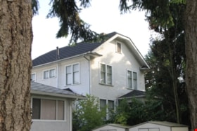
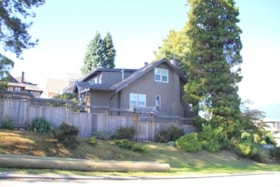
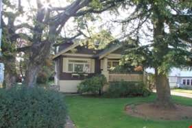
- Built after the end of the First World War, this house features an eclectic blend of Arts and Crafts elements. Constructed for A.E. Brown and a full two storeys in height, it has a front jerkin-headed roof with a jerkin-headed side projection, and a corner wraparound verandah with tapered columns. The house has been maintained in near original condition, with original lapped wooden siding, multi-paned windows and square balusters.
- Locality
- Edmonds
- Historic Neighbourhood
- Edmonds (Historic Neighbourhood)
- Planning Study Area
- Kingsway-Beresford Area
- Ownership
- Private
- Street Address
- 6830 Sperling Avenue
- Street View URL
- Google Maps Street View
Images
Agnes & Elizabeth Michie Residence
https://search.heritageburnaby.ca/link/landmark554
- Repository
- Burnaby Heritage Planning
- Description
- Residential building.
- Associated Dates
- c.1935
- Street View URL
- Google Maps Street View
- Repository
- Burnaby Heritage Planning
- Geographic Access
- Yale Street
- Associated Dates
- c.1935
- Description
- Residential building.
- Heritage Value
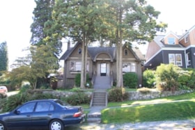
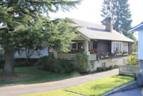
- This interwar bungalow is beautifully preserved and retains many original features. Symmetrical in design, with two steeply-pitched front gables that flank a central arched gable over the front entrance, it also retains its narrow arched windows and projecting purlins in the front gables. Narrow sidelights flank the front door. The matching front elevation windows are typical of the period, with double-hung sash flanking a plate glass “picture window” with a curved transom; the upper panes are cross-leaded. This house was built by Agnes Michie and Elizabeth D. Michie.
- Locality
- Vancouver Heights
- Historic Neighbourhood
- Vancouver Heights (Historic Neighbourhood)
- Planning Study Area
- Burnaby Heights Area
- Ownership
- Private
- Street Address
- 3894 Yale Street
- Street View URL
- Google Maps Street View
Images
Agreement for sale of land between Joseph C. Armstrong and Jesse Love re District Lot 25
https://search.heritageburnaby.ca/link/museumdescription18788
- Repository
- Burnaby Village Museum
- Date
- 6 Oct. 1893
- Collection/Fonds
- Love family fonds
- Description Level
- Item
- Physical Description
- 1 p. of textual records + 1 plan : red and black ink on linen ; 16 x 8.5 cm
- Scope and Content
- Item consists of an Agreement for Sale of Land dated October 6, 1893 between Joseph C. Armstrong and Jesse Love for District Lot 25, Group one, New Westminster District and a small hand drawn plan showing District Lot 25, Cumberland Road and location of building. Land Agreement was registered Febru…
- Repository
- Burnaby Village Museum
- Collection/Fonds
- Love family fonds
- Description Level
- Item
- Physical Description
- 1 p. of textual records + 1 plan : red and black ink on linen ; 16 x 8.5 cm
- Scope and Content
- Item consists of an Agreement for Sale of Land dated October 6, 1893 between Joseph C. Armstrong and Jesse Love for District Lot 25, Group one, New Westminster District and a small hand drawn plan showing District Lot 25, Cumberland Road and location of building. Land Agreement was registered February 13, 1894.
- Accession Code
- BV992.26.8
- Access Restriction
- No restrictions
- Reproduction Restriction
- No known restrictions
- Date
- 6 Oct. 1893
- Media Type
- Textual Record
- Cartographic Material
- Notes
- Title based on contents of item
- Document dated Oct 6 1893; "ARTICLES OF AGREEMENT" between Joseph C. Armstrong and Jesse Love; one page, folded on buff, legal-sized paper with pink borders; black print; handwritten in faded brown ink; for a parcel of land in the New Westminster District, all that portion of Lot 25, Group I, from a point on the Easterly side 20 chains from the South Easterly corner, then from the South Easterly corner, then northerly and parallel with the Cumberland Road for 10 chains and 52 links, then southerly 10 chains, then Easterly 14 chains and 52 links, total 14 acres and 52/100; for $1161 in 17 instalments at 6% interest; signed by Jesse Love and J.C. Armstrong, witnessed by H.A. Eastman; two seals are missing, pink stains on paper; addition May 1900 signed by Jesse Love and H.A. Eastman; folds twice; when folded, panel showing is "AGREEMENT for Sale of Land." "on Cumberland road in Lot 25 Group I"; handwritten "H.A. Eastman" over printed "E.H. PORT & CO.", "REAL ESTATE BROKERS" "NEW WESTMINSTER BRITISH COLUMBIA"; back panel has blue stamping and pink additions, giving No. 546C, registered February 13, 1894, Charge Book Vol. 13, Folio 51, signed C.S. Corrigan? District Registrar; with hand-drawn plan on stained linen, pink ink with black additions, shows Cumberland Road and city limits.
Alfred & Ruth MacLeod Cottage
https://search.heritageburnaby.ca/link/landmark503
- Repository
- Burnaby Heritage Planning
- Description
- Located atop a hill on the southern shore of picturesque Deer Lake, the Alfred and Ruth MacLeod Cottage is a one and one-half storey, wood-frame, rustic Arts and Crafts-style bungalow. The cottage is well-maintained, but has been altered through the enclosure of much of its original wraparound vera…
- Associated Dates
- 1913
- Repository
- Burnaby Heritage Planning
- Geographic Access
- Deer Lake Drive
- Associated Dates
- 1913
- Description
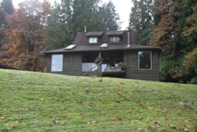
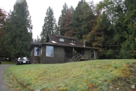
- Located atop a hill on the southern shore of picturesque Deer Lake, the Alfred and Ruth MacLeod Cottage is a one and one-half storey, wood-frame, rustic Arts and Crafts-style bungalow. The cottage is well-maintained, but has been altered through the enclosure of much of its original wraparound verandah. Its sits on the brow of a steep slope, with panoramic views north to Deer Lake.
- Heritage Value
- The Alfred and Ruth MacLeod Cottage is valued as a significant example of the early development of summer estates in Burnaby, specifically in the Deer Lake neighbourhood, that attracted residents from the burgeoning cities of New Westminster and Vancouver. Access to the area was facilitated by the construction of the Burnaby Lake Interurban tramline, which opened in June 1911. This modest, rustic cottage illustrates the desire for a simple country lifestyle and retreat into nature of those who settled on the south shore of Deer Lake. While the grand mansions on the north shore of Deer Lake are set in formally landscaped gardens, the informality of this cottage demonstrates reverence for its natural, wooded surroundings, oriented towards views of Deer Lake. The Alfred and Ruth MacLeod Cottage is important for its connection with prominent New Westminster insurance and real estate broker, Alfred W. MacLeod, and his wife, Ruth. The MacLeods had recently constructed a large city home, and built this cottage as a summer residence in 1913. In 2005, the Alfred and Ruth MacLeod Cottage was purchased by the City of Burnaby and today constitutes part of the Deer Lake Park Heritage Precinct, which is Burnaby's most significant collection of historic sites.
- Defining Elements
- Key elements that define the heritage character of the Alfred and Ruth MacLeod Cottage include its: - secluded setting on the brow of a steep hill on the southern shore of Deer Lake, with expansive views of Deer Lake to the north - residential form, scale and massing as expressed by its one and one-half storey rectangular plan, side-gabled roof, hipped roof over original verandah and two shed dormers - associated landscape features such as mature coniferous and deciduous trees surrounding the property
- Historic Neighbourhood
- Burnaby Lake (Historic Neighbourhood)
- Planning Study Area
- Morley-Buckingham Area
- Function
- Primary Historic--Single Dwelling
- Primary Current--Single Dwelling
- Cadastral Identifier
- P.I.D.000-708-038
- Boundaries
- The Alfred and Ruth MacLeod Cottage is comprised of a single residential lot located at 6466 Deer Lake Drive, Burnaby.
- Area
- 13354.63
- Contributing Resource
- Building
- Ownership
- Public (local)
- Documentation
- City of Burnaby Planning and Building Department, Heritage Site Files
- Street Address
- 6466 Deer Lake Drive
Images
Alfred & Sarah Chrisp Residence
https://search.heritageburnaby.ca/link/landmark556
- Repository
- Burnaby Heritage Planning
- Description
- Rsidential building.
- Associated Dates
- 1913
- Street View URL
- Google Maps Street View
- Repository
- Burnaby Heritage Planning
- Geographic Access
- 11th Avenue
- Associated Dates
- 1913
- Description
- Rsidential building.
- Heritage Value
- This high-quality Craftsman bungalow was built for Alfred John Chrisp (1882-1944) and his wife Sarah Hannah Chrisp (née Hindmarch, 1883-1954). Starting in 1908, Alfred worked as an accountant for the CPR in New Westminster, and he and Sarah were married there in 1910. This house features a front gabled roof and gabled front porch, and is notable for its elaborate stained glass windows in the front door glazing, sidelights and the narrow transom over the front elevation window. Maintaining a very high degree of original integrity, the bungalow features lapped siding at the foundation level, a shingle clad main floor, a combination of casement and double-hung windows and square tapered porch columns.
- Locality
- East Burnaby
- Historic Neighbourhood
- East Burnaby (Historic Neighbourhood)
- Planning Study Area
- Edmonds Area
- Street Address
- 7349 11th Avenue
- Street View URL
- Google Maps Street View
Images
Alfred's Fountain Pen
https://search.heritageburnaby.ca/link/museumdescription9684
- Repository
- Burnaby Village Museum
- Date
- 2016
- Collection/Fonds
- Burnaby Village Museum Film and Video collection
- Description Level
- Item
- Physical Description
- 1 video recording (mp4) (3 min., 40 sec.) : digital, 25 fps, col., sd., stereo
- Scope and Content
- The video depicts the challenges of film maker Alfred Woo’s physical, social, and cultural transformation to a foreign country. Sentimentally prior to departing Hong Kong in 1954, Alfred was presented a fountain pen by some of his grade two classmates, a souvenir that he has cherished all these yea…
- Repository
- Burnaby Village Museum
- Collection/Fonds
- Burnaby Village Museum Film and Video collection
- Description Level
- Item
- Physical Description
- 1 video recording (mp4) (3 min., 40 sec.) : digital, 25 fps, col., sd., stereo
- Scope and Content
- The video depicts the challenges of film maker Alfred Woo’s physical, social, and cultural transformation to a foreign country. Sentimentally prior to departing Hong Kong in 1954, Alfred was presented a fountain pen by some of his grade two classmates, a souvenir that he has cherished all these years despite losing contact with them long ago. In his seniority, he muses poignantly about the symbolism of this writing instrument and shares his wonderment about the destiny of these childhood benefactors.
- History
- Immigrating from Hong Kong to Canada as a child, Alfred Woo easily assimilated into the Canadian way of life at an early age and has enjoyed the best of both worlds. A law graduate, his professional career included service as a Crown Counsel, securities administrator, corporate executive, and as private practitioner. He also served in the Canadian Army (Reserve Force) as a legal officer and an artillery officer before being honorably discharged at the rank of Major. A Burnaby resident for over 30 years, and now retired, he continues to volunteer helping seniors, a community service club, and a veterans group.
- Creator
- Woo, Alfred
- Other Title Information
- title supplied by film maker
- Subjects
- Persons - Chinese Canadians
- Names
- Woo, Alfred
- Accession Code
- BV016.37.15
- Access Restriction
- No restrictions
- Reproduction Restriction
- May be restricted by third party rights
- Date
- 2016
- Media Type
- Moving Images
- Notes
- Transcribed title
Images
Video
Alfred's Fountain Pen, 2016
Alfred's Fountain Pen, 2016
https://search.heritageburnaby.ca/media/hpo/_Data/_BVM_Moving_Images/2016_0037_0015_001.mp4Aliceville
https://search.heritageburnaby.ca/link/landmark721
- Repository
- Burnaby Heritage Planning
- Associated Dates
- 1886
- Heritage Value
- Shortly after the townsite of Port Moody was surveyed in the early 1880s, a resort community developed on the border of Burnaby and Port Moody that would come to be called Aliceville. Located near the north end of North Road, in 1886 the Canadian Pacific Railway established a flag station there and the settlement was named after Alice May Webster who, with her sister Mrs. Jenns, operated the Aliceville Hotel.
- Historic Neighbourhood
- Barnet (Historic Neighbourhood)
- Planning Study Area
- Burnaby Mountain Area
Images
Allman Road - DL 87
https://search.heritageburnaby.ca/link/archivedescription489
- Repository
- City of Burnaby Archives
- Date
- 1911
- Collection/Fonds
- City Council and Office of the City Clerk fonds
- Description Level
- File
- Physical Description
- Textual record and cartographic material
- Scope and Content
- File contains correspondence pertaining to the construction of a road in DL 87. File includes a pamphlet with an advertisement for land auction and plan of subdivision of lots 1, 2 and 5 of Lot 87 and a 20 1/2 acre part in the northwest section of Lot 87.
- Repository
- City of Burnaby Archives
- Date
- 1911
- Collection/Fonds
- City Council and Office of the City Clerk fonds
- Physical Description
- Textual record and cartographic material
- Description Level
- File
- Record No.
- 2196
- Accession Number
- 2001-02
- Scope and Content
- File contains correspondence pertaining to the construction of a road in DL 87. File includes a pamphlet with an advertisement for land auction and plan of subdivision of lots 1, 2 and 5 of Lot 87 and a 20 1/2 acre part in the northwest section of Lot 87.
- Media Type
- Textual Record
- Cartographic Material
- Notes
- Plans/maps are located in file and have not been moved to map case.
All Saints Church
https://search.heritageburnaby.ca/link/museumdescription11924
- Repository
- Burnaby Village Museum
- Date
- [ca.1910]
- Collection/Fonds
- Ronald G. Scobbie collection
- Description Level
- Item
- Physical Description
- 1 plan : black ink and watercol. on paper ; 30.45 x 30.5 cm
- Scope and Content
- Item consists of building insurance plan of "All Saints Church / Lot "A" BK 29 DL 98 GP1 N.W.D.". Watling Street is idenfied to the north of the church building and Royal Oak Avenue to the west.
- Repository
- Burnaby Village Museum
- Collection/Fonds
- Ronald G. Scobbie collection
- Description Level
- Item
- Physical Description
- 1 plan : black ink and watercol. on paper ; 30.45 x 30.5 cm
- Material Details
- Scale 1 inch = 20 feet
- Scope and Content
- Item consists of building insurance plan of "All Saints Church / Lot "A" BK 29 DL 98 GP1 N.W.D.". Watling Street is idenfied to the north of the church building and Royal Oak Avenue to the west.
- Subjects
- Buildings - Religious - Churches
- Accession Code
- BV003.83.46
- Access Restriction
- No restrictions
- Reproduction Restriction
- No known restrictions
- Date
- [ca.1910]
- Media Type
- Cartographic Material
- Scan Resolution
- 600
- Scan Date
- 15-Jan-2021
- Scale
- 100
- Notes
- Transcribed title
- Note in pencil on verso reads: ""All Saints Church / Lot "A" BK 29 DL 98 / Scale 1 inch = 20 feet"
- Note in balck in on verso reads: "3704"
Images
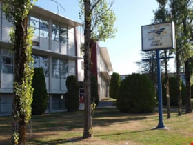
Alpha Secondary School
https://search.heritageburnaby.ca/link/landmark678
- Repository
- Burnaby Heritage Planning
- Geographic Access
- Parker Street
- Associated Dates
- 1950
- Heritage Value
- The unexpected period of growth in Burnaby during the first few years of the 1950s resulted in many overcrowded schools. As a result, the School Board decided it required a Junior High to alleviate enrolment issues at Gilmore Avenue Elementary-Junior school. Alpha opened in 1950 with 423 students. The new school had 12 rooms but added more in 1953. There were fires at the school in 1956 and 1964, resulting in the rebuilding of seven classrooms, library and administrative offices. There were additions made in 1968 and 1969 and in 1976 a gymnasium was built.
- Planning Study Area
- Brentwood Area
- Street Address
- 4600 Parker Street
- Street View URL
- Google Maps Street View
Images
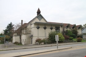
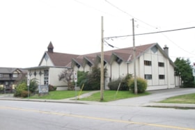
Alta Vista Baptist Church
https://search.heritageburnaby.ca/link/landmark557
- Repository
- Burnaby Heritage Planning
- Description
- Church building.
- Associated Dates
- 1936
- Other Names
- Royal Oak Community Church
- Street View URL
- Google Maps Street View
- Repository
- Burnaby Heritage Planning
- Other Names
- Royal Oak Community Church
- Geographic Access
- Royal Oak Avenue
- Associated Dates
- 1936
- Description
- Church building.
- Heritage Value
- This Baptist congregation originally held services in a tent at the corner of McGregor Avenue and Portland but they soon were able to build a small church. A membership drive by Pastor Arthur James Bowbrick (1875-1961) was so successful that the congregation was able build this fine structure, prominently located at the corner of Victory Street. Although it has been altered with later additions and stucco over the original siding, the original windows and the rooftop belfry remain.
- Locality
- Alta Vista
- Historic Neighbourhood
- Alta Vista (Historic Neighbourhood)
- Planning Study Area
- Sussex-Nelson Area
- Ownership
- Private
- Street Address
- 7175 Royal Oak Avenue
- Street View URL
- Google Maps Street View
Images
Alta Vista Neighbourhood
https://search.heritageburnaby.ca/link/landmark707
- Repository
- Burnaby Heritage Planning
- Associated Dates
- 1925-1954
- Heritage Value
- As with many areas of Burnaby during this period, the years after World War Two marked a rapid growth in residential development in the Alta-Vista Neighbourhood. Subdivisions like Sussex and Suncrest were built and new schools and amenities were constructed to meet the demands of increased population.
- Historic Neighbourhood
- Alta Vista (Historic Neighbourhood)
- Planning Study Area
- Sussex-Nelson Area
Images
Alta Vista Neighbourhood
https://search.heritageburnaby.ca/link/landmark766
- Repository
- Burnaby Heritage Planning
- Associated Dates
- 1905-1924
- Heritage Value
- Alta Vista, named for its high views of the Fraser Valley, rapidly grew during the period 1910-1912, seeing its settlement jump from about a dozen buildings in 1910 to about four hundred by the end of 1912. Home-seekers were attracted to its location just a short walk from the B.C.E.R. line at Royal Oak and Highland Park and easily accessible to both New Westminster and Vancouver.
- Historic Neighbourhood
- Alta Vista (Historic Neighbourhood)
- Planning Study Area
- Sussex-Nelson Area
![1892 Burnaby Centennial, [1992] thumbnail](/media/hpo/_Data/_BVM_Cartographic_Material/2013/2013_0008_0001_001.jpg?width=280)
![1912 Parker Carousel Restoration 1991 to 1994, [between 1991 and 1994] thumbnail](/media/hpo/_Data/_BVM_Moving_Images/2020_0012_0001_001.jpg?width=280)
![All Saints Church, [ca.1910] thumbnail](/media/hpo/_Data/_BVM_Cartographic_Material/2003/2003_0083_0046_001.jpg?width=280)
