Narrow Results By
Creator
- Bancroft, Rose 1
- Burnett and McGugan B.C. Land Surveyors, New Westminster 5
- Burnett, David H. 1
- Burnett, Geoffrey K. 5
- Burnett & McGugan, Engineers and Surveyors 21
- City of Burnaby 1
- Coast Map and Blue Print Co. 1
- Forsyth, Mary 1
- Garden, Hermon and Burwell 2
- Gauvreau, Narcisse B. 1
- Geoffrey K. Burnett 1
- Government of Canada - Department of the Interior 1
Person / Organization
- All Saints Anglican Church 1
- Armstrong Avenue School 1
- Barnet School 1
- Broadview Presbyterian Church 1
- Burnett, Geoffrey K. 2
- Douglas Road School 1
- Dundonald United Church 1
- Edmonds Community School 2
- Gilmore Avenue School 1
- Gordon Presbyterian Church 1
- Hamilton Road School 1
- Hill, Louis Claude "Claude" 1
Survey and Subdivision plans in New Westminster District Group 2 - Surrey, Delta
https://search.heritageburnaby.ca/link/museumdescription7047
- Repository
- Burnaby Village Museum
- Date
- [1898-1910]
- Collection/Fonds
- Burnaby Village Museum Map collection
- Description Level
- File
- Physical Description
- 10 plans : graphite and ink on paper and linen; various sizes mounted on 2 sides of cardboard 76 x 102 cm
- Scope and Content
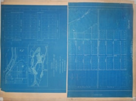
- File consists of a large board with four plans in New Westminster District mounted on one side and six plans mounted on the other side. Side A: 1. Plan : black ink on paper with colour (no formal title). Plan covers area in New Westminster District, Group 2 situated along the south shore of the …
- Repository
- Burnaby Village Museum
- Collection/Fonds
- Burnaby Village Museum Map collection
- Description Level
- File
- Physical Description
- 10 plans : graphite and ink on paper and linen; various sizes mounted on 2 sides of cardboard 76 x 102 cm
- Material Details
- Scales vary
- Indexed number on tape on edge of board reads "78"
- Scope and Content
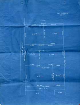
- File consists of a large board with four plans in New Westminster District mounted on one side and six plans mounted on the other side. Side A: 1. Plan : black ink on paper with colour (no formal title). Plan covers area in New Westminster District, Group 2 situated along the south shore of the Fraser River identified as "Indian Reserve / Turner 1868" situated in District Lot 1 between District Lot 2 identified as "Mohun's Line" and "Herring's Line" bordered by lots B and A. Includes note "see plan of subdivision of Lots 3 & 4 Gr. 2". (Geographic location: Surrey) 2. Plan : graphite on paper ; Title reads: "B5N R2W, Sec.26_Sec. 28 / Sec. 35_Sec.36". Plan covers a 60 acre parcel in Sec. 35 with Yale wagon road to the south. Scale: 6 chains = 1 inch (Geographic location: Surrey) 3. Plan : black ink on paper ; Title reads: "Survey for Proposed Highway in Indian Reserve Surrey". Plan covers area of land to the northwest of Lot 2 along the shore of the Fraser River and identfies route of proposed highway, proposed tramway as well at the Great Northern Railway and bridge. Scale: 2 chains = 1 inch 4. Plan : black ink on red lined graphing paper ; Title reads: "Sketch Plan Showing Section of Great Northern R. of W. at Point of Crossing of Proposed Ditch". Plan covers area of Lot 2 in New Westminster District, Group 2. (Surrey) Scale: 1 inch = 5 feet. (Geographic location: Surrey) Side B: 1. Plan : black ink on paper ; Title reads: "Plan of Subdivision of a Portion of Section 13, TP2, Surrey Municipality, New Westminster District, B.C.". Plan covers land bordered by Coast Meridian Road (to the east), Bose Road (to the south) and Pike Road (to the west). Surveyed for D.S. Bayners, Nov. 24, 1908. Scale: 5 chains= 1 inch 2. Plan : black ink on linen with colour ; Title reads: "Traverse of the Waterline in front of Lots 3 and 4, Group 2, New Westminster District with G.N. Railway Right of Way". Plan covers area along the southern shore of the Fraser River with a road crossing the Great Northern Railway and leading to a wharf. Scale: 100 feet = 1 inch (Geographic location: Surrey) 3. Plan : black ink on paper ; Title reads: "Survey of the South Boundary of Sec. 12, Township 2, New Westminster District". Plan covers area south of Bose Road and west of Coast Meridean Road and north of McClellen Road. Scale: 400 feet = 1 inch. Sec.12 (Geographic location: Surrey) 4. Plan : graphite on paper ; Title reads: "Plan of Subdivisioin of a part of S.E. 1/4 of Sec. 7, TP 8". Plan covers area of Section 7 in New Westminster District, Group 2, Township 8. Streets are identified running through lot including, Langley Ave., Robinson Ave, Melrose Ave., Hawthorne Ave., Broadway, Bond Ave., Mable Ave., Breene Ave. and McLelland Ave. and Clover Valley Road. Scale: 200 feet = 1 inch. Note in black ink reads: See Bd. 166 for blue print. (Geographic location: Surrey) 5. Plan : graphite on linen ; Title reads: "Sec.20, B5N R2W". Plan covers area north of Yale Road and is subdivided into parts identified as A, B, C, D, E, and unknown. (Geographic location: Surrey) 6. Plan : black ink and graphite on paper ; (no formal title) Plan covers lots surveyed along Ladner Road identified as A, B and Lots 13, 12 and 11. [Geographic location: Delta]
- Accession Code
- HV977.93.78
- Access Restriction
- No restrictions
- Reproduction Restriction
- No known restrictions
- Date
- [1898-1910]
- Media Type
- Cartographic Material
- Scan Resolution
- 600
- Scan Date
- 2023-06-26
- Notes
- Title based on contents of file
- Note re plans 1A & 3A: The sight of Brownsville was also the former site of the Qayqayt First Nation and one of the main summer villages of the Kwantlen and ʷməθkʷəy̓əm (Musqueam) peoples
- Scale is measured in chains and feet. (One chain equals 792 inches)
Zoomable Images
![Survey and Subdivision plans in New Westminster District Group 2 - Surrey, Delta
, [1898-1910] thumbnail](/media/hpo/_Data/_BVM_Cartographic_Material/1977/1977_0093_0078_003_seadragon/1977_0093_0078_003.jpg?w=280)
Survey and Subdivision plans in New Westminster District Group 2 - Surrey, Delta , [1898-1910]
Zoom into ImageSurvey and Subdivision plans series
https://search.heritageburnaby.ca/link/museumdescription18778
- Repository
- Burnaby Village Museum
- Date
- [1890-1920]
- Collection/Fonds
- Burnaby Village Museum Map collection
- Description Level
- Series
- Physical Description
- over 1000 plans + textual records (34 notebooks)
- Scope and Content
- Series consists of Survey and Subdivision Plans of Burnaby and other geographic regions, including the Greater Vancouver area and New Westminster District, Group 1 and Group 2 along with a series of surveyor's field notebooks [1917-1940]. A significant portion of this series came from the Land Surv…
- Repository
- Burnaby Village Museum
- Collection/Fonds
- Burnaby Village Museum Map collection
- Description Level
- Series
- Physical Description
- over 1000 plans + textual records (34 notebooks)
- Scope and Content
- Series consists of Survey and Subdivision Plans of Burnaby and other geographic regions, including the Greater Vancouver area and New Westminster District, Group 1 and Group 2 along with a series of surveyor's field notebooks [1917-1940]. A significant portion of this series came from the Land Surveyor's office of Geoffrey K. Burnett, first established by Albert J. Hill in [1890].
- Accession Code
- HV976.57
- HV977.93
- BV998.11
- BV004.14
- Date
- [1890-1920]
- Media Type
- Cartographic Material
- Textual Record
- Notes
- Title based on contents of series
Survey maps - Sundries
https://search.heritageburnaby.ca/link/archivedescription664
- Repository
- City of Burnaby Archives
- Date
- 1902-1910
- Collection/Fonds
- City Council and Office of the City Clerk fonds
- Description Level
- File
- Physical Description
- Textual record and cartographic material
- Scope and Content
- File contains various maps - 1 ink on paper and 5 linen plans by Albert J. Hill as well as survey descriptions (textual).
- Repository
- City of Burnaby Archives
- Date
- 1902-1910
- Collection/Fonds
- City Council and Office of the City Clerk fonds
- Physical Description
- Textual record and cartographic material
- Description Level
- File
- Record No.
- 2389
- Accession Number
- 2001-02
- Scope and Content
- File contains various maps - 1 ink on paper and 5 linen plans by Albert J. Hill as well as survey descriptions (textual).
- Media Type
- Textual Record
- Cartographic Material
- Notes
- Plans/maps are located in file and have not been moved to map case.
Survey of North Road
https://search.heritageburnaby.ca/link/museumdescription11916
- Repository
- Burnaby Village Museum
- Date
- June 24, 1911
- Collection/Fonds
- Ronald G. Scobbie collection
- Description Level
- Item
- Physical Description
- 1 survey plan : pencil on paper ; 22.5 x 23 cm
- Scope and Content
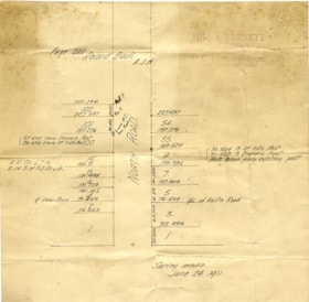
- Item consists of a survey plan along the east and west sides of North Road. Lots on the east side include District Lots 102; 101; 100; 15; 8; 6; 4; 2; 1. Lots on the west side include; District Lots 54; 55; 9; 7; 5; 3 and 1.
- Repository
- Burnaby Village Museum
- Collection/Fonds
- Ronald G. Scobbie collection
- Description Level
- Item
- Physical Description
- 1 survey plan : pencil on paper ; 22.5 x 23 cm
- Scope and Content
- Item consists of a survey plan along the east and west sides of North Road. Lots on the east side include District Lots 102; 101; 100; 15; 8; 6; 4; 2; 1. Lots on the west side include; District Lots 54; 55; 9; 7; 5; 3 and 1.
- Creator
- Hill & Burnett
- Geographic Access
- North Road
- Accession Code
- BV003.83.26
- Access Restriction
- No restrictions
- Reproduction Restriction
- No known restrictions
- Date
- June 24, 1911
- Media Type
- Cartographic Material
- Scan Resolution
- 600
- Scan Date
- Dec. 15, 2020
- Scale
- 100
- Notes
- Title based on contents of plan
- Notes in pencil on verso read: P.11 Vol 1 / P. 15 Vol 1 / P. 17 Vol 1 / Lot 9 / John [Keys] P.R. 2100 / River foreshore"
- Note in red pencil crayon on verso reads: "001609”
- Stamp in red ink on plan reads: "Hill & Burnett / Civil Engineers / and / B.C. Land Surveyors / New Westminter B.C."
Images
Survey plans along North Road
https://search.heritageburnaby.ca/link/museumdescription11141
- Repository
- Burnaby Village Museum
- Date
- [1911]
- Collection/Fonds
- Ronald G. Scobbie collection
- Description Level
- File
- Physical Description
- 1 survey plan : ink on waxed linen ; 28.5 x 18 cm + 4 survey plans : blueprints ; 28 x 24 cm and smaller
- Scope and Content
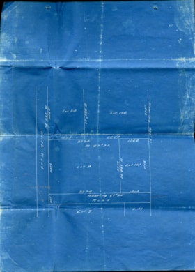
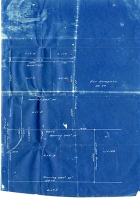
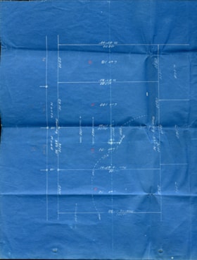
- File consists of four survey plans of District Lots on the east side of North Road, New Westminster Dist / Group 1 and one survey plan including District Lots on the west side of North Road in New Westminster District Group 1.
- Repository
- Burnaby Village Museum
- Collection/Fonds
- Ronald G. Scobbie collection
- Description Level
- File
- Physical Description
- 1 survey plan : ink on waxed linen ; 28.5 x 18 cm + 4 survey plans : blueprints ; 28 x 24 cm and smaller
- Scope and Content
- File consists of four survey plans of District Lots on the east side of North Road, New Westminster Dist / Group 1 and one survey plan including District Lots on the west side of North Road in New Westminster District Group 1.
- Geographic Access
- North Road
- Accession Code
- BV003.83.20
- Access Restriction
- No restrictions
- Reproduction Restriction
- No known restrictions
- Date
- [1911]
- Media Type
- Cartographic Material
- Scan Resolution
- 600
- Scan Date
- 24-Nov-2020
- Scale
- 100
- Notes
- Title based on contents of maps
- Note in black ink on verso of maps reads:"000233"
Images
Survey - Roberts Road and Power House Road
https://search.heritageburnaby.ca/link/archivedescription8038
- Repository
- City of Burnaby Archives
- Date
- [191-?]
- Collection/Fonds
- City Council and Office of the City Clerk fonds
- Description Level
- Item
- Physical Description
- 1 map
- Scope and Content
- One white linen plan with Vancouver Road to the north and North Arm Road to the south.
- Repository
- City of Burnaby Archives
- Date
- [191-?]
- Collection/Fonds
- City Council and Office of the City Clerk fonds
- Physical Description
- 1 map
- Description Level
- Item
- Record No.
- 10993
- Accession Number
- 2001-02
- Scope and Content
- One white linen plan with Vancouver Road to the north and North Arm Road to the south.
- Media Type
- Cartographic Material
- Notes
- Located in map case.
Tank Site - Central Park
https://search.heritageburnaby.ca/link/archivedescription577
- Repository
- City of Burnaby Archives
- Date
- 1911-1912
- Collection/Fonds
- City Council and Office of the City Clerk fonds
- Description Level
- File
- Physical Description
- Textual record and cartographic material
- Scope and Content
- File contains agreement and correspondence between the Corporation of the District of Burnaby and the Central Park Agricultural Association and Farmers Institute regarding the water tank site. File also contains 3 blueprint plans of the tank site.
- Repository
- City of Burnaby Archives
- Date
- 1911-1912
- Collection/Fonds
- City Council and Office of the City Clerk fonds
- Physical Description
- Textual record and cartographic material
- Description Level
- File
- Record No.
- 2287
- Accession Number
- 2001-02
- Scope and Content
- File contains agreement and correspondence between the Corporation of the District of Burnaby and the Central Park Agricultural Association and Farmers Institute regarding the water tank site. File also contains 3 blueprint plans of the tank site.
- Media Type
- Textual Record
- Cartographic Material
- Notes
- A plan of site for water tank in Central Park : M9-B-3-6
vey and Subdivision plans in New Westminster District Group 1 – Burnaby
https://search.heritageburnaby.ca/link/museumdescription6976
- Repository
- Burnaby Village Museum
- Date
- [1900-1910]
- Collection/Fonds
- Burnaby Village Museum Map collection
- Description Level
- File
- Physical Description
- 4 plans : blueprints on paper mounted on 2 sides of cardboard 76 x 102 cm
- Scope and Content
- Item consists of a large board of two New Westminster District plans mounted on one side and two New Westminster District subdivision plans mounted on the other side. Side A: 1. Blueprint "Plan / of Subdivision / of a portion / of / Lot 96 / Group One / New Westminster District / Scale 2 chs = …
- Repository
- Burnaby Village Museum
- Collection/Fonds
- Burnaby Village Museum Map collection
- Description Level
- File
- Physical Description
- 4 plans : blueprints on paper mounted on 2 sides of cardboard 76 x 102 cm
- Material Details
- Scales [between 1:120 and 1:1584]
- Index number on edge of board reads: "7"
- Scope and Content
- Item consists of a large board of two New Westminster District plans mounted on one side and two New Westminster District subdivision plans mounted on the other side. Side A: 1. Blueprint "Plan / of Subdivision / of a portion / of / Lot 96 / Group One / New Westminster District / Scale 2 chs = 1in." (Geographic locaiton: Burnaby) 2. Blueprint "Plan / North Road / from Holmes' Corner, North / Scale 100 ' = 1"" and "Profile on North Road / from / Holmes' Corner, North". The following are identified: Ravine filled, V.W. & Y. Railway, Brunette River, Holmes' Corner, Holmes' Crib, Private Road, North Road, Old Road and New Westminster Municipal Boundary. (Geographic locaiton: Burnaby) Side B: 1. Blueprint "Subdivision / of Blocks 14, 7 and 4 / In the Subdivision / of / Lot 53, Group 1 / New Westminster District / Scale 1 ch = 1 in." Plan also includes two inset Maps showing the location of DL 53 in relation to the City of New Westminster and Vancouver. The subdivision plans identifies: First Avenue, Second Avenue, Third Avenue, Fourth Avenue bordered by Seventeenth Street and Sixteenth Street. (Geographic locaiton: Burnaby) 2. Blueprint with handwritten title "No. 631 / Plan / of / Subdivision / Lots _ see sheets 1-19, 36-53, 69-75.../ Lot 30 Group 1 / ... Scale 2 chs = 1 in." Edmonds Street and Westminster & Vancouver Tramway are identified along with Walter Street, Kemp Street, Fortune Street, Alice Street, Henry Street, Beatrice Street and Humphries Avenue. (Geographic locaiton: Burnaby)
- Accession Code
- HV977.93.7
- Access Restriction
- No restrictions
- Reproduction Restriction
- No known restrictions
- Date
- [1900-1910]
- Media Type
- Cartographic Material
- Scan Resolution
- 300
- Scale
- 72
- Notes
- Title based on contents of file Scale is measured in chains and feet (One chain equals 792 inches)
- The term "Lot" can also refer to a "District Lot"
Images
Walkem Wiggins Roads
https://search.heritageburnaby.ca/link/archivedescription373
- Repository
- City of Burnaby Archives
- Date
- 1911-1912
- Collection/Fonds
- City Council and Office of the City Clerk fonds
- Description Level
- File
- Physical Description
- Textual record and cartographic material
- Scope and Content
- File contains records related to a quit claim agreement sworn out by Charles S. Richmond for DL 166, including blueprint plans. The agreement was made to facilitate the construction of the New Wiggins Road.
- Repository
- City of Burnaby Archives
- Date
- 1911-1912
- Collection/Fonds
- City Council and Office of the City Clerk fonds
- Physical Description
- Textual record and cartographic material
- Description Level
- File
- Record No.
- 2066
- Accession Number
- 2001-02
- Scope and Content
- File contains records related to a quit claim agreement sworn out by Charles S. Richmond for DL 166, including blueprint plans. The agreement was made to facilitate the construction of the New Wiggins Road.
- Media Type
- Textual Record
- Cartographic Material
- Notes
- Plans/maps are located in file and have not been moved to map case.
Water lots, DL 188, 212
https://search.heritageburnaby.ca/link/archivedescription675
- Repository
- City of Burnaby Archives
- Date
- 1911
- Collection/Fonds
- City Council and Office of the City Clerk fonds
- Description Level
- File
- Physical Description
- Textual record and cartographic material
- Scope and Content
- File contains correspondence and memos regarding applications for water lots in DL 188 and 212. File also includes blueprint "Plan of Foreshore Lot in front of Block "C" DL 188."
- Repository
- City of Burnaby Archives
- Date
- 1911
- Collection/Fonds
- City Council and Office of the City Clerk fonds
- Physical Description
- Textual record and cartographic material
- Description Level
- File
- Record No.
- 2400
- Accession Number
- 2001-02
- Scope and Content
- File contains correspondence and memos regarding applications for water lots in DL 188 and 212. File also includes blueprint "Plan of Foreshore Lot in front of Block "C" DL 188."
- Media Type
- Textual Record
- Cartographic Material
- Notes
- Plans/maps are located in file and have not been moved to map case.
Water main crossing - Boundary Road
https://search.heritageburnaby.ca/link/archivedescription811
- Repository
- City of Burnaby Archives
- Date
- 1914
- Collection/Fonds
- City Council and Office of the City Clerk fonds
- Description Level
- File
- Physical Description
- Textual record and cartographic material
- Scope and Content
- File contains correspondence and agreement with B.C. Electric Railway Co. which contains a blueprint "Plan of Portion of DL 161 showing watermain crossing under BCER track Eburne line."
- Repository
- City of Burnaby Archives
- Date
- 1914
- Collection/Fonds
- City Council and Office of the City Clerk fonds
- Physical Description
- Textual record and cartographic material
- Description Level
- File
- Record No.
- 2564
- Accession Number
- 2001-02
- Scope and Content
- File contains correspondence and agreement with B.C. Electric Railway Co. which contains a blueprint "Plan of Portion of DL 161 showing watermain crossing under BCER track Eburne line."
- Media Type
- Textual Record
- Cartographic Material
- Notes
- Plans/maps are located in file and have not been moved to map case.
Water main crossing - West Burnaby station
https://search.heritageburnaby.ca/link/archivedescription812
- Repository
- City of Burnaby Archives
- Date
- 1914
- Collection/Fonds
- City Council and Office of the City Clerk fonds
- Description Level
- File
- Physical Description
- Textual record and cartographic material
- Scope and Content
- File contains correspondence and agreement with B.C. Electric Railway Co. which contains "Plan showing location of Water Pipe crossing BCER at West Burnaby Station."
- Repository
- City of Burnaby Archives
- Date
- 1914
- Collection/Fonds
- City Council and Office of the City Clerk fonds
- Physical Description
- Textual record and cartographic material
- Description Level
- File
- Record No.
- 2565
- Accession Number
- 2001-02
- Scope and Content
- File contains correspondence and agreement with B.C. Electric Railway Co. which contains "Plan showing location of Water Pipe crossing BCER at West Burnaby Station."
- Media Type
- Textual Record
- Cartographic Material
- Notes
- Plans/maps are located in file and have not been moved to map case.
Waterworks system
https://search.heritageburnaby.ca/link/archivedescription374
- Repository
- City of Burnaby Archives
- Date
- 1911
- Collection/Fonds
- City Council and Office of the City Clerk fonds
- Description Level
- File
- Physical Description
- Textual record and cartographic material
- Scope and Content
- File includes records regarding a water works system for Blocks 1 and 7, DL 153; Blocks 1 to 12 and 29 to 32, DL 34; and Blocks 14 to 24 and 40 to 49, DL 35. Includes sketch plan.
- Repository
- City of Burnaby Archives
- Date
- 1911
- Collection/Fonds
- City Council and Office of the City Clerk fonds
- Physical Description
- Textual record and cartographic material
- Description Level
- File
- Record No.
- 2067
- Accession Number
- 2001-02
- Scope and Content
- File includes records regarding a water works system for Blocks 1 and 7, DL 153; Blocks 1 to 12 and 29 to 32, DL 34; and Blocks 14 to 24 and 40 to 49, DL 35. Includes sketch plan.
- Media Type
- Textual Record
- Cartographic Material
- Notes
- Plans/maps are located in file and have not been moved to map case.
Waterworks system for DL 186 (Vancouver Heights)
https://search.heritageburnaby.ca/link/archivedescription391
- Repository
- City of Burnaby Archives
- Date
- 1910-1913
- Collection/Fonds
- City Council and Office of the City Clerk fonds
- Description Level
- File
- Physical Description
- Textual record and cartographic material
- Scope and Content
- File includes some hand drawn sketch plans, tenders, and agreements regarding waterworks in DL 186 (Vancouver Heights).
- Repository
- City of Burnaby Archives
- Date
- 1910-1913
- Collection/Fonds
- City Council and Office of the City Clerk fonds
- Physical Description
- Textual record and cartographic material
- Description Level
- File
- Record No.
- 2084
- Accession Number
- 2001-02
- Scope and Content
- File includes some hand drawn sketch plans, tenders, and agreements regarding waterworks in DL 186 (Vancouver Heights).
- Media Type
- Textual Record
- Cartographic Material
- Notes
- For related records see also file 6-3-4-8 and file 6-3-4-9. A plan showing a watermain for DL 186 : M9-A-6-1
Way Sang Yuen Wat Kee & Co.
https://search.heritageburnaby.ca/link/museumdescription4648
- Repository
- Burnaby Village Museum
- Date
- 1908-1975
- Collection/Fonds
- Way Sang Yuen Wat Kee & Co. fonds
- Description Level
- Fonds
- Physical Description
- 3 folders of textual records + 180 photographs + ephemera + 1 map + 1 architectural drawing
- Scope and Content
- Fonds consists of records acquired from the Chinese Herbalist shop “Way Sang Yuen Wat Kee & Co” operating in Victoria from 1905 until 1968. Textual records include a few pieces of correspondence, receipts and ephemera addressed to "Way Sang Yuen Wat Kee & Co.", Lim You and Lim Yau (Yew Long Lum) wh…
- Repository
- Burnaby Village Museum
- Collection/Fonds
- Way Sang Yuen Wat Kee & Co. fonds
- Description Level
- Fonds
- Physical Description
- 3 folders of textual records + 180 photographs + ephemera + 1 map + 1 architectural drawing
- Scope and Content
- Fonds consists of records acquired from the Chinese Herbalist shop “Way Sang Yuen Wat Kee & Co” operating in Victoria from 1905 until 1968. Textual records include a few pieces of correspondence, receipts and ephemera addressed to "Way Sang Yuen Wat Kee & Co.", Lim You and Lim Yau (Yew Long Lum) while the shop was in operation at 1620 Government Street in the 1940s. Some of the records are written in English while a portion are written in Cantonese and haven't been translated. Most of the photographs document the content of the original shop at the time of aquistion in 1975. Some photographs of unidentified people may be related to the owner or proprietor of the shop. A collection of other photographs document various Chinese Canadian organizations that were in operation in Victoria. Records are arranged into the following series: 1) Way Sang Yuen Wat Kee & Co. photographs series 2) Way Sang Yuen Wat Kee & Co. documents series
- History
- The Chinese Herbalist shop "Way Sang Yuen Wat Kee & Co" operated in Victoria, BC from about 1905 until [1968]. The meaning of "Way Sang Yuen Wat Kee & Co" can be translated as "Collection, Life, Source, Alive, Shop" although many interpretations can be taken since each Chinese character can have several meanings. Contents of the shop were purchased by the Burnaby Village Museum in 1975 and reassembled as a permanent display in the Burnaby Village Museum. The shop’s original owner was Ng Chee Fong who opened the shop ca.1905. In 1921, Ng returned to Hong Kong and sold the business to Lam Yuen and Wong Ying who were from Vancouver. Lam Yuen and Wong Ying employed Lum Chuck Yue to operate the shop. Lum Chuck Yue had formerly operated a small herbal counter in a Chinese apothecary store on the south side of Fisgard Street, Victoria. In 1924 Lam Yuen and Wong Ying purchased Wah Sun & Co. from Lee S. Yew and Way Sang Yuen Wat Kee & Co. moved into the Wah Sun premises at 1620 Government Street in the Lee Block . The furnishings and fixtures of both stores were combined, with the more elaborate fixtures from WSYWK remaining as part of the public part of the shop and the plainer fixtures of Wah Sun moved into the workroom and basement. In the 1930s Lum Chuck Yue took over the business and became the proprietor. In about 1934, Tan Yi Tang purchased the business and the shop reopened as Way Sang Yuen Wat Kee & Co. following renovations with Lum Yew Jong as the shop's proprietor. Lum Yew Jong continued to operate the shop until his death in 1967 at the age of 68 years. Following Lum’s death, the property and contents of the shop were purchased by Mr. J. Watson Marles, a local owner operator of an antique store at 1714 Government Street. The shop and contents went through a few more private owners including Rodney Pain before it was purchased by the Heritage Village Museum in 1975 with funds made available by the Vancouver Foundation and the Province of British Columbia. Contents of the original shop were reasembled in a reconstructed building as a permanent display on site at the Burnaby Village Museum.
- Creator
- Way Sang Yuen Wat Kee & Company
- Accession Code
- HV975.5
- BV985.5331
- BV017.7
- Access Restriction
- Restricted access
- Reproduction Restriction
- May be restricted by third party rights
- Date
- 1908-1975
- Related Material
- See also Artifacts under Accessions HV975.5; BV985.5331 and BV017.7
- Notes
- Title based on contents of fonds
Way Sang Yuen Wat Kee & Co. documents series
https://search.heritageburnaby.ca/link/museumdescription19022
- Repository
- Burnaby Village Museum
- Date
- 1910-1970
- Collection/Fonds
- Way Sang Yuen Wat Kee & Co. fonds
- Description Level
- Series
- Physical Description
- textual records + 1 map + 1 architectural drawing
- Scope and Content
- Series consists of small collection of business records and newspapers that were part of the contents of the Way Sang Yuen Wat Kee & Co. at 1620 Government Street, Victoria in 1975.
- Repository
- Burnaby Village Museum
- Collection/Fonds
- Way Sang Yuen Wat Kee & Co. fonds
- Description Level
- Series
- Physical Description
- textual records + 1 map + 1 architectural drawing
- Scope and Content
- Series consists of small collection of business records and newspapers that were part of the contents of the Way Sang Yuen Wat Kee & Co. at 1620 Government Street, Victoria in 1975.
- Accession Code
- HV975.5
- BV985.5331
- BV017.7
- Date
- 1910-1970
- Related Material
- See also Artifacts under Accessions HV975.5; BV985.5331 and BV017.7
- Notes
- Title based on contents of series
Western Canada Power Company
https://search.heritageburnaby.ca/link/archivedescription395
- Repository
- City of Burnaby Archives
- Date
- 1909-1930
- Collection/Fonds
- City Council and Office of the City Clerk fonds
- Description Level
- File
- Physical Description
- 5 folders textual records and cartographic material
- Scope and Content
- File contains draft bylaws, draft contracts and correspondence related to the operation of the Western Canada Power Company. As well, file contains declarations, news clippings, correspondence, ballots, and tally sheets that resulted from the voting held regarding the Western Canada Power Co. Byla…
- Repository
- City of Burnaby Archives
- Date
- 1909-1930
- Collection/Fonds
- City Council and Office of the City Clerk fonds
- Physical Description
- 5 folders textual records and cartographic material
- Description Level
- File
- Record No.
- 2091
- Accession Number
- 2001-02
- Scope and Content
- File contains draft bylaws, draft contracts and correspondence related to the operation of the Western Canada Power Company. As well, file contains declarations, news clippings, correspondence, ballots, and tally sheets that resulted from the voting held regarding the Western Canada Power Co. Bylaw. Also included are agreements, correspondence and bylaw no. 114. The 1922 agreement includes a blueprint. As well, file contains a white linen plan of DL 15 and blueprint plans of standard power pole and transmission towers on Broadway and Cariboo Roads, 1916.
- Media Type
- Textual Record
- Cartographic Material
- Notes
- For related records see also file 6-1-5-2. A map of the Municipality of Burnaby by Archibald Moir and Co. : M9-B-2-11; blueprint of Burnaby Municipality : M9-B-2-15
![Survey and Subdivision plans in New Westminster District Group 2 - Surrey, Delta
, [1898-1910] thumbnail](/media/hpo/_Data/_BVM_Cartographic_Material/1977/1977_0093_0078_001.jpg?width=280)

![Survey plans along North Road, [1911] thumbnail](/media/hpo/_Data/_BVM_Cartographic_Material/2003/2003_0083_0020A_001.jpg?width=280)
![vey and Subdivision plans in New Westminster District Group 1 – Burnaby
, [1900-1910] thumbnail](/media/hpo/_Data/_BVM_Cartographic_Material/1977/1977_0093_0007a_001.jpg?width=280)
