Narrow Results By
Creator
- Bekins Moving and Storage Company Limited 1
- British Columbia Underwriters' Association 3
- Burnaby Village Museum 1
- Burnett & McGugan, Engineers and Surveyors 1
- City Map and White Print Co. 1
- Coast Map and Blue Print Co. 1
- Digney, Andy 35
- Digney, Ernest Frank "Dig" 9
- Geographia Limited 1
- Government of Canada - Department of the Interior 1
- Green, Susan 1
- McGugan, Donald Johnston 1
![Municipality of Burnaby, [between 1910 and 1930] thumbnail](/media/hpo/_Data/_BVM_Cartographic_Material/2008/2008_0024_0001_002.jpg?width=280)
Municipality of Burnaby
https://search.heritageburnaby.ca/link/museumdescription8702
- Repository
- Burnaby Village Museum
- Date
- [between 1910 and 1930]
- Collection/Fonds
- Burnaby Village Museum Map collection
- Description Level
- Item
- Physical Description
- 1 map : blackline print with col. ; 83 x 53 cm on sheet 92 x 61 cm
- Scope and Content
- Item consists of "Municipality of Burnaby" map outlining waterlines, telephone lines, lights and power lines, and street lights. A section of the upper left corner (borded by Boundary Road to the west; Queens Ave to the east; Burrard Inlet to the north and Parker Avenue to the south) of map is han…
- Repository
- Burnaby Village Museum
- Collection/Fonds
- Burnaby Village Museum Map collection
- Description Level
- Item
- Physical Description
- 1 map : blackline print with col. ; 83 x 53 cm on sheet 92 x 61 cm
- Material Details
- Scale 10 chains = 1 inch
- Scope and Content
- Item consists of "Municipality of Burnaby" map outlining waterlines, telephone lines, lights and power lines, and street lights. A section of the upper left corner (borded by Boundary Road to the west; Queens Ave to the east; Burrard Inlet to the north and Parker Avenue to the south) of map is hand coloured in red with "Queens Avenue" and "Parker Avenue" identified.
- Creator
- Coast Map and Blue Print Co.
- Responsibility
- Municipal Council of Burnaby
- Accession Code
- BV008.24.1
- Access Restriction
- No restrictions
- Reproduction Restriction
- No known restrictions
- Date
- [between 1910 and 1930]
- Media Type
- Cartographic Material
- Scan Resolution
- 300
- Scan Date
- 2022-05-10
- Notes
- Transcribed title
- "COMPILED EXPRESSLY FOR / THE MUNICIPAL COUNCIL OF BURNABY/ BY/ THE COAST MAP AND BLUE PRINT CO/ EMPIRE BLDG VANCOUVER B.C."
Images
![Municipality of Burnaby, [between 1910 and 1930] thumbnail](/media/hpo/_Data/_BVM_Cartographic_Material/2008/2008_0024_0001_002.jpg)

Interviews with Bill and Albert Parker by Colin Stevens January 17, 1992
https://search.heritageburnaby.ca/link/museumdescription9840
- Repository
- Burnaby Village Museum
- Date
- 1920-1930 (interview content), interviewed January 17, 1992 (date of original), digitized 2020
- Collection/Fonds
- Burnaby Village Museum fonds
- Description Level
- Item
- Physical Description
- 1 videocassette (53 min., 14 sec.) : col. , sd.
- Scope and Content
- Film footage documenting informal interviews with brothers William “Bill” and Albert Parker conducted by Burnaby Village Museum curator, Colin Stevens. The footage opens in the administration building of the Burnaby Village Museum where Bill Parker describes a pair of cross country skis that he is …
- Repository
- Burnaby Village Museum
- Collection/Fonds
- Burnaby Village Museum fonds
- Series
- Jesse Love farmhouse series
- Description Level
- Item
- Physical Description
- 1 videocassette (53 min., 14 sec.) : col. , sd.
- Material Details
- Interviewer: Colin Stevens
- Interviewee:William (Bill) Parker; Albert Parker; Mrs. William Parker
- Location of Interview: Jesse Love farmhouse at the Burnaby Village Museum
- Camera: Susan Green and Colin Stevens
- Scope and Content
- Film footage documenting informal interviews with brothers William “Bill” and Albert Parker conducted by Burnaby Village Museum curator, Colin Stevens. The footage opens in the administration building of the Burnaby Village Museum where Bill Parker describes a pair of cross country skis that he is donating to the museum. Bill recollects how he constructed the skis out of cedar in the late 1920s when he was about 9 or 10 years old. Bill tells of how he skied in the neighbourhood of the Jesse Love farmhouse on Cumberland Road, using the skis until the mid to late 1930s. The film continues with a tour of the Jesse Love farmhouse which is under restoration on site of the Burnaby Village Museum. Curator Colin Stevens takes Albert and Bill Parker through various rooms inside of the house sharing details of what staff have discovered during the restoration process and gathers informative details by interviewing them. During the interviews, the brothers recollect what it was like living in the house in the 1920s. They provide details on the house’s construction, fixtures, heating and water systems along with particulars regarding furnishings and décor. Information that was gathered through interviews such as this, supported the restoration to be completed as accurately as possible.
- History
- Albert and William Charles “Bill” Parker are the sons of Sarah Parker (nee Love) and William Parker. Sarah Parker was the daughter of Jesse and Martha Love and grew up in the Love farmhouse located at 1390 Cumberland Road in Burnaby. Sarah and William Parker and their three children (Albert, Bill and Elsie) moved into the Love farmhouse in about 1925, eventually buying it in 1928 following the death of Sarah’s father Jesse Love. Sarah continued to live in the house until after her husband William died and eventually sold the house to her daughter Elsie Hughes and her husband John Hughes in 1966.
- Creator
- Burnaby Village Museum
- Subjects
- Sports - Skiing
- Buildings - Heritage
- Accession Code
- BV018.41.50
- Access Restriction
- Restricted access
- Reproduction Restriction
- May be restricted by third party rights
- Date
- 1920-1930 (interview content), interviewed January 17, 1992 (date of original), digitized 2020
- Media Type
- Moving Images
- Photographer
- Green, Susan
- Stevens, Colin
- Notes
- Title based on contents of video
- Video was digitized to mp4 in March 2020 from original VHS tape
Images

Video
Interviews with Bill and Albert Parker by Colin Stevens January 17, 1992, 1920-1930 (interview content), interviewed January 17, 1992 (date of original), digitized 2020
Interviews with Bill and Albert Parker by Colin Stevens January 17, 1992, 1920-1930 (interview content), interviewed January 17, 1992 (date of original), digitized 2020
https://search.heritageburnaby.ca/media/hpo/_Data/_BVM_Moving_Images/2018_0041_0050_001.mp4Fire insurance plans - Greater Vancouver - Volume XV - Municipality of Burnaby
https://search.heritageburnaby.ca/link/museumdescription17795
- Repository
- Burnaby Village Museum
- Date
- 1927-1940
- Collection/Fonds
- Burnaby Village Museum Map collection
- Description Level
- Item
- Physical Description
- 11 plans on 8 sheets : col. lithographic print ; 64 x 54 cm
- Scope and Content
- Item consists of fire insurance plans titled "Greater Vancouver / Volume XV / Municipality / of Burnaby" surveyed May 1927 and revised October 1940. Volume XV includes a two page Key Plan (A and B) identifying associated plan numbers and district lots and nine numbered fire insurance plans identifi…
- Repository
- Burnaby Village Museum
- Collection/Fonds
- Burnaby Village Museum Map collection
- Description Level
- Item
- Physical Description
- 11 plans on 8 sheets : col. lithographic print ; 64 x 54 cm
- Material Details
- Scales between [1:600] and [1:6000]
- Scope and Content
- Item consists of fire insurance plans titled "Greater Vancouver / Volume XV / Municipality / of Burnaby" surveyed May 1927 and revised October 1940. Volume XV includes a two page Key Plan (A and B) identifying associated plan numbers and district lots and nine numbered fire insurance plans identified as; 1507; 1508 ; 1517; 1518; 1519; 1520;1521; 1531and 1532.
- Publisher
- Plan Department of Fire Branch of British Columbia Underwriters' Association
- Accession Code
- BV987.1.70
- Access Restriction
- No restrictions
- Reproduction Restriction
- May be restricted by third party rights
- Date
- 1927-1940
- Media Type
- Cartographic Material
- Historic Neighbourhood
- Vancouver Heights (Historic Neighbourhood)
- Planning Study Area
- Burnaby Heights Area
- Willingdon Heights Area
- Scan Resolution
- 400
- Notes
- Title based on contents of item
- These plans are contained within a bound book with labels on cover page reading: "Plan No. 90 / THIS INSURANCE PLAN / of / Vancouver VOLUME "8" / IN THE PROPERTY OF THE / British Columbia Insurance Underwriter's Association / Vancouver B.C. / AND IS LOANED / MELVILLE F. THOMSON CO. .../ Date May 26th, 1934"; / "Plan No. 74 / THIS INSURANCE PLAN / OF / VANCOUVER VOLUME "9"" / Plan No. 11 / THIS INSURANCE PLAN / OF / BURNABY VOLUMES 15-19" / "THIS PLAN IS THE PROPERTY OF / THE / BRITISH LAW INSURANCE COMPANY / LIMITED"
- Fire insurance plans cover various district lots in Burnaby including: District Lot 116,121, 186 and 187.
- Sticker adhered to Key Plan B reads: "
- Contact Burnaby Village Museum to view fire insurance plans that are part of Volume XV
Fire insurance plans - Greater Vancouver - Volume XVII - Municipality of Burnaby
https://search.heritageburnaby.ca/link/museumdescription17797
- Repository
- Burnaby Village Museum
- Date
- 1927-1950
- Collection/Fonds
- Burnaby Village Museum Map collection
- Description Level
- Item
- Physical Description
- 4 plans on 4 sheets : col. lithographic prints
- Scope and Content
- Item consists of fire insurance plans titled "Greater Vancouver / Volume XVII / Municipality / of Burnaby" surveyed May 1927, revised in October 1940 and September 1950. Includes a two page key plan (E and F) and two associated plans numbered 1729 and 1738 (located within District Lot 35).
- Repository
- Burnaby Village Museum
- Collection/Fonds
- Burnaby Village Museum Map collection
- Description Level
- Item
- Physical Description
- 4 plans on 4 sheets : col. lithographic prints
- Scope and Content
- Item consists of fire insurance plans titled "Greater Vancouver / Volume XVII / Municipality / of Burnaby" surveyed May 1927, revised in October 1940 and September 1950. Includes a two page key plan (E and F) and two associated plans numbered 1729 and 1738 (located within District Lot 35).
- Publisher
- Plan Department of Fire Branch of British Columbia Underwriters' Association
- Accession Code
- BV987.1.70
- Access Restriction
- No restrictions
- Reproduction Restriction
- May be restricted by third party rights
- Date
- 1927-1950
- Media Type
- Cartographic Material
- Historic Neighbourhood
- Central Park (Historic Neighbourhood)
- Planning Study Area
- Garden Village Area
- Scan Resolution
- 400
- Scan Date
- 2021-11-17
- Notes
- Title based on contents of item
- These plans were removed from a bound book with labels on cover page reading: "Plan No. 90 / THIS INSURANCE PLAN / of / Vancouver VOLUME "8" / IN THE PROPERTY OF THE / British Columbia Insurance Underwriter's Association / Vancouver B.C. / AND IS LOANED / MELVILLE F. THOMSON CO. .../ Date May 26th, 1934"; / "Plan No. 74 / THIS INSURANCE PLAN / OF / VANCOUVER VOLUME "9"" / Plan No. 11 / THIS INSURANCE PLAN / OF / BURNABY VOLUMES 15-19" / "THIS PLAN IS THE PROPERTY OF / THE / BRITISH LAW INSURANCE COMPANY / LIMITED"
- Contact Burnaby Village Museum to view associated fire insurance plans XVIII
Fire insurance plans - Greater Vancouver - Volume XVIII - Municipality of Burnaby
https://search.heritageburnaby.ca/link/museumdescription17798
- Repository
- Burnaby Village Museum
- Date
- 1927-1950
- Collection/Fonds
- Burnaby Village Museum Map collection
- Description Level
- Item
- Physical Description
- 22 plans on 12 sheets : col. lithographic print ; 64 x 54 cm
- Scope and Content
- Item consists of fire insurance plans titled "Greater Vancouver / Volume XVIII / Municipality / of Burnaby" surveyed May 1927, revised in October 1940 and September 1950. Includes a two page key plan (G and H) and twenty associated plans numbered; 1801; 1802; 1803; 1804; 1805; 1806; 1807; 1808; 18…
- Repository
- Burnaby Village Museum
- Collection/Fonds
- Burnaby Village Museum Map collection
- Description Level
- Item
- Physical Description
- 22 plans on 12 sheets : col. lithographic print ; 64 x 54 cm
- Material Details
- Scales between [1:600] and [1:6000]
- Scope and Content
- Item consists of fire insurance plans titled "Greater Vancouver / Volume XVIII / Municipality / of Burnaby" surveyed May 1927, revised in October 1940 and September 1950. Includes a two page key plan (G and H) and twenty associated plans numbered; 1801; 1802; 1803; 1804; 1805; 1806; 1807; 1808; 1809; 1810; 1811; 1812; 1813; 1814; 1815; 1819; 1820; 1821; 1822 and 1832.
- Publisher
- Plan Department of Fire Branch of British Columbia Underwriters' Association
- Accession Code
- BV987.1.70
- Access Restriction
- No restrictions
- Reproduction Restriction
- May be restricted by third party rights
- Date
- 1927-1950
- Media Type
- Cartographic Material
- Scan Resolution
- 400
- Scan Date
- 11/17/2021
- Notes
- Title based on contents of item
- Scale 1 inch = 50 feet
- These plans were removed from a bound book with labels on cover page reading: "Plan No. 90 / THIS INSURANCE PLAN / of / Vancouver VOLUME "8" / IN THE PROPERTY OF THE / British Columbia Insurance Underwriter's Association / Vancouver B.C. / AND IS LOANED / MELVILLE F. THOMSON CO. .../ Date May 26th, 1934"; / "Plan No. 74 / THIS INSURANCE PLAN / OF / VANCOUVER VOLUME "9"" / Plan No. 11 / THIS INSURANCE PLAN / OF / BURNABY VOLUMES 15-19" / "THIS PLAN IS THE PROPERTY OF / THE / BRITISH LAW INSURANCE COMPANY / LIMITED"
- Contact Burnaby Village Museum to view associated fire insurance plans
![Map of proposed provincial exhibition site at Burnaby Lake, [between 1929 and 1931] thumbnail](/media/hpo/_Data/_BVM_Cartographic_Material/2017/2017_0002_0009_005.jpg?width=280)
Map of proposed provincial exhibition site at Burnaby Lake
https://search.heritageburnaby.ca/link/museumdescription8703
- Repository
- Burnaby Village Museum
- Date
- [between 1929 and 1931]
- Collection/Fonds
- Burnaby Village Museum Map collection
- Description Level
- Item
- Physical Description
- 1 map : photostat print ; 3 parts 45 x 33.7 cm totalling 45 x 101 cm
- Scope and Content
- Item consists of a tri-part folding map of a proposed Provincial Exhibition site located along the southern and western shore of Burnaby Lake. Exhibtion site on map identifies proposed locations for a golf course, pier, hydroplane landing ramp, sports ground, one-mile horse racing track and various…
- Repository
- Burnaby Village Museum
- Collection/Fonds
- Burnaby Village Museum Map collection
- Description Level
- Item
- Physical Description
- 1 map : photostat print ; 3 parts 45 x 33.7 cm totalling 45 x 101 cm
- Material Details
- Scale [1:1800]
- Scope and Content
- Item consists of a tri-part folding map of a proposed Provincial Exhibition site located along the southern and western shore of Burnaby Lake. Exhibtion site on map identifies proposed locations for a golf course, pier, hydroplane landing ramp, sports ground, one-mile horse racing track and various buildings for mechanical, agricultural and botanical displays.
- Subjects
- Exhibitions
- Accession Code
- BV017.2.9
- Access Restriction
- No restrictions
- Reproduction Restriction
- No known restrictions
- Date
- [between 1929 and 1931]
- Media Type
- Cartographic Material
- Historic Neighbourhood
- Burnaby Lake (Historic Neighbourhood)
- Planning Study Area
- Burnaby Lake Area
- Scan Resolution
- 400
- Scan Date
- 2021-11-18
- Notes
- Title based on contents of map
- Scale on map reads: "150 feet to 1 inch"
- Overall measurements when fully opened: L: 98.0 cm x H: 45.3 cm ; Individual map parts: L: 32.7 cm x H: 45.0 cm
- Commercially printed label on front of portfolio card reads "PLOWRIGHT PRINTING COMPANY / TELEPHONE N.W. 1942 / 39 McKENZIE STREET NEW WESTMINSTER, B.C. / TO: [illegible writing in pencil]" in blue ink. Red typewritten text reads: "PHOTOSTAT OF BURNABY LAKE".
Images
![Map of proposed provincial exhibition site at Burnaby Lake, [between 1929 and 1931] thumbnail](/media/hpo/_Data/_BVM_Cartographic_Material/2017/2017_0002_0009_005.jpg)


![Indexed map of Greater Vancouver, [193-] thumbnail](/media/hpo/_Data/_BVM_Cartographic_Material/1976/1976_0026_0001_001.jpg?width=280)
Indexed map of Greater Vancouver
https://search.heritageburnaby.ca/link/museumdescription8201
- Repository
- Burnaby Village Museum
- Date
- [193-]
- Collection/Fonds
- Burnaby Village Museum Map collection
- Description Level
- Item
- Physical Description
- 1 map + 1 p. textual records : b&w lithographic print on 1 sheet ; 46 x 41 cm folded to 23 x 10 cm
- Scope and Content
- Item consists of a promotional brochure for Bekins Moving and Storage, with an indexed map of Greater Vancouver showing distances from the Bekins building located at Pender Street and Beatty Street on one side, and text and images advertising the company's services and facilities on the other side.…
- Repository
- Burnaby Village Museum
- Collection/Fonds
- Burnaby Village Museum Map collection
- Description Level
- Item
- Physical Description
- 1 map + 1 p. textual records : b&w lithographic print on 1 sheet ; 46 x 41 cm folded to 23 x 10 cm
- Material Details
- Scale not defined
- Printing on two sides of sheet
- Folded into eight sections
- Scope and Content
- Item consists of a promotional brochure for Bekins Moving and Storage, with an indexed map of Greater Vancouver showing distances from the Bekins building located at Pender Street and Beatty Street on one side, and text and images advertising the company's services and facilities on the other side. Cover of folded map reads "Indexed Map of Greater Vancouver / The Great Northwest for Opportunity / Compliments of / Bekins Moving and / Storage Co.".
- Responsibility
- Bekins Moving and Storage Company Limited
- Accession Code
- HV976.26.1
- Access Restriction
- No restrictions
- Reproduction Restriction
- No known restrictions
- Date
- [193-]
- Media Type
- Cartographic Material
- Textual Record
- Scan Resolution
- 600
- Scan Date
- 2023-08-17
- Notes
- Title based on contents of map
Zoomable Images
![Indexed map of Greater Vancouver, [193-] thumbnail](/media/hpo/_Data/_BVM_Cartographic_Material/1976/1976_0026_0001_001_seadragon/1976_0026_0001_001.jpg?w=280)
![Highways map of British Columbia, Alberta and adjacent states, [1930] thumbnail](/media/hpo/_Data/_BVM_Cartographic_Material/1977/1977_0037_0187_001.jpg?width=280)
Highways map of British Columbia, Alberta and adjacent states
https://search.heritageburnaby.ca/link/museumdescription9668
- Repository
- Burnaby Village Museum
- Date
- [1930]
- Collection/Fonds
- Burnaby Village Museum Map collection
- Description Level
- Item
- Physical Description
- 1 map : col. lithographic print ; both sides ; 89.5 x 58 cm, folded to 11.5 x 20 cm
- Scope and Content
- Double sided road map published by Imperial Oil, Ltd. and featuring the main travelled highway routes of British Columbia, Alberta and the Northwestern-most states of the United States of America. The map is a colour lithograph. The main map is green, with the highways highlighted in red. The litho…
- Repository
- Burnaby Village Museum
- Collection/Fonds
- Burnaby Village Museum Map collection
- Description Level
- Item
- Physical Description
- 1 map : col. lithographic print ; both sides ; 89.5 x 58 cm, folded to 11.5 x 20 cm
- Material Details
- Scale 1 inch = 20 miles
- A.R. THOMSON / CHIEF CARTOGRAPHER
- Scope and Content
- Double sided road map published by Imperial Oil, Ltd. and featuring the main travelled highway routes of British Columbia, Alberta and the Northwestern-most states of the United States of America. The map is a colour lithograph. The main map is green, with the highways highlighted in red. The lithograph was created in Canada by Rolph Clark Stone Ltd in Toronto. The opposite side of the map features inset maps of the following: the Trans-Canada Highway, the highway between Prince Rupert and Prince George, the highway through the Canadian Rockies, and the highway through the Peace River District. Small city plan maps of highways through major cities, as well as advertisements for Imperial Oil products, are also found on the opposite side of the main map. This map is one of four produced by Imperial Oil that covered the most populated areas of Canada from coast to coast and paralleled Imperial Oil's distribution service.
- Creator
- Thomson, A.R.
- Publisher
- Imperial Oil Limited
- Accession Code
- HV977.37.187
- Access Restriction
- No restrictions
- Reproduction Restriction
- No known restrictions
- Date
- [1930]
- Media Type
- Cartographic Material
- Scan Resolution
- 600
- Scan Date
- 2023-11-10
- Notes
- Title based on content of map
Zoomable Images
![Highways map of British Columbia, Alberta and adjacent states, [1930] thumbnail](/media/hpo/_Data/_BVM_Cartographic_Material/1977/1977_0037_0187_003_seadragon/1977_0037_0187_003.jpg?w=280)

Daily Telegraph War Map of Germany with bombing sites
https://search.heritageburnaby.ca/link/museumdescription20312
- Repository
- Burnaby Village Museum
- Date
- [before 1938] (date of creation of map), annotations added [between 1943 and 1945]
- Collection/Fonds
- Joseph H.C. Corsbie fonds
- Description Level
- Item
- Physical Description
- 1 map : col. lithographic print ; 51 x 77 cm
- Scope and Content
- Item consists of a map entitled "Daily Telegraph War Map of Germany" with secondary title "Daily Telegraph WAR MAP No. 10 Revised Edition". Map was produced prior to the Second World War [pre-Munich International Boundary lines]. Map depicts approximately 47 N to 55 N and from 3E to 22E. The countr…
- Repository
- Burnaby Village Museum
- Collection/Fonds
- Joseph H.C. Corsbie fonds
- Description Level
- Item
- Physical Description
- 1 map : col. lithographic print ; 51 x 77 cm
- Scope and Content
- Item consists of a map entitled "Daily Telegraph War Map of Germany" with secondary title "Daily Telegraph WAR MAP No. 10 Revised Edition". Map was produced prior to the Second World War [pre-Munich International Boundary lines]. Map depicts approximately 47 N to 55 N and from 3E to 22E. The country of Germany sits at the centre of the map bordered by Holland, Belgium and France to the west; Switzerland, Austria and Hungary to the south; Lithuania, Poland, Czechoslavakia, Hungary and Romania to the east and Denmark and the Baltic Sea to the north. Annotations in green ink on the map mark areas of Germany that were bombed during World War Two and were added by Royal Canadian Air Force First Officer Joseph (Joe) H. Corsbie during his service.
- Creator
- Geographia Limited
- Publisher
- Hutchinsons & Co. (Publishers Ltd.) LONDON & MELBORNE"
- Parallel Title
- WAR MAP No. 10 Revised Edition
- Subjects
- Wars - World War, 1939-1945
- Accession Code
- BV020.31.35
- Access Restriction
- No restrictions
- Reproduction Restriction
- No known restrictions
- Date
- [before 1938] (date of creation of map), annotations added [between 1943 and 1945]
- Media Type
- Cartographic Material
- Notes
- Title based on contents of map
- Label printed on verso of map reads: "Daily Telegraph / War Map No. 10 / GERMANY / (REVISED EDITION) / PRICE 1/-NET"
- Copyright. "GEOGRAPHIA" LTD. 167 FLEET STREET, LONDON, E.C.4
- Specially drawn for the Daily Telegraph by "Geographia" Ltd."
- Scale: "Heights in English Feet / Scale of English Miles / Kilometres"
Map of Dominion of Canada
https://search.heritageburnaby.ca/link/museumdescription11396
- Repository
- Burnaby Village Museum
- Date
- [1932]
- Collection/Fonds
- Burnaby Village Museum Map collection
- Description Level
- Item
- Physical Description
- 1 map : col. ink on paper ; 50 x 88 cm on paper 58.5 x 96 cm
- Scope and Content
- Item consists of "Map of the Dominion of Canada" produced by the Department of the Interior and the National Development Bureau in 1932. The map includes information about the railway lines in operation and under construction for the Canadian National Railways, Canadian Pacific Railways, and other …
- Repository
- Burnaby Village Museum
- Collection/Fonds
- Burnaby Village Museum Map collection
- Description Level
- Item
- Physical Description
- 1 map : col. ink on paper ; 50 x 88 cm on paper 58.5 x 96 cm
- Material Details
- Scale 100 miles = 1 inch
- Scope and Content
- Item consists of "Map of the Dominion of Canada" produced by the Department of the Interior and the National Development Bureau in 1932. The map includes information about the railway lines in operation and under construction for the Canadian National Railways, Canadian Pacific Railways, and other railways. The map also includes Steamship Routes with distances included.
- Accession Code
- BV006.24.20
- Access Restriction
- No restrictions
- Reproduction Restriction
- May be restricted by third party rights
- Date
- [1932]
- Media Type
- Cartographic Material
- Notes
- Transcribed title

Proposed sidewalk on grounds of Kingsway West School
https://search.heritageburnaby.ca/link/museumdescription11917
- Repository
- Burnaby Village Museum
- Date
- March 24, 1932
- Collection/Fonds
- Ronald G. Scobbie collection
- Description Level
- Item
- Physical Description
- 1 survey plan : ink on waxed linen sheet ; 55 x 25 cm
- Scope and Content
- Item consists of a survey plan titled “Plan Showing Proposed / Sidewalk on Grounds of / Kingsway West School”
- Repository
- Burnaby Village Museum
- Collection/Fonds
- Ronald G. Scobbie collection
- Description Level
- Item
- Physical Description
- 1 survey plan : ink on waxed linen sheet ; 55 x 25 cm
- Material Details
- Scale 20’=1”
- Scope and Content
- Item consists of a survey plan titled “Plan Showing Proposed / Sidewalk on Grounds of / Kingsway West School”
- Creator
- McGugan, Donald Johnston
- Names
- Kingsway West School
- Accession Code
- BV003.83.40
- Access Restriction
- No restrictions
- Reproduction Restriction
- No known restrictions
- Date
- March 24, 1932
- Media Type
- Cartographic Material
- Scan Resolution
- 600
- Scan Date
- 15-Jan-2021
- Scale
- 100
- Notes
- Transcribed title
- Note in pencil reads: ‘4222”
Images


Burnaby Park track
https://search.heritageburnaby.ca/link/museumdescription11918
- Repository
- Burnaby Village Museum
- Date
- June 30, 1932
- Collection/Fonds
- Ronald G. Scobbie collection
- Description Level
- Item
- Physical Description
- 1 survey plan : ink on waxed linen sheet ; 27 x 39 cm
- Scope and Content
- Item consists of a survey plan titled “Burnaby Park Track”.
- Repository
- Burnaby Village Museum
- Collection/Fonds
- Ronald G. Scobbie collection
- Description Level
- Item
- Physical Description
- 1 survey plan : ink on waxed linen sheet ; 27 x 39 cm
- Scope and Content
- Item consists of a survey plan titled “Burnaby Park Track”.
- Accession Code
- BV003.83.41
- Access Restriction
- No restrictions
- Reproduction Restriction
- No known restrictions
- Date
- June 30, 1932
- Media Type
- Cartographic Material
- Notes
- Transcribed title
- Note in pencil reads: ‘4222”
Images

![Through the Lens of Andy Digney, [between 1934 and 1964] (date of original film), edited and narrated in 2016 thumbnail](/media/hpo/_Data/_BVM_Moving_Images/2019_0018_0001_001.JPG?width=280)
Through the Lens of Andy Digney
https://search.heritageburnaby.ca/link/museumdescription10099
- Repository
- Burnaby Village Museum
- Date
- [between 1934 and 1964] (date of original film), edited and narrated in 2016
- Collection/Fonds
- Burnaby Village Museum fonds
- Description Level
- Item
- Physical Description
- 1 video recording (mp4) (12 min., 17 sec.) : digital, 23 fps, col., sd., stereo
- Scope and Content
- Item consists of a short film featuring a compilation of film footage created by Andy Digney that was edited and narrated by the Burnaby Village Museum. Burnaby resident Andy Digney captured footage of Burnaby and beyond from 1934 to 1964. Highlights within this film compilaton include the constru…
- Repository
- Burnaby Village Museum
- Collection/Fonds
- Burnaby Village Museum fonds
- Description Level
- Item
- Physical Description
- 1 video recording (mp4) (12 min., 17 sec.) : digital, 23 fps, col., sd., stereo
- Material Details
- Research and Narration: Lisa Codd
- Editing and Audio Recording: Matthew Ball
- Special thanks to Paul Digney
- Scope and Content
- Item consists of a short film featuring a compilation of film footage created by Andy Digney that was edited and narrated by the Burnaby Village Museum. Burnaby resident Andy Digney captured footage of Burnaby and beyond from 1934 to 1964. Highlights within this film compilaton include the construction and events held at the Oak Theatre; Royal visit motorcade of King George VI and Queen Elizabeth; Sports Day at Central Park; Gymcana event at Burnaby Lake Riding Stables; lawn bowling at Central Park; a Depression-era May Day workers’ parade in 1936; May Day celebrations in Burnaby; visits to locations throughout the Lower Mainland, including Stanley Park, Capilano Suspension Bridge, Grouse Mountain and boat trip up Burrard Inlet; the Digney Speedway; the Digney family at their home on Bonsor Avenue and the Digney Bowling Alley.
- Creator
- Digney, Andy
- Names
- Digney, Andy
- Digney Bowling Alley
- Digney Speedway
- Codd, Lisa
- Oak Theatre
- Burnaby Lawn Bowling Club
- Geographic Access
- Kingsway
- Central Park
- Street Address
- 6521 Bonsor Avenue
- Accession Code
- BV019.18.1
- Access Restriction
- No restrictions
- Reproduction Restriction
- No known restrictions
- Date
- [between 1934 and 1964] (date of original film), edited and narrated in 2016
- Media Type
- Moving Images
- Related Material
- See also the City of Burnaby Archives "Digney Family fonds" MI catalogue 562.003 for film masters
- Notes
- Title based on contents
- City of Burnaby Archives holds the original Digney film masters (562.003) that this narrated segment was disseminated from. See Digney family fonds
Images
![Through the Lens of Andy Digney, [between 1934 and 1964] (date of original film), edited and narrated in 2016 thumbnail](/media/hpo/_Data/_BVM_Moving_Images/2019_0018_0001_001.JPG)
Video
Through the Lens of Andy Digney, [between 1934 and 1964] (date of original film), edited and narrated in 2016
Through the Lens of Andy Digney, [between 1934 and 1964] (date of original film), edited and narrated in 2016
https://search.heritageburnaby.ca/media/hpo/_Data/_BVM_Moving_Images/2019_0018_0001_001.mp4
Andy's first film
https://search.heritageburnaby.ca/link/archivedescription85207
- Repository
- City of Burnaby Archives
- Date
- 1934
- Collection/Fonds
- Digney Family fonds
- Description Level
- Item
- Physical Description
- 1 film clip (10 min., 3 sec.) : digital, b&w, col., si.
- Scope and Content
- Item is a silent digitized (DVD) film segment with footage identified as 'Reel 1' . Film footage flucuates between black and white and colour providing a look into activities of Andy Digney and his family while they resided in Brandon, Manitoba. Footage documents outdoor activities such as camping…
- Repository
- City of Burnaby Archives
- Date
- 1934
- Collection/Fonds
- Digney Family fonds
- Physical Description
- 1 film clip (10 min., 3 sec.) : digital, b&w, col., si.
- Description Level
- Item
- Record No.
- 562-003-1
- Access Restriction
- No restrictions
- Reproduction Restriction
- May be restricted by third party rights
- Accession Number
- 2014-04
- Scope and Content
- Item is a silent digitized (DVD) film segment with footage identified as 'Reel 1' . Film footage flucuates between black and white and colour providing a look into activities of Andy Digney and his family while they resided in Brandon, Manitoba. Footage documents outdoor activities such as camping,fishing, boating, golfing, swimming, picnicing and a parade in Banff, Alberta.
- Subjects
- Animals - Dogs
- Recreational Activities - Fishing
- Recreational Activities - Camping
- Recreational Activities - Picnics
- Recreational Activities - Golf
- Geographic Features - Rivers
- Events - Parades
- Media Type
- Moving Images
- Photographer
- Digney, Andy
- Creator
- Digney, Andy
- Notes
- Title based on contents of film
Images
Video
Andy's first film, 1934
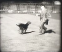
![Burnaby and Digney recreational events, [between 1934 and 1938] thumbnail](/media/Hpo/_Data/_Archives_Moving_Images/_Unrestricted/562-003-3.jpg?width=280)
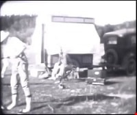
Burnaby and Digney recreational events
https://search.heritageburnaby.ca/link/archivedescription85208
- Repository
- City of Burnaby Archives
- Date
- [between 1934 and 1938]
- Collection/Fonds
- Digney Family fonds
- Description Level
- Item
- Physical Description
- 1 film clip (10 min., 30 sec.) : digital, b&w, col., si.
- Scope and Content
- Item is a silent digitized colour and black and white film segment identified as Reel 3. The film segment opens with footage of Digney family automobile travels and of Pelican Lake, Alberta where the family spent their summer, the footage switches to footage of a parade somewhere in the Rockies (B…
- Repository
- City of Burnaby Archives
- Date
- [between 1934 and 1938]
- Collection/Fonds
- Digney Family fonds
- Physical Description
- 1 film clip (10 min., 30 sec.) : digital, b&w, col., si.
- Description Level
- Item
- Record No.
- 562-003-3
- Access Restriction
- No restrictions
- Reproduction Restriction
- May be restricted by third party rights
- Accession Number
- 2014-04
- Scope and Content
- Item is a silent digitized colour and black and white film segment identified as Reel 3. The film segment opens with footage of Digney family automobile travels and of Pelican Lake, Alberta where the family spent their summer, the footage switches to footage of a parade somewhere in the Rockies (Banff) which begins in black and white and changes to colour format. This is followed by colour footage of car racing at the Digney Speedway located on 10 acres of property on MacPherson Ave. Jelopy stock car racing is seen taking place with crowds of people looking on.
- Subjects
- Sports - Swimming
- Events - Parades
- Persons - Children
- Persons - Crowds
- Sports - Automobile Racing
- Media Type
- Moving Images
- Photographer
- Digney, Andy
- Creator
- Digney, Andy
- Notes
- Title based on contents of film
- Geographic Access
- MacPherson Avenue
- Historic Neighbourhood
- Alta-Vista (Historic Neighbourhood)
- Planning Study Area
- Clinton-Glenwood Area
Images
![Burnaby and Digney recreational events, [between 1934 and 1938] thumbnail](/media/Hpo/_Data/_Archives_Moving_Images/_Unrestricted/562-003-3.jpg)
Video
Burnaby and Digney recreational events, [between 1934 and 1938]
Burnaby and Digney recreational events, [between 1934 and 1938]
https://search.heritageburnaby.ca/media/hpo/_Data/_Archives_Moving_Images/_Unrestricted/562-003-3.m4v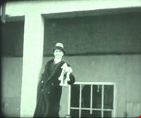
Brandon, Manitoba
https://search.heritageburnaby.ca/link/archivedescription85231
- Repository
- City of Burnaby Archives
- Date
- 1934
- Collection/Fonds
- Digney Family fonds
- Description Level
- Item
- Physical Description
- 1 film clip (14 min., 12 sec.) : digital, b&w, col., si.
- Scope and Content
- Item is a silent digitized (DVD) film segment with footage identified as 'Reel 2' . Film footage flucuates between black and white and colour opening with a glimpse of a dog show in the winter outside the Oak Theatre in Brandon, Manitoba. Andy Digney appears in a hat in front of a poster. He sol…
- Repository
- City of Burnaby Archives
- Date
- 1934
- Collection/Fonds
- Digney Family fonds
- Physical Description
- 1 film clip (14 min., 12 sec.) : digital, b&w, col., si.
- Description Level
- Item
- Record No.
- 562-003-2
- Access Restriction
- No restrictions
- Reproduction Restriction
- May be restricted by third party rights
- Accession Number
- 2014-04
- Scope and Content
- Item is a silent digitized (DVD) film segment with footage identified as 'Reel 2' . Film footage flucuates between black and white and colour opening with a glimpse of a dog show in the winter outside the Oak Theatre in Brandon, Manitoba. Andy Digney appears in a hat in front of a poster. He sold the Oak Theatre in 1935 when the family moved to British Columbia. Other glimpses provide a view of an ice jam on the Assinboine River,Brandon floods, the Sandhills animal farm, the North Hill Motorcycle hill climb and an RCMP show in Regina.
- Media Type
- Moving Images
- Photographer
- Digney, Andy
- Creator
- Digney, Andy
- Notes
- Title based on contents of film
Images

Video
Brandon, Manitoba, 1934
Andy Digney Film
https://search.heritageburnaby.ca/link/archivedescription85335
- Repository
- City of Burnaby Archives
- Date
- [between 1934 and 1961]
- Collection/Fonds
- Digney Family fonds
- Description Level
- Item
- Physical Description
- 2 optical discs (approx. 2 hrs, 40 min) : digital, b&w, col., si.
- Scope and Content
- Item is a collection of 18 short films on DVD. These films were created by Andy Digney using his 8 mm camera and provide views of the Digney family gatherings, trips, vacations at home and abroad. They also provide glimpses of Burnaby parades, celebrations and the Digney Speedway. The 18 segments h…
- Repository
- City of Burnaby Archives
- Date
- [between 1934 and 1961]
- Collection/Fonds
- Digney Family fonds
- Physical Description
- 2 optical discs (approx. 2 hrs, 40 min) : digital, b&w, col., si.
- Description Level
- Item
- Record No.
- 562-003
- Access Restriction
- No restrictions
- Reproduction Restriction
- May be restricted by third party rights
- Accession Number
- 2014-04
- Scope and Content
- Item is a collection of 18 short films on DVD. These films were created by Andy Digney using his 8 mm camera and provide views of the Digney family gatherings, trips, vacations at home and abroad. They also provide glimpses of Burnaby parades, celebrations and the Digney Speedway. The 18 segments have all been described at item level.
- Subjects
- Animals - Dogs
- Recreational Activities - Fishing
- Recreational Activities - Camping
- Recreational Activities - Picnics
- Geographic Features - Rivers
- Events - Parades
- Media Type
- Moving Images
- Photographer
- Digney, Andy
- Creator
- Digney, Andy
- Notes
- Title based on contents of film
- The original 8mm film footage was digitized and broken down into 18 segments, reflecting the original order. Items are described as 562-003-1 : 562-003-18

Travels to England # 2
https://search.heritageburnaby.ca/link/archivedescription85246
- Repository
- City of Burnaby Archives
- Date
- 1935
- Collection/Fonds
- Digney Family fonds
- Description Level
- Item
- Physical Description
- 1 film clip (10 min., 31 sec.) : digital, b&w, col., si.
- Scope and Content
- Item is a digitized silent film segment identified as Reel 9. The film alternates between black and white and a rosy hue of colour. The film continues from item 562-003-9 and provides views of England and the countryside as the Digney family travels by car visiting various landmarks and castles alo…
- Repository
- City of Burnaby Archives
- Date
- 1935
- Collection/Fonds
- Digney Family fonds
- Physical Description
- 1 film clip (10 min., 31 sec.) : digital, b&w, col., si.
- Description Level
- Item
- Record No.
- 562-003-9
- Access Restriction
- No restrictions
- Reproduction Restriction
- May be restricted by third party rights
- Accession Number
- 2014-04
- Scope and Content
- Item is a digitized silent film segment identified as Reel 9. The film alternates between black and white and a rosy hue of colour. The film continues from item 562-003-9 and provides views of England and the countryside as the Digney family travels by car visiting various landmarks and castles along the way.
- Subjects
- Transportation - Automobiles
- Media Type
- Moving Images
- Photographer
- Digney, Andy
- Creator
- Digney, Andy
- Notes
- Title based on contents of film
Images
Video
Travels to England # 2, 1935
Travels to England # 2, 1935
https://search.heritageburnaby.ca/media/hpo/_Data/_Archives_Moving_Images/_Unrestricted/562-003-9.m4v
Travels to England # 3
https://search.heritageburnaby.ca/link/archivedescription85247
- Repository
- City of Burnaby Archives
- Date
- 1935
- Collection/Fonds
- Digney Family fonds
- Description Level
- Item
- Physical Description
- 1 film clip (10 min., 25 sec.) : digital, b&w, si.
- Scope and Content
- Item is a digitized silent black and white film segment identified as Reel 10. This film continues from item number 562-003-11, following the Digney family as they continue to travel through England. It interchanges with views of the seaside and the Henley airshow, followed by footage of the Chang…
- Repository
- City of Burnaby Archives
- Date
- 1935
- Collection/Fonds
- Digney Family fonds
- Physical Description
- 1 film clip (10 min., 25 sec.) : digital, b&w, si.
- Description Level
- Item
- Record No.
- 562-003-10
- Access Restriction
- No restrictions
- Reproduction Restriction
- May be restricted by third party rights
- Accession Number
- 2014-04
- Scope and Content
- Item is a digitized silent black and white film segment identified as Reel 10. This film continues from item number 562-003-11, following the Digney family as they continue to travel through England. It interchanges with views of the seaside and the Henley airshow, followed by footage of the Changing of the Guards, Liverpool, a storm on the Atlantic, an iceberg and the St. Lawrence seaway.
- Media Type
- Moving Images
- Photographer
- Digney, Andy
- Creator
- Digney, Andy
- Notes
- Title based on contents of film
Images
Video
Travels to England # 3, 1935
Travels to England # 3, 1935
https://search.heritageburnaby.ca/media/hpo/_Data/_Archives_Moving_Images/_Unrestricted/562-003-10.m4v![Digney family travels in the praries and the rockies, [between 1935 and 1936] thumbnail](/media/Hpo/_Data/_Archives_Moving_Images/_Unrestricted/562-003-17.jpg?width=280)
Digney family travels in the praries and the rockies
https://search.heritageburnaby.ca/link/archivedescription85311
- Repository
- City of Burnaby Archives
- Date
- [between 1935 and 1936]
- Collection/Fonds
- Digney Family fonds
- Description Level
- Item
- Physical Description
- 1 film clip ( 12 min., 37 sec.) : digital, b&w, col., si.
- Scope and Content
- Item is a digitized film segment identified as Reel 17. The film opens with colour footage with views of a lake (possibly Pelican Lake, Manitoba) and switches to black and white footage of Dig Digney playing in a canoe on a lake and family camping adventures as they travel west from Manitoba throug…
- Repository
- City of Burnaby Archives
- Date
- [between 1935 and 1936]
- Collection/Fonds
- Digney Family fonds
- Physical Description
- 1 film clip ( 12 min., 37 sec.) : digital, b&w, col., si.
- Description Level
- Item
- Record No.
- 562-003-17
- Access Restriction
- No restrictions
- Reproduction Restriction
- May be restricted by third party rights
- Accession Number
- 2014-04
- Scope and Content
- Item is a digitized film segment identified as Reel 17. The film opens with colour footage with views of a lake (possibly Pelican Lake, Manitoba) and switches to black and white footage of Dig Digney playing in a canoe on a lake and family camping adventures as they travel west from Manitoba through to Saskatchewan and visit with Dorothy Swan (Alice Digney's sister) who is dressed in her nurses' uniform. Their travels continue as they visit the Calgary Zoo, the foothills of Alberta, Bow River and falls, Banff Hot Springs and Lake Louise pools.
- Media Type
- Moving Images
- Photographer
- Digney, Andy
- Creator
- Digney, Andy
- Notes
- Title based on contents of film
Images
![Digney family travels in the praries and the rockies, [between 1935 and 1936] thumbnail](/media/Hpo/_Data/_Archives_Moving_Images/_Unrestricted/562-003-17.jpg)
Video
Digney family travels in the praries and the rockies, [between 1935 and 1936]
Digney family travels in the praries and the rockies, [between 1935 and 1936]
https://search.heritageburnaby.ca/media/hpo/_Data/_Archives_Moving_Images/_Unrestricted/562-003-17.m4v