Narrow Results By
Subject
- Adornment - Jewelry 1
- Agriculture - Farms 2
- Animals - Horses 3
- Armament - Firearms 1
- Arts 1
- Buildings - Agricultural 16
- Buildings - Civic - Museums 21
- Buildings - Commercial 1
- Buildings - Commercial - Bakeries 14
- Buildings - Commercial - Barber Shops 1
- Buildings - Commercial - Grocery Stores 1
- Buildings - Commercial - Hardware Stores 1
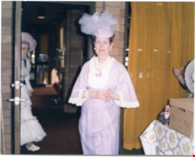
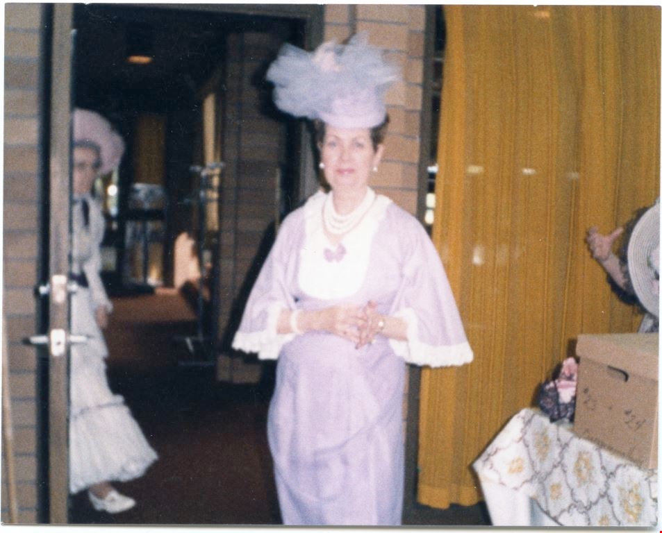
Confederation Singer
https://search.heritageburnaby.ca/link/museumdescription5058
- Repository
- Burnaby Village Museum
- Date
- 1980-1990
- Collection/Fonds
- Burnaby Village Museum Photograph collection
- Description Level
- Item
- Physical Description
- 1 photograph : coloured ; 9 x 11 cm
- Scope and Content
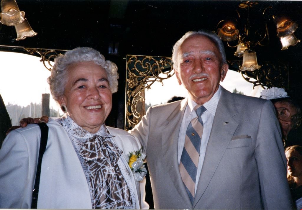
- A woman from the Confederation Singers standing in a room. She is wearing a pale lilac and white trim dress and matching hat. A second woman visible in the background walking through doorway.
- Repository
- Burnaby Village Museum
- Collection/Fonds
- Burnaby Village Museum Photograph collection
- Description Level
- Item
- Physical Description
- 1 photograph : coloured ; 9 x 11 cm
- Scope and Content
- A woman from the Confederation Singers standing in a room. She is wearing a pale lilac and white trim dress and matching hat. A second woman visible in the background walking through doorway.
- History
- Mrs Bate was a church choir singer. In 1976 she was asked to help form the Confederation Singers at the North Burnaby Confederation Seniors Centre. She started the choir and conducted it until her retirement in 1986. The costume, as seen in several photographs and also in the Burnaby Vilalge Museum collection, was made by members of the choir who made similar 1890's period costumes for themselves. The choir sang in seniors centres and at special events at Century Park (now known as the Burnaby Village Museum). They were also invited to sing at Government House in Victoria.
- Other Title Information
- Title based on contents of photograph
- Accession Code
- BV010.8.88
- Access Restriction
- No restrictions
- Date
- 1980-1990
- Media Type
- Photograph
- Scan Resolution
- 600
- Scan Date
- 05-06-2018
Images
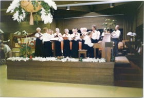
Confederation Singers on stage.
https://search.heritageburnaby.ca/link/museumdescription5064
- Repository
- Burnaby Village Museum
- Date
- 1980-1990
- Collection/Fonds
- Burnaby Village Museum Photograph collection
- Description Level
- Item
- Physical Description
- 1 photograph : coloured ; 10 x 15 cm
- Scope and Content
- The Confederation Singers onstage rehearsing for a Christmas concert. They are wearing dark skirts or pants and white shirts. The women are wearing T-shaped ties in black and red and the men are wearing red bow ties. There are Christmas cards displayed along the wall at the back.
- Repository
- Burnaby Village Museum
- Collection/Fonds
- Burnaby Village Museum Photograph collection
- Description Level
- Item
- Physical Description
- 1 photograph : coloured ; 10 x 15 cm
- Scope and Content
- The Confederation Singers onstage rehearsing for a Christmas concert. They are wearing dark skirts or pants and white shirts. The women are wearing T-shaped ties in black and red and the men are wearing red bow ties. There are Christmas cards displayed along the wall at the back.
- History
- Mrs Bate was a church choir singer. In 1976 she was asked to help form the Confederation Singers at the North Burnaby Confederation Seniors Centre. She started the choir and conducted it until her retirement in 1986. The costume, as seen in several photographs and also in the Burnaby Vilalge Museum collection, was made by members of the choir who made similar 1890's period costumes for themselves. The choir sang in seniors centres and at special events at Century Park (now known as the Burnaby Village Museum). They were also invited to sing at Government House in Victoria.
- Other Title Information
- Title based on contents of photograph
- Accession Code
- BV010.8.94
- Access Restriction
- No restrictions
- Date
- 1980-1990
- Media Type
- Photograph
- Scan Resolution
- 600
- Scan Date
- 05-06-2018
Images

![Parker carousel center pole and ring gear at warehouse, [1990-1993] thumbnail](/media/hpo/_Data/_BVM_Images/2015/2015_0041_0015.jpg?width=280)
Parker carousel center pole and ring gear at warehouse
https://search.heritageburnaby.ca/link/museumdescription5065
- Repository
- Burnaby Village Museum
- Date
- [1990-1993]
- Collection/Fonds
- Keith Jamieson fonds
- Description Level
- Item
- Physical Description
- 1 photograph : colour ; 15.2 cm x 10.2 cm
- Scope and Content
- Photograph of the C.W. Parker carouselcentre pole and ring gear at the warehouse where restoration took place. The pole is lying horizontally, with the ring gear resting on a wheeled dolly. Keith Jamieson is standing behind the gear. There are two other unidentified men in the photograph. One is wo…
- Repository
- Burnaby Village Museum
- Collection/Fonds
- Keith Jamieson fonds
- Description Level
- Item
- Physical Description
- 1 photograph : colour ; 15.2 cm x 10.2 cm
- Scope and Content
- Photograph of the C.W. Parker carouselcentre pole and ring gear at the warehouse where restoration took place. The pole is lying horizontally, with the ring gear resting on a wheeled dolly. Keith Jamieson is standing behind the gear. There are two other unidentified men in the photograph. One is working on the ring gear and one is standing in the background.
- Subjects
- Recreational Devices - Carousels
- Names
- Lower Mainland Association of the Friends of the Vancouver Carousel
- Jamieson, Keith
- Jamieson, Pat
- Pacific National Exhibition (PNE)
- C.W. Parker no. 119 Carousel
- Accession Code
- BV015.41.15
- Date
- [1990-1993]
- Media Type
- Photograph
- Arrangement
- Scrapbooks were arranged by Keith and Pat Jamieson before donation.
- Notes
- Title based on contents of photograph
- The photograph was removed from the scrapbook titled, "Parker Carousel Volume II- Product Endorsements, Advertisements, Etc" (BV015.41.2). The scrapbook included a wide array of photographs documenting "The Friends of the Carousel" fundraising endeavours as well as a detailed account of the transport, restoration, installation and ground breaking ceremony of the Parker Carousel #119 prior to its opening at the Burnaby Village Museum
Images
![Parker carousel center pole and ring gear at warehouse, [1990-1993] thumbnail](/media/hpo/_Data/_BVM_Images/2015/2015_0041_0015.jpg)
Frances Fleming and John Waplington
https://search.heritageburnaby.ca/link/museumdescription5163
- Repository
- Burnaby Village Museum
- Date
- 1993
- Collection/Fonds
- Waplington family fonds
- Description Level
- Item
- Physical Description
- 1 photograph : col. ; 10 x 15 cm
- Scope and Content
- Photograph a Frances L. Fleming with her brother John (Jack) Waplington at Peter Sherry's wedding reception aboard at Coal Harbour.
- Repository
- Burnaby Village Museum
- Collection/Fonds
- Waplington family fonds
- Description Level
- Item
- Physical Description
- 1 photograph : col. ; 10 x 15 cm
- Scope and Content
- Photograph a Frances L. Fleming with her brother John (Jack) Waplington at Peter Sherry's wedding reception aboard at Coal Harbour.
- Accession Code
- BV016.46.118
- Access Restriction
- No restrictions
- Reproduction Restriction
- May be restricted by third party rights
- Date
- 1993
- Media Type
- Photograph
- Scan Resolution
- 600
- Scan Date
- 13-Aug-2018
- Notes
- Title based on contents of photograph
- Note in blue ink on verso of photograph reads: "Peter Sherry's wedding reception / aboard / at Coal Habour - / Frances Fleming & brother-"
- Photograph is part of Photograph album BV016.46.52
Images
Fleming Children
https://search.heritageburnaby.ca/link/museumdescription5164
- Repository
- Burnaby Village Museum
- Date
- 1993
- Collection/Fonds
- Waplington family fonds
- Description Level
- Item
- Physical Description
- 1 photograph : col. ; 10 x 15 cm
- Scope and Content
- Photograph of Maureen, Jack and Edith (Edie) Fleming seated on a stone wall in Sidney B.C.
- Repository
- Burnaby Village Museum
- Collection/Fonds
- Waplington family fonds
- Description Level
- Item
- Physical Description
- 1 photograph : col. ; 10 x 15 cm
- Scope and Content
- Photograph of Maureen, Jack and Edith (Edie) Fleming seated on a stone wall in Sidney B.C.
- Accession Code
- BV016.46.119
- Access Restriction
- No restrictions
- Reproduction Restriction
- May be restricted by third party rights
- Date
- 1993
- Media Type
- Photograph
- Scan Resolution
- 600
- Scan Date
- 13-Aug-2018
- Notes
- Title based on annotations in album
- Photograph is part of Photograph album BV016.46.52
Images

![Volunteer Shriner, [1993] thumbnail](/media/Hpo/_Data/_BVM_Images/2016/2016_0046_0120_001.jpg?width=280)
Volunteer Shriner
https://search.heritageburnaby.ca/link/museumdescription5165
- Repository
- Burnaby Village Museum
- Date
- [1993]
- Collection/Fonds
- Waplington family fonds
- Description Level
- Item
- Physical Description
- 1 photograph : col. ; 15 x 10 cm
- Scope and Content
- Photograph of siblings Edith (Edie) Ehlers (nee Fleming), John (Jack) Fleming and Maureen Clayton (nee Fleming). Jack is in the centre dressed up as a Shriner and holding a trombone as a participant in a parade in Sidney B.C.
- Repository
- Burnaby Village Museum
- Collection/Fonds
- Waplington family fonds
- Description Level
- Item
- Physical Description
- 1 photograph : col. ; 15 x 10 cm
- Scope and Content
- Photograph of siblings Edith (Edie) Ehlers (nee Fleming), John (Jack) Fleming and Maureen Clayton (nee Fleming). Jack is in the centre dressed up as a Shriner and holding a trombone as a participant in a parade in Sidney B.C.
- Accession Code
- BV016.46.120
- Access Restriction
- No restrictions
- Reproduction Restriction
- May be restricted by third party rights
- Date
- [1993]
- Media Type
- Photograph
- Scan Resolution
- 600
- Scan Date
- 13-Aug-2018
- Notes
- Title based on annotations in album
- Photograph is part of Photograph album BV016.46.52
Images
![Volunteer Shriner, [1993] thumbnail](/media/Hpo/_Data/_BVM_Images/2016/2016_0046_0120_001.jpg)
![Edith, Jack and Maureen Fleming, [1993] thumbnail](/media/Hpo/_Data/_BVM_Images/2016/2016_0046_0121_001.jpg?width=280)
Edith, Jack and Maureen Fleming
https://search.heritageburnaby.ca/link/museumdescription5166
- Repository
- Burnaby Village Museum
- Date
- [1993]
- Collection/Fonds
- Waplington family fonds
- Description Level
- Item
- Physical Description
- 1 photograph : col. ; 12.5 x 9 cm
- Scope and Content
- Photograph of siblings Edith (Edie) Ehlers (nee Fleming), John (Jack) Fleming and Maureen Clayton (nee Fleming) standing next to a Christmas tree.
- Repository
- Burnaby Village Museum
- Collection/Fonds
- Waplington family fonds
- Description Level
- Item
- Physical Description
- 1 photograph : col. ; 12.5 x 9 cm
- Scope and Content
- Photograph of siblings Edith (Edie) Ehlers (nee Fleming), John (Jack) Fleming and Maureen Clayton (nee Fleming) standing next to a Christmas tree.
- Subjects
- Holidays - Christmas
- Accession Code
- BV016.46.121
- Access Restriction
- No restrictions
- Reproduction Restriction
- May be restricted by third party rights
- Date
- [1993]
- Media Type
- Photograph
- Scan Resolution
- 600
- Scan Date
- 13-Aug-2018
- Notes
- Title based on annotations in album
- Photograph is part of Photograph album BV016.46.52
Images
![Edith, Jack and Maureen Fleming, [1993] thumbnail](/media/Hpo/_Data/_BVM_Images/2016/2016_0046_0121_001.jpg)
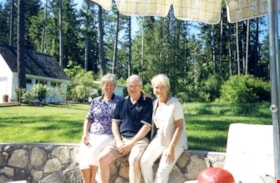
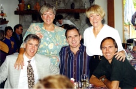
60th Wedding Anniversary
https://search.heritageburnaby.ca/link/museumdescription5167
- Repository
- Burnaby Village Museum
- Date
- 1995
- Collection/Fonds
- Waplington family fonds
- Description Level
- Item
- Physical Description
- 1 photograph : col. ; 10 x 15 cm
- Scope and Content
- Photograph of the Fleming clan celebrating the 60th Anniversary of Ray and Frances Fleming with their children Edith (Edie) Ehlers (nee Fleming), John (Jack) Fleming and Maureen Clayton (nee Fleming).
- Repository
- Burnaby Village Museum
- Collection/Fonds
- Waplington family fonds
- Description Level
- Item
- Physical Description
- 1 photograph : col. ; 10 x 15 cm
- Scope and Content
- Photograph of the Fleming clan celebrating the 60th Anniversary of Ray and Frances Fleming with their children Edith (Edie) Ehlers (nee Fleming), John (Jack) Fleming and Maureen Clayton (nee Fleming).
- Names
- Ehlers, Edith "Edie" Fleming
- Fleming, John "Jack" Reyland
- Clayton, Sara Maureen Fleming
- Fleming, John Reyland "Ray"
- Fleming, Frances "Fanny" Waplington
- Accession Code
- BV016.46.122
- Access Restriction
- No restrictions
- Reproduction Restriction
- May be restricted by third party rights
- Date
- 1995
- Media Type
- Photograph
- Scan Resolution
- 600
- Scan Date
- 13-Aug-2018
- Notes
- Title based on annotations in album
- Note in blue ink on verso of photograph reads: "The Fleming Clan / 60th Anniversary!"
- Photograph is part of Photograph album BV016.46.52
Images
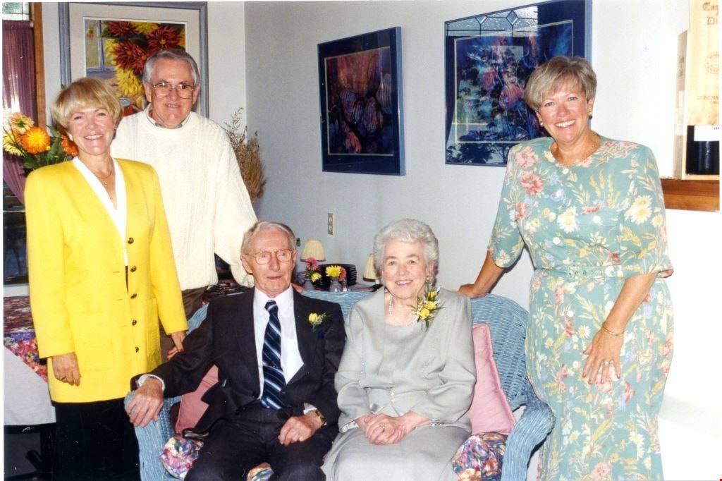
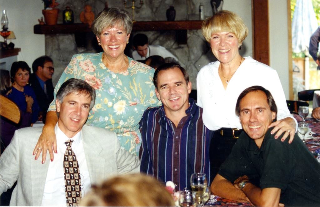
60th Wedding Anniversary
https://search.heritageburnaby.ca/link/museumdescription5168
- Repository
- Burnaby Village Museum
- Date
- 1995
- Collection/Fonds
- Waplington family fonds
- Description Level
- Item
- Physical Description
- 1 photograph : col. ; 10 x 15 cm
- Scope and Content
- Photograph of Brian Waplington, Maureen Clayton (nee Fleming), cousin Ray Ferguson, Edith (Edie) Ehners (nee Fleming) and cousin Norm Ferguson at the 60th Anniversary celebration of Ray and Frances Fleming.
- Repository
- Burnaby Village Museum
- Collection/Fonds
- Waplington family fonds
- Description Level
- Item
- Physical Description
- 1 photograph : col. ; 10 x 15 cm
- Scope and Content
- Photograph of Brian Waplington, Maureen Clayton (nee Fleming), cousin Ray Ferguson, Edith (Edie) Ehners (nee Fleming) and cousin Norm Ferguson at the 60th Anniversary celebration of Ray and Frances Fleming.
- Names
- Ehlers, Edith "Edie" Fleming
- Fleming, John "Jack" Reyland
- Clayton, Sara Maureen Fleming
- Waplington, Brian
- Ferguson, Ray
- Ferguson, Norman
- Accession Code
- BV016.46.123
- Access Restriction
- No restrictions
- Reproduction Restriction
- May be restricted by third party rights
- Date
- 1995
- Media Type
- Photograph
- Scan Resolution
- 600
- Scan Date
- 13-Aug-2018
- Notes
- Title based on annotations in album
- Photograph is part of Photograph album BV016.46.52
Images
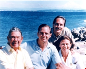
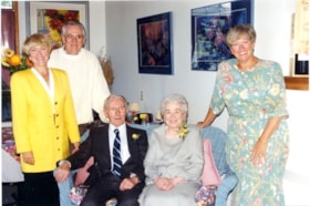
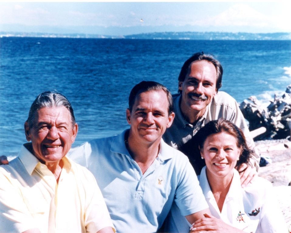
Grace Waplington's family
https://search.heritageburnaby.ca/link/museumdescription5169
- Repository
- Burnaby Village Museum
- Date
- 1994
- Collection/Fonds
- Waplington family fonds
- Description Level
- Item
- Physical Description
- 1 photograph : col. ; 9 x 11 cm
- Scope and Content
- Photograph of Grace Waplington's family identified from L to R: husband Dave Ferguson, Ray Ferguson, Norman Ferguson and Kay Ferguson. The photograph was taken on the occasion of her husband Dave's 80th birthday June 1994. The photograph is taken from Bainbridge Island looking across Puget Sound to…
- Repository
- Burnaby Village Museum
- Collection/Fonds
- Waplington family fonds
- Description Level
- Item
- Physical Description
- 1 photograph : col. ; 9 x 11 cm
- Scope and Content
- Photograph of Grace Waplington's family identified from L to R: husband Dave Ferguson, Ray Ferguson, Norman Ferguson and Kay Ferguson. The photograph was taken on the occasion of her husband Dave's 80th birthday June 1994. The photograph is taken from Bainbridge Island looking across Puget Sound towards Seattle with Mt. Rainier in the distance.
- Accession Code
- BV016.46.124
- Access Restriction
- No restrictions
- Reproduction Restriction
- May be restricted by third party rights
- Date
- 1994
- Media Type
- Photograph
- Scan Resolution
- 600
- Scan Date
- 13-Aug-2018
- Notes
- Title based on annotations in album
- Note in black ink on verso of photograph reads: "Dave, Ray, Norman & kay Ferg- / uson taken on the ocasion of / Daves 80th birthday, June '94 / Photo taken from Bainbridge / Is looking accross Puget sound / towards Seattle / Mt Rainier (3 miles high) / top right."
- Photograph is part of Photograph album BV016.46.52
Images
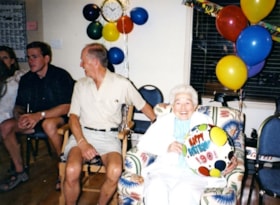
90th birthday celebration
https://search.heritageburnaby.ca/link/museumdescription5173
- Repository
- Burnaby Village Museum
- Date
- 2003
- Collection/Fonds
- Waplington family fonds
- Description Level
- Item
- Physical Description
- 1 photograph : col. ; 10 x 13.7 cm
- Scope and Content
- Photograph of Frances L. Fleming at her 90th Birthday celebration. Frances passed away on July 8, 2004 just one month short of her 91st birthday.
- Repository
- Burnaby Village Museum
- Collection/Fonds
- Waplington family fonds
- Description Level
- Item
- Physical Description
- 1 photograph : col. ; 10 x 13.7 cm
- Scope and Content
- Photograph of Frances L. Fleming at her 90th Birthday celebration. Frances passed away on July 8, 2004 just one month short of her 91st birthday.
- Accession Code
- BV016.46.129
- Access Restriction
- No restrictions
- Reproduction Restriction
- May be restricted by third party rights
- Date
- 2003
- Media Type
- Photograph
- Scan Resolution
- 600
- Scan Date
- 13-Aug-2018
- Notes
- Title based on contents of photograph and notes in photograph album
- Photograph is part of Photograph album BV016.46.52
Images

![Subdivision plans in New Westminster District Group 1 – Burnaby
, [1882-1910] thumbnail](/media/hpo/_Data/_BVM_Cartographic_Material/1977/1977_0093_0013a_001.jpg?width=280)
Subdivision plans in New Westminster District Group 1 – Burnaby
https://search.heritageburnaby.ca/link/museumdescription6982
- Repository
- Burnaby Village Museum
- Date
- [1882-1910]
- Collection/Fonds
- Burnaby Village Museum Map collection
- Description Level
- File
- Physical Description
- 4 plans : blueprint on paper mounted on 2 sides of cardboard 76 x 102 cm
- Scope and Content
- Item consists of a large board of two New Westminster District Gp 1 - subdivision plans mounted on one side and two New Westminster District Gp 1 - subdivision plans mounted on the other side. Side A: 1. Blueprint "Plan / of the / Subdivision / of / Lot 98 / G.1, N.W.D. / Scale 4 chs = 1 in. / …
- Repository
- Burnaby Village Museum
- Collection/Fonds
- Burnaby Village Museum Map collection
- Description Level
- File
- Physical Description
- 4 plans : blueprint on paper mounted on 2 sides of cardboard 76 x 102 cm
- Material Details
- Scales [between 1:1584 and 1:3168]
- Index number on edge of board reads: "13"
- Scope and Content
- Item consists of a large board of two New Westminster District Gp 1 - subdivision plans mounted on one side and two New Westminster District Gp 1 - subdivision plans mounted on the other side. Side A: 1. Blueprint "Plan / of the / Subdivision / of / Lot 98 / G.1, N.W.D. / Scale 4 chs = 1 in. / Map No 573" (Geographic location: Burnaby) 2. Blueprint "Plan / of Subdivision of / Lot 157 / Gr.1, New. West. Dist. / Scale 3 chs = 1 in. / Map No. 612". (Geographic location: Burnaby) Side B: 1. Blueprint "Plan / of Subdivision / of a Portion of / Lot 90 / Group One / New Westminster Dist. / Scale 2 chs = 1 in. / Map No. 555". Plan is signed by "Jno Strathern [sic]_P.L.S."n (Geographic location: Burnaby) 2. Blueprint "Subdivision of Lot 31, Group 1. / New Westminster District / As Amended by Order of Court / 1st Sept. 1882 and Numbered 847 / Scale 4 chs = 1in. / Map No 80" (Geographic location: Burnaby)
- Creator
- Stathern, John
- Accession Code
- HV977.93.13
- Access Restriction
- No restrictions
- Reproduction Restriction
- No known restrictions
- Date
- [1882-1910]
- Media Type
- Cartographic Material
- Historic Neighbourhood
- Alta Vista (Historic Neighbourhood)
- Planning Study Area
- Richmond Park Area
- Lakeview-Mayfield Area
- Scan Resolution
- 300
- Scale
- 72
- Notes
- Title based on contents of file
- Scale is measured in chains. (One chain equals 792 inches)
- The term "Lot" can also refer to a "District Lot”
Images
![Subdivision plans in New Westminster District Group 1 – Burnaby
, [1882-1910] thumbnail](/media/hpo/_Data/_BVM_Cartographic_Material/1977/1977_0093_0013a_001.jpg)

![Survey and Subdivision plans in New Westminster District Group 1 – Burnaby
, [1861]-[1910] thumbnail](/media/hpo/_Data/_BVM_Cartographic_Material/1977/1977_0093_0019a_001.jpg?width=280)
Survey and Subdivision plans in New Westminster District Group 1 – Burnaby
https://search.heritageburnaby.ca/link/museumdescription6988
- Repository
- Burnaby Village Museum
- Date
- [1861]-[1910]
- Collection/Fonds
- Burnaby Village Museum Map collection
- Description Level
- File
- Physical Description
- 14 plans : 3 plans : black ink on paper hand col. + 7 plans : black ink on paper + 4 plans : graphite on paper mounted on 2 sides of cardboard 76 x 102 cm
- Scope and Content
- Item consists of a large board of four New Westminster District Gp 1 - subdivision plans mounted on one side and ten New Westminster District Gp 1 - subdivision plans mounted on the other side. Side A: 1. "Plan /of / Lots 166A, 166 and 167 /, Gr.1, N.W.D. / Showing Misconstructed Roads in Gree…
- Repository
- Burnaby Village Museum
- Collection/Fonds
- Burnaby Village Museum Map collection
- Description Level
- File
- Physical Description
- 14 plans : 3 plans : black ink on paper hand col. + 7 plans : black ink on paper + 4 plans : graphite on paper mounted on 2 sides of cardboard 76 x 102 cm
- Material Details
- Scales [between 1:2376 and 1:7920]
- Index number on edge of board reads: "19"
- Scope and Content
- Item consists of a large board of four New Westminster District Gp 1 - subdivision plans mounted on one side and ten New Westminster District Gp 1 - subdivision plans mounted on the other side. Side A: 1. "Plan /of / Lots 166A, 166 and 167 /, Gr.1, N.W.D. / Showing Misconstructed Roads in Green / 5 chs = 1 in.". (plan is drawn in black ink and hand coloured in red, green and orange ink). A section in the centre of the plan is coloured in red ink and identified as "C.S. Richmond" running from the North Arm of Fraser River to Wiggins Road and divided by "New Wiggins Rd. (as gazetted)" (coloured in orange ink) and two"Constructed Road(s)" (coloured in green ink). Plan is initialed by: "RB" [sic] (in blue pencil crayon) 2. Plan of / Subdivision of / Lot 166 / Group One / New Westminster District / Scale 4 chs = 1 in. / Map No 524". Plan is drawn in graphite and signed by "Surrig [sic] Welhams [sic] / P.L.S." Plan is initialed by: "RB" [sic] (in blue pencil crayon) 3. Plan of "Survey / of Highway / For / Burnaby Council / in / Lots 13 _14 / Group One / Scale 4 chs = 1 in." Signed by "Albert J. Hill, P.L.S." Caribou Street and Caribou Road run through the centre of the plan. Plan is stamped: "Albert J. Hill, Civil Engineer / and / Provincial Land Surveyor, / New Westminster, / B.C.". Plan is initialed by: "RB" [sic] (in blue pencil crayon) 4. A Plan of Lots 166A, 166 and 167, Group One, New Westminster District (drawn in graphite). A section in the centre of the plan is identified as "C.S. Richmond" running from the North Arm of Fraser River and divided by "New Wiggins Rd. (as gazetted)" and two "Constructed Road(s)". Plan is initialed by: "RB" [sic] (in blue pencil crayon) Side B: 1. Small plan drawn in black ink (no title) identifying lots north of the "North Arm" of the Fraser River. Lots identified include: Lot 99, Lot 98, Lot 157, Lot 158, Lot 163, Lot 162, Lot 159, Lot 163, Lot 162, Lot 165, Lot 166A, Lot 155B, Lot 155A and Lot 159. "Scale 40 chains to one inch" . Plan is initialed by: "RB" [sic] (in blue pencil crayon) (Geographic location: Burnaby) 2. Small plan drawn in black ink (no title) identifying lots north of the North Arm of the Fraser River as "Lots 155, 155A, 155B, 155C, 162, 163, 164, 165, 166A and 167". Plan is initialed by: "RB" [sic] (in blue pencil crayon) (Geographic location: Burnaby) 3. Small plan drawn in black ink (no title) which identifies "Lot 151 / Reserve/ for / Race Course"; "Reserve / 64 A / L. 152 G.1"; and other Lots: 32, 33, 34, 35, 36, 38, 39. The plan is signed "Surveyor G.Turn [sic] July / 61 / from Vol 40 R.L. notes [sic]" Plan is stamped: "Albert J. Hill, Civil Engineer / and / Provincial Land Surveyor, / New Westminster, / B.C." Plan is initialed by: "RB" [sic] (in blue pencil crayon) (Geographic location: Burnaby) 4. Small plan drawn in black in with faded red colouring on centre lot identified as "Lot 34" running north from "Vancouver Road" . Plan is stamped: "Albert J. Hill, Civil Engineer / and / Provincial Land Surveyor, / New Westminster, / B.C." Plan is initialed by: "RB" [sic] (in blue pencil crayon) (Geographic location: Burnaby) 5. Plan drawn in graphite and identified as "Lot 98, Gr.1," along with the intials "RB" [sic] (both are handwritten in blue crayon pencil on top of plan) The B.C.E.Railway is identified running through the plan along with Jubilee Road and Royal Oak Road. The plan is signed with the name "Wm. Murray" and the Plan is stamped: "Albert J. Hill, Civil Engineer / and / Provincial Land Surveyor, / New Westminster, / B.C.". (Geographic location: Burnaby) 6. Plan drawn in graphite identified as "Port Lot 13, Gr.1" along with the intials "RB" [sic] (both are handwritten in blue crayon pencil on top of plan) Plan is stamped: "Albert J. Hill, Civil Engineer / and / Provincial Land Surveyor, / New Westminster, / B.C.". (Geographic location: Burnaby) 7.Plan drawn in black ink and identified as "Lot 98 G.1" along with the intials "RB" [sic] (both are handwritten in blue crayon pencil on top of plan). A "Road Reservation" is identified running north between "Electric Tramway" and connecting with "Royal Oak Road". Plan is stamped: "Albert J. Hill, Civil Engineer / and / Provincial Land Surveyor, / New Westminster, / B.C." (Geographic location: Burnaby) 8. Plan drawn in black ink and divided into two sections, the upper plan is identified as "Portion / Lots 100 / area / 101, Gr.1" and the lower plan is identified as "Portion L. 3 G. 1" along with the intials "RB" [sic] (these identifiers are handwritten in blue crayon pencil on top of the plan). Portions of Lot 100 and Lot 101 are each divided into 6 sections and the Portion of Lot 3 plan is divided into 24 sections. The plan includes a note in black ink that reads: " Received from Wm Fromme [sic] / from Wm. Trapp / Nov. 28, 1895 / A. J. T...[sic]". (Geographic location: Burnaby) 9. Plan drawn in black ink (no title) identifying soil, buildings and geographic features in southern Burnaby. The plan is bordered by "New Westminster City" (Tenth Avenue and DL 172) to the south east and DL 173 to the south, DL 158 to the west and the B.C.E. Tramway to the north. Plan includes District Lots: 155A, 158, 159, 171, 160, 53 and 95 and identifies soil, marshland and ravines throughout. Plan identifies the following features: a "Team Road" running through Lots 158 and 159 along with "Fair Orchard Soil / Even Surface Throughout / No Ravines", "Gravel and Shingle" (bottom of Lot 158), "North Arm Road" crossing "Byrne Road" and connecting with "Power House Road" which runs north to connect with "Highland Park Station" and the B.C.E. Tramway, "Power Ho" in the northeast corner of DL 160, a "Brook" connected with a "Deep Ravine" running between DL 53, DL 95 and DL 160 along with "Good Soil" and "Fair Orchard Soil" identified nearby in DL 95. Scale is identified as "10 chs = 1 in." Plan is stamped: "Albert J. Hill, Civil Engineer / and / Provincial Land Surveyor, / New Westminster, / B.C." Plan is initialed by: "RB" [sic] (in blue pencil crayon) (Geographic location: Burnaby) 10. Plan drawn in black ink (no title) with Burnaby Lake and Deer Lake at the centre. The plan is bordered by the following District Lots identified as: 117, 118 and 68 to the west, Lots 80, 79 and 85 to the southwest, Lots 11, 13, and 1 (City of New Westminster) to the south east, the North Road boundary to the east and Lots 8, 56, 57, 59, and 136 to the North. The lower right hand corner of the plan has a small inset which reads: "Burnaby Lake" and "Page 19 R.B. Notes". Plan is initialed by: "RB" [sic] (in blue pencil crayon) (Geographic location: Burnaby)
- Creator
- Hill, Albert James
- Accession Code
- HV977.93.19
- Access Restriction
- No restrictions
- Reproduction Restriction
- No known restrictions
- Date
- [1861]-[1910]
- Media Type
- Cartographic Material
- Scan Resolution
- 300
- Scale
- 72
- Notes
- Title based on contents of file
- Scale is measured in chains. (One chain equals 792 inches)
- The term "Lot" can also refer to a "District Lot”
- Some plans are stamped: "Albert J. Hill, Civil Engineer / and / Provincial Land Surveyor, / New Westminster, / B.C." and intialed: "RB" [sic]
Images
![Survey and Subdivision plans in New Westminster District Group 1 – Burnaby
, [1861]-[1910] thumbnail](/media/hpo/_Data/_BVM_Cartographic_Material/1977/1977_0093_0019a_001.jpg)

![Survey and Subdivision plans in New Westminster District Group 1 – Burnaby, Port Moody, [1862-1908] thumbnail](/media/hpo/_Data/_BVM_Cartographic_Material/1977/1977_0093_0026a_001.jpg?width=280)
Survey and Subdivision plans in New Westminster District Group 1 – Burnaby, Port Moody
https://search.heritageburnaby.ca/link/museumdescription6995
- Repository
- Burnaby Village Museum
- Date
- [1862-1908]
- Collection/Fonds
- Burnaby Village Museum Map collection
- Description Level
- File
- Physical Description
- 9 plans : 6 plans : black ink on paper ; 57 x 36.5 cm or smaller + 1 plan : black ink and grahite on paper ; 46.5 x 49 cm + 1 plan : blueprint on paper ; 15.5 x 19.5 cm + cm + 1 plan : graphite on paper ; 25 x 17 cm ; mounted on both sides of board 76 x 102 cm
- Scope and Content
- Item consists of a large board of four New Westminster District subdivision plans mounted on one side and five New Westminster District subdivision plans mounted on the other side. Side A: 1. "Plan / of Subdivision / of a Portion / of / Lot 87 / Group One / New Westminster District / Scale 4 chs…
- Repository
- Burnaby Village Museum
- Collection/Fonds
- Burnaby Village Museum Map collection
- Description Level
- File
- Physical Description
- 9 plans : 6 plans : black ink on paper ; 57 x 36.5 cm or smaller + 1 plan : black ink and grahite on paper ; 46.5 x 49 cm + 1 plan : blueprint on paper ; 15.5 x 19.5 cm + cm + 1 plan : graphite on paper ; 25 x 17 cm ; mounted on both sides of board 76 x 102 cm
- Material Details
- Scales [between 1:792 and 1:3600]
- Index number on edge of board reads: "26"
- Scope and Content
- Item consists of a large board of four New Westminster District subdivision plans mounted on one side and five New Westminster District subdivision plans mounted on the other side. Side A: 1. "Plan / of Subdivision / of a Portion / of / Lot 87 / Group One / New Westminster District / Scale 4 chs = 1 in". Plan is stamped: "Albert J. Hill, Civil Engineer / and / Provincial Land Surveyor, / New Westminster, / B.C." and intialed by: "RB" [sic] (in blue pencil crayon). Names two of the subdivisons of District Lot 87 are identified as, "L.E. Sprott" and "John Ledger". (Geographic location: Burnaby) 2. "Plan of Subdivision / of / Portions of / Lot 136, 131 and Lots 44 and 78 Gr.1 / New Westminster District / Scale 300 ft = 1 inch". Annotation above title reads: "No. 901 / Deposited in Land Registry Office / New Westminster / Aug. 19th 1905 / Charles S. Keith D. Reg." Annotations and signatures at bottom of plan read: "I, William Nelson Draper, / W.H.R. Collister / Charles E. Perkins / E.B. Morgan / make / Surveys / correct / representation / upon / the / Land Registry Act / (sgd) W.N. Draper, P.L.S.". Plan includes a handwritten title: "Lots 136, 131, 44 & 78" and is initialed: "RB" [sic] (in blue pencil crayon) (Geographic location: Burnaby) 3. "Survey / of / a Portion / of / Lot 95, Gr.1 / Scale 1 ch = 1in." Plan is stamped: "Albert J. Hill, Civil Engineer / and / Provincial Land Surveyor, / New Westminster, / B.C." and is initialed : "RB" [sic] (in blue pencil crayon) (Geographic location: Burnaby) 4. Blueprint plan of "Lot 396. Group One." with Scale : 3 chs = 1 in. A two acre portion of District Lot 396 is filled in with red ink." Plan is signed by "Albert J. Hill / B.C.L.S." (Geographic location: Port Moody) Side B: 1. Plan titled "District Lot 92 / Burnaby / Municipality / for sale by / Mahon / McFarland & / Mahon Ltd. / Vancouver, B.C. / Scale : 4 chains to one inch". District Lot 92 is subdivided into 161 lots and identifies roads: Norwich Road, Pole Line Road, Oakland Road, Stanley Road, Burford Road, Dalhousie Road, Brantford Road, Colborne Road, Roberts Road, Vancouver & Westminster Road, B.C. Electric Railway, Gilley Stn. and Burnaby (Power House). The bottom of the plan reads: "G.S. Dawson, P.LS. Vancouver, B.C." (Geographic location: Burnaby) 2. "Plan / of Subdivision / of a Portion / of / Lot 29 / Group 1 / New Westminster District / Scale 2 chs = 1 in". Plan is stamped: "Albert J. Hill, Civil Engineer / and / Provincial Land Surveyor, / New Westminster, / B.C." and is initialed by: "RB" [sic] (in blue pencil crayon) (Geographic location: Burnaby) 3. Small handrawn plan (no title) identifying "Lot 84 / Hydes, Claim" at the centre surrounded by lots and features identified as: "Lot 85", "Lot 93", "Lot 94", "Lot 32", "Lot 82", "Lot 83", "Lot 79", "swamp" and a "Small Lake" (Burnaby Lake). Identifying marks in the right corner of the plan read: "Page 13 / Surveyed by G. Turner / May 62". Plan also includes surveyor's bearing measurements and trails to "Small Lake" (Burnaby Lake). (Geographic location: Burnaby) 4. Untitled plan showing District Lots west of North Road and north of Burnaby Lake including: Lots 2, 4, 6, 8, 15, 10, 56, 148, 57, 58, 40. and Lots 3, 5, 7 east of North Road (Coquitlam). Lots in Burnaby are identifed for timber including: "Heavily Timbered" (Lot 57), " "Some Fir and Cedar" (Lot 40), "Splendid Fir and Cedar" (Lot 143), "Heavy Fir etc" (Lots 143 and 148), " "Fine Cedar" (Lot 15), "Rough Light Timber" (Lot 56). Other features identified at the lower portion of the plan include "Burnaby Lake" and "Brunette River". (Geographic location: Burnaby) 5. Untitled plan drawn in graphite showing sections of District Lot 85 south of Burnaby Lake and north of Hazsard Road. Plan is signed: "Albert J. Hill / B.C.L.S." and dated "12/26/08". Plan is initialed by: "RB" [sic] (in blue pencil crayon) (Geographic location: Burnaby)
- Publisher
- Mahon, McFarland & Mahon Ltd
- Accession Code
- HV977.93.26
- Access Restriction
- No restrictions
- Reproduction Restriction
- No known restrictions
- Date
- [1862-1908]
- Media Type
- Cartographic Material
- Historic Neighbourhood
- Burnaby Lake (Historic Neighbourhood)
- Burquitlam (Historic Neighbourhood)
- Planning Study Area
- Burnaby Lake Area
- Scan Resolution
- 300
- Scale
- 72
- Notes
- Title based on contents of file
- Scale is measured in chains and feet. (One chain equals 792 inches)
- The term "Lot" can also refer to a "District Lot”
Images
![Survey and Subdivision plans in New Westminster District Group 1 – Burnaby, Port Moody, [1862-1908] thumbnail](/media/hpo/_Data/_BVM_Cartographic_Material/1977/1977_0093_0026a_001.jpg)


![1892 Burnaby Centennial, [1992] thumbnail](/media/hpo/_Data/_BVM_Cartographic_Material/2013/2013_0008_0001_001.jpg?width=280)
1892 Burnaby Centennial
https://search.heritageburnaby.ca/link/museumdescription8704
- Repository
- Burnaby Village Museum
- Date
- [1992]
- Collection/Fonds
- Burnaby Village Museum Map collection
- Description Level
- Item
- Physical Description
- 1 map : blueline print ; 71 cm x 119 cm
- Scope and Content
- A birds eye view map of Burnaby, drawn by Mark Lewis, Parks staff, as a Parks-Maintenance Centennial Project for the 1892 - 1992 Burnaby Centennial. It features wildlife found in Burnaby and highlights civic buildings, parks and other prominent structures of the time. This is not a scale map.
- Repository
- Burnaby Village Museum
- Collection/Fonds
- Burnaby Village Museum Map collection
- Description Level
- Item
- Physical Description
- 1 map : blueline print ; 71 cm x 119 cm
- Material Details
- "1892 BURNABY/ CENTENNIAL 1992" printed in a banner across the top of the map Burnaby Centennial logo is located in the lower right side. "ALL WILDLIFE SHOWN CAN STILL / BE FOUND IN THE BURNABY AREA" printed in lower right corner "DRAWN BY / MARK LEWIS / A PARKS-MAINTENANCE / CENTENNIAL PROJECT" printed in the very lower right corner.
- The map is dark blue ink, there is no colour.
- Scope and Content
- A birds eye view map of Burnaby, drawn by Mark Lewis, Parks staff, as a Parks-Maintenance Centennial Project for the 1892 - 1992 Burnaby Centennial. It features wildlife found in Burnaby and highlights civic buildings, parks and other prominent structures of the time. This is not a scale map.
- History
- Drawn by Mark Lewis of the Parks-Maintenance Dept for the 1882 - 1992 Centennial of Burnaby. Mark always loved birds-eye maps, and showed this map to his supervisors while the work was still in progress. They suggested the map could be a Parks Maintenance Centennial Project. Mark agreed, and completed the map, including Burnaby landmarks and sketches of wildlife. Several copies of the map were given to schools so students could colour them.
- Creator
- Lewis, Mark
- Accession Code
- BV013.8.1
- Access Restriction
- No restrictions
- Reproduction Restriction
- No known restrictions
- Date
- [1992]
- Media Type
- Cartographic Material
- Scan Resolution
- 300
- Scan Date
- 05-Jun-2013
- Scale
- 96
- Notes
- Transcribed title
Images
![1892 Burnaby Centennial, [1992] thumbnail](/media/hpo/_Data/_BVM_Cartographic_Material/2013/2013_0008_0001_001.jpg)
![Group of volunteers with carousel parts, [between 1989 and 1999] thumbnail](/media/hpo/_Data/_BVM_Images/2015/2015_0041_0017_001.jpg?width=280)
Group of volunteers with carousel parts
https://search.heritageburnaby.ca/link/museumdescription9575
- Repository
- Burnaby Village Museum
- Date
- [between 1989 and 1999]
- Collection/Fonds
- Keith Jamieson fonds
- Description Level
- Item
- Physical Description
- 1 photograph : col. ; copy print ; 15.1 x 10 cm
- Scope and Content
- Group of eleven people standing and one crouching in brick building with curved machinery parts on the floor.
- Repository
- Burnaby Village Museum
- Collection/Fonds
- Keith Jamieson fonds
- Description Level
- Item
- Physical Description
- 1 photograph : col. ; copy print ; 15.1 x 10 cm
- Material Details
- Printed label in scrapbook beneath photograph read: "ORIENTATION / DAY / JAN., 1991".
- Scope and Content
- Group of eleven people standing and one crouching in brick building with curved machinery parts on the floor.
- History
- From Scrapbook vol II Carousel Restoration. In 1989, Ms. Venus Solano and Mr. Doug McCalum and other local people came together to "Save the Carousel" and formed the "Friends of the Vancouver Carousel Society". In May 1989, Burnaby Village Museum agreed to provide a home for the carousel and the "Friends", led by President Don Wrigley, set about raising the $350,000 to purchase the machine. Keith Jamieson, a carousel expert, was brought in to coordinate the rebuilding project. With a lot of hard work, the help of the Government of British Columbia and the support of the Municipality of Burnaby, the carousel was purchased. Funds were also raised to pay for the restoration, and Burnaby agreed to build a new pavilion for it as a Centennial project.
- Subjects
- Recreational Devices - Carousels
- Names
- Lower Mainland Association of the Friends of the Vancouver Carousel
- Jamieson, Keith
- C.W. Parker no. 119 Carousel
- Accession Code
- BV015.41.17
- Date
- [between 1989 and 1999]
- Media Type
- Photograph
- Scan Resolution
- 600
- Scan Date
- 17-Sep-18
- Notes
- Title based on contents of photograph
- The photograph was removed from the scrapbook titled, "Parker Carousel Volume II- Product Endorsements, Advertisements, Etc" (BV015.41.2). The scrapbook included a wide array of photographs documenting "The Friends of the Carousel" fundraising endeavours as well as a detailed account of the transport, restoration, installation and ground breaking ceremony of the Parker Carousel #119 prior to its opening at the Burnaby Village Museum
Images
![Group of volunteers with carousel parts, [between 1989 and 1999] thumbnail](/media/hpo/_Data/_BVM_Images/2015/2015_0041_0017_001.jpg)
![Carousel horse named Shannon, [between 1989 and 1999] thumbnail](/media/hpo/_Data/_BVM_Images/2015/2015_0041_0022_001.jpg?width=280)
Carousel horse named Shannon
https://search.heritageburnaby.ca/link/museumdescription9580
- Repository
- Burnaby Village Museum
- Date
- [between 1989 and 1999]
- Collection/Fonds
- Keith Jamieson fonds
- Description Level
- Item
- Physical Description
- 1 photograph : col. ; copy print ; 10.1 x 15.1 cm
- Scope and Content
- Shannon: white horse with black tail and mane before restoration. Horse has pink saddle and faces to the right. Bridle is yellow with red stripe.
- Repository
- Burnaby Village Museum
- Collection/Fonds
- Keith Jamieson fonds
- Description Level
- Item
- Physical Description
- 1 photograph : col. ; copy print ; 10.1 x 15.1 cm
- Scope and Content
- Shannon: white horse with black tail and mane before restoration. Horse has pink saddle and faces to the right. Bridle is yellow with red stripe.
- History
- From Scrapbook vol II Carousel Restoration. In 1989, Ms. Venus Solano and Mr. Doug McCalum and other local people came together to "Save the Carousel" and formed the "Friends of the Vancouver Carousel Society". In May 1989, Burnaby Village Museum agreed to provide a home for the carousel and the "Friends", led by President Don Wrigley, set about raising the $350,000 to purchase the machine. Keith Jamieson, a carousel expert, was brought in to coordinate the rebuilding project. With a lot of hard work, the help of the Government of British Columbia and the support of the Municipality of Burnaby, the carousel was purchased. Funds were also raised to pay for the restoration, and Burnaby agreed to build a new pavilion for it as a Centennial project.
- Subjects
- Recreational Devices - Carousels
- Names
- Lower Mainland Association of the Friends of the Vancouver Carousel
- C.W. Parker no. 119 Carousel
- Accession Code
- BV015.41.22
- Date
- [between 1989 and 1999]
- Media Type
- Photograph
- Scan Resolution
- 600
- Scan Date
- 17-Sep-18
- Notes
- Title based on contents of photograph
- The photograph was removed from the scrapbook titled, "Parker Carousel Volume II- Product Endorsements, Advertisements, Etc" (BV015.41.2). The scrapbook included a wide array of photographs documenting "The Friends of the Carousel" fundraising endeavours as well as a detailed account of the transport, restoration, installation and ground breaking ceremony of the Parker Carousel #119 prior to its opening at the Burnaby Village Museum.
Images
![Carousel horse named Shannon, [between 1989 and 1999] thumbnail](/media/hpo/_Data/_BVM_Images/2015/2015_0041_0022_001.jpg)
![Carousel rounding boards and mirrors, [between 1989 and 1999] thumbnail](/media/hpo/_Data/_BVM_Images/2015/2015_0041_0030_001.jpg?width=280)
Carousel rounding boards and mirrors
https://search.heritageburnaby.ca/link/museumdescription9588
- Repository
- Burnaby Village Museum
- Date
- [between 1989 and 1999]
- Collection/Fonds
- Keith Jamieson fonds
- Description Level
- Item
- Physical Description
- 1 photograph : col. ; copy print ; 10.1 x 15.1 cm
- Scope and Content
- Stacks of three different types of decorative panels for the carousel. Seven white rectangular; twelve silver square; and about twenty-four off-white panels.
- Repository
- Burnaby Village Museum
- Collection/Fonds
- Keith Jamieson fonds
- Description Level
- Item
- Physical Description
- 1 photograph : col. ; copy print ; 10.1 x 15.1 cm
- Material Details
- Printed label in scrapbook beneath photograph read: "ROUNDING BOARDS & MIRRORS".
- Scope and Content
- Stacks of three different types of decorative panels for the carousel. Seven white rectangular; twelve silver square; and about twenty-four off-white panels.
- History
- From Scrapbook vol II Carousel Restoration. In 1989, Ms. Venus Solano and Mr. Doug McCalum and other local people came together to "Save the Carousel" and formed the "Friends of the Vancouver Carousel Society". In May 1989, Burnaby Village Museum agreed to provide a home for the carousel and the "Friends", led by President Don Wrigley, set about raising the $350,000 to purchase the machine. Keith Jamieson, a carousel expert, was brought in to coordinate the rebuilding project. With a lot of hard work, the help of the Government of British Columbia and the support of the Municipality of Burnaby, the carousel was purchased. Funds were also raised to pay for the restoration, and Burnaby agreed to build a new pavilion for it as a Centennial project.
- Subjects
- Recreational Devices - Carousels
- Names
- Lower Mainland Association of the Friends of the Vancouver Carousel
- C.W. Parker no. 119 Carousel
- Accession Code
- BV015.41.30
- Date
- [between 1989 and 1999]
- Media Type
- Photograph
- Scan Resolution
- 600
- Scan Date
- 17-Sep-18
- Notes
- Title based on contents of photograph
- The photograph was removed from the scrapbook titled, "Parker Carousel Volume II- Product Endorsements, Advertisements, Etc" (BV015.41.2). The scrapbook included a wide array of photographs documenting "The Friends of the Carousel" fundraising endeavours as well as a detailed account of the transport, restoration, installation and ground breaking ceremony of the Parker Carousel #119 prior to its opening at the Burnaby Village Museum.
Images
![Carousel rounding boards and mirrors, [between 1989 and 1999] thumbnail](/media/hpo/_Data/_BVM_Images/2015/2015_0041_0030_001.jpg)
![Carousel horse restoration in progress, [between 1989 and 1999] thumbnail](/media/hpo/_Data/_BVM_Images/2015/2015_0041_0031_001.jpg?width=280)
Carousel horse restoration in progress
https://search.heritageburnaby.ca/link/museumdescription9589
- Repository
- Burnaby Village Museum
- Date
- [between 1989 and 1999]
- Collection/Fonds
- Keith Jamieson fonds
- Description Level
- Item
- Physical Description
- 1 photograph : col. ; copy print ; 12.5 x 12.7 cm
- Scope and Content
- Man stripping paint from parts of carousel horse. Line of about twelve carousel horses in background.
- Repository
- Burnaby Village Museum
- Collection/Fonds
- Keith Jamieson fonds
- Description Level
- Item
- Physical Description
- 1 photograph : col. ; copy print ; 12.5 x 12.7 cm
- Scope and Content
- Man stripping paint from parts of carousel horse. Line of about twelve carousel horses in background.
- History
- From Scrapbook vol II Carousel Restoration. In 1989, Ms. Venus Solano and Mr. Doug McCalum and other local people came together to "Save the Carousel" and formed the "Friends of the Vancouver Carousel Society". In May 1989, Burnaby Village Museum agreed to provide a home for the carousel and the "Friends", led by President Don Wrigley, set about raising the $350,000 to purchase the machine. Keith Jamieson, a carousel expert, was brought in to coordinate the rebuilding project. With a lot of hard work, the help of the Government of British Columbia and the support of the Municipality of Burnaby, the carousel was purchased. Funds were also raised to pay for the restoration, and Burnaby agreed to build a new pavilion for it as a Centennial project.
- Subjects
- Recreational Devices - Carousels
- Names
- Lower Mainland Association of the Friends of the Vancouver Carousel
- C.W. Parker no. 119 Carousel
- Accession Code
- BV015.41.31
- Date
- [between 1989 and 1999]
- Media Type
- Photograph
- Scan Resolution
- 600
- Scan Date
- 17-Sep-18
- Notes
- Title based on contents of photograph
- The photograph was removed from the scrapbook titled, "Parker Carousel Volume II- Product Endorsements, Advertisements, Etc" (BV015.41.2). The scrapbook included a wide array of photographs documenting "The Friends of the Carousel" fundraising endeavours as well as a detailed account of the transport, restoration, installation and ground breaking ceremony of the Parker Carousel #119 prior to its opening at the Burnaby Village Museum.
Images
![Carousel horse restoration in progress, [between 1989 and 1999] thumbnail](/media/hpo/_Data/_BVM_Images/2015/2015_0041_0031_001.jpg)
![Carousel horse stripped of paint, [between 1989 and 1999] thumbnail](/media/hpo/_Data/_BVM_Images/2015/2015_0041_0033_001.jpg?width=280)
Carousel horse stripped of paint
https://search.heritageburnaby.ca/link/museumdescription9591
- Repository
- Burnaby Village Museum
- Date
- [between 1989 and 1999]
- Collection/Fonds
- Keith Jamieson fonds
- Description Level
- Item
- Physical Description
- 1 photograph : col. ; copy print ; 10.1 x 15.1 cm
- Scope and Content
- Single carousel horse stripped of paint and jewels. View shows frontquarters and body.
- Repository
- Burnaby Village Museum
- Collection/Fonds
- Keith Jamieson fonds
- Description Level
- Item
- Physical Description
- 1 photograph : col. ; copy print ; 10.1 x 15.1 cm
- Scope and Content
- Single carousel horse stripped of paint and jewels. View shows frontquarters and body.
- History
- From Scrapbook vol II Carousel Restoration. In 1989, Ms. Venus Solano and Mr. Doug McCalum and other local people came together to "Save the Carousel" and formed the "Friends of the Vancouver Carousel Society". In May 1989, Burnaby Village Museum agreed to provide a home for the carousel and the "Friends", led by President Don Wrigley, set about raising the $350,000 to purchase the machine. Keith Jamieson, a carousel expert, was brought in to coordinate the rebuilding project. With a lot of hard work, the help of the Government of British Columbia and the support of the Municipality of Burnaby, the carousel was purchased. Funds were also raised to pay for the restoration, and Burnaby agreed to build a new pavilion for it as a Centennial project.
- Subjects
- Recreational Devices - Carousels
- Names
- Lower Mainland Association of the Friends of the Vancouver Carousel
- C.W. Parker no. 119 Carousel
- Accession Code
- BV015.41.33
- Date
- [between 1989 and 1999]
- Media Type
- Photograph
- Scan Resolution
- 600
- Scan Date
- 17-Sep-18
- Notes
- Title based on contents of photograph
- The photograph was removed from the scrapbook titled, "Parker Carousel Volume II- Product Endorsements, Advertisements, Etc" (BV015.41.2). The scrapbook included a wide array of photographs documenting "The Friends of the Carousel" fundraising endeavours as well as a detailed account of the transport, restoration, installation and ground breaking ceremony of the Parker Carousel #119 prior to its opening at the Burnaby Village Museum.
Images
![Carousel horse stripped of paint, [between 1989 and 1999] thumbnail](/media/hpo/_Data/_BVM_Images/2015/2015_0041_0033_001.jpg)