Narrow Results By
Decade
- 2020s 56
- 2010s 52
- 2000s 24
- 1990s 56
- 1980s 31
- 1970s 53
- 1960s 79
- 1950s 79
- 1940s
- 1930s 78
- 1920s 78
- 1910s 164
- 1900s 76
- 1890s 25
- 1880s 6
- 1870s 3
- 1860s 3
- 1850s 1
- 1840s 1
- 1830s 1
- 1820s 1
- 1810s 1
- 1800s 1
- 1790s 1
- 1780s 1
- 1770s 1
- 1760s 1
- 1750s 1
- 1740s 1
- 1730s 1
- 1720s 1
- 1710s 1
- 1700s 1
- 1690s 1
- 1680s 1
- 1670s 1
- 1660s 1
- 1650s 1
- 1640s 1
- 1630s 1
- 1620s 1
- 1610s 1
- 1600s 1
Creator
- Bancroft, Rose 1
- British Columbia Electric Company 2
- British Columbia Underwriters' Association 4
- Brown, Donald N. "Don" 1
- Bureau of Post War Rehabilitation and Reconstruction Regional Planning Division 1
- Burnaby School Board 1
- Burnaby Village Museum 1
- City of Burnaby 3
- Corsbie, Joseph Hardcastle-Cumberland "Joe" 1
- Digney, Andy 11
- Digney family 1
- Easthope family 1
Progress report
https://search.heritageburnaby.ca/link/museumlibrary7355
- Repository
- Burnaby Village Museum
- Collection
- Reference Collection
- Material Type
- Moving Images
- Call Number
- 388.46 BCH VR
- Contributor
- British Columbia Electric Company
- Place of Publication
- [British Columbia, Canada]
- Publisher
- BC Hydro
- Publication Date
- c1947
- Physical Description
- 1 videodisc (13 min.) : sd., b&w. ; 4 3/4 in.
- Library Subject (LOC)
- Natural gas industry
- Local transit
- Hydroelectric power plants
- Electric railroads
- Electric power-plants
- Transportation
- British Columbia--History
- Subjects
- Transportation
- Geographic Access
- Vancouver
- Notes
- Summary: Promotional film. The BC Electric Railway Company's $50 million post-war expansion and modernization program, to be completed by 1950. Includes: expansion of transit services, including start of the switch from streetcars to trolley buses; water gas plant; explanation of the Bridge River project, with footage of construction (including La Joie Falls storage dam); Lower Mainland power sub-stations. Various Vancouver street scenes, especially Fraser Street and downtown
- Credit note : sponsored/presented by: British Columbia Electric Company; producer: Lew M. Parry; producing agency/company: Trans-Canada Films Ltd.
![Paul Digney and family, [between 1948 and 1949] thumbnail](/media/Hpo/_Data/_Archives_Moving_Images/_Unrestricted/562-003-13.jpg?width=280)
Paul Digney and family
https://search.heritageburnaby.ca/link/archivedescription85250
- Repository
- City of Burnaby Archives
- Date
- [between 1948 and 1949]
- Collection/Fonds
- Digney Family fonds
- Description Level
- Item
- Physical Description
- 1 film clip (10 min., 21 sec.) : digital, col., si.
- Scope and Content
- Item is a digitized silent colour film segment identified as Reel 13. Film provides footage of Paul Digney as a young child as he interacts with family members and pet dogs at the Digney family home on Bonsor Avenue in Burnaby. The film contains views of the Digney family home, yard and neighborhoo…
- Repository
- City of Burnaby Archives
- Date
- [between 1948 and 1949]
- Collection/Fonds
- Digney Family fonds
- Physical Description
- 1 film clip (10 min., 21 sec.) : digital, col., si.
- Description Level
- Item
- Record No.
- 562-003-13
- Access Restriction
- No restrictions
- Reproduction Restriction
- May be restricted by third party rights
- Accession Number
- 2014-04
- Scope and Content
- Item is a digitized silent colour film segment identified as Reel 13. Film provides footage of Paul Digney as a young child as he interacts with family members and pet dogs at the Digney family home on Bonsor Avenue in Burnaby. The film contains views of the Digney family home, yard and neighborhood in summer and winter time. Some of the footage shows some wear.
- Media Type
- Moving Images
- Photographer
- Digney, Andy
- Creator
- Digney, Andy
- Notes
- Title based on contents of film
- Geographic Access
- Bonsor Avenue
- Historic Neighbourhood
- Central Park (Historic Neighbourhood)
- Planning Study Area
- Maywood Area
Images
![Paul Digney and family, [between 1948 and 1949] thumbnail](/media/Hpo/_Data/_Archives_Moving_Images/_Unrestricted/562-003-13.jpg)
Video
Paul Digney and family, [between 1948 and 1949]
Paul Digney and family, [between 1948 and 1949]
https://search.heritageburnaby.ca/media/hpo/_Data/_Archives_Moving_Images/_Unrestricted/562-003-13.m4v![Building and opening the Digney Speedway, [between 1948 and 1949] thumbnail](/media/Hpo/_Data/_Archives_Moving_Images/_Unrestricted/562-003-16.jpg?width=280)
Building and opening the Digney Speedway
https://search.heritageburnaby.ca/link/archivedescription85334
- Repository
- City of Burnaby Archives
- Date
- [between 1948 and 1949]
- Collection/Fonds
- Digney Family fonds
- Description Level
- Item
- Physical Description
- 1 film clip (10 min., 47sec.) : digital, b&w, col., si.
- Scope and Content
- Item is a digitized silent film segment identified as Reel 16. The film footage shows land being cleared to make way for the Digney Speedway located near the corner of Irmin Street and MacPherson Avenue, one of the men seen in this footage clearing the land is named Lucky Fordham. The film continue…
- Repository
- City of Burnaby Archives
- Date
- [between 1948 and 1949]
- Collection/Fonds
- Digney Family fonds
- Physical Description
- 1 film clip (10 min., 47sec.) : digital, b&w, col., si.
- Description Level
- Item
- Record No.
- 562-003-16
- Access Restriction
- No restrictions
- Reproduction Restriction
- May be restricted by third party rights
- Accession Number
- 2014-04
- Scope and Content
- Item is a digitized silent film segment identified as Reel 16. The film footage shows land being cleared to make way for the Digney Speedway located near the corner of Irmin Street and MacPherson Avenue, one of the men seen in this footage clearing the land is named Lucky Fordham. The film continues with footage of a press dinner in the garden of Andy Digney's home on Bonsor Avenue in Burnaby and is followed with footage of the Digney Speedway in operation for the grand opening on July 8, 1948. Midget cars and jalopies (stock cars) can be seen racing on the speedway. Some of the footage of the raceway pit and races switches to black and white.The film closes with colour footage of a truck moving Lucky Fordham's house from Bonsor Ave to the speedway.
- Subjects
- Sports - Automobile Racing
- Media Type
- Moving Images
- Photographer
- Digney, Andy
- Creator
- Digney, Andy
- Notes
- Title based on contents of film
- Geographic Access
- Bonsor Avenue
- Historic Neighbourhood
- Alta-Vista (Historic Neighbourhood)
- Central Park (Historic Neighbourhood)
- Planning Study Area
- Clinton-Glenwood Area
- Maywood Area
Images
![Building and opening the Digney Speedway, [between 1948 and 1949] thumbnail](/media/Hpo/_Data/_Archives_Moving_Images/_Unrestricted/562-003-16.jpg)
Video
Building and opening the Digney Speedway, [between 1948 and 1949]
Building and opening the Digney Speedway, [between 1948 and 1949]
https://search.heritageburnaby.ca/media/hpo/_Data/_Archives_Moving_Images/_Unrestricted/562-003-16.m4v
Okanagan Fishing Guide
https://search.heritageburnaby.ca/link/museumdescription11398
- Repository
- Burnaby Village Museum
- Date
- 1948
- Collection/Fonds
- Burnaby Village Museum Map collection
- Description Level
- Item
- Physical Description
- 1 map : col. ink on paper handcol. ; 24 x 35 cm
- Scope and Content
- Item consists of map titled "Okanagan Fishing Guide / Showing / Major Roads / and the / Best Fish Lakes". Hand drawn map compiled and drawn by W.C. Rueber, Kelowna B.C. of Okanagan Lake area. Advertisement at bottom of page indicates that it may have been produced by "OK USED FURNITURE STORE / 239 …
- Repository
- Burnaby Village Museum
- Collection/Fonds
- Burnaby Village Museum Map collection
- Description Level
- Item
- Physical Description
- 1 map : col. ink on paper handcol. ; 24 x 35 cm
- Scope and Content
- Item consists of map titled "Okanagan Fishing Guide / Showing / Major Roads / and the / Best Fish Lakes". Hand drawn map compiled and drawn by W.C. Rueber, Kelowna B.C. of Okanagan Lake area. Advertisement at bottom of page indicates that it may have been produced by "OK USED FURNITURE STORE / 239 BERNARD AVE., KELOWNA, B.C....". The map was copyrighted in Canada on July 20, 1948, No. 79416.
- Creator
- Rueber, W.C.
- Publisher
- OK Used Furniture Store
- Accession Code
- BV006.24.116
- Access Restriction
- No restrictions
- Reproduction Restriction
- May be restricted by third party rights
- Date
- 1948
- Media Type
- Cartographic Material
- Scan Resolution
- 600
- Scan Date
- 2021-11-23
- Notes
- Transcribed title
- Staining on map with creases from being folded and handcoloured markings with blue pencil
Images

Dinner for Miss Creeden
https://search.heritageburnaby.ca/link/museumlibrary7356
- Repository
- Burnaby Village Museum
- Collection
- Reference Collection
- Material Type
- Moving Images
- Call Number
- 388.46 BCH
- Contributor
- British Columbia Electric Company
- Place of Publication
- [British Columbia, Canada]
- Publisher
- BC Hydro
- Publication Date
- 1947
- Physical Description
- 1 videodisc (36 min.) : sd., col ; 4 3/4 in.
- Library Subject (LOC)
- Natural gas industry
- World War, 1914-1918--Mobilization
- World War, 1939-1945--Mobilization
- Street-railroads
- Electric railroads
- Transportation
- British Columbia--History
- Notes
- Summary: Industrial film. A film about the growth of B.C. Electric from 1906 to 1946, built around the story of stenographer Flossie Creeden, the first female office employee of the company. Footage includes: Goldstream power plant; Vancouver natural gas facilities; BC Electric Railway lines in Fraser Valley; Stave Falls generator plant; Alouette Lake and Ruskin plants; 1939 royal visit; BCE employee's newsletter; A.E. Grauer family at home; office scenes; plans & construction at Bridge River project; BCE employee's service in World Wars I & II; BCE streetcar and trolley bus services
- Credit notes: producer: Lew M. Parry; director: Lew M. Parry; photography: John Young; script: Cecil Maiden; sound: S.G. Wilson; narrator: A.E. Grauer; sponsored/presented by: British Columbia Electric Company; producing agency/company: Trans-Canada Films Ltd.

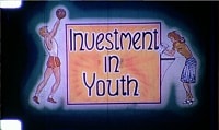
Investment in Youth
https://search.heritageburnaby.ca/link/archivedescription85187
- Repository
- City of Burnaby Archives
- Date
- 1946
- Collection/Fonds
- Norm Henderson collection
- Description Level
- Item
- Physical Description
- 1 film reel [19 min, 37 sec] : kodak kodachrome, col., sd.; 16mm
- Scope and Content
- Item consists of a motion picture film entitled 'Investment in Youth'. The film was created between October 1945 and March 15, 1946 and had its first public screening in April of 1946 at the North Burnaby High School with The Deputy Minister of Education of British Columbia, Dr. F.T. Fairey in atte…
- Repository
- City of Burnaby Archives
- Date
- 1946
- Collection/Fonds
- Norm Henderson collection
- Physical Description
- 1 film reel [19 min, 37 sec] : kodak kodachrome, col., sd.; 16mm
- Description Level
- Item
- Record No.
- 565-001
- Access Restriction
- No restrictions
- Reproduction Restriction
- No known restrictions
- Accession Number
- 2013-33
- Scope and Content
- Item consists of a motion picture film entitled 'Investment in Youth'. The film was created between October 1945 and March 15, 1946 and had its first public screening in April of 1946 at the North Burnaby High School with The Deputy Minister of Education of British Columbia, Dr. F.T. Fairey in attendance. It was produced for the Burnaby School Board as one method of demonstrating the importance of education as well as pointing out the need for school improvements. The depression of the 1930s left Burnaby in a difficult position with limited school construction and during World War II there were little resources for maintenance. Ken West was the producer and amateur cinematographer while Vancouver teacher, Roth Gordon assisted with the cinematography as well as providing technical assistance. The script was written by Norman D. MacDonald, who was the principal of Burnaby South High School while Inspector of Burnaby Schools, Cliff G. Brown, provided the overall supervision and idea for the production. Norm Henderson worked as a student assistant during the filming and assisted with much of the sound work. The speed of the film was ASA 2 ( artifical lighting) to 4 (natural lighting). As a result many of the sets had to have outside lighting. A 16 mm Bolex camera was used to film the entire production with sound being added later.
- History
- Norm Henderson came from Saskatchewan to Burnaby with his parents in December of 1940 to visit his grandmothers. Norm and his parents stayed on and bought the Old Orchard Auto Park on the corner of Kingsway and Willingdon Avenue, which they ran until 1944. Norm attended Burnaby South High School from 1941 to 1947, during which time he was involved in the production of the Burnaby School Board film; “Investment in Youth." In 1945 Norm got a part time job at Woodward’s Department Store in Vancouver where he worked until he went into teacher training at Vancouver Normal School in the early nineteen-fifties. Kathleen MacFarlane (later Henderson) was born in 1929 and grew up in Vancouver. Kathleen also went through teacher training at Vancouver Normal School. Norm Henderson and Kathleen MacFarlane were married in 1953 and moved to a small suite located at Patterson Avenue and Kingsway in Burnaby. Norm taught at Gilmore Avenue School and Kathleen taught at Nelson Avenue Elementary School. Norm was a member of West Burnaby United Church from 1941 until he and Kathleen moved to Richmond in 1959.
- Subjects
- Buildings - Schools
- Persons - Children
- Media Type
- Moving Images
- Photographer
- Gordon, Roth
- West, Ken
- Responsibility
- Burnaby School Board
- Notes
- Transcribed title
Images
Video
Investment in Youth, 1946
Investment in Youth, 1946
https://search.heritageburnaby.ca/media/hpo/_Data/_Archives_Moving_Images/_Unrestricted/565-001.m4v![Digney family at Bonsor Avenue and family outings, [between 1946 and 1947] thumbnail](/media/Hpo/_Data/_Archives_Moving_Images/_Unrestricted/562-003-15.jpg?width=280)
Digney family at Bonsor Avenue and family outings
https://search.heritageburnaby.ca/link/archivedescription85309
- Repository
- City of Burnaby Archives
- Date
- [between 1946 and 1947]
- Collection/Fonds
- Digney Family fonds
- Description Level
- Item
- Physical Description
- 1 film clip (13 min., 10 sec.) : digital,col., si.
- Scope and Content
- Item is a digitized silent colour film segment identified as Reel 15. Film footage opens with Andy and Alice Digney in the yard of the Digney family home on Bonsor Avenue and their son Ernest Frank (Dig) and his wife Dorothy (Dot) with thier infant son Paul at age 6 months and later as a toddler wi…
- Repository
- City of Burnaby Archives
- Date
- [between 1946 and 1947]
- Collection/Fonds
- Digney Family fonds
- Physical Description
- 1 film clip (13 min., 10 sec.) : digital,col., si.
- Description Level
- Item
- Record No.
- 562-003-15
- Access Restriction
- No restrictions
- Reproduction Restriction
- May be restricted by third party rights
- Accession Number
- 2014-04
- Scope and Content
- Item is a digitized silent colour film segment identified as Reel 15. Film footage opens with Andy and Alice Digney in the yard of the Digney family home on Bonsor Avenue and their son Ernest Frank (Dig) and his wife Dorothy (Dot) with thier infant son Paul at age 6 months and later as a toddler with a variety of family members. Footage also includes a view of Prince George, family members with Elephants and ponies from the Bible Brothers Circus, the Crystal Pool and Butchart Gardens in Victoria. The film closes with Paul, grandpa Dig and the family dog, Nero back in the yard of their home on Bonsor Avenue.
- Media Type
- Moving Images
- Photographer
- Digney, Andy
- Creator
- Digney, Andy
- Notes
- Title based on contents of film
- Geographic Access
- Bonsor Avenue
- Historic Neighbourhood
- Central Park (Historic Neighbourhood)
- Planning Study Area
- Maywood Area
Images
![Digney family at Bonsor Avenue and family outings, [between 1946 and 1947] thumbnail](/media/Hpo/_Data/_Archives_Moving_Images/_Unrestricted/562-003-15.jpg)
Video
Digney family at Bonsor Avenue and family outings, [between 1946 and 1947]
Digney family at Bonsor Avenue and family outings, [between 1946 and 1947]
https://search.heritageburnaby.ca/media/hpo/_Data/_Archives_Moving_Images/_Unrestricted/562-003-15.m4v1946 Data Report (supplement) - Burnaby Town Planning Commission
https://search.heritageburnaby.ca/link/archivedescription8844
- Repository
- City of Burnaby Archives
- Date
- 1946
- Collection/Fonds
- Planning Department fonds
- Description Level
- Item
- Physical Description
- Textual record and cartographic material
- Scope and Content
- This data report also contains a supplemental folder of maps.
- Repository
- City of Burnaby Archives
- Date
- 1946
- Collection/Fonds
- Planning Department fonds
- Series
- Planning General series
- Physical Description
- Textual record and cartographic material
- Description Level
- Item
- Record No.
- 11805
- Accession Number
- 2003-17
- Scope and Content
- This data report also contains a supplemental folder of maps.
- Media Type
- Textual Record
- Cartographic Material
Norm Henderson collection
https://search.heritageburnaby.ca/link/archivedescription85186
- Repository
- City of Burnaby Archives
- Date
- 1945-1946
- Collection/Fonds
- Norm Henderson collection
- Description Level
- Fonds
- Physical Description
- 1 film reel [19 min, 37 sec] : kodak kodachrome, col., sd.; 16mm
- Scope and Content
- Fonds comprises one film entitled "Investment in Youth." The film was produced for the Burnaby School Board and Norm Henderson participated as a student assistant and was present for all of the filming and much of the sound work.
- Repository
- City of Burnaby Archives
- Date
- 1945-1946
- Collection/Fonds
- Norm Henderson collection
- Physical Description
- 1 film reel [19 min, 37 sec] : kodak kodachrome, col., sd.; 16mm
- Description Level
- Fonds
- Access Restriction
- No restrictions
- Reproduction Restriction
- May be restricted by third party rights
- Accession Number
- 2013-33
- Scope and Content
- Fonds comprises one film entitled "Investment in Youth." The film was produced for the Burnaby School Board and Norm Henderson participated as a student assistant and was present for all of the filming and much of the sound work.
- History
- Norm Henderson came from Saskatchewan to Burnaby with his parents in December of 1940 to visit his grandmothers. Norm and his parents stayed on and bought the Old Orchard Auto Park on the corner of Kingsway and Willingdon Avenue, which they ran until 1944. Norm attended Burnaby South High School from 1941 to 1947, during which time he was involved in the production of the Burnaby School Board film, “Investment in Youth." In 1945, Norm got a part-time job at Woodward’s Department Store in Vancouver where he worked until he went into teacher training at Vancouver Normal School in the early 1950s. Kathleen MacFarlane (later Henderson) was born in 1929 and grew up in Vancouver. Kathleen also went through teacher training at Vancouver Normal School. Norm and Kathleen (MacFarlane) Henderson were married in 1953 and moved to a small suite at Patterson Avenue and Kingsway. Norm was a teacher at Gilmore Avenue School and Kathleen taught at Nelson Avenue Elementary School. Norm was a member of West Burnaby United Church from 1941 until he and Kathleen moved to Richmond in 1959.
- Media Type
- Moving Images
- Creator
- Henderson, Norman "Norm"
- Notes
- Title based on contents of collection.
- Photo/MI catalogue 565
Lower Mainland Regional Plan
https://search.heritageburnaby.ca/link/archivedescription90139
- Repository
- City of Burnaby Archives
- Date
- 1945
- Collection/Fonds
- Planning Department fonds
- Description Level
- Item
- Physical Description
- 7 maps : col. ; 22.5 x 53.5 cm on sheets 42 x 65 cm
- Scope and Content
- A collection of seven maps titled "Lower Mainland Regional Plan". Maps are numbered and subtitled as: "Light and Power Distribution / Map No. 5"; "Harbour Areas" / Map No. 8"; "Land Use" / Map No. 2"; "Water Supply" / Map No. 6"; "Dykes" / Map No. 7"; "Population Distribution / Map_No._1". All maps…
- Repository
- City of Burnaby Archives
- Date
- 1945
- Collection/Fonds
- Planning Department fonds
- Series
- Planning General series
- Physical Description
- 7 maps : col. ; 22.5 x 53.5 cm on sheets 42 x 65 cm
- Material Details
- Scale : in miles
- Map no. 4 is missing
- Description Level
- Item
- Record No.
- 59929
- Access Restriction
- Open access
- Accession Number
- 2016-09
- Scope and Content
- A collection of seven maps titled "Lower Mainland Regional Plan". Maps are numbered and subtitled as: "Light and Power Distribution / Map No. 5"; "Harbour Areas" / Map No. 8"; "Land Use" / Map No. 2"; "Water Supply" / Map No. 6"; "Dykes" / Map No. 7"; "Population Distribution / Map_No._1". All maps have are marked with boundaries, and landmarks including Historical Monuments, Custom Ports, Airports and Railways.
- Media Type
- Cartographic Material
- Notes
- Transcribed title
- Credit on maps read as: "Bureau_of_Post_War / Rehabilitation_and_Reconstruction / Regional_Planning_Design / Parliament_Buildings_Victoria_BC / Date_Sept_1st_1945 / (signed by ) [A.G._Graham]"
Dease Lake survey map
https://search.heritageburnaby.ca/link/archivedescription64449
- Repository
- City of Burnaby Archives
- Date
- April 12, 1944
- Collection/Fonds
- Burnaby Historical Society fonds
- Description Level
- Item
- Physical Description
- 1 map
- Scope and Content
- Item is a Dease Lake survey map produced by the Canada Department of Mines and Resources, Surveys and Engineering Branch.
- Repository
- City of Burnaby Archives
- Date
- April 12, 1944
- Collection/Fonds
- Burnaby Historical Society fonds
- Subseries
- Bancroft family subseries
- Physical Description
- 1 map
- Description Level
- Item
- Record No.
- MSS110-037
- Accession Number
- BHS2004-06
- Scope and Content
- Item is a Dease Lake survey map produced by the Canada Department of Mines and Resources, Surveys and Engineering Branch.
- Media Type
- Cartographic Material

RCAF Flying Log Book and navigation maps
https://search.heritageburnaby.ca/link/museumdescription20321
- Repository
- Burnaby Village Museum
- Date
- 1943-1945
- Collection/Fonds
- Joseph H.C. Corsbie fonds
- Description Level
- File
- Physical Description
- 1 book (hardcover) + 1 map : b&w lithograph on paper with annotations in col. ink ; 34.5 x 40.5 cm + 7 maps : b&w lithograph on paper with annotations in col. ink ; 41.5 x 33.5 cm
- Scope and Content
- File consists of a "Royal Canadian Air Force Flying Log Book for Aircrew other than Pilot" assigned to J.H. Corsbie along with eight aircraft navigation maps for flying at night titled; "Newcastle to Prague" and "Hull to Venice" with navigational markings created by Joseph H. Corsbie. Entries in lo…
- Repository
- Burnaby Village Museum
- Collection/Fonds
- Joseph H.C. Corsbie fonds
- Description Level
- File
- Physical Description
- 1 book (hardcover) + 1 map : b&w lithograph on paper with annotations in col. ink ; 34.5 x 40.5 cm + 7 maps : b&w lithograph on paper with annotations in col. ink ; 41.5 x 33.5 cm
- Material Details
- Scale : 1:2,890,000 (approx.)
- Scope and Content
- File consists of a "Royal Canadian Air Force Flying Log Book for Aircrew other than Pilot" assigned to J.H. Corsbie along with eight aircraft navigation maps for flying at night titled; "Newcastle to Prague" and "Hull to Venice" with navigational markings created by Joseph H. Corsbie. Entries in log book provide detailed records of Corsbie's training and flights undertaken on RCAF service aircraft between March 1943 and July 1945 along with units which Corsbie served as observer or air gunner and the aircraft in which he's flown (1943-1944).
- Other Title Information
- Full title of book "Royal Canadian Air Force Flying Log Book for aircrew other than Pilot"
- Responsibility
- Royal Canadian Air Force
- Accession Code
- BV020.31.44
- Access Restriction
- No restrictions
- Reproduction Restriction
- No known restrictions
- Date
- 1943-1945
- Media Type
- Textual Record
- Cartographic Material
- Scan Resolution
- 600
- Scan Date
- 19-09-2023
- Notes
- Title based on contents of file
- 7 maps titled "Hull to Venice / Heights in Feet" include identifier below bottom border reading: "O.R.1373 / Spot-Height Corrections, 1944"_"Compiled and drawn at H.Q./G.S.G.S.-1943"
- 1 map titled "Newcastle to Prague / Heights in Feet" include identifier below bottom border reading: "O.R.1373 / Spot-Height Corrections, 1944"_" H.Q./G.S.G.S.-1943"
Images

Documents
Joseph H. Corsbie RCAF records series
https://search.heritageburnaby.ca/link/museumdescription20332
- Repository
- Burnaby Village Museum
- Date
- 1942-1945
- Collection/Fonds
- Joseph H.C. Corsbie fonds
- Description Level
- Series
- Physical Description
- 13 photographs + 1 book + 10 maps + 2 cm textual records
- Scope and Content
- Series consists of documents and photographs relating to Joseph (Joe) Hardcastle Cumberland Corsbie's service and training with the Royal Canadian Air Force between 1942 and 1945.
- Repository
- Burnaby Village Museum
- Collection/Fonds
- Joseph H.C. Corsbie fonds
- Description Level
- Series
- Physical Description
- 13 photographs + 1 book + 10 maps + 2 cm textual records
- Scope and Content
- Series consists of documents and photographs relating to Joseph (Joe) Hardcastle Cumberland Corsbie's service and training with the Royal Canadian Air Force between 1942 and 1945.
- Subjects
- Wars - World War, 1939-1945
- Accession Code
- BV020.31
- Access Restriction
- No restrictions
- Reproduction Restriction
- No known restrictions
- Date
- 1942-1945
- Media Type
- Textual Record
- Photograph
- Cartographic Material
- Notes
- Title based on contents of series
Joseph H.C. Corsbie fonds
https://search.heritageburnaby.ca/link/museumdescription20275
- Repository
- Burnaby Village Museum
- Date
- [1941-1988]
- Collection/Fonds
- Joseph H.C. Corsbie fonds
- Description Level
- Fonds
- Physical Description
- 35 photographs + 1.5 cm textual records + 1 map + 1 book
- Scope and Content
- Fonds consists of photographs and documents relating to Joseph (Joe) Hardcastle Cumberland Corsbie during his service with the RCAF during World War II (1942-1945) along with photographs and docments relating to his personal and professional life (. Fonds is arranged into series: 1) Joseph H.C. Co…
- Repository
- Burnaby Village Museum
- Collection/Fonds
- Joseph H.C. Corsbie fonds
- Description Level
- Fonds
- Physical Description
- 35 photographs + 1.5 cm textual records + 1 map + 1 book
- Scope and Content
- Fonds consists of photographs and documents relating to Joseph (Joe) Hardcastle Cumberland Corsbie during his service with the RCAF during World War II (1942-1945) along with photographs and docments relating to his personal and professional life (. Fonds is arranged into series: 1) Joseph H.C. Corsbie RCAF records series 2) Joseph H.C. Corsbie personal and professional records series
- History
- Joseph “Joe” Hardcastle Cumberland Corsbie was born in 1913 in Peace River (Doe River) to parents Joseph Hardcastle Cumberland Corsbie and Winnifred Ann Mapleton Corsbie. As an adult Joe trained and served with the Royal Canadian Air Force as a navigator between 1942 and 1945. In 1945, while serving with the RCAF during World War II, Joe was awarded the Distinguished Flying Cross. After World War II, Joe returned to Peace River where he was elected as a Member of the Legislative Assembly serving as a Co-operative Commonwealth Federation MLA for one term between 1945 and 1948. In April 1948, Joe Corsbie married Margaret Carr in the Metropolitan United Church in Victoria followed by a reception held at the B.C. Legislature buildings. On their wedding day, the couple were honoured with a hand painted congratulatory certificate signed by members of the B.C. Legislature. In late, 1948, Joe lost the election and moved with his wife Margaret to Black Creek, B.C. to manage a co-op store. In 1949, the couple welcome their first child who they named Margaret after her mother. In 1950, Joe, Margaret and their daughter moved to a home on Charles Street in Burnaby and Joe began working as the General Manager of the Gulf and Fraser Fishermen’s Credit Union. In 1951, Joe and Margaret welcomed their second child, named Josesph after his father and in 1952, Joe, Margaret and family moved to 84 Springer Avenue, Burnaby where they lived until 1989. Between 1959 and 1976, Joe worked as a General Manager for the CU & C Health Services Society (later became Pacific Blue Cross). While working there, he focused on organizing both extended healthcare benefits and dental coverage for employee groups. In 1964, Joe Corsbie was elected to Burnaby Municipal Council and served one term between 1964 and 1968. Joe also served on the Burnaby Parks Commission (after 1968); served on the Board of Directors for Heritage Village, worked for a short period as a temporary curator for Heritage Village, represented the United Church in organizing and building St. Michael’s Care Centre and served on the Board of Director's. Joe Corsbie died in 1992 and his wife Margaret Corsbie died in 2004.
- Accession Code
- BV020.31
- Access Restriction
- No restrictions
- Reproduction Restriction
- No known restrictions
- Date
- [1941-1988]
- Media Type
- Photograph
- Textual Record
- Cartographic Material
- Arrangement
- Arrangement of fonds is based on the original arrangement by donor.
- Notes
- Title based on contents of fonds
Planning Department fonds
https://search.heritageburnaby.ca/link/archivedescription102
- Repository
- City of Burnaby Archives
- Date
- 1940-2016
- Collection/Fonds
- Planning Department fonds
- Description Level
- Fonds
- Physical Description
- 80 m of textual records and other material
- Scope and Content
- Fonds consists of those records created during the regular conduct of business by the Planning Department and its predecessor agencies according to their mandate of providing professional and technical advice to Council on the current and future uses of City land and resources.
- Repository
- City of Burnaby Archives
- Date
- 1940-2016
- Collection/Fonds
- Planning Department fonds
- Physical Description
- 80 m of textual records and other material
- Description Level
- Fonds
- File Class
- 71000 10 (add. 2020)
- 71000 20 (add. 2020)
- 71000 30 (add. 2020)
- 71000 40 (add. 2020)
- Access Restriction
- Subject to FOIPPA
- Reproduction Restriction
- Reproductions subject to FOIPPA.
- Scope and Content
- Fonds consists of those records created during the regular conduct of business by the Planning Department and its predecessor agencies according to their mandate of providing professional and technical advice to Council on the current and future uses of City land and resources.
- History
- The City of Burnaby Planning Department was established on October 9, 1956, when the City Council unanimously carried the motion to create a distinct department to deal with planning issues within the City and appointed Mr. William John Blakely as its head. This decision followed a report and recommendation made by the City’s Chief Administrative Officer which indicated that the role of the Planning Engineer and his staff had quickly expanded to become a separate division within the Engineering Department and that they were functioning as an independent unit in all but name. The proposed separation of the Engineering and Planning departments had been in the works since the early part of 1956 when staff changes and restructuring within the Engineering Department’s Planning Division illustrated the undermanned condition of the Planning Engineer’s office. As a result, Council asked the Chief Administrative Officer to undertake a study examining the feasibility of creating a distinct Planning Department. This report was delivered to Council on July 3, 1956, but was laid over until a Committee of the Council had the opportunity to study the functions of the Planning department to determine the necessity of the proposal. The Committee’s findings were in line with the initial report and the Planning Department was established with a staff of nine (the head Planning Engineer, an Administrative Planner, three Research Planning Assistants, a Draughtsman, a Subdivision Control Clerk, a department Clerk and a Clerk Stenographer). This new department was to offer advice and carry out the work intensive in matters such as zoning and rezoning applications, subdivision control, traffic and transportation planning, and general City planning schemes. Prior to the creation of the Planning Department, a number of bodies within the City had been responsible for fulfilling the functions carried out by this new unit. In the earliest years of the City, the members of Council were responsible for matters of planning and were assisted in their job by the City’s Engineer or any number of hired consultants (e.g. surveyors, cartographers). By 1906, however, the provincial laws surrounding the subdivision process had changed, and local governments were charged with the task of approving all private subdivision plans in their respective Municipalities. In Burnaby, the City Council passed a bylaw decreeing that all subdivision plans were to be submitted to Council for review and the City Engineer was responsible for ensuring compliance with the law. After the first Town Planning Bylaw in 1924 which restricted the type and size of construction that could occur in certain City areas, the Engineering and Building departments were to work together to oversee the enforcement of the Bylaw and the development of City plans. The scope and competence required to carry out this work grew as Burnaby’s population expanded, and in 1930 Council passed the Town Planning Commission Bylaw (No. 1028) that saw the creation of a permanent body – the Town Planning Commission – which was to serve as an advisory body to help direct the planning activities in the City while the actual work continued to be carried out by the Engineering Department. This body was comprised of the Reeve, the Chairman of the School Board, the Chairman of the Park Committee (later, the Board of Parks Commissioners), and six appointed citizens who served three-year terms. Council referred all matters of subdivisions, transportation planning, and rezoning to this Commission, which was later supported in its work by several other special or standing committees such as the Subdivision Committee, the Apartment Committee, the Transportation Committee or the Town Planning Board of Appeal. By 1953, it had become apparent that the advisory committees that were dedicated to these planning issues needed a permanent staff to carry out the work intensive, so a restructuring of the Engineering department resulted in a permanent Planning Engineer’s office being created. The Town Planning Commission continued in its advisory capacity even after the determination came in 1956 to create a separate Planning Department. When Bylaw No. 4473 was passed in 1963, the Town Planning Commission was disbanded in favour of a new Advisory Planning Commission that would turn over all routine matters such as subdivision and rezoning applications to the Planning Department but would offer advice and community input into the more complex planning schemes within the City and act as an intermediary in cases where Council and Planning staff were in disagreement. A new Advisory Planning Commission Bylaw (No. 7600) was adopted in 1980 which allowed for even greater community participation in the planning process. The Planning Department was initially responsible to report directly to Council, but in 1957, the administrative structure of Municipal staff changed with the introduction of the Burnaby Municipal Manager Bylaw (No. 3859) and from that point on, the head of the Planning Department held a direct reporting relationship to the Municipal Manager, who in turn was responsible for reporting the activities of the Department to the City Council. Over the years, the internal structure and the scope of responsibilities of the Department have changed during periods of staff reorganizations. Under the larger umbrella of the Planning and Building Department, Planning has come to be comprised of two divisions: the Current Planning Division and the Long Range Planning Division. The functions of the Current Planning Division include rezoning, subdivision, development plan areas, preliminary plan approvals, urban design, heritage planning, and urban trails and bicycle routes. The Long Range Planning Division is responsible for environmental planning concerns, transportation planning, housing, neighbourhood area planning, social planning and planning information services. In 2022, the Planning and Building Department was reorganized to better align functions with delivery of services. The Climate Action and Engery Division moved from Corporate Services to the Planning and Building Department, while Indigenous Relations and Facilities Management moved to Corporate Services and Lands and Facilities, respectively. The position of Director of Planning and Building was changed to General Manager, Planning and Development. The following individuals have served as Planning Engineer and/or Director of the Planning Department and/or General Manager, Planning and Development for the City of Burnaby: William John Blakely 1954-1956 (as Planning Engineer) 1956-1963 (as Head of the Department) Anthony P. Parr 1964-1993 Don G. Stenson 1993-2001 Jack S. Belhouse 2001-2006 Basil Luksun 2006-2012 Lou Pelletier 2012-2019 Edward Kozak 2019-present
- Formats
- Microforms exist for some records. See series descriptions.
- Media Type
- Textual Record
- Photograph
- Moving Images
- Creator
- City of Burnaby
- Notes
- Title based on contents of fonds
The Fraser Canyon and Okanagan
https://search.heritageburnaby.ca/link/archivedescription66720
- Repository
- City of Burnaby Archives
- Date
- [194-]
- Collection/Fonds
- Maurice Phillips collection
- Description Level
- Item
- Physical Description
- 1 map : col. on paper ; 42.5 x 49 cm, folded to 23 x 10 cm
- Scope and Content
- Item is a map of "the Fraser Canyon and Okanagan / Scenic Highway Loop of British Columbia, Canada" published by the British Columbia Government Travel Bureau, Department of Trade and Industry.
- Repository
- City of Burnaby Archives
- Date
- [194-]
- Collection/Fonds
- Maurice Phillips collection
- Physical Description
- 1 map : col. on paper ; 42.5 x 49 cm, folded to 23 x 10 cm
- Material Details
- Scale not indicated
- Description Level
- Item
- Record No.
- MSS158-003
- Accession Number
- 2011-13
- Scope and Content
- Item is a map of "the Fraser Canyon and Okanagan / Scenic Highway Loop of British Columbia, Canada" published by the British Columbia Government Travel Bureau, Department of Trade and Industry.
- Media Type
- Cartographic Material
- Notes
- Transcribed title
![Digney family and the Oak Theatre gardens, [between 1940 and 1944] thumbnail](/media/Hpo/_Data/_Archives_Moving_Images/_Unrestricted/562-003-14.jpg?width=280)
Digney family and the Oak Theatre gardens
https://search.heritageburnaby.ca/link/archivedescription85251
- Repository
- City of Burnaby Archives
- Date
- [between 1940 and 1944]
- Collection/Fonds
- Digney Family fonds
- Description Level
- Item
- Physical Description
- 1 film clip (10 min., 12 sec.) : digital, b&w, col., si.
- Scope and Content
- Item is a digitized silent film segment identified as Reel 14. The film opens in with the Digney family in their yard and garden and Grandma Swan's funeral (Royal Oak Cemetery). The remainder of the footage provides views of the gardens surrounding the Oak Theatre and includes footage of a wedding,…
- Repository
- City of Burnaby Archives
- Date
- [between 1940 and 1944]
- Collection/Fonds
- Digney Family fonds
- Physical Description
- 1 film clip (10 min., 12 sec.) : digital, b&w, col., si.
- Description Level
- Item
- Record No.
- 562-003-14
- Access Restriction
- No restrictions
- Reproduction Restriction
- May be restricted by third party rights
- Accession Number
- 2014-04
- Scope and Content
- Item is a digitized silent film segment identified as Reel 14. The film opens in with the Digney family in their yard and garden and Grandma Swan's funeral (Royal Oak Cemetery). The remainder of the footage provides views of the gardens surrounding the Oak Theatre and includes footage of a wedding, family pets at play, men and women playing badminton, views of both the interior and exterior of the Oak Theatre including female ushers. The film then moves on to a War Bond Drive and parade along Kingsway followed by more views of the Oak Theatre gardens.
- Media Type
- Moving Images
- Photographer
- Digney, Andy
- Creator
- Digney, Andy
- Notes
- Title based on contents of film
- Historic Neighbourhood
- Central Park (Historic Neighbourhood)
- Planning Study Area
- Marlborough Area
Images
![Digney family and the Oak Theatre gardens, [between 1940 and 1944] thumbnail](/media/Hpo/_Data/_Archives_Moving_Images/_Unrestricted/562-003-14.jpg)
Video
Digney family and the Oak Theatre gardens, [between 1940 and 1944]
Digney family and the Oak Theatre gardens, [between 1940 and 1944]
https://search.heritageburnaby.ca/media/hpo/_Data/_Archives_Moving_Images/_Unrestricted/562-003-14.m4v![Galiano Island, Oak Theatre and Calgary, [between 1939 and 1941] thumbnail](/media/Hpo/_Data/_Archives_Moving_Images/_Unrestricted/562-003-7.jpg?width=280)
Galiano Island, Oak Theatre and Calgary
https://search.heritageburnaby.ca/link/archivedescription85241
- Repository
- City of Burnaby Archives
- Date
- [between 1939 and 1941]
- Collection/Fonds
- Digney Family fonds
- Description Level
- Item
- Physical Description
- 1 film clip (9 min., 51 sec.) : digital, col., si.
- Scope and Content
- Item is a silent digitized colour film segment identified as Reel 7. The film segment opens with footage of the shores of Galiano Island and soon switches to a game of table tennis and a boat ride up Burrard Inlet with Grannie Swan and company. The boat ride continues to the marina at Horseshoe Bay…
- Repository
- City of Burnaby Archives
- Date
- [between 1939 and 1941]
- Collection/Fonds
- Digney Family fonds
- Physical Description
- 1 film clip (9 min., 51 sec.) : digital, col., si.
- Description Level
- Item
- Record No.
- 562-003-7
- Access Restriction
- No restrictions
- Reproduction Restriction
- May be restricted by third party rights
- Accession Number
- 2014-04
- Scope and Content
- Item is a silent digitized colour film segment identified as Reel 7. The film segment opens with footage of the shores of Galiano Island and soon switches to a game of table tennis and a boat ride up Burrard Inlet with Grannie Swan and company. The boat ride continues to the marina at Horseshoe Bay where the family goes ashore. This footage is followed with a dark segment of footage of a paegant at the Oak Theatre in 1941 and the gardens of the Oak Theatre. The film has a break and continues with footage of the Digney family travels to the Calgary Breweries, Calgary Zoo, and the Calgary Stampede parade and fairgrounds, Alberta, closing with footage of the Rockies and Rogers Pass.
- Subjects
- Animals - Birds
- Events - Parades
- Media Type
- Moving Images
- Photographer
- Digney, Andy
- Creator
- Digney, Andy
- Notes
- Title based on contents of film
- Geographic Access
- Burrard Inlet
- Historic Neighbourhood
- Central Park (Historic Neighbourhood)
- Planning Study Area
- Kingsway-Beresford Area
Images
![Galiano Island, Oak Theatre and Calgary, [between 1939 and 1941] thumbnail](/media/Hpo/_Data/_Archives_Moving_Images/_Unrestricted/562-003-7.jpg)
Video
Galiano Island, Oak Theatre and Calgary, [between 1939 and 1941]
Galiano Island, Oak Theatre and Calgary, [between 1939 and 1941]
https://search.heritageburnaby.ca/media/hpo/_Data/_Archives_Moving_Images/_Unrestricted/562-003-7.m4v![Digney family in Burnaby, [between 1939 and 1959] thumbnail](/media/Hpo/_Data/_Archives_Moving_Images/_Unrestricted/562-003-12.jpg?width=280)
Digney family in Burnaby
https://search.heritageburnaby.ca/link/archivedescription85249
- Repository
- City of Burnaby Archives
- Date
- [between 1939 and 1959]
- Collection/Fonds
- Digney Family fonds
- Description Level
- Item
- Physical Description
- 1 film clip (5 min., 17sec.) : digital, col., si.
- Scope and Content
- Item is a digitized film colour segment identified as Reel 12. The film is a compilation of Digney family events. The film opens with children Paul and Bruce Digney running around the Digney family yard at their home on Bonsor Avenue with Andy and Ernest (Dig) Digney looking on. This is followed by…
- Repository
- City of Burnaby Archives
- Date
- [between 1939 and 1959]
- Collection/Fonds
- Digney Family fonds
- Physical Description
- 1 film clip (5 min., 17sec.) : digital, col., si.
- Description Level
- Item
- Record No.
- 562-003-12
- Access Restriction
- No restrictions
- Reproduction Restriction
- May be restricted by third party rights
- Accession Number
- 2014-04
- Scope and Content
- Item is a digitized film colour segment identified as Reel 12. The film is a compilation of Digney family events. The film opens with children Paul and Bruce Digney running around the Digney family yard at their home on Bonsor Avenue with Andy and Ernest (Dig) Digney looking on. This is followed by interspersed footage of the family's pet dog Nero and puppies along with some brief glimpses of the Royal visit (King George VI and Queen Elizabeth) and cavilicade in 1939 along Kingsway. The film then switches to footage of Digney family Christmas festivities, a cat playing with a fish in a bowl and summer time at Pelican Lake in the 1940s and ends with a dog playing with a ball.
- Media Type
- Moving Images
- Photographer
- Digney, Andy
- Creator
- Digney, Andy
- Notes
- Title based on contents of film
- Geographic Access
- Bonsor Avenue
- Kingsway
- Historic Neighbourhood
- Central Park (Historic Neighbourhood)
- Planning Study Area
- Maywood Area
Images
![Digney family in Burnaby, [between 1939 and 1959] thumbnail](/media/Hpo/_Data/_Archives_Moving_Images/_Unrestricted/562-003-12.jpg)
Video
Digney family in Burnaby, [between 1939 and 1959]
Digney family in Burnaby, [between 1939 and 1959]
https://search.heritageburnaby.ca/media/hpo/_Data/_Archives_Moving_Images/_Unrestricted/562-003-12.m4vHerbert Yee Law family fonds
https://search.heritageburnaby.ca/link/museumdescription18929
- Repository
- Burnaby Village Museum
- Date
- [1938-1959] (date of originals), 2017-2019 (date of duplication)
- Collection/Fonds
- Herbert Yee Law family fonds
- Description Level
- Fonds
- Physical Description
- 4 photographs (tiffs + jpgs)
- Scope and Content
- Fonds consists of a collection of photographs of Herbert Yee Law, United Fruit Growers, his farm on Marine Drive and a scanned copy of a survey plan of District Lots 163, 162, 157, 158 and 165.
- Repository
- Burnaby Village Museum
- Collection/Fonds
- Herbert Yee Law family fonds
- Description Level
- Fonds
- Physical Description
- 4 photographs (tiffs + jpgs)
- Scope and Content
- Fonds consists of a collection of photographs of Herbert Yee Law, United Fruit Growers, his farm on Marine Drive and a scanned copy of a survey plan of District Lots 163, 162, 157, 158 and 165.
- History
- Herbert (Yee) Law was born in New Westminster British Columbia in 1916. Between 1938 and 1945, Yee Law worked for the United Fraser Growers Limited in Vancouver. The company was a wholesaler that purchased produce from Chinese farmers. In 1948 Yee Law purchased land from another Chinese family along Marine Drive in the Big Bend Area of Burnaby. From this location, Yee Law operated a Chinese market garden. Yee Law and his wife Jean had five daughters who attended schools in the area including Riverway West School, McPherson Park School and Burnaby South High School. In 1954, Yee Law continued to live in the area but left his farm to work for a plastic bag company on Annacis Island. Herbert (Yee) Law died in 2003.
- Creator
- Law, Yee "Herbert"
- Accession Code
- BV017.40
- BV019.11
- Date
- [1938-1959] (date of originals), 2017-2019 (date of duplication)
- Media Type
- Photograph
- Cartographic Material
- Notes
- Title based on contents of fonds