Narrow Results By
Creator
- Bartel, Mario 20
- Born, A. J. 2
- British Columbia Underwriters' Association 2
- Burnett & McGugan, Engineers and Surveyors 1
- Cheung, Nakita 1
- Crawford, T. James (Thomas James) 1
- Digney, Andy 2
- Disney, John Harold "Jack" 2
- Edmonds Studio 1
- Hoyer Studios 1
- Lessenberry, D. D. (David Daniel), 1896- 1
- Lloyd, Frank Ernest 1

Jacob & Margaret Wysong House
https://search.heritageburnaby.ca/link/landmark507
- Repository
- Burnaby Heritage Planning
- Description
- The Jacob and Margaret Wysong House is a two and one-half storey, wood-frame Arts and Crafts house with a hipped roof and hipped dormers. Symmetrical in massing, it is distinguished by its masonry verandah columns, foundations and chimneys. It is located on a corner lot on Sperling Avenue at Stanle…
- Associated Dates
- 1912
- Formal Recognition
- Heritage Designation, Community Heritage Register
- Street View URL
- Google Maps Street View
- Repository
- Burnaby Heritage Planning
- Geographic Access
- Sperling Avenue
- Associated Dates
- 1912
- Formal Recognition
- Heritage Designation, Community Heritage Register
- Enactment Type
- By-law No. 11978
- Enactment Date
- 17/10/2005
- Description
- The Jacob and Margaret Wysong House is a two and one-half storey, wood-frame Arts and Crafts house with a hipped roof and hipped dormers. Symmetrical in massing, it is distinguished by its masonry verandah columns, foundations and chimneys. It is located on a corner lot on Sperling Avenue at Stanley Street in the Edmonds neighbourhood of South Burnaby.
- Heritage Value
- The Jacob and Margaret Wysong House is significant for illustrating the early development of the Edmonds neighbourhood, a speculative subdivision that was created and marketed during the pre-First World War real estate boom. The area’s proximity to New Westminster, coupled with extensive views and two newly developed streetcar lines, ensured that Edmonds attracted a wave of suburban development. The scale of this house is atypical of the usual suburban lots, and reflects the prominence of this location and its spectacular views. Set on a large lot, the Jacob and Margaret Wysong House is a grand estate home that is one of the earliest, and most prominent, in South Burnaby. This is also an exceptional example of Arts and Crafts architecture, displaying the use of native materials that was a hallmark of the style. The first owners were Jacob Wysong and his wife Margaret. Jacob Wysong, a local contractor, constructed the house in 1912. The stonework is exceptional, and the use of rough-cut granite and fieldstone, with overall shingle cladding, recalls the rustic vernacular common in Western park lodges, and evokes a country lifestyle in harmony with nature. The hipped roof was designed with a flat top that acted as a lookout tower that provided views of the surrounding landscape.
- Defining Elements
- Key elements that define the heritage character of the Jacob and Margaret Wysong House include its: - prominent corner location in the Edmonds neighbourhood of South Burnaby - residential form, scale and massing as expressed by its two and one-half storey plus raised basement height, symmetrical plan, hipped roof with flat top, hipped dormers, and hipped roof over the full open front verandah with a central front gable - masonry elements such as rough-cut granite and fieldstone foundations, verandah columns, stair cheeks, and external and internal chimneys - wooden-frame construction including original cedar shingling on dormers and facing verandah, shingling on remainder of house under later stucco cladding, and surviving original dimensional trim facing verandah and on dormers - Arts and Crafts features such as the use of natural materials, open soffits and angled roof overhang - windows including: double-hung 18-over-1 wooden sash windows; multi-paned casement windows; French doors to verandah; and front door with glazed sidelights - associated landscape features including surrounding mature trees, hedges and perimeter plantings
- Historic Neighbourhood
- Edmonds (Historic Neighbourhood)
- Planning Study Area
- Kingsway-Beresford Area
- Function
- Primary Historic--Single Dwelling
- Primary Current--Single Dwelling
- Community
- Edmonds
- Cadastral Identifier
- P.I.D. 000-497-801
- Boundaries
- The Jacob and Margaret Wysong House is comprised of a single residential lot located at 6325 Sperling Avenue, Burnaby.
- Area
- 1087.62
- Contributing Resource
- Building
- Ownership
- Private
- Documentation
- City of Burnaby Planning and Building Department, Heritage Site Files
- Street Address
- 6325 Sperling Avenue
- Street View URL
- Google Maps Street View
Images


'The Gables'
https://search.heritageburnaby.ca/link/landmark516
- Repository
- Burnaby Heritage Planning
- Description
- 'The Gables' is a one and one-half storey plus basement residence with a distinctive cross-gambrel roof. The foundations and first storey facade are constructed of granite rubble-stone with raised pointing, and the remainder of the house is clad in cedar shingles. It is now part of the Tudor Grove …
- Associated Dates
- 1920
- Formal Recognition
- Heritage Designation, Community Heritage Register
- Other Names
- John & Christina Mackie House
- Street View URL
- Google Maps Street View
- Repository
- Burnaby Heritage Planning
- Other Names
- John & Christina Mackie House
- Geographic Access
- Arbroath Street
- Southoaks Crescent
- Associated Dates
- 1920
- Formal Recognition
- Heritage Designation, Community Heritage Register
- Enactment Type
- Bylaw No. 10314
- Enactment Date
- 15/01/1996
- Description
- 'The Gables' is a one and one-half storey plus basement residence with a distinctive cross-gambrel roof. The foundations and first storey facade are constructed of granite rubble-stone with raised pointing, and the remainder of the house is clad in cedar shingles. It is now part of the Tudor Grove residential complex.
- Heritage Value
- The residence is valued as the house of John Mackie (1879-1937) and Christina Mackie (1881-1959) and is significant as the last house remaining from the original Highland Park subdivision. The area was first laid out in 1902, and then remarketed by C.L. Merritt and Company in 1911 as 'Gilley Park - the Suburb Beautiful.' Located on the B.C. Electric Railway interurban line, this was one of many middle-class commuter suburbs in Burnaby promoted during the Edwardian era. These suburbs were reflective of the City Beautiful Movement, a process of urbanization that sought to create morally, socially and aesthetically uplifting civic environments. The site is significant as a rare example of a modest residence incorporating high quality Arts and Crafts stylistic elements. Unusual for a house of this moderate scale, the foundation, first storey walls and chimney are constructed of rough-dressed granite. John Mackie was a stone mason, and it is assumed that he undertook the work himself. The cross gambrel roof is an unusual feature, relatively uncommon in B.C., from which the house derives its name, ‘The Gables.’
- Defining Elements
- Key elements that define the heritage character of 'The Gables' include its: - location in the original Highland Park subdivision - vernacular residential form, scale and massing as exemplified by the one and one-half storey plus basement height, inset porch and symmetrical, rectangular plan - cross-gambrel roof with closed eaves and returned lower edges, clad with cedar shingles - Arts and Crafts influence as exemplified in its use of natural materials such as rough-dressed granite rubble-stone foundation, first storey walls and chimney, and cedar shingle siding on the upper storey - other elements of masonry construction, such as the granite window-box brackets, granite stair cheeks and granite interior chimney with rustic cap - wooden-sash windows - house name, ‘The Gables,’ carved into a granite block on the left-hand pier of the front porch
- Historic Neighbourhood
- Edmonds (Historic Neighbourhood)
- Planning Study Area
- Kingsway-Beresford Area
- Function
- Primary Historic--Single Dwelling
- Primary Current--Single Dwelling
- Community
- Burnaby
- Cadastral Identifier
- 002-837-765
- Boundaries
- 'The Gables' is comprised of a single residential lot located at 6445 Arbroath Street, Burnaby.
- Area
- 5453.12
- Contributing Resource
- Building
- Ownership
- Private
- Street Address
- 6445 Arbroath Street
- Street View URL
- Google Maps Street View
Images


Kingsway East School
https://search.heritageburnaby.ca/link/landmark546
- Repository
- Burnaby Heritage Planning
- Description
- The Kingsway East School is a two-storey wood-frame Arts and Crafts styled building. The school, and the adjacent cenotaph and memorial tennis courts, comprise Burnaby South Memorial Park.
- Associated Dates
- 1913
- Formal Recognition
- Heritage Designation, Community Heritage Register
- Other Names
- Alan Emmott Centre
- Street View URL
- Google Maps Street View
- Repository
- Burnaby Heritage Planning
- Other Names
- Alan Emmott Centre
- Geographic Access
- Southoaks Crescent
- Associated Dates
- 1913
- Formal Recognition
- Heritage Designation, Community Heritage Register
- Enactment Type
- Bylaw No. 9807
- Enactment Date
- 23/11/1992
- Description
- The Kingsway East School is a two-storey wood-frame Arts and Crafts styled building. The school, and the adjacent cenotaph and memorial tennis courts, comprise Burnaby South Memorial Park.
- Heritage Value
- This school structure completed in 1913, the oldest surviving public education building in the city, was intended to be the auditorium and gymnasium for Burnaby’s first high school. However, because of the 1913 recession and the outbreak of the First World War, it was utilized as the Kingsway East Elementary School for the Edmonds District until 1921. Burnaby South High School opened here in 1922, and after it relocated this building was used for a variety of school purposes until it became redundant. The school was rehabilitated for community purposes in 2002-03 and renamed the Alan Emmott Centre to honor a former Mayor of Burnaby. The impressive scale of the Kingsway East School is indicative of the relative size of the community and its growing demand for schooling at the time of construction, illustrating the value that early community residents placed on education. Built to plans of the Burnaby School Board architect, Joseph Henry Bowman (1864-1943), it also indicates the individual values and design control exercised by the school board during this era. It is also significant for its Arts and Crafts style, allied to the typical Craftsman residential vocabulary, which was employed locally for school buildings of the Edwardian era. By using a common architectural vocabulary, this allowed the institution to reflect the values and aspirations of the local community. The Arts and Crafts style also demonstrated an allegiance to British educational antecedents and a demonstration of loyalty to the Mother Country.
- Historic Neighbourhood
- Edmonds (Historic Neighbourhood)
- Planning Study Area
- Kingsway-Beresford Area
- Function
- Primary Historic--Primary School
- Community
- Burnaby
- Cadastral Identifier
- P.I.D. No. 016-367-154 Legal Description: Lot 1, District Lot 96, Group 1 New Westminster District, Plan 86581
- Boundaries
- The Kingsway East School is comprised of a single municipally-owned property located at 6650 Southoaks Crescent, Burnaby.
- Area
- 6,070.00
- Contributing Resource
- Building
- Landscape Feature
- Structure
- Ownership
- Public (local)
- Documentation
- Heritage Site Files: PC77000 20. City of Burnaby Planning and Building Department, 4949 Canada Way, Burnaby, B.C., V5G 1M2
- Street Address
- 6650 Southoaks Crescent
- Street View URL
- Google Maps Street View
Images


Burnaby South High School Cenotaph & Memorial Tennis Courts
https://search.heritageburnaby.ca/link/landmark547
- Repository
- Burnaby Heritage Planning
- Description
- This memorial comprises a cenotaph and three tennis courts: the former a monument of British Columbia granite inscribed with the names of fifty-one students of Burnaby South High School who lost their lives in the Second World War; and the latter a living memorial to these former students.
- Associated Dates
- 1948
- Formal Recognition
- Heritage Designation, Community Heritage Register
- Street View URL
- Google Maps Street View
- Repository
- Burnaby Heritage Planning
- Geographic Access
- Southoaks Crescent
- Associated Dates
- 1948
- Formal Recognition
- Heritage Designation, Community Heritage Register
- Enactment Type
- Bylaw No. 9807
- Enactment Date
- 23/11/1992
- Description
- This memorial comprises a cenotaph and three tennis courts: the former a monument of British Columbia granite inscribed with the names of fifty-one students of Burnaby South High School who lost their lives in the Second World War; and the latter a living memorial to these former students.
- Heritage Value
- This memorial is important for its spiritual, symbolic, and cultural associations for the former students of Burnaby South High School, and for all youth in the community. The cenotaph is of personal significance to the families of those who lost their lives. The unusual combination of cenotaph and living memorial - the tennis courts - represents a rare statement of a community's commitment to not allow the sacrifice of its youth to be forgotten by providing an active facility which draw people to the place on a regular basis rather than just on occasions of remembrance. As such it is an important symbol of a humanitarian ethic. In combination with the Kingsway East School, now rehabilitated as the Alan Emmott Centre, this memorial represents a valuable haven of green-space and recreation in the high-density urban development that now surrounds it.
- Defining Elements
- Key elements that define the heritage character of the Burnaby South High School Cenotaph & Memorial Tennis Courts include the: - location of the cenotaph adjacent to the living memorial - spatial association of this memorial and the remaining school building - physical fabric of both the granite monument and the tennis courts
- Historic Neighbourhood
- Edmonds (Historic Neighbourhood)
- Planning Study Area
- Kingsway-Beresford Area
- Function
- Primary Current--Public Feature
- Primary Historic--Public Feature
- Community
- Burnaby
- Cadastral Identifier
- P.I.D. No. 016-367-154 Legal Description: Lot 1, District Lot 96, Group 1 New Westminster District, Plan 86581
- Boundaries
- Burnaby South High School Cenotaph & Memorial Tennis Courts is comprised of a single municipally-owned property located at 6650 Southoaks Crescent, Burnaby.
- Area
- 6,070.00
- Contributing Resource
- Building
- Landscape Feature
- Structure
- Ownership
- Public (local)
- Documentation
- Heritage Site Files: PC77000 20. City of Burnaby Planning and Building Department, 4949 Canada Way, Burnaby, B.C., V5G 1M2
- Street Address
- 6650 Southoaks Crescent
- Street View URL
- Google Maps Street View
Images


A.E. Brown Residence
https://search.heritageburnaby.ca/link/landmark553
- Repository
- Burnaby Heritage Planning
- Description
- Residential building.
- Associated Dates
- 1924
- Street View URL
- Google Maps Street View
- Repository
- Burnaby Heritage Planning
- Geographic Access
- Sperling Avenue
- Associated Dates
- 1924
- Description
- Residential building.
- Heritage Value
- Built after the end of the First World War, this house features an eclectic blend of Arts and Crafts elements. Constructed for A.E. Brown and a full two storeys in height, it has a front jerkin-headed roof with a jerkin-headed side projection, and a corner wraparound verandah with tapered columns. The house has been maintained in near original condition, with original lapped wooden siding, multi-paned windows and square balusters.
- Locality
- Edmonds
- Historic Neighbourhood
- Edmonds (Historic Neighbourhood)
- Planning Study Area
- Kingsway-Beresford Area
- Ownership
- Private
- Street Address
- 6830 Sperling Avenue
- Street View URL
- Google Maps Street View
Images

![Gilley Brothers Logging team, [1895]. . thumbnail](/media/hpo/_Data/_Archives_Images/_Unrestricted/371/461-003.jpg?width=280)
Vancouver Road (Kingsway)
https://search.heritageburnaby.ca/link/landmark729
- Repository
- Burnaby Heritage Planning
- Associated Dates
- 1860
- Heritage Value
- The street we know as Kingsway is one of the legacies of the Royal Engineers' military defences for New Westminster. The fear of an American attack prompted the construction of the False Creek trail - later known as Vancouver Road and now Kingsway - in 1860 to connect the capital city to the ice-free salt water harbour at English Bay.
- Historic Neighbourhood
- Central Park (Historic Neighbourhood)
- Edmonds (Historic Neighbourhood)
- Planning Study Area
- Maywood Area
- Marlborough Area
- Windsor Area
- Kingsway-Beresford Area
- Stride Avenue Area
- Edmonds Area
Images
![Gilley Brothers Logging team, [1895]. . thumbnail](/media/hpo/_Data/_Archives_Images/_Unrestricted/371/461-003.jpg)

Powerhouse
https://search.heritageburnaby.ca/link/landmark731
- Repository
- Burnaby Heritage Planning
- Geographic Access
- Griffiths Avenue
- Kingsway
- Associated Dates
- 1891
- Heritage Value
- Constructed in 1891 between Edmonds and Highland Park on the Central Park Interurban Line, the steam plant provided power to run the line, then operated by Westminster and Vancouver Tramway Company. The steam powerhouse was replaced in 1905 by a B.C. Electric substation which was put into operation to receive and distribute power from the B.C.E.R. Buntzen Lake power dam. Prior to Burnaby having its own Municipal Hall, Council meetings were often held at the boarding house adjacent to the powerhouse and in 1892, Burnaby’s first Council meeting was held at the boarding house in 1892.
- Historic Neighbourhood
- Edmonds (Historic Neighbourhood)
- Planning Study Area
- Kingsway-Beresford Area
Images


Burnaby South High School
https://search.heritageburnaby.ca/link/landmark770
- Repository
- Burnaby Heritage Planning
- Associated Dates
- 1922-1988
- Street View URL
- Google Maps Street View
- Repository
- Burnaby Heritage Planning
- Geographic Access
- Southoaks Crescent
- Associated Dates
- 1922-1988
- Heritage Value
- Burnaby South and Burnaby North were Burnaby's first high schools. The first rooms of the school were built in 1922 on the same grounds as the Kingsway East Elementary School. In 1940, a two-storey building was erected and additions were made in 1963, 1967 and 1972. Kingsway East closed in 1925 and its buildings were used by the high school for Industrial Arts and Home Economics. In the early 1990s, a new "urban education centre" (Burnaby South/B.C. School for the Deaf) was opened, replacing the old Burnaby South High School.
- Historic Neighbourhood
- Edmonds (Historic Neighbourhood)
- Planning Study Area
- Kingsway-Beresford Area
- Street Address
- 6650 Southoaks Crescent
- Street View URL
- Google Maps Street View
Images


Kingsway
https://search.heritageburnaby.ca/link/landmark775
- Repository
- Burnaby Heritage Planning
- Associated Dates
- 1913
- Heritage Value
- The years 1911-1912 saw great expansion and settlement in Burnaby and large public works projects were undertaken to service the growing community. One project that was determined to be a necessity was the construction of a proper highway between New Westminster and Vancouver. The Province and the Municipality agreed to share the costs of construction (with Burnaby paying 25% and the Province 75%) and so Kingsway was built to improve the current Vancouver Road. The road was named after the famous King's Way in London, England.
- Historic Neighbourhood
- Central Park (Historic Neighbourhood)
- Edmonds (Historic Neighbourhood)
- Planning Study Area
- Maywood Area
- Marlborough Area
- Windsor Area
- Kingsway-Beresford Area
- Stride Avenue Area
- Edmonds Area
Images


Kingsway-Beresford Neighbourhood
https://search.heritageburnaby.ca/link/landmark805
- Repository
- Burnaby Heritage Planning
- Associated Dates
- 1955-2008
- Heritage Value
- Since the building boom of the 1950s, the Kingsway-Beresford Neighbourhood has maintained a residential character with the exception of the Kingsway corridor, which has become a primary commercial and light industrial sector.
- Historic Neighbourhood
- Edmonds (Historic Neighbourhood)
- Planning Study Area
- Kingsway-Beresford Area
Images


Brantford Elementary School
https://search.heritageburnaby.ca/link/landmark809
- Repository
- Burnaby Heritage Planning
- Geographic Access
- Brantford Avenue
- Associated Dates
- 1965
- Heritage Value
- As housing developments extended north from Kingsway, pupil enrolments grew at Windsor and at Morley Schools so Brantford was built equidistant from the two to help ease enrolment problems. Brantford Elementary school opened in 1965 and was similar in structure to other schools built in Burnaby during this period - no basements, no second stories and no high stairways. Classrooms were built in a line and could easily be added to as enrolments increased. Brantford had room additions in 1969.
- Historic Neighbourhood
- Edmonds (Historic Neighbourhood)
- Planning Study Area
- Kingsway-Beresford Area
- Street Address
- 6512 Brantford Avenue
- Street View URL
- Google Maps Street View
Images

![Girls' Day Festival at the Nikkei National Museum, [2002] thumbnail](/media/hpo/_Data/_Archives_Images/_Unrestricted/535/535-1995-2.jpg?width=280)
Girls' Day Festival at the Nikkei National Museum
https://search.heritageburnaby.ca/link/archivedescription96312
- Repository
- City of Burnaby Archives
- Date
- [2002]
- Collection/Fonds
- Burnaby NewsLeader photograph collection
- Description Level
- File
- Physical Description
- 2 photographs (tiff) : col.
- Scope and Content
- File contains photographs from the Girls' Day Festival at the Nikkei National Museum & Cultural Centre in Burnaby. Photographs show Erika Tajiri dressing up in a traditional Japanese kimono and Miyuki Taniguchi viewing a Fuzoku Ningyo, a traditional Japanese doll, during the festivities.
- Repository
- City of Burnaby Archives
- Date
- [2002]
- Collection/Fonds
- Burnaby NewsLeader photograph collection
- Physical Description
- 2 photographs (tiff) : col.
- Description Level
- File
- Record No.
- 535-1995
- Access Restriction
- No restrictions
- Reproduction Restriction
- No restrictions
- Accession Number
- 2018-12
- Scope and Content
- File contains photographs from the Girls' Day Festival at the Nikkei National Museum & Cultural Centre in Burnaby. Photographs show Erika Tajiri dressing up in a traditional Japanese kimono and Miyuki Taniguchi viewing a Fuzoku Ningyo, a traditional Japanese doll, during the festivities.
- Media Type
- Photograph
- Photographer
- Bartel, Mario
- Notes
- Title based on caption
- Collected by editorial for use in a March 2002 issue of the Burnaby NewsLeader
- Caption from metadata for 535-1995-1: "Erika Tajiri, 6, is outfitted with a traditional Japanese kimono at the Girl's Day Festival at the National Nikkei Heritage Centre, in Burnaby. In addition to dressing up, visitors also participated in Origami workshops, sampled Japanese food and were entertained by Koto players."
- Caption from metadata for 535-1995-2: "Miyuki Taniguchi admires a Fuzoku Ningyo, a traditional Japanese doll, on display at the Girl's Day Festival at the National Nikkei Heritage Centre in Burnaby."
- Geographic Access
- Southoaks Crescent
- Street Address
- 6688 Southoaks Crescent
- Historic Neighbourhood
- Edmonds (Historic Neighbourhood)
- Planning Study Area
- Kingsway-Beresford Area
Images
![Girls' Day Festival at the Nikkei National Museum, [2002] thumbnail](/media/hpo/_Data/_Archives_Images/_Unrestricted/535/535-1995-2.jpg)
![Brantford Elementary school crosswalk, [2004] thumbnail](/media/hpo/_Data/_Archives_Images/_Unrestricted/535/535-2054.jpg?width=280)
Brantford Elementary school crosswalk
https://search.heritageburnaby.ca/link/archivedescription96384
- Repository
- City of Burnaby Archives
- Date
- [2004]
- Collection/Fonds
- Burnaby NewsLeader photograph collection
- Description Level
- Item
- Physical Description
- 1 photograph (tiff) : col.
- Scope and Content
- Photograph of Ernie Kashima, the principal of Brantford Elementary School, standing at a school crosswalk at Sperling Avenue near the elementary school.
- Repository
- City of Burnaby Archives
- Date
- [2004]
- Collection/Fonds
- Burnaby NewsLeader photograph collection
- Physical Description
- 1 photograph (tiff) : col.
- Description Level
- Item
- Record No.
- 535-2054
- Access Restriction
- No restrictions
- Reproduction Restriction
- No restrictions
- Accession Number
- 2018-12
- Scope and Content
- Photograph of Ernie Kashima, the principal of Brantford Elementary School, standing at a school crosswalk at Sperling Avenue near the elementary school.
- Media Type
- Photograph
- Photographer
- Bartel, Mario
- Notes
- Title based on caption
- Collected by editorial for use in a March 2004 issue of the Burnaby NewsLeader
- Caption from metadata: "Ernie Kashima, the principal of Brantford Elementary School, says he pulled his school's student crossing guards from a crossing on Sperling Ave. because of fears for the guards' safety, as the street doesn't have a school speed zone."
- Geographic Access
- Sperling Avenue
- Brantford Avenue
- Street Address
- 6512 Brantford Avenue
- Historic Neighbourhood
- Edmonds (Historic Neighbourhood)
- Planning Study Area
- Kingsway-Beresford Area
Images
![Brantford Elementary school crosswalk, [2004] thumbnail](/media/hpo/_Data/_Archives_Images/_Unrestricted/535/535-2054.jpg)
Brantford Elementary School
https://search.heritageburnaby.ca/link/archivedescription62699
- Repository
- City of Burnaby Archives
- Date
- September 8, 2009
- Collection/Fonds
- Community Heritage Commission Special Projects fonds
- Description Level
- Item
- Physical Description
- 1 photograph (tiff) : col. ; 600 ppi
- Scope and Content
- Photograph of Brantford Elementary School.
- Repository
- City of Burnaby Archives
- Date
- September 8, 2009
- Collection/Fonds
- Community Heritage Commission Special Projects fonds
- Physical Description
- 1 photograph (tiff) : col. ; 600 ppi
- Description Level
- Item
- Record No.
- 503-032
- Access Restriction
- No restrictions
- Reproduction Restriction
- No restrictions
- Accession Number
- 2009-10
- Scope and Content
- Photograph of Brantford Elementary School.
- Subjects
- Buildings - Schools
- Media Type
- Photograph
- Photographer
- Pasch, Rebecca
- Notes
- Title based on contents of photograph
- Geographic Access
- Brantford Avenue
- Street Address
- 6512 Brantford Avenue
- Historic Neighbourhood
- Edmonds (Historic Neighbourhood)
- Planning Study Area
- Kingsway-Beresford Area
Images
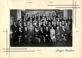
Group at Gai Paree Super Club
https://search.heritageburnaby.ca/link/archivedescription64878
- Repository
- City of Burnaby Archives
- Date
- March 25, 1950
- Collection/Fonds
- Burnaby Historical Society fonds
- Description Level
- Item
- Physical Description
- 1 photograph : b&w ; 8 x 13 cm (sight), in card 12.5 x 35.5 cm folded to 15.5 x 17.5 cm
- Scope and Content
- Photograph of a large group of people at the Gai Paree Supper Club. George Grant and his wife are identified as the second and third from the right in the first row; all other individuals are unidentified.
- Repository
- City of Burnaby Archives
- Date
- March 25, 1950
- Collection/Fonds
- Burnaby Historical Society fonds
- Subseries
- Richard Hardy family subseries
- Physical Description
- 1 photograph : b&w ; 8 x 13 cm (sight), in card 12.5 x 35.5 cm folded to 15.5 x 17.5 cm
- Material Details
- Photograph is housed inside a souvenir card
- Description Level
- Item
- Record No.
- 312-005
- Access Restriction
- No restrictions
- Reproduction Restriction
- Reproduce for fair dealing purposes only
- Accession Number
- BHS1993-09
- Scope and Content
- Photograph of a large group of people at the Gai Paree Supper Club. George Grant and his wife are identified as the second and third from the right in the first row; all other individuals are unidentified.
- Subjects
- Events - Parties
- Media Type
- Photograph
- Photographer
- Hoyer Studios
- Notes
- Title based on contents of photograph
- Front cover of souvenir card reads: "Souvenir Photo / Gai Paree Supper Club / on Kingsway / Your Friendly Inter City Rendezvous / DEx. 4505 / Between Vancouver & New Westminster, B.C. Canada / Featuring Rudy Morin & His Orchestra / Canada's Liveliest Band"
- Inside front cover of souvenir card reads: "Hoyer Studios / 2321 Kingsway (Burnaby, B.C.) Canada / Photographers / Gai Paree Provides Free Personal Table Cards For Birthdays & Anneversaries [sp] / To reorder No. Scouts / Have this Photo Enlarged to any size / Phone Particulars DEx. 4504"
- Photographers name on recto of mat reads: "Hoyer Studios"
- Geographic Access
- Kingsway
- Street Address
- 6669 Kingsway
- Historic Neighbourhood
- Edmonds (Historic Neighbourhood)
- Planning Study Area
- Kingsway-Beresford Area
Images

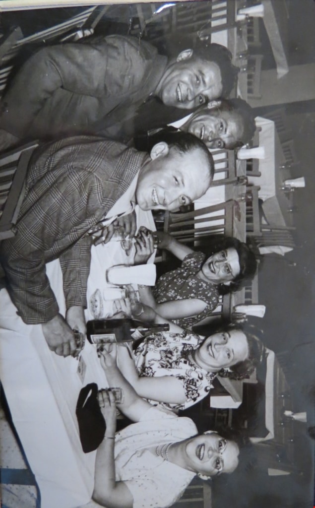
At the Gai Paree Supper Club
https://search.heritageburnaby.ca/link/archivedescription66396
- Repository
- City of Burnaby Archives
- Date
- March 6, 1952
- Collection/Fonds
- Grieve family fonds
- Description Level
- Item
- Physical Description
- 1 photograph : b&w ; 9 x 14 cm, mounted in card ; 12.5 x 33.5 cm, folded to 12.5 x 17 cm
- Scope and Content
- Photograph of William Ewart "Bill" Grieve sitting at a table at the Gai Paree Supper Club with Clifford G. Brown. The four other individuals at the table have not been identified.
- Repository
- City of Burnaby Archives
- Date
- March 6, 1952
- Collection/Fonds
- Grieve family fonds
- Physical Description
- 1 photograph : b&w ; 9 x 14 cm, mounted in card ; 12.5 x 33.5 cm, folded to 12.5 x 17 cm
- Description Level
- Item
- Record No.
- 523-010
- Access Restriction
- No restrictions
- Reproduction Restriction
- Reproduce for fair dealing purposes only
- Accession Number
- 2011-04
- Scope and Content
- Photograph of William Ewart "Bill" Grieve sitting at a table at the Gai Paree Supper Club with Clifford G. Brown. The four other individuals at the table have not been identified.
- Subjects
- Events - Parties
- Media Type
- Photograph
- Notes
- Title based on contents of photograph
- Note on recto of card mount reads: "2004 January I believe the Gai Paree has disappeared"
- Notes inside card on recto of photograph mount read: "Maybe wartime?", "Bill Grieve, Chair of Burnaby School Bd circa 1955?" and "Clifford [sic] G. Brown, a school superintendent after whom a Pool named by Burnaby Lake"
- Geographic Access
- Kingsway
- Street Address
- 6669 Kingsway
- Historic Neighbourhood
- Edmonds (Historic Neighbourhood)
- Planning Study Area
- Kingsway-Beresford Area
![Burnaby South High School class, [1952] (date of original), digitally copied 2012 thumbnail](/media/hpo/_Data/_Archives_Images/_Unrestricted/540/549-038.jpg?width=280)
Burnaby South High School class
https://search.heritageburnaby.ca/link/archivedescription75095
- Repository
- City of Burnaby Archives
- Date
- [1952] (date of original), digitally copied 2012
- Collection/Fonds
- Community Heritage Commission Special Projects fonds
- Description Level
- Item
- Physical Description
- 1 photograph (jpeg) : col. ; 300ppi
- Scope and Content
- Photograph of a Burnaby South High School class. Kay O'Cook (later Jackson) is in the middle row, third from the right.
- Repository
- City of Burnaby Archives
- Date
- [1952] (date of original), digitally copied 2012
- Collection/Fonds
- Community Heritage Commission Special Projects fonds
- Physical Description
- 1 photograph (jpeg) : col. ; 300ppi
- Description Level
- Item
- Record No.
- 549-038
- Access Restriction
- No restrictions
- Reproduction Restriction
- Reproduce for fair dealing purposes only
- Accession Number
- 2012-30
- Scope and Content
- Photograph of a Burnaby South High School class. Kay O'Cook (later Jackson) is in the middle row, third from the right.
- Media Type
- Photograph
- Notes
- Title based on contents of photograph
- Geographic Access
- Southoaks Crescent
- Street Address
- 6650 Southoaks Crescent
- Historic Neighbourhood
- Edmonds (Historic Neighbourhood)
- Planning Study Area
- Kingsway-Beresford Area
Images
![Burnaby South High School class, [1952] (date of original), digitally copied 2012 thumbnail](/media/hpo/_Data/_Archives_Images/_Unrestricted/540/549-038.jpg)
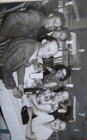
Gai Paree mushroom banquet
https://search.heritageburnaby.ca/link/archivedescription76938
- Repository
- City of Burnaby Archives
- Date
- 1950 (date of original), digitally copied 2012
- Collection/Fonds
- Community Heritage Commission Special Projects fonds
- Description Level
- Item
- Physical Description
- 1 photograph (jpeg) : col. ; 300ppi
- Scope and Content
- Photograph of a group of men and women sitting at a table, smiling and laughing at the Gay Paree mushroom banquet. Seated from left to right are; Jack Stiglish, Frank Pietrasko, Walter Peters, Irene Pietrasko, Euda Peters and Helen Stiglish.
- Repository
- City of Burnaby Archives
- Date
- 1950 (date of original), digitally copied 2012
- Collection/Fonds
- Community Heritage Commission Special Projects fonds
- Physical Description
- 1 photograph (jpeg) : col. ; 300ppi
- Description Level
- Item
- Record No.
- 549-068
- Access Restriction
- No restrictions
- Reproduction Restriction
- Reproduce for fair dealing purposes only
- Accession Number
- 2012-30
- Scope and Content
- Photograph of a group of men and women sitting at a table, smiling and laughing at the Gay Paree mushroom banquet. Seated from left to right are; Jack Stiglish, Frank Pietrasko, Walter Peters, Irene Pietrasko, Euda Peters and Helen Stiglish.
- Subjects
- Celebrations
- Names
- Gai Paree Supper Club
- Stiglish, F.J. "Jack"
- Pietrasko, Frank
- Peters, Walter
- Pietrasko, Irene
- Peters, Euda
- Stiglish, Helen
- Media Type
- Photograph
- Notes
- Title based on contents of photograph
- Original spelling of surname "Stiglish" was "Stiglich"
- Geographic Access
- Kingsway
- Street Address
- 6669 Kingsway
- Historic Neighbourhood
- Edmonds (Historic Neighbourhood)
- Planning Study Area
- Kingsway-Beresford Area
Images
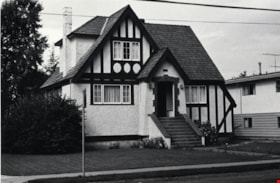
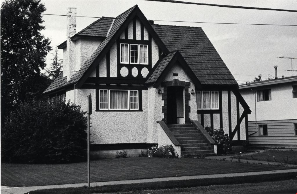
House at 6855 Sperling Avenue
https://search.heritageburnaby.ca/link/archivedescription78956
- Repository
- City of Burnaby Archives
- Date
- September 10,1976
- Collection/Fonds
- Burnaby Public Library Contemporary Visual Archive Project
- Description Level
- Item
- Physical Description
- 1 photograph : b&w ; 11 x 16 cm mounted on cardboard
- Scope and Content
- Photograph shows a house at 6855 Sperling Avenue.
- Repository
- City of Burnaby Archives
- Date
- September 10,1976
- Collection/Fonds
- Burnaby Public Library Contemporary Visual Archive Project
- Physical Description
- 1 photograph : b&w ; 11 x 16 cm mounted on cardboard
- Description Level
- Item
- Record No.
- 556-049
- Access Restriction
- No restrictions
- Reproduction Restriction
- Reproduce for fair dealing purposes only
- Accession Number
- 2013-13
- Scope and Content
- Photograph shows a house at 6855 Sperling Avenue.
- Media Type
- Photograph
- Photographer
- Norton, Paul
- Notes
- Scope note taken directly from BPL photograph description.
- 1 b&w copy negative : 10 x 12.5 cm accompanying
- Geographic Access
- Sperling Avenue
- Street Address
- 6855 Sperling Avenue
- Historic Neighbourhood
- Edmonds (Historic Neighbourhood)
- Planning Study Area
- Kingsway-Beresford Area
Images
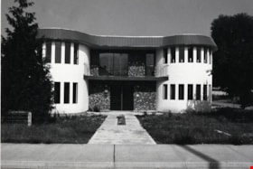
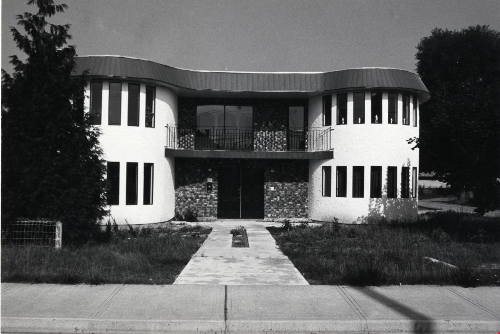
House at 6619 Imperial Street
https://search.heritageburnaby.ca/link/archivedescription78975
- Repository
- City of Burnaby Archives
- Date
- November 4, 1976
- Collection/Fonds
- Burnaby Public Library Contemporary Visual Archive Project
- Description Level
- Item
- Physical Description
- 1 photograph : b&w ; 11 x 16 cm mounted on cardboard
- Scope and Content
- Photograph shows a house at 6619 Imperial Street, constructed in 1976.
- Repository
- City of Burnaby Archives
- Date
- November 4, 1976
- Collection/Fonds
- Burnaby Public Library Contemporary Visual Archive Project
- Physical Description
- 1 photograph : b&w ; 11 x 16 cm mounted on cardboard
- Description Level
- Item
- Record No.
- 556-060
- Access Restriction
- No restrictions
- Reproduction Restriction
- Reproduce for fair dealing purposes only
- Accession Number
- 2013-13
- Scope and Content
- Photograph shows a house at 6619 Imperial Street, constructed in 1976.
- Media Type
- Photograph
- Photographer
- Ross, Martha
- Notes
- Scope note taken directly from BPL photograph description.
- 1 b&w copy negative : 10 x 12.5 cm accompanying
- Geographic Access
- Imperial Street
- Street Address
- 6619 Imperial Street
- Historic Neighbourhood
- Edmonds (Historic Neighbourhood)
- Planning Study Area
- Kingsway-Beresford Area
Images