Narrow Results By
Decade
- 2020s 217
- 2010s 151
- 2000s 1333
- 1990s
- 1980s 1276
- 1970s 3380
- 1960s 1236
- 1950s 1585
- 1940s 2124
- 1930s 2099
- 1920s 2395
- 1910s 1973
- 1900s 788
- 1890s 221
- 1880s 158
- 1870s 70
- 1860s 118
- 1850s 13
- 1840s 5
- 1830s 2
- 1820s 2
- 1810s 3
- 1800s 3
- 1790s 2
- 1780s 2
- 1770s 2
- 1760s
- 1750s 2
- 1740s 2
- 1730s 2
- 1720s 2
- 1710s 2
- 1700s 2
- 1690s 2
- 1680s 2
- 1670s 1
- 1660s 1
- 1650s 1
- 1640s 1
- 1630s 1
- 1620s 1
- 1610s 1
- 1600s 1
- 1590s 1
- 1580s 1
- 1570s 1
- 1560s 1
- 1550s 1
- 1540s 1
- 1530s 1
- 1520s 2
- 1510s 1
- 1500s 1
- 1490s 1
- 1480s 1
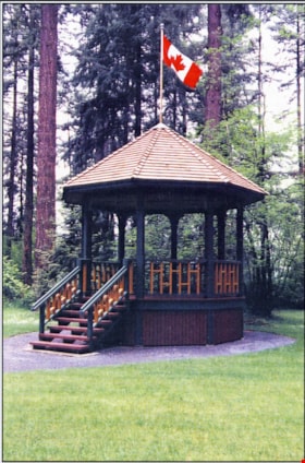
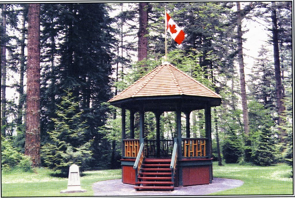
Reconstructed Central Park Bandstand
https://search.heritageburnaby.ca/link/archivedescription58424
- Repository
- City of Burnaby Archives
- Date
- 1996
- Collection/Fonds
- Burnaby Historical Society fonds
- Description Level
- Item
- Physical Description
- 1 photographic postcard : col.
- Scope and Content
- Photographic postcard of the reconstructed Central Park Bandstand used to promote its official opening taking place May 29, 1996 (to be described).
- Repository
- City of Burnaby Archives
- Date
- 1996
- Collection/Fonds
- Burnaby Historical Society fonds
- Subseries
- Pixie McGeachie subseries
- Physical Description
- 1 photographic postcard : col.
- Description Level
- Item
- Record No.
- 332-002
- Access Restriction
- No restrictions
- Reproduction Restriction
- No restrictions
- Accession Number
- BHS1996-16
- Scope and Content
- Photographic postcard of the reconstructed Central Park Bandstand used to promote its official opening taking place May 29, 1996 (to be described).
- Media Type
- Photograph
- Geographic Access
- Central Park
- Imperial Street
- Street Address
- 3883 Imperial Street
- Historic Neighbourhood
- Central Park (Historic Neighbourhood)
- Planning Study Area
- Maywood Area
Images
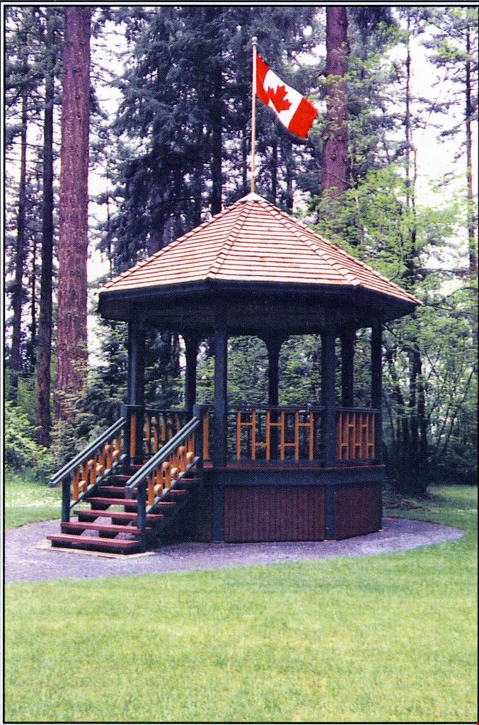
Reconstructed Central Park Bandstand
https://search.heritageburnaby.ca/link/archivedescription58425
- Repository
- City of Burnaby Archives
- Date
- 1996
- Collection/Fonds
- Burnaby Historical Society fonds
- Description Level
- Item
- Physical Description
- 1 photographic postcard : col.
- Scope and Content
- Photographic postcard of the reconstructed Central Park Bandstand used to promote its official opening taking place May 29, 1996.
- Repository
- City of Burnaby Archives
- Date
- 1996
- Collection/Fonds
- Burnaby Historical Society fonds
- Subseries
- Pixie McGeachie subseries
- Physical Description
- 1 photographic postcard : col.
- Description Level
- Item
- Record No.
- 332-003
- Access Restriction
- No restrictions
- Reproduction Restriction
- Reproduce for fair dealing purposes only
- Accession Number
- BHS1996-16
- Scope and Content
- Photographic postcard of the reconstructed Central Park Bandstand used to promote its official opening taking place May 29, 1996.
- Media Type
- Photograph
- Geographic Access
- Central Park
- Imperial Street
- Street Address
- 3883 Imperial Street
- Historic Neighbourhood
- Central Park (Historic Neighbourhood)
- Planning Study Area
- Maywood Area
Images
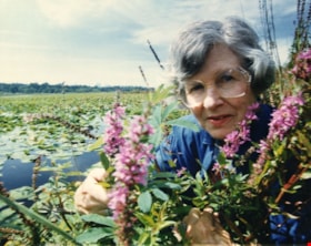
Doreen Lawson among purple loosestrife
https://search.heritageburnaby.ca/link/archivedescription91719
- Repository
- City of Burnaby Archives
- Date
- December 1992
- Collection/Fonds
- Doreen Lawson fonds
- Description Level
- Item
- Physical Description
- 1 photograph : col. ; 19 cm x 24 cm
- Scope and Content
- Photograph of Doreen Lawson posing with purple loosestrife plants with Burnaby Lake behind her.
- Repository
- City of Burnaby Archives
- Date
- December 1992
- Collection/Fonds
- Doreen Lawson fonds
- Physical Description
- 1 photograph : col. ; 19 cm x 24 cm
- Description Level
- Item
- Record No.
- 605-019
- Access Restriction
- No restrictions
- Reproduction Restriction
- Reproduce for fair dealing purposes only
- Accession Number
- 2003-30
- Scope and Content
- Photograph of Doreen Lawson posing with purple loosestrife plants with Burnaby Lake behind her.
- Names
- Lawson, Doreen A.
- Media Type
- Photograph
- Notes
- Title based on contents of photograph
- Note is grey ink on verso of photograph reads: "Dec. 92 / From Ethel Chernesky & Cam Avery"
- Stamp of verso of photograph reads: "The News / [address] / [phone]"
- Geographic Access
- Burnaby Lake
- Historic Neighbourhood
- Burnaby Lake (Historic Neighbourhood)
- Planning Study Area
- Burnaby Lake Area
Images
Looking west from Douglas Road
https://search.heritageburnaby.ca/link/archivedescription91833
- Repository
- City of Burnaby Archives
- Date
- 1991
- Collection/Fonds
- Small family fonds
- Description Level
- Item
- Physical Description
- 1 photograph : col. copy print ; 10 cm x 15 cm
- Scope and Content
- Photograph of the houses located on the corner of Douglas Road and Dominion Street, with large oak, hemlock, and fir trees in the yard. The house in the foreground is 3131 Douglas Road; the house in the background is 5536 Dominion Street. The photograph was taken from Douglas Street, looking west.
- Repository
- City of Burnaby Archives
- Date
- 1991
- Collection/Fonds
- Small family fonds
- Physical Description
- 1 photograph : col. copy print ; 10 cm x 15 cm
- Description Level
- Item
- Record No.
- 620-014
- Access Restriction
- No restrictions
- Reproduction Restriction
- No reproduction permitted
- Accession Number
- 2017-01
- Scope and Content
- Photograph of the houses located on the corner of Douglas Road and Dominion Street, with large oak, hemlock, and fir trees in the yard. The house in the foreground is 3131 Douglas Road; the house in the background is 5536 Dominion Street. The photograph was taken from Douglas Street, looking west.
- Media Type
- Photograph
- Notes
- Transcribed title
- Title transcribed from donor's notes
- Note in blue ink on verso of photograph reads: "Corner of Douglas Rd and Dominion St. with Oak Tree, Summer 1991"
- Note in blue ink on verso of photograph reads: "P14"
- 5118 Douglas Road renumbered to 3131 Douglas Road in 1958 and to 5538 Dominion Street in 1970 or 1971
- The oak tree (centre) is the same tree as in photograph 620-007
- Street Address
- 3131 Douglas Road
- 5118 Douglas Road
- 5538 Dominion Street
- Historic Neighbourhood
- Burnaby Lake (Historic Neighbourhood)
- Planning Study Area
- Ardingley-Sprott Area
Images

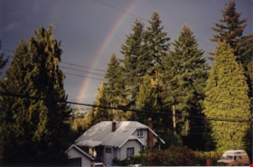
Looking north from south side of Dominion Street
https://search.heritageburnaby.ca/link/archivedescription91843
- Repository
- City of Burnaby Archives
- Date
- 1995
- Collection/Fonds
- Small family fonds
- Description Level
- Item
- Physical Description
- 1 photograph : col. ; 10 cm x 15 cm
- Scope and Content
- Photograph of a house located at 3093 Douglas Road surrounded by trees. A rainbow is visible through a break in the trees. The photograph was taken from the south side of Dominion Street, looking north.
- Repository
- City of Burnaby Archives
- Date
- 1995
- Collection/Fonds
- Small family fonds
- Physical Description
- 1 photograph : col. ; 10 cm x 15 cm
- Description Level
- Item
- Record No.
- 620-024
- Access Restriction
- No restrictions
- Reproduction Restriction
- No reproduction permitted
- Accession Number
- 2017-01
- Scope and Content
- Photograph of a house located at 3093 Douglas Road surrounded by trees. A rainbow is visible through a break in the trees. The photograph was taken from the south side of Dominion Street, looking north.
- Subjects
- Buildings - Residential - Houses
- Media Type
- Photograph
- Notes
- Transcribed title
- Title transcribed from donor's notes
- Note in black ink on verso of photograph reads: "Rainbow - Burnaby"
- Note in blue ink on verso of photograph reads: "P.24"
- Note in blue ink on verso of photograph reads: "1995 / 3093 Douglas Rd."
- Street Address
- 3093 Douglas Road
- Historic Neighbourhood
- Burnaby Lake (Historic Neighbourhood)
- Planning Study Area
- Ardingley-Sprott Area
Images

Looking northwest along Dominion Street from near Douglas Road
https://search.heritageburnaby.ca/link/archivedescription91845
- Repository
- City of Burnaby Archives
- Date
- 1991
- Collection/Fonds
- Small family fonds
- Description Level
- Item
- Physical Description
- 1 photograph : col. ; 10 cm x 15 cm
- Scope and Content
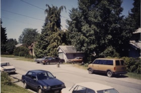
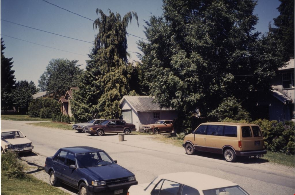
- Photograph of 5493 Dominion Street (left) and 3093 Douglas Road (right). Cars are parked on either side of the street and the houses are largely obscured by trees. The photograph was taken from Douglas Road, looking northwest along Dominion Street.
- Repository
- City of Burnaby Archives
- Date
- 1991
- Collection/Fonds
- Small family fonds
- Physical Description
- 1 photograph : col. ; 10 cm x 15 cm
- Description Level
- Item
- Record No.
- 620-026
- Access Restriction
- No restrictions
- Reproduction Restriction
- No reproduction permitted
- Accession Number
- 2017-01
- Scope and Content
- Photograph of 5493 Dominion Street (left) and 3093 Douglas Road (right). Cars are parked on either side of the street and the houses are largely obscured by trees. The photograph was taken from Douglas Road, looking northwest along Dominion Street.
- Subjects
- Buildings - Residential - Houses
- Media Type
- Photograph
- Notes
- Transcribed title
- Title transcribed from donor's notes
- Note in blue ink on verso of photograph reads: "P.26"
- Note in blue ink on verso of photograph reads: "N. Side of Dominion St. / Summer 1991"
- 5493 Dominion Street was previously numbered 3107 Dominion Street and was later subdivided into two lots: 5491 and 5495 Dominion Street.
- Street Address
- 3093 Douglas Road
- 5493 Dominion Street
- Historic Neighbourhood
- Burnaby Lake (Historic Neighbourhood)
- Planning Study Area
- Ardingley-Sprott Area
Images

Looking north from 5486 Dominion Street
https://search.heritageburnaby.ca/link/archivedescription91853
- Repository
- City of Burnaby Archives
- Date
- 1991
- Collection/Fonds
- Small family fonds
- Description Level
- Item
- Physical Description
- 1 photograph : col. ; 10 cm x 15 cm
- Scope and Content
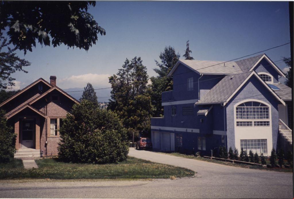
- Photograph of a single-storey brown stucco house located at 5495 Dominion Street and a three-storey blue stucco house at 5505 Dominion Street. The property at 3093 Douglas Road was subdivided and the blue house at 5505 Dominion Street was built. The photograph was taken from 5486 Dominion Street,…
- Repository
- City of Burnaby Archives
- Date
- 1991
- Collection/Fonds
- Small family fonds
- Physical Description
- 1 photograph : col. ; 10 cm x 15 cm
- Description Level
- Item
- Record No.
- 620-034
- Access Restriction
- No restrictions
- Reproduction Restriction
- No reproduction permitted
- Accession Number
- 2017-01
- Scope and Content
- Photograph of a single-storey brown stucco house located at 5495 Dominion Street and a three-storey blue stucco house at 5505 Dominion Street. The property at 3093 Douglas Road was subdivided and the blue house at 5505 Dominion Street was built. The photograph was taken from 5486 Dominion Street, looking north.
- Subjects
- Buildings - Residential - Houses
- Media Type
- Photograph
- Notes
- Transcribed title
- Title transcribed from donor's notes
- Note in blue ink on verso of photograph reads: "P.34"
- Note in blue ink on verso of photograph reads: "Looking North from Dominion St. by "side lane" / MacFaydens House Kit Brocklebank's house / Summer 1991"
- 5118 Douglas Road renumbered to 3131 Douglas Road in 1958 and to 5538 Dominion Street in 1970 or 1971
- Street Address
- 5505 Dominion Street
- 5495 Dominion Street
- Historic Neighbourhood
- Burnaby Lake (Historic Neighbourhood)
- Planning Study Area
- Ardingley-Sprott Area
Images
Looking west along the back lane
https://search.heritageburnaby.ca/link/archivedescription91860
- Repository
- City of Burnaby Archives
- Date
- June 1994
- Collection/Fonds
- Small family fonds
- Description Level
- Item
- Physical Description
- 1 photograph : col. copy print ; 10 cm x 15 cm
- Scope and Content
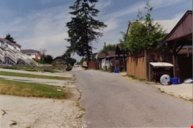
- Photograph of the back lane between Dominion Street and Norfolk Street, looking west. The fir tree in the centre of the photograph is one of many planted by John Roberts along the south property line of 5538 Dominion Street. The other trees were removed in 1982 when the Roberts' property was larg…
- Repository
- City of Burnaby Archives
- Date
- June 1994
- Collection/Fonds
- Small family fonds
- Physical Description
- 1 photograph : col. copy print ; 10 cm x 15 cm
- Description Level
- Item
- Record No.
- 620-041
- Access Restriction
- No restrictions
- Reproduction Restriction
- No reproduction permitted
- Accession Number
- 2017-01
- Scope and Content
- Photograph of the back lane between Dominion Street and Norfolk Street, looking west. The fir tree in the centre of the photograph is one of many planted by John Roberts along the south property line of 5538 Dominion Street. The other trees were removed in 1982 when the Roberts' property was largely cleared in order to relocate the house 100 feet west and subdivide the property into 33 foot lots.
- Subjects
- Geographic Features - Lanes
- Media Type
- Photograph
- Notes
- Transcribed title
- Title transcribed from donor's notes
- Note in blue ink on verso of photograph reads: "P.4"
- Note in blue ink on verso of photograph reads: "The Back lane behind 3131 Douglas Rd to 5496 etc Dominion St. / June 1994"
- 5118 Douglas Road renumbered to 3131 Douglas Road in 1958 and to 5538 Dominion Street in 1970 or 1971
- Street Address
- 3131 Douglas Road
- 5118 Douglas Road
- 5538 Dominion Street
- Historic Neighbourhood
- Burnaby Lake (Historic Neighbourhood)
- Planning Study Area
- Ardingley-Sprott Area
Images

Looking south from 5496 Dominion Street
https://search.heritageburnaby.ca/link/archivedescription91865
- Repository
- City of Burnaby Archives
- Date
- April 1998
- Collection/Fonds
- Small family fonds
- Description Level
- Item
- Physical Description
- 1 photograph : col. ; 10 cm x 15 cm
- Scope and Content
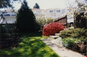
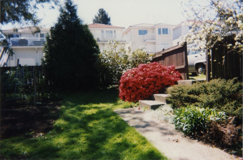
- Photograph of the backyard at 5496 Dominion Street, looking south with the houses on Norfolk Street visible above the fence. These houses were built in the 1980s and 1990s following the rezoning of the properties.
- Repository
- City of Burnaby Archives
- Date
- April 1998
- Collection/Fonds
- Small family fonds
- Physical Description
- 1 photograph : col. ; 10 cm x 15 cm
- Description Level
- Item
- Record No.
- 620-046
- Access Restriction
- No restrictions
- Reproduction Restriction
- No reproduction permitted
- Accession Number
- 2017-01
- Scope and Content
- Photograph of the backyard at 5496 Dominion Street, looking south with the houses on Norfolk Street visible above the fence. These houses were built in the 1980s and 1990s following the rezoning of the properties.
- Media Type
- Photograph
- Notes
- Transcribed title
- Title transcribed from donor's notes
- Note in blue ink on verso of photograph reads: "P9"
- Note in black ink on verso of photograph reads: "April 1998 / 5496 Dominion St"
- Geographic Access
- Norfolk Street
- Street Address
- 5496 Dominion Street
- Historic Neighbourhood
- Burnaby Lake (Historic Neighbourhood)
- Planning Study Area
- Ardingley-Sprott Area
Images
Burnaby's Photographic Family Album-Burnaby Image Bank Collection: Volume 1
https://search.heritageburnaby.ca/link/archivedescription64764
- Repository
- City of Burnaby Archives
- Date
- 1992
- Collection/Fonds
- Burnaby Historical Society fonds
- Description Level
- Item
- Physical Description
- 1 videocassette (1 hr., 56 min., 40 sec.) : b&w, col., sd.
- Scope and Content
- Item is a copy of "Burnaby's Photographic Family Album / Burnaby Image Bank Collection / Volume 1 / 1992" produced by the Simon Fraser University (SFU) Archives, and Archivist, Jim Ross in recognition of Burnaby’s Centennial. The video consists of 812 images from the Burnaby Image Bank which are i…
- Repository
- City of Burnaby Archives
- Date
- 1992
- Collection/Fonds
- Burnaby Historical Society fonds
- Subseries
- Burnaby Image Bank subseries
- Physical Description
- 1 videocassette (1 hr., 56 min., 40 sec.) : b&w, col., sd.
- Material Details
- Video Home System (VHS) tape
- Description Level
- Item
- Record No.
- 577-001
- Access Restriction
- No restrictions
- Reproduction Restriction
- May be restricted by third party rights
- Accession Number
- BHS2001-15
- Scope and Content
- Item is a copy of "Burnaby's Photographic Family Album / Burnaby Image Bank Collection / Volume 1 / 1992" produced by the Simon Fraser University (SFU) Archives, and Archivist, Jim Ross in recognition of Burnaby’s Centennial. The video consists of 812 images from the Burnaby Image Bank which are indexed by Communities, Neighbourhoods, Subjects and Names. The indexes are provided at both the beginning and end of the video with photographs dispersed in between. An introduction is provided by Simon Fraser University Archivist, Jim Ross. The video was made available for public purchase and viewing on Video Home System (VHS) format and distributed to each Burnaby school and branch of the Burnaby Public Library for information and research purposes.
- Media Type
- Moving Images
- Notes
- Transcribed title
Images
Video
Burnaby's Photographic Family Album-Burnaby Image Bank Collection: Volume 1, 1992
Burnaby's Photographic Family Album-Burnaby Image Bank Collection: Volume 1, 1992
https://search.heritageburnaby.ca/media/Hpo/_Data/_Archives_Moving_Images/_Unrestricted/577-001.m4v![Give Art a Home campaign, [1992] thumbnail](/media/Hpo/_Data/_Archives_Moving_Images/_Unrestricted/599-001.jpg?width=280)
Give Art a Home campaign
https://search.heritageburnaby.ca/link/archivedescription64770
- Repository
- City of Burnaby Archives
- Date
- [1992]
- Collection/Fonds
- Burnaby Historical Society fonds
- Description Level
- Item
- Physical Description
- 1 file of textual records + 1 videocassette (7 min.)
- Scope and Content
- File consists of records pertaining to the Burnaby Arts Centre for their Capital Campaign entitled, "Give Art a Home" including a seven minute Video Home System (VHS) tape and correspondence. Also included in the file is a box of "Mr. Dressup" crayons.
- Repository
- City of Burnaby Archives
- Date
- [1992]
- Collection/Fonds
- Burnaby Historical Society fonds
- Subseries
- Municipal record subseries
- Physical Description
- 1 file of textual records + 1 videocassette (7 min.)
- Description Level
- Item
- Record No.
- MSS133-001
- 599-001
- Access Restriction
- No restrictions
- Reproduction Restriction
- May be restricted by third party rights
- Accession Number
- BHS2001-14
- Scope and Content
- File consists of records pertaining to the Burnaby Arts Centre for their Capital Campaign entitled, "Give Art a Home" including a seven minute Video Home System (VHS) tape and correspondence. Also included in the file is a box of "Mr. Dressup" crayons.
- Media Type
- Moving Images
- Notes
- Image used in the campaign is by Joe Average
Images
![Give Art a Home campaign, [1992] thumbnail](/media/Hpo/_Data/_Archives_Moving_Images/_Unrestricted/599-001.jpg)
Video
Give Art a Home campaign, [1992]
Give Art a Home campaign, [1992]
https://search.heritageburnaby.ca/media/Hpo/_Data/_Archives_Moving_Images/_Unrestricted/599-001.mp4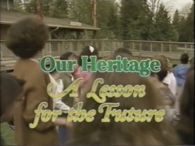
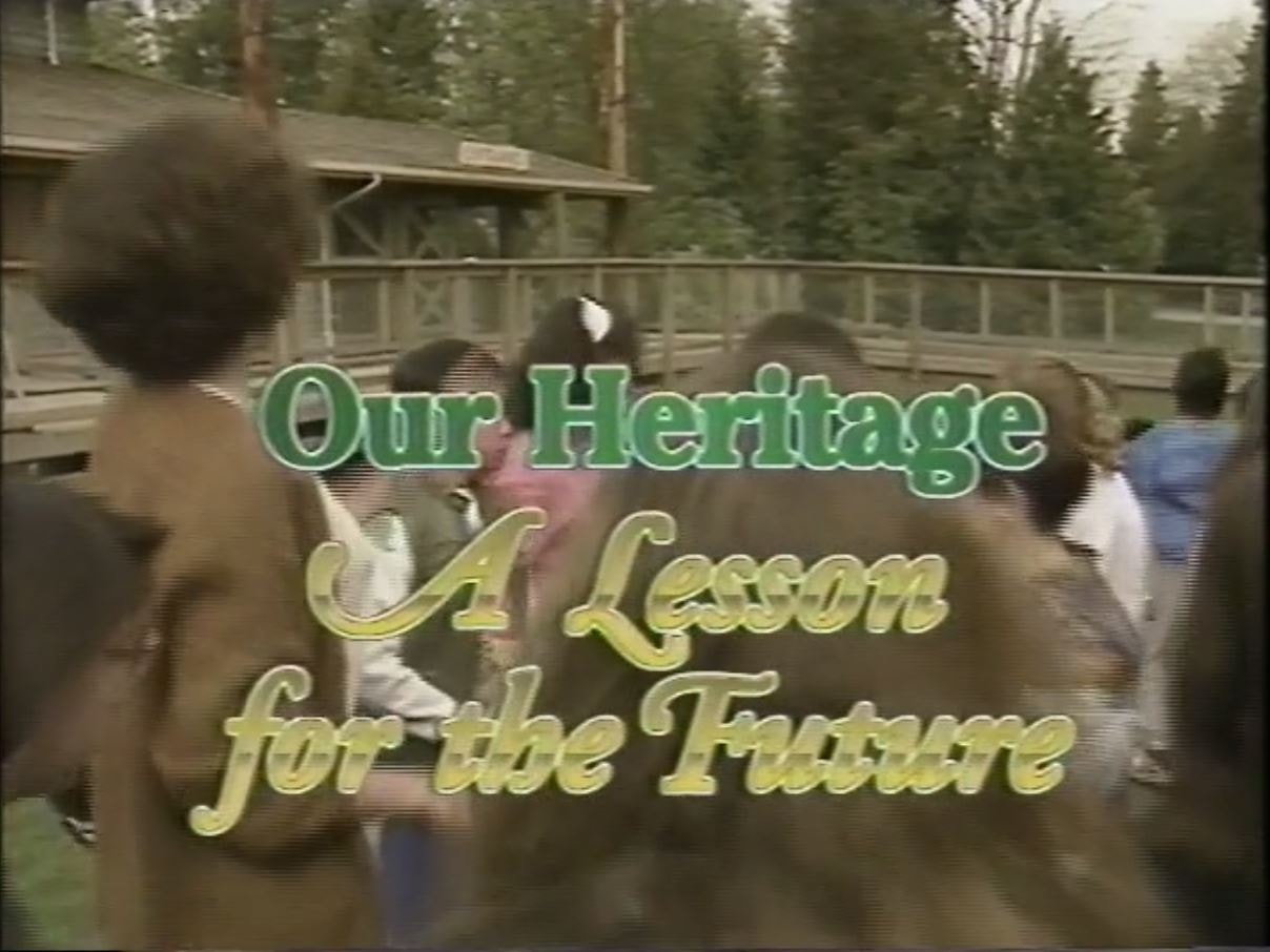
Our Heritage: A Lesson for the Future
https://search.heritageburnaby.ca/link/archivedescription64776
- Repository
- City of Burnaby Archives
- Date
- 1992
- Collection/Fonds
- Burnaby Historical Society fonds
- Description Level
- Item
- Physical Description
- 1 video cassette (22 min., 5 sec.) : VHS
- Scope and Content
- File consists of a VHS tape entitled “Our Heritage: A Lesson for the Future", a Burnaby Heritage Advisory Centennial project funded by the City of Burnaby that describes a school field trip to Burnaby Village Museum.
- Repository
- City of Burnaby Archives
- Date
- 1992
- Collection/Fonds
- Burnaby Historical Society fonds
- Subseries
- Municipal record subseries
- Physical Description
- 1 video cassette (22 min., 5 sec.) : VHS
- Description Level
- Item
- Record No.
- 597-002
- Access Restriction
- No restrictions
- Reproduction Restriction
- May be restricted by third party rights
- Accession Number
- BHS2004-13
- Scope and Content
- File consists of a VHS tape entitled “Our Heritage: A Lesson for the Future", a Burnaby Heritage Advisory Centennial project funded by the City of Burnaby that describes a school field trip to Burnaby Village Museum.
- Names
- Burnaby Village Museum
- Media Type
- Moving Images
- Notes
- Title based on contents of video
- Label on video cassette reads: "Burnaby Heritage "A Lesson For The Future" Length: 22:05"
- Video cassette cover available in accession file
- Street Address
- 6501 Deer Lake Avenue
- Historic Neighbourhood
- Burnaby Lake (Historic Neighbourhood)
- Planning Study Area
- Morley-Buckingham Area
Images
Video
Our Heritage: A Lesson for the Future, 1992
Our Heritage: A Lesson for the Future, 1992
https://search.heritageburnaby.ca/media/Hpo/_Data/_Archives_Moving_Images/_Unrestricted/597-002.m4v![Stoney Creek, [1998-1999] thumbnail](/media/Hpo/_Data/_Archives_Images/_Unrestricted/316/353-005.jpg?width=280)
Stoney Creek
https://search.heritageburnaby.ca/link/archivedescription66637
- Repository
- City of Burnaby Archives
- Date
- [1998-1999]
- Collection/Fonds
- Millway family fonds
- Description Level
- Item
- Physical Description
- 1 photograph : col. ; 10 x 30.5 cm
- Scope and Content
- Photograph of Stoney Creek taken from above.
- Repository
- City of Burnaby Archives
- Date
- [1998-1999]
- Collection/Fonds
- Millway family fonds
- Physical Description
- 1 photograph : col. ; 10 x 30.5 cm
- Description Level
- Item
- Record No.
- 353-005
- Access Restriction
- No restrictions
- Reproduction Restriction
- Reproduce for fair dealing purposes only
- Accession Number
- 2011-05
- Scope and Content
- Photograph of Stoney Creek taken from above.
- Subjects
- Geographic Features - Creeks
- Media Type
- Photograph
- Notes
- Title based on contents of photograph
- Historic Neighbourhood
- Burquitlam (Historic Neighbourhood)
- Planning Study Area
- Lyndhurst Area
Images
![Stoney Creek, [1998-1999] thumbnail](/media/Hpo/_Data/_Archives_Images/_Unrestricted/316/353-005.jpg)
![Stoney Creek Bridge, [1998-1999] thumbnail](/media/Hpo/_Data/_Archives_Images/_Unrestricted/316/353-006.jpg?width=280)
Stoney Creek Bridge
https://search.heritageburnaby.ca/link/archivedescription66638
- Repository
- City of Burnaby Archives
- Date
- [1998-1999]
- Collection/Fonds
- Millway family fonds
- Description Level
- Item
- Physical Description
- 1 photograph : col. ; 10 x 30.5 cm
- Scope and Content
- Photograph of Stoney Creek Bridge soon after it was built. An unidentified man and woman are visible on the bridge.
- Repository
- City of Burnaby Archives
- Date
- [1998-1999]
- Collection/Fonds
- Millway family fonds
- Physical Description
- 1 photograph : col. ; 10 x 30.5 cm
- Description Level
- Item
- Record No.
- 353-006
- Access Restriction
- No restrictions
- Reproduction Restriction
- Reproduce for fair dealing purposes only
- Accession Number
- 2011-05
- Scope and Content
- Photograph of Stoney Creek Bridge soon after it was built. An unidentified man and woman are visible on the bridge.
- Subjects
- Structures - Bridges
- Media Type
- Photograph
- Notes
- Title based on contents of photograph
- Historic Neighbourhood
- Burquitlam (Historic Neighbourhood)
- Planning Study Area
- Lyndhurst Area
Images
![Stoney Creek Bridge, [1998-1999] thumbnail](/media/Hpo/_Data/_Archives_Images/_Unrestricted/316/353-006.jpg)
![Stoney Creek Bridge, [1998-1999] thumbnail](/media/Hpo/_Data/_Archives_Images/_Unrestricted/316/353-007.jpg?width=280)
Stoney Creek Bridge
https://search.heritageburnaby.ca/link/archivedescription66639
- Repository
- City of Burnaby Archives
- Date
- [1998-1999]
- Collection/Fonds
- Millway family fonds
- Description Level
- Item
- Physical Description
- 1 photograph : col. ; 10 x 30.5 cm
- Scope and Content
- Photograph of Stoney Creek Bridge taken from a distance. A bicycle rider is about to cross the bridge.
- Repository
- City of Burnaby Archives
- Date
- [1998-1999]
- Collection/Fonds
- Millway family fonds
- Physical Description
- 1 photograph : col. ; 10 x 30.5 cm
- Description Level
- Item
- Record No.
- 353-007
- Access Restriction
- No restrictions
- Reproduction Restriction
- Reproduce for fair dealing purposes only
- Accession Number
- 2011-05
- Scope and Content
- Photograph of Stoney Creek Bridge taken from a distance. A bicycle rider is about to cross the bridge.
- Subjects
- Structures - Bridges
- Media Type
- Photograph
- Notes
- Title based on contents of photograph
- Historic Neighbourhood
- Burquitlam (Historic Neighbourhood)
- Planning Study Area
- Lyndhurst Area
Images
![Stoney Creek Bridge, [1998-1999] thumbnail](/media/Hpo/_Data/_Archives_Images/_Unrestricted/316/353-007.jpg)
![Stoney Creek path, [1998-1999] thumbnail](/media/Hpo/_Data/_Archives_Images/_Unrestricted/316/353-008.jpg?width=280)
Stoney Creek path
https://search.heritageburnaby.ca/link/archivedescription66640
- Repository
- City of Burnaby Archives
- Date
- [1998-1999]
- Collection/Fonds
- Millway family fonds
- Description Level
- Item
- Physical Description
- 1 photograph : col. ; 10 x 30.5 cm
- Scope and Content
- Photograph of the paved walking trail that leads to Stoney Creek Bridge.
- Repository
- City of Burnaby Archives
- Date
- [1998-1999]
- Collection/Fonds
- Millway family fonds
- Physical Description
- 1 photograph : col. ; 10 x 30.5 cm
- Description Level
- Item
- Record No.
- 353-008
- Access Restriction
- No restrictions
- Reproduction Restriction
- Reproduce for fair dealing purposes only
- Accession Number
- 2011-05
- Scope and Content
- Photograph of the paved walking trail that leads to Stoney Creek Bridge.
- Subjects
- Geographic Features - Trails
- Media Type
- Photograph
- Notes
- Title based on contents of photograph
- Historic Neighbourhood
- Burquitlam (Historic Neighbourhood)
- Planning Study Area
- Lyndhurst Area
Images
![Stoney Creek path, [1998-1999] thumbnail](/media/Hpo/_Data/_Archives_Images/_Unrestricted/316/353-008.jpg)
![Stoney Creek surrounds, [1998-1999] thumbnail](/media/Hpo/_Data/_Archives_Images/_Unrestricted/316/353-009.jpg?width=280)
Stoney Creek surrounds
https://search.heritageburnaby.ca/link/archivedescription66641
- Repository
- City of Burnaby Archives
- Date
- [1998-1999]
- Collection/Fonds
- Millway family fonds
- Description Level
- Item
- Physical Description
- 1 photograph : col. ; 10 x 30.5 cm
- Scope and Content
- Photograph of the treed area surrounding Stoney Creek.
- Repository
- City of Burnaby Archives
- Date
- [1998-1999]
- Collection/Fonds
- Millway family fonds
- Physical Description
- 1 photograph : col. ; 10 x 30.5 cm
- Description Level
- Item
- Record No.
- 353-009
- Access Restriction
- No restrictions
- Reproduction Restriction
- Reproduce for fair dealing purposes only
- Accession Number
- 2011-05
- Scope and Content
- Photograph of the treed area surrounding Stoney Creek.
- Media Type
- Photograph
- Notes
- Title based on contents of photograph
- Historic Neighbourhood
- Burquitlam (Historic Neighbourhood)
- Planning Study Area
- Lyndhurst Area
Images
![Stoney Creek surrounds, [1998-1999] thumbnail](/media/Hpo/_Data/_Archives_Images/_Unrestricted/316/353-009.jpg)
![Ron Smitherman, [199-] (date of original), digitally copied 2012 thumbnail](/media/hpo/_Data/_Archives_Images/_Unrestricted/540/549-065.jpg?width=280)
Ron Smitherman
https://search.heritageburnaby.ca/link/archivedescription76593
- Repository
- City of Burnaby Archives
- Date
- [199-] (date of original), digitally copied 2012
- Collection/Fonds
- Community Heritage Commission Special Projects fonds
- Description Level
- Item
- Physical Description
- 1 photograph (jpeg) : col. ; 300ppi
- Scope and Content
- Photograph of Ron Smitherman, smiling.
- Repository
- City of Burnaby Archives
- Date
- [199-] (date of original), digitally copied 2012
- Collection/Fonds
- Community Heritage Commission Special Projects fonds
- Physical Description
- 1 photograph (jpeg) : col. ; 300ppi
- Description Level
- Item
- Record No.
- 549-065
- Access Restriction
- No restrictions
- Reproduction Restriction
- Reproduce for fair dealing purposes only
- Accession Number
- 2012-30
- Scope and Content
- Photograph of Ron Smitherman, smiling.
- Names
- Smitherman, Ron
- Media Type
- Photograph
- Notes
- Title based on contents of photograph
Images
![Ron Smitherman, [199-] (date of original), digitally copied 2012 thumbnail](/media/hpo/_Data/_Archives_Images/_Unrestricted/540/549-065.jpg)
![Brown family home, [199-] (date of original), digitally copied 2012 thumbnail](/media/hpo/_Data/_Archives_Images/_Unrestricted/540/549-020.jpg?width=280)
Brown family home
https://search.heritageburnaby.ca/link/archivedescription76900
- Repository
- City of Burnaby Archives
- Date
- [199-] (date of original), digitally copied 2012
- Collection/Fonds
- Community Heritage Commission Special Projects fonds
- Description Level
- Item
- Physical Description
- 1 photograph (jpeg) : col. ; 300ppi
- Scope and Content
- Photograph of Dennis and Cice Brown's house on Willingdon Avenue.
- Repository
- City of Burnaby Archives
- Date
- [199-] (date of original), digitally copied 2012
- Collection/Fonds
- Community Heritage Commission Special Projects fonds
- Physical Description
- 1 photograph (jpeg) : col. ; 300ppi
- Description Level
- Item
- Record No.
- 549-020
- Access Restriction
- No restrictions
- Reproduction Restriction
- Reproduce for fair dealing purposes only
- Accession Number
- 2012-30
- Scope and Content
- Photograph of Dennis and Cice Brown's house on Willingdon Avenue.
- Subjects
- Buildings - Residential - Houses
- Media Type
- Photograph
- Notes
- Title based on contents of photograph
- Geographic Access
- Willingdon Avenue
- Historic Neighbourhood
- Central Park (Historic Neighbourhood)
- Planning Study Area
- Maywood Area
Images
![Brown family home, [199-] (date of original), digitally copied 2012 thumbnail](/media/hpo/_Data/_Archives_Images/_Unrestricted/540/549-020.jpg)
![Backyard playhouse, [199-] (date of original), digitally copied 2012 thumbnail](/media/hpo/_Data/_Archives_Images/_Unrestricted/540/549-022.jpg?width=280)
Backyard playhouse
https://search.heritageburnaby.ca/link/archivedescription76901
- Repository
- City of Burnaby Archives
- Date
- [199-] (date of original), digitally copied 2012
- Collection/Fonds
- Community Heritage Commission Special Projects fonds
- Description Level
- Item
- Physical Description
- 1 photograph (jpeg) : col. ; 300ppi
- Scope and Content
- Photograph of the original backyard playhouse on the Champion family property (the windows on the playhouse are from an early Stanley Park beach house).
- Repository
- City of Burnaby Archives
- Date
- [199-] (date of original), digitally copied 2012
- Collection/Fonds
- Community Heritage Commission Special Projects fonds
- Physical Description
- 1 photograph (jpeg) : col. ; 300ppi
- Description Level
- Item
- Record No.
- 549-022
- Access Restriction
- No restrictions
- Reproduction Restriction
- Reproduce for fair dealing purposes only
- Accession Number
- 2012-30
- Scope and Content
- Photograph of the original backyard playhouse on the Champion family property (the windows on the playhouse are from an early Stanley Park beach house).
- Subjects
- Buildings - Other
- Media Type
- Photograph
- Notes
- Title based on contents of photograph
- Historic Neighbourhood
- Central Park (Historic Neighbourhood)
- Planning Study Area
- Marlborough Area
Images
![Backyard playhouse, [199-] (date of original), digitally copied 2012 thumbnail](/media/hpo/_Data/_Archives_Images/_Unrestricted/540/549-022.jpg)