Narrow Results By
Decade
- 2020s 56
- 2010s 49
- 2000s 60
- 1990s 88
- 1980s 69
- 1970s 83
- 1960s 122
- 1950s 131
- 1940s 65
- 1930s
- 1920s 85
- 1910s 102
- 1900s 45
- 1890s 18
- 1880s 3
- 1870s 1
- 1860s 4
- 1850s 2
- 1840s 1
- 1830s 1
- 1820s 1
- 1810s 1
- 1800s 1
- 1790s 1
- 1780s 1
- 1770s 1
- 1760s 1
- 1750s 1
- 1740s 1
- 1730s 1
- 1720s 1
- 1710s 1
- 1700s 1
- 1690s 1
- 1680s 1
- 1670s 1
- 1660s 1
- 1650s 1
- 1640s 1
- 1630s 1
- 1620s 1
- 1610s 1
- 1600s 1

Agnes & Elizabeth Michie Residence
https://search.heritageburnaby.ca/link/landmark554
- Repository
- Burnaby Heritage Planning
- Description
- Residential building.
- Associated Dates
- c.1935
- Street View URL
- Google Maps Street View
- Repository
- Burnaby Heritage Planning
- Geographic Access
- Yale Street
- Associated Dates
- c.1935
- Description
- Residential building.
- Heritage Value
- This interwar bungalow is beautifully preserved and retains many original features. Symmetrical in design, with two steeply-pitched front gables that flank a central arched gable over the front entrance, it also retains its narrow arched windows and projecting purlins in the front gables. Narrow sidelights flank the front door. The matching front elevation windows are typical of the period, with double-hung sash flanking a plate glass “picture window” with a curved transom; the upper panes are cross-leaded. This house was built by Agnes Michie and Elizabeth D. Michie.
- Locality
- Vancouver Heights
- Historic Neighbourhood
- Vancouver Heights (Historic Neighbourhood)
- Planning Study Area
- Burnaby Heights Area
- Ownership
- Private
- Street Address
- 3894 Yale Street
- Street View URL
- Google Maps Street View
Images


Alta Vista Baptist Church
https://search.heritageburnaby.ca/link/landmark557
- Repository
- Burnaby Heritage Planning
- Description
- Church building.
- Associated Dates
- 1936
- Other Names
- Royal Oak Community Church
- Street View URL
- Google Maps Street View
- Repository
- Burnaby Heritage Planning
- Other Names
- Royal Oak Community Church
- Geographic Access
- Royal Oak Avenue
- Associated Dates
- 1936
- Description
- Church building.
- Heritage Value
- This Baptist congregation originally held services in a tent at the corner of McGregor Avenue and Portland but they soon were able to build a small church. A membership drive by Pastor Arthur James Bowbrick (1875-1961) was so successful that the congregation was able build this fine structure, prominently located at the corner of Victory Street. Although it has been altered with later additions and stucco over the original siding, the original windows and the rooftop belfry remain.
- Locality
- Alta Vista
- Historic Neighbourhood
- Alta Vista (Historic Neighbourhood)
- Planning Study Area
- Sussex-Nelson Area
- Ownership
- Private
- Street Address
- 7175 Royal Oak Avenue
- Street View URL
- Google Maps Street View
Images


Alta Vista Neighbourhood
https://search.heritageburnaby.ca/link/landmark707
- Repository
- Burnaby Heritage Planning
- Associated Dates
- 1925-1954
- Heritage Value
- As with many areas of Burnaby during this period, the years after World War Two marked a rapid growth in residential development in the Alta-Vista Neighbourhood. Subdivisions like Sussex and Suncrest were built and new schools and amenities were constructed to meet the demands of increased population.
- Historic Neighbourhood
- Alta Vista (Historic Neighbourhood)
- Planning Study Area
- Sussex-Nelson Area
Images

Andy Digney Film
https://search.heritageburnaby.ca/link/archivedescription85335
- Repository
- City of Burnaby Archives
- Date
- [between 1934 and 1961]
- Collection/Fonds
- Digney Family fonds
- Description Level
- Item
- Physical Description
- 2 optical discs (approx. 2 hrs, 40 min) : digital, b&w, col., si.
- Scope and Content
- Item is a collection of 18 short films on DVD. These films were created by Andy Digney using his 8 mm camera and provide views of the Digney family gatherings, trips, vacations at home and abroad. They also provide glimpses of Burnaby parades, celebrations and the Digney Speedway. The 18 segments h…
- Repository
- City of Burnaby Archives
- Date
- [between 1934 and 1961]
- Collection/Fonds
- Digney Family fonds
- Physical Description
- 2 optical discs (approx. 2 hrs, 40 min) : digital, b&w, col., si.
- Description Level
- Item
- Record No.
- 562-003
- Access Restriction
- No restrictions
- Reproduction Restriction
- May be restricted by third party rights
- Accession Number
- 2014-04
- Scope and Content
- Item is a collection of 18 short films on DVD. These films were created by Andy Digney using his 8 mm camera and provide views of the Digney family gatherings, trips, vacations at home and abroad. They also provide glimpses of Burnaby parades, celebrations and the Digney Speedway. The 18 segments have all been described at item level.
- Subjects
- Animals - Dogs
- Recreational Activities - Fishing
- Recreational Activities - Camping
- Recreational Activities - Picnics
- Geographic Features - Rivers
- Events - Parades
- Media Type
- Moving Images
- Photographer
- Digney, Andy
- Creator
- Digney, Andy
- Notes
- Title based on contents of film
- The original 8mm film footage was digitized and broken down into 18 segments, reflecting the original order. Items are described as 562-003-1 : 562-003-18

Andy's first film
https://search.heritageburnaby.ca/link/archivedescription85207
- Repository
- City of Burnaby Archives
- Date
- 1934
- Collection/Fonds
- Digney Family fonds
- Description Level
- Item
- Physical Description
- 1 film clip (10 min., 3 sec.) : digital, b&w, col., si.
- Scope and Content
- Item is a silent digitized (DVD) film segment with footage identified as 'Reel 1' . Film footage flucuates between black and white and colour providing a look into activities of Andy Digney and his family while they resided in Brandon, Manitoba. Footage documents outdoor activities such as camping…
- Repository
- City of Burnaby Archives
- Date
- 1934
- Collection/Fonds
- Digney Family fonds
- Physical Description
- 1 film clip (10 min., 3 sec.) : digital, b&w, col., si.
- Description Level
- Item
- Record No.
- 562-003-1
- Access Restriction
- No restrictions
- Reproduction Restriction
- May be restricted by third party rights
- Accession Number
- 2014-04
- Scope and Content
- Item is a silent digitized (DVD) film segment with footage identified as 'Reel 1' . Film footage flucuates between black and white and colour providing a look into activities of Andy Digney and his family while they resided in Brandon, Manitoba. Footage documents outdoor activities such as camping,fishing, boating, golfing, swimming, picnicing and a parade in Banff, Alberta.
- Subjects
- Animals - Dogs
- Recreational Activities - Fishing
- Recreational Activities - Camping
- Recreational Activities - Picnics
- Recreational Activities - Golf
- Geographic Features - Rivers
- Events - Parades
- Media Type
- Moving Images
- Photographer
- Digney, Andy
- Creator
- Digney, Andy
- Notes
- Title based on contents of film
Images
Video
Andy's first film, 1934

Annie Barrett-Lennard Residence
https://search.heritageburnaby.ca/link/landmark559
- Repository
- Burnaby Heritage Planning
- Description
- Residential building.
- Associated Dates
- c.1935
- Street View URL
- Google Maps Street View
- Repository
- Burnaby Heritage Planning
- Geographic Access
- Parker Street
- Associated Dates
- c.1935
- Description
- Residential building.
- Heritage Value
- Built for Annie Barrett-Lennard, this British Arts and Crafts residence has retained many of its original features, such as its stucco and half-timbering exterior with a cat’s slide roof over the front entrance. The steeply-pitched gables, asymmetrical half-massing, leaded windows and pegged joinery are all references to traditional British antecedents.
- Locality
- Capitol Hill
- Historic Neighbourhood
- Capitol Hill (Historic Neighbourhood)
- Planning Study Area
- Parkcrest-Aubrey Area
- Area
- 1227.44
- Contributing Resource
- Building
- Ownership
- Private
- Street Address
- 5450 Parker Street
- Street View URL
- Google Maps Street View
Images


Barnet Neighbourhood
https://search.heritageburnaby.ca/link/landmark681
- Repository
- Burnaby Heritage Planning
- Associated Dates
- 1925-1954
- Heritage Value
- In 1925, the mill at Barnet was under new ownership and was known as the Barnet Lumber Company. It was one of the most successful local employers in Burnaby until the 1930s, when the economic crisis of the Great Depression resulted in a strike at the mill. The City of Burnaby eventually assumed control of the site - including all of the homes - when the company failed to pay its taxes. The City then dismantled the mill and resold the property in two parts - the eastern section would become the Kapoor sawmill and the western portion, the McColl-Frontenac Oil Company.
- Historic Neighbourhood
- Barnet (Historic Neighbourhood)
- Planning Study Area
- Burnaby Mountain Area
Images


Bishop Block
https://search.heritageburnaby.ca/link/landmark562
- Repository
- Burnaby Heritage Planning
- Description
- Commercial building.
- Associated Dates
- 1935
- Street View URL
- Google Maps Street View
- Repository
- Burnaby Heritage Planning
- Geographic Access
- Hastings Street
- Associated Dates
- 1935
- Description
- Commercial building.
- Heritage Value
- This one-storey commercial block retains its original division into three retail units. An eclectic Spanish Colonial Revival character is imparted by the use of visor roofs, covered in metal pantiles, that extend over the recessed entries. The stepped parapets are more reminiscent of the Art Deco style. Each of the three retail spaces retains their plate glass display windows. This commercial block was owned in 1939 by Mary J. Bishop of Vancouver.
- Locality
- Vancouver Heights
- Historic Neighbourhood
- Vancouver Heights (Historic Neighbourhood)
- Planning Study Area
- Willingdon Heights Area
- Ownership
- Private
- Street Address
- 3736 Hastings Street
- Street View URL
- Google Maps Street View
Images


Brandon, Manitoba
https://search.heritageburnaby.ca/link/archivedescription85231
- Repository
- City of Burnaby Archives
- Date
- 1934
- Collection/Fonds
- Digney Family fonds
- Description Level
- Item
- Physical Description
- 1 film clip (14 min., 12 sec.) : digital, b&w, col., si.
- Scope and Content
- Item is a silent digitized (DVD) film segment with footage identified as 'Reel 2' . Film footage flucuates between black and white and colour opening with a glimpse of a dog show in the winter outside the Oak Theatre in Brandon, Manitoba. Andy Digney appears in a hat in front of a poster. He sol…
- Repository
- City of Burnaby Archives
- Date
- 1934
- Collection/Fonds
- Digney Family fonds
- Physical Description
- 1 film clip (14 min., 12 sec.) : digital, b&w, col., si.
- Description Level
- Item
- Record No.
- 562-003-2
- Access Restriction
- No restrictions
- Reproduction Restriction
- May be restricted by third party rights
- Accession Number
- 2014-04
- Scope and Content
- Item is a silent digitized (DVD) film segment with footage identified as 'Reel 2' . Film footage flucuates between black and white and colour opening with a glimpse of a dog show in the winter outside the Oak Theatre in Brandon, Manitoba. Andy Digney appears in a hat in front of a poster. He sold the Oak Theatre in 1935 when the family moved to British Columbia. Other glimpses provide a view of an ice jam on the Assinboine River,Brandon floods, the Sandhills animal farm, the North Hill Motorcycle hill climb and an RCMP show in Regina.
- Media Type
- Moving Images
- Photographer
- Digney, Andy
- Creator
- Digney, Andy
- Notes
- Title based on contents of film
Images

Video
Brandon, Manitoba, 1934

Brentwood Neighbourhood
https://search.heritageburnaby.ca/link/landmark669
- Repository
- Burnaby Heritage Planning
- Associated Dates
- 1925-1954
- Heritage Value
- In July, 1953, Burnaby's Municipal Council gave approval for the construction of a $12,000,000 residential and shopping development to be called Brentwood Park, located on the northeast corner of Lougheed and Willingdon. Plans called for about 400 homes and a 30-acre shopping centre to be built in this new subdivision - the first large residential subdivision in Burnaby to be developed with sewers and paved streets as well as other services.
- Planning Study Area
- Brentwood Area
Images


Broadview Neighbourhood
https://search.heritageburnaby.ca/link/landmark687
- Repository
- Burnaby Heritage Planning
- Associated Dates
- 1925-1954
- Heritage Value
- Development in the Broadview area slowed during World War Two, but after the war, the area became home to a number of industrial sites. The first major plant to be built here was the Dominion Bridge Company which opened in 1930.
- Historic Neighbourhood
- Broadview (Historic Neighbourhood)
- Planning Study Area
- Cascade-Schou Area
Images

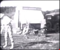
![Burnaby, [between 1937 and 1938] thumbnail](/media/Hpo/_Data/_Archives_Moving_Images/_Unrestricted/562-002-5.jpg?width=280)
Burnaby
https://search.heritageburnaby.ca/link/archivedescription85235
- Repository
- City of Burnaby Archives
- Date
- [between 1937 and 1938]
- Collection/Fonds
- Digney Family fonds
- Description Level
- Item
- Physical Description
- 1 film clip (9 min., 26 sec.) : digital, b&w, col., si.
- Scope and Content
- Item is a silent digitized film segment identified as Reel 5. The film segment opens with black and white footage of a Burnaby May Day Parade. Children are seen in costumes pushing carriages and bicycles along with pets as they come to gather at Central Park for judging. This event is followed with…
- Repository
- City of Burnaby Archives
- Date
- [between 1937 and 1938]
- Collection/Fonds
- Digney Family fonds
- Physical Description
- 1 film clip (9 min., 26 sec.) : digital, b&w, col., si.
- Description Level
- Item
- Record No.
- 562-003-5
- Access Restriction
- No restrictions
- Reproduction Restriction
- May be restricted by third party rights
- Accession Number
- 2014-04
- Scope and Content
- Item is a silent digitized film segment identified as Reel 5. The film segment opens with black and white footage of a Burnaby May Day Parade. Children are seen in costumes pushing carriages and bicycles along with pets as they come to gather at Central Park for judging. This event is followed with colour footage of a gymkhana event with people riding horses at the Lubbock farm in Burnaby and closes with Victory Bond fundraising outside the Oak Theatre, a parade on Kingsway and contrails from an airplane. Many of the men can be seen marching in the parade with their A.R.P. (Air Raid Precautions) uniforms and arm bands.
- Media Type
- Moving Images
- Photographer
- Digney, Andy
- Creator
- Digney, Andy
- Notes
- Title based on contents of film
- Geographic Access
- Kingsway
- Historic Neighbourhood
- Central Park (Historic Neighbourhood)
- Planning Study Area
- Sussex-Nelson Area
Images
![Burnaby, [between 1937 and 1938] thumbnail](/media/Hpo/_Data/_Archives_Moving_Images/_Unrestricted/562-002-5.jpg)
Video
Burnaby, [between 1937 and 1938]
Burnaby, [between 1937 and 1938]
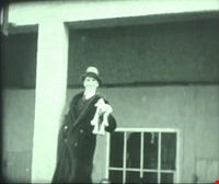
https://search.heritageburnaby.ca/media/hpo/_Data/_Archives_Moving_Images/_Unrestricted/562-003-5.m4v![Burnaby and Digney recreational events, [between 1934 and 1938] thumbnail](/media/Hpo/_Data/_Archives_Moving_Images/_Unrestricted/562-003-3.jpg?width=280)
Burnaby and Digney recreational events
https://search.heritageburnaby.ca/link/archivedescription85208
- Repository
- City of Burnaby Archives
- Date
- [between 1934 and 1938]
- Collection/Fonds
- Digney Family fonds
- Description Level
- Item
- Physical Description
- 1 film clip (10 min., 30 sec.) : digital, b&w, col., si.
- Scope and Content
- Item is a silent digitized colour and black and white film segment identified as Reel 3. The film segment opens with footage of Digney family automobile travels and of Pelican Lake, Alberta where the family spent their summer, the footage switches to footage of a parade somewhere in the Rockies (B…
- Repository
- City of Burnaby Archives
- Date
- [between 1934 and 1938]
- Collection/Fonds
- Digney Family fonds
- Physical Description
- 1 film clip (10 min., 30 sec.) : digital, b&w, col., si.
- Description Level
- Item
- Record No.
- 562-003-3
- Access Restriction
- No restrictions
- Reproduction Restriction
- May be restricted by third party rights
- Accession Number
- 2014-04
- Scope and Content
- Item is a silent digitized colour and black and white film segment identified as Reel 3. The film segment opens with footage of Digney family automobile travels and of Pelican Lake, Alberta where the family spent their summer, the footage switches to footage of a parade somewhere in the Rockies (Banff) which begins in black and white and changes to colour format. This is followed by colour footage of car racing at the Digney Speedway located on 10 acres of property on MacPherson Ave. Jelopy stock car racing is seen taking place with crowds of people looking on.
- Subjects
- Sports - Swimming
- Events - Parades
- Persons - Children
- Persons - Crowds
- Sports - Automobile Racing
- Media Type
- Moving Images
- Photographer
- Digney, Andy
- Creator
- Digney, Andy
- Notes
- Title based on contents of film
- Geographic Access
- MacPherson Avenue
- Historic Neighbourhood
- Alta-Vista (Historic Neighbourhood)
- Planning Study Area
- Clinton-Glenwood Area
Images
![Burnaby and Digney recreational events, [between 1934 and 1938] thumbnail](/media/Hpo/_Data/_Archives_Moving_Images/_Unrestricted/562-003-3.jpg)
Video
Burnaby and Digney recreational events, [between 1934 and 1938]
Burnaby and Digney recreational events, [between 1934 and 1938]
https://search.heritageburnaby.ca/media/hpo/_Data/_Archives_Moving_Images/_Unrestricted/562-003-3.m4vBurnaby Image Bank subseries
https://search.heritageburnaby.ca/link/archivedescription64462
- Repository
- City of Burnaby Archives
- Date
- [1910] (date of original) -1993
- Collection/Fonds
- Burnaby Historical Society fonds
- Description Level
- Subseries
- Physical Description
- Photographs and other material
- Scope and Content
- Subseries consists of the SFU/Burnaby Centennial Committee's Image Bank project records. Records include: Image Bank database and backups in a variety of formats; 813 photographs collected by Simon Fraser University Archives staff; eleven screened negatives from the Burnaby Image Bank that were us…
- Repository
- City of Burnaby Archives
- Date
- [1910] (date of original) -1993
- Collection/Fonds
- Burnaby Historical Society fonds
- Subseries
- Burnaby Image Bank subseries
- Physical Description
- Photographs and other material
- Description Level
- Subseries
- Access Restriction
- Open Access
- Accession Number
- BHS1999-03
- BHS2004-13
- BHS2001-15
- Scope and Content
- Subseries consists of the SFU/Burnaby Centennial Committee's Image Bank project records. Records include: Image Bank database and backups in a variety of formats; 813 photographs collected by Simon Fraser University Archives staff; eleven screened negatives from the Burnaby Image Bank that were used for the publication "Burnaby: A Cultural Inventory and Resource Guide"; and one VHS tape and DVD access copy of "Burnaby's Photographic Family Album / Burnaby Image Bank Collection / Volume 1 / 1992" which was created by the Committee for public viewing and purchase. The collection of photographs for the Image Bank project were gathered from various donors to commemorate the Centennial of the City of Burnaby. All photographs were collected from Burnaby families' personal albums by Simon Fraser University Archives staff during 1991 with a focus on the history of the people and the landscape of Burnaby. Photographs were collected from every decade for every neighbourhood in effort to describe the City's evolving ethnic, cultural and physical landscape. In March 1992, 20 of these images were selected by a jury for their aesthetic quality and displayed at the Bennett Library Gallery at Simon Fraser University for the "Images of Burnaby" exhibition. This exhibit travelled to various locations between 1992-1993 within Burnaby and Douglas College in New Westminster. The entire 800+ collection was made available for public purchase and viewing on video cassette. As well, each Burnaby school and each branch of the Burnaby Public Library received their own VHS copy for information and research purposes. The "Image Bank" video collection was buried alongside the video "Images and Voices of Burnaby" in the City of Burnaby's time capsule, mounted at City Hall in 1992.
- Media Type
- Photograph
- Textual Record
- Moving Images
- Creator
- SFU/Burnaby Centennial Committee
- Notes
- Title based on contents of subseries
- PC 370, MSS131, MSS088, MI577

Burnaby Lake Neighbourhood
https://search.heritageburnaby.ca/link/landmark700
- Repository
- Burnaby Heritage Planning
- Associated Dates
- 1925-1954
- Heritage Value
- After World War I and the Great Depression of the 1930s, more homes were constructed and subdivisions created in the Burnaby Lake district. The area around Deer Lake gained a reputation for being an "artistic development of commodious homes with park-like grounds."
- Historic Neighbourhood
- Burnaby Lake (Historic Neighbourhood)
- Planning Study Area
- Burnaby Lake Area
Images


Burnaby North High School
https://search.heritageburnaby.ca/link/landmark745
- Repository
- Burnaby Heritage Planning
- Associated Dates
- 1923-1982
- Street View URL
- Google Maps Street View
- Repository
- Burnaby Heritage Planning
- Geographic Access
- Willingdon Avenue
- Associated Dates
- 1923-1982
- Heritage Value
- Burnaby North and Burnaby South were the first high schools built in the City. Before the high school opened, Burnaby students had to travel to Vancouver if they wished to pursue education beyond an elementary level. In 1921, arrangements were made to use the basement of the Presbyterian Church for instruction of local students. By 1922 the Burnaby North High School opened at its first permanent location (4375 Pandora Street - which is now Rosser Elementary). In 1945, the Willingdon Avenue site was built and was used until a new building was constructed in 1961 on Hammarskjold Drive. From 1962, the school was used as Burnaby Heights Junior High school, but it closed in 1982 and the junior high students went to the new Burnaby North on Hammarskjold.
- Historic Neighbourhood
- Capitol Hill (Historic Neighbourhood)
- Planning Study Area
- Capitol Hill Area
- Street Address
- 250 Willingdon Avenue
- Street View URL
- Google Maps Street View
Images


Burnaby South High School
https://search.heritageburnaby.ca/link/landmark770
- Repository
- Burnaby Heritage Planning
- Associated Dates
- 1922-1988
- Street View URL
- Google Maps Street View
- Repository
- Burnaby Heritage Planning
- Geographic Access
- Southoaks Crescent
- Associated Dates
- 1922-1988
- Heritage Value
- Burnaby South and Burnaby North were Burnaby's first high schools. The first rooms of the school were built in 1922 on the same grounds as the Kingsway East Elementary School. In 1940, a two-storey building was erected and additions were made in 1963, 1967 and 1972. Kingsway East closed in 1925 and its buildings were used by the high school for Industrial Arts and Home Economics. In the early 1990s, a new "urban education centre" (Burnaby South/B.C. School for the Deaf) was opened, replacing the old Burnaby South High School.
- Historic Neighbourhood
- Edmonds (Historic Neighbourhood)
- Planning Study Area
- Kingsway-Beresford Area
- Street Address
- 6650 Southoaks Crescent
- Street View URL
- Google Maps Street View
Images

![Burnaby Sports Day, [between 1936 and 1939] thumbnail](/media/Hpo/_Data/_Archives_Moving_Images/_Unrestricted/562-002-3.jpg?width=280)
Burnaby Sports Day
https://search.heritageburnaby.ca/link/archivedescription85204
- Repository
- City of Burnaby Archives
- Date
- [between 1936 and 1939]
- Collection/Fonds
- Digney Family fonds
- Description Level
- Item
- Physical Description
- 1 film clip (8 min., 37 sec.) : digital, col., si.
- Scope and Content
- Item is a digitized copy of a silent colour film segment with footage of the annual Sports Day events held at Burnaby Central Park. The film opens with an unidentified dedication ceremony and tree planting in an unknown location and switches to students marching into Central Park. Hundreds of child…
- Repository
- City of Burnaby Archives
- Date
- [between 1936 and 1939]
- Collection/Fonds
- Digney Family fonds
- Physical Description
- 1 film clip (8 min., 37 sec.) : digital, col., si.
- Description Level
- Item
- Record No.
- 562-002-3
- Access Restriction
- No restrictions
- Reproduction Restriction
- May be restricted by third party rights
- Accession Number
- 2012-15
- Scope and Content
- Item is a digitized copy of a silent colour film segment with footage of the annual Sports Day events held at Burnaby Central Park. The film opens with an unidentified dedication ceremony and tree planting in an unknown location and switches to students marching into Central Park. Hundreds of children and Youth are showcased in sporting field events and competitions such as track and field sports, acrobatics, gymnastics, dancing, leap frog, skipping, rugby.
- Subjects
- Events - Parades
- Occupations
- Occupations - Labourers
- Organizations - Mens' Societies and Clubs
- Organizations - Womens' Societies and Clubs
- Media Type
- Moving Images
- Photographer
- Digney, Andy
- Creator
- Digney, Andy
- Notes
- Title based on contents of film
- Film clip originates from digitized version of original 16 mm film footage (item 562-002). This segment was part of digitized portion titled 'May Day Events'
- Geographic Access
- Kingsway
- Central Park
- Street Address
- 3883 Imperial Street
- Historic Neighbourhood
- Central Park (Historic Neighbourhood)
- Planning Study Area
- Sussex-Nelson Area
Images
![Burnaby Sports Day, [between 1936 and 1939] thumbnail](/media/Hpo/_Data/_Archives_Moving_Images/_Unrestricted/562-002-3.jpg)
Video
Burnaby Sports Day, [between 1936 and 1939]
Burnaby Sports Day, [between 1936 and 1939]
https://search.heritageburnaby.ca/media/hpo/_Data/_Archives_Moving_Images/_Unrestricted/562-002-3.m4v![Burnaby, Vancouver and the north shore, [between 1937 and 1938] thumbnail](/media/Hpo/_Data/_Archives_Moving_Images/_Unrestricted/562-003-6.jpg?width=280)
Burnaby, Vancouver and the north shore
https://search.heritageburnaby.ca/link/archivedescription85238
- Repository
- City of Burnaby Archives
- Date
- [between 1937 and 1938]
- Collection/Fonds
- Digney Family fonds
- Description Level
- Item
- Physical Description
- 1 film clip (5 min., 21 sec.) : digital, b&w, col., si.
- Scope and Content
- Item is a silent digitized film segment identified as Reel 6. The film segment opens with colour footage of people lawn bowling at Burnaby's Central Park. Dot Digney, Sid and Connie Swan can be seen bowling. This footage is followed with Andy Digney and Charles E. Jones at the Bird's of Paradise b…
- Repository
- City of Burnaby Archives
- Date
- [between 1937 and 1938]
- Collection/Fonds
- Digney Family fonds
- Physical Description
- 1 film clip (5 min., 21 sec.) : digital, b&w, col., si.
- Description Level
- Item
- Record No.
- 562-003-6
- Access Restriction
- No restrictions
- Reproduction Restriction
- May be restricted by third party rights
- Accession Number
- 2014-04
- Scope and Content
- Item is a silent digitized film segment identified as Reel 6. The film segment opens with colour footage of people lawn bowling at Burnaby's Central Park. Dot Digney, Sid and Connie Swan can be seen bowling. This footage is followed with Andy Digney and Charles E. Jones at the Bird's of Paradise bird sanctuary followed by footage of Stanley Park. The footage continues and interchanges between black and white and colour as the Digney's take a ferry ride to North Vancouver where they visit the Capilano Suspension Bridge and Fishermen's Cove. The reel closes with footage of skiers on Grouse Mountain and a fire at Pier D in 1938.
- Media Type
- Moving Images
- Photographer
- Digney, Andy
- Creator
- Digney, Andy
- Notes
- Title based on contents of film
- Geographic Access
- Kingsway
- Historic Neighbourhood
- Central Park (Historic Neighbourhood)
- Planning Study Area
- Kingsway-Beresford Area
Images
![Burnaby, Vancouver and the north shore, [between 1937 and 1938] thumbnail](/media/Hpo/_Data/_Archives_Moving_Images/_Unrestricted/562-003-6.jpg)
Video
Burnaby, Vancouver and the north shore, [between 1937 and 1938]
Burnaby, Vancouver and the north shore, [between 1937 and 1938]
https://search.heritageburnaby.ca/media/hpo/_Data/_Archives_Moving_Images/_Unrestricted/562-003-6.m4v
Burquitlam Neighbourhood
https://search.heritageburnaby.ca/link/landmark703
- Repository
- Burnaby Heritage Planning
- Associated Dates
- 1925-1954
- Heritage Value
- By the 1950s, the Burquitlam Neighbourhood was becoming a residential and commercial centre for the northeast section of Burnaby. The Sullivan Heights area was developed as a single-family residential area with the Lyndhurst School opening in 1954. The completion of the Lougheed Highway in 1953 encouraged more commercial and retail development and fostered the growth of the neighbourhood throughout this period.
- Historic Neighbourhood
- Burquitlam (Historic Neighbourhood)
- Planning Study Area
- Lyndhurst Area
Images
