Narrow Results By
Subject
- Building Components 1
- Buildings - Agricultural 3
- Buildings - Agricultural - Greenhouses 2
- Buildings - Heritage 3
- Buildings - Public - Detention Facilities 1
- Buildings - Residential 1
- Buildings - Residential - Houses 1
- Documentary Artifacts 4
- Documentary Artifacts - Books 4
- Music 1
- Persons - Chinese Canadians 1
- Persons - Royalty 4
Person / Organization
- Borstal School 1
- British Columbia Mills Timber and Trading Company 1
- Canadian Institute of Mining and Metallurgy 1
- Ceperley, Grace 3
- Ceperley, H.T. 3
- Clarke, Ellen 1
- Clarke, Joseph 1
- Fripp, Robert Mackay 3
- G.F. and J. Galt Limited 1
- Home of the Friendless 1
- Macdonald, Angus 1
- McGregor, Duncan C. (1853-1929) 1

A country girl : a new and original musical play
https://search.heritageburnaby.ca/link/museumlibrary4922
- Repository
- Burnaby Village Museum
- Author
- Tanner, James T.
- Edition
- New ed.
- Publication Date
- c1904
- Call Number
- 789 TAN
- Repository
- Burnaby Village Museum
- Collection
- Special Collection
- Material Type
- Book
- Accession Code
- BV997.34.9
- Call Number
- 789 TAN
- Edition
- New ed.
- Author
- Tanner, James T.
- Contributor
- Ross, Adrian, 1859-1933
- Monckton, Lionel, 1861-1924
- Rubens, Paul A. (Paul Alfred), 1875-1917
- Greenbank, Percy, 1878-1968
- Place of Publication
- London
- Publisher
- Chappell & Co., Ltd.
- Publication Date
- c1904
- Printer
- Henderson and Spalding, Marylebone Press
- Physical Description
- 212 p. : 28 cm.
- Inscription
- "E. B. Wilson" [Handwritten twice in pencil on title page]
- Library Subject (LOC)
- Musical revues, comedies, etc.
- Musical plays--Vocal scores
- Musical plays
- Music
- Subjects
- Music
- Names
- Wilson, Elsie
- Object History
- Elsie Wilson - The material in the donation is from her estate. Miss Wilson was a Burnaby resident and music teacher. The brass plaque was on her fathers home "Penrith Castle" on Blenheim St. in Burnaby
- Notes
- "By James T. Tanner. Lyrics by Adrian Ross. Music by Lionel Monckton. Additional lyrics and numbers by Paul A. Rubens. Additional lyrics by Percy Greenbank" -- Title page
- Contributor's full name and dates: Rubens, Paul A. (Paul Alfred), 1875-1917
Images


Alta Vista Neighbourhood
https://search.heritageburnaby.ca/link/landmark766
- Repository
- Burnaby Heritage Planning
- Associated Dates
- 1905-1924
- Heritage Value
- Alta Vista, named for its high views of the Fraser Valley, rapidly grew during the period 1910-1912, seeing its settlement jump from about a dozen buildings in 1910 to about four hundred by the end of 1912. Home-seekers were attracted to its location just a short walk from the B.C.E.R. line at Royal Oak and Highland Park and easily accessible to both New Westminster and Vancouver.
- Historic Neighbourhood
- Alta Vista (Historic Neighbourhood)
- Planning Study Area
- Sussex-Nelson Area
Images


Angus & Margaret MacDonald House
https://search.heritageburnaby.ca/link/landmark495
- Repository
- Burnaby Heritage Planning
- Description
- Set on a large corner lot at North Esmond Avenue and Oxford Street, the Angus & Margaret MacDonald House is a prominent, two and one-half storey Queen Anne Revival-style residence. The high hipped roof has open projecting gables. The house is a landmark within the Vancouver Heights neighbourhood of…
- Associated Dates
- 1909
- Formal Recognition
- Heritage Designation, Community Heritage Register
- Street View URL
- Google Maps Street View
- Repository
- Burnaby Heritage Planning
- Geographic Access
- Oxford Street
- Associated Dates
- 1909
- Formal Recognition
- Heritage Designation, Community Heritage Register
- Enactment Type
- Bylaw No. 12174
- Enactment Date
- 11/12/2006
- Description
- Set on a large corner lot at North Esmond Avenue and Oxford Street, the Angus & Margaret MacDonald House is a prominent, two and one-half storey Queen Anne Revival-style residence. The high hipped roof has open projecting gables. The house is a landmark within the Vancouver Heights neighbourhood of North Burnaby, on a high point of land overlooking Burrard Inlet and the North Shore Mountains.
- Heritage Value
- The MacDonald House is valued as one of Burnaby’s most elaborate examples of the Queen Anne Revival style. The house retains many of its original features, including a prominent front corner turret wrapped by a clamshell verandah. The eclectic and transitional nature of Edwardian-era architecture is demonstrated by the late persistence of these Queen Anne Revival details, combined with the use of newly-popular classical revival elements such as Ionic columns. The interior retains a number of original architectural elements, and the early garage at the rear originally housed Angus MacDonald’s Cadillac, one of the first known automobiles owned by a Burnaby resident. Constructed in 1909, this house was built for Angus MacDonald (1857-1943) and his wife, Margaret Isabella Thompson MacDonald (1862-1939). Angus MacDonald, an electrical contractor, relocated from Nova Scotia to Vancouver in 1891 and served on Vancouver Council from 1904-08. The MacDonald family moved to Burnaby upon his retirement from the B.C. Electric Railway Company, and he then served the North Burnaby Ward as a councillor from 1911-1916 and again in 1921. MacDonald Street in Burnaby was named in his honour. The MacDonald House has additional significance as one of the surviving landmark residences, built between 1909 and 1914, during the first development of Vancouver Heights. In 1909, C.J. Peter and his employer, G.F. and J. Galt Limited, initiated the development of this North Burnaby neighbourhood, promoting it as one of the most picturesque districts in the region and an alternative to the CPR’s prestigious Shaughnessy Heights development in Vancouver. Buyers were obligated to build houses worth $3,500 at a time when the average house price was $1,000. Reputed to be the second house built in the subdivision, this house cost $7,000 to build.
- Defining Elements
- Key elements that define the heritage character of the MacDonald House include its: - prominent corner location in the Vancouver Heights neighbourhood, with views to Burrard Inlet and the North Shore Mountains - residential form, scale and massing as exemplified by its two and one-half storey height, full basement, compound plan, and high hipped roof with gabled projections at the front and side - wood-frame construction including wooden lapped siding, trim and mouldings - rubble-stone granite foundation - Queen Anne Revival details such as scroll-cut modillions, octagonal corner turret, wraparound, clamshell verandah with classical columns, and projecting square and semi-octagonal bays - external red-brick chimney with corbelled top - original windows including double-hung, 1-over-1 wooden sash windows in single and double assembly, and arched-top casement windows in the gable peaks - original interior features such as the main staircase, a panelled dining room with a fireplace and built-in cabinets, a living room with a parquet floor, and a rear den with an oak mantle and tiled hearth - associated early wood-frame garage at the rear of the property - landscape features such as mature coniferous and deciduous trees surrounding the property
- Historic Neighbourhood
- Vancouver Heights (Historic Neighbourhood)
- Planning Study Area
- Burnaby Heights Area
- Organization
- British Columbia Mills Timber and Trading Company
- Function
- Primary Historic--Single Dwelling
- Primary Current--Single Dwelling
- Community
- Vancouver Heights
- Cadastral Identifier
- P.I.D.011-999-462
- Boundaries
- The MacDonald House is comprised of a single residential lot located at 3814 Oxford Street, Burnaby.
- Area
- 566.71
- Contributing Resource
- Building
- Ownership
- Private
- Documentation
- City of Burnaby Planning and Building Department, Heritage Site Files
- Street Address
- 3814 Oxford Street
- Street View URL
- Google Maps Street View
Images


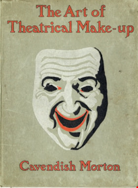
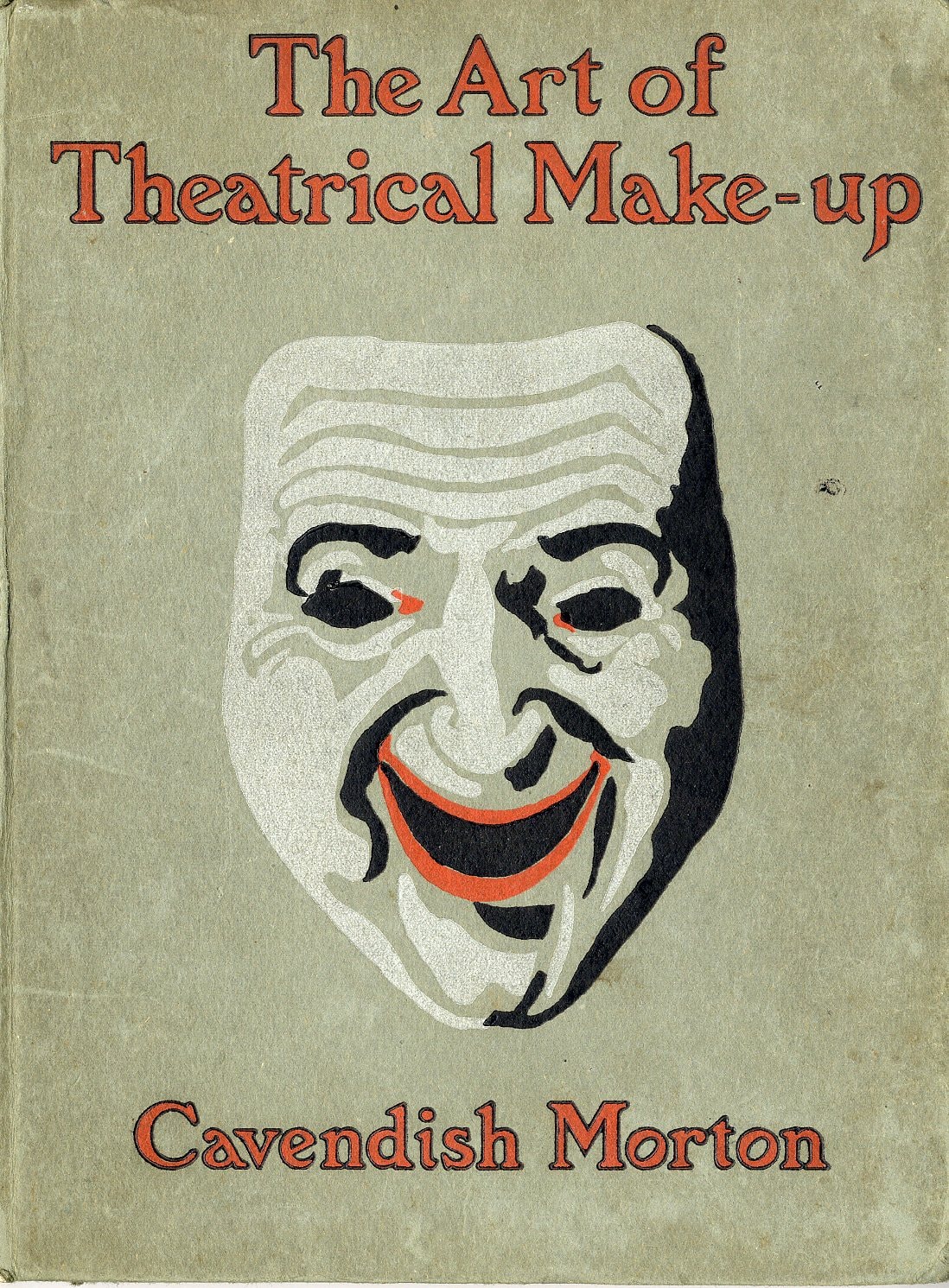
The art of theatrical make-up
https://search.heritageburnaby.ca/link/museumlibrary419
- Repository
- Burnaby Village Museum
- Author
- Morton, Cavendish, 1911-
- Publication Date
- 1909
- Call Number
- 792.02 CAV
- Repository
- Burnaby Village Museum
- Collection
- Special Collection
- Material Type
- Book
- Accession Code
- BV988.44.195
- Call Number
- 792.02 CAV
- Author
- Morton, Cavendish, 1911-
- Place of Publication
- London
- Publisher
- Adam and Charles Black
- Publication Date
- 1909
- Printer
- Ballantyne
- Physical Description
- 137 p. : ill. ; 25 cm.
- Inscription
- Front endpaper: "C.J Caunt" [written in pencil] Back endpaper: "mnh" [written in pencil] "200" [written in pencil] "G.S. Forsyth & Co Vancouver, B.C." [stamped in purple ink]
- Library Subject (LOC)
- Theatrical makeup
- Notes
- "Illustrated with thirty-two reproductions from photographs of the author by himself" -- t.p.
Images
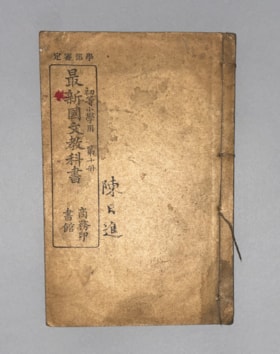
Authorized by the Education Ministry For Lower Division Primary School Use, Volume 10 New Chinese Language Textbook
https://search.heritageburnaby.ca/link/museumlibrary616
- Repository
- Burnaby Village Museum
- Collection
- Special Collection
- Material Type
- Book
- Accession Code
- BV985.360.10
- Author
- Shang Wu Yin Shu Guan
- Place of Publication
- Shanghai
- Publisher
- Commercial Press, Limited
- Publication Date
- 1906
- Physical Description
- 61 p. : ill (some col.), ports, maps ; 22 cm
- Subjects
- Persons - Chinese Canadians
- Object History
- Some books in this accession are marked: "Mr. Chan Y. Leong, 111 Pender St. E., Vancouver B.C., Canada, North America, Western H."
- Sam Kee & Company merchants is the business located at 111 Pender St. E. Vancouver - originally owned by Chan Toy (many alternative names including Chang Toy) which was later run by Chang Yat Leong - presumably the same person as Chan Y. Leong.
- Notes
- Chinese language book
- On double leaves, East Asian binding
Images


Barnet Neighbourhood
https://search.heritageburnaby.ca/link/landmark716
- Repository
- Burnaby Heritage Planning
- Associated Dates
- 1889-1904
- Heritage Value
- The North Pacific Lumber Company in Barnet was one of Burnaby's first industrial developments and one of the largest in the British Empire. Partners James MacLaren and Frank Ross built the mill in 1889 (activated in 1899) as a requirement for obtaining 84,000 acres of timber rights in northern BC. Due to the mill's isolation, the firm built homes for its employees with families and bunkhouses for the bachelors which separated Caucasian workers from Chinese and Sikh workers. Barnet became a distinct company town with its own general store, school, post office, community hall and telephone exchange.
- Historic Neighbourhood
- Barnet (Historic Neighbourhood)
- Planning Study Area
- Burnaby Mountain Area
Images


Barnet Neighbourhood
https://search.heritageburnaby.ca/link/landmark747
- Repository
- Burnaby Heritage Planning
- Associated Dates
- 1905-1924
- Heritage Value
- The original Barnet mill burned down in 1909 after a dramatic explosion in the boiler house. The company rebuilt a new plant, considered a model of mill construction. The company's timber was towed down the Pacific in huge rafts containing about 400,000 to 500,000 board feet. Mill capacity during a 10-hour day was 150,000 board feet with an amazing annual output of 50 million feet.
- Historic Neighbourhood
- Barnet (Historic Neighbourhood)
- Planning Study Area
- Burnaby Mountain Area
Images


Bayley & Ferguson's Violin Album. 100 popular & classical airs
https://search.heritageburnaby.ca/link/museumlibrary3787
- Repository
- Burnaby Village Museum
- Author
- Moffat, Alfred, 1866-1950
- Publication Date
- c1908
- Call Number
- 784 MOF
- Repository
- Burnaby Village Museum
- Collection
- Special Collection
- Material Type
- Book
- Accession Code
- BV002.67.5
- Call Number
- 784 MOF
- Author
- Moffat, Alfred, 1866-1950
- Place of Publication
- London
- Publisher
- Bayley & Ferguson
- Publication Date
- c1908
- Physical Description
- 109 p. : 31 cm.
- Inscription
- "Violin pieces" [Handwritten in pencil on outer envelope] "W.E. Spain" [Handwritten in pencil on outer envelope] "W. Spain" [Handwritten in blue crayon on title page]
- Library Subject (LOC)
- Violin and piano music
- Violin music
- Piano music
- Object History
- Donor inherited object in 1987 from the estate of her father, William Alexander Spain.
- Notes
- "arranged with pianoforte accompaniments by Alfred Moffat." -- title page
- "Including separate violin part" -- Title page
Images


BCER Eburne Line
https://search.heritageburnaby.ca/link/landmark771
- Repository
- Burnaby Heritage Planning
- Associated Dates
- 1909
- Heritage Value
- In 1908, construction began on the British Columbia Electric Railway Eburne tramline which was to connect Eburne (now known as Marpole) with New Westminster. It opened on September 15, 1909 and its tracks were built across the bog of the Fraser Arm district with little regard to the fact that virtually no one lived there. However, within one year an hourly passenger service, a milk train and three-times weekly freight service used this level fast-running connector. With the completion of the Chilliwack interurban line and various other steam railroads which were funnelled onto this line it became one of the most important industrial freight lines in the Lower Mainland.
- Historic Neighbourhood
- Fraser Arm (Historic Neighbourhood)
- Planning Study Area
- Big Bend Area
Images

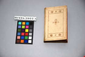
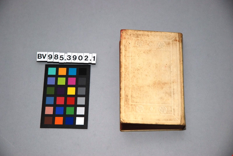
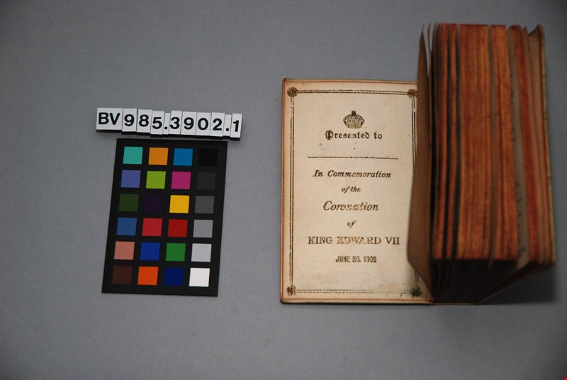
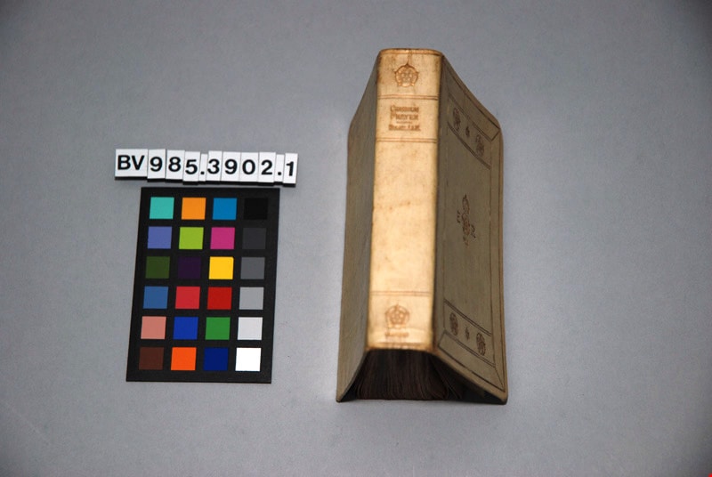
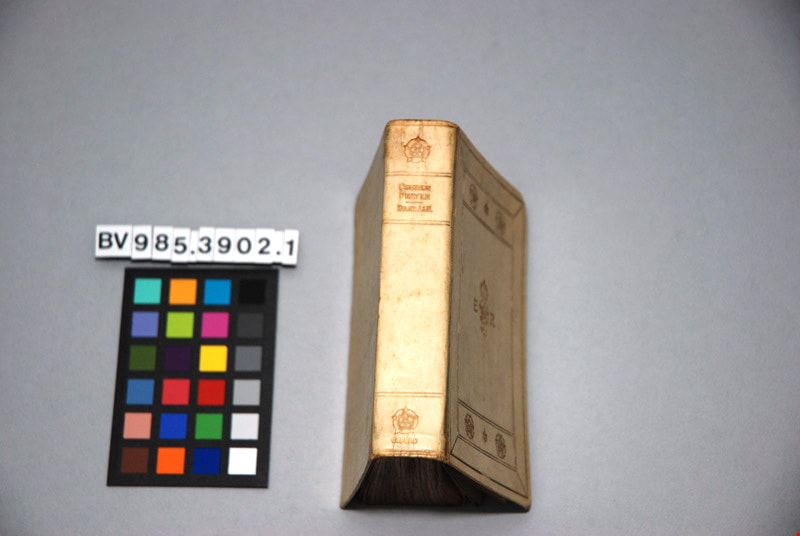
The book of common prayer, and administration of the sacraments, and other rites and ceremonies of the church, according to the use of the Church of England : together with the Psalter or Psalms of David, pointed as they are to be sung or said in churches ; and the form and manner of making, ordaining, and consecrating of bishops, priests, and deacons
https://search.heritageburnaby.ca/link/museumlibrary4865
- Repository
- Burnaby Village Museum
- Author
- Church of England
- Publication Date
- 1902
- Call Number
- 264.03 CHU
- Repository
- Burnaby Village Museum
- Collection
- Special Collection
- Material Type
- Book
- Accession Code
- BV985.3902.1
- Call Number
- 264.03 CHU
- Author
- Church of England
- Place of Publication
- London
- Publisher
- Henry Frowde
- Publication Date
- 1902
- Printer
- Oxford University Press
- Physical Description
- 1 vol. ; 12 cm.
- Inscription
- "THE BOOK OF Common Prayer" "E R" "VII" front centre "COMMON PRAYER" "HYMNS A&M", "OXFORD"; "Presented to [blank] In Commemoration of the Coronation of KING EDWARD VII" "JUNE 26, 1902"; page, "The Royal Commemoration Prayer Book" "Oxford 1902" "FEAR GOD, HONOUR THE KING"; "HORACE HART PRINTER TO THE UNIVERSITY"; 197pp; illustrated
- Library Subject (LOC)
- Church of England--Liturgy--Texts
- Church of England--Prayers and devotions
- Prayer books
Images

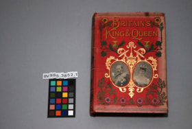
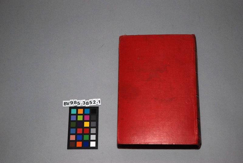
Britain's King and Queen : the story of their lives , with sixty-eight illustrations
https://search.heritageburnaby.ca/link/museumlibrary5110
- Repository
- Burnaby Village Museum
- Author
- Paul, Thomas
- Edition
- New enl. ed.
- Publication Date
- 1902
- Call Number
- 923.1361 PAU
- Repository
- Burnaby Village Museum
- Collection
- Special Collection
- Material Type
- Book
- Accession Code
- BV985.3852.1
- Call Number
- 923.1361 PAU
- Edition
- New enl. ed.
- Author
- Paul, Thomas
- Place of Publication
- London
- Publisher
- John F. Shaw And Co.
- Publication Date
- 1902
- Physical Description
- xii, 387 p. : ill. ; 21 cm.
- Inscription
- "BRITAIN'S KING & QUEEN" "J.F. SHAW & CO." 388pp; sepia floral endpapers, pencil scribbles; several pages of advertising at the end for other books.
- Library Subject (LOC)
- Great Britain--Kings and rulers
Images


Broadview Neighbourhood
https://search.heritageburnaby.ca/link/landmark750
- Repository
- Burnaby Heritage Planning
- Associated Dates
- 1905-1924
- Heritage Value
- Between 1905 and 1924, the Broadview neighbourhood in Burnaby was settled by almost 100 families who saw the advantage of living in an area that was served by two railway lines - the B.C. Electric Railway and the Great Northern Railway. Touted as being only a 20 minute car ride to the city centre, this neighbourhood expanded during the early 1920s with the promise of a new direct access road to the city being built by the Great Northern Railway company and new blocks being opened up on two government reserves adjoining it.
- Historic Neighbourhood
- Broadview (Historic Neighbourhood)
- Planning Study Area
- Cascade-Schou Area
Images


Buena Vista Neighbourhood
https://search.heritageburnaby.ca/link/landmark759
- Repository
- Burnaby Heritage Planning
- Associated Dates
- 1905-1924
- Heritage Value
- The Buena Vista neighbourhood (so named for its wonderful views) grew out of its proximity to Edmonds and New Westminster and was developed in the period 1911-1912. By the 1950s, the area had been further subdivided and in 1986, Burnaby Municipal Council adopted the Cariboo Hills Development Plan for the neighbourhood to maintain its character as a residential area of the city.
- Historic Neighbourhood
- East Burnaby (Historic Neighbourhood)
- Planning Study Area
- Cariboo-Armstrong Area
Images


Burnaby Lake Neighbourhood
https://search.heritageburnaby.ca/link/landmark755
- Repository
- Burnaby Heritage Planning
- Associated Dates
- 1905-1924
- Heritage Value
- Along with logging and sawmills, Burnaby became known as a prime agricultural area and the Burnaby Lake Neighbourhood saw the development of many vegetable and fruit farms. Growers in the Burnaby and Deer Lake districts took their produce to the tram line on Edmonds Street and shipped it to markets in New Westminster and Vancouver on a specially designed interurban freight car that was open-sided for easy loading. The car's canvas curtains which sometimes came loose and flapped like wings in the wind led people to dub it "the flying dutchman." Most Burnaby fruit and vegetable growers depended on seasonal Chinese work forces and other local Chinese farm residents to oversee operations; these workers being recruited from New Westminsters' Asian community. Besides being good farmers, Burnaby Lake's early residents fostered a strong sense of community. Both L. Claude Hill and his brother Bernard were elected to Burnaby Municipal council and Bernard was the one who knocked on doors to find enough children to meet the qualifications for establishing a school in the district.
- Historic Neighbourhood
- Burnaby Lake (Historic Neighbourhood)
- Planning Study Area
- Morley-Buckingham Area
- Lakeview-Mayfield Area
Images


Burquitlam Neighbourhood
https://search.heritageburnaby.ca/link/landmark757
- Repository
- Burnaby Heritage Planning
- Associated Dates
- 1905-1924
- Heritage Value
- In 1921, the pamphlet "Beautiful Burnaby" was produced and it described the Burquitlam neighbourhood as such: "No part of Burnaby has more consistently laboured to advance its prosperity than Burquitlam. Enterprise and intelligence has hewn homes from the forest and developed land into highly productive gardens and poultry ranches. Burquitlam is the growing suburb to the north of the City of New Westminster. It is reached by the Sapperton carline direct from Edmonds being only a few minutes ride from New Westminster market. It is also served by the B.C.E.R. Burnaby Lake line and adjoins on the best golf links in Greater Vancouver."
- Historic Neighbourhood
- Burquitlam (Historic Neighbourhood)
- Planning Study Area
- Cameron Area
- Lyndhurst Area
Images

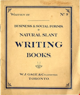
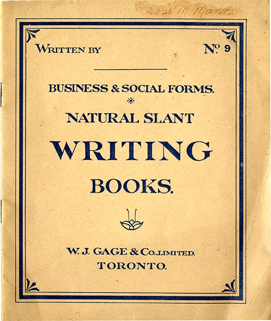
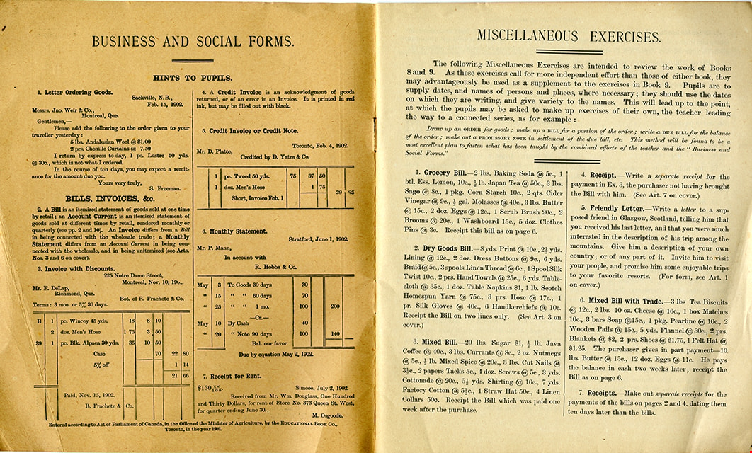
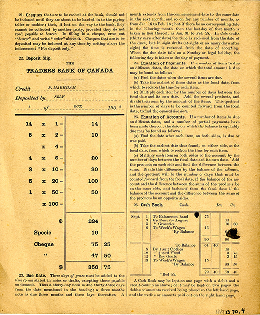
Business & social forms : natural slant writing books, no. 9
https://search.heritageburnaby.ca/link/museumlibrary6450
- Repository
- Burnaby Village Museum
- Collection
- Special Collection
- Material Type
- Book
- Accession Code
- HV973.70.4
- Call Number
- 372.634 GAG
- Place of Publication
- Toronto
- Publisher
- W. J. Gage & Co. Limited
- Publication Date
- c1902
- Physical Description
- 1 vol. ; 24 cm.
- Inscription
- "Doris M Mann" [handwritten in ink on cover]
- Library Subject (LOC)
- Penmanship
Images

Buster Brown the busy body
https://search.heritageburnaby.ca/link/museumlibrary2702
- Repository
- Burnaby Village Museum
- Collection
- Special Collection
- Material Type
- Book
- Accession Code
- HV974.50.10
- Call Number
- 741.5 OUT
- Place of Publication
- New York
- Publisher
- The New York Herald Co.
- Publication Date
- c1908
- Physical Description
- 1 v. (multiple pagings) : col. ill. : 29 x 41 cm.
- Inscription
- "Walter Galloway Bookstore 100 _______ St. E. Vancouver, B.C." [Stamped in black ink on cover verso and title page] "George Herbert Savage" [Handwritten in pencil on title page] "George Herbert Savage 6976 Culloden St. Vancouver B.C." [Handwritten in pencil on title page verso] "From Auntie Maggie Christmas 1919" [Handwritten in pencil on title page verso]
- Library Subject (LOC)
- Comic books, strips, etc.
- United States
Images


Capitol Hill Neighbourhood
https://search.heritageburnaby.ca/link/landmark742
- Repository
- Burnaby Heritage Planning
- Associated Dates
- 1905-1924
- Heritage Value
- Real estate ventures became quite active in the Vancouver Heights and Capitol Hill areas of Burnaby by 1908. Brokerage firms and agents who bought large tracts, subdivided and sold them off in parcels and by 1909 had adopted the name "Capitol Hill" to describe Burnaby's newest neighbourhood. In his book, History of Burnaby and Vicinity," historian George Green explains that the term "Capitol Hill" was taken from ancient Rome where the civic centre was built upon the Capitoline Hill, one of the seven hills of the eternal city. In 1909, the Scott Brokerage Company advertised the sale of lots on Capitol Hill, calling it "one of Vancouver's swellest suburbs."
- Historic Neighbourhood
- Capitol Hill (Historic Neighbourhood)
- Planning Study Area
- Capitol Hill Area
Images


Central Park Neighbourhood
https://search.heritageburnaby.ca/link/landmark723
- Repository
- Burnaby Heritage Planning
- Associated Dates
- 1891-1904
- Heritage Value
- Central Park was one of the first and fastest-growing communities in Burnaby. Located along the electric tram line and the Vancouver Road (Kingsway), it was also chosen for a government settlement project referred to as the Central Park Small Holdings. The lands held by the Provincial Government were subdivided and sold around 1894 and by 1899 the settlement was large enough to warrant the construction of an Anglican Church there.
- Historic Neighbourhood
- Central Park (Historic Neighbourhood)
- Planning Study Area
- Maywood Area
Images


Central Park Neighbourhood
https://search.heritageburnaby.ca/link/landmark751
- Repository
- Burnaby Heritage Planning
- Associated Dates
- 1905-1924
- Heritage Value
- In 1906, Maxwell Smith, President of the Central Park Farmer's Institute gave a speech in which he commented on the growth of this district and its ideal location during the boom years after 1905. He said: "Central Park is destined to become the epicentre of a great commercial metropolis, when Vancouver and New Westminster will have both expanded and prospered until they meet and fill up the intervening distances with residences of a new city, greater than few can now imagine, even in their wildest flights of fancy...we are proud of the two cities that lie on either side of us but they are, but mere hamlets compared with the great city that is to be on this peninsula. The time is coming when there will be one vast city, one commercial metropolis, and Central Park will be the heart of it."
- Historic Neighbourhood
- Central Park (Historic Neighbourhood)
- Planning Study Area
- Maywood Area
Images
