Narrow Results By
Subject
- Buildings - Religious - Churches 7
- Documentary Artifacts 4
- Documentary Artifacts - Books 4
- Documentary Artifacts - Maps 1
- Exhibitions 1
- First Nations reserves - British Columbia 8
- Geographic Features - Forests 1
- Geographic Features - Roads 1
- Indigenous peoples - Indian Territory 7
- Music 1
- Persons - Chinese Canadians 1
- Persons - Royalty 4
Creator
- Bekins Moving and Storage Company Limited 1
- British Columbia Underwriters' Association 1
- Burnett, Geoffrey K. 1
- Burnett & McGugan, Engineers and Surveyors 8
- Church of England 1
- City Map and White Print Co. 1
- Coast Map and Blue Print Co. 1
- Draper, William Nelson 1
- Garden, Hermon and Burwell 2
- Garden, Hermon & Burwell 1
- Gauvreau, Narcisse B. 1
- Gordon & Belyea Limited 1

Buster Brown the busy body
https://search.heritageburnaby.ca/link/museumlibrary2702
- Repository
- Burnaby Village Museum
- Collection
- Special Collection
- Material Type
- Book
- Accession Code
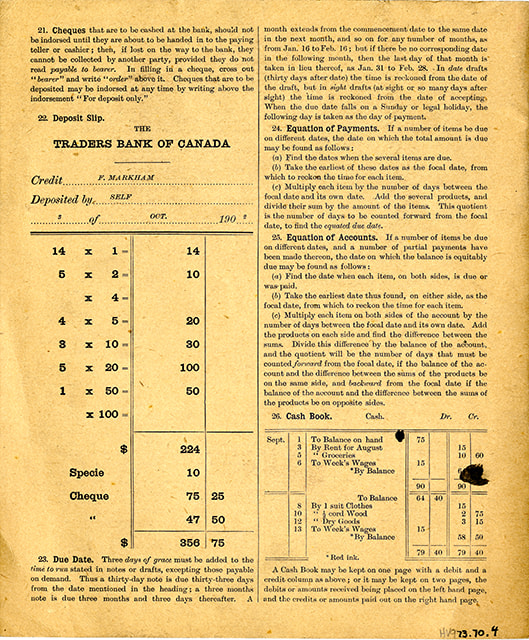
- HV974.50.10
- Call Number
- 741.5 OUT
- Place of Publication
- New York
- Publisher
- The New York Herald Co.
- Publication Date
- c1908
- Physical Description
- 1 v. (multiple pagings) : col. ill. : 29 x 41 cm.
- Inscription
- "Walter Galloway Bookstore 100 _______ St. E. Vancouver, B.C." [Stamped in black ink on cover verso and title page] "George Herbert Savage" [Handwritten in pencil on title page] "George Herbert Savage 6976 Culloden St. Vancouver B.C." [Handwritten in pencil on title page verso] "From Auntie Maggie Christmas 1919" [Handwritten in pencil on title page verso]
- Library Subject (LOC)
- Comic books, strips, etc.
- United States
Images


Bayley & Ferguson's Violin Album. 100 popular & classical airs
https://search.heritageburnaby.ca/link/museumlibrary3787
- Repository
- Burnaby Village Museum
- Author
- Moffat, Alfred, 1866-1950
- Publication Date
- c1908
- Call Number
- 784 MOF
- Repository
- Burnaby Village Museum
- Collection
- Special Collection
- Material Type
- Book
- Accession Code
- BV002.67.5
- Call Number
- 784 MOF
- Author
- Moffat, Alfred, 1866-1950
- Place of Publication
- London
- Publisher
- Bayley & Ferguson
- Publication Date
- c1908
- Physical Description
- 109 p. : 31 cm.
- Inscription
- "Violin pieces" [Handwritten in pencil on outer envelope] "W.E. Spain" [Handwritten in pencil on outer envelope] "W. Spain" [Handwritten in blue crayon on title page]
- Library Subject (LOC)
- Violin and piano music
- Violin music
- Piano music
- Object History
- Donor inherited object in 1987 from the estate of her father, William Alexander Spain.
- Notes
- "arranged with pianoforte accompaniments by Alfred Moffat." -- title page
- "Including separate violin part" -- Title page
Images


A country girl : a new and original musical play
https://search.heritageburnaby.ca/link/museumlibrary4922
- Repository
- Burnaby Village Museum
- Author
- Tanner, James T.
- Edition
- New ed.
- Publication Date
- c1904
- Call Number
- 789 TAN
- Repository
- Burnaby Village Museum
- Collection
- Special Collection
- Material Type
- Book
- Accession Code
- BV997.34.9
- Call Number
- 789 TAN
- Edition
- New ed.
- Author
- Tanner, James T.
- Contributor
- Ross, Adrian, 1859-1933
- Monckton, Lionel, 1861-1924
- Rubens, Paul A. (Paul Alfred), 1875-1917
- Greenbank, Percy, 1878-1968
- Place of Publication
- London
- Publisher
- Chappell & Co., Ltd.
- Publication Date
- c1904
- Printer
- Henderson and Spalding, Marylebone Press
- Physical Description
- 212 p. : 28 cm.
- Inscription
- "E. B. Wilson" [Handwritten twice in pencil on title page]
- Library Subject (LOC)
- Musical revues, comedies, etc.
- Musical plays--Vocal scores
- Musical plays
- Music
- Subjects
- Music
- Names
- Wilson, Elsie
- Object History
- Elsie Wilson - The material in the donation is from her estate. Miss Wilson was a Burnaby resident and music teacher. The brass plaque was on her fathers home "Penrith Castle" on Blenheim St. in Burnaby
- Notes
- "By James T. Tanner. Lyrics by Adrian Ross. Music by Lionel Monckton. Additional lyrics and numbers by Paul A. Rubens. Additional lyrics by Percy Greenbank" -- Title page
- Contributor's full name and dates: Rubens, Paul A. (Paul Alfred), 1875-1917
Images

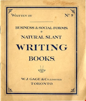
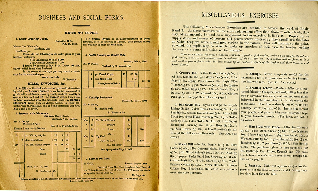
Business & social forms : natural slant writing books, no. 9
https://search.heritageburnaby.ca/link/museumlibrary6450
- Repository
- Burnaby Village Museum
- Collection
- Special Collection
- Material Type
- Book
- Accession Code
- HV973.70.4
- Call Number
- 372.634 GAG
- Place of Publication
- Toronto
- Publisher
- W. J. Gage & Co. Limited
- Publication Date
- c1902
- Physical Description
- 1 vol. ; 24 cm.
- Inscription
- "Doris M Mann" [handwritten in ink on cover]
- Library Subject (LOC)
- Penmanship
Images

Municipality of Burnaby
https://search.heritageburnaby.ca/link/museumdescription13096
- Repository
- Burnaby Village Museum
- Date
- 1936
- Collection/Fonds
- Burnaby Village Museum Map collection
- Description Level
- Item
- Physical Description
- 1 map : b&w print on paper ; 59 x 43 cm
- Scope and Content
- Map of the Municipality of Burnaby compiled and published by City Map and White Print Co.
- Repository
- Burnaby Village Museum
- Collection/Fonds
- Burnaby Village Museum Map collection
- Description Level
- Item
- Physical Description
- 1 map : b&w print on paper ; 59 x 43 cm
- Scope and Content
- Map of the Municipality of Burnaby compiled and published by City Map and White Print Co.
- Creator
- City Map and White Print Co.
- Publisher
- City Map and White Print Co.
- Accession Code
- HV976.158.7
- Access Restriction
- No restrictions
- Reproduction Restriction
- No known restrictions
- Date
- 1936
- Media Type
- Cartographic Material
- Scan Resolution
- 600
- Scan Date
- 2022-04-06
- Scale
- 100
- Notes
- Title based on content of map
- Title on map reads: "MUNICIPALITY / OF / BURNABY / BRITISH COLUMBIA / Compiled and Published by / CITY MAP AND WHITE PRINT CO."
- Stamp on map reads: "SFU LIBRARY / SEP 1974 / G. 3514 / B87 / 1936"
- Stamp on map reads: "SFU LIBRARY / AUG 1973 / G. 3514 / B87 / 1936"
- Cirular seal stamp on map reads: "The University of / Library / British Columbia"
Zoomable Images


Wrigley's Greater Vancouver City Street Guide
https://search.heritageburnaby.ca/link/museumlibrary421
- Repository
- Burnaby Village Museum
- Collection
- Special Collection
- Material Type
- Book
- Accession Code
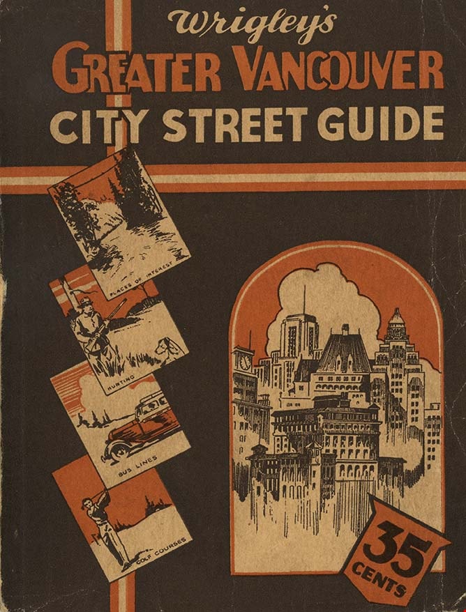
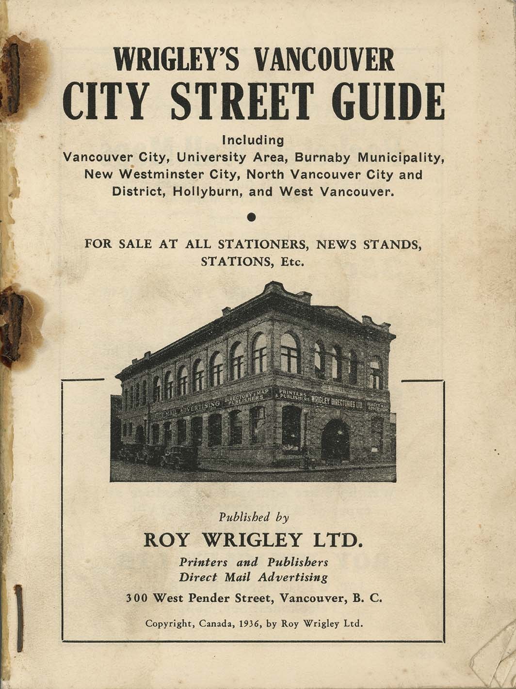
- BV988.53.7
- Publisher
- Roy Wrigley Ltd.
- Publication Date
- 1936
- Physical Description
- 160 pages, [1] folded leaf of plates : ill. , map ; 15 cm.
- Inscription
- "Wrigley's Greater Vancouver City Street Guide", printed on cover of book
- Object History
- From Hougland's Drug Store, 45th and Fraser in Vancouver.
Images
General catalogue
https://search.heritageburnaby.ca/link/museumlibrary5583
- Repository
- Burnaby Village Museum
- Author
- Gordon & Belyea Limited
- Publication Date
- 1935
- Call Number
- 387.2 GOR
- Repository
- Burnaby Village Museum
- Collection
- Special Collection
- Material Type
- Book
- Accession Code
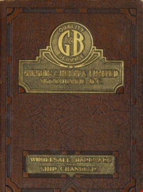
- HV983.89.1
- Call Number
- 387.2 GOR
- Author
- Gordon & Belyea Limited
- Place of Publication
- Vancouver
- Publisher
- Gordon & Belyea Ltd.
- Publication Date
- 1935
- Physical Description
- xxiv, 972 p. : ill. : 31 cm.
- Inscription
- "April 25th, 1935. THIS CATALOGUE is loaned to you with our compliments Gordon & Belyea Limited If at any time you do not require this Catalogue, please advise us and we will have one of our representatives call for it." [Typed in blue ink and pasted to front endpaper]
- Library Subject (LOC)
- Ships
- Hardware
- Wholesale trade
- Ship chandlers
- Catalogs
Images


Proposed sidewalk on grounds of Kingsway West School
https://search.heritageburnaby.ca/link/museumdescription11917
- Repository
- Burnaby Village Museum
- Date
- March 24, 1932
- Collection/Fonds
- Ronald G. Scobbie collection
- Description Level
- Item
- Physical Description
- 1 survey plan : ink on waxed linen sheet ; 55 x 25 cm
- Scope and Content
- Item consists of a survey plan titled “Plan Showing Proposed / Sidewalk on Grounds of / Kingsway West School”
- Repository
- Burnaby Village Museum
- Collection/Fonds
- Ronald G. Scobbie collection
- Description Level
- Item
- Physical Description
- 1 survey plan : ink on waxed linen sheet ; 55 x 25 cm
- Material Details
- Scale 20’=1”
- Scope and Content
- Item consists of a survey plan titled “Plan Showing Proposed / Sidewalk on Grounds of / Kingsway West School”
- Creator
- McGugan, Donald Johnston
- Names
- Kingsway West School
- Accession Code
- BV003.83.40
- Access Restriction
- No restrictions
- Reproduction Restriction
- No known restrictions
- Date
- March 24, 1932
- Media Type
- Cartographic Material
- Scan Resolution
- 600
- Scan Date
- 15-Jan-2021
- Scale
- 100
- Notes
- Transcribed title
- Note in pencil reads: ‘4222”
Images


Burnaby Park track
https://search.heritageburnaby.ca/link/museumdescription11918
- Repository
- Burnaby Village Museum
- Date
- June 30, 1932
- Collection/Fonds
- Ronald G. Scobbie collection
- Description Level
- Item
- Physical Description
- 1 survey plan : ink on waxed linen sheet ; 27 x 39 cm
- Scope and Content
- Item consists of a survey plan titled “Burnaby Park Track”.
- Repository
- Burnaby Village Museum
- Collection/Fonds
- Ronald G. Scobbie collection
- Description Level
- Item
- Physical Description
- 1 survey plan : ink on waxed linen sheet ; 27 x 39 cm
- Scope and Content
- Item consists of a survey plan titled “Burnaby Park Track”.
- Accession Code
- BV003.83.41
- Access Restriction
- No restrictions
- Reproduction Restriction
- No known restrictions
- Date
- June 30, 1932
- Media Type
- Cartographic Material
- Notes
- Transcribed title
- Note in pencil reads: ‘4222”
Images

![Indexed map of Greater Vancouver, [193-] thumbnail](/media/hpo/_Data/_BVM_Cartographic_Material/1976/1976_0026_0001_001.jpg?width=280)
Indexed map of Greater Vancouver
https://search.heritageburnaby.ca/link/museumdescription8201
- Repository
- Burnaby Village Museum
- Date
- [193-]
- Collection/Fonds
- Burnaby Village Museum Map collection
- Description Level
- Item
- Physical Description
- 1 map + 1 p. textual records : b&w lithographic print on 1 sheet ; 46 x 41 cm folded to 23 x 10 cm
- Scope and Content
- Item consists of a promotional brochure for Bekins Moving and Storage, with an indexed map of Greater Vancouver showing distances from the Bekins building located at Pender Street and Beatty Street on one side, and text and images advertising the company's services and facilities on the other side.…
- Repository
- Burnaby Village Museum
- Collection/Fonds
- Burnaby Village Museum Map collection
- Description Level
- Item
- Physical Description
- 1 map + 1 p. textual records : b&w lithographic print on 1 sheet ; 46 x 41 cm folded to 23 x 10 cm
- Material Details
- Scale not defined
- Printing on two sides of sheet
- Folded into eight sections
- Scope and Content
- Item consists of a promotional brochure for Bekins Moving and Storage, with an indexed map of Greater Vancouver showing distances from the Bekins building located at Pender Street and Beatty Street on one side, and text and images advertising the company's services and facilities on the other side. Cover of folded map reads "Indexed Map of Greater Vancouver / The Great Northwest for Opportunity / Compliments of / Bekins Moving and / Storage Co.".
- Responsibility
- Bekins Moving and Storage Company Limited
- Accession Code
- HV976.26.1
- Access Restriction
- No restrictions
- Reproduction Restriction
- No known restrictions
- Date
- [193-]
- Media Type
- Cartographic Material
- Textual Record
- Scan Resolution
- 600
- Scan Date
- 2023-08-17
- Notes
- Title based on contents of map
Zoomable Images
![Indexed map of Greater Vancouver, [193-] thumbnail](/media/hpo/_Data/_BVM_Cartographic_Material/1976/1976_0026_0001_001_seadragon/1976_0026_0001_001.jpg?w=280)
![Highways map of British Columbia, Alberta and adjacent states, [1930] thumbnail](/media/hpo/_Data/_BVM_Cartographic_Material/1977/1977_0037_0187_001.jpg?width=280)
Highways map of British Columbia, Alberta and adjacent states
https://search.heritageburnaby.ca/link/museumdescription9668
- Repository
- Burnaby Village Museum
- Date
- [1930]
- Collection/Fonds
- Burnaby Village Museum Map collection
- Description Level
- Item
- Physical Description
- 1 map : col. lithographic print ; both sides ; 89.5 x 58 cm, folded to 11.5 x 20 cm
- Scope and Content
- Double sided road map published by Imperial Oil, Ltd. and featuring the main travelled highway routes of British Columbia, Alberta and the Northwestern-most states of the United States of America. The map is a colour lithograph. The main map is green, with the highways highlighted in red. The litho…
- Repository
- Burnaby Village Museum
- Collection/Fonds
- Burnaby Village Museum Map collection
- Description Level
- Item
- Physical Description
- 1 map : col. lithographic print ; both sides ; 89.5 x 58 cm, folded to 11.5 x 20 cm
- Material Details
- Scale 1 inch = 20 miles
- A.R. THOMSON / CHIEF CARTOGRAPHER
- Scope and Content
- Double sided road map published by Imperial Oil, Ltd. and featuring the main travelled highway routes of British Columbia, Alberta and the Northwestern-most states of the United States of America. The map is a colour lithograph. The main map is green, with the highways highlighted in red. The lithograph was created in Canada by Rolph Clark Stone Ltd in Toronto. The opposite side of the map features inset maps of the following: the Trans-Canada Highway, the highway between Prince Rupert and Prince George, the highway through the Canadian Rockies, and the highway through the Peace River District. Small city plan maps of highways through major cities, as well as advertisements for Imperial Oil products, are also found on the opposite side of the main map. This map is one of four produced by Imperial Oil that covered the most populated areas of Canada from coast to coast and paralleled Imperial Oil's distribution service.
- Creator
- Thomson, A.R.
- Publisher
- Imperial Oil Limited
- Accession Code
- HV977.37.187
- Access Restriction
- No restrictions
- Reproduction Restriction
- No known restrictions
- Date
- [1930]
- Media Type
- Cartographic Material
- Scan Resolution
- 600
- Scan Date
- 2023-11-10
- Notes
- Title based on content of map
Zoomable Images
![Highways map of British Columbia, Alberta and adjacent states, [1930] thumbnail](/media/hpo/_Data/_BVM_Cartographic_Material/1977/1977_0037_0187_003_seadragon/1977_0037_0187_003.jpg?w=280)

![Copy of Official British Columbia Road Maps, [193-] thumbnail](/media/hpo/_Data/_BVM_Cartographic_Material/1972/1972_0179_0001_001.jpg?width=280)
Copy of Official British Columbia Road Maps
https://search.heritageburnaby.ca/link/museumdescription18945
- Repository
- Burnaby Village Museum
- Date
- [193-]
- Collection/Fonds
- Burnaby Village Museum Map collection
- Physical Description
- 1 map : lithographic print on sheet ; 43 x 56 cm folded to 22 x 11 cm
- Scope and Content
- Item consists of Road maps of British Columbia presented by Union Oil Company of Canada Limited. Includes seventeen maps printed on both sides of sheet. One side of sheet includes ten separate road maps titled "Cariboo"; "Chilcotin Plateau"; "150 Mile House to Prince George"; "Prince George - Burns…
- Repository
- Burnaby Village Museum
- Collection/Fonds
- Burnaby Village Museum Map collection
- Physical Description
- 1 map : lithographic print on sheet ; 43 x 56 cm folded to 22 x 11 cm
- Material Details
- Scale not defined
- Scope and Content
- Item consists of Road maps of British Columbia presented by Union Oil Company of Canada Limited. Includes seventeen maps printed on both sides of sheet. One side of sheet includes ten separate road maps titled "Cariboo"; "Chilcotin Plateau"; "150 Mile House to Prince George"; "Prince George - Burns Lake"; "Burns Lake - Hazelton"; "Similkameen - Nicola"; "Salmon Arm to Revelstoke"; "Ashcroft to Salmon Arm / Kamloops to Vernon"; "Okanagan Valley"; "Boundary District". Other side of sheet includes seven road maps titled "Vancouver Island"; "Vancouver to Yale"' "Fraser Canyon Section Cariboo Road"; "Lytton to 150 Mile House"; "Arrow and Kootenay Lakes"; "The Kootenays"; "Columbia Valley". When folded, cover of maps reads "COPY OF / OFFICIAL / BRITISH COLUMBIA / ROAD-MAPS" / Presented by / UNION OIL / COMPANY / of Canada Ltd."; verso of cover includes advertisement for Union Motor oil "MOTORITE"; inside cover includes advertisement for Union Gasoline with title reading "See Canada's Evergreen Playground".
- Responsibility
- Union Oil Company of Canada Limited
- Accession Code
- HV972.179.1
- Access Restriction
- No restrictions
- Reproduction Restriction
- No known restrictions
- Date
- [193-]
- Media Type
- Cartographic Material
- Scan Resolution
- 600
- Scan Date
- 2023-08-17
- Notes
- Title based on contents of map
Images
![Copy of Official British Columbia Road Maps, [193-] thumbnail](/media/hpo/_Data/_BVM_Cartographic_Material/1972/1972_0179_0001_001.jpg)


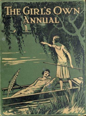
The girl's own annual : vol. 51
https://search.heritageburnaby.ca/link/museumlibrary647
- Repository
- Burnaby Village Museum
- Collection
- Special Collection
- Material Type
- Book
- Accession Code
- BV985.1317.1
- Call Number
- 820.8 GIR v.51
- Contributor
- Klickmann, Flora
- Place of Publication
- London
- Publisher
- "Leisure Hour" Office
- Publication Date
- 1930
- Printer
- Wyman & Sons Ltd.
- Physical Description
- 704 p. : ill. ; 29 cm.
- Library Subject (LOC)
- Gift books
- Girls--Great Britain
- Children's literature
- Periodicals
- Notes
- Includes index
- Volume 51
Images
![Map of proposed provincial exhibition site at Burnaby Lake, [between 1929 and 1931] thumbnail](/media/hpo/_Data/_BVM_Cartographic_Material/2017/2017_0002_0009_005.jpg?width=280)
Map of proposed provincial exhibition site at Burnaby Lake
https://search.heritageburnaby.ca/link/museumdescription8703
- Repository
- Burnaby Village Museum
- Date
- [between 1929 and 1931]
- Collection/Fonds
- Burnaby Village Museum Map collection
- Description Level
- Item
- Physical Description
- 1 map : photostat print ; 3 parts 45 x 33.7 cm totalling 45 x 101 cm
- Scope and Content
- Item consists of a tri-part folding map of a proposed Provincial Exhibition site located along the southern and western shore of Burnaby Lake. Exhibtion site on map identifies proposed locations for a golf course, pier, hydroplane landing ramp, sports ground, one-mile horse racing track and various…
- Repository
- Burnaby Village Museum
- Collection/Fonds
- Burnaby Village Museum Map collection
- Description Level
- Item
- Physical Description
- 1 map : photostat print ; 3 parts 45 x 33.7 cm totalling 45 x 101 cm
- Material Details
- Scale [1:1800]
- Scope and Content
- Item consists of a tri-part folding map of a proposed Provincial Exhibition site located along the southern and western shore of Burnaby Lake. Exhibtion site on map identifies proposed locations for a golf course, pier, hydroplane landing ramp, sports ground, one-mile horse racing track and various buildings for mechanical, agricultural and botanical displays.
- Subjects
- Exhibitions
- Accession Code
- BV017.2.9
- Access Restriction
- No restrictions
- Reproduction Restriction
- No known restrictions
- Date
- [between 1929 and 1931]
- Media Type
- Cartographic Material
- Historic Neighbourhood
- Burnaby Lake (Historic Neighbourhood)
- Planning Study Area
- Burnaby Lake Area
- Scan Resolution
- 400
- Scan Date
- 2021-11-18
- Notes
- Title based on contents of map
- Scale on map reads: "150 feet to 1 inch"
- Overall measurements when fully opened: L: 98.0 cm x H: 45.3 cm ; Individual map parts: L: 32.7 cm x H: 45.0 cm
- Commercially printed label on front of portfolio card reads "PLOWRIGHT PRINTING COMPANY / TELEPHONE N.W. 1942 / 39 McKENZIE STREET NEW WESTMINSTER, B.C. / TO: [illegible writing in pencil]" in blue ink. Red typewritten text reads: "PHOTOSTAT OF BURNABY LAKE".
Images
![Map of proposed provincial exhibition site at Burnaby Lake, [between 1929 and 1931] thumbnail](/media/hpo/_Data/_BVM_Cartographic_Material/2017/2017_0002_0009_005.jpg)


![Municipality of Burnaby - Volume XV and Volume XVIII, 1927-[1940] thumbnail](/media/hpo/_Data/_BVM_Artifacts/1972/1972_0111_0004_003.jpg?width=280)
Municipality of Burnaby - Volume XV and Volume XVIII
https://search.heritageburnaby.ca/link/museumdescription8682
- Repository
- Burnaby Village Museum
- Date
- 1927-[1940]
- Collection/Fonds
- Burnaby Village Museum Map collection
- Description Level
- File
- Physical Description
- 4 plans on 4 sheets: col. lithographic prints ; 63.5 x 53.5 cm folded to 53 x 31.5 cm
- Scope and Content
- File consists of four pages of plans removed from a bound book containing a series of fire insurance plans of the Municipality of Burnaby. Plan "1518" and "1519" are from "GREATER VANCOUVER B.C. / VOLUME XV / Municipality of Burnaby / May, 1927". Plan "1518" covers District Lot 116 and Plan "1519"…
- Repository
- Burnaby Village Museum
- Collection/Fonds
- Burnaby Village Museum Map collection
- Description Level
- File
- Physical Description
- 4 plans on 4 sheets: col. lithographic prints ; 63.5 x 53.5 cm folded to 53 x 31.5 cm
- Material Details
- Scale [1:600]
- Scope and Content
- File consists of four pages of plans removed from a bound book containing a series of fire insurance plans of the Municipality of Burnaby. Plan "1518" and "1519" are from "GREATER VANCOUVER B.C. / VOLUME XV / Municipality of Burnaby / May, 1927". Plan "1518" covers District Lot 116 and Plan "1519" covers District Lot 121. Plan "1802" and plan "1803" are from "GREATER VANCOUVER B.C. / VOLUME XVIII / Municipality of Burnaby / May, 1927". Both plans "1802" and "1803" cover District Lot 153.
- Responsibility
- British Columbia Underwriters' Association
- Accession Code
- HV972.111.4
- Access Restriction
- No restrictions
- Reproduction Restriction
- May be restricted by third party rights
- Date
- 1927-[1940]
- Media Type
- Cartographic Material
- Historic Neighbourhood
- Vancouver Heights (Historic Neighbourhood)
- Central Park (Historic Neighbourhood)
- Planning Study Area
- Willingdon Heights Area
- Marlborough Area
- Scan Resolution
- 400
- Scan Date
- 2021-11-18
- Notes
- Title based on content of plans
- See also BV987.1.70d for revised versions of plans
- Scale is measured 1 inch = 50 feet
- Contact Burnaby Village Museum to access plans 1518 and 1519 (these plans have revisions on top - date of revisions is uncertain)
Images
![Municipality of Burnaby - Volume XV and Volume XVIII, 1927-[1940] thumbnail](/media/hpo/_Data/_BVM_Artifacts/1972/1972_0111_0004_003.jpg)

![Municipality of Burnaby, [between 1910 and 1930] thumbnail](/media/hpo/_Data/_BVM_Cartographic_Material/2008/2008_0024_0001_002.jpg?width=280)
Municipality of Burnaby
https://search.heritageburnaby.ca/link/museumdescription8702
- Repository
- Burnaby Village Museum
- Date
- [between 1910 and 1930]
- Collection/Fonds
- Burnaby Village Museum Map collection
- Description Level
- Item
- Physical Description
- 1 map : blackline print with col. ; 83 x 53 cm on sheet 92 x 61 cm
- Scope and Content
- Item consists of "Municipality of Burnaby" map outlining waterlines, telephone lines, lights and power lines, and street lights. A section of the upper left corner (borded by Boundary Road to the west; Queens Ave to the east; Burrard Inlet to the north and Parker Avenue to the south) of map is han…
- Repository
- Burnaby Village Museum
- Collection/Fonds
- Burnaby Village Museum Map collection
- Description Level
- Item
- Physical Description
- 1 map : blackline print with col. ; 83 x 53 cm on sheet 92 x 61 cm
- Material Details
- Scale 10 chains = 1 inch
- Scope and Content
- Item consists of "Municipality of Burnaby" map outlining waterlines, telephone lines, lights and power lines, and street lights. A section of the upper left corner (borded by Boundary Road to the west; Queens Ave to the east; Burrard Inlet to the north and Parker Avenue to the south) of map is hand coloured in red with "Queens Avenue" and "Parker Avenue" identified.
- Creator
- Coast Map and Blue Print Co.
- Responsibility
- Municipal Council of Burnaby
- Accession Code
- BV008.24.1
- Access Restriction
- No restrictions
- Reproduction Restriction
- No known restrictions
- Date
- [between 1910 and 1930]
- Media Type
- Cartographic Material
- Scan Resolution
- 300
- Scan Date
- 2022-05-10
- Notes
- Transcribed title
- "COMPILED EXPRESSLY FOR / THE MUNICIPAL COUNCIL OF BURNABY/ BY/ THE COAST MAP AND BLUE PRINT CO/ EMPIRE BLDG VANCOUVER B.C."
Images
![Municipality of Burnaby, [between 1910 and 1930] thumbnail](/media/hpo/_Data/_BVM_Cartographic_Material/2008/2008_0024_0001_002.jpg)
![Survey and Subdivision plans in New Westminster District Group 1 – Burnaby
, [1909] thumbnail](/media/hpo/_Data/_BVM_Cartographic_Material/1977/1977_0093_0002a_001.jpg?width=280)
Survey and Subdivision plans in New Westminster District Group 1 – Burnaby
https://search.heritageburnaby.ca/link/museumdescription6972
- Repository
- Burnaby Village Museum
- Date
- [1909]
- Collection/Fonds
- Burnaby Village Museum Map collection
- Description Level
- File
- Physical Description
- 6 Plans : blueprint ink on paper + 1 black ink on paper mounted on 2 sides of cardboard 76 cm x 102 cm
- Scope and Content
- Item consists of a large board of three New Westminster District Gp 1 - subdivision plans mounted on one side and three New Westminster District Gp 1 - subdivision plans mounted on the other side with scales ranging from one chain equals one inch to four chains equals one inch. Side A: 1. Bluepri…
- Repository
- Burnaby Village Museum
- Collection/Fonds
- Burnaby Village Museum Map collection
- Description Level
- File
- Physical Description
- 6 Plans : blueprint ink on paper + 1 black ink on paper mounted on 2 sides of cardboard 76 cm x 102 cm
- Material Details
- Scales [1:792] and [1:3168]
- Index number on edge of board reads: "2"
- Scope and Content
- Item consists of a large board of three New Westminster District Gp 1 - subdivision plans mounted on one side and three New Westminster District Gp 1 - subdivision plans mounted on the other side with scales ranging from one chain equals one inch to four chains equals one inch. Side A: 1. Blueprint "Plan, / of Subdivision / of / Blocks 61, 62 and 2 / Lot 30 / Group 1 /N.W.Dist." Plan includes Fulton Street, Edmonds Street and Vancouver Road at the bottom. (Geographic location: Burnaby) 2. Blueprint "Location / for Burnaby Council / of / The West Boundary of Lots 161 & 175 / Group One". Plan includes River Road, North Arm Road, Boundary Rd. Diversion and the North Arm of the Fraser at the bottom. (Geographic location: Burnaby) 3. Blueprint "Survey / of Highway / for / Burnaby Council / Lots 13 & 14 / Group One". Plan includes Armstrong Street, Caribou [sic] Street, Caribou [sic] Road and Brunette River with Lower Dam and Upper Dam. (Geographic location: Burnaby) Side B: 1. Blueprint "Plan of Subdivision / of Lots 1, 2 and 5 / in the Subdivision of / Lot 87, Gr.1 / Also of 20 1/2 acre part / in the North-West portion of / said Lot 87, Gr.1 / New Westminster District". Plan is bordered by Lot 86 / Hastings Road, Esplanade / Burnaby Lake with Nursery Road running east west. Plan is identified as "Albert J. Hill / B.C.LotS. / 25/06/09" (Geographic location: Burnaby) 2. Blueprint "Plan / of / Subdivision of / Portion of / Lot 85, Gp.1, / New Westminster District" Plan is bordered by Douglas Road and Poleline Road and Esplanade / Burnaby Lake with Byrne Drive running through. Plan is identified as "Albert J. Hill / B.C.LotS. / 11/6/09" (Geographic location: Burnaby) 3. "Plan / of Resubdivision / of / Block VIII / In the Subdivision / of Lot 27 / Group 1 / New Westminster District" Annotation in red ink reads: "Original Subdivision Shown in Red". Plan includes an index at the top and is bordered by Block VII / Second Street, Block V. / Third Avenue, Block XI / Fourth Avenue / Block IX / First Street. (Geographic location: Burnaby)
- Creator
- Hill, Albert James
- Accession Code
- HV977.93.2
- Access Restriction
- No restrictions
- Reproduction Restriction
- No known restrictions
- Date
- [1909]
- Media Type
- Cartographic Material
- Scan Resolution
- 300
- Scale
- 72
- Notes
- Title based on contents of file
- Scale is measured in chains. (One chain equals 792 inches)
- The term "Lot" can also refer to a "District Lot”
Images
![Survey and Subdivision plans in New Westminster District Group 1 – Burnaby
, [1909] thumbnail](/media/hpo/_Data/_BVM_Cartographic_Material/1977/1977_0093_0002a_001.jpg)

![Survey and Subdivision plans in New Westminster District Group 1 – Burnaby
, [1909] thumbnail](/media/hpo/_Data/_BVM_Cartographic_Material/1977/1977_0093_0005a_001.jpg?width=280)
Survey and Subdivision plans in New Westminster District Group 1 – Burnaby
https://search.heritageburnaby.ca/link/museumdescription6974
- Repository
- Burnaby Village Museum
- Date
- [1909]
- Collection/Fonds
- Burnaby Village Museum Map collection
- Description Level
- File
- Physical Description
- 5 plans : blueprint ink on paper + 1 plan : black ink on paper mounted on 2 sides of cardboard ; 76 cm x 102 cm
- Scope and Content
- Item consists of a large board of three New Westminster District Gp 1 - subdivision plans mounted on one side and three New Westminster District Gp 1 - subdivision plans mounted on the other side. Side A: 1. Blueprint "Plan / of Subdivision of / Lot 1 and the West Half of Lot 2 / in the Subdivis…
- Repository
- Burnaby Village Museum
- Collection/Fonds
- Burnaby Village Museum Map collection
- Description Level
- File
- Physical Description
- 5 plans : blueprint ink on paper + 1 plan : black ink on paper mounted on 2 sides of cardboard ; 76 cm x 102 cm
- Material Details
- Scales [between 1:1584 and 1:3960]
- Index number on edge of board reads: "5"
- Scope and Content
- Item consists of a large board of three New Westminster District Gp 1 - subdivision plans mounted on one side and three New Westminster District Gp 1 - subdivision plans mounted on the other side. Side A: 1. Blueprint "Plan / of Subdivision of / Lot 1 and the West Half of Lot 2 / in the Subdivision of / Lot 136, 131, 44 and 78 Gr.1 / District of New Westminster , B.C." . Plan is bordered by Johnston Road, Pole Line Road, V.W.& Y. Railway and Lot 43. (Geographic location: Burnaby) 2. Blueprint "Plan / of Subdivision / of a portion / of / Lot 13, Gr.1 / New Westminster District". Plan is bordered by north east of Cariboo Street and Armstrong Street with Lillooet Street bisecting through the middle. (Geographic location: Burnaby) 3. Blueprint "Plan / of Subdivision / of / Lots 2 and 4 / Group One / New Westminster District." Plan is bordered west of North Road, north of Lot 1 and south of Lot 6. (Geographic location: Burnaby) Side B: 1. Blueprint plan of "Diversion of Gunn Road / in / Lots 10 & 4 / Group One." Plan idenfies V.W.& Y. Railway alongside proposed diversion of Gunn Road. (Geographic location: Burnaby) 2. Blueprint "Survey and Subdivision / of / Lot 12 and a portion of Lot 13 / Group One / New Westminster District." Plan ids bordered by Gunn Rd. to the north, and Cariboo Road / Lot s 10 and 14 to the east and Lot 1 to the west with V.W.& Y. Rwy and Brunette River running through diagonally. (Geographic location: Burnaby) 3. Blueprint "Plan of Subdivision / of / Lot 97, Group 1 / New Westminster District." Plan is bordered by Webster Road, Power House Road, Lot 94 and Lot 93 to the north with Jenn's Rd. running north through the centre and Vancouver & New Westminster Rd. and New Westminster Vancouver Tramway running east-west. Handwritten annotation in pencil over top of plan reads: "Cancelled" (Geographic location: Burnaby)
- Accession Code
- HV977.93.5
- Access Restriction
- No restrictions
- Reproduction Restriction
- No known restrictions
- Date
- [1909]
- Media Type
- Cartographic Material
- Scan Resolution
- 300
- Scale
- 72
- Notes
- Title based on contents of file
- Scale is measured in chains. (One chain equals 792 inches)
- The term "Lot" can also refer to a "District Lot”
Images
![Survey and Subdivision plans in New Westminster District Group 1 – Burnaby
, [1909] thumbnail](/media/hpo/_Data/_BVM_Cartographic_Material/1977/1977_0093_0005a_001.jpg)

![Municipality of Burnaby, [ca. 1909] thumbnail](/media/hpo/_Data/_BVM_Cartographic_Material/1976/1976_0158_0006_002%20WEB.jpg?width=280)
Municipality of Burnaby
https://search.heritageburnaby.ca/link/museumdescription13095
- Repository
- Burnaby Village Museum
- Date
- [ca. 1909]
- Collection/Fonds
- Burnaby Village Museum Map collection
- Description Level
- Item
- Physical Description
- 1 map : b&w lithographic print on linen, b&w ; 40 x 43.5 cm
- Scope and Content
- Map of the Municipality of Burnaby issued by Mahon, McFarland and Mahon (Real Estate, Insurance and Loans, Vancouver B.C.). A handrawn red line runs south of Burnaby Lake and between North Road and Boundary Road.
- Repository
- Burnaby Village Museum
- Collection/Fonds
- Burnaby Village Museum Map collection
- Description Level
- Item
- Physical Description
- 1 map : b&w lithographic print on linen, b&w ; 40 x 43.5 cm
- Scope and Content
- Map of the Municipality of Burnaby issued by Mahon, McFarland and Mahon (Real Estate, Insurance and Loans, Vancouver B.C.). A handrawn red line runs south of Burnaby Lake and between North Road and Boundary Road.
- Creator
- Mahon, McFarland & Mahon
- Publisher
- The Angel Engraving Co.
- Accession Code
- HV976.158.6
- Access Restriction
- No restrictions
- Reproduction Restriction
- No known restrictions
- Date
- [ca. 1909]
- Media Type
- Cartographic Material
- Scan Resolution
- 420
- Scan Date
- Dec. 22, 2020
- Scale
- 100
- Notes
- Title based on content of map
- Title on map reads: "Map / of The / Municipality / of / BURNABY / ISSUED BY / Mahon, McFarland & Mahon"
- Map contains the initals "F.R.G." [sic]
- Circular insignia in left corner reads: "THE ANGEL ENGRAVING CO."
Zoomable Images
![Municipality of Burnaby, [ca. 1909] thumbnail](/media/hpo/_Data/_BVM_Cartographic_Material/1976/1976_0158_0006_001_seadragon/1976_0158_0006_001.jpg?w=280)
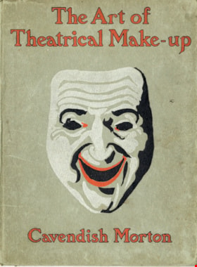
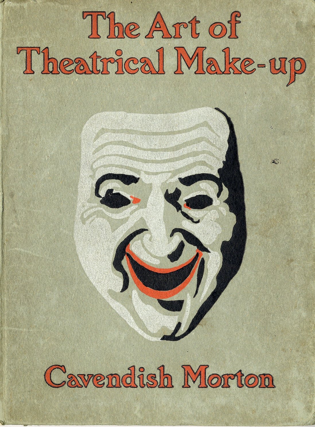
The art of theatrical make-up
https://search.heritageburnaby.ca/link/museumlibrary419
- Repository
- Burnaby Village Museum
- Author
- Morton, Cavendish, 1911-
- Publication Date
- 1909
- Call Number
- 792.02 CAV
- Repository
- Burnaby Village Museum
- Collection
- Special Collection
- Material Type
- Book
- Accession Code
- BV988.44.195
- Call Number
- 792.02 CAV
- Author
- Morton, Cavendish, 1911-
- Place of Publication
- London
- Publisher
- Adam and Charles Black
- Publication Date
- 1909
- Printer
- Ballantyne
- Physical Description
- 137 p. : ill. ; 25 cm.
- Inscription
- Front endpaper: "C.J Caunt" [written in pencil] Back endpaper: "mnh" [written in pencil] "200" [written in pencil] "G.S. Forsyth & Co Vancouver, B.C." [stamped in purple ink]
- Library Subject (LOC)
- Theatrical makeup
- Notes
- "Illustrated with thirty-two reproductions from photographs of the author by himself" -- t.p.
Images