Corner view of Love farmhouse
https://search.heritageburnaby.ca/link/museumdescription9919
- Repository
- Burnaby Village Museum
- Date
- [between 1966 and 1970]
- Collection/Fonds
- Love family fonds
- Description Level
- Item
- Physical Description
- 1 photograph : col. ; 10 x 15 cm print
- Scope and Content
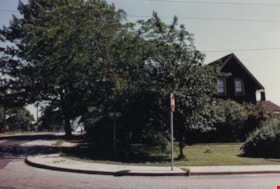
- Photograph of the exterior of the Love farmhouse taken at the corner of Fourteenth Avenue and Cumberland Street. The house is hidden behind large trees at it's orignal address of 7651 Cumberland Street (Address pre 1960: 1390 Cumberland Road). This photograph was taken while Elsie Hughes (nee Love)…
- Repository
- Burnaby Village Museum
- Collection/Fonds
- Love family fonds
- Description Level
- Item
- Physical Description
- 1 photograph : col. ; 10 x 15 cm print
- Material Details
- Copy print was made from re-photographing an original colour slide
- Scope and Content
- Photograph of the exterior of the Love farmhouse taken at the corner of Fourteenth Avenue and Cumberland Street. The house is hidden behind large trees at it's orignal address of 7651 Cumberland Street (Address pre 1960: 1390 Cumberland Road). This photograph was taken while Elsie Hughes (nee Love), her husband John Hughes and son Brent Hughes lived in the house. Elsie is the daughter of Sarah (nee Love) and William Parker. Sarah and William purchased the house in 1928, shortly after the death of Sarah's father, Jesse Love. Sarah and William Parker lived in the house with their three children, Albert, Bill and Elsie. William Parker died in 1961 and Sarah continued to live in the house until 1966 before selling it to her daughter Elsie and son in law John Hughes. Elsie and John lived in the house with their son Brent until 1971.
- Subjects
- Buildings - Heritage
- Geographic Access
- 14th Avenue
- Cumberland Street
- Street Address
- 7651 Cumberland Street
- Accession Code
- BV019.3.5
- Access Restriction
- No restrictions
- Reproduction Restriction
- No known restrictions
- Date
- [between 1966 and 1970]
- Media Type
- Photograph
- Historic Neighbourhood
- East Burnaby (Historic Neighbourhood)
- Planning Study Area
- Cariboo-Armstrong Area
- Scan Resolution
- 600
- Scan Date
- 31-Jan-2019
- Scale
- 96
- Photographer
- Parker, Albert "Bert"
- Notes
- Title based on contents of photograph
- See also BV992.15.12
Images
Corner view of Love farmhouse
https://search.heritageburnaby.ca/link/museumdescription9920
- Repository
- Burnaby Village Museum
- Date
- [between 1966 and 1970]
- Collection/Fonds
- Love family fonds
- Description Level
- Item
- Physical Description
- 1 photograph : col. ; 10 x 15 cm print
- Scope and Content
- Photograph of the exterior of the Love farmhouse taken at the corner of Fourteenth Avenue and Cumberland Street. The north side of the house and kitchen are in view with large trees covering the front of the house at it's orignal address of 7651 Cumberland Street (Address pre 1960: 1390 Cumberland …
- Repository
- Burnaby Village Museum
- Collection/Fonds
- Love family fonds
- Description Level
- Item
- Physical Description
- 1 photograph : col. ; 10 x 15 cm print
- Material Details
- Copy print was made from re-photographing an original colour slide
- Scope and Content
- Photograph of the exterior of the Love farmhouse taken at the corner of Fourteenth Avenue and Cumberland Street. The north side of the house and kitchen are in view with large trees covering the front of the house at it's orignal address of 7651 Cumberland Street (Address pre 1960: 1390 Cumberland Road). This photograph was taken while Elsie Hughes (nee Love), her husband John Hughes and son Brent Hughes lived in the house. Elsie is the daughter of Sarah (nee Love) and William Parker. Sarah and William purchased the house in 1928, shortly after the death of Sarah's father, Jesse Love. Sarah and William Parker lived in the house with their three children, Albert, Bill and Elsie. William Parker died in 1961 and Sarah continued to live in the house until 1966 before selling it to her daughter Elsie and son in law John Hughes. Elsie and John lived in the house with their son Brent until 1971.
- Subjects
- Buildings - Heritage
- Geographic Access
- 14th Avenue
- Cumberland Street
- Street Address
- 7651 Cumberland Street
- Accession Code
- BV019.3.6
- Access Restriction
- No restrictions
- Reproduction Restriction
- No known restrictions
- Date
- [between 1966 and 1970]
- Media Type
- Photograph
- Historic Neighbourhood
- East Burnaby (Historic Neighbourhood)
- Planning Study Area
- Cariboo-Armstrong Area
- Scan Resolution
- 600
- Scan Date
- 31-Jan-2019
- Scale
- 96
- Photographer
- Parker, Albert "Bert"
- Notes
- Title based on contents of photograph
- See also BV992.15.12
Images
COVID-19 sign in Conderation Park
https://search.heritageburnaby.ca/link/museumdescription15363
- Repository
- Burnaby Village Museum
- Date
- 6 May 2020
- Collection/Fonds
- Burnaby Village Museum COVID-19 collection
- Description Level
- Item
- Physical Description
- 1 photograph (jpg)
- Scope and Content
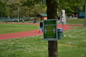
- Photograph of a City of Burnaby COVID-19 sign in Confederation Park. Sign is attached to a tree near the running track and reads: "Do your part, Stay Apart..." and includes an illustration of two figures standing two metres apart. People are walking and running on the track and the tennis and baske…
- Repository
- Burnaby Village Museum
- Collection/Fonds
- Burnaby Village Museum COVID-19 collection
- Description Level
- Item
- Physical Description
- 1 photograph (jpg)
- Scope and Content
- Photograph of a City of Burnaby COVID-19 sign in Confederation Park. Sign is attached to a tree near the running track and reads: "Do your part, Stay Apart..." and includes an illustration of two figures standing two metres apart. People are walking and running on the track and the tennis and basketball courts are visible in the distance.
- Geographic Access
- Albert Street
- Confederation Park
- Accession Code
- BV021.2.25
- Access Restriction
- No restrictions
- Reproduction Restriction
- May be restricted by third party rights
- Date
- 6 May 2020
- Media Type
- Photograph
- Planning Study Area
- Sperling-Broadway Area
- Notes
- Title based on contents of photograph
Images
Exterior of Love farmhouse
https://search.heritageburnaby.ca/link/museumdescription1131
- Repository
- Burnaby Village Museum
- Date
- 1971 (date of original), copied 1990
- Collection/Fonds
- Love family fonds
- Description Level
- Item
- Physical Description
- 1 photograph : col. ; 10 x 15 cm print
- Scope and Content
- Photograph of the exterior of the Love farmhouse taken from the corner of Fourteenth Avenue and Cumberland Street while Elsie (nee Love) Hughes, her husband John and son Brent lived in the house. The house was located at 7651 Cumberland Street (Address pre 1960: 1390 Cumberland Road) and was moved …
- Repository
- Burnaby Village Museum
- Collection/Fonds
- Love family fonds
- Description Level
- Item
- Physical Description
- 1 photograph : col. ; 10 x 15 cm print
- Material Details
- Copy print was made from re-photographing an original colour slide
- Scope and Content
- Photograph of the exterior of the Love farmhouse taken from the corner of Fourteenth Avenue and Cumberland Street while Elsie (nee Love) Hughes, her husband John and son Brent lived in the house. The house was located at 7651 Cumberland Street (Address pre 1960: 1390 Cumberland Road) and was moved from its original site to the Burnaby Village Museum in 1988 and designated a Municipal Heritage Landmark in 1992.
- Geographic Access
- Cumberland Street
- 14th Avenue
- Street Address
- 7651 Cumberland Street
- Accession Code
- BV992.15.12
- Access Restriction
- Restricted access
- Reproduction Restriction
- May be restricted by third party rights
- Date
- 1971 (date of original), copied 1990
- Media Type
- Photograph
- Historic Neighbourhood
- East Burnaby (Historic Neighbourhood)
- Planning Study Area
- Cariboo-Armstrong Area
- Scan Resolution
- 600
- Scan Date
- 01-Jun-09
- Scale
- 100
- Photographer
- Parker, Albert "Bert"
- Notes
- Title based on contents of photograph
Images
Facility closure sign in Conderation Park
https://search.heritageburnaby.ca/link/museumdescription15362
- Repository
- Burnaby Village Museum
- Date
- 6 May 2020
- Collection/Fonds
- Burnaby Village Museum COVID-19 collection
- Description Level
- Item
- Physical Description
- 1 photograph (jpg)
- Scope and Content
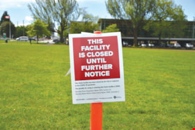
- Photograph of a City of Burnaby facility closure sign at Confederation Park. Sign is attached to a pole in the park and reads: "This Facility is closed until further notice". The McGill Library and City of Burnaby Archives building are visible to the north.
- Repository
- Burnaby Village Museum
- Collection/Fonds
- Burnaby Village Museum COVID-19 collection
- Description Level
- Item
- Physical Description
- 1 photograph (jpg)
- Scope and Content
- Photograph of a City of Burnaby facility closure sign at Confederation Park. Sign is attached to a pole in the park and reads: "This Facility is closed until further notice". The McGill Library and City of Burnaby Archives building are visible to the north.
- Geographic Access
- Albert Street
- Confederation Park
- Accession Code
- BV021.2.26
- Access Restriction
- No restrictions
- Reproduction Restriction
- May be restricted by third party rights
- Date
- 6 May 2020
- Media Type
- Photograph
- Planning Study Area
- Sperling-Broadway Area
- Notes
- Title based on contents of photograph
Images
Quittenbaum family home
https://search.heritageburnaby.ca/link/museumdescription227
- Repository
- Burnaby Village Museum
- Date
- [1915]
- Collection/Fonds
- Burnaby Village Museum Photograph collection
- Description Level
- Item
- Physical Description
- 1 photograph : b&w ; 19.5 x 24 cm, mounted on card 26.5 x 31.5 cm
- Scope and Content
- Photograph of members of the Quittenbaum family standing on their front porch at 3586 Albert Street in Vancouver. Included in the photograph are Hans Emil Quittebaum and his two daughters, Clara and Frieda. The house was built by Hans Emil Quittenbaum with lumber from Fraser Mills in New Westminste…
- Repository
- Burnaby Village Museum
- Collection/Fonds
- Burnaby Village Museum Photograph collection
- Description Level
- Item
- Physical Description
- 1 photograph : b&w ; 19.5 x 24 cm, mounted on card 26.5 x 31.5 cm
- Scope and Content
- Photograph of members of the Quittenbaum family standing on their front porch at 3586 Albert Street in Vancouver. Included in the photograph are Hans Emil Quittebaum and his two daughters, Clara and Frieda. The house was built by Hans Emil Quittenbaum with lumber from Fraser Mills in New Westminster and the family lived there for two or three years.
- Subjects
- Buildings - Residential - Houses
- Geographic Access
- Albert Street
- Accession Code
- BV985.2551.1
- Access Restriction
- No restrictions
- Date
- [1915]
- Media Type
- Photograph
- Scan Resolution
- 600
- Scan Date
- 1/8/2010
- Scale
- 100
- Notes
- Title based on contents of photograph
- Notes on verso of photograph read: "Home of Mr. Hans Quittenbaum / My father, Mother / Albert Street / Sister Clara + Frieda / Now 6507 Silver Avenue S. Burnaby / Came to North Burnaby 1915" and "Vancouver no. 3586" and "Return to From Mrs. G. Rienzer 5591 Oakland Street S. Burnaby 1 BC 4357315 / John + Mary Steele of 118 N. Boundary + Box 93 Gibsons lived here from 1923 - 1929 (from Winnipeg)"
![Corner view of Love farmhouse, [between 1966 and 1970] thumbnail](/media/hpo/_Data/_BVM_Images/2019/2019_0003_0005_001.jpg?width=280)
![Corner view of Love farmhouse, [between 1966 and 1970] thumbnail](/media/hpo/_Data/_BVM_Images/2019/2019_0003_0006_001.jpg?width=280)


![Quittenbaum family home, [1915] thumbnail](/media/hpo/_Data/_BVM_Images/1985/198525510001.jpg?width=280)