Narrow Results By
Creator
- Bekins Moving and Storage Company Limited 1
- British Columbia Underwriters' Association 2
- Burnett and McGugan B.C. Land Surveyors, New Westminster 5
- Burnett, Geoffrey K. 1
- Burnett & McGugan, Engineers and Surveyors 5
- City Map and White Print Co. 1
- Dominion Map and Blueprint Co. 1
- Geoffrey K. Burnett 1
- Government of British Columbia - Department of Lands and Works 1
- Government of British Columbia - Department of Mines and Resources 1
- Hill & Burnett 2
- Leibly & Blumer Realty Co. Incorporated 1
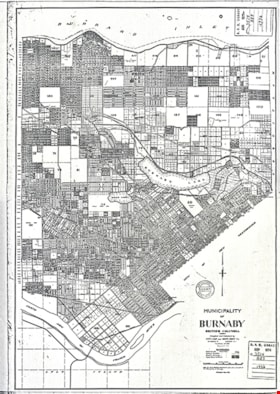
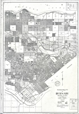
Municipality of Burnaby
https://search.heritageburnaby.ca/link/museumdescription13096
- Repository
- Burnaby Village Museum
- Date
- 1936
- Collection/Fonds
- Burnaby Village Museum Map collection
- Description Level
- Item
- Physical Description
- 1 map : b&w print on paper ; 59 x 43 cm
- Scope and Content
- Map of the Municipality of Burnaby compiled and published by City Map and White Print Co.
- Repository
- Burnaby Village Museum
- Collection/Fonds
- Burnaby Village Museum Map collection
- Description Level
- Item
- Physical Description
- 1 map : b&w print on paper ; 59 x 43 cm
- Scope and Content
- Map of the Municipality of Burnaby compiled and published by City Map and White Print Co.
- Creator
- City Map and White Print Co.
- Publisher
- City Map and White Print Co.
- Accession Code
- HV976.158.7
- Access Restriction
- No restrictions
- Reproduction Restriction
- No known restrictions
- Date
- 1936
- Media Type
- Cartographic Material
- Scan Resolution
- 600
- Scan Date
- 2022-04-06
- Scale
- 100
- Notes
- Title based on content of map
- Title on map reads: "MUNICIPALITY / OF / BURNABY / BRITISH COLUMBIA / Compiled and Published by / CITY MAP AND WHITE PRINT CO."
- Stamp on map reads: "SFU LIBRARY / SEP 1974 / G. 3514 / B87 / 1936"
- Stamp on map reads: "SFU LIBRARY / AUG 1973 / G. 3514 / B87 / 1936"
- Cirular seal stamp on map reads: "The University of / Library / British Columbia"
Zoomable Images
Map of the Municipality of Burnaby
https://search.heritageburnaby.ca/link/museumdescription14766
- Repository
- Burnaby Village Museum
- Date
- [ca.1913]
- Collection/Fonds
- Burnaby Village Museum Map collection
- Description Level
- Item
- Physical Description
- 1 map : lithographic print, b&w ; 82 x 62 cm
- Scope and Content
- Item is a map of the Municipality of Burnaby, "Published by Archibald Moir and Company, 570 Granville St., Vancouver". Map was published compliments of "Walker Brothers Real Estate Brokers and Insurance Agents", Vancouver.
- Repository
- Burnaby Village Museum
- Collection/Fonds
- Burnaby Village Museum Map collection
- Description Level
- Item
- Physical Description
- 1 map : lithographic print, b&w ; 82 x 62 cm
- Material Details
- Scale 1 inch = 1000 feet
- Scope and Content
- Item is a map of the Municipality of Burnaby, "Published by Archibald Moir and Company, 570 Granville St., Vancouver". Map was published compliments of "Walker Brothers Real Estate Brokers and Insurance Agents", Vancouver.
- Publisher
- Archibald Moir and Company
- Responsibility
- Walker Brothers Real Estate Brokers and Insurance Agents
- Accession Code
- BV988.56.1
- Access Restriction
- No restrictions
- Reproduction Restriction
- No known restrictions
- Date
- [ca.1913]
- Media Type
- Cartographic Material
- Scan Resolution
- 350
- Scan Date
- Dec. 22,2020
- Scale
- 100
- Notes
- Title based on contents of map
Zoomable Images
Fire insurance key plan - Greater Vancouver - Volume XVI - Municipality of Burnaby
https://search.heritageburnaby.ca/link/museumdescription17796
- Repository
- Burnaby Village Museum
- Date
- 1927
- Collection/Fonds
- Burnaby Village Museum Map collection
- Description Level
- Item
- Physical Description
- 2 plans on 2 sheets: col. lithographic print ; 64 x 54 cm
- Scope and Content
- Item consists of a two page fire insurance key plan titled "Greater Vancouver / Volume XVI / Municipality / of Burnaby / Key Plan" surveyed May 1927. Volume XVI includes a two page Key Plan (C and D). .
- Repository
- Burnaby Village Museum
- Collection/Fonds
- Burnaby Village Museum Map collection
- Description Level
- Item
- Physical Description
- 2 plans on 2 sheets: col. lithographic print ; 64 x 54 cm
- Scope and Content
- Item consists of a two page fire insurance key plan titled "Greater Vancouver / Volume XVI / Municipality / of Burnaby / Key Plan" surveyed May 1927. Volume XVI includes a two page Key Plan (C and D). .
- Publisher
- Plan Department of Fire Branch of British Columbia Underwriters Association
- Accession Code
- BV987.1.70
- Access Restriction
- No restrictions
- Reproduction Restriction
- May be restricted by third party rights
- Date
- 1927
- Media Type
- Cartographic Material
- Scan Resolution
- 400
- Scan Date
- 11/17/2021
- Notes
- Title based on contents of item
- Item "GREATER VANCOUVER / VOLUME XVI / MUNICIPALITY OF / BURNABY / KEY PLAN" does not include associated numbered plans (1601 to 1651)
- These plans were removed from a bound book with labels on cover page reading: "Plan No. 90 / THIS INSURANCE PLAN / of / Vancouver VOLUME "8" / IN THE PROPERTY OF THE / British Columbia Insurance Underwriter's Association / Vancouver B.C. / AND IS LOANED / MELVILLE F. THOMSON CO. .../ Date May 26th, 1934"; / "Plan No. 74 / THIS INSURANCE PLAN / OF / VANCOUVER VOLUME "9"" / Plan No. 11 / THIS INSURANCE PLAN / OF / BURNABY VOLUMES 15-19" / "THIS PLAN IS THE PROPERTY OF / THE / BRITISH LAW INSURANCE COMPANY / LIMITED"
Zoomable Images

Fire insurance key plan - Greater Vancouver - Volume XVI - Municipality of Burnaby, 1927
Zoom into ImageFire insurance key plan - Greater Vancouver - Volume XIX - Municipality of Burnaby
https://search.heritageburnaby.ca/link/museumdescription17799
- Repository
- Burnaby Village Museum
- Date
- 1927
- Collection/Fonds
- Burnaby Village Museum Map collection
- Description Level
- Item
- Physical Description
- 1 plan on 1 sheet : col. lithographic print ; 64 x 54 cm
- Scope and Content
- Item consists of a one page fire insurance key plan titled "Greater Vancouver / Volume XIX / Municipality / of Burnaby / Key Plan" surveyed May 1927. Key plan from compilation, "Insurance Plans of Greater Vancouver Plan No. 11, Volumes 15 to 19 Burnaby".
- Repository
- Burnaby Village Museum
- Collection/Fonds
- Burnaby Village Museum Map collection
- Description Level
- Item
- Physical Description
- 1 plan on 1 sheet : col. lithographic print ; 64 x 54 cm
- Material Details
- Scale [1:6000]
- Scope and Content
- Item consists of a one page fire insurance key plan titled "Greater Vancouver / Volume XIX / Municipality / of Burnaby / Key Plan" surveyed May 1927. Key plan from compilation, "Insurance Plans of Greater Vancouver Plan No. 11, Volumes 15 to 19 Burnaby".
- Publisher
- Plan Department of Fire Branch of British Columbia Underwriters' Association
- Accession Code
- BV987.1.70
- Access Restriction
- No restrictions
- Reproduction Restriction
- May be restricted by third party rights
- Date
- 1927
- Media Type
- Cartographic Material
- Historic Neighbourhood
- Fraser Arm (Historic Neighbourhood)
- Planning Study Area
- Big Bend Area
- Scan Resolution
- 400
- Scan Date
- 2021-11-17
- Notes
- Title based on contents of item
- Scale 500 feet = 1 inch
- These plans were removed from a bound book with labels on cover page reading: "Plan No. 90 / THIS INSURANCE PLAN / of / Vancouver VOLUME "8" / IN THE PROPERTY OF THE / British Columbia Insurance Underwriter's Association / Vancouver B.C. / AND IS LOANED / MELVILLE F. THOMSON CO. .../ Date May 26th, 1934"; / "Plan No. 74 / THIS INSURANCE PLAN / OF / VANCOUVER VOLUME "9"" / Plan No. 11 / THIS INSURANCE PLAN / OF / BURNABY VOLUMES 15-19" / "THIS PLAN IS THE PROPERTY OF / THE / BRITISH LAW INSURANCE COMPANY / LIMITED"
- Does not include the corresponding key plan page or associated plans numbered 1901 to 1914
- Contact Burnaby Village Museum to view associated fire insurance plans
Zoomable Images

Fire insurance key plan - Greater Vancouver - Volume XIX - Municipality of Burnaby, 1927
Zoom into ImageSketch map of the Province of British Columbia showing mining divisions
https://search.heritageburnaby.ca/link/museumdescription18946
- Repository
- Burnaby Village Museum
- Date
- 1907
- Collection/Fonds
- Burnaby Village Museum Map collection
- Description Level
- Item
- Physical Description
- 1 map : col. lithographic print on paper ; 52 x 59 cm
- Scope and Content
- Item consists of a map titled "Sketch map of the Province of / British Columbia / Showing Mining Divisions"; "Department of Mines, / Victoria, 1907". Map includes wagon roads and trails and geographic disticts.
- Repository
- Burnaby Village Museum
- Collection/Fonds
- Burnaby Village Museum Map collection
- Description Level
- Item
- Physical Description
- 1 map : col. lithographic print on paper ; 52 x 59 cm
- Material Details
- Scale not determinable
- Scope and Content
- Item consists of a map titled "Sketch map of the Province of / British Columbia / Showing Mining Divisions"; "Department of Mines, / Victoria, 1907". Map includes wagon roads and trails and geographic disticts.
- Accession Code
- HV977.37.172
- Access Restriction
- No restrictions
- Reproduction Restriction
- No known restrictions
- Date
- 1907
- Media Type
- Cartographic Material
- Scan Resolution
- 600
- Scan Date
- 2023-08-17
- Notes
- Title based on contents of map
- Stamp on verso of map reads: "Compliments of Vancouver Tourist Bureau"


![Map of the Municipality of Burnaby, [ca.1913] thumbnail](/media/hpo/_Data/_BVM_Cartographic_Material/1988/1988_0056_0001_002%20WEB.jpg?width=280)
![Map of the Municipality of Burnaby, [ca.1913] thumbnail](/media/hpo/_Data/_BVM_Cartographic_Material/1988/1988_0056_0001_001_seadragon/1988_0056_0001_001.jpg?w=280)


