Narrow Results By
Decade
- 2020s 217
- 2010s
- 2000s
- 1990s 2711
- 1980s 1276
- 1970s 3378
- 1960s 1234
- 1950s 1542
- 1940s 2042
- 1930s 2065
- 1920s 2342
- 1910s 1980
- 1900s 786
- 1890s 220
- 1880s 158
- 1870s 70
- 1860s 118
- 1850s 13
- 1840s 5
- 1830s 2
- 1820s 2
- 1810s 3
- 1800s 3
- 1790s 2
- 1780s 2
- 1770s 2
- 1760s 2
- 1750s 2
- 1740s 2
- 1730s 2
- 1720s 2
- 1710s 2
- 1700s 2
- 1690s 2
- 1680s 2
- 1670s 1
- 1660s 1
- 1650s 1
- 1640s 1
- 1630s 1
- 1620s 1
- 1610s 1
- 1600s 1
- 1590s 1
- 1580s 1
- 1570s 1
- 1560s 1
- 1550s 1
- 1540s 1
- 1530s 1
- 1520s 2
- 1510s 1
- 1500s 1
- 1490s 1
- 1480s 1
Subject
- Accidents 1
- Accidents - Automobile Accidents 6
- Adornment - Lapel Pins 1
- Advertising Medium 1
- Advertising Medium - Signs and Signboards 9
- Agricultural Tools and Equipment - Gardening Equipment 1
- Agriculture 2
- Agriculture - Farms 6
- Agriculture - Fruit and Berries 1
- Animals - Birds 2
- Animals - Cats 1
- Animals - Dogs 14
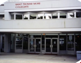
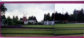
Saint Thomas More Collegiate
https://search.heritageburnaby.ca/link/archivedescription78775
- Repository
- City of Burnaby Archives
- Date
- 2001 (date of original); 2013 (date of duplication)
- Collection/Fonds
- Walker family fonds
- Description Level
- Item
- Physical Description
- 1 photograph (jpeg) : col. ; 96 dpi
- Scope and Content
- Photograph of Saint Thomas More Collegiate.
- Repository
- City of Burnaby Archives
- Date
- 2001 (date of original); 2013 (date of duplication)
- Collection/Fonds
- Walker family fonds
- Physical Description
- 1 photograph (jpeg) : col. ; 96 dpi
- Description Level
- Item
- Record No.
- 557-026
- Access Restriction
- No restrictions
- Reproduction Restriction
- No restrictions
- Accession Number
- 2013-15
- Scope and Content
- Photograph of Saint Thomas More Collegiate.
- Subjects
- Buildings - Schools
- Media Type
- Photograph
- Notes
- Title based on contents of photograph
- Street Address
- 7450 12th Avenue
- Historic Neighbourhood
- Edmonds (Historic Neighbourhood)
- Planning Study Area
- Edmonds Area
Images

Saint Thomas More Collegiate
https://search.heritageburnaby.ca/link/archivedescription78776
- Repository
- City of Burnaby Archives
- Date
- 2001 (date of original); 2013 (date of duplication)
- Collection/Fonds
- Walker family fonds
- Description Level
- Item
- Physical Description
- 1 photograph (jpeg) : col. ; 300 dpi
- Scope and Content
- Photograph of Saint Thomas More Collegiate.
- Repository
- City of Burnaby Archives
- Date
- 2001 (date of original); 2013 (date of duplication)
- Collection/Fonds
- Walker family fonds
- Physical Description
- 1 photograph (jpeg) : col. ; 300 dpi
- Description Level
- Item
- Record No.
- 557-027
- Access Restriction
- No restrictions
- Reproduction Restriction
- No restrictions
- Accession Number
- 2013-15
- Scope and Content
- Photograph of Saint Thomas More Collegiate.
- Subjects
- Buildings - Schools
- Media Type
- Photograph
- Notes
- Title based on contents of photograph
- Street Address
- 7450 12th Avenue
- Historic Neighbourhood
- Edmonds (Historic Neighbourhood)
- Planning Study Area
- Edmonds Area
Images

Saint Thomas More Collegiate
https://search.heritageburnaby.ca/link/archivedescription78778
- Repository
- City of Burnaby Archives
- Date
- 2001 (date of original); 2013 (date of duplication)
- Collection/Fonds
- Walker family fonds
- Description Level
- Item
- Physical Description
- 1 photograph (jpeg) : col. ; 300 dpi
- Scope and Content
- Photograph of Saint Thomas More Collegiate.
- Repository
- City of Burnaby Archives
- Date
- 2001 (date of original); 2013 (date of duplication)
- Collection/Fonds
- Walker family fonds
- Physical Description
- 1 photograph (jpeg) : col. ; 300 dpi
- Description Level
- Item
- Record No.
- 557-028
- Access Restriction
- No restrictions
- Reproduction Restriction
- No known restrictions
- Accession Number
- 2013-15
- Scope and Content
- Photograph of Saint Thomas More Collegiate.
- Subjects
- Buildings - Schools
- Media Type
- Photograph
- Notes
- Title based on contents of photograph
- Street Address
- 7450 12th Avenue
- Historic Neighbourhood
- Edmonds (Historic Neighbourhood)
- Planning Study Area
- Edmonds Area
Images

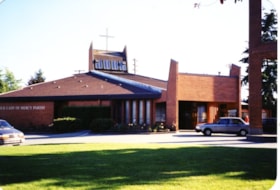
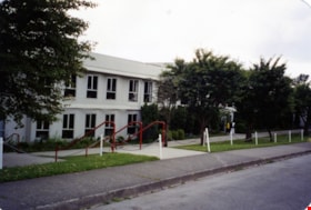
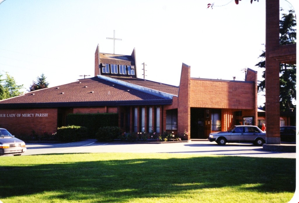
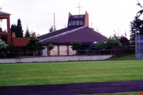
Our Lady of Mercy Parish
https://search.heritageburnaby.ca/link/archivedescription78779
- Repository
- City of Burnaby Archives
- Date
- 2001 (date of original); 2013 (date of duplication)
- Collection/Fonds
- Walker family fonds
- Description Level
- Item
- Physical Description
- 1 photograph (jpeg) : col. ; 96 dpi
- Scope and Content
- Photograph of Our Lady of Mercy Parish.
- Repository
- City of Burnaby Archives
- Date
- 2001 (date of original); 2013 (date of duplication)
- Collection/Fonds
- Walker family fonds
- Physical Description
- 1 photograph (jpeg) : col. ; 96 dpi
- Description Level
- Item
- Record No.
- 557-029
- Access Restriction
- No restrictions
- Reproduction Restriction
- No known restrictions
- Accession Number
- 2013-15
- Scope and Content
- Photograph of Our Lady of Mercy Parish.
- Subjects
- Buildings - Religious - Churches
- Media Type
- Photograph
- Notes
- Title based on contents of photograph
- Street Address
- 7455 10th Avenue
- Historic Neighbourhood
- Edmonds (Historic Neighbourhood)
- Planning Study Area
- Edmonds Area
Images
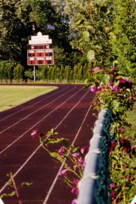
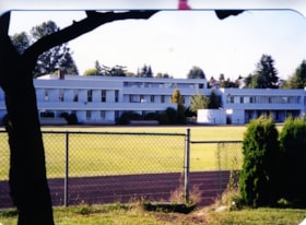
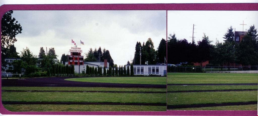
Running track at Saint Thomas More Collegiate
https://search.heritageburnaby.ca/link/archivedescription78780
- Repository
- City of Burnaby Archives
- Date
- 2001 (date of original); 2013 (date of duplication)
- Collection/Fonds
- Walker family fonds
- Description Level
- Item
- Physical Description
- 1 photograph (jpeg) : col. ; 96 dpi
- Scope and Content
- Photograph of the running track at Saint Thomas More Collegiate.
- Repository
- City of Burnaby Archives
- Date
- 2001 (date of original); 2013 (date of duplication)
- Collection/Fonds
- Walker family fonds
- Physical Description
- 1 photograph (jpeg) : col. ; 96 dpi
- Description Level
- Item
- Record No.
- 557-030
- Access Restriction
- No restrictions
- Reproduction Restriction
- No known restrictions
- Accession Number
- 2013-15
- Scope and Content
- Photograph of the running track at Saint Thomas More Collegiate.
- Media Type
- Photograph
- Notes
- Title based on contents of photograph
- Street Address
- 7450 12th Avenue
- Historic Neighbourhood
- Edmonds (Historic Neighbourhood)
- Planning Study Area
- Edmonds Area
Images

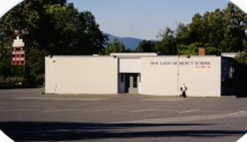
Our Lady of Mercy School
https://search.heritageburnaby.ca/link/archivedescription78781
- Repository
- City of Burnaby Archives
- Date
- 2001 (date of original); 2013 (date of duplication)
- Collection/Fonds
- Walker family fonds
- Description Level
- Item
- Physical Description
- 1 photograph (jpeg) : col. ; 96 dpi
- Scope and Content
- Photograph of Our Lady of Mercy School.
- Repository
- City of Burnaby Archives
- Date
- 2001 (date of original); 2013 (date of duplication)
- Collection/Fonds
- Walker family fonds
- Physical Description
- 1 photograph (jpeg) : col. ; 96 dpi
- Description Level
- Item
- Record No.
- 557-031
- Access Restriction
- No restrictions
- Reproduction Restriction
- No restrictions
- Accession Number
- 2013-15
- Scope and Content
- Photograph of Our Lady of Mercy School.
- Subjects
- Buildings - Schools
- Media Type
- Photograph
- Notes
- Title based on contents of photograph
- Street Address
- 7481 12th Avenue
- Historic Neighbourhood
- Edmonds (Historic Neighbourhood)
- Planning Study Area
- Edmonds Area
Images

Running track at Saint Thomas More Collegiate
https://search.heritageburnaby.ca/link/archivedescription78786
- Repository
- City of Burnaby Archives
- Date
- 2001 (date of original); 2013 (date of annotation)
- Collection/Fonds
- Walker family fonds
- Description Level
- Item
- Physical Description
- 1 photograph (jpeg) : col. ; 300 dpi
- Scope and Content
- Photograph of the running track at Saint Thomas More Collegiate with the school visible in the background.
- Repository
- City of Burnaby Archives
- Date
- 2001 (date of original); 2013 (date of annotation)
- Collection/Fonds
- Walker family fonds
- Physical Description
- 1 photograph (jpeg) : col. ; 300 dpi
- Description Level
- Item
- Record No.
- 557-036
- Access Restriction
- No restrictions
- Reproduction Restriction
- No known restrictions
- Accession Number
- 2013-15
- Scope and Content
- Photograph of the running track at Saint Thomas More Collegiate with the school visible in the background.
- Subjects
- Buildings - Schools
- Media Type
- Photograph
- Notes
- Title based on contents of photograph
- Street Address
- 7450 12th Avenue
- Historic Neighbourhood
- Edmonds (Historic Neighbourhood)
- Planning Study Area
- Edmonds Area
Images
Our Lady of Mercy Parish
https://search.heritageburnaby.ca/link/archivedescription78787
- Repository
- City of Burnaby Archives
- Date
- 2001 (date of original); 2013 (date of annotation)
- Collection/Fonds
- Walker family fonds
- Description Level
- Item
- Physical Description
- 1 photograph (jpeg) : col. ; 96 dpi
- Scope and Content
- Photograph of Our Lady of Mercy Parish.
- Repository
- City of Burnaby Archives
- Date
- 2001 (date of original); 2013 (date of annotation)
- Collection/Fonds
- Walker family fonds
- Physical Description
- 1 photograph (jpeg) : col. ; 96 dpi
- Description Level
- Item
- Record No.
- 557-037
- Access Restriction
- No restrictions
- Reproduction Restriction
- No known restrictions
- Accession Number
- 2013-15
- Scope and Content
- Photograph of Our Lady of Mercy Parish.
- Subjects
- Buildings - Religious - Churches
- Media Type
- Photograph
- Notes
- Title based on contents of photograph
- Street Address
- 7455 10th Avenue
- Historic Neighbourhood
- Edmonds (Historic Neighbourhood)
- Planning Study Area
- Edmonds Area
Images


Running track at Saint Thomas More Collegiate
https://search.heritageburnaby.ca/link/archivedescription78788
- Repository
- City of Burnaby Archives
- Date
- 2001 (date of original); 2013 (date of annotation)
- Collection/Fonds
- Walker family fonds
- Description Level
- Item
- Physical Description
- 1 photograph (jpeg) : col. ; 300 dpi
- Scope and Content
- Photograph of the running track at Saint Thomas More Collegiate with Our Lady of Mercy Parish visible in the background.
- Repository
- City of Burnaby Archives
- Date
- 2001 (date of original); 2013 (date of annotation)
- Collection/Fonds
- Walker family fonds
- Physical Description
- 1 photograph (jpeg) : col. ; 300 dpi
- Description Level
- Item
- Record No.
- 557-038
- Access Restriction
- No restrictions
- Reproduction Restriction
- No known restrictions
- Accession Number
- 2013-15
- Scope and Content
- Photograph of the running track at Saint Thomas More Collegiate with Our Lady of Mercy Parish visible in the background.
- Subjects
- Buildings - Religious - Churches
- Media Type
- Photograph
- Notes
- Title based on contents of photograph
- Geographic Access
- 10th Avenue
- Historic Neighbourhood
- Edmonds (Historic Neighbourhood)
- Planning Study Area
- Edmonds Area
Images


Running track at Saint Thomas More Collegiate
https://search.heritageburnaby.ca/link/archivedescription78789
- Repository
- City of Burnaby Archives
- Date
- 2001 (date of original); 2013 (date of annotation)
- Collection/Fonds
- Walker family fonds
- Description Level
- Item
- Physical Description
- 1 photograph (jpeg) : col. ; 300 dpi
- Scope and Content
- Photograph of the running track at Saint Thomas More Collegiate with the school visible in the background.
- Repository
- City of Burnaby Archives
- Date
- 2001 (date of original); 2013 (date of annotation)
- Collection/Fonds
- Walker family fonds
- Physical Description
- 1 photograph (jpeg) : col. ; 300 dpi
- Description Level
- Item
- Record No.
- 557-039
- Access Restriction
- No restrictions
- Reproduction Restriction
- No known restrictions
- Accession Number
- 2013-15
- Scope and Content
- Photograph of the running track at Saint Thomas More Collegiate with the school visible in the background.
- Subjects
- Buildings - Schools
- Media Type
- Photograph
- Notes
- Title based on contents of photograph
- Geographic Access
- 10th Avenue
- Historic Neighbourhood
- Edmonds (Historic Neighbourhood)
- Planning Study Area
- Edmonds Area
Images


Running track at Saint Thomas More Collegiate
https://search.heritageburnaby.ca/link/archivedescription78790
- Repository
- City of Burnaby Archives
- Date
- 2001 (date of original); 2013 (date of annotation)
- Collection/Fonds
- Walker family fonds
- Description Level
- Item
- Physical Description
- 1 photograph (jpeg) : col. ; 96 dpi
- Scope and Content
- Photograph of the running track at Saint Thomas More Collegiate with the school visible in the background.
- Repository
- City of Burnaby Archives
- Date
- 2001 (date of original); 2013 (date of annotation)
- Collection/Fonds
- Walker family fonds
- Physical Description
- 1 photograph (jpeg) : col. ; 96 dpi
- Description Level
- Item
- Record No.
- 557-040
- Access Restriction
- No restrictions
- Reproduction Restriction
- No known restrictions
- Accession Number
- 2013-15
- Scope and Content
- Photograph of the running track at Saint Thomas More Collegiate with the school visible in the background.
- Subjects
- Buildings - Schools
- Media Type
- Photograph
- Notes
- Title based on contents of photograph
- Geographic Access
- 10th Avenue
- Historic Neighbourhood
- Edmonds (Historic Neighbourhood)
- Planning Study Area
- Edmonds Area
Images


2007 Advisory Planning Commission portrait
https://search.heritageburnaby.ca/link/archivedescription90391
- Repository
- City of Burnaby Archives
- Date
- 2007
- Collection/Fonds
- City Council and Office of the City Clerk fonds
- Description Level
- Item
- Physical Description
- 1 photograph : col. ; 12.5 x 19 cm
- Scope and Content
- Photograph of the 2007 Advisory Planning Commission. Commission members left to right are: Rana Dhatt, Joanne Tseng, Tony Coccia, David Pereira, Gurmukh Bhogal, and Kwangyoung Conn. Photograph is a studio portrait.
- Repository
- City of Burnaby Archives
- Date
- 2007
- Collection/Fonds
- City Council and Office of the City Clerk fonds
- Series
- Council Committee series
- Subseries
- Advisory Planning Commission subseries
- Physical Description
- 1 photograph : col. ; 12.5 x 19 cm
- Description Level
- Item
- Record No.
- 527-002
- Reproduction Restriction
- No restrictions
- Accession Number
- 2011-07
- Scope and Content
- Photograph of the 2007 Advisory Planning Commission. Commission members left to right are: Rana Dhatt, Joanne Tseng, Tony Coccia, David Pereira, Gurmukh Bhogal, and Kwangyoung Conn. Photograph is a studio portrait.
- Subjects
- Documentary Artifacts - Portraits
- Officials - Alderman and Councillors
- Officials - Commissioners
- Media Type
- Photograph
- Notes
- Title based on contents of photograph
Images


Looking east from north side of 5118 Douglas Road - The Roberts House
https://search.heritageburnaby.ca/link/archivedescription91821
- Repository
- City of Burnaby Archives
- Date
- 2016
- Collection/Fonds
- Small family fonds
- Description Level
- Item
- Physical Description
- 1 photograph : col. ; 10 cm x 15 cm
- Scope and Content
- Photograph of a two-storey house located at 3090 Douglas Road. The house was constructed in 1922 and is painted white with brown trim. The photograph was taken from the Roberts' property at 5538 Dominion Street.
- Repository
- City of Burnaby Archives
- Date
- 2016
- Collection/Fonds
- Small family fonds
- Physical Description
- 1 photograph : col. ; 10 cm x 15 cm
- Description Level
- Item
- Record No.
- 620-002
- Access Restriction
- No restrictions
- Reproduction Restriction
- No reproduction permitted
- Accession Number
- 2017-01
- Scope and Content
- Photograph of a two-storey house located at 3090 Douglas Road. The house was constructed in 1922 and is painted white with brown trim. The photograph was taken from the Roberts' property at 5538 Dominion Street.
- Subjects
- Buildings - Residential - Houses
- Media Type
- Photograph
- Notes
- Transcribed title
- Title transcribed from donor's notes
- The same house is visible in the background of photograph 620-001
- Note in blue ink on verso of photograph reads: "Jan. 2016 / 3090 Douglas Rd. (N.E. Corner Douglas Road and Dominion St.)
- Note in blue ink on verson of photograph reads: "P3"
- 5538 Dominion Street was previously numbered previously 5118 Douglas Road and 3131 Douglas Road
- Street Address
- 3090 Douglas Road
- Historic Neighbourhood
- Burnaby Lake (Historic Neighbourhood)
- Planning Study Area
- Ardingley-Sprott Area
Images


Looking east from 3131 Douglas Road
https://search.heritageburnaby.ca/link/archivedescription91826
- Repository
- City of Burnaby Archives
- Date
- January 2016
- Collection/Fonds
- Small family fonds
- Description Level
- Item
- Physical Description
- 1 photograph : col. copy print ; 15 cm x 10 cm
- Scope and Content
- Photograph of the Roberts' front yard . A large oak tree stands in the centre of the photograph with a row of short shrubs on each side. The house located at 3090 Douglas Road is visible in the distance. The photograph is taken from 3131 Douglas Road, looking east.
- Repository
- City of Burnaby Archives
- Date
- January 2016
- Collection/Fonds
- Small family fonds
- Physical Description
- 1 photograph : col. copy print ; 15 cm x 10 cm
- Description Level
- Item
- Record No.
- 620-007
- Access Restriction
- No restrictions
- Reproduction Restriction
- No reproduction permitted
- Accession Number
- 2017-01
- Scope and Content
- Photograph of the Roberts' front yard . A large oak tree stands in the centre of the photograph with a row of short shrubs on each side. The house located at 3090 Douglas Road is visible in the distance. The photograph is taken from 3131 Douglas Road, looking east.
- Media Type
- Photograph
- Notes
- Transcribed title
- Title transcribed from donor's notes
- 5118 Douglas Road renumbered to 3131 Douglas Road in 1958 and to 5538 Dominion Street in 1970 or 1971
- Note in blue ink on verso of photograph reads: "Jan. 2016 / Looking East from Roberts' front yard"
- Note in blue ink on verso of photograph reads: "P8"
- Photograph 620-003 depicts the same house on 3090 Douglas Road.
- Street Address
- 3131 Douglas Road
- 5118 Douglas Road
- 5538 Dominion Street
- 3090 Douglas Road
- Historic Neighbourhood
- Burnaby Lake (Historic Neighbourhood)
- Planning Study Area
- Ardingley-Sprott Area
Images


Looking west from Douglas Road
https://search.heritageburnaby.ca/link/archivedescription91834
- Repository
- City of Burnaby Archives
- Date
- April 2015
- Collection/Fonds
- Small family fonds
- Description Level
- Item
- Physical Description
- 1 photograph : col. copy print ; 10 cm x 15 cm
- Scope and Content
- Photograph of the houses located on the corner of Douglas Road and Dominion Street, with a large oak tree in the front of the yard. The house on the left is 3131 Douglas Road; the house behind is 5536 Dominion Street. The photograph was taken from Douglas Road, looking west.
- Repository
- City of Burnaby Archives
- Date
- April 2015
- Collection/Fonds
- Small family fonds
- Physical Description
- 1 photograph : col. copy print ; 10 cm x 15 cm
- Description Level
- Item
- Record No.
- 620-015
- Access Restriction
- No restrictions
- Reproduction Restriction
- No reproduction permitted
- Accession Number
- 2017-01
- Scope and Content
- Photograph of the houses located on the corner of Douglas Road and Dominion Street, with a large oak tree in the front of the yard. The house on the left is 3131 Douglas Road; the house behind is 5536 Dominion Street. The photograph was taken from Douglas Road, looking west.
- Media Type
- Photograph
- Notes
- Transcribed title
- Title transcribed from donor's notes
- Note in blue ink on verso of photograph reads: "April 2015 / 3131 Douglas Rd. / with Oak Tree"
- Note in blue ink on verso of photograph reads: "P.15"
- 5118 Douglas Road renumbered to 3131 Douglas Road in 1958 and to 5538 Dominion Street in 1970 or 1971
- The oak tree (centre) is the same tree as in photographs 620-007 and 620-014
- Street Address
- 3131 Douglas Road
- 5118 Douglas Road
- 5538 Dominion Street
- Historic Neighbourhood
- Burnaby Lake (Historic Neighbourhood)
- Planning Study Area
- Ardingley-Sprott Area
Images


Looking northwest from Douglas Road
https://search.heritageburnaby.ca/link/archivedescription91835
- Repository
- City of Burnaby Archives
- Date
- October 2015
- Collection/Fonds
- Small family fonds
- Description Level
- Item
- Physical Description
- 1 photograph : col. copy print ; 10 cm x 15 cm
- Scope and Content
- Photograph of a two-storey house located at 3131 Douglas Road. The house is white with brown trim and a brown shingle roof. The large oak tree in the front yard of the property is full of vibrant autum-coloured leaves. The photograph was taken from across Douglas Road, looking northwest.
- Repository
- City of Burnaby Archives
- Date
- October 2015
- Collection/Fonds
- Small family fonds
- Physical Description
- 1 photograph : col. copy print ; 10 cm x 15 cm
- Description Level
- Item
- Record No.
- 620-016
- Access Restriction
- No restrictions
- Reproduction Restriction
- No reproduction permitted
- Accession Number
- 2017-01
- Scope and Content
- Photograph of a two-storey house located at 3131 Douglas Road. The house is white with brown trim and a brown shingle roof. The large oak tree in the front yard of the property is full of vibrant autum-coloured leaves. The photograph was taken from across Douglas Road, looking northwest.
- Media Type
- Photograph
- Notes
- Transcribed title
- Title transcribed from donor's notes
- Note in blue ink on verso of photograph reads: "Oct. 2016 / 3131 Douglas Rd. - with Oak Tree - Fall Colours"
- Note in blue ink on verso of photograph reads: "P.16"
- 5118 Douglas Road renumbered to 3131 Douglas Road in 1958 and to 5538 Dominion Street in 1970 or 1971
- The oak tree (centre) is the same tree as in photographs 620-007, 620-014, and 620-015
- Street Address
- 3131 Douglas Road
- 5118 Douglas Road
- 5538 Dominion Street
- Historic Neighbourhood
- Burnaby Lake (Historic Neighbourhood)
- Planning Study Area
- Ardingley-Sprott Area
Images


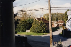
Looking northwest along Dominion Street from near Douglas Road
https://search.heritageburnaby.ca/link/archivedescription91846
- Repository
- City of Burnaby Archives
- Date
- April 2015
- Collection/Fonds
- Small family fonds
- Description Level
- Item
- Physical Description
- 1 photograph : col. copy print ; 10 cm x 15 cm
- Scope and Content
- Photograph of Dominion Street, looking northwest from near Douglas Road. The house at 3093 Douglas Road is just visible between the trees. In 2009 Dominion Street was repaved and sidewalks were installed following a local improvement request to the City.
- Repository
- City of Burnaby Archives
- Date
- April 2015
- Collection/Fonds
- Small family fonds
- Physical Description
- 1 photograph : col. copy print ; 10 cm x 15 cm
- Description Level
- Item
- Record No.
- 620-027
- Access Restriction
- No restrictions
- Reproduction Restriction
- No reproduction permitted
- Accession Number
- 2017-01
- Scope and Content
- Photograph of Dominion Street, looking northwest from near Douglas Road. The house at 3093 Douglas Road is just visible between the trees. In 2009 Dominion Street was repaved and sidewalks were installed following a local improvement request to the City.
- Subjects
- Buildings - Residential - Houses
- Media Type
- Photograph
- Notes
- Transcribed title
- Note in blue ink on verso of photograph reads: "P.27"
- Note in blue ink on verso of photograph reads: "April 2015 / Looking Northwest along Dominion St. from near Douglas Rd."
- Street Address
- 3093 Douglas Road
- Historic Neighbourhood
- Burnaby Lake (Historic Neighbourhood)
- Planning Study Area
- Ardingley-Sprott Area
Images

Looking north from 5496 Dominion Street
https://search.heritageburnaby.ca/link/archivedescription91854
- Repository
- City of Burnaby Archives
- Date
- November 2001
- Collection/Fonds
- Small family fonds
- Description Level
- Item
- Physical Description
- 1 photograph : col. ; 10 cm x 15 cm
- Scope and Content
- Photograph of the McLean family's house located at 5493 Dominion Street. The property was later owned by the McFaydens. The photograph was taken from the porch of the house at 5496 Dominion Street, looking north, and the house is largely obscured by trees.
- Repository
- City of Burnaby Archives
- Date
- November 2001
- Collection/Fonds
- Small family fonds
- Physical Description
- 1 photograph : col. ; 10 cm x 15 cm
- Description Level
- Item
- Record No.
- 620-035
- Access Restriction
- No restrictions
- Reproduction Restriction
- No reproduction permitted
- Accession Number
- 2017-01
- Scope and Content
- Photograph of the McLean family's house located at 5493 Dominion Street. The property was later owned by the McFaydens. The photograph was taken from the porch of the house at 5496 Dominion Street, looking north, and the house is largely obscured by trees.
- Subjects
- Buildings - Residential - Houses
- Media Type
- Photograph
- Notes
- Transcribed title
- Title transcribed from donor's notes
- Note in blue ink on verso of photograph reads: "P.35"
- Note in black ink on verso of photograph reads: "McLean's old house Nov. 2001"
- Note in blue ink on verso of photograph reads: "(later, McFayden's)"
- 5493 Dominion Street was previously numbered 3107 Dominion Street and it was later subdivided into two lots: 5491 and 5495 Dominion Street.
- Street Address
- 3107 Dominion Street
- 5493 Dominion Street
- Historic Neighbourhood
- Burnaby Lake (Historic Neighbourhood)
- Planning Study Area
- Ardingley-Sprott Area
Images
Looking north from 5496 Dominion Street
https://search.heritageburnaby.ca/link/archivedescription91855
- Repository
- City of Burnaby Archives
- Date
- 2002
- Collection/Fonds
- Small family fonds
- Description Level
- Item
- Physical Description
- 1 photograph : col. ; 10 cm x 15 cm
- Scope and Content
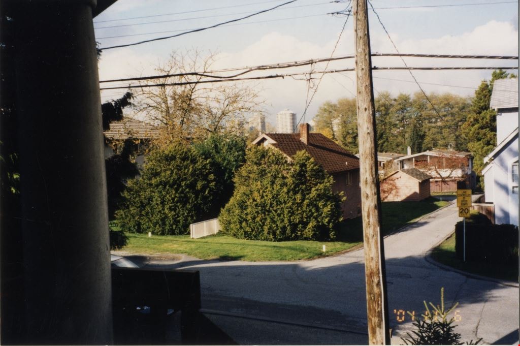
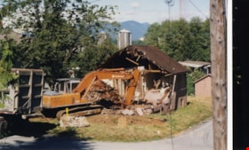
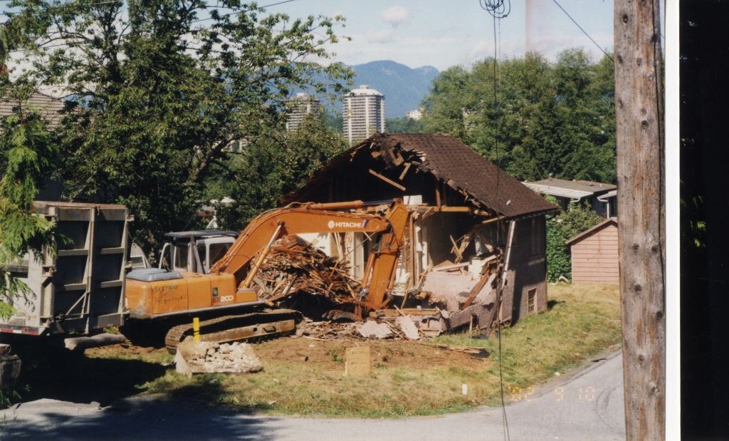
- Photograph of the house at 5493 Dominion Street being demolished. The house was previously owned by the McLean family. The photograph was taken from 5496 Dominion Street, looking north.
- Repository
- City of Burnaby Archives
- Date
- 2002
- Collection/Fonds
- Small family fonds
- Physical Description
- 1 photograph : col. ; 10 cm x 15 cm
- Description Level
- Item
- Record No.
- 620-036
- Access Restriction
- No restrictions
- Reproduction Restriction
- No reproduction permitted
- Accession Number
- 2017-01
- Scope and Content
- Photograph of the house at 5493 Dominion Street being demolished. The house was previously owned by the McLean family. The photograph was taken from 5496 Dominion Street, looking north.
- Media Type
- Photograph
- Notes
- Transcribed title
- Note in blue ink on verso of photograph reads: "P.35"
- Note in blue ink on verso of photograph reads: "2002"
- Note in blue ink on verso of photograph reads: "Farewell [illegible] old house on Dominion Street"
- 5493 Dominion Street was previously numbered 3107 Dominion Street and it was later subdivided into two lots: 5491 and 5495 Dominion Street.
- Street Address
- 3107 Dominion Street
- 5493 Dominion Street
- Historic Neighbourhood
- Burnaby Lake (Historic Neighbourhood)
- Planning Study Area
- Ardingley-Sprott Area
Images

Looking north from 5496 Dominion Street
https://search.heritageburnaby.ca/link/archivedescription91856
- Repository
- City of Burnaby Archives
- Date
- December 22, 2008
- Collection/Fonds
- Small family fonds
- Description Level
- Item
- Physical Description
- 1 photograph : col. ; 10 cm x 15 cm
- Scope and Content
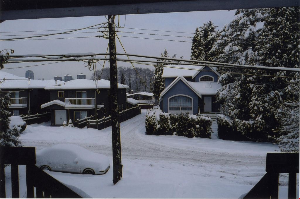
- Photograph of two duplexes located at 5491 and 5495 Dominion Street (left) and house at 5505 Dominion Street (right) after a snowfall. The duplexes replaced a single-family home located at 5493 (previously 3107) Dominion Street following the lot's subdivision. The photograph was taken from the po…
- Repository
- City of Burnaby Archives
- Date
- December 22, 2008
- Collection/Fonds
- Small family fonds
- Physical Description
- 1 photograph : col. ; 10 cm x 15 cm
- Description Level
- Item
- Record No.
- 620-037
- Access Restriction
- No restrictions
- Reproduction Restriction
- No reproduction permitted
- Accession Number
- 2017-01
- Scope and Content
- Photograph of two duplexes located at 5491 and 5495 Dominion Street (left) and house at 5505 Dominion Street (right) after a snowfall. The duplexes replaced a single-family home located at 5493 (previously 3107) Dominion Street following the lot's subdivision. The photograph was taken from the porch at 5496 Dominion street, looking north.
- Media Type
- Photograph
- Notes
- Title based on contents of photograph
- Note in blue ink on verso of photograph reads: "P.36"
- Note in blue ink on verso of photograph reads: "Dec. 22, 2008 / 2 New Duplex's replace 5493 Dominion Street"
- 5493 Dominion Street was previously numbered 3107 Dominion Street and it was later subdivided into two lots: 5491 and 5495 Dominion Street.
- Photograph 620-034 depicts the same house at 5505 Dominion Street and the previous house located at 5495 Dominion Street.
- Historic Neighbourhood
- Burnaby Lake (Historic Neighbourhood)
- Planning Study Area
- Ardingley-Sprott Area
Images