Narrow Results By
Creator
- Bancroft, Rose 1
- Bekins Moving and Storage Company Limited 1
- British Columbia Underwriters' Association 13
- Burnett and McGugan B.C. Land Surveyors, New Westminster 5
- Burnett, David H. 1
- Burnett, Geoffrey K. 5
- Burnett & McGugan, Engineers and Surveyors 24
- City Map and White Print Co. 1
- City of Burnaby 2
- Coast Map and Blue Print Co. 1
- Dominion Map and Blue Print Co. 1
- Dominion Map and Blueprint Co. 1
Person / Organization
- All Saints Anglican Church 1
- Armstrong Avenue School 1
- Barnet School 1
- Broadview Presbyterian Church 1
- Burnett, Geoffrey K. 2
- Douglas Road School 1
- Dundonald United Church 1
- East Burnaby United Church, 1925-2008 1
- Edmonds Community School 2
- Gilmore Avenue School 1
- Gordon Presbyterian Church 1
- Hamilton Road School 1
Imperial Oil Company
https://search.heritageburnaby.ca/link/archivedescription535
- Repository
- City of Burnaby Archives
- Date
- 1911
- Collection/Fonds
- City Council and Office of the City Clerk fonds
- Description Level
- File
- Physical Description
- Textual record and cartographic material
- Scope and Content
- File contains correspondence pertaining to oil storage tanks belonging to Imperial Oil Co., in DL 218. A plan is in map case at M9-A-1-2.
- Repository
- City of Burnaby Archives
- Date
- 1911
- Collection/Fonds
- City Council and Office of the City Clerk fonds
- Physical Description
- Textual record and cartographic material
- Description Level
- File
- Record No.
- 2243
- Accession Number
- 2001-02
- Scope and Content
- File contains correspondence pertaining to oil storage tanks belonging to Imperial Oil Co., in DL 218. A plan is in map case at M9-A-1-2.
- Media Type
- Textual Record
- Cartographic Material
- Notes
- A plan of subdivision of Block B, DL 218 (Imperial Oil) : M9-A-1-2.
Johnston Road expropriation
https://search.heritageburnaby.ca/link/archivedescription565
- Repository
- City of Burnaby Archives
- Date
- 1911-1914
- Collection/Fonds
- City Council and Office of the City Clerk fonds
- Description Level
- File
- Physical Description
- 2 folders textual records, cartographic material, and technical drawing
- Scope and Content
- File contains correspondence, reports, and memos related to the construction of a road in DL 125 - Johnston Road - and the resulting expropriations of land for that purpose. Map in map case.
- Repository
- City of Burnaby Archives
- Date
- 1911-1914
- Collection/Fonds
- City Council and Office of the City Clerk fonds
- Physical Description
- 2 folders textual records, cartographic material, and technical drawing
- Description Level
- File
- Record No.
- 2274
- Accession Number
- 2001-02
- Scope and Content
- File contains correspondence, reports, and memos related to the construction of a road in DL 125 - Johnston Road - and the resulting expropriations of land for that purpose. Map in map case.
- Media Type
- Technical Drawing
- Textual Record
- Cartographic Material
- Notes
- A map of DL 125 : M9-A-3-8; Standard Pole Top for 60000 Volt Line Western Canada Power Co. : M9-A-5-1
Tank Site - Central Park
https://search.heritageburnaby.ca/link/archivedescription577
- Repository
- City of Burnaby Archives
- Date
- 1911-1912
- Collection/Fonds
- City Council and Office of the City Clerk fonds
- Description Level
- File
- Physical Description
- Textual record and cartographic material
- Scope and Content
- File contains agreement and correspondence between the Corporation of the District of Burnaby and the Central Park Agricultural Association and Farmers Institute regarding the water tank site. File also contains 3 blueprint plans of the tank site.
- Repository
- City of Burnaby Archives
- Date
- 1911-1912
- Collection/Fonds
- City Council and Office of the City Clerk fonds
- Physical Description
- Textual record and cartographic material
- Description Level
- File
- Record No.
- 2287
- Accession Number
- 2001-02
- Scope and Content
- File contains agreement and correspondence between the Corporation of the District of Burnaby and the Central Park Agricultural Association and Farmers Institute regarding the water tank site. File also contains 3 blueprint plans of the tank site.
- Media Type
- Textual Record
- Cartographic Material
- Notes
- A plan of site for water tank in Central Park : M9-B-3-6
Road allowance - Block 13, DL 91 (Allan Bros.)
https://search.heritageburnaby.ca/link/archivedescription602
- Repository
- City of Burnaby Archives
- Date
- 1911-1912
- Collection/Fonds
- City Council and Office of the City Clerk fonds
- Description Level
- File
- Physical Description
- Textual record and cartographic material
- Scope and Content
- File contains agreements and correspondence regarding road allowance agreement with Joseph Dodd Allan and John George Allan for Block 13, DL 91. File also includes 2 indentures, one containing 2 white linen plans of "Portion of lot 13, Central Portion of DL 91, group 1, NWD."
- Repository
- City of Burnaby Archives
- Date
- 1911-1912
- Collection/Fonds
- City Council and Office of the City Clerk fonds
- Physical Description
- Textual record and cartographic material
- Description Level
- File
- Record No.
- 2315
- Accession Number
- 2001-02
- Scope and Content
- File contains agreements and correspondence regarding road allowance agreement with Joseph Dodd Allan and John George Allan for Block 13, DL 91. File also includes 2 indentures, one containing 2 white linen plans of "Portion of lot 13, Central Portion of DL 91, group 1, NWD."
- Media Type
- Textual Record
- Cartographic Material
- Notes
- Plans/maps are located in file and have not been moved to map case.
Lane between Blocks 39/43 and 64/68, DL 95
https://search.heritageburnaby.ca/link/archivedescription634
- Repository
- City of Burnaby Archives
- Date
- 1911
- Collection/Fonds
- City Council and Office of the City Clerk fonds
- Description Level
- File
- Physical Description
- Textual record and cartographic material
- Scope and Content
- File contains correspondence and reports regarding the construction of a lane between Blocks 39/43 and 64/68, DL 95, and a sketch of the location of the proposed lane. Also included in this file are memos regarding overcrowding of cars on Burnaby Lake line.
- Repository
- City of Burnaby Archives
- Date
- 1911
- Collection/Fonds
- City Council and Office of the City Clerk fonds
- Physical Description
- Textual record and cartographic material
- Description Level
- File
- Record No.
- 2358
- Accession Number
- 2001-02
- Scope and Content
- File contains correspondence and reports regarding the construction of a lane between Blocks 39/43 and 64/68, DL 95, and a sketch of the location of the proposed lane. Also included in this file are memos regarding overcrowding of cars on Burnaby Lake line.
- Media Type
- Textual Record
- Cartographic Material
- Notes
- Plans/maps are located in file and have not been moved to map case.
Local improvement DL 122, 123, 124
https://search.heritageburnaby.ca/link/archivedescription652
- Repository
- City of Burnaby Archives
- Date
- 1911-1912
- Collection/Fonds
- City Council and Office of the City Clerk fonds
- Description Level
- File
- Physical Description
- Textual record and cartographic material
- Scope and Content
- File contains correspondence, Council reports, and cost estimates for a Local Improvement project in DL 122, 123 and 124. File includes a plan of the area.
- Repository
- City of Burnaby Archives
- Date
- 1911-1912
- Collection/Fonds
- City Council and Office of the City Clerk fonds
- Physical Description
- Textual record and cartographic material
- Description Level
- File
- Record No.
- 2377
- Accession Number
- 2001-02
- Scope and Content
- File contains correspondence, Council reports, and cost estimates for a Local Improvement project in DL 122, 123 and 124. File includes a plan of the area.
- Media Type
- Textual Record
- Cartographic Material
- Notes
- Plans/maps are located in file and have not been moved to map case.
Water lots, DL 188, 212
https://search.heritageburnaby.ca/link/archivedescription675
- Repository
- City of Burnaby Archives
- Date
- 1911
- Collection/Fonds
- City Council and Office of the City Clerk fonds
- Description Level
- File
- Physical Description
- Textual record and cartographic material
- Scope and Content
- File contains correspondence and memos regarding applications for water lots in DL 188 and 212. File also includes blueprint "Plan of Foreshore Lot in front of Block "C" DL 188."
- Repository
- City of Burnaby Archives
- Date
- 1911
- Collection/Fonds
- City Council and Office of the City Clerk fonds
- Physical Description
- Textual record and cartographic material
- Description Level
- File
- Record No.
- 2400
- Accession Number
- 2001-02
- Scope and Content
- File contains correspondence and memos regarding applications for water lots in DL 188 and 212. File also includes blueprint "Plan of Foreshore Lot in front of Block "C" DL 188."
- Media Type
- Textual Record
- Cartographic Material
- Notes
- Plans/maps are located in file and have not been moved to map case.
Deer Lake
https://search.heritageburnaby.ca/link/archivedescription1016
- Repository
- City of Burnaby Archives
- Date
- 1911-1922
- Collection/Fonds
- City Council and Office of the City Clerk fonds
- Description Level
- File
- Physical Description
- Textual record and cartographic material
- Scope and Content
- File contains correspondence and complaints related to swimming in Deer Lake, accidental drownings, and the proposal to lower the lake. File also includes a blue print sketch of Deer Lake, showing reduced water level.
- Repository
- City of Burnaby Archives
- Date
- 1911-1922
- Collection/Fonds
- City Council and Office of the City Clerk fonds
- Physical Description
- Textual record and cartographic material
- Description Level
- File
- Record No.
- 2795
- Accession Number
- 2001-02
- Scope and Content
- File contains correspondence and complaints related to swimming in Deer Lake, accidental drownings, and the proposal to lower the lake. File also includes a blue print sketch of Deer Lake, showing reduced water level.
- Media Type
- Textual Record
- Cartographic Material
- Notes
- Plans/maps are located in file and have not been moved to map case.
Bird's eye view of New Westminster, Burnaby and Vancouver
https://search.heritageburnaby.ca/link/museumdescription8199
- Repository
- Burnaby Village Museum
- Date
- [ca. 1911]
- Collection/Fonds
- Burnaby Village Museum Map collection
- Description Level
- Item
- Physical Description
- 1 map : hand painted ; 65.5 x 99 cm
- Scope and Content
- An untitled monochromatic grayscale map of a developer's bird's eye view looking north west from Burnaby Mountain. View includes Burnaby, New Westminster, Vancouver with the North shore in the distance. Burnaby neighbourhood subdivisions of "Burnaby Heights" and "Buena Vista" are featured near the…
- Repository
- Burnaby Village Museum
- Collection/Fonds
- Burnaby Village Museum Map collection
- Description Level
- Item
- Physical Description
- 1 map : hand painted ; 65.5 x 99 cm
- Scope and Content
- An untitled monochromatic grayscale map of a developer's bird's eye view looking north west from Burnaby Mountain. View includes Burnaby, New Westminster, Vancouver with the North shore in the distance. Burnaby neighbourhood subdivisions of "Burnaby Heights" and "Buena Vista" are featured near the centre of the map. These neighbourhood subdivisions were marketed by Real Estate Agents Liebly & Blumer in 1911. Roads, buildings, factories, railways and bridges are identified on the map.
- Subjects
- Businesses - Real Estate Agencies
- Responsibility
- Leibly & Blumer Realty Co. Incorporated
- Accession Code
- HV983.12.1
- Access Restriction
- No restrictions
- Reproduction Restriction
- No known restrictions
- Date
- [ca. 1911]
- Media Type
- Cartographic Material
- Historic Neighbourhood
- East Burnaby (Historic Neighbourhood)
- Vancouver Heights (Historic Neighbourhood)
- Planning Study Area
- Cariboo-Armstrong Area
- Burnaby Heights Area
- Scan Resolution
- 300
- Scan Date
- December 2020
- Scale
- 100
- Notes
- Title based on contents of map
- Note in pencil on verso of photograph reads: "Make tint block of Buena Vista / Blocks only as shown in lots"
Zoomable Images
Plan of Subdivision of Blocks 1,2.3,6,21 and 23 of District Lot 211
https://search.heritageburnaby.ca/link/museumdescription11111
- Repository
- Burnaby Village Museum
- Date
- [between 1911 and 1912]
- Collection/Fonds
- Ronald G. Scobbie collection
- Description Level
- Item
- Physical Description
- 1 plan : ink on waxed linen ; 60 x 52.5 cm
- Scope and Content
- Item consists of a "Plan of Subdivision of Blocks 1,2.3,6,21 and 23 / of District Lot 211. Group 1 N.W.D. / Burnaby Municipality"
- Repository
- Burnaby Village Museum
- Collection/Fonds
- Ronald G. Scobbie collection
- Description Level
- Item
- Physical Description
- 1 plan : ink on waxed linen ; 60 x 52.5 cm
- Material Details
- Scale [1:1200]
- Scope and Content
- Item consists of a "Plan of Subdivision of Blocks 1,2.3,6,21 and 23 / of District Lot 211. Group 1 N.W.D. / Burnaby Municipality"
- Creator
- Hill & Burnett
- Accession Code
- HV984.57.4
- Access Restriction
- No restrictions
- Reproduction Restriction
- No known restrictions
- Date
- [between 1911 and 1912]
- Media Type
- Cartographic Material
- Planning Study Area
- Burnaby Mountain Area
- Scan Resolution
- 400
- Scan Date
- Dec. 22, 2020
- Scale
- 100
- Notes
- Transcribed title
- Scale is measured "100 feet to one inch"
- Credit on plan reads: "Hill & Burnett_BC_Land Surveyors_Civil Engineers_New Westminster_B.C."
Zoomable Images
![Plan of Subdivision of Blocks 1,2.3,6,21 and 23 of District Lot 211, [between 1911 and 1912] thumbnail](/media/hpo/_Data/_BVM_Cartographic_Material/1984/1984_0057_0004_001_seadragon/1984_0057_0004_001.jpg?w=280)
Plan of Subdivision of Blocks 1,2.3,6,21 and 23 of District Lot 211, [between 1911 and 1912]
Zoom into ImageSurvey plans along North Road
https://search.heritageburnaby.ca/link/museumdescription11141
- Repository
- Burnaby Village Museum
- Date
- [1911]
- Collection/Fonds
- Ronald G. Scobbie collection
- Description Level
- File
- Physical Description
- 1 survey plan : ink on waxed linen ; 28.5 x 18 cm + 4 survey plans : blueprints ; 28 x 24 cm and smaller
- Scope and Content
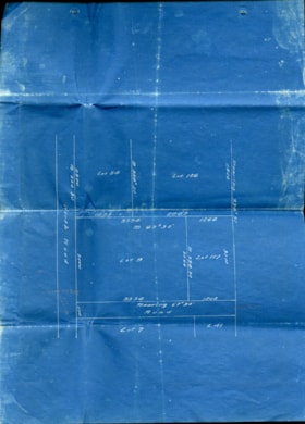
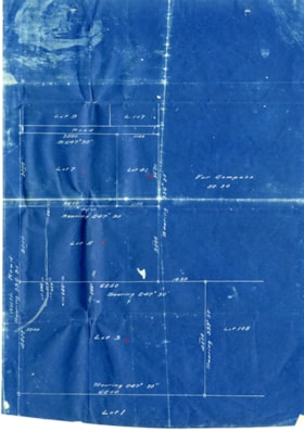
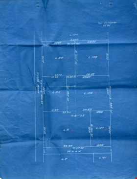
- File consists of four survey plans of District Lots on the east side of North Road, New Westminster Dist / Group 1 and one survey plan including District Lots on the west side of North Road in New Westminster District Group 1.
- Repository
- Burnaby Village Museum
- Collection/Fonds
- Ronald G. Scobbie collection
- Description Level
- File
- Physical Description
- 1 survey plan : ink on waxed linen ; 28.5 x 18 cm + 4 survey plans : blueprints ; 28 x 24 cm and smaller
- Scope and Content
- File consists of four survey plans of District Lots on the east side of North Road, New Westminster Dist / Group 1 and one survey plan including District Lots on the west side of North Road in New Westminster District Group 1.
- Geographic Access
- North Road
- Accession Code
- BV003.83.20
- Access Restriction
- No restrictions
- Reproduction Restriction
- No known restrictions
- Date
- [1911]
- Media Type
- Cartographic Material
- Scan Resolution
- 600
- Scan Date
- 24-Nov-2020
- Scale
- 100
- Notes
- Title based on contents of maps
- Note in black ink on verso of maps reads:"000233"
Images
Plan of Subdivision of Blocks 1,2,3,6,21 and 23 of District Lot 211
https://search.heritageburnaby.ca/link/museumdescription11212
- Repository
- Burnaby Village Museum
- Date
- [between 1911 and 1912]
- Collection/Fonds
- Ronald G. Scobbie collection
- Description Level
- Item
- Physical Description
- 1 plan : ink on waxed linen ; 77 x 53 cm
- Scope and Content
- "Plan of Subdivision of Blks 1,2.3.6.21. and 23 / of District Lot 211, Group ;1 , N.W.D./ Burnaby Municipality"
- Repository
- Burnaby Village Museum
- Collection/Fonds
- Ronald G. Scobbie collection
- Description Level
- Item
- Physical Description
- 1 plan : ink on waxed linen ; 77 x 53 cm
- Scope and Content
- "Plan of Subdivision of Blks 1,2.3.6.21. and 23 / of District Lot 211, Group ;1 , N.W.D./ Burnaby Municipality"
- Creator
- Hill & Burnett
- Accession Code
- HV984.57.5
- Access Restriction
- No restrictions
- Reproduction Restriction
- No known restrictions
- Date
- [between 1911 and 1912]
- Media Type
- Cartographic Material
- Planning Study Area
- Burnaby Mountain Area
- Scan Resolution
- 400
- Scan Date
- Dec. 22, 2020
- Scale
- 100
- Notes
- Transcribed title
- Scale is measured "100 feet to one inch"
- Credit on plan reads: "Hill & Burnett_BC_Land Surveyors_Civil Engineers_New Westminster_B.C."
Zoomable Images
![Plan of Subdivision of Blocks 1,2,3,6,21 and 23 of District Lot 211, [between 1911 and 1912] thumbnail](/media/hpo/_Data/_BVM_Cartographic_Material/1984/1984_0057_0005_001_seadragon/1984_0057_0005_001.jpg?w=280)
Plan of Subdivision of Blocks 1,2,3,6,21 and 23 of District Lot 211, [between 1911 and 1912]
Zoom into ImageSurvey of North Road
https://search.heritageburnaby.ca/link/museumdescription11916
- Repository
- Burnaby Village Museum
- Date
- June 24, 1911
- Collection/Fonds
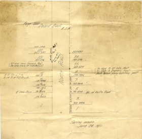
- Ronald G. Scobbie collection
- Description Level
- Item
- Physical Description
- 1 survey plan : pencil on paper ; 22.5 x 23 cm
- Scope and Content
- Item consists of a survey plan along the east and west sides of North Road. Lots on the east side include District Lots 102; 101; 100; 15; 8; 6; 4; 2; 1. Lots on the west side include; District Lots 54; 55; 9; 7; 5; 3 and 1.
- Repository
- Burnaby Village Museum
- Collection/Fonds
- Ronald G. Scobbie collection
- Description Level
- Item
- Physical Description
- 1 survey plan : pencil on paper ; 22.5 x 23 cm
- Scope and Content
- Item consists of a survey plan along the east and west sides of North Road. Lots on the east side include District Lots 102; 101; 100; 15; 8; 6; 4; 2; 1. Lots on the west side include; District Lots 54; 55; 9; 7; 5; 3 and 1.
- Creator
- Hill & Burnett
- Geographic Access
- North Road
- Accession Code
- BV003.83.26
- Access Restriction
- No restrictions
- Reproduction Restriction
- No known restrictions
- Date
- June 24, 1911
- Media Type
- Cartographic Material
- Scan Resolution
- 600
- Scan Date
- Dec. 15, 2020
- Scale
- 100
- Notes
- Title based on contents of plan
- Notes in pencil on verso read: P.11 Vol 1 / P. 15 Vol 1 / P. 17 Vol 1 / Lot 9 / John [Keys] P.R. 2100 / River foreshore"
- Note in red pencil crayon on verso reads: "001609”
- Stamp in red ink on plan reads: "Hill & Burnett / Civil Engineers / and / B.C. Land Surveyors / New Westminter B.C."
Images
Map of the Dominion of Canada
https://search.heritageburnaby.ca/link/museumdescription18944
- Repository
- Burnaby Village Museum
- Date
- 1911
- Collection/Fonds
- Burnaby Village Museum Map collection
- Description Level
- Item
- Physical Description
- 1 map : col. lithographic print on white paper ; 49.5 x 88.5 cm on sheet 63.5 x 90.5 cm
- Scope and Content
- Item consists of a "MAP OF THE DOMINION OF CANADA" produced by the Department of the Interior in 1911 . Text in lower border below map reads "THIS MAP IS PRESENTED WITH THE COMPLIMENTS OF THE ROYAL BANK OF CANADA" "WITH ITS FORTY-SECOND ANNUAL REPORT, 31st DECEMBER, 1911" at bottom centre, with lis…
- Repository
- Burnaby Village Museum
- Collection/Fonds
- Burnaby Village Museum Map collection
- Description Level
- Item
- Physical Description
- 1 map : col. lithographic print on white paper ; 49.5 x 88.5 cm on sheet 63.5 x 90.5 cm
- Material Details
- Scale: 100 miles = 1 inch
- Scope and Content
- Item consists of a "MAP OF THE DOMINION OF CANADA" produced by the Department of the Interior in 1911 . Text in lower border below map reads "THIS MAP IS PRESENTED WITH THE COMPLIMENTS OF THE ROYAL BANK OF CANADA" "WITH ITS FORTY-SECOND ANNUAL REPORT, 31st DECEMBER, 1911" at bottom centre, with list of branches in Canada and in other countries; at left is list of "PRINCIPAL FOREIGN CORRESPONDENTS"; at right is general information, "INCORPORATED 1869", "HEAD OFFICE MONTREAL", with "CAPITAL PAID UP", "RESERVE FUNDS", "AGGREGATE ASSETS" all listed, and "BOARD OF DIRECTORS" listed. Map shows proposed additions to Quebec, Ontario and Manitoba. Provincial and territorial borders, shipping routes, railway lines are identified. Two charts at upper right of distances, red print, one for distances in Canada from Montreal, the other for Montreal, Halifax and Churchill to foreign ports.
- Publisher
- Royal Bank of Canada
- Accession Code
- BV988.56.4
- Access Restriction
- No restrictions
- Reproduction Restriction
- No known restrictions
- Date
- 1911
- Media Type
- Cartographic Material
- Notes
- Title based on contents of map
Engineering Department fonds
https://search.heritageburnaby.ca/link/archivedescription43
- Repository
- City of Burnaby Archives
- Date
- 1912-2014
- Collection/Fonds
- Engineering Department fonds
- Description Level
- Fonds
- Physical Description
- 1m of textual records, approximately 2000 cartographic and architecural drawings
- Scope and Content
- Fonds consists of records created by the Engineering department including environmental service files, physical plant plans, and administrative records.
- Repository
- City of Burnaby Archives
- Date
- 1912-2014
- Collection/Fonds
- Engineering Department fonds
- Physical Description
- 1m of textual records, approximately 2000 cartographic and architecural drawings
- Description Level
- Fonds
- Access Restriction
- Subject to FOIPPA
- Reproduction Restriction
- Reproductions subject to FOIPPA
- Scope and Content
- Fonds consists of records created by the Engineering department including environmental service files, physical plant plans, and administrative records.
- History
- In 2020, responsibility for environmental management transferred to Climate Action and Energy, with Engineering retaining responsibility for geotechnical investigations and graffiti management. In 2022, Engineering became responsible for a consolidated Transportation group that aligns transportation planning and implementation functions. Green Fleet and Equipment also moved from Climate Action and Energy to the Public Works division of the Engineering Department. In 2022, Facilities Management was transferred from Engineering to the newly-created Lands and Facilities Department. James Lota served as General Manager, Engineering from 2021-2022. Jozsef Dioszeghy has served in the role since April 2022.
- Creator
- City of Burnaby
- Notes
- Title based on contents of fonds.
Sapperton sewage
https://search.heritageburnaby.ca/link/archivedescription393
- Repository
- City of Burnaby Archives
- Date
- 1912-1913
- Collection/Fonds
- City Council and Office of the City Clerk fonds
- Description Level
- File
- Physical Description
- Textual record and cartographic material
- Scope and Content
- File contains correspondence, memos, reports, meeting minutes and cost estimates related to the operation of the joint Sapperton sewerage system (Burnaby and New Westminster). Also included is a blueprint of the Sapperton sewerage area.
- Repository
- City of Burnaby Archives
- Date
- 1912-1913
- Collection/Fonds
- City Council and Office of the City Clerk fonds
- Physical Description
- Textual record and cartographic material
- Description Level
- File
- Record No.
- 2089
- Accession Number
- 2001-02
- Scope and Content
- File contains correspondence, memos, reports, meeting minutes and cost estimates related to the operation of the joint Sapperton sewerage system (Burnaby and New Westminster). Also included is a blueprint of the Sapperton sewerage area.
- Media Type
- Textual Record
- Cartographic Material
- Notes
- Plans/maps are located in file and have not been moved to map case.
East Burnaby tank site - East 36' of Lot 8 and east 36' of Lot 9, Block 34, DL 30
https://search.heritageburnaby.ca/link/archivedescription575
- Repository
- City of Burnaby Archives
- Date
- 1912-1922
- Collection/Fonds
- City Council and Office of the City Clerk fonds
- Description Level
- File
- Physical Description
- Textual record and cartographic material
- Scope and Content
- File contains agreements, conveyance, and correspondence pertaining to leases made with the Board of School Trustees for a water tank site. File also includes a plan of the southwest portion of Block 28, DL 30 G.I., N.W.D. on white linen.
- Repository
- City of Burnaby Archives
- Date
- 1912-1922
- Collection/Fonds
- City Council and Office of the City Clerk fonds
- Physical Description
- Textual record and cartographic material
- Description Level
- File
- Record No.
- 2285
- Accession Number
- 2001-02
- Scope and Content
- File contains agreements, conveyance, and correspondence pertaining to leases made with the Board of School Trustees for a water tank site. File also includes a plan of the southwest portion of Block 28, DL 30 G.I., N.W.D. on white linen.
- Media Type
- Textual Record
- Cartographic Material
- Notes
- Plans/maps are located in file and have not been moved to map case.
Queen's Avenue wharf
https://search.heritageburnaby.ca/link/archivedescription599
- Repository
- City of Burnaby Archives
- Date
- 1912-1925
- Collection/Fonds
- City Council and Office of the City Clerk fonds
- Description Level
- File
- Physical Description
- 3 folders textual records and cartographic material
- Scope and Content
- File contains petition, correspondence, and agreements with the Burrard Lumber Co. Ltd., the Bowness Lumber Co., Ltd., and the Pacific Lumber & Trading Co., Ltd., regarding the maintenance and construction of Queen's Avenue and Queen's Avenue Wharf. File also includes 2 white linen plans: "works o…
- Repository
- City of Burnaby Archives
- Date
- 1912-1925
- Collection/Fonds
- City Council and Office of the City Clerk fonds
- Physical Description
- 3 folders textual records and cartographic material
- Description Level
- File
- Record No.
- 2310
- Accession Number
- 2001-02
- Scope and Content
- File contains petition, correspondence, and agreements with the Burrard Lumber Co. Ltd., the Bowness Lumber Co., Ltd., and the Pacific Lumber & Trading Co., Ltd., regarding the maintenance and construction of Queen's Avenue and Queen's Avenue Wharf. File also includes 2 white linen plans: "works on Foreshore adjoining the North end of Queen's Avenue, Burnaby, "
- Media Type
- Textual Record
- Cartographic Material
- Notes
- Plans/maps are located in file and have not been moved to map case.
Plan - Block 6, DL 91 (Mark and Tigar)
https://search.heritageburnaby.ca/link/archivedescription603
- Repository
- City of Burnaby Archives
- Date
- 1912-1913
- Collection/Fonds
- City Council and Office of the City Clerk fonds
- Description Level
- File
- Physical Description
- Textual record and cartographic material
- Scope and Content
- File contains correspondence and a declaration regarding expropriation and subdivision of Block 6, DL 91, owned by Mr. Mark and Mr. Tigar. File also includes 1 white linen plan of the land to be expropriated.
- Repository
- City of Burnaby Archives
- Date
- 1912-1913
- Collection/Fonds
- City Council and Office of the City Clerk fonds
- Physical Description
- Textual record and cartographic material
- Description Level
- File
- Record No.
- 2316
- Accession Number
- 2001-02
- Scope and Content
- File contains correspondence and a declaration regarding expropriation and subdivision of Block 6, DL 91, owned by Mr. Mark and Mr. Tigar. File also includes 1 white linen plan of the land to be expropriated.
- Media Type
- Textual Record
- Cartographic Material
- Notes
- Plans/maps are located in file and have not been moved to map case.
Burrard-Westminster Boundary Railway Navigation Company (Vancouver to Mission)
https://search.heritageburnaby.ca/link/archivedescription706
- Repository
- City of Burnaby Archives
- Date
- 1912
- Collection/Fonds
- City Council and Office of the City Clerk fonds
- Description Level
- File
- Physical Description
- Textual record and cartographic material
- Scope and Content
- File contains correspondence and Council minutes regarding an application for electric railway from Vancouver through North Burnaby to Mission made by the Burrard Westminster Boundary Railway and Navigation Company.
- Repository
- City of Burnaby Archives
- Date
- 1912
- Collection/Fonds
- City Council and Office of the City Clerk fonds
- Physical Description
- Textual record and cartographic material
- Description Level
- File
- Record No.
- 2432
- Accession Number
- 2001-02
- Scope and Content
- File contains correspondence and Council minutes regarding an application for electric railway from Vancouver through North Burnaby to Mission made by the Burrard Westminster Boundary Railway and Navigation Company.
- Media Type
- Textual Record
- Cartographic Material
- Notes
- A map showing Vancouver - Mission is in map case.
![Bird's eye view of New Westminster, Burnaby and Vancouver, [ca. 1911] thumbnail](/media/hpo/_Data/_BVM_Cartographic_Material/1983/1983_0012_0001_002%20Web.jpg?width=280)
![Bird's eye view of New Westminster, Burnaby and Vancouver, [ca. 1911] thumbnail](/media/hpo/_Data/_BVM_Cartographic_Material/1983/1983_0012_0001_001_seadragon/1983_0012_0001_001.jpg?w=280)
![Plan of Subdivision of Blocks 1,2.3,6,21 and 23 of District Lot 211, [between 1911 and 1912] thumbnail](/media/hpo/_Data/_BVM_Cartographic_Material/1984/1984_0057_0004_002%20Web.jpg?width=280)
![Survey plans along North Road, [1911] thumbnail](/media/hpo/_Data/_BVM_Cartographic_Material/2003/2003_0083_0020A_001.jpg?width=280)
![Plan of Subdivision of Blocks 1,2,3,6,21 and 23 of District Lot 211, [between 1911 and 1912] thumbnail](/media/hpo/_Data/_BVM_Cartographic_Material/1984/1984_0057_0005_002%20Web.jpg?width=280)
