Narrow Results By
Subject
- Accidents 14
- Accidents - Automobile Accidents 30
- Accidents - Train Accidents 23
- Adminstrative Groups - Committees 4
- Adornment - Jewelry 7
- Adornment - Lapel Pins 1
- Advertising Medium 11
- Advertising Medium - Flyer 3
- Advertising Medium - Poster 16
- Advertising Medium - Signs and Signboards 221
- Aerial Photographs 132
- Agricultural Tools and Equipment 24
Creator
- A. A. Marks (firm) 1
- Abbott, George Knapp, 1880-1959 1
- Abbott, Jacob, 1803-1879 1
- Abraham, Dorothy, 1894- 1
- Ackerknecht, Erwin H. (Erwin Heinz), 1906-1988 1
- Action Line Housing Society 1
- Adams, Albert Egerton 1
- Adams, Beth 1
- Adams, Beverley 1
- Adams, Edith 2
- Adams, George Burton, 1851-1925 1
- Adams, Gladstone 1
![3830 Hazel Street, [ca. 1945] (date of original), copied 1991 thumbnail](/media/hpo/_Data/_Archives_Images/_Unrestricted/370/370-747.jpg?width=280)
3830 Hazel Street
https://search.heritageburnaby.ca/link/archivedescription38160
- Repository
- City of Burnaby Archives
- Date
- [ca. 1945] (date of original), copied 1991
- Collection/Fonds
- Burnaby Historical Society fonds
- Description Level
- Item
- Physical Description
- 1 photograph : b&w ; 3.0 x 5.4 cm print on contact sheet 20.1 x 26.3 cm
- Scope and Content
- Photograph of the view from 3830 Hazel Street (later renumbered 4662 Hazel Street) in the snow. Spud Murphy's car, a Desoto, can be seen in the street and the George family's house is in the background.
- Repository
- City of Burnaby Archives
- Date
- [ca. 1945] (date of original), copied 1991
- Collection/Fonds
- Burnaby Historical Society fonds
- Subseries
- Burnaby Image Bank subseries
- Physical Description
- 1 photograph : b&w ; 3.0 x 5.4 cm print on contact sheet 20.1 x 26.3 cm
- Description Level
- Item
- Record No.
- 370-747
- Access Restriction
- No restrictions
- Reproduction Restriction
- No known restrictions
- Accession Number
- BHS1999-03
- Scope and Content
- Photograph of the view from 3830 Hazel Street (later renumbered 4662 Hazel Street) in the snow. Spud Murphy's car, a Desoto, can be seen in the street and the George family's house is in the background.
- Media Type
- Photograph
- Notes
- Title based on contents of photograph
- 1 b&w copy negative accompanying
- Negative has a pink cast
- Geographic Access
- Hazel Street
- Street Address
- 4662 Hazel Street
- Historic Neighbourhood
- Central Park (Historic Neighbourhood)
- Planning Study Area
- Marlborough Area
Images
![3830 Hazel Street, [ca. 1945] (date of original), copied 1991 thumbnail](/media/hpo/_Data/_Archives_Images/_Unrestricted/370/370-747.jpg)
3855 Henning dr [sic]
https://search.heritageburnaby.ca/link/archivedescription94337
- Repository
- City of Burnaby Archives
- Date
- June 1995
- Collection/Fonds
- Grover, Elliott & Co. Ltd. fonds
- Description Level
- File
- Physical Description
- 19 photographs : col. negatives ; 35 mm
- Scope and Content
- Photographs of the exterior of a two-storey commercial building complex located at 3855 Henning Drive.
- Repository
- City of Burnaby Archives
- Date
- June 1995
- Collection/Fonds
- Grover, Elliott & Co. Ltd. fonds
- Physical Description
- 19 photographs : col. negatives ; 35 mm
- Description Level
- File
- Record No.
- 622-122
- Access Restriction
- No restrictions
- Reproduction Restriction
- No restrictions
- Accession Number
- 2017-39
- Scope and Content
- Photographs of the exterior of a two-storey commercial building complex located at 3855 Henning Drive.
- Subjects
- Buildings - Commercial
- Media Type
- Photograph
- Notes
- Transcribed title
- Title transcribed from envelope photographs were originally housed in
- File no. 95-194-B
- Geographic Access
- Henning Drive
- Street Address
- 3855 Henning Drive
- Historic Neighbourhood
- Broadview (Historic Neighbourhood)
- Planning Study Area
- West Central Valley Area
3855 Henning dr [sic]
https://search.heritageburnaby.ca/link/archivedescription94344
- Repository
- City of Burnaby Archives
- Date
- August 1995
- Collection/Fonds
- Grover, Elliott & Co. Ltd. fonds
- Description Level
- File
- Physical Description
- 21 photographs : col. negatives ; 35 mm
- Scope and Content
- Photographs of a two-storey commercial building located at 3855 Henning Drive.
- Repository
- City of Burnaby Archives
- Date
- August 1995
- Collection/Fonds
- Grover, Elliott & Co. Ltd. fonds
- Physical Description
- 21 photographs : col. negatives ; 35 mm
- Description Level
- File
- Record No.
- 622-129
- Access Restriction
- No restrictions
- Reproduction Restriction
- No restrictions
- Accession Number
- 2017-39
- Scope and Content
- Photographs of a two-storey commercial building located at 3855 Henning Drive.
- Subjects
- Buildings - Commercial
- Media Type
- Photograph
- Notes
- Transcribed title
- Title transcribed from envelope photographs were originally housed in
- File no. 95-269-B
- Geographic Access
- Henning Drive
- Street Address
- 3855 Henning Drive
- Historic Neighbourhood
- Broadview (Historic Neighbourhood)
- Planning Study Area
- West Central Valley Area
![3861 Hastings Street, [196-] thumbnail](/media/hpo/_Data/_Archives_Images/_Unrestricted/316/366-008.jpg?width=280)
3861 Hastings Street
https://search.heritageburnaby.ca/link/archivedescription37379
- Repository
- City of Burnaby Archives
- Date
- [196-]
- Collection/Fonds
- Burnaby Historical Society fonds
- Description Level
- Item
- Physical Description
- 1 photograph : b&w negative
- Scope and Content
- Photograph shows the building loctaed at 3861 Hastings Street.
- Repository
- City of Burnaby Archives
- Date
- [196-]
- Collection/Fonds
- Burnaby Historical Society fonds
- Subseries
- Municipal record subseries
- Physical Description
- 1 photograph : b&w negative
- Description Level
- Item
- Record No.
- 366-008
- Access Restriction
- No restrictions
- Reproduction Restriction
- Reproduce for fair dealing purposes only
- Accession Number
- BHS1998-12
- Scope and Content
- Photograph shows the building loctaed at 3861 Hastings Street.
- Subjects
- Buildings
- Media Type
- Photograph
- Notes
- Title based on contents of photograph.
- Geographic Access
- Hastings Street
- Street Address
- 3861 Hastings Street
- Historic Neighbourhood
- Vancouver Heights (Historic Neighbourhood)
- Planning Study Area
- Burnaby Heights Area
Images
![3861 Hastings Street, [196-] thumbnail](/media/hpo/_Data/_Archives_Images/_Unrestricted/316/366-008.jpg)
![3896 Hastings Street, [196-] thumbnail](/media/hpo/_Data/_Archives_Images/_Unrestricted/316/366-004.jpg?width=280)
3896 Hastings Street
https://search.heritageburnaby.ca/link/archivedescription37375
- Repository
- City of Burnaby Archives
- Date
- [196-]
- Collection/Fonds
- Burnaby Historical Society fonds
- Description Level
- Item
- Physical Description
- 1 photograph : b&w negative
- Scope and Content
- Photograph shows a view of 3896 Hastings Street (old street number), as seen from the lane.
- Repository
- City of Burnaby Archives
- Date
- [196-]
- Collection/Fonds
- Burnaby Historical Society fonds
- Subseries
- Municipal record subseries
- Physical Description
- 1 photograph : b&w negative
- Description Level
- Item
- Record No.
- 366-004
- Access Restriction
- No restrictions
- Reproduction Restriction
- Reproduce for fair dealing purposes only
- Accession Number
- BHS1998-12
- Scope and Content
- Photograph shows a view of 3896 Hastings Street (old street number), as seen from the lane.
- Subjects
- Buildings
- Media Type
- Photograph
- Notes
- Title based on contents of photograph
- Geographic Access
- Hastings Street
- Historic Neighbourhood
- Vancouver Heights (Historic Neighbourhood)
- Planning Study Area
- Burnaby Heights Area
Images
![3896 Hastings Street, [196-] thumbnail](/media/hpo/_Data/_Archives_Images/_Unrestricted/316/366-004.jpg)
![3896 Hastings Street, [196-] thumbnail](/media/hpo/_Data/_Archives_Images/_Unrestricted/316/366-005.jpg?width=280)
3896 Hastings Street
https://search.heritageburnaby.ca/link/archivedescription37376
- Repository
- City of Burnaby Archives
- Date
- [196-]
- Collection/Fonds
- Burnaby Historical Society fonds
- Description Level
- Item
- Physical Description
- 1 photograph : b&w negative
- Scope and Content
- Photograph shows the view of 3896 Hastings Street (old street number) as taken from the adjacent lane.
- Repository
- City of Burnaby Archives
- Date
- [196-]
- Collection/Fonds
- Burnaby Historical Society fonds
- Subseries
- Municipal record subseries
- Physical Description
- 1 photograph : b&w negative
- Description Level
- Item
- Record No.
- 366-005
- Access Restriction
- No restrictions
- Reproduction Restriction
- Reproduce for fair dealing purposes only
- Accession Number
- BHS1998-12
- Scope and Content
- Photograph shows the view of 3896 Hastings Street (old street number) as taken from the adjacent lane.
- Subjects
- Buildings
- Media Type
- Photograph
- Notes
- Title based on contents of photograph.
- Geographic Access
- Hastings Street
- Historic Neighbourhood
- Vancouver Heights (Historic Neighbourhood)
- Planning Study Area
- Burnaby Heights Area
Images
![3896 Hastings Street, [196-] thumbnail](/media/hpo/_Data/_Archives_Images/_Unrestricted/316/366-005.jpg)
3900-3978 Hastings
https://search.heritageburnaby.ca/link/archivedescription93809
- Repository
- City of Burnaby Archives
- Date
- September 12, 1992
- Collection/Fonds
- Grover, Elliott & Co. Ltd. fonds
- Description Level
- File
- Physical Description
- 4 photographs : col. ; 10 cm x 15 cm
- Scope and Content
- Photographs of a two-storey commercial building located at 3900 through 3978 Hastings Street, with a residential tower visible behind it. Stores visible in the photograph include: Budget Video, a dental centre, a produce store, Autoplan Insurance, Da Vinci Travel, Great Pacific Management, and Hea…
- Repository
- City of Burnaby Archives
- Date
- September 12, 1992
- Collection/Fonds
- Grover, Elliott & Co. Ltd. fonds
- Physical Description
- 4 photographs : col. ; 10 cm x 15 cm
- Description Level
- File
- Record No.
- 622-057
- Access Restriction
- No restrictions
- Reproduction Restriction
- No restrictions
- Accession Number
- 2017-39
- Scope and Content
- Photographs of a two-storey commercial building located at 3900 through 3978 Hastings Street, with a residential tower visible behind it. Stores visible in the photograph include: Budget Video, a dental centre, a produce store, Autoplan Insurance, Da Vinci Travel, Great Pacific Management, and Head Waze Hair and Skin Studio.
- Media Type
- Photograph
- Notes
- Transcribed title
- Title transcribed from envelope photographs were originally housed in
- File no. 92-336-B
- Photographer identified as "J.C."
- Geographic Access
- Hastings Street
- Historic Neighbourhood
- Vancouver Heights (Historic Neighbourhood)
- Planning Study Area
- Burnaby Heights Area
![3900 Albert Street, [between 1965 and 1970] thumbnail](/media/hpo/_Data/_Archives_Images/_Unrestricted/316/366-018.jpg?width=280)
3900 Albert Street
https://search.heritageburnaby.ca/link/archivedescription37389
- Repository
- City of Burnaby Archives
- Date
- [between 1965 and 1970]
- Collection/Fonds
- Burnaby Historical Society fonds
- Description Level
- Item
- Physical Description
- 1 photograph : b&w negative
- Scope and Content
- Photograph of the north side of 3900 Albert Street, looking west. The Vancouver Heights Baptist Church can be seen to the far right (at the corner of Albert Street and Ingleton Avenue).
- Repository
- City of Burnaby Archives
- Date
- [between 1965 and 1970]
- Collection/Fonds
- Burnaby Historical Society fonds
- Subseries
- Municipal record subseries
- Physical Description
- 1 photograph : b&w negative
- Description Level
- Item
- Record No.
- 366-018
- Access Restriction
- No restrictions
- Reproduction Restriction
- Reproduce for fair dealing purposes only
- Accession Number
- BHS1998-12
- Scope and Content
- Photograph of the north side of 3900 Albert Street, looking west. The Vancouver Heights Baptist Church can be seen to the far right (at the corner of Albert Street and Ingleton Avenue).
- Media Type
- Photograph
- Notes
- Title based on contents of photograph
- Geographic Access
- Ingleton Avenue
- Albert Street
- Street Address
- 3900 Albert Street
- 271 Ingleton Avenue
- 3977 Albert Street
- Historic Neighbourhood
- Vancouver Heights (Historic Neighbourhood)
- Planning Study Area
- Burnaby Heights Area
Images
![3900 Albert Street, [between 1965 and 1970] thumbnail](/media/hpo/_Data/_Archives_Images/_Unrestricted/316/366-018.jpg)
![3900 Albert Street at Ingleton Avenue, [between 1965 and 1970] thumbnail](/media/hpo/_Data/_Archives_Images/_Unrestricted/316/366-019.jpg?width=280)
3900 Albert Street at Ingleton Avenue
https://search.heritageburnaby.ca/link/archivedescription37390
- Repository
- City of Burnaby Archives
- Date
- [between 1965 and 1970]
- Collection/Fonds
- Burnaby Historical Society fonds
- Description Level
- Item
- Physical Description
- 1 photograph : b&w negative
- Scope and Content
- Photograph looking west along the north side of Albert Street from the 3900 Block. At the far right can be seen the Vancouver Heights Baptist Church, at the intersection of Albert and Ingleton Avenue.
- Repository
- City of Burnaby Archives
- Date
- [between 1965 and 1970]
- Collection/Fonds
- Burnaby Historical Society fonds
- Subseries
- Municipal record subseries
- Physical Description
- 1 photograph : b&w negative
- Description Level
- Item
- Record No.
- 366-019
- Access Restriction
- No restrictions
- Reproduction Restriction
- Reproduce for fair dealing purposes only
- Accession Number
- BHS1998-12
- Scope and Content
- Photograph looking west along the north side of Albert Street from the 3900 Block. At the far right can be seen the Vancouver Heights Baptist Church, at the intersection of Albert and Ingleton Avenue.
- Media Type
- Photograph
- Notes
- Title based on contents of photograph.
- Geographic Access
- Albert Street
- Ingleton Avenue
- Street Address
- 3900 Albert Street
- 271 Ingleton Avenue
- Historic Neighbourhood
- Vancouver Heights (Historic Neighbourhood)
- Planning Study Area
- Burnaby Heights Area
Images
![3900 Albert Street at Ingleton Avenue, [between 1965 and 1970] thumbnail](/media/hpo/_Data/_Archives_Images/_Unrestricted/316/366-019.jpg)
![3900 Albert Street - South Side, [196-] thumbnail](/media/hpo/_Data/_Archives_Images/_Unrestricted/316/366-027.jpg?width=280)
3900 Albert Street - South Side
https://search.heritageburnaby.ca/link/archivedescription97610
- Repository
- City of Burnaby Archives
- Date
- [196-]
- Collection/Fonds
- Burnaby Historical Society fonds
- Description Level
- Item
- Physical Description
- 1 photograph : b&w negative
- Scope and Content
- Photograph of two houses on the south corner of Albert Street and Ingleton Avenue at 3900 Albert Street.
- Repository
- City of Burnaby Archives
- Date
- [196-]
- Collection/Fonds
- Burnaby Historical Society fonds
- Subseries
- Municipal record subseries
- Physical Description
- 1 photograph : b&w negative
- Description Level
- Item
- Record No.
- 366-027
- Access Restriction
- No restrictions
- Reproduction Restriction
- Reproduce for fair dealing purposes only
- Accession Number
- BHS1998-12
- Scope and Content
- Photograph of two houses on the south corner of Albert Street and Ingleton Avenue at 3900 Albert Street.
- Subjects
- Buildings - Residential - Houses
- Media Type
- Photograph
- Notes
- Transcribed title
- Note on verso of photograph in black ink reads: "3900 Albert - South Side - Two Houses at East End of Block"
- Geographic Access
- Albert Street
- Street Address
- 3900 Albert Street
- Historic Neighbourhood
- Vancouver Heights (Historic Neighbourhood)
- Planning Study Area
- Burnaby Heights Area
Images
![3900 Albert Street - South Side, [196-] thumbnail](/media/hpo/_Data/_Archives_Images/_Unrestricted/316/366-027.jpg)
![3900 Block East Hastings businesses, [196-] thumbnail](/media/hpo/_Data/_Archives_Images/_Unrestricted/316/366-031.jpg?width=280)
3900 Block East Hastings businesses
https://search.heritageburnaby.ca/link/archivedescription97616
- Repository
- City of Burnaby Archives
- Date
- [196-]
- Collection/Fonds
- Burnaby Historical Society fonds
- Description Level
- Item
- Physical Description
- 1 photograph : b&w negative
- Scope and Content
- Photograph of the businesses along the north side of the 3900 block of East Hastings Street. Signs for the National Bakery at 3918 East Hastings and Tobin's Quality Shoes at 3972 East Hastings are visible. Photograph taken from the north side of Hastings facing west.
- Repository
- City of Burnaby Archives
- Date
- [196-]
- Collection/Fonds
- Burnaby Historical Society fonds
- Subseries
- Municipal record subseries
- Physical Description
- 1 photograph : b&w negative
- Description Level
- Item
- Record No.
- 366-031
- Access Restriction
- No restrictions
- Reproduction Restriction
- Reproduce for fair dealing purposes only
- Accession Number
- BHS1998-12
- Scope and Content
- Photograph of the businesses along the north side of the 3900 block of East Hastings Street. Signs for the National Bakery at 3918 East Hastings and Tobin's Quality Shoes at 3972 East Hastings are visible. Photograph taken from the north side of Hastings facing west.
- Subjects
- Buildings - Commercial - Stores
- Media Type
- Photograph
- Notes
- Title based on content of photograph
- Geographic Access
- Hastings Street
- Historic Neighbourhood
- Vancouver Heights (Historic Neighbourhood)
- Planning Study Area
- Burnaby Heights Area
Images
![3900 Block East Hastings businesses, [196-] thumbnail](/media/hpo/_Data/_Archives_Images/_Unrestricted/316/366-031.jpg)
![3900 Block East Hastings Street, [196-] thumbnail](/media/hpo/_Data/_Archives_Images/_Unrestricted/316/366-033-3.jpg?width=280)
3900 Block East Hastings Street
https://search.heritageburnaby.ca/link/archivedescription97618
- Repository
- City of Burnaby Archives
- Date
- [196-]
- Collection/Fonds
- Burnaby Historical Society fonds
- Description Level
- File
- Physical Description
- 3 photograph : b&w negatives
- Scope and Content
- Photographs of the rears of the businesses located along the 3900 block of East Hastings Street.
- Repository
- City of Burnaby Archives
- Date
- [196-]
- Collection/Fonds
- Burnaby Historical Society fonds
- Subseries
- Municipal record subseries
- Physical Description
- 3 photograph : b&w negatives
- Description Level
- File
- Record No.
- 366-033
- Access Restriction
- No restrictions
- Reproduction Restriction
- Reproduce for fair dealing purposes only
- Accession Number
- BHS1998-12
- Scope and Content
- Photographs of the rears of the businesses located along the 3900 block of East Hastings Street.
- Subjects
- Buildings - Commercial - Stores
- Media Type
- Photograph
- Notes
- Title based on content of photographs
- Geographic Access
- Hastings Street
- Historic Neighbourhood
- Vancouver Heights (Historic Neighbourhood)
- Planning Study Area
- Burnaby Heights Area
Images
![3900 Block East Hastings Street, [196-] thumbnail](/media/hpo/_Data/_Archives_Images/_Unrestricted/316/366-033-3.jpg)
![3900 Block of Hastings Street, [between 1965 and 1970] thumbnail](/media/hpo/_Data/_Archives_Images/_Unrestricted/316/366-009.jpg?width=280)
3900 Block of Hastings Street
https://search.heritageburnaby.ca/link/archivedescription37380
- Repository
- City of Burnaby Archives
- Date
- [between 1965 and 1970]
- Collection/Fonds
- Burnaby Historical Society fonds
- Description Level
- Item
- Physical Description
- 1 photograph : b&w negative
- Scope and Content
- Photograph looking west along the lane between the 3900 block of Hastings Street and Albert Street. An unidentified man is walking down the lane.
- Repository
- City of Burnaby Archives
- Date
- [between 1965 and 1970]
- Collection/Fonds
- Burnaby Historical Society fonds
- Subseries
- Municipal record subseries
- Physical Description
- 1 photograph : b&w negative
- Description Level
- Item
- Record No.
- 366-009
- Access Restriction
- No restrictions
- Reproduction Restriction
- Reproduce for fair dealing purposes only
- Accession Number
- BHS1998-12
- Scope and Content
- Photograph looking west along the lane between the 3900 block of Hastings Street and Albert Street. An unidentified man is walking down the lane.
- Subjects
- Geographic Features - Lanes
- Media Type
- Photograph
- Notes
- Title based on contents of photograph
- Geographic Access
- Hastings Street
- Historic Neighbourhood
- Vancouver Heights (Historic Neighbourhood)
- Planning Study Area
- Burnaby Heights Area
Images
![3900 Block of Hastings Street, [between 1965 and 1970] thumbnail](/media/hpo/_Data/_Archives_Images/_Unrestricted/316/366-009.jpg)
![3900 Block Union Street, [between 1912 and 1915] (date of original), copied 1991 thumbnail](/media/hpo/_Data/_Archives_Images/_Unrestricted/370/370-772.jpg?width=280)
3900 Block Union Street
https://search.heritageburnaby.ca/link/archivedescription38185
- Repository
- City of Burnaby Archives
- Date
- [between 1912 and 1915] (date of original), copied 1991
- Collection/Fonds
- Burnaby Historical Society fonds
- Description Level
- Item
- Physical Description
- 1 photograph : b&w ; 4.4 x 3.4 cm print on contact sheet 20.6 x 26.5 cm
- Scope and Content
- Photograph of the Spraggon family home and another house on the 3900 block of Union Street (formerly named Barnard Street). There is a child at play in the snow in the foreground.
- Repository
- City of Burnaby Archives
- Date
- [between 1912 and 1915] (date of original), copied 1991
- Collection/Fonds
- Burnaby Historical Society fonds
- Subseries
- Burnaby Image Bank subseries
- Physical Description
- 1 photograph : b&w ; 4.4 x 3.4 cm print on contact sheet 20.6 x 26.5 cm
- Description Level
- Item
- Record No.
- 370-772
- Access Restriction
- No restrictions
- Reproduction Restriction
- No known restrictions
- Accession Number
- BHS1999-03
- Scope and Content
- Photograph of the Spraggon family home and another house on the 3900 block of Union Street (formerly named Barnard Street). There is a child at play in the snow in the foreground.
- Media Type
- Photograph
- Notes
- Title based on contents of photograph
- 1 b&w copy negative accompanying
- Negative has a pink cast
- Geographic Access
- Union Street
- Historic Neighbourhood
- Vancouver Heights (Historic Neighbourhood)
- Planning Study Area
- Willingdon Heights Area
Images
![3900 Block Union Street, [between 1912 and 1915] (date of original), copied 1991 thumbnail](/media/hpo/_Data/_Archives_Images/_Unrestricted/370/370-772.jpg)
![3900 Hastings Street, [between 1965 and 1970] thumbnail](/media/hpo/_Data/_Archives_Images/_Unrestricted/316/366-010.jpg?width=280)
3900 Hastings Street
https://search.heritageburnaby.ca/link/archivedescription37381
- Repository
- City of Burnaby Archives
- Date
- [between 1965 and 1970]
- Collection/Fonds
- Burnaby Historical Society fonds
- Description Level
- Item
- Physical Description
- 1 photograph : b&w negative
- Scope and Content
- Photograph taken looking west along Hastings Street, in front of the 3900 Block.
- Repository
- City of Burnaby Archives
- Date
- [between 1965 and 1970]
- Collection/Fonds
- Burnaby Historical Society fonds
- Subseries
- Municipal record subseries
- Physical Description
- 1 photograph : b&w negative
- Description Level
- Item
- Record No.
- 366-010
- Access Restriction
- No restrictions
- Reproduction Restriction
- Reproduce for fair dealing purposes only
- Accession Number
- BHS1998-12
- Scope and Content
- Photograph taken looking west along Hastings Street, in front of the 3900 Block.
- Media Type
- Photograph
- Notes
- Title based on contents of photograph
- Geographic Access
- Hastings Street
- Historic Neighbourhood
- Vancouver Heights (Historic Neighbourhood)
- Planning Study Area
- Burnaby Heights Area
Images
![3900 Hastings Street, [between 1965 and 1970] thumbnail](/media/hpo/_Data/_Archives_Images/_Unrestricted/316/366-010.jpg)
![3901 Hastings Street, [between 1965 and 1970] thumbnail](/media/hpo/_Data/_Archives_Images/_Unrestricted/316/366-011.jpg?width=280)
3901 Hastings Street
https://search.heritageburnaby.ca/link/archivedescription37382
- Repository
- City of Burnaby Archives
- Date
- [between 1965 and 1970]
- Collection/Fonds
- Burnaby Historical Society fonds
- Description Level
- Item
- Physical Description
- 1 photograph : b&w negative
- Scope and Content
- Photograph of the storefront at 3901 Hastings Street. A "for sale" sign is visible in the window.
- Repository
- City of Burnaby Archives
- Date
- [between 1965 and 1970]
- Collection/Fonds
- Burnaby Historical Society fonds
- Subseries
- Municipal record subseries
- Physical Description
- 1 photograph : b&w negative
- Description Level
- Item
- Record No.
- 366-011
- Access Restriction
- No restrictions
- Reproduction Restriction
- Reproduce for fair dealing purposes only
- Accession Number
- BHS1998-12
- Scope and Content
- Photograph of the storefront at 3901 Hastings Street. A "for sale" sign is visible in the window.
- Subjects
- Buildings - Commercial - Stores
- Media Type
- Photograph
- Notes
- Title based on contents of photograph.
- Geographic Access
- Hastings Street
- Street Address
- 3901 Hastings Street
- Historic Neighbourhood
- Vancouver Heights (Historic Neighbourhood)
- Planning Study Area
- Burnaby Heights Area
Images
![3901 Hastings Street, [between 1965 and 1970] thumbnail](/media/hpo/_Data/_Archives_Images/_Unrestricted/316/366-011.jpg)
![3951 and 3953 Hastings Street, [between 1965 and 1970] thumbnail](/media/hpo/_Data/_Archives_Images/_Unrestricted/316/366-013.jpg?width=280)
3951 and 3953 Hastings Street
https://search.heritageburnaby.ca/link/archivedescription37384
- Repository
- City of Burnaby Archives
- Date
- [between 1965 and 1970]
- Collection/Fonds
- Burnaby Historical Society fonds
- Description Level
- Item
- Physical Description
- 1 photograph : b&w negative
- Scope and Content
- Photograph of the driveway and lane between 3951 and 3953 Hastings Street. A note on the back of the photograph reads: "3951-53 Hastings Street from lane."
- Repository
- City of Burnaby Archives
- Date
- [between 1965 and 1970]
- Collection/Fonds
- Burnaby Historical Society fonds
- Subseries
- Municipal record subseries
- Physical Description
- 1 photograph : b&w negative
- Description Level
- Item
- Record No.
- 366-013
- Access Restriction
- No restrictions
- Reproduction Restriction
- Reproduce for fair dealing purposes only
- Accession Number
- BHS1998-12
- Scope and Content
- Photograph of the driveway and lane between 3951 and 3953 Hastings Street. A note on the back of the photograph reads: "3951-53 Hastings Street from lane."
- Subjects
- Geographic Features - Lanes
- Media Type
- Photograph
- Notes
- Title based on caption
- Geographic Access
- Hastings Street
- Street Address
- 3951 Hastings Street
- 3953 Hastings Street
- Historic Neighbourhood
- Vancouver Heights (Historic Neighbourhood)
- Planning Study Area
- Burnaby Heights Area
Images
![3951 and 3953 Hastings Street, [between 1965 and 1970] thumbnail](/media/hpo/_Data/_Archives_Images/_Unrestricted/316/366-013.jpg)
![3951 and 3953 Hastings Street, [1965] thumbnail](/media/hpo/_Data/_Archives_Images/_Unrestricted/316/366-014.jpg?width=280)
3951 and 3953 Hastings Street
https://search.heritageburnaby.ca/link/archivedescription37385
- Repository
- City of Burnaby Archives
- Date
- [1965]
- Collection/Fonds
- Burnaby Historical Society fonds
- Description Level
- Item
- Physical Description
- 1 photograph : b&w negative
- Scope and Content
- Photograph of the buildings at 3951 and 3953 Hastings Street. A number of business signs are visible including "Paulettes Beauty Salon" and "Norburn Secondhand Store."
- Repository
- City of Burnaby Archives
- Date
- [1965]
- Collection/Fonds
- Burnaby Historical Society fonds
- Subseries
- Municipal record subseries
- Physical Description
- 1 photograph : b&w negative
- Description Level
- Item
- Record No.
- 366-014
- Access Restriction
- No restrictions
- Reproduction Restriction
- Reproduce for fair dealing purposes only
- Accession Number
- BHS1998-12
- Scope and Content
- Photograph of the buildings at 3951 and 3953 Hastings Street. A number of business signs are visible including "Paulettes Beauty Salon" and "Norburn Secondhand Store."
- Media Type
- Photograph
- Notes
- Title based on contents of photograph
- Geographic Access
- Hastings Street
- Street Address
- 3953 Hastings Street
- 3951 Hastings Street
- Historic Neighbourhood
- Vancouver Heights (Historic Neighbourhood)
- Planning Study Area
- Burnaby Heights Area
Images
![3951 and 3953 Hastings Street, [1965] thumbnail](/media/hpo/_Data/_Archives_Images/_Unrestricted/316/366-014.jpg)
![3951 and 3953 Hastings Street from Lane, [196-] thumbnail](/media/hpo/_Data/_Archives_Images/_Unrestricted/316/366-016.jpg?width=280)
3951 and 3953 Hastings Street from Lane
https://search.heritageburnaby.ca/link/archivedescription37387
- Repository
- City of Burnaby Archives
- Date
- [196-]
- Collection/Fonds
- Burnaby Historical Society fonds
- Description Level
- Item
- Physical Description
- 1 photograph : b&w negative
- Scope and Content
- Photograph shows a truck and a car parked in the lane behind 3951 and 3953 Hastings Street.
- Repository
- City of Burnaby Archives
- Date
- [196-]
- Collection/Fonds
- Burnaby Historical Society fonds
- Subseries
- Municipal record subseries
- Physical Description
- 1 photograph : b&w negative
- Description Level
- Item
- Record No.
- 366-016
- Access Restriction
- No restrictions
- Reproduction Restriction
- Reproduce for fair dealing purposes only
- Accession Number
- BHS1998-12
- Scope and Content
- Photograph shows a truck and a car parked in the lane behind 3951 and 3953 Hastings Street.
- Media Type
- Photograph
- Notes
- Title based on contents of photograph.
- Geographic Access
- Hastings Street
- Street Address
- 3951 Hastings Street
- 3953 Hastings Street
- Historic Neighbourhood
- Vancouver Heights (Historic Neighbourhood)
- Planning Study Area
- Burnaby Heights Area
Images
![3951 and 3953 Hastings Street from Lane, [196-] thumbnail](/media/hpo/_Data/_Archives_Images/_Unrestricted/316/366-016.jpg)

3955 Moscrop Street
https://search.heritageburnaby.ca/link/archivedescription98654
- Repository
- City of Burnaby Archives
- Date
- 2021
- Collection/Fonds
- Disappearing Burnaby collection
- Description Level
- Item
- Physical Description
- 1 photograph (jpeg) : col.
- Scope and Content
- Photograph of the exterior of a house located at 3955 Moscrop Street. The house was constructed in 1954. The photograph depicts the house at night, with the house's porch light on, and a car is in the driveway in front of the house.
- Repository
- City of Burnaby Archives
- Date
- 2021
- Collection/Fonds
- Disappearing Burnaby collection
- Physical Description
- 1 photograph (jpeg) : col.
- Description Level
- Item
- Record No.
- 634-001
- Access Restriction
- No restrictions
- Reproduction Restriction
- No restrictions
- Accession Number
- 2022-14
- Scope and Content
- Photograph of the exterior of a house located at 3955 Moscrop Street. The house was constructed in 1954. The photograph depicts the house at night, with the house's porch light on, and a car is in the driveway in front of the house.
- Media Type
- Photograph
- Photographer
- Cheung, Nakita
- Notes
- Title taken from the associated blog post
- Associated blog post: https://disappearingburnaby.wordpress.com/2022/02/24/moscrop-house/
- Geographic Access
- Moscrop Street
- Street Address
- 3955 Moscrop Street
- Historic Neighbourhood
- Broadview (Historic Neighbourhood)
- Planning Study Area
- Cascade-Schou Area
Images

![3980 Albert Street, [between 1965 and 1970] thumbnail](/media/hpo/_Data/_Archives_Images/_Unrestricted/316/366-024.jpg?width=280)
3980 Albert Street
https://search.heritageburnaby.ca/link/archivedescription37395
- Repository
- City of Burnaby Archives
- Date
- [between 1965 and 1970]
- Collection/Fonds
- Burnaby Historical Society fonds
- Description Level
- Item
- Physical Description
- 1 photograph : b&w negative
- Scope and Content
- Photograph of the home located at 3980 Albert Street (old street number).
- Repository
- City of Burnaby Archives
- Date
- [between 1965 and 1970]
- Collection/Fonds
- Burnaby Historical Society fonds
- Subseries
- Municipal record subseries
- Physical Description
- 1 photograph : b&w negative
- Description Level
- Item
- Record No.
- 366-024
- Access Restriction
- No restrictions
- Reproduction Restriction
- Reproduce for fair dealing purposes only
- Accession Number
- BHS1998-12
- Scope and Content
- Photograph of the home located at 3980 Albert Street (old street number).
- Subjects
- Buildings - Residential - Houses
- Media Type
- Photograph
- Notes
- Title based on contents of photograph
- Geographic Access
- Albert Street
- Historic Neighbourhood
- Vancouver Heights (Historic Neighbourhood)
- Planning Study Area
- Burnaby Heights Area
Images
![3980 Albert Street, [between 1965 and 1970] thumbnail](/media/hpo/_Data/_Archives_Images/_Unrestricted/316/366-024.jpg)
![3980 Albert Street, [between 1965 and 1970] thumbnail](/media/hpo/_Data/_Archives_Images/_Unrestricted/316/366-025.jpg?width=280)
3980 Albert Street
https://search.heritageburnaby.ca/link/archivedescription37396
- Repository
- City of Burnaby Archives
- Date
- [between 1965 and 1970]
- Collection/Fonds
- Burnaby Historical Society fonds
- Description Level
- Item
- Physical Description
- 1 photograph : b&w negative
- Scope and Content
- Photograph of a house located at 3980 Albert Street (old street number).
- Repository
- City of Burnaby Archives
- Date
- [between 1965 and 1970]
- Collection/Fonds
- Burnaby Historical Society fonds
- Subseries
- Municipal record subseries
- Physical Description
- 1 photograph : b&w negative
- Description Level
- Item
- Record No.
- 366-025
- Access Restriction
- No restrictions
- Reproduction Restriction
- Reproduce for fair dealing purposes only
- Accession Number
- BHS1998-12
- Scope and Content
- Photograph of a house located at 3980 Albert Street (old street number).
- Subjects
- Buildings - Residential - Houses
- Media Type
- Photograph
- Notes
- Title based on contents of photograph
- Geographic Access
- Albert Street
- Historic Neighbourhood
- Vancouver Heights (Historic Neighbourhood)
- Planning Study Area
- Burnaby Heights Area
Images
![3980 Albert Street, [between 1965 and 1970] thumbnail](/media/hpo/_Data/_Archives_Images/_Unrestricted/316/366-025.jpg)
![4006 Douglas Road, [1960] (date of original), copied 1991 thumbnail](/media/hpo/_Data/_Archives_Images/_Unrestricted/370/370-516.jpg?width=280)
4006 Douglas Road
https://search.heritageburnaby.ca/link/archivedescription37928
- Repository
- City of Burnaby Archives
- Date
- [1960] (date of original), copied 1991
- Collection/Fonds
- Burnaby Historical Society fonds
- Description Level
- Item
- Physical Description
- 1 photograph : b&w ; 3.1 x 3.1 cm print on contact sheet 20.7 x 26.5 cm
- Scope and Content
- Photograph of 4006 Douglas Road (old numbering) in the snow. The house was located near Douglas Road and Gilpin Street.
- Repository
- City of Burnaby Archives
- Date
- [1960] (date of original), copied 1991
- Collection/Fonds
- Burnaby Historical Society fonds
- Subseries
- Burnaby Image Bank subseries
- Physical Description
- 1 photograph : b&w ; 3.1 x 3.1 cm print on contact sheet 20.7 x 26.5 cm
- Description Level
- Item
- Record No.
- 370-516
- Access Restriction
- No restrictions
- Reproduction Restriction
- No restrictions
- Accession Number
- BHS1999-03
- Scope and Content
- Photograph of 4006 Douglas Road (old numbering) in the snow. The house was located near Douglas Road and Gilpin Street.
- Subjects
- Natural Phenomena - Snow
- Media Type
- Photograph
- Notes
- Title based on contents of photograph
- 1 b&w copy negative accompanying
- Negative has a pink cast
- Geographic Access
- Gilpin Street
- Historic Neighbourhood
- Burnaby Lake (Historic Neighbourhood)
- Planning Study Area
- Douglas-Gilpin Area
Images
![4006 Douglas Road, [1960] (date of original), copied 1991 thumbnail](/media/hpo/_Data/_Archives_Images/_Unrestricted/370/370-516.jpg)
4010 Regent St.
https://search.heritageburnaby.ca/link/archivedescription94318
- Repository
- City of Burnaby Archives
- Date
- September 1994
- Collection/Fonds
- Grover, Elliott & Co. Ltd. fonds
- Description Level
- File
- Physical Description
- 25 photographs : col. negatives ; 35 mm
- Scope and Content
- Photographs of an undeveloped property located at 4010 Regent Street. Property is covered with soil, brush, and some trees.
- Repository
- City of Burnaby Archives
- Date
- September 1994
- Collection/Fonds
- Grover, Elliott & Co. Ltd. fonds
- Physical Description
- 25 photographs : col. negatives ; 35 mm
- Description Level
- File
- Record No.
- 622-103
- Access Restriction
- No restrictions
- Reproduction Restriction
- No restrictions
- Accession Number
- 2017-39
- Scope and Content
- Photographs of an undeveloped property located at 4010 Regent Street. Property is covered with soil, brush, and some trees.
- Subjects
- Land Clearing
- Media Type
- Photograph
- Photographer
- Young, Richard
- Notes
- Transcribed title
- Title transcribed from envelope photographs were originally housed in
- File no. 94-342-B
- Geographic Access
- Regent Street
- Street Address
- 4010 Regent Street
- Historic Neighbourhood
- Broadview (Historic Neighbourhood)
- Planning Study Area
- West Central Valley Area
4021 Kingsway, Burnaby
https://search.heritageburnaby.ca/link/archivedescription93882
- Repository
- City of Burnaby Archives
- Date
- February 8, 1993
- Collection/Fonds
- Grover, Elliott & Co. Ltd. fonds
- Description Level
- File
- Physical Description
- 22 photographs : col. negatives ; 35 mm
- Scope and Content
- Photographs of an undeveloped property located at 4021 Kingsway and the intersection at Kingsway and Inman Avenue.
- Repository
- City of Burnaby Archives
- Date
- February 8, 1993
- Collection/Fonds
- Grover, Elliott & Co. Ltd. fonds
- Physical Description
- 22 photographs : col. negatives ; 35 mm
- Description Level
- File
- Record No.
- 622-065
- Access Restriction
- No restrictions
- Reproduction Restriction
- No restrictions
- Accession Number
- 2017-39
- Scope and Content
- Photographs of an undeveloped property located at 4021 Kingsway and the intersection at Kingsway and Inman Avenue.
- Subjects
- Geographic Features - Roads
- Buildings
- Media Type
- Photograph
- Notes
- Transcribed title
- Title transcribed from envelope photographs were originally housed in
- File no. 93-058-B
- Geographic Access
- Kingsway
- Inman Avenue
- Street Address
- 4021 Kingsway
- Historic Neighbourhood
- Central Park (Historic Neighbourhood)
- Planning Study Area
- Garden Village Area
![4042 Yale Street, [1961 or 1962] (date of original), copied 1991 thumbnail](/media/hpo/_Data/_Archives_Images/_Unrestricted/370/370-213.jpg?width=280)
4042 Yale Street
https://search.heritageburnaby.ca/link/archivedescription37625
- Repository
- City of Burnaby Archives
- Date
- [1961 or 1962] (date of original), copied 1991
- Collection/Fonds
- Burnaby Historical Society fonds
- Description Level
- Item
- Physical Description
- 1 photograph : b&w ; 3.9 x 3.9 cm print on contact sheet 20.2 x 25.3 cm
- Scope and Content
- Photograph of 4042 Yale Street, taken from behind and above the house. The photograph was taken facing north, with the north shore mountains visible in the background. The photograph was taken during the winter of 1961 to 1962, and there is snow.
- Repository
- City of Burnaby Archives
- Date
- [1961 or 1962] (date of original), copied 1991
- Collection/Fonds
- Burnaby Historical Society fonds
- Subseries
- Burnaby Image Bank subseries
- Physical Description
- 1 photograph : b&w ; 3.9 x 3.9 cm print on contact sheet 20.2 x 25.3 cm
- Description Level
- Item
- Record No.
- 370-213
- Access Restriction
- No restrictions
- Reproduction Restriction
- No restrictions
- Accession Number
- BHS1999-03
- Scope and Content
- Photograph of 4042 Yale Street, taken from behind and above the house. The photograph was taken facing north, with the north shore mountains visible in the background. The photograph was taken during the winter of 1961 to 1962, and there is snow.
- Media Type
- Photograph
- Notes
- Title based on contents of photograph
- 1 b&w copy negative accompanying
- Geographic Access
- Yale Street
- Street Address
- 4042 Yale Street
- Historic Neighbourhood
- Vancouver Heights (Historic Neighbourhood)
- Planning Study Area
- Burnaby Heights Area
Images
![4042 Yale Street, [1961 or 1962] (date of original), copied 1991 thumbnail](/media/hpo/_Data/_Archives_Images/_Unrestricted/370/370-213.jpg)
![4042 Yale Street, [1961 or 1962] (date of original), copied 1991 thumbnail](/media/hpo/_Data/_Archives_Images/_Unrestricted/370/370-214.jpg?width=280)
4042 Yale Street
https://search.heritageburnaby.ca/link/archivedescription37626
- Repository
- City of Burnaby Archives
- Date
- [1961 or 1962] (date of original), copied 1991
- Collection/Fonds
- Burnaby Historical Society fonds
- Description Level
- Item
- Physical Description
- 1 photograph : b&w ; 3.9 x 3.9 cm print on contact sheet 20.2 x 25.3 cm
- Scope and Content
- Photograph from above 4042 Yale Street looking northeast. Burrard Inlet and the northshore mountains are visible in the background. The photograph was taken during the winter of 1961 to 1962, and there is snow.
- Repository
- City of Burnaby Archives
- Date
- [1961 or 1962] (date of original), copied 1991
- Collection/Fonds
- Burnaby Historical Society fonds
- Subseries
- Burnaby Image Bank subseries
- Physical Description
- 1 photograph : b&w ; 3.9 x 3.9 cm print on contact sheet 20.2 x 25.3 cm
- Description Level
- Item
- Record No.
- 370-214
- Access Restriction
- No restrictions
- Reproduction Restriction
- No restrictions
- Accession Number
- BHS1999-03
- Scope and Content
- Photograph from above 4042 Yale Street looking northeast. Burrard Inlet and the northshore mountains are visible in the background. The photograph was taken during the winter of 1961 to 1962, and there is snow.
- Subjects
- Buildings - Residential - Houses
- Geographic Features - Inlets
- Geographic Features - Mountains
- Media Type
- Photograph
- Notes
- Title based on contents of photograph
- 1 b&w copy negative accompanying
- Geographic Access
- Yale Street
- Street Address
- 4042 Yale Street
- Historic Neighbourhood
- Vancouver Heights (Historic Neighbourhood)
- Planning Study Area
- Burnaby Heights Area
Images
![4042 Yale Street, [1961 or 1962] (date of original), copied 1991 thumbnail](/media/hpo/_Data/_Archives_Images/_Unrestricted/370/370-214.jpg)
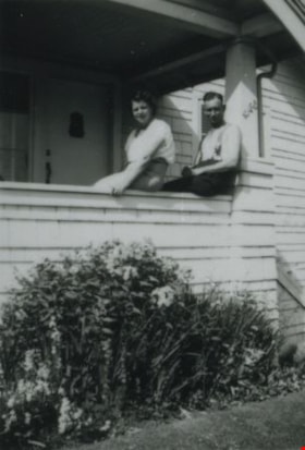
4123 Oxford Street
https://search.heritageburnaby.ca/link/archivedescription38197
- Repository
- City of Burnaby Archives
- Date
- 1953 (date of original), copied 1991
- Collection/Fonds
- Burnaby Historical Society fonds
- Description Level
- Item
- Physical Description
- 1 photograph : b&w ; 4.2 x 2.8 cm print on contact sheet 20.3 x 26.6 cm
- Scope and Content
- Photograph of a woman and a man sitting on the edge of the porch at 4123 Oxford Street.
- Repository
- City of Burnaby Archives
- Date
- 1953 (date of original), copied 1991
- Collection/Fonds
- Burnaby Historical Society fonds
- Subseries
- Burnaby Image Bank subseries
- Physical Description
- 1 photograph : b&w ; 4.2 x 2.8 cm print on contact sheet 20.3 x 26.6 cm
- Description Level
- Item
- Record No.
- 370-784
- Access Restriction
- No restrictions
- Reproduction Restriction
- No restrictions
- Accession Number
- BHS1999-03
- Scope and Content
- Photograph of a woman and a man sitting on the edge of the porch at 4123 Oxford Street.
- Media Type
- Photograph
- Notes
- Title based on contents of photograph
- 1 b&w copy negative accompanying
- Geographic Access
- Oxford Street
- Street Address
- 4123 Oxford Street
- Historic Neighbourhood
- Vancouver Heights (Historic Neighbourhood)
- Planning Study Area
- Burnaby Heights Area
Images

![4200 Block Cambridge Street, [1940] (date of original), copied 1991 thumbnail](/media/hpo/_Data/_Archives_Images/_Unrestricted/370/370-408.jpg?width=280)
4200 Block Cambridge Street
https://search.heritageburnaby.ca/link/archivedescription37820
- Repository
- City of Burnaby Archives
- Date
- [1940] (date of original), copied 1991
- Collection/Fonds
- Burnaby Historical Society fonds
- Description Level
- Item
- Physical Description
- 1 photograph : b&w ; 3.9 x 2.6 cm print on contact sheet 20.3 x 26.4 cm
- Scope and Content
- Photograph of a dog on the sidewalk of the 4200 block of Cambridge Street. The photograph was taken facing east, and Capitol Hill is visible in the background.
- Repository
- City of Burnaby Archives
- Date
- [1940] (date of original), copied 1991
- Collection/Fonds
- Burnaby Historical Society fonds
- Subseries
- Burnaby Image Bank subseries
- Physical Description
- 1 photograph : b&w ; 3.9 x 2.6 cm print on contact sheet 20.3 x 26.4 cm
- Description Level
- Item
- Record No.
- 370-408
- Access Restriction
- No restrictions
- Reproduction Restriction
- No known restrictions
- Accession Number
- BHS1999-03
- Scope and Content
- Photograph of a dog on the sidewalk of the 4200 block of Cambridge Street. The photograph was taken facing east, and Capitol Hill is visible in the background.
- Media Type
- Photograph
- Notes
- Title based on contents of photograph
- 1 b&w copy negative accompanying
- Negative has a pink cast
- Geographic Access
- Cambridge Street
- Historic Neighbourhood
- Vancouver Heights (Historic Neighbourhood)
- Planning Study Area
- Burnaby Heights Area
Images
![4200 Block Cambridge Street, [1940] (date of original), copied 1991 thumbnail](/media/hpo/_Data/_Archives_Images/_Unrestricted/370/370-408.jpg)
![4200 Block Cambridge Street, [1940] (date of original), copied 1991 thumbnail](/media/hpo/_Data/_Archives_Images/_Unrestricted/370/370-409.jpg?width=280)
4200 Block Cambridge Street
https://search.heritageburnaby.ca/link/archivedescription37821
- Repository
- City of Burnaby Archives
- Date
- [1940] (date of original), copied 1991
- Collection/Fonds
- Burnaby Historical Society fonds
- Description Level
- Item
- Physical Description
- 1 photograph : b&w ; 3.9 x 2.6 cm print on contact sheet 20.3 x 26.4 cm
- Scope and Content
- Photograph of a dog sitting beside the sidewalk on the 4200 block of Cambridge Street.
- Repository
- City of Burnaby Archives
- Date
- [1940] (date of original), copied 1991
- Collection/Fonds
- Burnaby Historical Society fonds
- Subseries
- Burnaby Image Bank subseries
- Physical Description
- 1 photograph : b&w ; 3.9 x 2.6 cm print on contact sheet 20.3 x 26.4 cm
- Description Level
- Item
- Record No.
- 370-409
- Access Restriction
- No restrictions
- Reproduction Restriction
- No known restrictions
- Accession Number
- BHS1999-03
- Scope and Content
- Photograph of a dog sitting beside the sidewalk on the 4200 block of Cambridge Street.
- Subjects
- Animals - Dogs
- Media Type
- Photograph
- Notes
- Title based on contents of photograph
- 1 b&w copy negative accompanying
- Negative has a pink cast
- Geographic Access
- Cambridge Street
- Historic Neighbourhood
- Vancouver Heights (Historic Neighbourhood)
- Planning Study Area
- Burnaby Heights Area
Images
![4200 Block Cambridge Street, [1940] (date of original), copied 1991 thumbnail](/media/hpo/_Data/_Archives_Images/_Unrestricted/370/370-409.jpg)
![4200 Block Cambridge Street, [ca. 1940] (date of original), copied 1991 thumbnail](/media/hpo/_Data/_Archives_Images/_Unrestricted/370/370-410.jpg?width=280)
4200 Block Cambridge Street
https://search.heritageburnaby.ca/link/archivedescription37822
- Repository
- City of Burnaby Archives
- Date
- [ca. 1940] (date of original), copied 1991
- Collection/Fonds
- Burnaby Historical Society fonds
- Description Level
- Item
- Physical Description
- 1 photograph : b&w ; 3.9 x 2.6 cm print on contact sheet 20.3 x 26.4 cm
- Scope and Content
- Photograph of a dog standing beside the sidewalk on the 4200 block of Cambridge Street. The back of a car can be seen on the right, and the road can be seen in the background.
- Repository
- City of Burnaby Archives
- Date
- [ca. 1940] (date of original), copied 1991
- Collection/Fonds
- Burnaby Historical Society fonds
- Subseries
- Burnaby Image Bank subseries
- Physical Description
- 1 photograph : b&w ; 3.9 x 2.6 cm print on contact sheet 20.3 x 26.4 cm
- Description Level
- Item
- Record No.
- 370-410
- Access Restriction
- No restrictions
- Reproduction Restriction
- No known restrictions
- Accession Number
- BHS1999-03
- Scope and Content
- Photograph of a dog standing beside the sidewalk on the 4200 block of Cambridge Street. The back of a car can be seen on the right, and the road can be seen in the background.
- Subjects
- Animals - Dogs
- Media Type
- Photograph
- Notes
- Title based on contents of photograph
- 1 b&w copy negative accompanying
- Negative has a pink cast
- Geographic Access
- Cambridge Street
- Historic Neighbourhood
- Vancouver Heights (Historic Neighbourhood)
- Planning Study Area
- Burnaby Heights Area
Images
![4200 Block Cambridge Street, [ca. 1940] (date of original), copied 1991 thumbnail](/media/hpo/_Data/_Archives_Images/_Unrestricted/370/370-410.jpg)
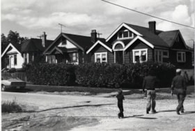
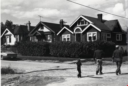
4200 Block Pandora Street
https://search.heritageburnaby.ca/link/archivedescription78914
- Repository
- City of Burnaby Archives
- Date
- September 5, 1976
- Collection/Fonds
- Burnaby Public Library Contemporary Visual Archive Project
- Description Level
- Item
- Physical Description
- 1 photograph : b&w ; 11 x 16 cm mounted on cardboard
- Scope and Content
- Photograph shows houses on 4200 Block Pandora Street, near Madison Avenue.
- Repository
- City of Burnaby Archives
- Date
- September 5, 1976
- Collection/Fonds
- Burnaby Public Library Contemporary Visual Archive Project
- Physical Description
- 1 photograph : b&w ; 11 x 16 cm mounted on cardboard
- Description Level
- Item
- Record No.
- 556-030
- Access Restriction
- No restrictions
- Reproduction Restriction
- Reproduce for fair dealing purposes only
- Accession Number
- 2013-13
- Scope and Content
- Photograph shows houses on 4200 Block Pandora Street, near Madison Avenue.
- Media Type
- Photograph
- Notes
- Scope note taken directly from BPL photograph description.
- 1 b&w copy negative : 10 x 12.5 cm accompanying
- Photographers identified by surnames only: Carr and Vardeman
- Geographic Access
- Pandora Street
- Historic Neighbourhood
- Vancouver Heights (Historic Neighbourhood)
- Planning Study Area
- Burnaby Heights Area
Images
4200 Phillips Ave
https://search.heritageburnaby.ca/link/archivedescription94317
- Repository
- City of Burnaby Archives
- Date
- September 1994
- Collection/Fonds
- Grover, Elliott & Co. Ltd. fonds
- Description Level
- File
- Physical Description
- 24 photographs : col. negatives ; 35 mm
- Scope and Content
- Photographs of the exterior of a single-storey industrial building located at 4200 Phillips Avenue - an address that no longer exists.
- Repository
- City of Burnaby Archives
- Date
- September 1994
- Collection/Fonds
- Grover, Elliott & Co. Ltd. fonds
- Physical Description
- 24 photographs : col. negatives ; 35 mm
- Description Level
- File
- Record No.
- 622-102
- Access Restriction
- No restrictions
- Reproduction Restriction
- No restrictions
- Accession Number
- 2017-39
- Scope and Content
- Photographs of the exterior of a single-storey industrial building located at 4200 Phillips Avenue - an address that no longer exists.
- Subjects
- Buildings - Industrial
- Media Type
- Photograph
- Notes
- Transcribed title
- Title transcribed from envelope photographs were originally housed in
- File no. 94-329-B
- Photographer identified as "J.C."
- Geographic Access
- Phillips Avenue
- Historic Neighbourhood
- Lozells (Historic Neighbourhood)
- Planning Study Area
- Government Road Area
4226 Hastings St.
https://search.heritageburnaby.ca/link/archivedescription94311
- Repository
- City of Burnaby Archives
- Date
- May 1994
- Collection/Fonds
- Grover, Elliott & Co. Ltd. fonds
- Description Level
- File
- Physical Description
- 18 photographs : col. negatives ; 35 mm
- Scope and Content
- Photographs of the commerical businesses located along the 4200 block of Hastings Street, including: Ultra X-Ray, Vote Reform, and United Optical
- Repository
- City of Burnaby Archives
- Date
- May 1994
- Collection/Fonds
- Grover, Elliott & Co. Ltd. fonds
- Physical Description
- 18 photographs : col. negatives ; 35 mm
- Description Level
- File
- Record No.
- 622-096
- Access Restriction
- No restrictions
- Reproduction Restriction
- No restrictions
- Accession Number
- 2017-39
- Scope and Content
- Photographs of the commerical businesses located along the 4200 block of Hastings Street, including: Ultra X-Ray, Vote Reform, and United Optical
- Subjects
- Buildings - Commercial
- Media Type
- Photograph
- Notes
- Transcribed title
- Title transcribed from envelope photographs were originally housed in
- File no. 94-190-B
- Photographer identified as "L.D."
- Geographic Access
- Hastings Street
- Street Address
- 4226 Hastings Street
- Historic Neighbourhood
- Vancouver Heights (Historic Neighbourhood)
- Planning Study Area
- Willingdon Heights Area
4250 Grange St
https://search.heritageburnaby.ca/link/archivedescription93892
- Repository
- City of Burnaby Archives
- Date
- June 1993
- Collection/Fonds
- Grover, Elliott & Co. Ltd. fonds
- Description Level
- File
- Physical Description
- 25 photographs : col. negatives ; 35 mm
- Scope and Content
- Photographs of an undeveloped property located at 4250 Grange Street - an address that no longer exists. The property's current address is 5833 Wilson Avenue. A billboard in front of the property reads: Paramount / Coming Soon / Two 21-Storey Luxury Twin Towers".
- Repository
- City of Burnaby Archives
- Date
- June 1993
- Collection/Fonds
- Grover, Elliott & Co. Ltd. fonds
- Physical Description
- 25 photographs : col. negatives ; 35 mm
- Description Level
- File
- Record No.
- 622-075
- Access Restriction
- No restrictions
- Reproduction Restriction
- No restrictions
- Accession Number
- 2017-39
- Scope and Content
- Photographs of an undeveloped property located at 4250 Grange Street - an address that no longer exists. The property's current address is 5833 Wilson Avenue. A billboard in front of the property reads: Paramount / Coming Soon / Two 21-Storey Luxury Twin Towers".
- Media Type
- Photograph
- Notes
- Transcribed title
- Title transcribed from envelope photographs were originally housed in
- File no. 93-284-B
- Photographer identified as "J.C."
- Geographic Access
- Wilson Avenue
- Grange Street
- Street Address
- 5833 Wilson Avenue
- Historic Neighbourhood
- Central Park (Historic Neighbourhood)
- Planning Study Area
- Garden Village Area
4260 Edmonds St.
https://search.heritageburnaby.ca/link/archivedescription94351
- Repository
- City of Burnaby Archives
- Date
- October 1995
- Collection/Fonds
- Grover, Elliott & Co. Ltd. fonds
- Description Level
- File
- Physical Description
- 26 photographs : col. negatives ; 35 mm
- Scope and Content
- Photographs of the exterior of Lumberland, located at 4260 Edmonds Street (an address that no longer exists) and the surrounding area at Edmonds Street and Kingsway.
- Repository
- City of Burnaby Archives
- Date
- October 1995
- Collection/Fonds
- Grover, Elliott & Co. Ltd. fonds
- Physical Description
- 26 photographs : col. negatives ; 35 mm
- Description Level
- File
- Record No.
- 622-136
- Access Restriction
- No restrictions
- Reproduction Restriction
- No restrictions
- Accession Number
- 2017-39
- Scope and Content
- Photographs of the exterior of Lumberland, located at 4260 Edmonds Street (an address that no longer exists) and the surrounding area at Edmonds Street and Kingsway.
- Subjects
- Buildings - Commercial
- Names
- Lumberland
- Media Type
- Photograph
- Photographer
- Young, Richard
- Notes
- Transcribed title
- Title transcribed from envelope photographs were originally housed in
- File no. 95-358-B
- Sticky note adhered to 622-135-1 print reads: "3) View north east from Edmonds St."
- Sticky note adhered to 622-135-2 print reads: "4) View east along Kingsway"
- Sticky note adhered to 622-135-5 print reads: "8) View south along the east lane"
- Sticky note adhered to 622-135-8 print reads: "2) View south west from Kingsway"
- Sticky note adhered to 622-135-11 print reads: "5) View west along Kingsway"
- Sticky note adhered to 622-135-14 print reads: "1) View south from Kingsway"
- Sticky note adhered to 622-135-18 print reads: "6) View south along Edmonds St."
- Sticky note adhered to 622-135-21 print reads: "7) View north along Edmonds St."
- Geographic Access
- Edmonds Street
- Kingsway

4297 Albert Street
https://search.heritageburnaby.ca/link/archivedescription37591
- Repository
- City of Burnaby Archives
- Date
- 1951 (date of original), copied 1991
- Collection/Fonds
- Burnaby Historical Society fonds
- Description Level
- Item
- Physical Description
- 1 photograph : b&w ; 2.7 x 4.2 cm print on contact sheet 20.2 x 25.3 cm
- Scope and Content
- Photograph of 4297 Albert Street. Another house is visible in the background.
- Repository
- City of Burnaby Archives
- Date
- 1951 (date of original), copied 1991
- Collection/Fonds
- Burnaby Historical Society fonds
- Subseries
- Burnaby Image Bank subseries
- Physical Description
- 1 photograph : b&w ; 2.7 x 4.2 cm print on contact sheet 20.2 x 25.3 cm
- Description Level
- Item
- Record No.
- 370-179
- Access Restriction
- No restrictions
- Reproduction Restriction
- No restrictions
- Accession Number
- BHS1999-03
- Scope and Content
- Photograph of 4297 Albert Street. Another house is visible in the background.
- Subjects
- Buildings - Residential - Houses
- Media Type
- Photograph
- Notes
- Title based on contents of photograph
- 1 b&w copy negative accompanying
- Negative has a pink cast
- Geographic Access
- Albert Street
- Street Address
- 4297 Albert Street
- Historic Neighbourhood
- Vancouver Heights (Historic Neighbourhood)
- Planning Study Area
- Burnaby Heights Area
Images


4297 Albert Street
https://search.heritageburnaby.ca/link/archivedescription37592
- Repository
- City of Burnaby Archives
- Date
- 1950 (date of original), copied 1991
- Collection/Fonds
- Burnaby Historical Society fonds
- Description Level
- Item
- Physical Description
- 1 photograph : b&w ; 3.4 x 3.5 cm print on contact sheet 20.2 x 25.3 cm
- Scope and Content
- Photograph of 4297 Albert Street.
- Repository
- City of Burnaby Archives
- Date
- 1950 (date of original), copied 1991
- Collection/Fonds
- Burnaby Historical Society fonds
- Subseries
- Burnaby Image Bank subseries
- Physical Description
- 1 photograph : b&w ; 3.4 x 3.5 cm print on contact sheet 20.2 x 25.3 cm
- Description Level
- Item
- Record No.
- 370-180
- Access Restriction
- No restrictions
- Reproduction Restriction
- No restrictions
- Accession Number
- BHS1999-03
- Scope and Content
- Photograph of 4297 Albert Street.
- Subjects
- Buildings - Residential - Houses
- Media Type
- Photograph
- Notes
- Title based on contents of photograph
- 1 b&w copy negative accompanying
- Negative has a pink cast
- Geographic Access
- Albert Street
- Street Address
- 4297 Albert Street
- Historic Neighbourhood
- Vancouver Heights (Historic Neighbourhood)
- Planning Study Area
- Burnaby Heights Area
Images

4322-4342 Victory St
https://search.heritageburnaby.ca/link/archivedescription93770
- Repository
- City of Burnaby Archives
- Date
- August 1992
- Collection/Fonds
- Grover, Elliott & Co. Ltd. fonds
- Description Level
- File
- Physical Description
- 56 photographs : col. negatives ; 35 mm
- Scope and Content
- Photographs of the houses located between 4322-4342 Victory Street - addresses that no longer exist. The Skytrain Expo line is visible in the background of some photographs.
- Repository
- City of Burnaby Archives
- Date
- August 1992
- Collection/Fonds
- Grover, Elliott & Co. Ltd. fonds
- Physical Description
- 56 photographs : col. negatives ; 35 mm
- Description Level
- File
- Record No.
- 622-054
- Access Restriction
- No restrictions
- Reproduction Restriction
- No restrictions
- Accession Number
- 2017-39
- Scope and Content
- Photographs of the houses located between 4322-4342 Victory Street - addresses that no longer exist. The Skytrain Expo line is visible in the background of some photographs.
- Media Type
- Photograph
- Notes
- Transcribed title
- Title transcribed from envelope photographs were originally housed in
- File no. 92-304-B
- Geographic Access
- Victory Street
- Historic Neighbourhood
- Alta Vista (Historic Neighbourhood)
- Planning Study Area
- Maywood Area
4350 Grange St
https://search.heritageburnaby.ca/link/archivedescription93886
- Repository
- City of Burnaby Archives
- Date
- March 1993
- Collection/Fonds
- Grover, Elliott & Co. Ltd. fonds
- Description Level
- File
- Physical Description
- 24 photographs : col. negatives ; 35 mm
- Scope and Content
- Photographs of an undeveloped property located at 4350 Grange Street (an address that no longer exists) and the intersection of Grange Street and Wilson Avenue.
- Repository
- City of Burnaby Archives
- Date
- March 1993
- Collection/Fonds
- Grover, Elliott & Co. Ltd. fonds
- Physical Description
- 24 photographs : col. negatives ; 35 mm
- Description Level
- File
- Record No.
- 622-069
- Access Restriction
- No restrictions
- Reproduction Restriction
- No restrictions
- Accession Number
- 2017-39
- Scope and Content
- Photographs of an undeveloped property located at 4350 Grange Street (an address that no longer exists) and the intersection of Grange Street and Wilson Avenue.
- Media Type
- Photograph
- Notes
- Transcribed title
- Title transcribed from envelope photographs were originally housed in
- File no. 93-150-B
- Photographer identified as "J.C."
- Geographic Access
- Grange Street
- Historic Neighbourhood
- Central Park (Historic Neighbourhood)
- Planning Study Area
- Garden Village Area
4390 Grange Street, Bby [sic]
https://search.heritageburnaby.ca/link/archivedescription94319
- Repository
- City of Burnaby Archives
- Date
- September 1994
- Collection/Fonds
- Grover, Elliott & Co. Ltd. fonds
- Description Level
- File
- Physical Description
- 22 photographs : col. negatives ; 35 mm
- Scope and Content
- Photographs of the exterior of a high-rise apartment complex located at 4390 Grange Street.
- Repository
- City of Burnaby Archives
- Date
- September 1994
- Collection/Fonds
- Grover, Elliott & Co. Ltd. fonds
- Physical Description
- 22 photographs : col. negatives ; 35 mm
- Description Level
- File
- Record No.
- 622-104
- Access Restriction
- No restrictions
- Reproduction Restriction
- No restrictions
- Accession Number
- 2017-39
- Scope and Content
- Photographs of the exterior of a high-rise apartment complex located at 4390 Grange Street.
- Subjects
- Buildings - Residential - Apartments
- Media Type
- Photograph
- Notes
- Transcribed title
- Title transcribed from envelope photographs were originally housed in
- File no. 94-353-B
- Geographic Access
- Grange Street
- Street Address
- 4390 Grange Street
- Historic Neighbourhood
- Central Park (Historic Neighbourhood)
- Planning Study Area
- Maywood Area
4411 Grange St.
https://search.heritageburnaby.ca/link/archivedescription94338
- Repository
- City of Burnaby Archives
- Date
- June 1995
- Collection/Fonds
- Grover, Elliott & Co. Ltd. fonds
- Description Level
- File
- Physical Description
- 22 photographs : col. negatives ; 35 mm
- Scope and Content
- Photographs of the exterior of a three-storey apartment building located at 4411 Grange Street.
- Repository
- City of Burnaby Archives
- Date
- June 1995
- Collection/Fonds
- Grover, Elliott & Co. Ltd. fonds
- Physical Description
- 22 photographs : col. negatives ; 35 mm
- Description Level
- File
- Record No.
- 622-123
- Access Restriction
- No restrictions
- Reproduction Restriction
- No restrictions
- Accession Number
- 2017-39
- Scope and Content
- Photographs of the exterior of a three-storey apartment building located at 4411 Grange Street.
- Subjects
- Buildings - Residential - Apartments
- Media Type
- Photograph
- Photographer
- Young, Richard
- Notes
- Transcribed title
- Title transcribed from envelope photographs were originally housed in
- File no. 95-228-B
- Geographic Access
- Grange Street
- Street Address
- 4411 Grange Street
- Historic Neighbourhood
- Central Park (Historic Neighbourhood)
- Planning Study Area
- Garden Village Area
4430 Halifax Street
https://search.heritageburnaby.ca/link/archivedescription93810
- Repository
- City of Burnaby Archives
- Date
- September 12, 1992
- Collection/Fonds
- Grover, Elliott & Co. Ltd. fonds
- Description Level
- Item
- Physical Description
- 1 photograph : col. ; 10 cm x 15 cm
- Scope and Content
- Photograph of a two-storey office building located at 4430 Halifax Street. Photograph is of the rear of the building and a small parking lot, taken from Buchanan Street.
- Repository
- City of Burnaby Archives
- Date
- September 12, 1992
- Collection/Fonds
- Grover, Elliott & Co. Ltd. fonds
- Physical Description
- 1 photograph : col. ; 10 cm x 15 cm
- Description Level
- Item
- Record No.
- 622-058
- Access Restriction
- No restrictions
- Reproduction Restriction
- No restrictions
- Accession Number
- 2017-39
- Scope and Content
- Photograph of a two-storey office building located at 4430 Halifax Street. Photograph is of the rear of the building and a small parking lot, taken from Buchanan Street.
- Subjects
- Buildings - Commercial - Offices
- Media Type
- Photograph
- Notes
- Transcribed title
- Title transcribed from envelope photographs were originally housed in
- File no. 92-337-B
- Photographer identified as "J.C."
- Geographic Access
- Halifax Street
- Street Address
- 4430 Halifax Street
- Historic Neighbourhood
- Vancouver Heights (Historic Neighbourhood)
- Planning Study Area
- Willingdon Heights Area

4447 Venables Street
https://search.heritageburnaby.ca/link/archivedescription52397
- Repository
- City of Burnaby Archives
- Date
- 1975
- Collection/Fonds
- Harold H. Johnston fonds
- Description Level
- Item
- Physical Description
- 1 photograph (jpeg) : b&w
- Scope and Content
- Photograph of the Johnston family home at 4447 Venables Street. A woman (Frances Johnston) can be seen carrying parcels and walking towards the front steps of the home. A car is parked in front of the house.
- Repository
- City of Burnaby Archives
- Date
- 1975
- Collection/Fonds
- Harold H. Johnston fonds
- Physical Description
- 1 photograph (jpeg) : b&w
- Description Level
- Item
- Record No.
- 483-094
- Access Restriction
- No restrictions
- Reproduction Restriction
- No reproduction permitted
- Accession Number
- 2008-08
- Scope and Content
- Photograph of the Johnston family home at 4447 Venables Street. A woman (Frances Johnston) can be seen carrying parcels and walking towards the front steps of the home. A car is parked in front of the house.
- Subjects
- Buildings - Residential - Houses
- Names
- Johnston, Frances
- Media Type
- Photograph
- Photographer
- Johnston, Harold H.
- Notes
- Title based on contents of photograph
- Geographic Access
- Venables Street
- Street Address
- 4447 Venables Street
- Historic Neighbourhood
- Vancouver Heights (Historic Neighbourhood)
- Planning Study Area
- Willingdon Heights Area
Images

4647-4649 Hastings
https://search.heritageburnaby.ca/link/archivedescription93808
- Repository
- City of Burnaby Archives
- Date
- September 12, 1992
- Collection/Fonds
- Grover, Elliott & Co. Ltd. fonds
- Description Level
- File
- Physical Description
- 3 photographs : col. ; 10 cm x 15 cm
- Scope and Content
- Photographs of the two-storey office building located at 4647-4649 Hastings Street.
- Repository
- City of Burnaby Archives
- Date
- September 12, 1992
- Collection/Fonds
- Grover, Elliott & Co. Ltd. fonds
- Physical Description
- 3 photographs : col. ; 10 cm x 15 cm
- Description Level
- File
- Record No.
- 622-056
- Access Restriction
- No restrictions
- Reproduction Restriction
- No restrictions
- Accession Number
- 2017-39
- Scope and Content
- Photographs of the two-storey office building located at 4647-4649 Hastings Street.
- Subjects
- Buildings - Commercial - Offices
- Media Type
- Photograph
- Notes
- Transcribed title
- Title transcribed from envelope photographs were originally housed in
- File no. 92-335-B
- Photographer identified as "J.C."
- Geographic Access
- Hastings Street
- Historic Neighbourhood
- Vancouver Heights (Historic Neighbourhood)
- Planning Study Area
- Burnaby Heights Area
![4674 Southlawn Drive, [1958] (date of original), copied 1991 thumbnail](/media/hpo/_Data/_Archives_Images/_Unrestricted/370/370-461.jpg?width=280)
4674 Southlawn Drive
https://search.heritageburnaby.ca/link/archivedescription37873
- Repository
- City of Burnaby Archives
- Date
- [1958] (date of original), copied 1991
- Collection/Fonds
- Burnaby Historical Society fonds
- Description Level
- Item
- Physical Description
- 1 photograph : b&w ; 2.8 x 2.8 cm print on contact sheet 20.1 x 26.7 cm
- Scope and Content
- Photograph of 4674 Southlawn Drive in the snow. The snow-covered road can be seen in front of the house.
- Repository
- City of Burnaby Archives
- Date
- [1958] (date of original), copied 1991
- Collection/Fonds
- Burnaby Historical Society fonds
- Subseries
- Burnaby Image Bank subseries
- Physical Description
- 1 photograph : b&w ; 2.8 x 2.8 cm print on contact sheet 20.1 x 26.7 cm
- Description Level
- Item
- Record No.
- 370-461
- Access Restriction
- No restrictions
- Reproduction Restriction
- No restrictions
- Accession Number
- BHS1999-03
- Scope and Content
- Photograph of 4674 Southlawn Drive in the snow. The snow-covered road can be seen in front of the house.
- Media Type
- Photograph
- Notes
- Title based on contents of photograph
- 1 b&w copy negative accompanying
- Negative has a pink cast
- Geographic Access
- Southlawn Drive
- Street Address
- 4674 Southlawn Drive
- Planning Study Area
- Brentwood Area
Images
![4674 Southlawn Drive, [1958] (date of original), copied 1991 thumbnail](/media/hpo/_Data/_Archives_Images/_Unrestricted/370/370-461.jpg)
![4674 Southlawn Drive, [ca. 1954] (date of original), copied 1991 thumbnail](/media/hpo/_Data/_Archives_Images/_Unrestricted/370/370-462.jpg?width=280)
4674 Southlawn Drive
https://search.heritageburnaby.ca/link/archivedescription37874
- Repository
- City of Burnaby Archives
- Date
- [ca. 1954] (date of original), copied 1991
- Collection/Fonds
- Burnaby Historical Society fonds
- Description Level
- Item
- Physical Description
- 1 photograph : b&w ; 2.5 x 3.7 cm print on contact sheet 20.1 x 26.7 cm
- Scope and Content
- Photograph of the view from 4674 Southlawn Drive, facing north. A car and houses across the street can be seen. Capitol Hill is visible in the distance.
- Repository
- City of Burnaby Archives
- Date
- [ca. 1954] (date of original), copied 1991
- Collection/Fonds
- Burnaby Historical Society fonds
- Subseries
- Burnaby Image Bank subseries
- Physical Description
- 1 photograph : b&w ; 2.5 x 3.7 cm print on contact sheet 20.1 x 26.7 cm
- Description Level
- Item
- Record No.
- 370-462
- Access Restriction
- No restrictions
- Reproduction Restriction
- No restrictions
- Accession Number
- BHS1999-03
- Scope and Content
- Photograph of the view from 4674 Southlawn Drive, facing north. A car and houses across the street can be seen. Capitol Hill is visible in the distance.
- Media Type
- Photograph
- Notes
- Title based on contents of photograph
- 1 b&w copy negative accompanying
- Negative has a pink cast
- Geographic Access
- Southlawn Drive
- Planning Study Area
- Brentwood Area
Images
![4674 Southlawn Drive, [ca. 1954] (date of original), copied 1991 thumbnail](/media/hpo/_Data/_Archives_Images/_Unrestricted/370/370-462.jpg)
![4674 Southlawn Drive, [1989 or 1990] (date of original), copied 1991 thumbnail](/media/hpo/_Data/_Archives_Images/_Unrestricted/370/370-463.jpg?width=280)
4674 Southlawn Drive
https://search.heritageburnaby.ca/link/archivedescription37875
- Repository
- City of Burnaby Archives
- Date
- [1989 or 1990] (date of original), copied 1991
- Collection/Fonds
- Burnaby Historical Society fonds
- Description Level
- Item
- Physical Description
- 1 photograph : b&w ; 3.7 x 4.7 cm print on contact sheet 20.1 x 26.7 cm
- Scope and Content
- Photograph taken from 4674 Southlawn Drive after a snowfall, facing northwest.
- Repository
- City of Burnaby Archives
- Date
- [1989 or 1990] (date of original), copied 1991
- Collection/Fonds
- Burnaby Historical Society fonds
- Subseries
- Burnaby Image Bank subseries
- Physical Description
- 1 photograph : b&w ; 3.7 x 4.7 cm print on contact sheet 20.1 x 26.7 cm
- Description Level
- Item
- Record No.
- 370-463
- Access Restriction
- No restrictions
- Reproduction Restriction
- No restrictions
- Accession Number
- BHS1999-03
- Scope and Content
- Photograph taken from 4674 Southlawn Drive after a snowfall, facing northwest.
- Media Type
- Photograph
- Notes
- Title based on contents of photograph
- 1 b&w copy negative accompanying
- Negative has a pink cast
- Copied from col. photograph
- Geographic Access
- Southlawn Drive
- Planning Study Area
- Brentwood Area
Images
![4674 Southlawn Drive, [1989 or 1990] (date of original), copied 1991 thumbnail](/media/hpo/_Data/_Archives_Images/_Unrestricted/370/370-463.jpg)
![4674 Southlawn Drive construction, [1954 or 1955] (date of original), copied 1991 thumbnail](/media/hpo/_Data/_Archives_Images/_Unrestricted/370/370-460.jpg?width=280)
4674 Southlawn Drive construction
https://search.heritageburnaby.ca/link/archivedescription37872
- Repository
- City of Burnaby Archives
- Date
- [1954 or 1955] (date of original), copied 1991
- Collection/Fonds
- Burnaby Historical Society fonds
- Description Level
- Item
- Physical Description
- 1 photograph : b&w ; 2.8 x 2.8 cm print on contact sheet 20.1 x 26.7 cm
- Scope and Content
- Photograph of the begining construction of a house at 4674 Southlawn Drive.
- Repository
- City of Burnaby Archives
- Date
- [1954 or 1955] (date of original), copied 1991
- Collection/Fonds
- Burnaby Historical Society fonds
- Subseries
- Burnaby Image Bank subseries
- Physical Description
- 1 photograph : b&w ; 2.8 x 2.8 cm print on contact sheet 20.1 x 26.7 cm
- Description Level
- Item
- Record No.
- 370-460
- Access Restriction
- No restrictions
- Reproduction Restriction
- No restrictions
- Accession Number
- BHS1999-03
- Scope and Content
- Photograph of the begining construction of a house at 4674 Southlawn Drive.
- Subjects
- Construction
- Media Type
- Photograph
- Notes
- Title based on contents of photograph
- 1 b&w copy negative accompanying
- Negative has a pink cast
- Geographic Access
- Southlawn Drive
- Street Address
- 4674 Southlawn Drive
- Planning Study Area
- Brentwood Area
Images
![4674 Southlawn Drive construction, [1954 or 1955] (date of original), copied 1991 thumbnail](/media/hpo/_Data/_Archives_Images/_Unrestricted/370/370-460.jpg)

4700 Block Kingsway
https://search.heritageburnaby.ca/link/archivedescription79227
- Repository
- City of Burnaby Archives
- Date
- February 7, 1977
- Collection/Fonds
- Burnaby Public Library Contemporary Visual Archive Project
- Description Level
- Item
- Physical Description
- 1 photograph : b&w ; 11 x 16 cm mounted on cardboard
- Scope and Content
- Photograph shows small businesses in the 4700 block Kingsway looking east along Kingsway. Businesses include William's Cafe, Fire Places Unlimited and Vacuum Self-Service.
- Repository
- City of Burnaby Archives
- Date
- February 7, 1977
- Collection/Fonds
- Burnaby Public Library Contemporary Visual Archive Project
- Physical Description
- 1 photograph : b&w ; 11 x 16 cm mounted on cardboard
- Description Level
- Item
- Record No.
- 556-210
- Access Restriction
- No restrictions
- Reproduction Restriction
- Reproduce for fair dealing purposes only
- Accession Number
- 2013-13
- Scope and Content
- Photograph shows small businesses in the 4700 block Kingsway looking east along Kingsway. Businesses include William's Cafe, Fire Places Unlimited and Vacuum Self-Service.
- Media Type
- Photograph
- Notes
- Scope note taken directly from BPL photograph description.
- 1 b&w copy negative : 10 x 12.5 cm accompanying
- Photographers identified by surnames only: Carr and Vardeman
- Geographic Access
- Kingsway
- Historic Neighbourhood
- Central Park (Historic Neighbourhood)
- Planning Study Area
- Marlborough Area
Images
