Narrow Results By
Subject
- Agriculture - Crops 1
- Agriculture - Farms 1
- Buildings - Religious - Churches 12
- Buildings - Schools 16
- Businesses - Real Estate Agencies 1
- Documentary Artifacts - Maps 1
- Exhibitions 1
- First Nations reserves - British Columbia 10
- Geographic Features - Forests 1
- Geographic Features - Roads 1
- Indigenous peoples - Indian Territory 8
- Persons - Chinese Canadians 1
Creator
- Adams, John 2
- Bekins Moving and Storage Company Limited 1
- British Columbia Underwriters' Association 10
- Burnett and McGugan B.C. Land Surveyors, New Westminster 5
- Burnett, David H. 1
- Burnett, Geoffrey K. 6
- Burnett & McGugan, Engineers and Surveyors 23
- City Map and White Print Co. 1
- Coast Map and Blue Print Co. 1
- Dominion Map and Blueprint Co. 2
- Draper, William Nelson 1
- Garden, Hermon and Burwell 3
Person / Organization
- All Saints Anglican Church 1
- Armstrong Avenue School 1
- Barnet School 1
- British Columbia Electric Railway Company 1
- Broadview Presbyterian Church 1
- Brownlee, James Harrison 1
- Burnett, Geoffrey K. 2
- Ceperley, H.T. 2
- Chinese Market Gardens 1
- Corsbie, Joseph Hardcastle-Cumberland "Joe" 1
- Douglas Road School 1
- Dundonald United Church 1
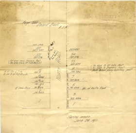
Survey of North Road
https://search.heritageburnaby.ca/link/museumdescription11916
- Repository
- Burnaby Village Museum
- Date
- June 24, 1911
- Collection/Fonds
- Ronald G. Scobbie collection
- Description Level
- Item
- Physical Description
- 1 survey plan : pencil on paper ; 22.5 x 23 cm
- Scope and Content
- Item consists of a survey plan along the east and west sides of North Road. Lots on the east side include District Lots 102; 101; 100; 15; 8; 6; 4; 2; 1. Lots on the west side include; District Lots 54; 55; 9; 7; 5; 3 and 1.
- Repository
- Burnaby Village Museum
- Collection/Fonds
- Ronald G. Scobbie collection
- Description Level
- Item
- Physical Description
- 1 survey plan : pencil on paper ; 22.5 x 23 cm
- Scope and Content
- Item consists of a survey plan along the east and west sides of North Road. Lots on the east side include District Lots 102; 101; 100; 15; 8; 6; 4; 2; 1. Lots on the west side include; District Lots 54; 55; 9; 7; 5; 3 and 1.
- Creator
- Hill & Burnett
- Geographic Access
- North Road
- Accession Code
- BV003.83.26
- Access Restriction
- No restrictions
- Reproduction Restriction
- No known restrictions
- Date
- June 24, 1911
- Media Type
- Cartographic Material
- Scan Resolution
- 600
- Scan Date
- Dec. 15, 2020
- Scale
- 100
- Notes
- Title based on contents of plan
- Notes in pencil on verso read: P.11 Vol 1 / P. 15 Vol 1 / P. 17 Vol 1 / Lot 9 / John [Keys] P.R. 2100 / River foreshore"
- Note in red pencil crayon on verso reads: "001609”
- Stamp in red ink on plan reads: "Hill & Burnett / Civil Engineers / and / B.C. Land Surveyors / New Westminter B.C."
Images
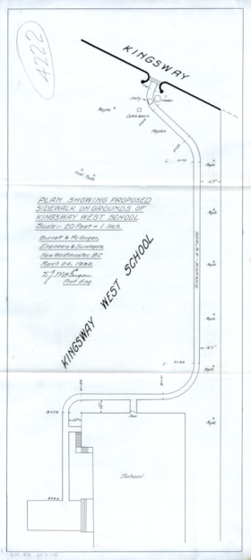
Proposed sidewalk on grounds of Kingsway West School
https://search.heritageburnaby.ca/link/museumdescription11917
- Repository
- Burnaby Village Museum
- Date
- March 24, 1932
- Collection/Fonds
- Ronald G. Scobbie collection
- Description Level
- Item
- Physical Description
- 1 survey plan : ink on waxed linen sheet ; 55 x 25 cm
- Scope and Content
- Item consists of a survey plan titled “Plan Showing Proposed / Sidewalk on Grounds of / Kingsway West School”
- Repository
- Burnaby Village Museum
- Collection/Fonds
- Ronald G. Scobbie collection
- Description Level
- Item
- Physical Description
- 1 survey plan : ink on waxed linen sheet ; 55 x 25 cm
- Material Details
- Scale 20’=1”
- Scope and Content
- Item consists of a survey plan titled “Plan Showing Proposed / Sidewalk on Grounds of / Kingsway West School”
- Creator
- McGugan, Donald Johnston
- Names
- Kingsway West School
- Accession Code
- BV003.83.40
- Access Restriction
- No restrictions
- Reproduction Restriction
- No known restrictions
- Date
- March 24, 1932
- Media Type
- Cartographic Material
- Scan Resolution
- 600
- Scan Date
- 15-Jan-2021
- Scale
- 100
- Notes
- Transcribed title
- Note in pencil reads: ‘4222”
Images
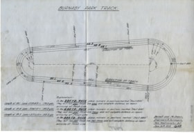
Burnaby Park track
https://search.heritageburnaby.ca/link/museumdescription11918
- Repository
- Burnaby Village Museum
- Date
- June 30, 1932
- Collection/Fonds
- Ronald G. Scobbie collection
- Description Level
- Item
- Physical Description
- 1 survey plan : ink on waxed linen sheet ; 27 x 39 cm
- Scope and Content
- Item consists of a survey plan titled “Burnaby Park Track”.
- Repository
- Burnaby Village Museum
- Collection/Fonds
- Ronald G. Scobbie collection
- Description Level
- Item
- Physical Description
- 1 survey plan : ink on waxed linen sheet ; 27 x 39 cm
- Scope and Content
- Item consists of a survey plan titled “Burnaby Park Track”.
- Accession Code
- BV003.83.41
- Access Restriction
- No restrictions
- Reproduction Restriction
- No known restrictions
- Date
- June 30, 1932
- Media Type
- Cartographic Material
- Notes
- Transcribed title
- Note in pencil reads: ‘4222”
Images
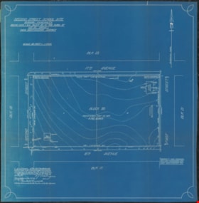
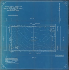
Second Street School site
https://search.heritageburnaby.ca/link/museumdescription11920
- Repository
- Burnaby Village Museum
- Date
- May 29, 1915
- Collection/Fonds
- Ronald G. Scobbie collection
- Description Level
- Item
- Physical Description
- 1 survey plan : blueprint on paper ; 56 x 54 cm
- Scope and Content
- Survey plan of "Second Street School Site" "Burnaby Municipality" "Being Lots 1 & 2 , Block 20 of the Subd of / Lot 27. Group 1 / New Westminster District".
- Repository
- Burnaby Village Museum
- Collection/Fonds
- Ronald G. Scobbie collection
- Description Level
- Item
- Physical Description
- 1 survey plan : blueprint on paper ; 56 x 54 cm
- Material Details
- Scale: 40 feet = 1 inch
- Scope and Content
- Survey plan of "Second Street School Site" "Burnaby Municipality" "Being Lots 1 & 2 , Block 20 of the Subd of / Lot 27. Group 1 / New Westminster District".
- Creator
- McGugan, Donald Johnston
- Subjects
- Buildings - Schools
- Names
- Edmonds Community School
- Responsibility
- Burnett and McGugan B.C. Land Surveyors, New Westminster
- Geographic Access
- Edmonds Street
- Street Address
- 7641 Edmonds Street
- Accession Code
- BV003.83.6
- Access Restriction
- No restrictions
- Reproduction Restriction
- No known restrictions
- Date
- May 29, 1915
- Media Type
- Cartographic Material
- Historic Neighbourhood
- Edmonds (Historic Neighbourhood)
- Planning Study Area
- Edmonds Area
- Scan Resolution
- 440
- Scan Date
- 22-Dec-2020
- Scale
- 100
- Notes
- Title based on contents of plan
- Oath in bottom left corner reads: "I, D.J. McGugan...and did personally superintend the survey..." "...completed on the 8th day of March 1915"; signed "D.J. McGugan / BCLS / sworn...29 day / of May 1915"
- handwritten on back, "1733"
Zoomable Images
Anglican Church
https://search.heritageburnaby.ca/link/museumdescription11921
- Repository
- Burnaby Village Museum
- Date
- [ca.1910]
- Collection/Fonds
- Ronald G. Scobbie collection
- Description Level
- Item
- Physical Description
- 1 plan : black ink and watercol. on paper ; 30.45 x 30.5 cm
- Scope and Content
- Item consists of building insurance plan of "Anglican Church / Lot 2 BK 37 DL69, GP.1, N.W.D. (15th Ave. (Dominion) is identified to the north of Lots 1, 2 and 3).
- Repository
- Burnaby Village Museum
- Collection/Fonds
- Ronald G. Scobbie collection
- Description Level
- Item
- Physical Description
- 1 plan : black ink and watercol. on paper ; 30.45 x 30.5 cm
- Material Details
- Scale 1 inch = 20 feet
- Scope and Content
- Item consists of building insurance plan of "Anglican Church / Lot 2 BK 37 DL69, GP.1, N.W.D. (15th Ave. (Dominion) is identified to the north of Lots 1, 2 and 3).
- Subjects
- Buildings - Religious - Churches
- Accession Code
- BV003.83.43
- Access Restriction
- No restrictions
- Reproduction Restriction
- No known restrictions
- Date
- [ca.1910]
- Media Type
- Cartographic Material
- Scan Resolution
- 600
- Scan Date
- 15-Jan-2021
- Scale
- 100
- Notes
- Transcribed title
- Note in pencil on verso reads: "Anglican Church / Lot 2 Bk 37 DL69 / 1"=20' "
- Note in balck in on verso reads: "3704"
Images
St. John the Divine
https://search.heritageburnaby.ca/link/museumdescription11922
- Repository
- Burnaby Village Museum
- Date
- [ca.1910]
- Collection/Fonds
- Ronald G. Scobbie collection
- Description Level
- Item
- Physical Description
- 1 plan : black ink and watercol. on paper ; 30.45 x 30.5 cm
- Scope and Content
- Item consists of building insurance plan of "St. John the Divine / Lot "A" BK. 49 DL 35 GP1 N.W.D.". Kingsway is identified to the south of building.
- Repository
- Burnaby Village Museum
- Collection/Fonds
- Ronald G. Scobbie collection
- Description Level
- Item
- Physical Description
- 1 plan : black ink and watercol. on paper ; 30.45 x 30.5 cm
- Material Details
- Scale 1 inch = 20 feet
- Scope and Content
- Item consists of building insurance plan of "St. John the Divine / Lot "A" BK. 49 DL 35 GP1 N.W.D.". Kingsway is identified to the south of building.
- Subjects
- Buildings - Religious - Churches
- Accession Code
- BV003.83.44
- Access Restriction
- No restrictions
- Reproduction Restriction
- No known restrictions
- Date
- [ca.1910]
- Media Type
- Cartographic Material
- Scan Resolution
- 600
- Scan Date
- 15-Jan-2021
- Scale
- 100
- Notes
- Transcribed title
- Note in pencil on verso reads: "St. John the Divine / Lot "A" BK. 49 DL 35 / 1"=20' "
- Note in balck in on verso reads: "3704"
Images
Gordon Presbyterian Church
https://search.heritageburnaby.ca/link/museumdescription11923
- Repository
- Burnaby Village Museum
- Date
- [ca.1912]
- Collection/Fonds
- Ronald G. Scobbie collection
- Description Level
- Item
- Physical Description
- 1 plan : black ink and watercol. on paper ; 30.45 x 30.5 cm
- Scope and Content
- Item consists of building insurance plan of "Gordon Presbyterian Church / Blocks 1-2 BK 7 DL 30 GP1 N.W.D.". Arbutus Street is identified to the north of Lots 1, 2, & 3 and Humphries Avenue to the east.
- Repository
- Burnaby Village Museum
- Collection/Fonds
- Ronald G. Scobbie collection
- Description Level
- Item
- Physical Description
- 1 plan : black ink and watercol. on paper ; 30.45 x 30.5 cm
- Material Details
- Scale 1 inch = 20 feet
- Scope and Content
- Item consists of building insurance plan of "Gordon Presbyterian Church / Blocks 1-2 BK 7 DL 30 GP1 N.W.D.". Arbutus Street is identified to the north of Lots 1, 2, & 3 and Humphries Avenue to the east.
- Subjects
- Buildings - Religious - Churches
- Accession Code
- BV003.83.45
- Access Restriction
- No restrictions
- Reproduction Restriction
- No known restrictions
- Date
- [ca.1912]
- Media Type
- Cartographic Material
- Scan Resolution
- 600
- Scan Date
- 15-Jan-2021
- Scale
- 100
- Notes
- Transcribed title
- Note in pencil on verso reads: "Gordon Presbyterian Church / Blocks 1-2 BK 7 DL 30 / Scale 1 inch = 20 feet" "Total area Lot 1 / Portion exempted / Total area Lot 2 / Portion exempted"
- Note in balck in on verso reads: "3704"
Images
All Saints Church
https://search.heritageburnaby.ca/link/museumdescription11924
- Repository
- Burnaby Village Museum
- Date
- [ca.1910]
- Collection/Fonds
- Ronald G. Scobbie collection
- Description Level
- Item
- Physical Description
- 1 plan : black ink and watercol. on paper ; 30.45 x 30.5 cm
- Scope and Content
- Item consists of building insurance plan of "All Saints Church / Lot "A" BK 29 DL 98 GP1 N.W.D.". Watling Street is idenfied to the north of the church building and Royal Oak Avenue to the west.
- Repository
- Burnaby Village Museum
- Collection/Fonds
- Ronald G. Scobbie collection
- Description Level
- Item
- Physical Description
- 1 plan : black ink and watercol. on paper ; 30.45 x 30.5 cm
- Material Details
- Scale 1 inch = 20 feet
- Scope and Content
- Item consists of building insurance plan of "All Saints Church / Lot "A" BK 29 DL 98 GP1 N.W.D.". Watling Street is idenfied to the north of the church building and Royal Oak Avenue to the west.
- Subjects
- Buildings - Religious - Churches
- Accession Code
- BV003.83.46
- Access Restriction
- No restrictions
- Reproduction Restriction
- No known restrictions
- Date
- [ca.1910]
- Media Type
- Cartographic Material
- Scan Resolution
- 600
- Scan Date
- 15-Jan-2021
- Scale
- 100
- Notes
- Transcribed title
- Note in pencil on verso reads: ""All Saints Church / Lot "A" BK 29 DL 98 / Scale 1 inch = 20 feet"
- Note in balck in on verso reads: "3704"
Images
St. Stephens
https://search.heritageburnaby.ca/link/museumdescription11925
- Repository
- Burnaby Village Museum
- Date
- [ca.1912]
- Collection/Fonds
- Ronald G. Scobbie collection
- Description Level
- Item
- Physical Description
- 1 plan : black ink and watercol. on paper ; 30.45 x 30.5 cm
- Scope and Content
- Item consists of building insurance plan of "St. Stephens / Lot A BK 1 DL 6 GP1 N.W.D." Cameron Street is indentified to the south of Lot A BK 1. District Lot 6.
- Repository
- Burnaby Village Museum
- Collection/Fonds
- Ronald G. Scobbie collection
- Description Level
- Item
- Physical Description
- 1 plan : black ink and watercol. on paper ; 30.45 x 30.5 cm
- Material Details
- Scale 1 inch = 30 feet
- Scope and Content
- Item consists of building insurance plan of "St. Stephens / Lot A BK 1 DL 6 GP1 N.W.D." Cameron Street is indentified to the south of Lot A BK 1. District Lot 6.
- Subjects
- Buildings - Religious - Churches
- Accession Code
- BV003.83.47
- Access Restriction
- No restrictions
- Reproduction Restriction
- No known restrictions
- Date
- [ca.1912]
- Media Type
- Cartographic Material
- Scan Resolution
- 600
- Scan Date
- 15-Jan-2021
- Scale
- 100
- Notes
- Transcribed title
- Note in pencil on verso reads: "St. Stephens / Lot A BK 1, DL 6 / 30' = 1" "
- Note in balck in on verso reads: "3704"
Images
St. Albans the Martyr
https://search.heritageburnaby.ca/link/museumdescription11926
- Repository
- Burnaby Village Museum
- Date
- [ca.1910]
- Collection/Fonds
- Ronald G. Scobbie collection
- Description Level
- Item
- Physical Description
- 1 plan : black ink and watercol. on paper ; 30.45 x 30.5 cm
- Scope and Content
- Item consists of building insurance plan of "St. Albans the Martyr / Lots 45 & 46 North Part DL 28 / GP1 N.W.D." Edmonds Street is to the north, Douglas Road to the west and 19th Avenue to the south.
- Repository
- Burnaby Village Museum
- Collection/Fonds
- Ronald G. Scobbie collection
- Description Level
- Item
- Physical Description
- 1 plan : black ink and watercol. on paper ; 30.45 x 30.5 cm
- Material Details
- Scale 1 inch = 40 feet
- Scope and Content
- Item consists of building insurance plan of "St. Albans the Martyr / Lots 45 & 46 North Part DL 28 / GP1 N.W.D." Edmonds Street is to the north, Douglas Road to the west and 19th Avenue to the south.
- Subjects
- Buildings - Religious - Churches
- Accession Code
- BV003.83.48
- Access Restriction
- No restrictions
- Reproduction Restriction
- No known restrictions
- Date
- [ca.1910]
- Media Type
- Cartographic Material
- Scan Resolution
- 600
- Scan Date
- 15-Jan-2021
- Scale
- 100
- Notes
- Transcribed title
- Note in pencil on verso reads: "St. Albans the Martyr / Lots 45 & 46 North Part DL 28 / 1" = 40' "
- Note in balck in on verso reads: "3704"
Images
Broadview Presbyterian Church
https://search.heritageburnaby.ca/link/museumdescription11927
- Repository
- Burnaby Village Museum
- Date
- [ca.1910]
- Collection/Fonds
- Ronald G. Scobbie collection
- Description Level
- Item
- Physical Description
- 1 plan : black ink and watercol. on paper ; 30.45 x 30.5 cm
- Scope and Content
- Item consists of building insurance plan of "Broadview Presbyterian Church / Lot 6, BK 31, DL 69 / GP1 N.W.D." . Fourteenth Avenue (Manor) is identified to the north and Douglas Ave. to the east.
- Repository
- Burnaby Village Museum
- Collection/Fonds
- Ronald G. Scobbie collection
- Description Level
- Item
- Physical Description
- 1 plan : black ink and watercol. on paper ; 30.45 x 30.5 cm
- Material Details
- Scale 1 inch = 20 feet
- Scope and Content
- Item consists of building insurance plan of "Broadview Presbyterian Church / Lot 6, BK 31, DL 69 / GP1 N.W.D." . Fourteenth Avenue (Manor) is identified to the north and Douglas Ave. to the east.
- Subjects
- Buildings - Religious - Churches
- Accession Code
- BV003.83.49
- Access Restriction
- No restrictions
- Reproduction Restriction
- No known restrictions
- Date
- [ca.1910]
- Media Type
- Cartographic Material
- Scan Resolution
- 600
- Scan Date
- 15-Jan-2021
- Scale
- 100
- Notes
- Transcribed title
- Note in pencil on verso reads: "Broadview Presbyterian Church / Lot 6, BK 31, DL 69 / 1" = 20' "
- Note in balck in on verso reads: "3704"
Images
St. Margaret's Anglican Mission
https://search.heritageburnaby.ca/link/museumdescription11928
- Repository
- Burnaby Village Museum
- Date
- [1929]
- Collection/Fonds
- Ronald G. Scobbie collection
- Description Level
- Item
- Physical Description
- 1 plan : black ink and watercol. on paper ; 30.45 x 30.5 cm
- Scope and Content
- Item consists of building insurance plan for St. Margaret of Scotland Anglican Church. Title of plan reads: "St. Margaret's Anglican Mission (note:"Church" has been crossed out and corrected with "Mission") / Lot 10, DL 132 / GP1 N.W.D." . Curtis Street is identified to the north and Sperling Av…
- Repository
- Burnaby Village Museum
- Collection/Fonds
- Ronald G. Scobbie collection
- Description Level
- Item
- Physical Description
- 1 plan : black ink and watercol. on paper ; 30.45 x 30.5 cm
- Material Details
- Scale 1 inch = 40 feet
- Scope and Content
- Item consists of building insurance plan for St. Margaret of Scotland Anglican Church. Title of plan reads: "St. Margaret's Anglican Mission (note:"Church" has been crossed out and corrected with "Mission") / Lot 10, DL 132 / GP1 N.W.D." . Curtis Street is identified to the north and Sperling Ave. to the west.
- Subjects
- Buildings - Religious - Churches
- Geographic Access
- Sperling Avenue
- Curtis Street
- Accession Code
- BV003.83.50
- Access Restriction
- No restrictions
- Reproduction Restriction
- No known restrictions
- Date
- [1929]
- Media Type
- Cartographic Material
- Scan Resolution
- 600
- Scan Date
- 15-Jan-2021
- Scale
- 100
- Notes
- Transcribed title
- Note in pencil on verso reads: "St. Margaret's Anglican Mission / Lot 10, DL 132 / 1" = 40' "
- Note in balck in on verso reads: "3704"
Images
St. Helen's Church
https://search.heritageburnaby.ca/link/museumdescription11929
- Repository
- Burnaby Village Museum
- Date
- [ca.1910]
- Collection/Fonds
- Ronald G. Scobbie collection
- Description Level
- Item
- Physical Description
- 1 plan : black ink and watercol. on paper ; 30.45 x 30.5 cm
- Scope and Content
- Item consists of building insurance plan of "St. Helen's Church / Lots 11 & 12 BK 7 DL 186 / GP1 N.W.D." . Ingleton Ave is identified to the east and Pandora St. to the south.
- Repository
- Burnaby Village Museum
- Collection/Fonds
- Ronald G. Scobbie collection
- Description Level
- Item
- Physical Description
- 1 plan : black ink and watercol. on paper ; 30.45 x 30.5 cm
- Material Details
- Scale 1 inch = 20 feet
- Scope and Content
- Item consists of building insurance plan of "St. Helen's Church / Lots 11 & 12 BK 7 DL 186 / GP1 N.W.D." . Ingleton Ave is identified to the east and Pandora St. to the south.
- Subjects
- Buildings - Religious - Churches
- Accession Code
- BV003.83.51
- Access Restriction
- No restrictions
- Reproduction Restriction
- No known restrictions
- Date
- [ca.1910]
- Media Type
- Cartographic Material
- Scan Resolution
- 600
- Scan Date
- 15-Jan-2021
- Scale
- 100
- Notes
- Transcribed title
- Note in pencil on verso reads: ""St. Helen's Church / Lots 11 & 12 BK 7 DL 186 / 1" = 20' "
- Note in balck in on verso reads: "3704"
Images
Dundonald United Church
https://search.heritageburnaby.ca/link/museumdescription11930
- Repository
- Burnaby Village Museum
- Date
- [ca.1910]
- Collection/Fonds
- Ronald G. Scobbie collection
- Description Level
- Item
- Physical Description
- 1 plan : black ink and watercol. on paper ; 30.45 x 30.5 cm
- Scope and Content
- Item consists of a building insurance plan of "Dundonald United Church / Lots 9, 10 BK 28 DL 159 GP 1 / N.W.D.". Clinton Street is identified to the north of Lots nine and ten.
- Repository
- Burnaby Village Museum
- Collection/Fonds
- Ronald G. Scobbie collection
- Description Level
- Item
- Physical Description
- 1 plan : black ink and watercol. on paper ; 30.45 x 30.5 cm
- Material Details
- Scale 1 inch = 20 feet
- Scope and Content
- Item consists of a building insurance plan of "Dundonald United Church / Lots 9, 10 BK 28 DL 159 GP 1 / N.W.D.". Clinton Street is identified to the north of Lots nine and ten.
- Subjects
- Buildings - Religious - Churches
- Names
- Dundonald United Church
- Accession Code
- BV003.83.52
- Access Restriction
- No restrictions
- Reproduction Restriction
- No known restrictions
- Date
- [ca.1910]
- Media Type
- Cartographic Material
- Scan Resolution
- 600
- Scan Date
- 15-Jan-2021
- Scale
- 100
- Notes
- Transcribed title
- Note in pencil on verso reads: "_ _Church / Lots 9 & 10 BK 28 DL 159 / 1" = 20' "
- Note in black ink on verso reads: "3704"
Images
St. Nicolas Parish Church
https://search.heritageburnaby.ca/link/museumdescription11931
- Repository
- Burnaby Village Museum
- Date
- [ca.1912]
- Collection/Fonds
- Ronald G. Scobbie collection
- Description Level
- Item
- Physical Description
- 1 plan : black ink and watercol. on paper ; 30.45 x 30.5 cm
- Scope and Content
- Item consists of a building insurance plan of St. Nicholas Anglican Church. Title on plan reads "St. Nicolas [sic] Parish Church / Lots 11 & 12 BK 10 DL 186 GP 1 / N.W.D.". Ingleton Avenue is identified to the east and Triumph Street to the south.
- Repository
- Burnaby Village Museum
- Collection/Fonds
- Ronald G. Scobbie collection
- Description Level
- Item
- Physical Description
- 1 plan : black ink and watercol. on paper ; 30.45 x 30.5 cm
- Material Details
- Scale 1 inch = 20 feet
- Scope and Content
- Item consists of a building insurance plan of St. Nicholas Anglican Church. Title on plan reads "St. Nicolas [sic] Parish Church / Lots 11 & 12 BK 10 DL 186 GP 1 / N.W.D.". Ingleton Avenue is identified to the east and Triumph Street to the south.
- Subjects
- Buildings - Religious - Churches
- Geographic Access
- Triumph Street
- Street Address
- 3883 Triumph Street
- Accession Code
- BV003.83.53
- Access Restriction
- No restrictions
- Reproduction Restriction
- No known restrictions
- Date
- [ca.1912]
- Media Type
- Cartographic Material
- Historic Neighbourhood
- Vancouver Heights (Historic Neighbourhood)
- Scan Resolution
- 600
- Scan Date
- 15-Jan-2021
- Scale
- 100
- Notes
- Transcribed title
- Note in pencil on verso reads: "St. Nicholas Parish Church / Lots 11 & 12 BK 10 DL 186 / 1" = 20' "
- Note in black ink on verso reads: "3704"
Images
East Burnaby United Church
https://search.heritageburnaby.ca/link/museumdescription11932
- Repository
- Burnaby Village Museum
- Date
- [ca.1925]
- Collection/Fonds
- Ronald G. Scobbie collection
- Description Level
- Item
- Physical Description
- 1 plan : black ink and watercol. on paper ; 30.45 x 30.5 cm
- Scope and Content
- Item consists of a building insurance plan of "East Burnaby United Church / Lot 1 BK 2 south Part DL 28 GP 1 N.W.D.". Twelfth Avenue is identified to the north and Douglas Road to the west.
- Repository
- Burnaby Village Museum
- Collection/Fonds
- Ronald G. Scobbie collection
- Description Level
- Item
- Physical Description
- 1 plan : black ink and watercol. on paper ; 30.45 x 30.5 cm
- Material Details
- Scale 1 inch = 20 feet
- Scope and Content
- Item consists of a building insurance plan of "East Burnaby United Church / Lot 1 BK 2 south Part DL 28 GP 1 N.W.D.". Twelfth Avenue is identified to the north and Douglas Road to the west.
- Subjects
- Buildings - Religious - Churches
- Accession Code
- BV003.83.54
- Access Restriction
- No restrictions
- Reproduction Restriction
- No known restrictions
- Date
- [ca.1925]
- Media Type
- Cartographic Material
- Scan Resolution
- 600
- Scan Date
- 15-Jan-2021
- Scale
- 100
- Notes
- Transcribed title
- Note in pencil on verso reads: "East Burnaby United Church / Lot 1 BK 2 south Part DL 28 / 1" = 20' "
- Note in black ink on verso reads: "3704"
Images
Price list and plan of subdivision west half Lot 117 - Buckingham
https://search.heritageburnaby.ca/link/museumdescription13094
- Repository
- Burnaby Village Museum
- Date
- [ca. 1913]
- Collection/Fonds
- Burnaby Village Museum Map collection
- Description Level
- Item
- Physical Description
- 1 map : col. lithographic print ; both sides ; 40 x 43.5 cm, folded to 40 x 22 cm
- Scope and Content
- Folded price list and plan of Subdivision of West Half of District Lot 117, Ward V, New Westiminster District "Buckingham". Subdivision is bordered by Boundary Road to the west, John Street to the east, Halifax Street to the south and Amherst Street to the north.
- Repository
- Burnaby Village Museum
- Collection/Fonds
- Burnaby Village Museum Map collection
- Description Level
- Item
- Physical Description
- 1 map : col. lithographic print ; both sides ; 40 x 43.5 cm, folded to 40 x 22 cm
- Material Details
- Scale 1 inch = 200 feet
- Scope and Content
- Folded price list and plan of Subdivision of West Half of District Lot 117, Ward V, New Westiminster District "Buckingham". Subdivision is bordered by Boundary Road to the west, John Street to the east, Halifax Street to the south and Amherst Street to the north.
- Accession Code
- HV976.158.8
- Access Restriction
- No restrictions
- Reproduction Restriction
- No known restrictions
- Date
- [ca. 1913]
- Media Type
- Cartographic Material
- Historic Neighbourhood
- Vancouver Heights (Historic Neighbourhood)
- Planning Study Area
- Burnaby Heights Area
- Scan Resolution
- 96 dpi
- Scan Date
- 4-Jun-20
- Scale
- 100
- Notes
- Title based on content of map
- Title on plan reads: "BUCKINGHAM / W1/2 OF LOT 117, WARD V N.W.D. B.C. / AT THE JUNCTION OF THE BOUNDARY & N. WEST'R ROADS"
- Text on verso of plan reads: "BUCKINGHAM" / FOR SURE ADVANCE / AND QUICK TURN OVER"
- Image link shows side one of price list and plan
Images
Municipality of Burnaby
https://search.heritageburnaby.ca/link/museumdescription13095
- Repository
- Burnaby Village Museum
- Date
- [ca. 1909]
- Collection/Fonds
- Burnaby Village Museum Map collection
- Description Level
- Item
- Physical Description
- 1 map : b&w lithographic print on linen, b&w ; 40 x 43.5 cm
- Scope and Content
- Map of the Municipality of Burnaby issued by Mahon, McFarland and Mahon (Real Estate, Insurance and Loans, Vancouver B.C.). A handrawn red line runs south of Burnaby Lake and between North Road and Boundary Road.
- Repository
- Burnaby Village Museum
- Collection/Fonds
- Burnaby Village Museum Map collection
- Description Level
- Item
- Physical Description
- 1 map : b&w lithographic print on linen, b&w ; 40 x 43.5 cm
- Scope and Content
- Map of the Municipality of Burnaby issued by Mahon, McFarland and Mahon (Real Estate, Insurance and Loans, Vancouver B.C.). A handrawn red line runs south of Burnaby Lake and between North Road and Boundary Road.
- Creator
- Mahon, McFarland & Mahon
- Publisher
- The Angel Engraving Co.
- Accession Code
- HV976.158.6
- Access Restriction
- No restrictions
- Reproduction Restriction
- No known restrictions
- Date
- [ca. 1909]
- Media Type
- Cartographic Material
- Scan Resolution
- 420
- Scan Date
- Dec. 22, 2020
- Scale
- 100
- Notes
- Title based on content of map
- Title on map reads: "Map / of The / Municipality / of / BURNABY / ISSUED BY / Mahon, McFarland & Mahon"
- Map contains the initals "F.R.G." [sic]
- Circular insignia in left corner reads: "THE ANGEL ENGRAVING CO."
Zoomable Images
Municipality of Burnaby
https://search.heritageburnaby.ca/link/museumdescription13096
- Repository
- Burnaby Village Museum
- Date
- 1936
- Collection/Fonds
- Burnaby Village Museum Map collection
- Description Level
- Item
- Physical Description
- 1 map : b&w print on paper ; 59 x 43 cm
- Scope and Content
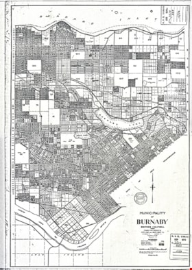
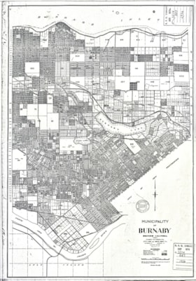
- Map of the Municipality of Burnaby compiled and published by City Map and White Print Co.
- Repository
- Burnaby Village Museum
- Collection/Fonds
- Burnaby Village Museum Map collection
- Description Level
- Item
- Physical Description
- 1 map : b&w print on paper ; 59 x 43 cm
- Scope and Content
- Map of the Municipality of Burnaby compiled and published by City Map and White Print Co.
- Creator
- City Map and White Print Co.
- Publisher
- City Map and White Print Co.
- Accession Code
- HV976.158.7
- Access Restriction
- No restrictions
- Reproduction Restriction
- No known restrictions
- Date
- 1936
- Media Type
- Cartographic Material
- Scan Resolution
- 600
- Scan Date
- 2022-04-06
- Scale
- 100
- Notes
- Title based on content of map
- Title on map reads: "MUNICIPALITY / OF / BURNABY / BRITISH COLUMBIA / Compiled and Published by / CITY MAP AND WHITE PRINT CO."
- Stamp on map reads: "SFU LIBRARY / SEP 1974 / G. 3514 / B87 / 1936"
- Stamp on map reads: "SFU LIBRARY / AUG 1973 / G. 3514 / B87 / 1936"
- Cirular seal stamp on map reads: "The University of / Library / British Columbia"
Zoomable Images
Map of the Municipality of Burnaby
https://search.heritageburnaby.ca/link/museumdescription14766
- Repository
- Burnaby Village Museum
- Date
- [ca.1913]
- Collection/Fonds
- Burnaby Village Museum Map collection
- Description Level
- Item
- Physical Description
- 1 map : lithographic print, b&w ; 82 x 62 cm
- Scope and Content
- Item is a map of the Municipality of Burnaby, "Published by Archibald Moir and Company, 570 Granville St., Vancouver". Map was published compliments of "Walker Brothers Real Estate Brokers and Insurance Agents", Vancouver.
- Repository
- Burnaby Village Museum
- Collection/Fonds
- Burnaby Village Museum Map collection
- Description Level
- Item
- Physical Description
- 1 map : lithographic print, b&w ; 82 x 62 cm
- Material Details
- Scale 1 inch = 1000 feet
- Scope and Content
- Item is a map of the Municipality of Burnaby, "Published by Archibald Moir and Company, 570 Granville St., Vancouver". Map was published compliments of "Walker Brothers Real Estate Brokers and Insurance Agents", Vancouver.
- Publisher
- Archibald Moir and Company
- Responsibility
- Walker Brothers Real Estate Brokers and Insurance Agents
- Accession Code
- BV988.56.1
- Access Restriction
- No restrictions
- Reproduction Restriction
- No known restrictions
- Date
- [ca.1913]
- Media Type
- Cartographic Material
- Scan Resolution
- 350
- Scan Date
- Dec. 22,2020
- Scale
- 100
- Notes
- Title based on contents of map
![Anglican Church, [ca.1910] thumbnail](/media/hpo/_Data/_BVM_Cartographic_Material/2003/2003_0083_0043_001.jpg?width=280)
![St. John the Divine, [ca.1910] thumbnail](/media/hpo/_Data/_BVM_Cartographic_Material/2003/2003_0083_0044_001.jpg?width=280)
![Gordon Presbyterian Church, [ca.1912] thumbnail](/media/hpo/_Data/_BVM_Cartographic_Material/2003/2003_0083_0045_001.jpg?width=280)
![All Saints Church, [ca.1910] thumbnail](/media/hpo/_Data/_BVM_Cartographic_Material/2003/2003_0083_0046_001.jpg?width=280)
![St. Stephens, [ca.1912] thumbnail](/media/hpo/_Data/_BVM_Cartographic_Material/2003/2003_0083_0047_001.jpg?width=280)
![St. Albans the Martyr, [ca.1910] thumbnail](/media/hpo/_Data/_BVM_Cartographic_Material/2003/2003_0083_0048_001.jpg?width=280)
![Broadview Presbyterian Church, [ca.1910] thumbnail](/media/hpo/_Data/_BVM_Cartographic_Material/2003/2003_0083_0049_001.jpg?width=280)
![St. Margaret's Anglican Mission, [1929] thumbnail](/media/hpo/_Data/_BVM_Cartographic_Material/2003/2003_0083_0050_001.jpg?width=280)
![St. Helen's Church, [ca.1910] thumbnail](/media/hpo/_Data/_BVM_Cartographic_Material/2003/2003_0083_0051_001.jpg?width=280)
![Dundonald United Church, [ca.1910] thumbnail](/media/hpo/_Data/_BVM_Cartographic_Material/2003/2003_0083_0052_001.jpg?width=280)
![St. Nicolas Parish Church, [ca.1912] thumbnail](/media/hpo/_Data/_BVM_Cartographic_Material/2003/2003_0083_0053_001.jpg?width=280)
![East Burnaby United Church, [ca.1925] thumbnail](/media/hpo/_Data/_BVM_Cartographic_Material/2003/2003_0083_0054_001.jpg?width=280)
![Price list and plan of subdivision west half Lot 117 - Buckingham, [ca. 1913] thumbnail](/media/hpo/_Data/_BVM_Cartographic_Material/1976/1976_0158_0008_001.jpg?width=280)
![Municipality of Burnaby, [ca. 1909] thumbnail](/media/hpo/_Data/_BVM_Cartographic_Material/1976/1976_0158_0006_002%20WEB.jpg?width=280)
![Municipality of Burnaby, [ca. 1909] thumbnail](/media/hpo/_Data/_BVM_Cartographic_Material/1976/1976_0158_0006_001_seadragon/1976_0158_0006_001.jpg?w=280)
![Map of the Municipality of Burnaby, [ca.1913] thumbnail](/media/hpo/_Data/_BVM_Cartographic_Material/1988/1988_0056_0001_002%20WEB.jpg?width=280)
![Map of the Municipality of Burnaby, [ca.1913] thumbnail](/media/hpo/_Data/_BVM_Cartographic_Material/1988/1988_0056_0001_001_seadragon/1988_0056_0001_001.jpg?w=280)