Narrow Results By
Decade
- 2020s 182
- 2010s 226
- 2000s 309
- 1990s 1022
- 1980s
- 1970s 2040
- 1960s 736
- 1950s 893
- 1940s 1111
- 1930s 1279
- 1920s 1461
- 1910s 1287
- 1900s
- 1890s 349
- 1880s 141
- 1870s 51
- 1860s 52
- 1850s 26
- 1840s 17
- 1830s 8
- 1820s 5
- 1810s 5
- 1800s 8
- 1790s 4
- 1780s 3
- 1770s 3
- 1760s 3
- 1750s 3
- 1740s 3
- 1730s 3
- 1720s 3
- 1710s 5
- 1700s 4
- 1690s 3
- 1680s 4
- 1670s 3
- 1660s 3
- 1650s 3
- 1640s 3
- 1630s 3
- 1620s 3
- 1610s 3
- 1600s 3
- 1520s 1
Creator
- Ackerknecht, Erwin H. (Erwin Heinz), 1906-1988 1
- Adams, George Burton, 1851-1925 1
- Adams, Peter 1
- Adams, W.H. Davenport (William Henry Davenport), 1828-1891 1
- Alberta. Alberta Culture 1
- Alexander, Charles M. (Charles McCallon), 1867-1920 1
- Alter, Ian 1
- Alymer-Small, Sidney 1
- American Association of Youth Museums 2
- Ancona, George 1
- Anderson, Joan, 1943- 1
- Andrews, Elisha Benjamin, 1844-1917 3

R.W. McMurray
https://search.heritageburnaby.ca/link/museumdescription4
- Repository
- Burnaby Village Museum
- Date
- 1907
- Collection/Fonds
- Burnaby Village Museum Photograph collection
- Description Level
- Item
- Physical Description
- 1 photograph : b&w ; 8.7 x 6.1 cm
- Scope and Content
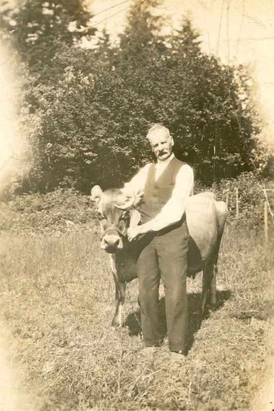
- Photograph of an older man wearing a vest standing in a field, holding a cow with horns by the neck. An annotation on the back of the photo reads: "This picture was taken 1907 - at the old ranch. / My Dad. R.W. McMurray." This ranch is where the old Gilley Brothers had their extensive logging ope…
- Repository
- Burnaby Village Museum
- Collection/Fonds
- Burnaby Village Museum Photograph collection
- Description Level
- Item
- Physical Description
- 1 photograph : b&w ; 8.7 x 6.1 cm
- Scope and Content
- Photograph of an older man wearing a vest standing in a field, holding a cow with horns by the neck. An annotation on the back of the photo reads: "This picture was taken 1907 - at the old ranch. / My Dad. R.W. McMurray." This ranch is where the old Gilley Brothers had their extensive logging operations since R.W. McMurray purchased the old Gilley Ranch.
- Subjects
- Animals - Cows
- Names
- McMurray, R.W.
- Accession Code
- HV981.3.2
- Access Restriction
- No restrictions
- Reproduction Restriction
- No known restrictions
- Date
- 1907
- Media Type
- Photograph
- Scan Resolution
- 600
- Scan Date
- 2023-09-12
- Notes
- Title based on contents of photograph
- 2016 technical exhibit
Images
![Falling Trees at Burnaby, BC, [190-] thumbnail](/media/hpo/_Data/_BVM_Images/1971/1971_0081_0001_001.jpg?width=280)
Falling Trees at Burnaby, BC
https://search.heritageburnaby.ca/link/museumdescription27
- Repository
- Burnaby Village Museum
- Date
- [190-]
- Collection/Fonds
- Burnaby Village Museum Photograph collection
- Description Level
- Item
- Physical Description
- 1 photograph : b&w ; 8.3 x 8.3 cm
- Scope and Content
- Photograph of three unidentified men standing in front of a very large tree stump. The man in the centre of the picture is holding an axe. Two axes are in the tree. A large two-man saw lies on the ground in front of the tree. An caption in blue ink on a separate label below the photograph reads…
- Repository
- Burnaby Village Museum
- Collection/Fonds
- Burnaby Village Museum Photograph collection
- Description Level
- Item
- Physical Description
- 1 photograph : b&w ; 8.3 x 8.3 cm
- Scope and Content
- Photograph of three unidentified men standing in front of a very large tree stump. The man in the centre of the picture is holding an axe. Two axes are in the tree. A large two-man saw lies on the ground in front of the tree. An caption in blue ink on a separate label below the photograph reads, "Falling Trees at / Burnaby, B.C."
- Accession Code
- HV971.81.1
- Access Restriction
- No restrictions
- Reproduction Restriction
- No known restrictions
- Date
- [190-]
- Media Type
- Photograph
- Scan Resolution
- 600
- Scan Date
- 2023-03-28
Images
![Falling Trees at Burnaby, BC, [190-] thumbnail](/media/hpo/_Data/_BVM_Images/1971/1971_0081_0001_001.jpg)

![Swing Bridge, [190-] thumbnail](/media/hpo/_Data/_BVM_Images/1971/1971_0081_0002_002.jpg?width=280)
Swing Bridge
https://search.heritageburnaby.ca/link/museumdescription28
- Repository
- Burnaby Village Museum
- Date
- [190-]
- Collection/Fonds
- Burnaby Village Museum Photograph collection
- Description Level
- Item
- Physical Description
- 1 photograph : b&w ; 8.4 x 8.4 cm
- Scope and Content
- Photograph of two men, each in dark suits and bowler hats standing with one hand on the railing of the swing bridge at Capilano, North Vancouver.
- Repository
- Burnaby Village Museum
- Collection/Fonds
- Burnaby Village Museum Photograph collection
- Description Level
- Item
- Physical Description
- 1 photograph : b&w ; 8.4 x 8.4 cm
- Scope and Content
- Photograph of two men, each in dark suits and bowler hats standing with one hand on the railing of the swing bridge at Capilano, North Vancouver.
- Subjects
- Structures - Bridges
- Accession Code
- HV971.81.2
- Access Restriction
- No restrictions
- Reproduction Restriction
- No known restrictions
- Date
- [190-]
- Media Type
- Photograph
- Scan Resolution
- 600
- Scan Date
- 2023-03-28
- Notes
- Title based on contents of photograph
- Caption in blue ink on a separate label below the photograph reads, "Swing Bridge at / Capalano [sic] B.C."
Images
![Swing Bridge, [190-] thumbnail](/media/hpo/_Data/_BVM_Images/1971/1971_0081_0002_002.jpg)
![Interurban tram at Steveston, [1908] thumbnail](/media/hpo/_Data/_BVM_Images/1985/198800070006.jpg?width=280)
Interurban tram at Steveston
https://search.heritageburnaby.ca/link/museumdescription88
- Repository
- Burnaby Village Museum
- Date
- [1908]
- Collection/Fonds
- Burnaby Village Museum Photograph collection
- Description Level
- Item
- Physical Description
- 1 photograph : b&w ; 19.5 x 24.5 cm print
- Scope and Content
- Photograph of British Columbia Electric Railway Company interurban tram "RICHMOND" at Steveston (the tram would later be called no. 1205). The tram is bound for Vancouver and loaded with passengers. Three men (two wearing conductor's uniforms) are standing near the front door of the tram, facing th…
- Repository
- Burnaby Village Museum
- Collection/Fonds
- Burnaby Village Museum Photograph collection
- Description Level
- Item
- Physical Description
- 1 photograph : b&w ; 19.5 x 24.5 cm print
- Scope and Content
- Photograph of British Columbia Electric Railway Company interurban tram "RICHMOND" at Steveston (the tram would later be called no. 1205). The tram is bound for Vancouver and loaded with passengers. Three men (two wearing conductor's uniforms) are standing near the front door of the tram, facing the camera.
- Subjects
- Transportation - Electric Railroads
- Accession Code
- BV988.7.6
- Access Restriction
- No restrictions
- Reproduction Restriction
- No known restrictions
- Date
- [1908]
- Media Type
- Photograph
- Scan Resolution
- 600
- Scan Date
- 01-Jun-09
- Scale
- 100
- Notes
- Title based on contents of photograph
- Note on verso of photograph reads: "RICHMOND" (later # 1205) at Steveston about 1908" and "H. EWERT photo [mailing address follows]"
Images
![Interurban tram at Steveston, [1908] thumbnail](/media/hpo/_Data/_BVM_Images/1985/198800070006.jpg)
![Evelina Ettinger, [1905] thumbnail](/media/hpo/_Data/_BVM_Images/1987/1987_0013_0019_001.jpg?width=280)
Evelina Ettinger
https://search.heritageburnaby.ca/link/museumdescription114
- Repository
- Burnaby Village Museum
- Date
- [1905]
- Collection/Fonds
- Burnaby Village Museum Photograph collection
- Description Level
- Item
- Physical Description
- 1 photograph : b&w ; 24.5 x 19.5 cm
- Scope and Content
- Photograph of Evelina Ettinger holding a bouquet of flowers (to her nose) taken in a photographic studio.
- Repository
- Burnaby Village Museum
- Collection/Fonds
- Burnaby Village Museum Photograph collection
- Description Level
- Item
- Physical Description
- 1 photograph : b&w ; 24.5 x 19.5 cm
- Scope and Content
- Photograph of Evelina Ettinger holding a bouquet of flowers (to her nose) taken in a photographic studio.
- History
- Evelina Ettinger was born on August 8, 1891 in Port Kells to James Ettinger and Martha Hembrough. The family was living on 19th Avenue in the Edmonds neighbourhood of Burnaby at the time of her birth. Evelina later worked as a clerk until her marriage to Donald Digby, an electrician and truck driver, in 1930. She died in 1976.
- Accession Code
- BV987.13.19
- Access Restriction
- No restrictions
- Reproduction Restriction
- No known restrictions
- Date
- [1905]
- Media Type
- Photograph
- Scan Resolution
- 600
- Scan Date
- 2024-04-02
- Notes
- Title based on contents of photograph
- Note written in pen on verso of photograph reads: "EVELINA ETTINGER/ (EVA)/ MARRIED MR. DON DIGBY/ BURNABY LADY/ EDMONDS AREA/ BORN EARLY 1880's ?/ PHOTO C. 1905 ?"
Images
![Evelina Ettinger, [1905] thumbnail](/media/hpo/_Data/_BVM_Images/1987/1987_0013_0019_001.jpg)
![A. MacKenzie and Company Jubilee Store, [1907 or 1908] thumbnail](/media/hpo/_Data/_BVM_Images/1985/1985_0024_0001_001.jpg?width=280)
A. MacKenzie and Company Jubilee Store
https://search.heritageburnaby.ca/link/museumdescription159
- Repository
- Burnaby Village Museum
- Date
- [1907 or 1908]
- Collection/Fonds
- Burnaby Village Museum Photograph collection
- Description Level
- Item
- Physical Description
- 1 photograph : b&w ; 9.8 x 14.0 cm, mounted on cardboard 13.2 x 18.8 cm
- Scope and Content
- Photograph of the exterior of a store on the ground floor of a two-storey building, with a sign painted on the front face of the second floor. It reads, "A. MacKenzie & Co / Jubilee Store." There are two men in suits standing out in front of the display windows that show stacks of boxes and cans.…
- Repository
- Burnaby Village Museum
- Collection/Fonds
- Burnaby Village Museum Photograph collection
- Description Level
- Item
- Physical Description
- 1 photograph : b&w ; 9.8 x 14.0 cm, mounted on cardboard 13.2 x 18.8 cm
- Scope and Content
- Photograph of the exterior of a store on the ground floor of a two-storey building, with a sign painted on the front face of the second floor. It reads, "A. MacKenzie & Co / Jubilee Store." There are two men in suits standing out in front of the display windows that show stacks of boxes and cans. The lot around the building looks vacant, but fenced. There is a wagon drawn by a team of two horses parked or travelling towards the store on the right side of the photograph. The store was owned by Alexander MacKenzie, (1870-1949) who arrived in Vancouver in 1907. There is a discrepancy in the date of the photograph; the accession register dates the photograph 1909 while the donation form signed by the donor dates all the photographs in the accession as 1907 or 1908. Annotations on the bottom front of the card mount read: "Ralph Libby" and "Vancouver B.C." This store later became the Matheson and Sons Market.
- Geographic Access
- Kingsway
- Nelson Avenue
- Accession Code
- BV985.24.1
- Access Restriction
- No restrictions
- Reproduction Restriction
- No known restrictions
- Date
- [1907 or 1908]
- Media Type
- Photograph
- Historic Neighbourhood
- Central Park (Historic Neighbourhood)
- Planning Study Area
- Marlborough Area
- Scan Resolution
- 600
- Scan Date
- 2023-12-19
- Photographer
- Libby, Ralph
- Notes
- Title based on contents of photograph
Images
![A. MacKenzie and Company Jubilee Store, [1907 or 1908] thumbnail](/media/hpo/_Data/_BVM_Images/1985/1985_0024_0001_001.jpg)

![MacKenzie family and friends, [1907 or 1908] thumbnail](/media/hpo/_Data/_BVM_Images/1985/1985_0024_0002_001.jpg?width=280)
MacKenzie family and friends
https://search.heritageburnaby.ca/link/museumdescription160
- Repository
- Burnaby Village Museum
- Date
- [1907 or 1908]
- Collection/Fonds
- Burnaby Village Museum Photograph collection
- Description Level
- Item
- Physical Description
- 1 photograph : b&w ; 8.1 x 10.3 cm
- Scope and Content
- Photograph of six adults and three children, identified as the MacKenzie family and friends. They are standing in the bushes in the woods. A note in the accession file identifies some of the people in the photograph. Back row of three men (l to r): Charles Hutton visiting from Moosejaw wearing a b…
- Repository
- Burnaby Village Museum
- Collection/Fonds
- Burnaby Village Museum Photograph collection
- Description Level
- Item
- Physical Description
- 1 photograph : b&w ; 8.1 x 10.3 cm
- Scope and Content
- Photograph of six adults and three children, identified as the MacKenzie family and friends. They are standing in the bushes in the woods. A note in the accession file identifies some of the people in the photograph. Back row of three men (l to r): Charles Hutton visiting from Moosejaw wearing a bowler hat on the back of his head, and two unidentified men. Middle row (l to r): Miss Evelyn Hutton from Moosejaw, the sister of Charles Hutton, Mrs. Eunice MacKenzie (the donor's mother), and Mr. Alexander MacKenzie (the donor's father) holding a baby (Art MacKenzie). Front row of two children (l to r): Donald B. MacKenzie and Jean MacKenzie Davidson, son and daugher of Eunice and Alexander MacKenzie.
- Subjects
- Plants - Trees
- Names
- Davidson, Jean MacKenzie
- Hutton, Charles
- Hutton, Evelyn
- MacKenzie, Alexander
- MacKenzie, Art
- MacKenzie, Donald B.
- MacKenzie, Eunice
- Accession Code
- BV985.24.2
- Access Restriction
- No restrictions
- Reproduction Restriction
- No known restrictions
- Date
- [1907 or 1908]
- Media Type
- Photograph
- Scan Resolution
- 600
- Scan Date
- 2023-12-19
- Notes
- Title based on contents of photograph
Images
![MacKenzie family and friends, [1907 or 1908] thumbnail](/media/hpo/_Data/_BVM_Images/1985/1985_0024_0002_001.jpg)
![MacKenzie family home, [1907 or 1908] thumbnail](/media/hpo/_Data/_BVM_Images/1985/1985_0024_0003_001.jpg?width=280)
MacKenzie family home
https://search.heritageburnaby.ca/link/museumdescription161
- Repository
- Burnaby Village Museum
- Date
- [1907 or 1908]
- Collection/Fonds
- Burnaby Village Museum Photograph collection
- Description Level
- Item
- Physical Description
- 1 photograph : b&w ; 7.8 x 10.3 cm
- Scope and Content
- Photograph of the MacKenzie family's two-storey house and shed (to the side of the house). There is a woman sitting on the porch with a child by her side. The lot around the house appears vacant, but there are foot paths on the fields. According to a note in the accession file, the location is ide…
- Repository
- Burnaby Village Museum
- Collection/Fonds
- Burnaby Village Museum Photograph collection
- Description Level
- Item
- Physical Description
- 1 photograph : b&w ; 7.8 x 10.3 cm
- Scope and Content
- Photograph of the MacKenzie family's two-storey house and shed (to the side of the house). There is a woman sitting on the porch with a child by her side. The lot around the house appears vacant, but there are foot paths on the fields. According to a note in the accession file, the location is identified as one block from Kingsway on Nelson Avenue.
- Subjects
- Buildings - Residential - Houses
- Geographic Access
- Nelson Avenue
- Kingsway
- Accession Code
- BV985.24.3
- Access Restriction
- No restrictions
- Reproduction Restriction
- No known restrictions
- Date
- [1907 or 1908]
- Media Type
- Photograph
- Historic Neighbourhood
- Central Park (Historic Neighbourhood)
- Scan Resolution
- 600
- Scan Date
- 2023-12-19
- Notes
- Title based on contents of photograph
Images
![MacKenzie family home, [1907 or 1908] thumbnail](/media/hpo/_Data/_BVM_Images/1985/1985_0024_0003_001.jpg)
![Mackenzie family on lawn swing, [1907 or 1908] thumbnail](/media/hpo/_Data/_BVM_Images/1985/1985_0024_0004_001.jpg?width=280)
Mackenzie family on lawn swing
https://search.heritageburnaby.ca/link/museumdescription162
- Repository
- Burnaby Village Museum
- Date
- [1907 or 1908]
- Collection/Fonds
- Burnaby Village Museum Photograph collection
- Description Level
- Item
- Physical Description
- 1 photograph : b&w ; 8.2 x 10.6 cm
- Scope and Content
- Photograph of the MacKenzie family on a wooden swinging bench on the lawn. Depicted in the photograph are Eunice MacKenzie (the mother), Jean MacKenzie (the daughter), Donald MacKenzie (the son), and a baby (Art MacKenzie) held by Mrs. MacKenzie.
- Repository
- Burnaby Village Museum
- Collection/Fonds
- Burnaby Village Museum Photograph collection
- Description Level
- Item
- Physical Description
- 1 photograph : b&w ; 8.2 x 10.6 cm
- Scope and Content
- Photograph of the MacKenzie family on a wooden swinging bench on the lawn. Depicted in the photograph are Eunice MacKenzie (the mother), Jean MacKenzie (the daughter), Donald MacKenzie (the son), and a baby (Art MacKenzie) held by Mrs. MacKenzie.
- Subjects
- Recreational Devices - Swings
- Accession Code
- BV985.24.4
- Access Restriction
- No restrictions
- Reproduction Restriction
- No known restrictions
- Date
- [1907 or 1908]
- Media Type
- Photograph
- Scan Resolution
- 600
- Scan Date
- 2023-12-19
- Notes
- Title based on contents of photograph
Images
![Mackenzie family on lawn swing, [1907 or 1908] thumbnail](/media/hpo/_Data/_BVM_Images/1985/1985_0024_0004_001.jpg)
![Jessie Jones and Margaret in bathing suits, [1900] thumbnail](/media/hpo/_Data/_BVM_Images/1985/1985_0441_0004_001.jpg?width=280)
Jessie Jones and Margaret in bathing suits
https://search.heritageburnaby.ca/link/museumdescription219
- Repository
- Burnaby Village Museum
- Date
- [1900]
- Collection/Fonds
- Burnaby Village Museum Photograph collection
- Description Level
- Item
- Physical Description
- 1 photograph : sepia
- Scope and Content
- Photograph of two women in bathing suits and caps standing with their bare feet on the lawn of a house. The area is residential with houses depicted in the background. The inscription on the photograph identifies them as Jessie Jones and Margaret.
- Repository
- Burnaby Village Museum
- Collection/Fonds
- Burnaby Village Museum Photograph collection
- Description Level
- Item
- Physical Description
- 1 photograph : sepia
- Material Details
- inscribed in black ink, verso, t. "Jessie Jones/ +/ Margaret"
- Scope and Content
- Photograph of two women in bathing suits and caps standing with their bare feet on the lawn of a house. The area is residential with houses depicted in the background. The inscription on the photograph identifies them as Jessie Jones and Margaret.
- Subjects
- Sports - Swimming
- Names
- Jones, Jesse
- Accession Code
- BV985.441.4
- Date
- [1900]
- Media Type
- Photograph
- Scan Resolution
- 600
- Scan Date
- 16-Jan-24
- Scale
- 100
- Notes
- Title based on contents of photograph
Images
![Jessie Jones and Margaret in bathing suits, [1900] thumbnail](/media/hpo/_Data/_BVM_Images/1985/1985_0441_0004_001.jpg)
![Two boys with a decorated candle, [190-] thumbnail](/media/hpo/_Data/_BVM_Images/1985/1985_2551_0002_001.jpg?width=280)
Two boys with a decorated candle
https://search.heritageburnaby.ca/link/museumdescription228
- Repository
- Burnaby Village Museum
- Date
- [190-]
- Collection/Fonds
- Burnaby Village Museum Photograph collection
- Description Level
- Item
- Physical Description
- 1 photograph : sepia
- Scope and Content
- Photograph of two unidentified boys, aged about ten and seven, dressed in suits and standing together in front of a bush. The younger boy is holding a long candle decorated with three bows.
- Repository
- Burnaby Village Museum
- Collection/Fonds
- Burnaby Village Museum Photograph collection
- Description Level
- Item
- Physical Description
- 1 photograph : sepia
- Material Details
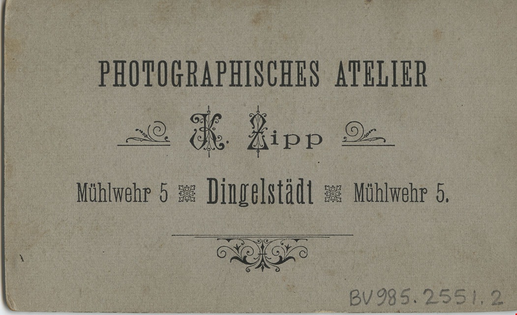
- printed on the card mount, recto, l.l. "K. Zipp," l.r. "Dingelstadt.", verso, c. "Photographisches Atelier/ K. Zipp/ Muhlwehr 5 Dingelstadt Muhlwehr 5."
- The photograph is mounted on a card provided by the photo studio
- Scope and Content
- Photograph of two unidentified boys, aged about ten and seven, dressed in suits and standing together in front of a bush. The younger boy is holding a long candle decorated with three bows.
- Accession Code
- BV985.2551.2
- Access Restriction
- No restrictions
- Reproduction Restriction
- No known restrictions
- Date
- [190-]
- Media Type
- Photograph
- Scan Resolution
- 600
- Scan Date
- 16-Jan-24
- Scale
- 100
- Photographer
- Zipp, K.
- Notes
- Title based on contents of photograph
Images
![Two boys with a decorated candle, [190-] thumbnail](/media/hpo/_Data/_BVM_Images/1985/1985_2551_0002_001.jpg)
![Girl and boy, [190-?] thumbnail](/media/hpo/_Data/_BVM_Images/1985/1985_2551_0003_001.jpg?width=280)
Girl and boy
https://search.heritageburnaby.ca/link/museumdescription229
- Repository
- Burnaby Village Museum
- Date
- [190-?]
- Collection/Fonds
- Burnaby Village Museum Photograph collection
- Description Level
- Item
- Physical Description
- 1 photograph : b&w oval
- Scope and Content
- Photograph of an unidentified girl and an unidentified boy, seated together. The girl is wearing a white dress with a hair band over her long curls. She has a pendant and a string of pearls around her neck. The boy, younger than the girl, is wearing a three piece suit with a big white collar and a …
- Repository
- Burnaby Village Museum
- Collection/Fonds
- Burnaby Village Museum Photograph collection
- Description Level
- Item
- Physical Description
- 1 photograph : b&w oval
- Material Details
- inscribed in blue ballpoint pen on the card mount, verso, "C. Ray Dec. 1962 / Ms Stante [or Ms Hunter]/ 1 35 Friday."
- Photograph is cut in a circular shape and mounted on a card cut into a circle.
- Scope and Content
- Photograph of an unidentified girl and an unidentified boy, seated together. The girl is wearing a white dress with a hair band over her long curls. She has a pendant and a string of pearls around her neck. The boy, younger than the girl, is wearing a three piece suit with a big white collar and a bow tie.
- Accession Code
- BV985.2551.3
- Date
- [190-?]
- Media Type
- Photograph
- Scan Resolution
- 600
- Scan Date
- 16-Jan-24
- Scale
- 100
- Notes
- Title based on contents of photograph
Images
![Girl and boy, [190-?] thumbnail](/media/hpo/_Data/_BVM_Images/1985/1985_2551_0003_001.jpg)
![Family outside house, [190-?] thumbnail](/media/hpo/_Data/_BVM_Images/1984/1984_0051_0053_001.jpg?width=280)
Family outside house
https://search.heritageburnaby.ca/link/museumdescription269
- Repository
- Burnaby Village Museum
- Date
- [190-?]
- Collection/Fonds
- Burnaby Village Museum Photograph collection
- Description Level
- Item
- Physical Description
- 1 photograph : b&w ; 6.4 x 10.2 cm mounted on cardboard 10.7 x 15.2 cm
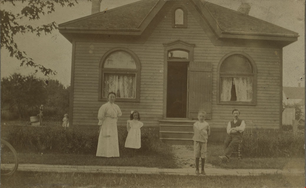
- Scope and Content
- Photograph of an unidentified family of four standing outside a house. The woman is standing to the left side of the photograph and beside her, a small girl in a white dress with a bow in her hair is standing. The man is seated on a chair to the right side of the photograph, and a boy in a sailor …
- Repository
- Burnaby Village Museum
- Collection/Fonds
- Burnaby Village Museum Photograph collection
- Description Level
- Item
- Physical Description
- 1 photograph : b&w ; 6.4 x 10.2 cm mounted on cardboard 10.7 x 15.2 cm
- Scope and Content
- Photograph of an unidentified family of four standing outside a house. The woman is standing to the left side of the photograph and beside her, a small girl in a white dress with a bow in her hair is standing. The man is seated on a chair to the right side of the photograph, and a boy in a sailor suit with dark stockings is standing on a wooden plank sidewalk in front of the house. The front door to the house is wide open, and there are two windows on the front face of the house. The location is not identified.
- Subjects
- Buildings - Residential - Houses
- Accession Code
- HV984.51.53
- Access Restriction
- No restrictions
- Reproduction Restriction
- No known restrictions
- Date
- [190-?]
- Media Type
- Photograph
- Scan Resolution
- 600
- Scan Date
- 2023-10-31
- Notes
- Title based on contents of photograph
Images
![Family outside house, [190-?] thumbnail](/media/hpo/_Data/_BVM_Images/1984/1984_0051_0053_001.jpg)
![Country Street, [190-?] thumbnail](/media/hpo/_Data/_BVM_Images/1984/1984_0051_0055_001.jpg?width=280)
Country Street
https://search.heritageburnaby.ca/link/museumdescription271
- Repository
- Burnaby Village Museum
- Date
- [190-?]
- Collection/Fonds
- Burnaby Village Museum Photograph collection
- Description Level
- Item
- Physical Description
- 1 photograph : b&w ; 8.2 x 13.8 cm
- Scope and Content
- Photograph of an unidentified country road. It is a dirt road sloping upwards to a village of houses and a church with a steeple and there is an ox walking along the road.
- Repository
- Burnaby Village Museum
- Collection/Fonds
- Burnaby Village Museum Photograph collection
- Description Level
- Item
- Physical Description
- 1 photograph : b&w ; 8.2 x 13.8 cm
- Scope and Content
- Photograph of an unidentified country road. It is a dirt road sloping upwards to a village of houses and a church with a steeple and there is an ox walking along the road.
- Accession Code
- HV984.51.55
- Access Restriction
- No restrictions
- Reproduction Restriction
- No known restrictions
- Date
- [190-?]
- Media Type
- Photograph
- Scan Resolution
- 600
- Scan Date
- 2023-10-31
- Notes
- Title based on contents of photograph
Images
![Country Street, [190-?] thumbnail](/media/hpo/_Data/_BVM_Images/1984/1984_0051_0055_001.jpg)
![House with a solarium, [190-?] thumbnail](/media/hpo/_Data/_BVM_Images/1984/1984_0069_0014_001.jpg?width=280)
House with a solarium
https://search.heritageburnaby.ca/link/museumdescription279
- Repository
- Burnaby Village Museum
- Date
- [190-?]
- Collection/Fonds
- Burnaby Village Museum Photograph collection
- Description Level
- Item
- Physical Description
- 1 photograph : b&w ; 5.5 x 9.5 cm mounted on cardboard 10.8 x 15.3 cm
- Scope and Content
- Photograph of an unidentified house. The house is a very large two-storey brick structure with large covered patio on the ground level. There is a man and a woman sitting on a bench on the porch, with a dog sitting in front of the man. There are at least two chimneys visible on the roof, and on the…
- Repository
- Burnaby Village Museum
- Collection/Fonds
- Burnaby Village Museum Photograph collection
- Description Level
- Item
- Physical Description
- 1 photograph : b&w ; 5.5 x 9.5 cm mounted on cardboard 10.8 x 15.3 cm
- Scope and Content
- Photograph of an unidentified house. The house is a very large two-storey brick structure with large covered patio on the ground level. There is a man and a woman sitting on a bench on the porch, with a dog sitting in front of the man. There are at least two chimneys visible on the roof, and on the second floor, there appears to be a solarium with large open windows just above the porch area. The location is not identified.
- Accession Code
- BV984.69.14
- Access Restriction
- No restrictions
- Reproduction Restriction
- No known restrictions
- Date
- [190-?]
- Media Type
- Photograph
- Related Material
- For another photograph of this house, see BV984.69.15
- Scan Resolution
- 600
- Scan Date
- 2023-11-07
- Notes
- Title based on contents of photograph
Images
![House with a solarium, [190-?] thumbnail](/media/hpo/_Data/_BVM_Images/1984/1984_0069_0014_001.jpg)
![House with Solarium, [190-?] thumbnail](/media/hpo/_Data/_BVM_Images/1984/1984_0069_0015_001.jpg?width=280)
House with Solarium
https://search.heritageburnaby.ca/link/museumdescription280
- Repository
- Burnaby Village Museum
- Date
- [190-?]
- Collection/Fonds
- Burnaby Village Museum Photograph collection
- Description Level
- Item
- Physical Description
- 1 photograph : b&w ; 7.7 x 13.4 cm mounted on cardboard 13.3 x 19.1 cm
- Scope and Content
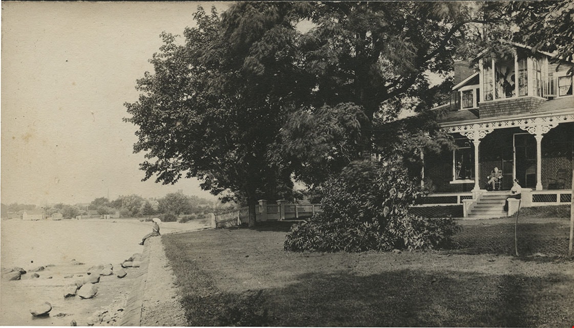
- Photograph of a very large two-storey brick house with a large covered patio on the ground level. There is a man sitting on a chair on the porch, and a woman seated on the steps to the porch. There appears to be a solarium with large open windows on the second floor just above the porch area. There…
- Repository
- Burnaby Village Museum
- Collection/Fonds
- Burnaby Village Museum Photograph collection
- Description Level
- Item
- Physical Description
- 1 photograph : b&w ; 7.7 x 13.4 cm mounted on cardboard 13.3 x 19.1 cm
- Scope and Content
- Photograph of a very large two-storey brick house with a large covered patio on the ground level. There is a man sitting on a chair on the porch, and a woman seated on the steps to the porch. There appears to be a solarium with large open windows on the second floor just above the porch area. There is a large old tree beside the house, providing shade, and a wire fence around the house property. Just outside of the house is the shore of a body of water, with a woman or a girl sitting on the embankment at the edge of the lawn. The location is not identified.
- Subjects
- Buildings - Residential - Houses
- Accession Code
- BV984.69.15
- Access Restriction
- No restrictions
- Reproduction Restriction
- May be restricted by third party rights
- Date
- [190-?]
- Media Type
- Photograph
- Related Material
- For another photograph of this house, see BV984.69.14
- Scan Resolution
- 600
- Scan Date
- 2023-11-07
- Notes
- Title based on contents of photograph
Images
![House with Solarium, [190-?] thumbnail](/media/hpo/_Data/_BVM_Images/1984/1984_0069_0015_001.jpg)
![Four men on a cobblestone street, [190-] thumbnail](/media/hpo/_Data/_BVM_Images/1983/198300420027.jpg?width=280)
Four men on a cobblestone street
https://search.heritageburnaby.ca/link/museumdescription287
- Repository
- Burnaby Village Museum
- Date
- [190-]
- Collection/Fonds
- Burnaby Village Museum Photograph collection
- Description Level
- Item
- Physical Description
- 1 photograph : sepia ; 8.5 x 8.5 cm
- Scope and Content
- Photograph of a group of four unidentified men in work clothes standing on a cobblestone street. There is a building to their left and a "hose house" in the back. The man on the left side of the photograph is holding a tea kettle in one hand and a tea cup in the other, and pretending to pour. A m…
- Repository
- Burnaby Village Museum
- Collection/Fonds
- Burnaby Village Museum Photograph collection
- Description Level
- Item
- Physical Description
- 1 photograph : sepia ; 8.5 x 8.5 cm
- Scope and Content
- Photograph of a group of four unidentified men in work clothes standing on a cobblestone street. There is a building to their left and a "hose house" in the back. The man on the left side of the photograph is holding a tea kettle in one hand and a tea cup in the other, and pretending to pour. A man beside him is holding up a broom and pretending to play the guitar with it. The man standing on the right side of the photograph is holding a shovel with one hand. An annotation on the back of the photograph reads: "Ed Johnson / Toronto" suggesting the location is Toronto and perhaps one of the men depicted is named Ed Johnson.
- Subjects
- Occupations - Labourers
- Accession Code
- HV983.42.27
- Access Restriction
- No restrictions
- Reproduction Restriction
- No known restrictions
- Date
- [190-]
- Media Type
- Photograph
- Scan Resolution
- 600
- Scan Date
- 2023-09-12
- Notes
- Title based on contents of photograph
Images
![Four men on a cobblestone street, [190-] thumbnail](/media/hpo/_Data/_BVM_Images/1983/198300420027.jpg)
![Two women in a horse-drawn wagon, [190-] thumbnail](/media/hpo/_Data/_BVM_Images/1983/198300420029.jpg?width=280)
Two women in a horse-drawn wagon
https://search.heritageburnaby.ca/link/museumdescription289
- Repository
- Burnaby Village Museum
- Date
- [190-]
- Collection/Fonds
- Burnaby Village Museum Photograph collection
- Description Level
- Item
- Physical Description
- 1 photograph : b&w ; 6.5 x 10.1 cm
- Scope and Content
- Photograph of two women riding in a horse-drawn wagon. They are wearing overcoats, hats and gloves. One of the women is driving the horse. There are trees, fields and a house in the background.
- Repository
- Burnaby Village Museum
- Collection/Fonds
- Burnaby Village Museum Photograph collection
- Description Level
- Item
- Physical Description
- 1 photograph : b&w ; 6.5 x 10.1 cm
- Scope and Content
- Photograph of two women riding in a horse-drawn wagon. They are wearing overcoats, hats and gloves. One of the women is driving the horse. There are trees, fields and a house in the background.
- Accession Code
- HV983.42.29
- Access Restriction
- No restrictions
- Reproduction Restriction
- No known restrictions
- Date
- [190-]
- Media Type
- Photograph
- Scan Resolution
- 600
- Scan Date
- 2023-09-12
- Notes
- Title based on contents of photograph
Images
![Two women in a horse-drawn wagon, [190-] thumbnail](/media/hpo/_Data/_BVM_Images/1983/198300420029.jpg)
![On a horse-drawn wagon, [190-] thumbnail](/media/hpo/_Data/_BVM_Images/1983/198300420030.jpg?width=280)
On a horse-drawn wagon
https://search.heritageburnaby.ca/link/museumdescription290
- Repository
- Burnaby Village Museum
- Date
- [190-]
- Collection/Fonds
- Burnaby Village Museum Photograph collection
- Description Level
- Item
- Physical Description
- 1 photograph : b&w ; 8.4 x 13.9 cm
- Scope and Content
- Photograph of six women and a man riding on a horse-drawn wagon. The driver is a woman in a dark coloured dress. There is a sheet of cloth covering the horse's body. The setting appears to be a farming community, with a farmhouse and a barn in the background, with a high chicken wire fence.
- Repository
- Burnaby Village Museum
- Collection/Fonds
- Burnaby Village Museum Photograph collection
- Description Level
- Item
- Physical Description
- 1 photograph : b&w ; 8.4 x 13.9 cm
- Scope and Content
- Photograph of six women and a man riding on a horse-drawn wagon. The driver is a woman in a dark coloured dress. There is a sheet of cloth covering the horse's body. The setting appears to be a farming community, with a farmhouse and a barn in the background, with a high chicken wire fence.
- Accession Code
- HV983.42.30
- Access Restriction
- No restrictions
- Reproduction Restriction
- No known restrictions
- Date
- [190-]
- Media Type
- Photograph
- Scan Resolution
- 600
- Scan Date
- 2023-09-12
- Notes
- Title based on contents of photograph
Images
![On a horse-drawn wagon, [190-] thumbnail](/media/hpo/_Data/_BVM_Images/1983/198300420030.jpg)
![Seated woman, [190-] thumbnail](/media/hpo/_Data/_BVM_Images/1983/198300420031.jpg?width=280)
Seated woman
https://search.heritageburnaby.ca/link/museumdescription291
- Repository
- Burnaby Village Museum
- Date
- [190-]
- Collection/Fonds
- Burnaby Village Museum Photograph collection
- Description Level
- Item
- Physical Description
- 1 photograph : b&w ; 6.5 x 10.7 cm
- Scope and Content
- Photograph of an unidentified woman in striped dress sitting on the ground, leaning back and resting on her elbows on a field of grass. In the background is a body of water with small boats visible in the distance.
- Repository
- Burnaby Village Museum
- Collection/Fonds
- Burnaby Village Museum Photograph collection
- Description Level
- Item
- Physical Description
- 1 photograph : b&w ; 6.5 x 10.7 cm
- Scope and Content
- Photograph of an unidentified woman in striped dress sitting on the ground, leaning back and resting on her elbows on a field of grass. In the background is a body of water with small boats visible in the distance.
- Accession Code
- HV983.42.31
- Access Restriction
- No restrictions
- Reproduction Restriction
- No known restrictions
- Date
- [190-]
- Media Type
- Photograph
- Scan Resolution
- 600
- Scan Date
- 2023-09-12
- Notes
- Title based on contents of photograph
Images
![Seated woman, [190-] thumbnail](/media/hpo/_Data/_BVM_Images/1983/198300420031.jpg)