More like 'Train travelling along the track'
Narrow Results By
Subject
- Academic Disciplines 1
- Accidents 7
- Accidents - Automobile Accidents 11
- Accidents - Train Accidents 9
- Adornment 1
- Adornment - Lapel Pins 1
- Advertising Medium 16
- Advertising Medium - Signs and Signboards 63
- Aerial Photographs 36
- Agricultural Tools and Equipment 6
- Agricultural Tools and Equipment - Gardening Equipment 6
- Agricultural Tools and Equipment - Plows 9

Dyke construction on Nicomen Island
https://search.heritageburnaby.ca/link/archivedescription34332
- Repository
- City of Burnaby Archives
- Date
- 1927
- Collection/Fonds
- Burnaby Historical Society fonds
- Description Level
- Item
- Physical Description
- 1 photograph : sepia ; 5.7 x 13.2 cm on page 17.5 x 22.7 cm
- Scope and Content
- Photograph of machinery and equipment working on the construction of dykes on Nicomen Island.
- Repository
- City of Burnaby Archives
- Date
- 1927
- Collection/Fonds
- Burnaby Historical Society fonds
- Subseries
- Peers family subseries
- Physical Description
- 1 photograph : sepia ; 5.7 x 13.2 cm on page 17.5 x 22.7 cm
- Description Level
- Item
- Record No.
- 020-039
- Access Restriction
- No restrictions
- Reproduction Restriction
- No known restrictions
- Accession Number
- BHS2007-04
- Scope and Content
- Photograph of machinery and equipment working on the construction of dykes on Nicomen Island.
- Media Type
- Photograph
- Notes
- Title based on caption accompanying photograph
Images


Dykes on Nicomen Island
https://search.heritageburnaby.ca/link/archivedescription34333
- Repository
- City of Burnaby Archives
- Date
- 1927
- Collection/Fonds
- Burnaby Historical Society fonds
- Description Level
- Item
- Physical Description
- 1 photograph : sepia ; 6.5 x 13.7 cm on page 17.5 x 22.7 cm
- Scope and Content
- Photograph of a barn (in the background), along the river bank near the dykes under construction on Nicomen Island.
- Repository
- City of Burnaby Archives
- Date
- 1927
- Collection/Fonds
- Burnaby Historical Society fonds
- Subseries
- Peers family subseries
- Physical Description
- 1 photograph : sepia ; 6.5 x 13.7 cm on page 17.5 x 22.7 cm
- Description Level
- Item
- Record No.
- 020-040
- Access Restriction
- No restrictions
- Reproduction Restriction
- No known restrictions
- Accession Number
- BHS2007-04
- Scope and Content
- Photograph of a barn (in the background), along the river bank near the dykes under construction on Nicomen Island.
- Media Type
- Photograph
- Notes
- Title based on caption accompanying photograph
Images


Fish
https://search.heritageburnaby.ca/link/archivedescription91687
- Repository
- City of Burnaby Archives
- Date
- 1982-1993
- Collection/Fonds
- Doreen Lawson fonds
- Description Level
- File
- Physical Description
- 37 photographs : col. slides ; 35 mm
- Scope and Content
- File consists of photographs of the Cariboo Dam situated along the Brunette River and Warner's fish lift located adjacent to the dam. Photographs depict the interior and exterior of the fish lift, the information sign for the lift, and a group of fisherman working in the river.
- Repository
- City of Burnaby Archives
- Date
- 1982-1993
- Collection/Fonds
- Doreen Lawson fonds
- Physical Description
- 37 photographs : col. slides ; 35 mm
- Description Level
- File
- Record No.
- 618-005
- Access Restriction
- No restrictions
- Reproduction Restriction
- May be restricted by third party rights
- Accession Number
- 2015-15
- Scope and Content
- File consists of photographs of the Cariboo Dam situated along the Brunette River and Warner's fish lift located adjacent to the dam. Photographs depict the interior and exterior of the fish lift, the information sign for the lift, and a group of fisherman working in the river.
- Media Type
- Photograph
- Photographer
- Lawson, Doreen A.
- Notes
- Transcribed title
- Title transcribed from binder divider photographs were originally housed behind.
- Note in red ink on recto of slide sheet photographs 618-005-11 : 618-005-23 originally housed in read: "Burnaby Lake / Warner's Fish Lift".
- Note in black ink on recto of slide sheet photographs 618-005-24 : 618-005-37 were originally housed in read: "Brunette River Dam".
- One of the fishermen is identified as Joe Calks in photograph 618-005-4
- Geographic Access
- Brunette River
- Burnaby Lake
- Historic Neighbourhood
- Burnaby Lake (Historic Neighbourhood)
- Planning Study Area
- Burnaby Lake Area
Images


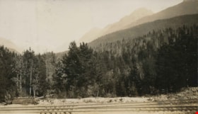
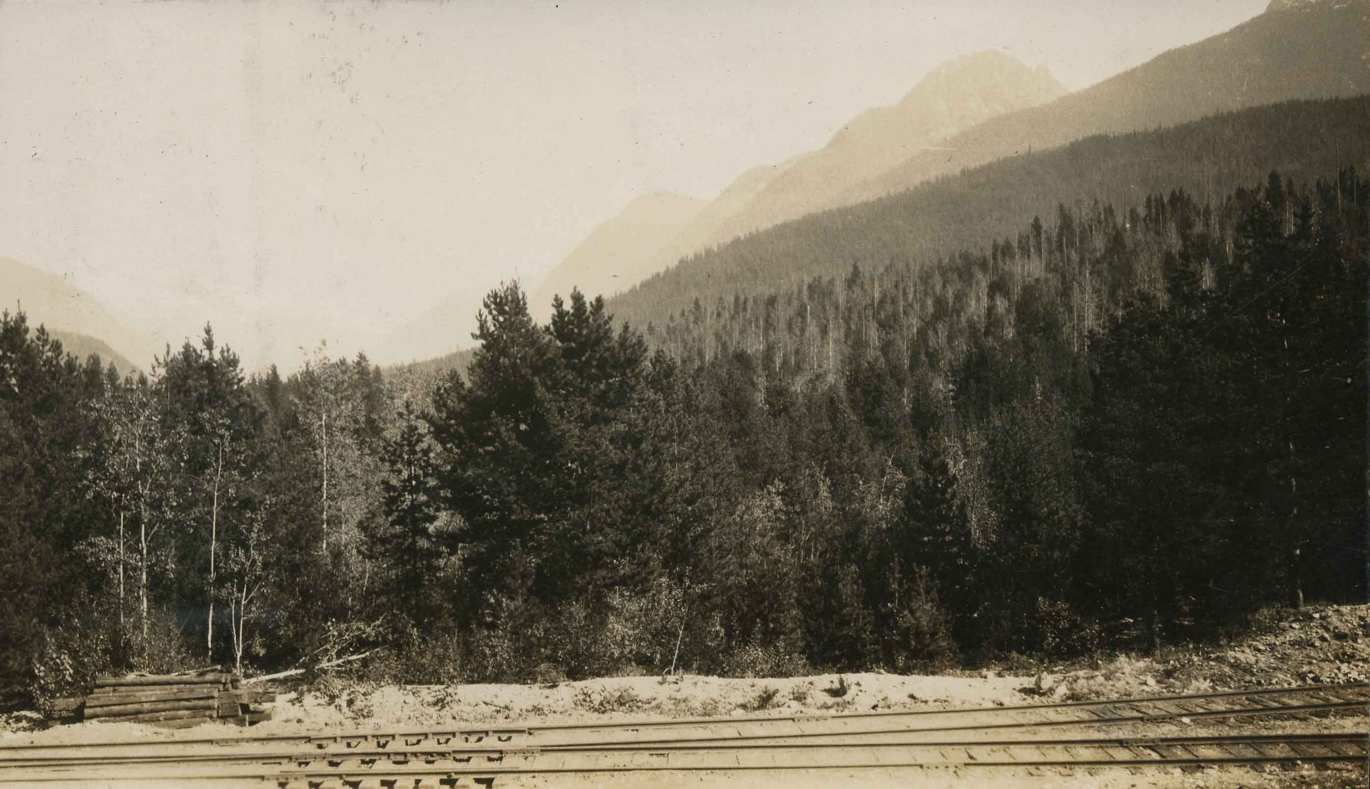
Fraser Canyon
https://search.heritageburnaby.ca/link/archivedescription34413
- Repository
- City of Burnaby Archives
- Date
- 1925
- Collection/Fonds
- Burnaby Historical Society fonds
- Description Level
- Item
- Physical Description
- 1 photograph : b&w ; 7 x 12 cm on page 17.5 x 26.5 cm
- Scope and Content
- Photograph of the Fraser Canyon. The railway line can be seen in the foreground and a caption accompanying the photograph reads "View up the Canyon, 2 Miles out of Yale." This photograph appears to have been taken by Arthur Peers, who travelled through the Fraser River Valley and worked on the con…
- Repository
- City of Burnaby Archives
- Date
- 1925
- Collection/Fonds
- Burnaby Historical Society fonds
- Subseries
- Peers family subseries
- Physical Description
- 1 photograph : b&w ; 7 x 12 cm on page 17.5 x 26.5 cm
- Description Level
- Item
- Record No.
- 020-120
- Access Restriction
- No restrictions
- Reproduction Restriction
- No known restrictions
- Accession Number
- BHS2007-04
- Scope and Content
- Photograph of the Fraser Canyon. The railway line can be seen in the foreground and a caption accompanying the photograph reads "View up the Canyon, 2 Miles out of Yale." This photograph appears to have been taken by Arthur Peers, who travelled through the Fraser River Valley and worked on the construction of the Trans-Provincial Highway during the later 1920s.
- Media Type
- Photograph
- Photographer
- Peers, Arthur Francis "Mike"
- Notes
- Title based on contents of photograph
Images


The Fraser, low water
https://search.heritageburnaby.ca/link/archivedescription34412
- Repository
- City of Burnaby Archives
- Date
- 1925
- Collection/Fonds
- Burnaby Historical Society fonds
- Description Level
- Item
- Physical Description
- 1 photograph : sepia ; 7 x 12.2 cm on page 17.5 x 26.5 cm
- Scope and Content
- Photograph of the Fraser River canyon, with the railway line visible to the left. A caption accompanying the photograph reads "The Fraser, Low Water, 1925." This photograph appears to have been taken by Arthur Peers, who travelled through the Fraser River Valley and worked on the construction of t…
- Repository
- City of Burnaby Archives
- Date
- 1925
- Collection/Fonds
- Burnaby Historical Society fonds
- Subseries
- Peers family subseries
- Physical Description
- 1 photograph : sepia ; 7 x 12.2 cm on page 17.5 x 26.5 cm
- Description Level
- Item
- Record No.
- 020-119
- Access Restriction
- No restrictions
- Reproduction Restriction
- No known restrictions
- Accession Number
- BHS2007-04
- Scope and Content
- Photograph of the Fraser River canyon, with the railway line visible to the left. A caption accompanying the photograph reads "The Fraser, Low Water, 1925." This photograph appears to have been taken by Arthur Peers, who travelled through the Fraser River Valley and worked on the construction of the Trans-Provincial Highway during the later 1920s.
- Media Type
- Photograph
- Photographer
- Peers, Arthur Francis "Mike"
- Notes
- Title based on caption accompanying photograph
Images

![Tony Fabian relaxing at a picnic table, [1970]. Item no. 549-026. thumbnail](/media/hpo/_Data/_Archives_Images/_Unrestricted/540/549-026.jpg?width=280)
Interview with Tony Fabian by Eric Damer October 10, 2012 - Track 5
https://search.heritageburnaby.ca/link/oralhistory326
- Repository
- City of Burnaby Archives
- Date Range
- 1971-2012
- Length
- 0:09:30
- Summary
- This portion of the recording pertains to Tony Fabian's memories of the development of the Fraser River Foreshore and the Confederation Community Centre (previously named Confederation House).
- Repository
- City of Burnaby Archives
- Summary
- This portion of the recording pertains to Tony Fabian's memories of the development of the Fraser River Foreshore and the Confederation Community Centre (previously named Confederation House).
- Date Range
- 1971-2012
- Photo Info
- Tony Fabian relaxing at a picnic table, [1970]. Item no. 549-026.
- Length
- 0:09:30
- Interviewer
- Damer, Eric
- Interview Date
- October 10, 2012
- Scope and Content
- Recording is an interview with Tony Fabian conducted by Burnaby Village Museum employee Eric Damer, October 10, 2012. Major theme discussed: environmental conservation practices in Burnaby.
- Biographical Notes
- Tony Fabian was born and raised in rural Saskatchewan in 1934. He and his wife moved to Burnaby in 1957, where he worked for the telephone company and raised a family. Tony has been an advocate for preservation of parklands and watercourses, helping to protect Burnaby and Deer Lake Parks and to create the Burnaby Fraser Foreshore and Barnet Marine Parks in the early nineteen-seventies, serving as a member of Burnaby’s Parks and Recreation Commission. Tony Fabian was presented with the 2008 City of Burnaby Environment Award for Community Stewardship.
- Total Tracks
- 5
- Total Length
- 0:47:48
- Interviewee Name
- Fabian, Tony
- Interview Location
- Burnaby Village Museum
- Interviewer Bio
- Eric Damer is a lifelong British Columbian born in Victoria, raised in Kamloops, and currently residing in Burnaby. After studying philosophy at the University of Victoria, he became interested in the educational forces that had shaped his own life. He completed master’s and doctoral degrees in educational studies at the University of British Columbia with a particular interest in the history of adult and higher education in the province. In 2012, Eric worked for the City of Burnaby as a field researcher and writer, conducting interviews for the City Archives and Museum Oral History Program.
- Collection/Fonds
- Community Heritage Commission Special Projects fonds
- Transcript Available
- None
- Media Type
- Sound Recording
Images
![Tony Fabian relaxing at a picnic table, [1970]. Item no. 549-026. thumbnail](/media/hpo/_Data/_Archives_Images/_Unrestricted/540/549-026.jpg)
Audio Tracks
Track five of recording of interview with Tony Fabian
Track five of recording of interview with Tony Fabian
https://search.heritageburnaby.ca/media/hpo/_Data/_Archives_Oral_Histories/_Unrestricted/MSS171-009/MSS171-009_Track_5.mp3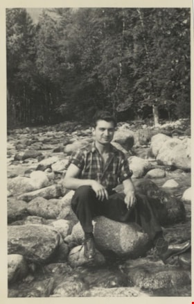
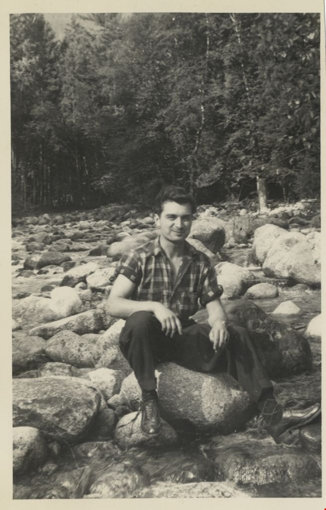
John Yanko at Kokanee Park
https://search.heritageburnaby.ca/link/archivedescription77915
- Repository
- City of Burnaby Archives
- Date
- 1948
- Collection/Fonds
- Yanko family fonds
- Description Level
- Item
- Physical Description
- 1 photograph : b&w ; 11.5 x 7 cm
- Scope and Content
- Photograph of John Ivan Yanko sitting on a rock along the river at Kokanee Park (now Kokanee Glacier Provincial Park).
- Repository
- City of Burnaby Archives
- Date
- 1948
- Collection/Fonds
- Yanko family fonds
- Physical Description
- 1 photograph : b&w ; 11.5 x 7 cm
- Material Details
- Secured to album page with photo corners
- Description Level
- Item
- Record No.
- 545-097
- Access Restriction
- No restrictions
- Reproduction Restriction
- No known restrictions
- Accession Number
- 2012-09
- Scope and Content
- Photograph of John Ivan Yanko sitting on a rock along the river at Kokanee Park (now Kokanee Glacier Provincial Park).
- Names
- Yanko, John Ivan
- Media Type
- Photograph
- Notes
- Title based on contents of photograph
- Note written on album page reads: "Kokanee Park / Johnny 1948"
- Note in blue ink on verso of photograph reads: "1948"
Images
![Murky creek, [1999] thumbnail](/media/hpo/_Data/_Archives_Images/_Unrestricted/535/535-3259.jpg?width=280)
Murky creek
https://search.heritageburnaby.ca/link/archivedescription98181
- Repository
- City of Burnaby Archives
- Date
- [1999]
- Collection/Fonds
- Burnaby NewsLeader photograph collection
- Description Level
- Item
- Physical Description
- 1 photograph (tiff) : col.
- Scope and Content
- Photograph of an unidentified person squatting at the edge of a creek and putting their hand into the murky water.
- Repository
- City of Burnaby Archives
- Date
- [1999]
- Collection/Fonds
- Burnaby NewsLeader photograph collection
- Physical Description
- 1 photograph (tiff) : col.
- Description Level
- Item
- Record No.
- 535-3259
- Access Restriction
- No restrictions
- Reproduction Restriction
- No restrictions
- Accession Number
- 2018-12
- Scope and Content
- Photograph of an unidentified person squatting at the edge of a creek and putting their hand into the murky water.
- Media Type
- Photograph
- Notes
- Title based on original file name
- Collected by editorial for use in a July 1999 issue of the Burnaby NewsLeader
Images
![Murky creek, [1999] thumbnail](/media/hpo/_Data/_Archives_Images/_Unrestricted/535/535-3259.jpg)
![Unidentified mountain range and river, [1880] thumbnail](/media/hpo/_Data/_Archives_Images/_Unrestricted/477/477-824.jpg?width=280)
Unidentified mountain range and river
https://search.heritageburnaby.ca/link/archivedescription39505
- Repository
- City of Burnaby Archives
- Date
- [1880]
- Collection/Fonds
- Peers Family and Hill Family fonds
- Description Level
- Item
- Physical Description
- 1 photograph : sepia ; 11.3 x 17.5 cm on page 21.5 x 28 cm (pasted in album)
- Scope and Content
- Photograph of a person sitting on a hillside, looking off into the distance at an unidentified mountain range and river. This photograph was in a scrapbook kept by Claude Hill who was originally from England but ultimately settled in the Burnaby Lake area. The photograph was likely taken in England…
- Repository
- City of Burnaby Archives
- Date
- [1880]
- Collection/Fonds
- Peers Family and Hill Family fonds
- Physical Description
- 1 photograph : sepia ; 11.3 x 17.5 cm on page 21.5 x 28 cm (pasted in album)
- Description Level
- Item
- Record No.
- 477-824
- Access Restriction
- No restrictions
- Reproduction Restriction
- No known restrictions
- Accession Number
- 2007-12
- Scope and Content
- Photograph of a person sitting on a hillside, looking off into the distance at an unidentified mountain range and river. This photograph was in a scrapbook kept by Claude Hill who was originally from England but ultimately settled in the Burnaby Lake area. The photograph was likely taken in England or Wales.
- Media Type
- Photograph
- Notes
- Title based on contents of photograph
Images
![Unidentified mountain range and river, [1880] thumbnail](/media/hpo/_Data/_Archives_Images/_Unrestricted/477/477-824.jpg)
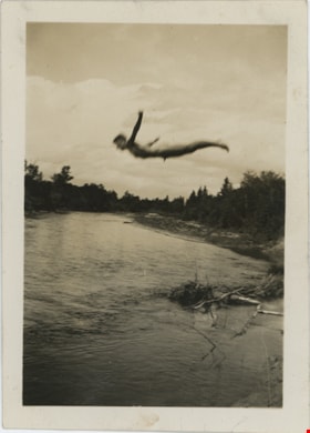
Wings over the Elbow River
https://search.heritageburnaby.ca/link/museumdescription19413
- Repository
- Burnaby Village Museum
- Date
- 1935
- Collection/Fonds
- Hawkshaw family fonds
- Description Level
- Item
- Physical Description
- 1 photograph : sepia ; 9 x 6.5 cm
- Scope and Content
- Photograph of a man doing a swan dive into the Elbow River, Alberta.
- Repository
- Burnaby Village Museum
- Collection/Fonds
- Hawkshaw family fonds
- Description Level
- Item
- Physical Description
- 1 photograph : sepia ; 9 x 6.5 cm
- Scope and Content
- Photograph of a man doing a swan dive into the Elbow River, Alberta.
- Accession Code
- BV996.6.97
- Access Restriction
- No restrictions
- Reproduction Restriction
- No known restrictions
- Date
- 1935
- Media Type
- Photograph
- Scan Resolution
- 600
- Scan Date
- 2023-02-06
- Notes
- Title based on contents of photograph
- Caption beneath photograph reads: "Wings over the / Elbow River"
- Photograph is part of photograph album BV996.6.1
Images


Construction of the Hastings Streetcar line extension
https://search.heritageburnaby.ca/link/archivedescription57733
- Repository
- City of Burnaby Archives
- Date
- 1913
- Collection/Fonds
- J.W. Phillips fonds
- Description Level
- Item
- Physical Description
- 1 photograph : b&w glass negative ; 11 x 15.5 cm
- Scope and Content
- Photograph of British Columbia Electric Railway Company labourers constructing the Hastings Streetcar line extension along Hastings Street at Holdom. The Dunsford House, home of the Holdom family is visible on the left along with a wooden plank roadway and sidewalk, with the Holdom family standing …
- Repository
- City of Burnaby Archives
- Date
- 1913
- Collection/Fonds
- J.W. Phillips fonds
- Physical Description
- 1 photograph : b&w glass negative ; 11 x 15.5 cm
- Material Details
- Emulsion measures 11 x 15.5 cm on the glass; entire glass plate measures 12 x 16 cm
- Description Level
- Item
- Record No.
- 487-031
- Access Restriction
- No restrictions
- Reproduction Restriction
- No known restrictions
- Accession Number
- 2008-18
- Scope and Content
- Photograph of British Columbia Electric Railway Company labourers constructing the Hastings Streetcar line extension along Hastings Street at Holdom. The Dunsford House, home of the Holdom family is visible on the left along with a wooden plank roadway and sidewalk, with the Holdom family standing on their front porch. Walter Holdom built Tea Rooms (partially visible on the far left) on his property to entertain prospective real estate buyers. This photograph was taken looking east towards Burnaby Mountain.
- Subjects
- Buildings - Residential - Houses
- Transportation - Rail
- Occupations - Railroad Labourers
- Geographic Features - Roads
- Media Type
- Photograph
- Photographer
- Phillips, James William "Jim"
- Notes
- Title based on contents of photograph
- Geographic Access
- Howard Avenue
- Hastings Street
- Street Address
- 5206 Hastings Street
- Historic Neighbourhood
- Capitol Hill (Historic Neighbourhood)
- Planning Study Area
- Capitol Hill Area
Images

![Great Northern Railway crossing, [1914] thumbnail](/media/hpo/_Data/_BVM_Images/1971/197200110009.jpg?width=280)
Great Northern Railway crossing
https://search.heritageburnaby.ca/link/museumdescription3095
- Repository
- Burnaby Village Museum
- Date
- [1914]
- Collection/Fonds
- Burnaby Village Museum Photograph collection
- Description Level
- Item
- Physical Description
- 1 photograph : b&w glass negative ; 20.2 x 15.8 cm
- Scope and Content
- Photograph of the Great Northern Railway crossing meeting a road that appears to have run parellel to the railway on a bluff. On the left side of the photograph is a small hut beside a sign that reads, "Railway Crossing." Two unidentified men are standing outside of the hut. An earlier catalogue re…
- Repository
- Burnaby Village Museum
- Collection/Fonds
- Burnaby Village Museum Photograph collection
- Description Level
- Item
- Physical Description
- 1 photograph : b&w glass negative ; 20.2 x 15.8 cm
- Material Details
- Inscribed on negative, and printed backwards on contact print, l.r. "G.N.RAILWAY......../SHEWI [rest of the word illegible] INTERSECTION). CROSSING.../ [illegible word] ROAD. LOOKING NORTH"
- Scope and Content
- Photograph of the Great Northern Railway crossing meeting a road that appears to have run parellel to the railway on a bluff. On the left side of the photograph is a small hut beside a sign that reads, "Railway Crossing." Two unidentified men are standing outside of the hut. An earlier catalogue record from 1988 notes that the crossing street is North Road, and the photograph was taken looking northwest into Burnaby. Inscribed on negative, lower right: "G.N. Railway /Shewi [rest of the word illegible] Intersection) Crossing / [illegible word] Road. Looking North."
- Names
- Great Northern Railway
- Geographic Access
- North Road
- Accession Code
- HV972.11.9
- Access Restriction
- No restrictions
- Reproduction Restriction
- No known restrictions
- Date
- [1914]
- Media Type
- Photograph
- Planning Study Area
- Cariboo-Armstrong Area
- Scan Resolution
- 300
- Scan Date
- 14/8/2006
- Scale
- 100
- Notes
- Title based on contents of photograph
- 1 b&w contact print accompanying negative
Images
![Great Northern Railway crossing, [1914] thumbnail](/media/hpo/_Data/_BVM_Images/1971/197200110009.jpg)
Mud Lake Valley
https://search.heritageburnaby.ca/link/archivedescription34482
- Repository
- City of Burnaby Archives
- Date
- 1927
- Collection/Fonds
- Burnaby Historical Society fonds
- Description Level
- Item
- Physical Description
- 1 photograph : b&w ; 6.9 x 11.9 cm on page 17.5 x 26.4 cm
- Scope and Content
- Photograph taken looking towards Mud Lake Valley. Railway tracks can be seen in the foreground with a pile of logs next to them on the left. This photograph appears to have been taken by Arthur Peers, who travelled through the Fraser River Valley and worked on the construction of the Trans-Provinc…
- Repository
- City of Burnaby Archives
- Date
- 1927
- Collection/Fonds
- Burnaby Historical Society fonds
- Subseries
- Peers family subseries
- Physical Description
- 1 photograph : b&w ; 6.9 x 11.9 cm on page 17.5 x 26.4 cm
- Description Level
- Item
- Record No.
- 020-189
- Access Restriction
- No restrictions
- Reproduction Restriction
- No known restrictions
- Accession Number
- BHS2007-04
- Scope and Content
- Photograph taken looking towards Mud Lake Valley. Railway tracks can be seen in the foreground with a pile of logs next to them on the left. This photograph appears to have been taken by Arthur Peers, who travelled through the Fraser River Valley and worked on the construction of the Trans-Provincial Highway during the later 1920s.
- Media Type
- Photograph
- Photographer
- Peers, Arthur Francis "Mike"
- Notes
- Title based on contents of photograph
Images
![Railway embankment, [1914] thumbnail](/media/hpo/_Data/_BVM_Images/1971/197200110002.jpg?width=280)
Railway embankment
https://search.heritageburnaby.ca/link/museumdescription3089
- Repository
- Burnaby Village Museum
- Date
- [1914]
- Collection/Fonds
- Burnaby Village Museum Photograph collection
- Description Level
- Item
- Physical Description
- 1 photograph : b&w glass negative ; 14.8 x 20.1 cm
- Scope and Content
- Photograph of a railway embankment. In the foreground is the railway, and in the midground a steep bluff, on top of which an unidentified man in a suit and a bowler hat is standing. There appears to be a road lined with electric posts close to where the man stands. An earlier catalogue record from…
- Repository
- Burnaby Village Museum
- Collection/Fonds
- Burnaby Village Museum Photograph collection
- Description Level
- Item
- Physical Description
- 1 photograph : b&w glass negative ; 14.8 x 20.1 cm
- Scope and Content
- Photograph of a railway embankment. In the foreground is the railway, and in the midground a steep bluff, on top of which an unidentified man in a suit and a bowler hat is standing. There appears to be a road lined with electric posts close to where the man stands. An earlier catalogue record from 1988 notes that this is the view of the Great Northern Railway just north of Brunette Creek on North Road. Also, it notes that the road running by the man is North Road.
- Names
- Great Northern Railway
- Geographic Access
- North Road
- Accession Code
- HV972.11.2
- Access Restriction
- No restrictions
- Reproduction Restriction
- No known restrictions
- Date
- [1914]
- Media Type
- Photograph
- Planning Study Area
- Cariboo-Armstrong Area
- Related Material
- for another view of the same railway embankment, see HV972.11.4
- Scan Resolution
- 300
- Scan Date
- 14/8/2006
- Scale
- 100
- Notes
- Title based on contents of photograph
- 1 b&w contact print accompanying negative
Images
![Railway embankment, [1914] thumbnail](/media/hpo/_Data/_BVM_Images/1971/197200110002.jpg)
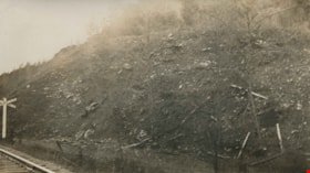
Rock bluff near old powder works
https://search.heritageburnaby.ca/link/archivedescription34427
- Repository
- City of Burnaby Archives
- Date
- 1925
- Collection/Fonds
- Burnaby Historical Society fonds
- Description Level
- Item
- Physical Description
- 1 photograph : b&w ; 6.9 x 12.3 cm on page 10 x 17.5 cm
- Scope and Content
- Photograph of a railroad crossing to the far left with a rock bluff to the right. This photograph appears to have been taken by Arthur Peers, who travelled through the Fraser River Valley and worked on the construction of the Trans-Provincial Highway during the later 1920s.
- Repository
- City of Burnaby Archives
- Date
- 1925
- Collection/Fonds
- Burnaby Historical Society fonds
- Subseries
- Peers family subseries
- Physical Description
- 1 photograph : b&w ; 6.9 x 12.3 cm on page 10 x 17.5 cm
- Description Level
- Item
- Record No.
- 020-134
- Access Restriction
- No restrictions
- Reproduction Restriction
- No known restrictions
- Accession Number
- BHS2007-04
- Scope and Content
- Photograph of a railroad crossing to the far left with a rock bluff to the right. This photograph appears to have been taken by Arthur Peers, who travelled through the Fraser River Valley and worked on the construction of the Trans-Provincial Highway during the later 1920s.
- Media Type
- Photograph
- Photographer
- Peers, Arthur Francis "Mike"
- Notes
- Title based on caption accompanying photograph
Images

![Second Narrows Bridge, [between 1945 and 1949] (date of original), copied 1991 thumbnail](/media/hpo/_Data/_Archives_Images/_Unrestricted/370/370-120.jpg?width=280)
Second Narrows Bridge
https://search.heritageburnaby.ca/link/archivedescription37532
- Repository
- City of Burnaby Archives
- Date
- [between 1945 and 1949] (date of original), copied 1991
- Collection/Fonds
- Burnaby Historical Society fonds
- Description Level
- Item
- Physical Description
- 1 photograph : b&w ; 3.1 x 5.2 cm print on contact sheet 20.2 x 25.3 cm
- Scope and Content
- Photograph of the original Second Narrow Bridge, taken from the railway tracks facing west, possibly near MacDonald Avenue. Squatters houses are visible in the foreground.
- Repository
- City of Burnaby Archives
- Date
- [between 1945 and 1949] (date of original), copied 1991
- Collection/Fonds
- Burnaby Historical Society fonds
- Subseries
- Burnaby Image Bank subseries
- Physical Description
- 1 photograph : b&w ; 3.1 x 5.2 cm print on contact sheet 20.2 x 25.3 cm
- Description Level
- Item
- Record No.
- 370-120
- Access Restriction
- No restrictions
- Reproduction Restriction
- No known restrictions
- Accession Number
- BHS1999-03
- Scope and Content
- Photograph of the original Second Narrow Bridge, taken from the railway tracks facing west, possibly near MacDonald Avenue. Squatters houses are visible in the foreground.
- Subjects
- Buildings - Residential
- Structures - Bridges
- Geographic Features - Inlets
- Transportation - Rail
- Media Type
- Photograph
- Notes
- Title based on contents of photograph
- 1 b&w copy negative accompanying
- Geographic Access
- Burrard Inlet
- Historic Neighbourhood
- Vancouver Heights (Historic Neighbourhood)
- Planning Study Area
- Burnaby Heights Area
Images
![Second Narrows Bridge, [between 1945 and 1949] (date of original), copied 1991 thumbnail](/media/hpo/_Data/_Archives_Images/_Unrestricted/370/370-120.jpg)
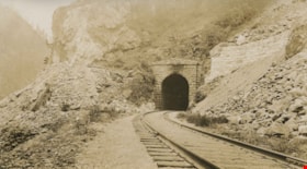
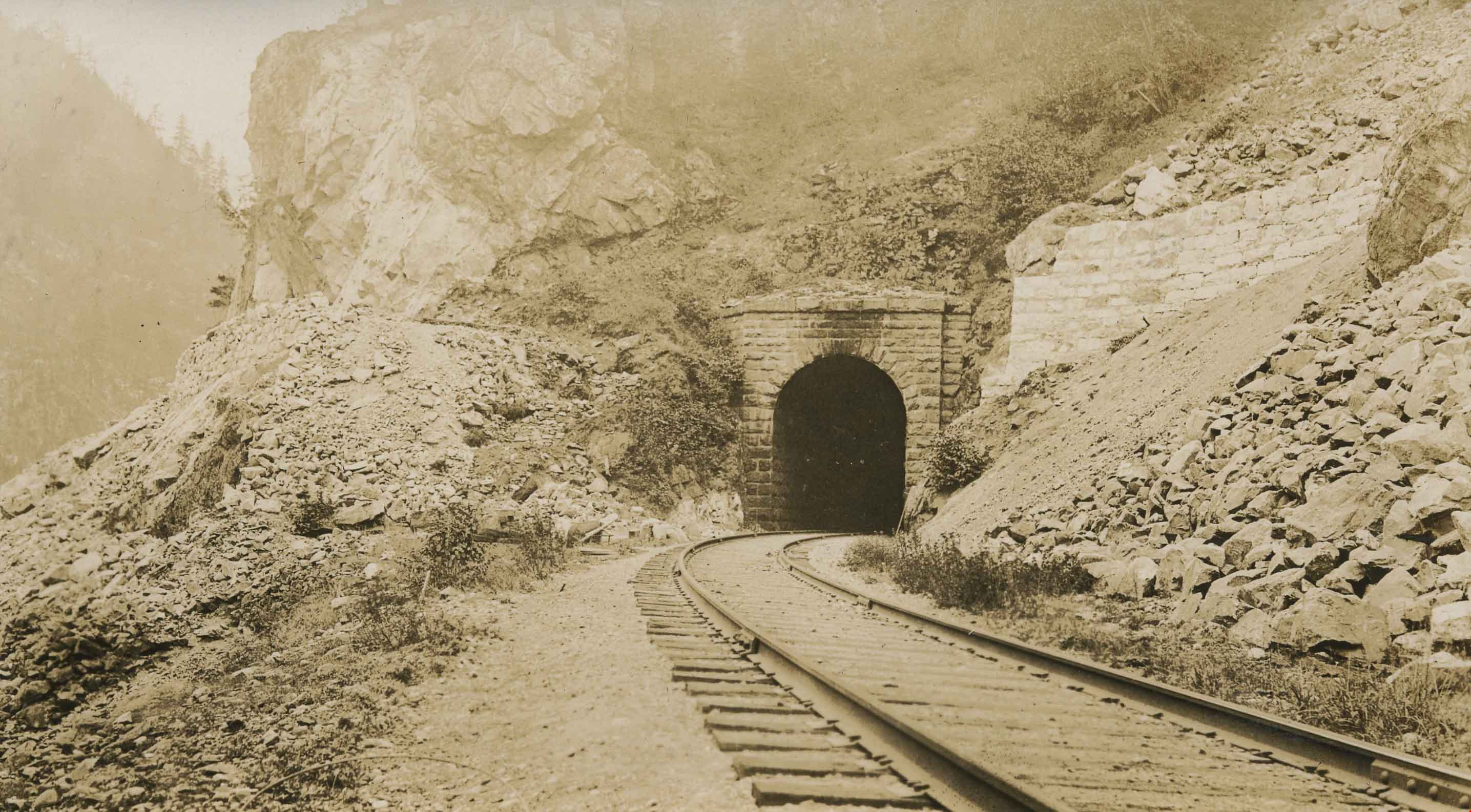
Site of overhead bridge
https://search.heritageburnaby.ca/link/archivedescription34408
- Repository
- City of Burnaby Archives
- Date
- 1925
- Collection/Fonds
- Burnaby Historical Society fonds
- Description Level
- Item
- Physical Description
- 1 photograph : sepia ; 7 x 12.2 cm on page 17.5 x 26.5 cm
- Scope and Content
- Photograph of the entrance to a railroad tunnel cut through the base of a mountain. A caption written below the photograph reads "site of overhead bridge, 1 1/2 m E. of Yale." This photograph appears to have been taken by Arthur Peers, who travelled through the Fraser River Valley and worked on th…
- Repository
- City of Burnaby Archives
- Date
- 1925
- Collection/Fonds
- Burnaby Historical Society fonds
- Subseries
- Peers family subseries
- Physical Description
- 1 photograph : sepia ; 7 x 12.2 cm on page 17.5 x 26.5 cm
- Description Level
- Item
- Record No.
- 020-115
- Access Restriction
- No restrictions
- Reproduction Restriction
- No known restrictions
- Accession Number
- BHS2007-04
- Scope and Content
- Photograph of the entrance to a railroad tunnel cut through the base of a mountain. A caption written below the photograph reads "site of overhead bridge, 1 1/2 m E. of Yale." This photograph appears to have been taken by Arthur Peers, who travelled through the Fraser River Valley and worked on the construction of the Trans-Provincial Highway during the later 1920s.
- Media Type
- Photograph
- Photographer
- Peers, Arthur Francis "Mike"
- Notes
- Title based on caption accompanying photograph
Images
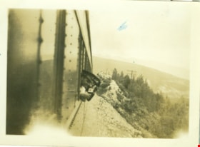
View from the train
https://search.heritageburnaby.ca/link/museumdescription2810
- Repository
- Burnaby Village Museum
- Date
- 1937
- Collection/Fonds
- Hawkshaw family fonds
- Description Level
- Item
- Physical Description
- 1 photograph : sepia ; 5.5 x 8 cm
- Scope and Content
- Photograph of two men sticking their heads out the side of a train window as the train is travelling through the Rocky Mountains. This is believed to be Yellowhead Pass, Alberta.
- Repository
- Burnaby Village Museum
- Collection/Fonds
- Hawkshaw family fonds
- Description Level
- Item
- Physical Description
- 1 photograph : sepia ; 5.5 x 8 cm
- Scope and Content
- Photograph of two men sticking their heads out the side of a train window as the train is travelling through the Rocky Mountains. This is believed to be Yellowhead Pass, Alberta.
- Accession Code
- BV996.6.45
- Access Restriction
- No restrictions
- Reproduction Restriction
- No known restrictions
- Date
- 1937
- Media Type
- Photograph
- Scan Resolution
- 600
- Scan Date
- 2/24/2011
- Scale
- 100
- Notes
- Title based on contents of photograph
- Caption for photograph reads: "Jack + Wood"
- Photograph is part of photograph album BV996.6.1
Images


Yale
https://search.heritageburnaby.ca/link/archivedescription34416
- Repository
- City of Burnaby Archives
- Date
- 1925
- Collection/Fonds
- Burnaby Historical Society fonds
- Description Level
- Item
- Physical Description
- 1 photograph : b&w ; 6 x 12.3 cm on page 17.5 x 26.1 cm
- Scope and Content
- Photograph looking down the railroad tracks into the town of Yale. This photograph appears to have been taken by Arthur Peers, who travelled through the Fraser River Valley and worked on the construction of the Trans-Provincial Highway during the later 1920s.
- Repository
- City of Burnaby Archives
- Date
- 1925
- Collection/Fonds
- Burnaby Historical Society fonds
- Subseries
- Peers family subseries
- Physical Description
- 1 photograph : b&w ; 6 x 12.3 cm on page 17.5 x 26.1 cm
- Description Level
- Item
- Record No.
- 020-123
- Access Restriction
- No restrictions
- Reproduction Restriction
- No known restrictions
- Accession Number
- BHS2007-04
- Scope and Content
- Photograph looking down the railroad tracks into the town of Yale. This photograph appears to have been taken by Arthur Peers, who travelled through the Fraser River Valley and worked on the construction of the Trans-Provincial Highway during the later 1920s.
- Media Type
- Photograph
- Photographer
- Peers, Arthur Francis "Mike"
- Notes
- Title based on caption accompanying photograph
Images

![Yale, BC, [1925] thumbnail](/media/hpo/_Data/_Archives_Images/_Unrestricted/001/020-075.jpg?width=280)
Yale, BC
https://search.heritageburnaby.ca/link/archivedescription34368
- Repository
- City of Burnaby Archives
- Date
- [1925]
- Collection/Fonds
- Burnaby Historical Society fonds
- Description Level
- Item
- Physical Description
- 1 photograph : b&w ; 7 x 11.6 cm on page 17.5 x 26.4 cm
- Scope and Content
- Photograph looking down the C.P.R. tracks towards the town of Yale. This photograph appears to have been taken by Arthur Peers, who travelled through the Fraser River Valley and worked on the construction of the Trans-Provincial Highway during the later 1920s.
- Repository
- City of Burnaby Archives
- Date
- [1925]
- Collection/Fonds
- Burnaby Historical Society fonds
- Subseries
- Peers family subseries
- Physical Description
- 1 photograph : b&w ; 7 x 11.6 cm on page 17.5 x 26.4 cm
- Description Level
- Item
- Record No.
- 020-075
- Access Restriction
- No restrictions
- Reproduction Restriction
- No known restrictions
- Accession Number
- BHS2007-04
- Scope and Content
- Photograph looking down the C.P.R. tracks towards the town of Yale. This photograph appears to have been taken by Arthur Peers, who travelled through the Fraser River Valley and worked on the construction of the Trans-Provincial Highway during the later 1920s.
- Media Type
- Photograph
- Photographer
- Peers, Arthur Francis "Mike"
- Notes
- Title based on caption accompanying photograph
Images
![Yale, BC, [1925] thumbnail](/media/hpo/_Data/_Archives_Images/_Unrestricted/001/020-075.jpg)