More like 'Aerial photograph of Burnaby'
Narrow Results By
Subject
- Advertising Medium - Signs and Signboards 1
- Aerial Photographs 131
- Agriculture - Crops 3
- Agriculture - Farms 1
- Agriculture - Fruit and Berries 2
- Arts - Paintings 1
- Buildings 34
- Buildings - Civic 4
- Buildings - Civic - Art Galleries 4
- Buildings - Civic - Hospitals 2
- Buildings - Commercial 24
- Buildings - Commercial - Drive-in Theatres 1
Person / Organization
- Alpha Secondary School 1
- Barnet Mill 1
- British Columbia Institute of Technology 1
- Burnaby Art Gallery 4
- Burnaby Chamber of Commerce 1
- Burnaby General Hospital 2
- Burnaby Historical Society 6
- Burnaby Mountain Centennial Park 2
- Burnaby Village Museum 6
- Cascade Drive-In Theatre 2
- Central Park Auto Camp 1
- Chinese Market Gardens 1
![Mark Drutz with photographs, [2002] thumbnail](/media/hpo/_Data/_Archives_Images/_Unrestricted/535/535-2753.jpg?width=280)
Mark Drutz with photographs
https://search.heritageburnaby.ca/link/archivedescription97378
- Repository
- City of Burnaby Archives
- Date
- [2002]
- Collection/Fonds
- Burnaby NewsLeader photograph collection
- Description Level
- Item
- Physical Description
- 1 photograph (tiff) : col.
- Scope and Content
- Photograph of Mark Drutz holding up photographs of two children who were sponsored by staff at BCIT.
- Repository
- City of Burnaby Archives
- Date
- [2002]
- Collection/Fonds
- Burnaby NewsLeader photograph collection
- Physical Description
- 1 photograph (tiff) : col.
- Description Level
- Item
- Record No.
- 535-2753
- Access Restriction
- No restrictions
- Reproduction Restriction
- No restrictions
- Accession Number
- 2018-12
- Scope and Content
- Photograph of Mark Drutz holding up photographs of two children who were sponsored by staff at BCIT.
- Media Type
- Photograph
- Photographer
- Bartel, Mario
- Notes
- Title based on caption
- Collected by editorial for use in an August 2002 issue of the Burnaby NewsLeader
- Caption from metadata: "Mark Drutz shows off photos of Hridoy Krishna, from Bangladesh, and Innocent Ncube, from Zimbabwe, two of the 13 foster children who have been sponsored by staff at BCIT. Mark has co-ordinated their efforts."
Images
![Mark Drutz with photographs, [2002] thumbnail](/media/hpo/_Data/_Archives_Images/_Unrestricted/535/535-2753.jpg)
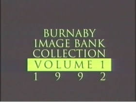
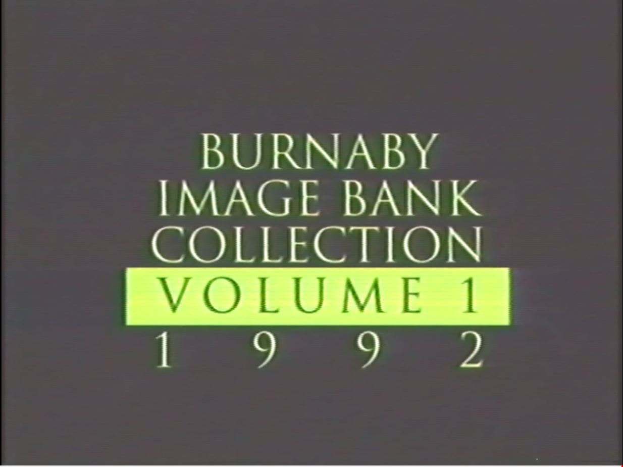
Burnaby's Photographic Family Album-Burnaby Image Bank Collection: Volume 1
https://search.heritageburnaby.ca/link/archivedescription64764
- Repository
- City of Burnaby Archives
- Date
- 1992
- Collection/Fonds
- Burnaby Historical Society fonds
- Description Level
- Item
- Physical Description
- 1 videocassette (1 hr., 56 min., 40 sec.) : b&w, col., sd.
- Scope and Content
- Item is a copy of "Burnaby's Photographic Family Album / Burnaby Image Bank Collection / Volume 1 / 1992" produced by the Simon Fraser University (SFU) Archives, and Archivist, Jim Ross in recognition of Burnaby’s Centennial. The video consists of 812 images from the Burnaby Image Bank which are i…
- Repository
- City of Burnaby Archives
- Date
- 1992
- Collection/Fonds
- Burnaby Historical Society fonds
- Subseries
- Burnaby Image Bank subseries
- Physical Description
- 1 videocassette (1 hr., 56 min., 40 sec.) : b&w, col., sd.
- Material Details
- Video Home System (VHS) tape
- Description Level
- Item
- Record No.
- 577-001
- Access Restriction
- No restrictions
- Reproduction Restriction
- May be restricted by third party rights
- Accession Number
- BHS2001-15
- Scope and Content
- Item is a copy of "Burnaby's Photographic Family Album / Burnaby Image Bank Collection / Volume 1 / 1992" produced by the Simon Fraser University (SFU) Archives, and Archivist, Jim Ross in recognition of Burnaby’s Centennial. The video consists of 812 images from the Burnaby Image Bank which are indexed by Communities, Neighbourhoods, Subjects and Names. The indexes are provided at both the beginning and end of the video with photographs dispersed in between. An introduction is provided by Simon Fraser University Archivist, Jim Ross. The video was made available for public purchase and viewing on Video Home System (VHS) format and distributed to each Burnaby school and branch of the Burnaby Public Library for information and research purposes.
- Media Type
- Moving Images
- Notes
- Transcribed title
Images
Video
Burnaby's Photographic Family Album-Burnaby Image Bank Collection: Volume 1, 1992
Burnaby's Photographic Family Album-Burnaby Image Bank Collection: Volume 1, 1992
https://search.heritageburnaby.ca/media/Hpo/_Data/_Archives_Moving_Images/_Unrestricted/577-001.m4v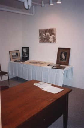
Framed photographs
https://search.heritageburnaby.ca/link/archivedescription36436
- Repository
- City of Burnaby Archives
- Date
- 1990
- Collection/Fonds
- Burnaby Historical Society fonds
- Description Level
- Item
- Physical Description
- 1 photograph : col. ; 15 x 10 cm
- Scope and Content
- Photograph a corner of a room with framed photographs hanging on the wall as well as lying on a table that has been covered with a white table cloth at the opening of the Burnaby Community Archives at the Burnaby Village Museum. There is another uncovered table in the room with pamphlets on it.
- Repository
- City of Burnaby Archives
- Date
- 1990
- Collection/Fonds
- Burnaby Historical Society fonds
- Subseries
- Donald N. Brown subseries
- Physical Description
- 1 photograph : col. ; 15 x 10 cm
- Description Level
- Item
- Record No.
- 271-004
- Access Restriction
- No restrictions
- Reproduction Restriction
- Reproduce for fair dealing purposes only
- Accession Number
- BHS1991-41
- Scope and Content
- Photograph a corner of a room with framed photographs hanging on the wall as well as lying on a table that has been covered with a white table cloth at the opening of the Burnaby Community Archives at the Burnaby Village Museum. There is another uncovered table in the room with pamphlets on it.
- Subjects
- Documentary Artifacts - Photographs
- Media Type
- Photograph
- Notes
- Title based on contents of photograph
- 1 photograph : col. negative ; 35 mm accompanying
- Geographic Access
- Deer Lake Avenue
- Street Address
- 6501 Deer Lake Avenue
- Historic Neighbourhood
- Burnaby Lake (Historic Neighbourhood)
- Planning Study Area
- Morley-Buckingham Area
Images

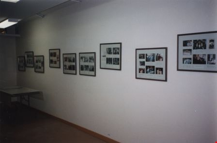
Display of photographs
https://search.heritageburnaby.ca/link/archivedescription36449
- Repository
- City of Burnaby Archives
- Date
- 1990
- Collection/Fonds
- Burnaby Historical Society fonds
- Description Level
- Item
- Physical Description
- 1 photograph : col. ; 10 x 15 cm
- Scope and Content
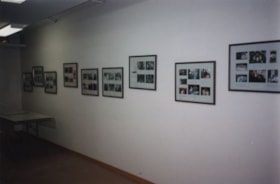
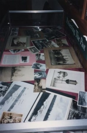
- Photograph of a display of framed photographs that were part of the opening of the Burnaby Community Archives at the Burnaby Village Museum.
- Repository
- City of Burnaby Archives
- Date
- 1990
- Collection/Fonds
- Burnaby Historical Society fonds
- Subseries
- Donald N. Brown subseries
- Physical Description
- 1 photograph : col. ; 10 x 15 cm
- Description Level
- Item
- Record No.
- 271-017
- Access Restriction
- No restrictions
- Reproduction Restriction
- Reproduce for fair dealing purposes only
- Accession Number
- BHS1991-41
- Scope and Content
- Photograph of a display of framed photographs that were part of the opening of the Burnaby Community Archives at the Burnaby Village Museum.
- Subjects
- Documentary Artifacts - Photographs
- Media Type
- Photograph
- Notes
- Title based on contents of photograph
- 1 photograph : col. negative ; 35 mm accompanying
- Geographic Access
- Deer Lake Avenue
- Street Address
- 6501 Deer Lake Avenue
- Historic Neighbourhood
- Burnaby Lake (Historic Neighbourhood)
- Planning Study Area
- Morley-Buckingham Area
Images
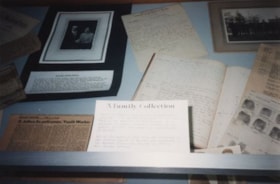
A Family Collection
https://search.heritageburnaby.ca/link/archivedescription36452
- Repository
- City of Burnaby Archives
- Date
- 1990
- Collection/Fonds
- Burnaby Historical Society fonds
- Description Level
- Item
- Physical Description
- 1 photograph : col. ; 10 x 15 cm
- Scope and Content
- Photograph of the George Jeffrey family collection on display during the opening of the Burnaby Community Archives at the Burnaby Village Museum.
- Repository
- City of Burnaby Archives
- Date
- 1990
- Collection/Fonds
- Burnaby Historical Society fonds
- Subseries
- Donald N. Brown subseries
- Physical Description
- 1 photograph : col. ; 10 x 15 cm
- Description Level
- Item
- Record No.
- 271-020
- Access Restriction
- No restrictions
- Reproduction Restriction
- Reproduce for fair dealing purposes only
- Accession Number
- BHS1991-41
- Scope and Content
- Photograph of the George Jeffrey family collection on display during the opening of the Burnaby Community Archives at the Burnaby Village Museum.
- Media Type
- Photograph
- Notes
- 1 col. negative accompanying
- Geographic Access
- Deer Lake Avenue
- Street Address
- 6501 Deer Lake Avenue
- Historic Neighbourhood
- Burnaby Lake (Historic Neighbourhood)
- Planning Study Area
- Morley-Buckingham Area
Images
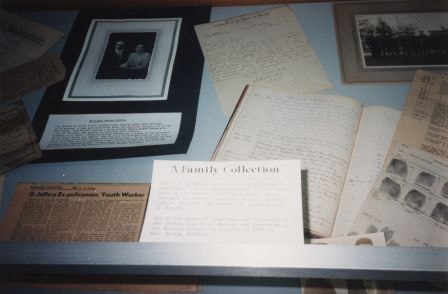
George Jeffrey family collection
https://search.heritageburnaby.ca/link/archivedescription36453
- Repository
- City of Burnaby Archives
- Date
- 1990
- Collection/Fonds
- Burnaby Historical Society fonds
- Description Level
- Item
- Physical Description
- 1 photograph : col. ; 15 x 10 cm
- Scope and Content
- Photograph of the display case that housed the George Jeffrey family collection during the opening of the Burnaby Community Archives at the Burnaby Village Museum.
- Repository
- City of Burnaby Archives
- Date
- 1990
- Collection/Fonds
- Burnaby Historical Society fonds
- Subseries
- Donald N. Brown subseries
- Physical Description
- 1 photograph : col. ; 15 x 10 cm
- Description Level
- Item
- Record No.
- 271-021
- Access Restriction
- No restrictions
- Reproduction Restriction
- Reproduce for fair dealing purposes only
- Accession Number
- BHS1991-41
- Scope and Content
- Photograph of the display case that housed the George Jeffrey family collection during the opening of the Burnaby Community Archives at the Burnaby Village Museum.
- Media Type
- Photograph
- Notes
- Title based on contents of photograph
- 1 col. negative accompanying
- Geographic Access
- Deer Lake Avenue
- Street Address
- 6501 Deer Lake Avenue
- Historic Neighbourhood
- Burnaby Lake (Historic Neighbourhood)
- Planning Study Area
- Morley-Buckingham Area
Images

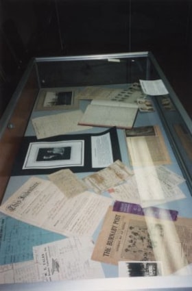
Photographs in a display case
https://search.heritageburnaby.ca/link/archivedescription36454
- Repository
- City of Burnaby Archives
- Date
- 1990
- Collection/Fonds
- Burnaby Historical Society fonds
- Description Level
- Item
- Physical Description
- 1 photograph : col. ; 15 x 10 cm
- Scope and Content
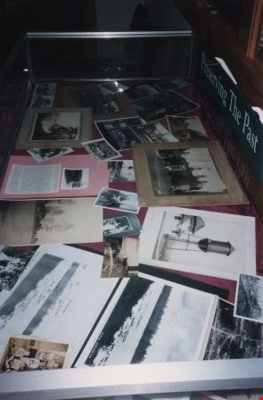
- Photograph of a display of jumbled photographs inside a display case at the opening of the Burnaby Community Archives at the Burnaby Village Museum.
- Repository
- City of Burnaby Archives
- Date
- 1990
- Collection/Fonds
- Burnaby Historical Society fonds
- Subseries
- Donald N. Brown subseries
- Physical Description
- 1 photograph : col. ; 15 x 10 cm
- Description Level
- Item
- Record No.
- 271-022
- Access Restriction
- No restrictions
- Reproduction Restriction
- Reproduce for fair dealing purposes only
- Accession Number
- BHS1991-41
- Scope and Content
- Photograph of a display of jumbled photographs inside a display case at the opening of the Burnaby Community Archives at the Burnaby Village Museum.
- Subjects
- Documentary Artifacts - Photographs
- Media Type
- Photograph
- Notes
- Title based on contents of photograph
- 1 photograph : col. negative ; 35 mm accompanying
- Geographic Access
- Deer Lake Avenue
- Street Address
- 6501 Deer Lake Avenue
- Historic Neighbourhood
- Burnaby Lake (Historic Neighbourhood)
- Planning Study Area
- Morley-Buckingham Area
Images

Marine Drive bypass
https://search.heritageburnaby.ca/link/archivedescription45661
- Repository
- City of Burnaby Archives
- Date
- March 18, 1981
- Collection/Fonds
- Columbian Newspaper collection
- Description Level
- Item
- Physical Description
- 1 photograph : b&w ; 24.5 x 16.5 cm
- Scope and Content
- Aerial photograph of the Marine Drive bypass into Burnaby.
- Repository
- City of Burnaby Archives
- Date
- March 18, 1981
- Collection/Fonds
- Columbian Newspaper collection
- Physical Description
- 1 photograph : b&w ; 24.5 x 16.5 cm
- Description Level
- Item
- Record No.
- 480-555
- Access Restriction
- No restrictions
- Reproduction Restriction
- Reproduce for fair dealing purposes only
- Accession Number
- 2003-02
- Scope and Content
- Aerial photograph of the Marine Drive bypass into Burnaby.
- Media Type
- Photograph
- Photographer
- Hodge, Craig
- Notes
- Title based on contents of photograph
- Geographic Access
- Marine Drive
- Historic Neighbourhood
- Fraser Arm (Historic Neighbourhood)
- Planning Study Area
- Big Bend Area
Images


Stormont Overpass
https://search.heritageburnaby.ca/link/archivedescription45376
- Repository
- City of Burnaby Archives
- Date
- August 1978
- Collection/Fonds
- Columbian Newspaper collection
- Description Level
- Item
- Physical Description
- 1 photograph : b&w ; 12.5 x 24 cm
- Scope and Content
- Aerial photograph of Stormont Overpass which would provide a direct link from the Trans Canada Highway (previously named the 401 Freeway) to the Lougheed Highway and Simon Fraser University. This was taken when the excavation work was completed, and grading and paving still need to be done.
- Repository
- City of Burnaby Archives
- Date
- August 1978
- Collection/Fonds
- Columbian Newspaper collection
- Physical Description
- 1 photograph : b&w ; 12.5 x 24 cm
- Description Level
- Item
- Record No.
- 480-271
- Access Restriction
- No restrictions
- Reproduction Restriction
- No restrictions
- Accession Number
- 2003-02
- Scope and Content
- Aerial photograph of Stormont Overpass which would provide a direct link from the Trans Canada Highway (previously named the 401 Freeway) to the Lougheed Highway and Simon Fraser University. This was taken when the excavation work was completed, and grading and paving still need to be done.
- Media Type
- Photograph
- Photographer
- Hodge, Craig
- Notes
- Title based on contents of photograph
- Note in pencil on verso of photograph reads: "Altair Aviation / photo by / Craig Hodge"
- Geographic Access
- Cariboo Road
- Gaglardi Way
- Trans Canada Highway
- Historic Neighbourhood
- Burquitlam (Historic Neighbourhood)
- Planning Study Area
- Burnaby Lake Area
- Cameron Area
Images


Stormont Overpass
https://search.heritageburnaby.ca/link/archivedescription45377
- Repository
- City of Burnaby Archives
- Date
- August 1978
- Collection/Fonds
- Columbian Newspaper collection
- Description Level
- Item
- Physical Description
- 1 photograph : b&w ; 16.5 x 24 cm
- Scope and Content
- Aerial photograph of Stormont Overpass which would provide a direct link from the 401 Freeway to the Lougheed Highway and Simon Fraser University. This was taken when the excavation work was completed, and grading and paving still need to be done.
- Repository
- City of Burnaby Archives
- Date
- August 1978
- Collection/Fonds
- Columbian Newspaper collection
- Physical Description
- 1 photograph : b&w ; 16.5 x 24 cm
- Description Level
- Item
- Record No.
- 480-272
- Access Restriction
- No restrictions
- Reproduction Restriction
- No restrictions
- Accession Number
- 2003-02
- Scope and Content
- Aerial photograph of Stormont Overpass which would provide a direct link from the 401 Freeway to the Lougheed Highway and Simon Fraser University. This was taken when the excavation work was completed, and grading and paving still need to be done.
- Media Type
- Photograph
- Photographer
- Hodge, Craig
- Notes
- Title based on contents of photograph
- Newspaper clipping attached to verso of photograph reads: "After six years, work on the Stormont interchange in Burnaby is only a few weeks from completion. The huge clover-leaf junction of Gaglardi Way and the Freeway is on the top left-hand corner, with Gaglardi Way approaching from the bottom right where a bridge has been completed over the Burlington Northern tracks. An embankment linking that bridge with one over the Brunette River awaits only a layer of tarmac, and a path has been cleared through the woods to link up with the clover-leaf. The present access to the Freeway is along the road running from the left to right across the middle of the picture. The interchange will open next month."
- Note in pencil on verso of photograph reads: "Altair Aviation / photo by / Craig Hodge"
- Geographic Access
- Cariboo Road
- Gaglardi Way
- Trans Canada Highway
- Historic Neighbourhood
- Burquitlam (Historic Neighbourhood)
- Planning Study Area
- Burnaby Lake Area
- Cameron Area
Images

![Cariboo Cloverleaf, Government Road and Gaglardi Way, [1978] thumbnail](/media/hpo/_Data/_Archives_Images/_Unrestricted/480/480-274.jpg?width=280)
Cariboo Cloverleaf, Government Road and Gaglardi Way
https://search.heritageburnaby.ca/link/archivedescription45379
- Repository
- City of Burnaby Archives
- Date
- [1978]
- Collection/Fonds
- Columbian Newspaper collection
- Description Level
- Item
- Physical Description
- 1 photograph : b&w ; 22.5 x 19 cm
- Scope and Content
- Aerial photograph of the Cariboo Cloverleaf, and the Government Road overpass construction that would join it with Gaglardi Way.
- Repository
- City of Burnaby Archives
- Date
- [1978]
- Collection/Fonds
- Columbian Newspaper collection
- Physical Description
- 1 photograph : b&w ; 22.5 x 19 cm
- Description Level
- Item
- Record No.
- 480-274
- Access Restriction
- No restrictions
- Reproduction Restriction
- No restrictions
- Accession Number
- 2003-02
- Scope and Content
- Aerial photograph of the Cariboo Cloverleaf, and the Government Road overpass construction that would join it with Gaglardi Way.
- Media Type
- Photograph
- Photographer
- King, Basil
- Notes
- Title based on contents of photograph
- Note on recto of photograph reads: "Cariboo cloverleaf in foreground and Government Road overpass construction (centre) will join with Gaglardi Way (top of pic)."
- Geographic Access
- Government Road
- Cariboo Road
- Gaglardi Way
- Historic Neighbourhood
- Burquitlam (Historic Neighbourhood)
- Planning Study Area
- Burnaby Lake Area
- Cariboo-Armstrong Area
- Cameron Area
Images
![Cariboo Cloverleaf, Government Road and Gaglardi Way, [1978] thumbnail](/media/hpo/_Data/_Archives_Images/_Unrestricted/480/480-274.jpg)
![Stormont Overpass, [1978] thumbnail](/media/hpo/_Data/_Archives_Images/_Unrestricted/480/480-275.jpg?width=280)
Stormont Overpass
https://search.heritageburnaby.ca/link/archivedescription45380
- Repository
- City of Burnaby Archives
- Date
- [1978]
- Collection/Fonds
- Columbian Newspaper collection
- Description Level
- Item
- Physical Description
- 1 photograph : b&w ; 16 x 24 cm
- Scope and Content
- Aerial photograph of Stormont Overpass which would provide a direct link from the Trans Canada Highway (previously named the 401 Freeway) to the Lougheed Highway and Simon Fraser University. This was taken when the excavation work was completed, and paving still need to be done.
- Repository
- City of Burnaby Archives
- Date
- [1978]
- Collection/Fonds
- Columbian Newspaper collection
- Physical Description
- 1 photograph : b&w ; 16 x 24 cm
- Description Level
- Item
- Record No.
- 480-275
- Access Restriction
- No restrictions
- Reproduction Restriction
- No restrictions
- Accession Number
- 2003-02
- Scope and Content
- Aerial photograph of Stormont Overpass which would provide a direct link from the Trans Canada Highway (previously named the 401 Freeway) to the Lougheed Highway and Simon Fraser University. This was taken when the excavation work was completed, and paving still need to be done.
- Media Type
- Photograph
- Photographer
- King, Basil
- Notes
- Title based on contents of photograph
- Note on verso of photograph reads: "One of the biggest Highways"
- Geographic Access
- Cariboo Road
- Gaglardi Way
- Trans Canada Highway
- Historic Neighbourhood
- Burquitlam (Historic Neighbourhood)
- Planning Study Area
- Burnaby Lake Area
- Cameron Area
Images
![Stormont Overpass, [1978] thumbnail](/media/hpo/_Data/_Archives_Images/_Unrestricted/480/480-275.jpg)
postcard
https://search.heritageburnaby.ca/link/museumartifact44486
- Repository
- Burnaby Village Museum
- Accession Code
- BV002.30.1
- Description
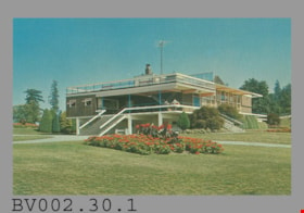
- Postcard: colour photo of Centennial Pavilion, Burnaby Mountain Park; horizontal; on reverse in navy, "4" "CENTENNIAL PAVILION" "Burnaby, B.C., Canada" "The Centennial Pavilion located..."; illustration at left of R.C.M.P. officer; at bottom, "Photo by George Allen Aerial Photos Ltd. For the Burnaby Parks & Recreation Commission" "S-2775"; navy bar up centre with "NATURAL COLOR PRODUCTIONS, LTD., VANCOUVER, B.C."; at bottom, "MADE IN CANADA" "GRANT-MANN", logo; at upper right, illustration of mounted R.C.M.P. officer, "POST CARD" "ADDRESS", and rectangle "USE CANADIAN POSTAGE"; in blue pen on left side, "July, 1977"
- Classification
- Written Communication T&E - - Writing Media
- Object Term
- Postcard
- Country Made
- Canada
- Province Made
- British Columbia
- Site/City Made
- Vancouver
- Title
- Centennial Pavilion Burnaby, B.C., Canada S-2775
- Publication Date
- July 1977
- Subjects
- Documentary Artifacts
- Documentary Artifacts - Postcards
- Documentary Artifacts - Photographs
- Geographic Features
- Geographic Features - Parks
Images
postcard
https://search.heritageburnaby.ca/link/museumartifact48608
- Repository
- Burnaby Village Museum
- Accession Code
- BV005.41.2
- Description
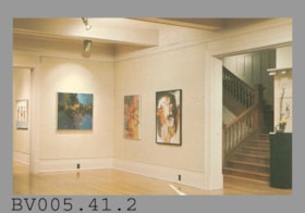
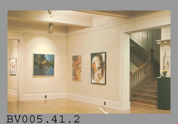
- Postcard: colour photo of interior, room with paintings on cream-coloured walls, staircase visible through doorway; horizontal; on reverse in navy, "BURNABY ART GALLERY" "Burnaby, B.C., Canada" "View of the Main Gallery and Entrance Hall"; housed in the Ceperley Mansion at Deer Lake Park; at bottom, "Photo by D.A. Denny"; up centre of card, "Grant-Mann Lithographers Ltd., Vancouver, Canada"; at bottom, "Traveltime PRODUCT" "C-2159", logo; at top, maple leaf "MADE IN CANADA"; at upper right, "POST CARD" "ADDRESS"; addressed in black pen to "Dorothy & Phil Mountain" "1016 Stevens St. White Rock B.C. V4B 4X7"; message "Your Welcome! Bln M."?; blue stamp with grey cameo profile image of Queen Elizabeth II, black "12" "POSTAGE POSTES" "CANADA"; round postmark "POSTES CANADA POST" "25 V 1977"; rectangular cancellation "POSTAL CODE" "CODE POSTAL"; series of short yellow vertical lines across bottom; pencilled "$2" at upper left
- Classification
- Written Communication T&E - - Writing Media
- Object Term
- Postcard
- Marks/Labels
- Burnaby Art Gallery / Burnaby, B.C., Canada / View of the Main Gallery and Hall
- Country Made
- Canada
- Province Made
- British Columbia
- Site/City Made
- Vancouver
- Title
- Burnaby Art Galley C-2159
- Publication Date
- May 25 1977
- Subjects
- Documentary Artifacts
- Documentary Artifacts - Postcards
- Documentary Artifacts - Photographs
- Buildings
- Buildings - Civic
- Buildings - Civic - Art Galleries
- Names
- Burnaby Art Gallery
Images

postcard
https://search.heritageburnaby.ca/link/museumartifact48690
- Repository
- Burnaby Village Museum
- Accession Code
- BV005.47.2
- Description
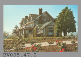
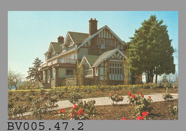
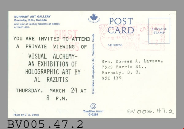
- Postcard: colour photo of large house, half-timbered style, with garden; horizontal; on reverse in navy, "BURNABY ART GALLERY" "Burnaby, B.C., Canada" "And view of Century Gardens on shores of Deer Lake", formerly the Ceperley Mansion "Fairacres"; at bottom, "Photo by D.A. Denny"; up centre of card, "Grant-Mann Lithographers Ltd., Vancouver, Canada"; at bottom, "Traveltime PRODUCT" "C-2158", logo; at top, maple leaf and "MADE IN CANADA"; at upper right, "POST CARD" "ADDRESS", rectangle with "POSTAGE STAMP"; typed address "Mrs. Doreen A. Lawson, 7522 Burris St., Burnaby, B.C. V5E 1Y9"; printed in black at left, "YOU ARE INVITED TO ATTEND A PRIVATE VIEWING OF VISUAL ALCHEMY - AN EXHIBITION OF HOLOGRAPHIC ART BY AL RAZUTIS" "THURSDAY, MARCH 24 AT 8 P.M."; pink metering "FIRST CLASS" "VANCOUVER B.C." "17 III '77" "CANADA" "POSTES" "POSTAGE" "12" "METER COMPTEUR" "PO" "568653"; some smudging
- Object History
- This item was found in book BV005.47.1.
- Classification
- Written Communication T&E - - Writing Media
- Object Term
- Postcard
- Marks/Labels
- Burnaby Art Gallery / Burnaby, B.C., Canada / and view of.. / A Private Viewing of / "Visual Alchemy" - / an Exhibition of / Holographic Art by / Al Razutis / Thursday, March 24 at / 8 P.M. / Mrs. Doreen A. Lawson / 7522 Burris St., / Burnaby, B.C. / V5E 1Y9 / Vancouver / 17 III '77
- Country Made
- Canada
- Province Made
- British Columbia
- Site/City Made
- Vancouver
- Title
- Burnaby Art Gallery C-2158
- Publication Date
- March 17 1977
- Subjects
- Documentary Artifacts
- Documentary Artifacts - Postcards
- Documentary Artifacts - Photographs
- Buildings
- Buildings - Civic
- Buildings - Civic - Art Galleries
- Names
- Burnaby Art Gallery
Images

Lougheed Highway
https://search.heritageburnaby.ca/link/archivedescription79939
- Repository
- City of Burnaby Archives
- Date
- September 27, 1976
- Collection/Fonds
- Burnaby Public Library Contemporary Visual Archive Project
- Description Level
- Item
- Physical Description
- 1 photograph : b&w ; 11 x 16 cm mounted on cardboard
- Scope and Content
- Photograph shows an aerial view of Lougheed Highway looking southeast from Salish Court Tower west.
- Repository
- City of Burnaby Archives
- Date
- September 27, 1976
- Collection/Fonds
- Burnaby Public Library Contemporary Visual Archive Project
- Physical Description
- 1 photograph : b&w ; 11 x 16 cm mounted on cardboard
- Description Level
- Item
- Record No.
- 556-510
- Access Restriction
- No restrictions
- Reproduction Restriction
- Reproduce for fair dealing purposes only
- Accession Number
- 2013-13
- Scope and Content
- Photograph shows an aerial view of Lougheed Highway looking southeast from Salish Court Tower west.
- Media Type
- Photograph
- Photographer
- Campbell, Peg
- Notes
- Scope note taken directly from BPL photograph description.
- 1 b&w copy negative : 10 x 12.5 cm accompanying
- Geographic Access
- Lougheed Highway
- Historic Neighbourhood
- Burquitlam (Historic Neighbourhood)
- Planning Study Area
- Cameron Area
Images


Lougheed Highway
https://search.heritageburnaby.ca/link/archivedescription79940
- Repository
- City of Burnaby Archives
- Date
- July, 1976
- Collection/Fonds
- Burnaby Public Library Contemporary Visual Archive Project
- Description Level
- Item
- Physical Description
- 1 photograph : b&w ; 11 x 16 cm mounted on cardboard
- Scope and Content
- Photograph shows an aerial view looking east along Lougheed Highway at Salish Court Towers with the Cariboo Shopping Centre in the background.
- Repository
- City of Burnaby Archives
- Date
- July, 1976
- Collection/Fonds
- Burnaby Public Library Contemporary Visual Archive Project
- Physical Description
- 1 photograph : b&w ; 11 x 16 cm mounted on cardboard
- Description Level
- Item
- Record No.
- 556-511
- Access Restriction
- No restrictions
- Reproduction Restriction
- Reproduce for fair dealing purposes only
- Accession Number
- 2013-13
- Scope and Content
- Photograph shows an aerial view looking east along Lougheed Highway at Salish Court Towers with the Cariboo Shopping Centre in the background.
- Media Type
- Photograph
- Photographer
- Gardiner, Robert
- Notes
- Scope note taken directly from BPL photograph description.
- 1 b&w copy negative : 10 x 12.5 cm accompanying
- Geographic Access
- Lougheed Highway
- Historic Neighbourhood
- Burquitlam (Historic Neighbourhood)
- Planning Study Area
- Cameron Area
Images


Burnaby Centre
https://search.heritageburnaby.ca/link/archivedescription79941
- Repository
- City of Burnaby Archives
- Date
- September 27, 1976
- Collection/Fonds
- Burnaby Public Library Contemporary Visual Archive Project
- Description Level
- Item
- Physical Description
- 1 photograph : b&w ; 11 x 16 cm mounted on cardboard
- Scope and Content
- Photograph shows an aerial view of Burnaby Centre looking east from Central Park Place. Kingsway is on the right and Grange Street is on the left.
- Repository
- City of Burnaby Archives
- Date
- September 27, 1976
- Collection/Fonds
- Burnaby Public Library Contemporary Visual Archive Project
- Physical Description
- 1 photograph : b&w ; 11 x 16 cm mounted on cardboard
- Description Level
- Item
- Record No.
- 556-512
- Access Restriction
- No restrictions
- Reproduction Restriction
- Reproduce for fair dealing purposes only
- Accession Number
- 2013-13
- Scope and Content
- Photograph shows an aerial view of Burnaby Centre looking east from Central Park Place. Kingsway is on the right and Grange Street is on the left.
- Media Type
- Photograph
- Photographer
- Norton, Paul
- Notes
- Scope note taken directly from BPL photograph description.
- 1 b&w copy negative : 10 x 12.5 cm accompanying
- Geographic Access
- Kingsway
- Grange Street
- Historic Neighbourhood
- Central Park (Historic Neighbourhood)
- Planning Study Area
- Maywood Area
Images


Vantage Point Highrise
https://search.heritageburnaby.ca/link/archivedescription79942
- Repository
- City of Burnaby Archives
- Date
- October, 1976
- Collection/Fonds
- Burnaby Public Library Contemporary Visual Archive Project
- Description Level
- Item
- Physical Description
- 1 photograph : b&w ; 11 x 16 cm mounted on cardboard
- Scope and Content
- Photograph shows a view of Vantage Point Highrise at Lougheed Highway and Bellwood Avenue with Trans-Cold Refrigeration on Douglas Road in the foreground.
- Repository
- City of Burnaby Archives
- Date
- October, 1976
- Collection/Fonds
- Burnaby Public Library Contemporary Visual Archive Project
- Physical Description
- 1 photograph : b&w ; 11 x 16 cm mounted on cardboard
- Description Level
- Item
- Record No.
- 556-513
- Access Restriction
- No restrictions
- Reproduction Restriction
- Reproduce for fair dealing purposes only
- Accession Number
- 2013-13
- Scope and Content
- Photograph shows a view of Vantage Point Highrise at Lougheed Highway and Bellwood Avenue with Trans-Cold Refrigeration on Douglas Road in the foreground.
- Media Type
- Photograph
- Photographer
- Salmon, Stu
- Notes
- Scope note taken directly from BPL photograph description.
- 1 b&w copy negative : 10 x 12.5 cm accompanying
- Planning Study Area
- Dawson-Delta Area
Images


Kingsway
https://search.heritageburnaby.ca/link/archivedescription79943
- Repository
- City of Burnaby Archives
- Date
- September 15, 1976
- Collection/Fonds
- Burnaby Public Library Contemporary Visual Archive Project
- Description Level
- Item
- Physical Description
- 1 photograph : b&w ; 11 x 16 cm mounted on cardboard
- Scope and Content
- Photograph shows a view of Kingsway looking southeast from the 21st floor of the Panorama Towers in Grange Street. The Esso Car Clinic is in the centre of the photo.
- Repository
- City of Burnaby Archives
- Date
- September 15, 1976
- Collection/Fonds
- Burnaby Public Library Contemporary Visual Archive Project
- Physical Description
- 1 photograph : b&w ; 11 x 16 cm mounted on cardboard
- Description Level
- Item
- Record No.
- 556-514
- Access Restriction
- No restrictions
- Reproduction Restriction
- Reproduce for fair dealing purposes only
- Accession Number
- 2013-13
- Scope and Content
- Photograph shows a view of Kingsway looking southeast from the 21st floor of the Panorama Towers in Grange Street. The Esso Car Clinic is in the centre of the photo.
- Subjects
- Aerial Photographs
- Media Type
- Photograph
- Photographer
- McCarron, John
- Notes
- Scope note taken directly from BPL photograph description.
- 1 b&w copy negative : 10 x 12.5 cm accompanying
- Geographic Access
- Kingsway
- Historic Neighbourhood
- Central Park (Historic Neighbourhood)
- Planning Study Area
- Maywood Area
Images
