More like '1000 Block Gilley Avenue'
Narrow Results By
Subject
- Aerial Photographs 6
- Agriculture - Farms 3
- Agriculture - Fruit and Berries 1
- Animals - Dogs 1
- Buildings - Civic - Hospitals 1
- Buildings - Commercial 1
- Buildings - Heritage 1
- Buildings - Industrial 1
- Buildings - Industrial - Factories 1
- Buildings - Industrial - Refineries 1
- Buildings - Public - Detention Facilities 3
- Buildings - Recreational 2
Person / Organization
- Barnet Mountain Park 2
- Barnet Park 1
- Bayntun, Charmaine "Sherrie" Yanko 3
- Belhouse, Jack 1
- Bolton, Richard 1
- Bossort, Kathy 19
- British Columbia Telephone Company 1
- Burnaby Mountain Centennial Park 2
- Burnaby Mountain Centennial Rose Garden 1
- Burnaby Mountain Park 2
- Burnaby Mountain Parkway 1
- Burnaby North High School 1
![311 Madison Avenue, [1949 or 1950] (date of original), copied 1991 thumbnail](/media/hpo/_Data/_Archives_Images/_Unrestricted/370/370-204.jpg?width=280)
311 Madison Avenue
https://search.heritageburnaby.ca/link/archivedescription37616
- Repository
- City of Burnaby Archives
- Date
- [1949 or 1950] (date of original), copied 1991
- Collection/Fonds
- Burnaby Historical Society fonds
- Description Level
- Item
- Physical Description
- 1 photograph : b&w ; 3.0 x 4.5 cm print on contact sheet 20.2 x 25.3 cm
- Scope and Content
- Photograph of a side view of 311 Madison Avenue, in the snow. The photograph was taken from Madison Avenue.
- Repository
- City of Burnaby Archives
- Date
- [1949 or 1950] (date of original), copied 1991
- Collection/Fonds
- Burnaby Historical Society fonds
- Subseries
- Burnaby Image Bank subseries
- Physical Description
- 1 photograph : b&w ; 3.0 x 4.5 cm print on contact sheet 20.2 x 25.3 cm
- Description Level
- Item
- Record No.
- 370-204
- Access Restriction
- No restrictions
- Reproduction Restriction
- No restrictions
- Accession Number
- BHS1999-03
- Scope and Content
- Photograph of a side view of 311 Madison Avenue, in the snow. The photograph was taken from Madison Avenue.
- Media Type
- Photograph
- Notes
- Title based on contents of photograph
- 1 b&w copy negative accompanying
- Geographic Access
- Madison Avenue
- Street Address
- 311 Madison Avenue
- Historic Neighbourhood
- Vancouver Heights (Historic Neighbourhood)
- Planning Study Area
- Burnaby Heights Area
Images
![311 Madison Avenue, [1949 or 1950] (date of original), copied 1991 thumbnail](/media/hpo/_Data/_Archives_Images/_Unrestricted/370/370-204.jpg)
![4674 Southlawn Drive, [1958] (date of original), copied 1991 thumbnail](/media/hpo/_Data/_Archives_Images/_Unrestricted/370/370-461.jpg?width=280)
4674 Southlawn Drive
https://search.heritageburnaby.ca/link/archivedescription37873
- Repository
- City of Burnaby Archives
- Date
- [1958] (date of original), copied 1991
- Collection/Fonds
- Burnaby Historical Society fonds
- Description Level
- Item
- Physical Description
- 1 photograph : b&w ; 2.8 x 2.8 cm print on contact sheet 20.1 x 26.7 cm
- Scope and Content
- Photograph of 4674 Southlawn Drive in the snow. The snow-covered road can be seen in front of the house.
- Repository
- City of Burnaby Archives
- Date
- [1958] (date of original), copied 1991
- Collection/Fonds
- Burnaby Historical Society fonds
- Subseries
- Burnaby Image Bank subseries
- Physical Description
- 1 photograph : b&w ; 2.8 x 2.8 cm print on contact sheet 20.1 x 26.7 cm
- Description Level
- Item
- Record No.
- 370-461
- Access Restriction
- No restrictions
- Reproduction Restriction
- No restrictions
- Accession Number
- BHS1999-03
- Scope and Content
- Photograph of 4674 Southlawn Drive in the snow. The snow-covered road can be seen in front of the house.
- Media Type
- Photograph
- Notes
- Title based on contents of photograph
- 1 b&w copy negative accompanying
- Negative has a pink cast
- Geographic Access
- Southlawn Drive
- Street Address
- 4674 Southlawn Drive
- Planning Study Area
- Brentwood Area
Images
![4674 Southlawn Drive, [1958] (date of original), copied 1991 thumbnail](/media/hpo/_Data/_Archives_Images/_Unrestricted/370/370-461.jpg)
![5987 Malvern Avenue during snowfall, [1958 or 1959] (date of original), copied 1991 thumbnail](/media/hpo/_Data/_Archives_Images/_Unrestricted/370/370-170.jpg?width=280)
5987 Malvern Avenue during snowfall
https://search.heritageburnaby.ca/link/archivedescription37582
- Repository
- City of Burnaby Archives
- Date
- [1958 or 1959] (date of original), copied 1991
- Collection/Fonds
- Burnaby Historical Society fonds
- Description Level
- Item
- Physical Description
- 1 photograph : b&w ; 3.1 x 4.6 cm print on contact sheet 20.2 x 25.3 cm
- Scope and Content
- Photograph of the front of 5987 Malvern Avenue during a heavy snowfall. Someone is standing outside the house under an umbrella.
- Repository
- City of Burnaby Archives
- Date
- [1958 or 1959] (date of original), copied 1991
- Collection/Fonds
- Burnaby Historical Society fonds
- Subseries
- Burnaby Image Bank subseries
- Physical Description
- 1 photograph : b&w ; 3.1 x 4.6 cm print on contact sheet 20.2 x 25.3 cm
- Description Level
- Item
- Record No.
- 370-170
- Access Restriction
- No restrictions
- Reproduction Restriction
- No restrictions
- Accession Number
- BHS1999-03
- Scope and Content
- Photograph of the front of 5987 Malvern Avenue during a heavy snowfall. Someone is standing outside the house under an umbrella.
- Media Type
- Photograph
- Notes
- Title based on contents of photograph
- 1 b&w copy negative accompanying
- Negative has a pink cast
- Geographic Access
- Malvern Avenue
- Street Address
- 5987 Malvern Avenue
- Historic Neighbourhood
- Burnaby Lake (Historic Neighbourhood)
- Planning Study Area
- Morley-Buckingham Area
Images
![5987 Malvern Avenue during snowfall, [1958 or 1959] (date of original), copied 1991 thumbnail](/media/hpo/_Data/_Archives_Images/_Unrestricted/370/370-170.jpg)
![Back yard of 5118 Douglas Road, [1951] thumbnail](/media/hpo/_Data/_Archives_Images/_Unrestricted/600/620-019.jpg?width=280)
Back yard of 5118 Douglas Road
https://search.heritageburnaby.ca/link/archivedescription91838
- Repository
- City of Burnaby Archives
- Date
- [1951]
- Collection/Fonds
- Small family fonds
- Description Level
- Item
- Physical Description
- 1 photograph : b&w ; 7 cm x 11.5 cm
- Scope and Content
- Photograph of the backyard and screened summer house at 5118 Douglas Road after a snowfall. The summer house was used by the Roberts children for sleeping outdoors in the summertime and by the Small children as a playhouse. It rotted and collapsed in the 1960s, likely following the "Big Snow" of …
- Repository
- City of Burnaby Archives
- Date
- [1951]
- Collection/Fonds
- Small family fonds
- Physical Description
- 1 photograph : b&w ; 7 cm x 11.5 cm
- Description Level
- Item
- Record No.
- 620-019
- Access Restriction
- No restrictions
- Reproduction Restriction
- No reproduction permitted
- Accession Number
- 2017-01
- Scope and Content
- Photograph of the backyard and screened summer house at 5118 Douglas Road after a snowfall. The summer house was used by the Roberts children for sleeping outdoors in the summertime and by the Small children as a playhouse. It rotted and collapsed in the 1960s, likely following the "Big Snow" of December 1964.
- Media Type
- Photograph
- Notes
- Transcribed title
- Title transcribed from donor's notes
- Note in black ink on verso of photograph reads: "Summer House in the Snow / Burnaby - 1951?"
- Note in blue ink on verson of photograph reads: "P.19"
- 5118 Douglas Road renumbered to 3131 Douglas Road in 1958 and to 5538 Dominion Street in 1970 or 1971
- Street Address
- 3131 Douglas Road
- 5118 Douglas Road
- 5538 Dominion Street
- Historic Neighbourhood
- Burnaby Lake (Historic Neighbourhood)
- Planning Study Area
- Ardingley-Sprott Area
Images
![Back yard of 5118 Douglas Road, [1951] thumbnail](/media/hpo/_Data/_Archives_Images/_Unrestricted/600/620-019.jpg)

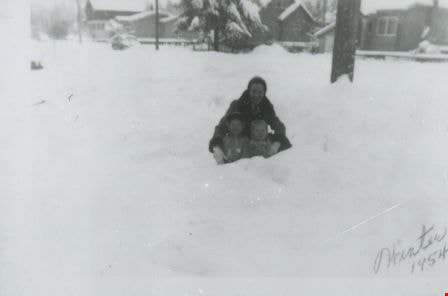
Bea Mengel, Sandy Matheson and Pat Loynes
https://search.heritageburnaby.ca/link/archivedescription37669
- Repository
- City of Burnaby Archives
- Date
- 1954 (date of original), copied 1991
- Collection/Fonds
- Burnaby Historical Society fonds
- Description Level
- Item
- Physical Description
- 1 photograph : b&w ; 3.1 x 4.6 cm print on contact sheet 20.2 x 25.3 cm
- Scope and Content
- Photograph of a woman and two children in the snow on the 6100 block of Kathleen Avenue. Clockwise from top: Bea Mengel, Sandy Matheson, and Pat Loynes.
- Repository
- City of Burnaby Archives
- Date
- 1954 (date of original), copied 1991
- Collection/Fonds
- Burnaby Historical Society fonds
- Subseries
- Burnaby Image Bank subseries
- Physical Description
- 1 photograph : b&w ; 3.1 x 4.6 cm print on contact sheet 20.2 x 25.3 cm
- Description Level
- Item
- Record No.
- 370-257
- Access Restriction
- No restrictions
- Reproduction Restriction
- No restrictions
- Accession Number
- BHS1999-03
- Scope and Content
- Photograph of a woman and two children in the snow on the 6100 block of Kathleen Avenue. Clockwise from top: Bea Mengel, Sandy Matheson, and Pat Loynes.
- Subjects
- Natural Phenomena - Snow
- Media Type
- Photograph
- Notes
- Title based on contents of photograph
- 1 b&w copy negative accompanying
- Negative has a pink cast
- Geographic Access
- Kathleen Avenue
- Historic Neighbourhood
- Central Park (Historic Neighbourhood)
- Planning Study Area
- Maywood Area
Images
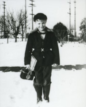
David Ellis
https://search.heritageburnaby.ca/link/archivedescription37718
- Repository
- City of Burnaby Archives
- Date
- 1952 (date of original), copied 1991
- Collection/Fonds
- Burnaby Historical Society fonds
- Description Level
- Item
- Physical Description
- 1 photograph : b&w ; 4.3 x 3.4 cm print on contact sheet 20.6 x 26.1 cm
- Scope and Content
- Photograph of David Ellis, leaving for school, in front of 6926 Nelson Avenue, the home of James and Sarah Ellis, his grandparents.
- Repository
- City of Burnaby Archives
- Date
- 1952 (date of original), copied 1991
- Collection/Fonds
- Burnaby Historical Society fonds
- Subseries
- Burnaby Image Bank subseries
- Physical Description
- 1 photograph : b&w ; 4.3 x 3.4 cm print on contact sheet 20.6 x 26.1 cm
- Description Level
- Item
- Record No.
- 370-306
- Access Restriction
- No restrictions
- Reproduction Restriction
- No restrictions
- Accession Number
- BHS1999-03
- Scope and Content
- Photograph of David Ellis, leaving for school, in front of 6926 Nelson Avenue, the home of James and Sarah Ellis, his grandparents.
- Subjects
- Natural Phenomena - Snow
- Names
- Ellis, David
- Media Type
- Photograph
- Notes
- Title based on contents of photograph
- 1 b&w copy negative accompanying
- Negative has a pink cast
- Geographic Access
- Nelson Avenue
- Street Address
- 6926 Nelson Avenue
- Historic Neighbourhood
- Central Park (Historic Neighbourhood)
- Planning Study Area
- Sussex-Nelson Area
Images

![Looking northwest from Roberts' property, [1951] thumbnail](/media/hpo/_Data/_Archives_Images/_Unrestricted/600/620-025.jpg?width=280)
Looking northwest from Roberts' property
https://search.heritageburnaby.ca/link/archivedescription91844
- Repository
- City of Burnaby Archives
- Date
- [1951]
- Collection/Fonds
- Small family fonds
- Description Level
- Item
- Physical Description
- 1 photograph : sepia ; 6.5 cm x 11.5 cm
- Scope and Content
- Photograph of the house and mushroom barns located at 3107 Dominion Street and the chicken house and garage at 3093 Douglas Road after a snowfall. The photograph was taken from the Roberts' property, looking northwest.
- Repository
- City of Burnaby Archives
- Date
- [1951]
- Collection/Fonds
- Small family fonds
- Physical Description
- 1 photograph : sepia ; 6.5 cm x 11.5 cm
- Description Level
- Item
- Record No.
- 620-025
- Access Restriction
- No restrictions
- Reproduction Restriction
- No reproduction permitted
- Accession Number
- 2017-01
- Scope and Content
- Photograph of the house and mushroom barns located at 3107 Dominion Street and the chicken house and garage at 3093 Douglas Road after a snowfall. The photograph was taken from the Roberts' property, looking northwest.
- Media Type
- Photograph
- Notes
- Transcribed title
- Title transcribed from donor's notes
- Note in blue ink on verso of photograph reads: "P.25"
- Note in blue ink on verso of photograph reads: "3107 (5493) Dominion St. / Prob 1951"
- Stamp in black ink of verso of photograph reads: "500"
- 3107 Dominion Street later renumbered 5493 Dominion Street and then subdivided into two lots: 5491 and 5495 Dominion Street.
- Street Address
- 3017 Douglas Road
- Historic Neighbourhood
- Burnaby Lake (Historic Neighbourhood)
- Planning Study Area
- Ardingley-Sprott Area
Images
![Looking northwest from Roberts' property, [1951] thumbnail](/media/hpo/_Data/_Archives_Images/_Unrestricted/600/620-025.jpg)

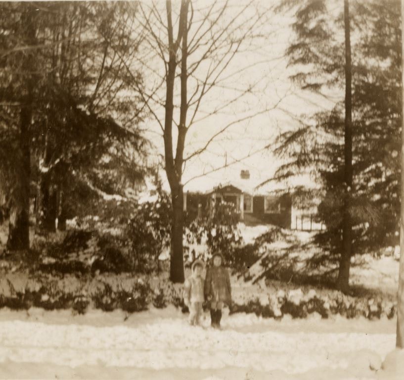
Looking west from Douglas Road
https://search.heritageburnaby.ca/link/archivedescription91831
- Repository
- City of Burnaby Archives
- Date
- 1951
- Collection/Fonds
- Small family fonds
- Description Level
- Item
- Physical Description
- 1 photograph : b&w ; 12.5 cm x 9 cm
- Scope and Content
- Photograph of Kathryn and Elizabeth Small standing in front of the Roberts' house at 5118 Douglas Road. Snow covers the ground, trees, and house and the girls wear winter coats. The photograph was taken from Douglas Road, looking west.
- Repository
- City of Burnaby Archives
- Date
- 1951
- Collection/Fonds
- Small family fonds
- Physical Description
- 1 photograph : b&w ; 12.5 cm x 9 cm
- Description Level
- Item
- Record No.
- 620-012
- Access Restriction
- No restrictions
- Reproduction Restriction
- No reproduction permitted
- Accession Number
- 2017-01
- Scope and Content
- Photograph of Kathryn and Elizabeth Small standing in front of the Roberts' house at 5118 Douglas Road. Snow covers the ground, trees, and house and the girls wear winter coats. The photograph was taken from Douglas Road, looking west.
- Media Type
- Photograph
- Notes
- Transcribed title
- Title transcribed from donor's notes
- Note in black ink on verso of photograph reads: "Kathryn and Elizabeth / Jan [struck through] 1951"
- Note in blue ink on verso of photograph reads: "March?"
- Note in blue ink on verso of photograph reads: "P.12"
- Stamp in black ink on verso of photograph reads: "754"
- 5118 Douglas Road renumbered to 3131 Douglas Road in 1958 and to 5538 Dominion Street in 1970 or 1971
- Street Address
- 3131 Douglas Road
- 5118 Douglas Road
- 5538 Dominion Street
- Historic Neighbourhood
- Burnaby Lake (Historic Neighbourhood)
- Planning Study Area
- Ardingley-Sprott Area
Images
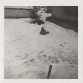
![Pat Loynes, Bob Matheson and Wendy Matheson, [1950] (date of original), copied 1991 thumbnail](/media/hpo/_Data/_Archives_Images/_Unrestricted/370/370-247.jpg?width=280)
Pat Loynes, Bob Matheson and Wendy Matheson
https://search.heritageburnaby.ca/link/archivedescription37659
- Repository
- City of Burnaby Archives
- Date
- [1950] (date of original), copied 1991
- Collection/Fonds
- Burnaby Historical Society fonds
- Description Level
- Item
- Physical Description
- 1 photograph : b&w ; 4.6 x 3.2 cm print on contact sheet 20.2 x 25.3 cm
- Scope and Content
- Photograph of three children seated in the snow on the 6100 block of Kathleen Avenue. Left to right: Pat Loynes, Bob Matheson, and Wendy Matheson. The photograph was taken looking west.
- Repository
- City of Burnaby Archives
- Date
- [1950] (date of original), copied 1991
- Collection/Fonds
- Burnaby Historical Society fonds
- Subseries
- Burnaby Image Bank subseries
- Physical Description
- 1 photograph : b&w ; 4.6 x 3.2 cm print on contact sheet 20.2 x 25.3 cm
- Description Level
- Item
- Record No.
- 370-247
- Access Restriction
- No restrictions
- Reproduction Restriction
- No restrictions
- Accession Number
- BHS1999-03
- Scope and Content
- Photograph of three children seated in the snow on the 6100 block of Kathleen Avenue. Left to right: Pat Loynes, Bob Matheson, and Wendy Matheson. The photograph was taken looking west.
- Subjects
- Natural Phenomena - Snow
- Media Type
- Photograph
- Notes
- Title based on contents of photograph
- 1 b&w copy negative accompanying
- Negative has a pink cast
- Geographic Access
- Kathleen Avenue
- Historic Neighbourhood
- Central Park (Historic Neighbourhood)
- Planning Study Area
- Maywood Area
Images
![Pat Loynes, Bob Matheson and Wendy Matheson, [1950] (date of original), copied 1991 thumbnail](/media/hpo/_Data/_Archives_Images/_Unrestricted/370/370-247.jpg)
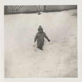
Sherrie Yanko in the snow
https://search.heritageburnaby.ca/link/archivedescription79725
- Repository
- City of Burnaby Archives
- Date
- December 1957
- Collection/Fonds
- Yanko family fonds
- Description Level
- Item
- Physical Description
- 1 photograph : b&w ; 7.5 x 7.5 cm
- Scope and Content
- Photograph of Charmaine "Sherry" Yanko (later Bayntun) playing in the snow at Christmastime.
- Repository
- City of Burnaby Archives
- Date
- December 1957
- Collection/Fonds
- Yanko family fonds
- Physical Description
- 1 photograph : b&w ; 7.5 x 7.5 cm
- Material Details
- Secured to album page with photo corners
- Description Level
- Item
- Record No.
- 545-235
- Access Restriction
- No restrictions
- Reproduction Restriction
- No restrictions
- Accession Number
- 2012-09
- Scope and Content
- Photograph of Charmaine "Sherry" Yanko (later Bayntun) playing in the snow at Christmastime.
- Subjects
- Natural Phenomena - Snow
- Media Type
- Photograph
- Notes
- Title based on contents of photograph
- Note written on album page reads: "Xmas 1957 Sherrie"
Images

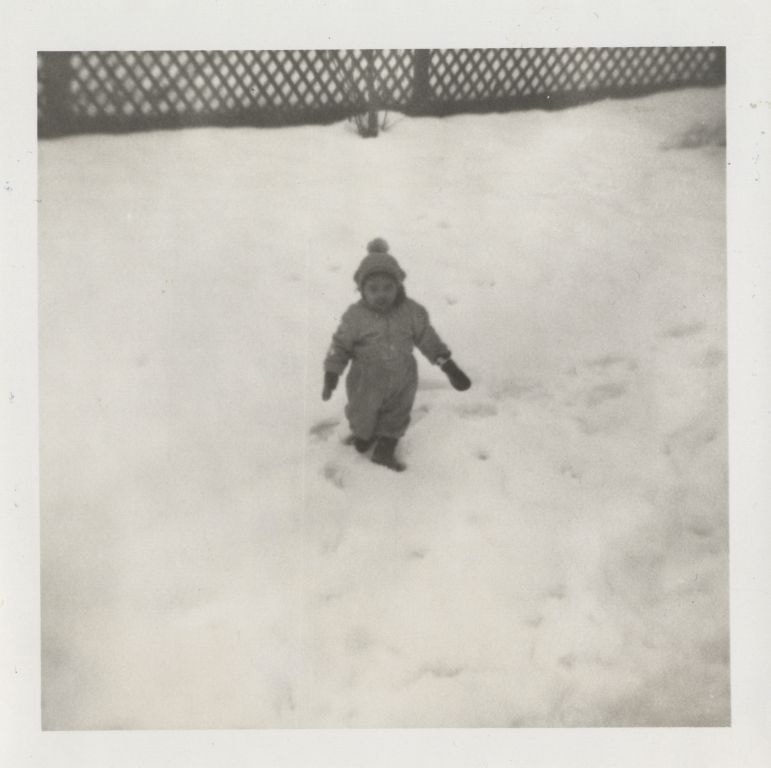
Sherrie Yanko in the snow
https://search.heritageburnaby.ca/link/archivedescription79727
- Repository
- City of Burnaby Archives
- Date
- December 1957
- Collection/Fonds
- Yanko family fonds
- Description Level
- Item
- Physical Description
- 1 photograph : b&w ; 7.5 x 7.5 cm
- Scope and Content
- Photograph of Charmaine "Sherry" Yanko (later Bayntun) playing in the snow at Christmastime.
- Repository
- City of Burnaby Archives
- Date
- December 1957
- Collection/Fonds
- Yanko family fonds
- Physical Description
- 1 photograph : b&w ; 7.5 x 7.5 cm
- Material Details
- Secured to album page with photo corners
- Description Level
- Item
- Record No.
- 545-238
- Access Restriction
- No restrictions
- Reproduction Restriction
- No restrictions
- Accession Number
- 2012-09
- Scope and Content
- Photograph of Charmaine "Sherry" Yanko (later Bayntun) playing in the snow at Christmastime.
- Subjects
- Natural Phenomena - Snow
- Media Type
- Photograph
- Notes
- Title based on contents of photograph
- Note written on album page reads: "Xmas 1957 Sherrie"
Images
![Underhill family home, [between 1945 and 1955] (date of original), copied 1991 thumbnail](/media/hpo/_Data/_Archives_Images/_Unrestricted/370/370-128.jpg?width=280)
Underhill family home
https://search.heritageburnaby.ca/link/archivedescription37540
- Repository
- City of Burnaby Archives
- Date
- [between 1945 and 1955] (date of original), copied 1991
- Collection/Fonds
- Burnaby Historical Society fonds
- Description Level
- Item
- Physical Description
- 1 photograph : b&w ; 2.6 x 2.7 cm print on contact sheet 20.2 x 25.3 cm
- Scope and Content
- Photograph of Dr. Underhill's home at 3789 Yale Street.
- Repository
- City of Burnaby Archives
- Date
- [between 1945 and 1955] (date of original), copied 1991
- Collection/Fonds
- Burnaby Historical Society fonds
- Subseries
- Burnaby Image Bank subseries
- Physical Description
- 1 photograph : b&w ; 2.6 x 2.7 cm print on contact sheet 20.2 x 25.3 cm
- Description Level
- Item
- Record No.
- 370-128
- Access Restriction
- No restrictions
- Reproduction Restriction
- No known restrictions
- Accession Number
- BHS1999-03
- Scope and Content
- Photograph of Dr. Underhill's home at 3789 Yale Street.
- Media Type
- Photograph
- Notes
- Title based on contents of photograph
- 1 b&w copy negative accompanying
- Geographic Access
- Yale Street
- Street Address
- 3789 Yale Street
- Historic Neighbourhood
- Vancouver Heights (Historic Neighbourhood)
- Planning Study Area
- Burnaby Heights Area
Images
![Underhill family home, [between 1945 and 1955] (date of original), copied 1991 thumbnail](/media/hpo/_Data/_Archives_Images/_Unrestricted/370/370-128.jpg)

Woodworking Plant
https://search.heritageburnaby.ca/link/archivedescription35247
- Repository
- City of Burnaby Archives
- Date
- 1954 (date of original), copied 1986
- Collection/Fonds
- Burnaby Historical Society fonds
- Description Level
- Item
- Physical Description
- 1 photograph : b&w ; 12.7 x 17.8 cm print
- Scope and Content
- Photograph of James Brookes Woodworking Plant, located at 7730 6th Street, taken from 6th Avenue after a heavy snowfall. The plant was built originally as Cliff's Can Factory, and also served as Western Canadian Can Factory.
- Repository
- City of Burnaby Archives
- Date
- 1954 (date of original), copied 1986
- Collection/Fonds
- Burnaby Historical Society fonds
- Subseries
- Pioneer Tales subseries
- Physical Description
- 1 photograph : b&w ; 12.7 x 17.8 cm print
- Description Level
- Item
- Record No.
- 204-104
- Access Restriction
- No restrictions
- Reproduction Restriction
- Reproduce for fair dealing purposes only
- Accession Number
- BHS1988-03
- Scope and Content
- Photograph of James Brookes Woodworking Plant, located at 7730 6th Street, taken from 6th Avenue after a heavy snowfall. The plant was built originally as Cliff's Can Factory, and also served as Western Canadian Can Factory.
- Media Type
- Photograph
- Notes
- Title based on contents of photograph
- Geographic Access
- 6th Street
- Street Address
- 7730 6th Street
- Historic Neighbourhood
- East Burnaby (Historic Neighbourhood)
- Planning Study Area
- Second Street Area
Images

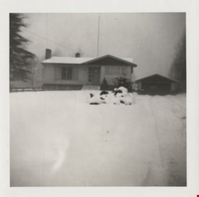
Yanko family house
https://search.heritageburnaby.ca/link/archivedescription79737
- Repository
- City of Burnaby Archives
- Date
- 1957
- Collection/Fonds
- Yanko family fonds
- Description Level
- Item
- Physical Description
- 1 photograph : b&w ; 7.5 x 7.5 cm
- Scope and Content
- Photograph of the Yanko family house at 7385 Broadway (later renumbered 7391) in Burnaby after a snowfall.
- Repository
- City of Burnaby Archives
- Date
- 1957
- Collection/Fonds
- Yanko family fonds
- Physical Description
- 1 photograph : b&w ; 7.5 x 7.5 cm
- Material Details
- Secured to album page with photo corners
- Description Level
- Item
- Record No.
- 545-239
- Access Restriction
- No restrictions
- Reproduction Restriction
- No restrictions
- Accession Number
- 2012-09
- Scope and Content
- Photograph of the Yanko family house at 7385 Broadway (later renumbered 7391) in Burnaby after a snowfall.
- Media Type
- Photograph
- Notes
- Title based on contents of photograph
- Note written on album page reads: "1957 Rhonda Sherrie / Burnaby House garage / Swing made by Uncle Fred"
- Street Address
- 7391 Broadway
- Planning Study Area
- Sperling-Broadway Area
Images

![North Burnaby, [1959] thumbnail](/media/hpo/_Data/_Archives_Images/_Unrestricted/001/106-001.jpg?width=280)
North Burnaby
https://search.heritageburnaby.ca/link/archivedescription34701
- Repository
- City of Burnaby Archives
- Date
- [1959]
- Collection/Fonds
- Burnaby Historical Society fonds
- Description Level
- Item
- Physical Description
- 1 photograph : b&w ; 16.6 x 20.5 cm
- Scope and Content
- Aerial photograph of North Burnaby and Burrard Inlet looking west.
- Repository
- City of Burnaby Archives
- Date
- [1959]
- Collection/Fonds
- Burnaby Historical Society fonds
- Subseries
- Photographs subseries
- Physical Description
- 1 photograph : b&w ; 16.6 x 20.5 cm
- Description Level
- Item
- Record No.
- 106-001
- Access Restriction
- No restrictions
- Reproduction Restriction
- Reproduce for fair dealing purposes only
- Accession Number
- BHS2007-04
- Scope and Content
- Aerial photograph of North Burnaby and Burrard Inlet looking west.
- Media Type
- Photograph
- Notes
- Title based on contents of photograph
- Historic Neighbourhood
- Vancouver Heights (Historic Neighbourhood)
- Capitol Hill (Historic Neighbourhood)
- Lochdale (Historic Neighbourhood)
- Planning Study Area
- Burnaby Heights Area
- Capitol Hill Area
- Westridge Area
- Willingdon Heights Area
- Brentwood Area
- Parkcrest-Aubrey Area
- Lochdale Area
Images
![North Burnaby, [1959] thumbnail](/media/hpo/_Data/_Archives_Images/_Unrestricted/001/106-001.jpg)
![Boundary Road and Kingsway, [1959] thumbnail](/media/Hpo/_Data/_Archives_Images/_Unrestricted/001/113-001.jpg?width=280)
Boundary Road and Kingsway
https://search.heritageburnaby.ca/link/archivedescription34709
- Repository
- City of Burnaby Archives
- Date
- [1959]
- Collection/Fonds
- Burnaby Historical Society fonds
- Description Level
- Item
- Physical Description
- 1 photograph : b&w ; 16.0 x 25.3 cm
- Scope and Content
- Photograph of buildings at Boundary Road and Kingsway, southwest corner. A typed description on the back of the photograph reads, "The new Hemlock (automatic) and old Dexter (manual) exchanges. / B.C. Telephone Company."
- Repository
- City of Burnaby Archives
- Date
- [1959]
- Collection/Fonds
- Burnaby Historical Society fonds
- Subseries
- Photographs subseries
- Physical Description
- 1 photograph : b&w ; 16.0 x 25.3 cm
- Description Level
- Item
- Record No.
- 113-001
- Access Restriction
- No restrictions
- Reproduction Restriction
- Reproduce for fair dealing purposes only
- Accession Number
- BHS2007-04
- Scope and Content
- Photograph of buildings at Boundary Road and Kingsway, southwest corner. A typed description on the back of the photograph reads, "The new Hemlock (automatic) and old Dexter (manual) exchanges. / B.C. Telephone Company."
- Media Type
- Photograph
- Photographer
- Williams Brothers Photographers Limited
- Notes
- Title based on contents of photograph
- Stamp on back of photograph reads, "Williams Bros. Photographers Ltd. / 413 Granville St. Vancouver 2, B.C. / Phone Tatlow 8588"
- Geographic Access
- Boundary Road
- Kingsway
- Historic Neighbourhood
- Central Park (Historic Neighbourhood)
- Planning Study Area
- Garden Village Area
Images
![Boundary Road and Kingsway, [1959] thumbnail](/media/Hpo/_Data/_Archives_Images/_Unrestricted/001/113-001.jpg)
![Freeway at the Willingdon Avenue exit, [1955] thumbnail](/media/hpo/_Data/_Archives_Images/_Unrestricted/480/480-283.jpg?width=280)
Freeway at the Willingdon Avenue exit
https://search.heritageburnaby.ca/link/archivedescription45388
- Repository
- City of Burnaby Archives
- Date
- [1955]
- Collection/Fonds
- Columbian Newspaper collection
- Description Level
- Item
- Physical Description
- 1 photograph : b&w ; 20 x 24.5 cm
- Scope and Content
- Photograph of the Freeway, now named the Trans Canada Highway, near the Willingdon Avenue exit.
- Repository
- City of Burnaby Archives
- Date
- [1955]
- Collection/Fonds
- Columbian Newspaper collection
- Physical Description
- 1 photograph : b&w ; 20 x 24.5 cm
- Description Level
- Item
- Record No.
- 480-283
- Access Restriction
- No restrictions
- Reproduction Restriction
- No restrictions
- Accession Number
- 2003-02
- Scope and Content
- Photograph of the Freeway, now named the Trans Canada Highway, near the Willingdon Avenue exit.
- Subjects
- Geographic Features - Roads
- Media Type
- Photograph
- Photographer
- British Columbia Government Photograph
- Notes
- Title based on contents of photograph
- Photographer identifies photograph as no. H - 1869
- Geographic Access
- Trans Canada Highway
- Willingdon Avenue
- Historic Neighbourhood
- Broadview (Historic Neighbourhood)
- Planning Study Area
- Cascade-Schou Area
Images
![Freeway at the Willingdon Avenue exit, [1955] thumbnail](/media/hpo/_Data/_Archives_Images/_Unrestricted/480/480-283.jpg)

New Freeway in Burnaby
https://search.heritageburnaby.ca/link/archivedescription45383
- Repository
- City of Burnaby Archives
- Date
- 1959
- Collection/Fonds
- Columbian Newspaper collection
- Description Level
- Item
- Physical Description
- 1 photograph : b&w ; 20.5 x 18.5 cm
- Scope and Content
- Photograph of the Lower mainland's "new freeway" in Burnaby. This was taken along the Trans Canada Highway with the Willingdon exit off to the south and the Grandview Highway off to the west.
- Repository
- City of Burnaby Archives
- Date
- 1959
- Collection/Fonds
- Columbian Newspaper collection
- Physical Description
- 1 photograph : b&w ; 20.5 x 18.5 cm
- Description Level
- Item
- Record No.
- 480-278
- Access Restriction
- No restrictions
- Reproduction Restriction
- No restrictions
- Accession Number
- 2003-02
- Scope and Content
- Photograph of the Lower mainland's "new freeway" in Burnaby. This was taken along the Trans Canada Highway with the Willingdon exit off to the south and the Grandview Highway off to the west.
- Subjects
- Geographic Features - Roads
- Media Type
- Photograph
- Photographer
- King, Basil
- Notes
- Title based on note on verso of photograph
- Note on verso of photograph reads: "Lower mainland's new freeway in Burnaby"
- Geographic Access
- Trans Canada Highway
- Historic Neighbourhood
- Broadview (Historic Neighbourhood)
- Planning Study Area
- Cascade-Schou Area
Images

![New Vista Society Housing Projects, [between 1949 and 1957] thumbnail](/media/hpo/_Data/_Archives_Images/_Unrestricted/513/514-013.jpg?width=280)
New Vista Society Housing Projects
https://search.heritageburnaby.ca/link/archivedescription64687
- Repository
- City of Burnaby Archives
- Date
- [between 1949 and 1957]
- Collection/Fonds
- Ernest Winch fonds
- Description Level
- Item
- Physical Description
- 1 photograph : b&w postcard ; 8 x 13 cm
- Scope and Content
- Photographic postcard of an unpaved road lined with New Vista Society Housing Projects.
- Repository
- City of Burnaby Archives
- Date
- [between 1949 and 1957]
- Collection/Fonds
- Ernest Winch fonds
- Physical Description
- 1 photograph : b&w postcard ; 8 x 13 cm
- Description Level
- Item
- Record No.
- 514-013
- Access Restriction
- No restrictions
- Reproduction Restriction
- Reproduce for fair dealing purposes only
- Accession Number
- 2010-06
- Scope and Content
- Photographic postcard of an unpaved road lined with New Vista Society Housing Projects.
- Names
- New Vista Society
- Media Type
- Photograph
- Notes
- Title based on contents of photograph
- Handwritten in border of photograph: "1-2-3"
Images
![New Vista Society Housing Projects, [between 1949 and 1957] thumbnail](/media/hpo/_Data/_Archives_Images/_Unrestricted/513/514-013.jpg)
![Valerie and Dorothy Shantz, [1956] (date of original), copied 1991 thumbnail](/media/hpo/_Data/_Archives_Images/_Unrestricted/370/370-178.jpg?width=280)
Valerie and Dorothy Shantz
https://search.heritageburnaby.ca/link/archivedescription37590
- Repository
- City of Burnaby Archives
- Date
- [1956] (date of original), copied 1991
- Collection/Fonds
- Burnaby Historical Society fonds
- Description Level
- Item
- Physical Description
- 1 photograph : b&w ; 4.6 x 3.1 cm print on contact sheet 20.2 x 25.3 cm
- Scope and Content
- Photograph of Dorothy Shantz holding her daughter, Valerie Shantz. The photograph was taken looking east along Albert Street at Madison Avenue. Capitol Hill is visible in the background.
- Repository
- City of Burnaby Archives
- Date
- [1956] (date of original), copied 1991
- Collection/Fonds
- Burnaby Historical Society fonds
- Subseries
- Burnaby Image Bank subseries
- Physical Description
- 1 photograph : b&w ; 4.6 x 3.1 cm print on contact sheet 20.2 x 25.3 cm
- Description Level
- Item
- Record No.
- 370-178
- Access Restriction
- No restrictions
- Reproduction Restriction
- No restrictions
- Accession Number
- BHS1999-03
- Scope and Content
- Photograph of Dorothy Shantz holding her daughter, Valerie Shantz. The photograph was taken looking east along Albert Street at Madison Avenue. Capitol Hill is visible in the background.
- Subjects
- Geographic Features - Roads
- Media Type
- Photograph
- Notes
- Title based on contents of photograph
- 2 b&w copy prints accompanying
- 1 b&w copy negative accompanying
- Negative has a pink cast
- Geographic Access
- Albert Street
- Madison Avenue
- Historic Neighbourhood
- Vancouver Heights (Historic Neighbourhood)
- Planning Study Area
- Burnaby Heights Area
Images
![Valerie and Dorothy Shantz, [1956] (date of original), copied 1991 thumbnail](/media/hpo/_Data/_Archives_Images/_Unrestricted/370/370-178.jpg)