Narrow Results By
Subject
- Advertising Medium - Signs and Signboards 1
- Armament - Firearms 1
- Buildings 3
- Buildings - Commercial 1
- Buildings - Commercial - Hotels and Motels 1
- Buildings - Commercial - Stores 3
- Buildings - Residential - Apartments 1
- Buildings - Residential - Houses 11
- Buildings - Schools 1
- Businesses - Real Estate Agencies 1
- Celebrations 1
- Ceremonies - Weddings 1

Wall Block
https://search.heritageburnaby.ca/link/landmark651
- Repository
- Burnaby Heritage Planning
- Description
- Commercial building.
- Associated Dates
- 1912
- Street View URL
- Google Maps Street View
- Repository
- Burnaby Heritage Planning
- Geographic Access
- Hastings Street
- Associated Dates
- 1912
- Description
- Commercial building.
- Heritage Value
- One of the prominent buildings along Vancouver Height’s early commercial strip, this block has continuously served its original commercial/retail use, with apartments on the second floor. Alterations over the years have included a coat of stucco over the original lapped wooden siding, and the alteration of the roofline cornice. Notably, the building has retained its distinctive second storey bay windows and three ground floor commercial spaces with recessed entrances. It was financed and built by Arthur Wall, a director of Hill, Wall & Company Ltd. Real Estate, which was based in the Pacific Block in Vancouver.
- Locality
- Vancouver Heights
- Historic Neighbourhood
- Vancouver Heights (Historic Neighbourhood)
- Planning Study Area
- Willingdon Heights Area
- Area
- 473.81
- Contributing Resource
- Building
- Ownership
- Private
- Street Address
- 3722 Hastings Street
- Street View URL
- Google Maps Street View
Images


Willingdon Heights Neighbourhood
https://search.heritageburnaby.ca/link/landmark777
- Repository
- Burnaby Heritage Planning
- Associated Dates
- 1955-2008
- Heritage Value
- The convenient location of Willingdon Heights to the Trans Canada Highway, Lougheed Highway and Hastings Street has fostered its development as a primarily residential commuter neighbourhood. Characterised in the post-World War Two period by predominantly single-family developments, the neighbourhood has retained this identity despite some higher density apartment buildings now found there.
- Planning Study Area
- Willingdon Heights Area
Images

![3700 Block Hastings, [196-] thumbnail](/media/hpo/_Data/_Archives_Images/_Unrestricted/316/366-001.jpg?width=280)
3700 Block Hastings
https://search.heritageburnaby.ca/link/archivedescription37372
- Repository
- City of Burnaby Archives
- Date
- [196-]
- Collection/Fonds
- Burnaby Historical Society fonds
- Description Level
- Item
- Physical Description
- 1 photograph : b&w negative
- Scope and Content
- Photograph shows a view looking west along the south side of the 3700 block of Hastings Street.
- Repository
- City of Burnaby Archives
- Date
- [196-]
- Collection/Fonds
- Burnaby Historical Society fonds
- Subseries
- Municipal record subseries
- Physical Description
- 1 photograph : b&w negative
- Description Level
- Item
- Record No.
- 366-001
- Access Restriction
- No restrictions
- Reproduction Restriction
- Reproduce for fair dealing purposes only
- Accession Number
- BHS1998-12
- Scope and Content
- Photograph shows a view looking west along the south side of the 3700 block of Hastings Street.
- Subjects
- Buildings
- Media Type
- Photograph
- Notes
- Title based on contents of photograph.
- Geographic Access
- Hastings Street
- Street Address
- 3700 Hastings Street
- Historic Neighbourhood
- Vancouver Heights (Historic Neighbourhood)
- Planning Study Area
- Willingdon Heights Area
Images
![3700 Block Hastings, [196-] thumbnail](/media/hpo/_Data/_Archives_Images/_Unrestricted/316/366-001.jpg)
![3700 Block Hastings Street, [196-] thumbnail](/media/hpo/_Data/_Archives_Images/_Unrestricted/316/366-002.jpg?width=280)
3700 Block Hastings Street
https://search.heritageburnaby.ca/link/archivedescription37373
- Repository
- City of Burnaby Archives
- Date
- [196-]
- Collection/Fonds
- Burnaby Historical Society fonds
- Description Level
- Item
- Physical Description
- 1 photograph : b&w negative
- Scope and Content
- Photograph shows a view looking west along the south side of the 3700 block of Hastings Street.
- Repository
- City of Burnaby Archives
- Date
- [196-]
- Collection/Fonds
- Burnaby Historical Society fonds
- Subseries
- Municipal record subseries
- Physical Description
- 1 photograph : b&w negative
- Description Level
- Item
- Record No.
- 366-002
- Access Restriction
- No restrictions
- Reproduction Restriction
- Reproduce for fair dealing purposes only
- Accession Number
- BHS1998-12
- Scope and Content
- Photograph shows a view looking west along the south side of the 3700 block of Hastings Street.
- Subjects
- Buildings
- Media Type
- Photograph
- Notes
- Title based on contents of photograph.
- Geographic Access
- Hastings Street
- Street Address
- 3700 Hastings Street
- Historic Neighbourhood
- Vancouver Heights (Historic Neighbourhood)
- Planning Study Area
- Willingdon Heights Area
Images
![3700 Block Hastings Street, [196-] thumbnail](/media/hpo/_Data/_Archives_Images/_Unrestricted/316/366-002.jpg)
![3722 Hastings Street, [196-] thumbnail](/media/hpo/_Data/_Archives_Images/_Unrestricted/316/366-003.jpg?width=280)
3722 Hastings Street
https://search.heritageburnaby.ca/link/archivedescription37374
- Repository
- City of Burnaby Archives
- Date
- [196-]
- Collection/Fonds
- Burnaby Historical Society fonds
- Description Level
- Item
- Physical Description
- 1 photograph : b&w negative
- Scope and Content
- Photograph shows a view of 3722 Hastings Street as seen from the front lane.
- Repository
- City of Burnaby Archives
- Date
- [196-]
- Collection/Fonds
- Burnaby Historical Society fonds
- Subseries
- Municipal record subseries
- Physical Description
- 1 photograph : b&w negative
- Description Level
- Item
- Record No.
- 366-003
- Access Restriction
- No restrictions
- Reproduction Restriction
- Reproduce for fair dealing purposes only
- Accession Number
- BHS1998-12
- Scope and Content
- Photograph shows a view of 3722 Hastings Street as seen from the front lane.
- Subjects
- Buildings
- Media Type
- Photograph
- Notes
- Title based on contents of photograph
- Street Address
- 3722 Hastings Street
- Historic Neighbourhood
- Vancouver Heights (Historic Neighbourhood)
- Planning Study Area
- Willingdon Heights Area
Images
![3722 Hastings Street, [196-] thumbnail](/media/hpo/_Data/_Archives_Images/_Unrestricted/316/366-003.jpg)
![3900 Block Union Street, [between 1912 and 1915] (date of original), copied 1991 thumbnail](/media/hpo/_Data/_Archives_Images/_Unrestricted/370/370-772.jpg?width=280)
3900 Block Union Street
https://search.heritageburnaby.ca/link/archivedescription38185
- Repository
- City of Burnaby Archives
- Date
- [between 1912 and 1915] (date of original), copied 1991
- Collection/Fonds
- Burnaby Historical Society fonds
- Description Level
- Item
- Physical Description
- 1 photograph : b&w ; 4.4 x 3.4 cm print on contact sheet 20.6 x 26.5 cm
- Scope and Content
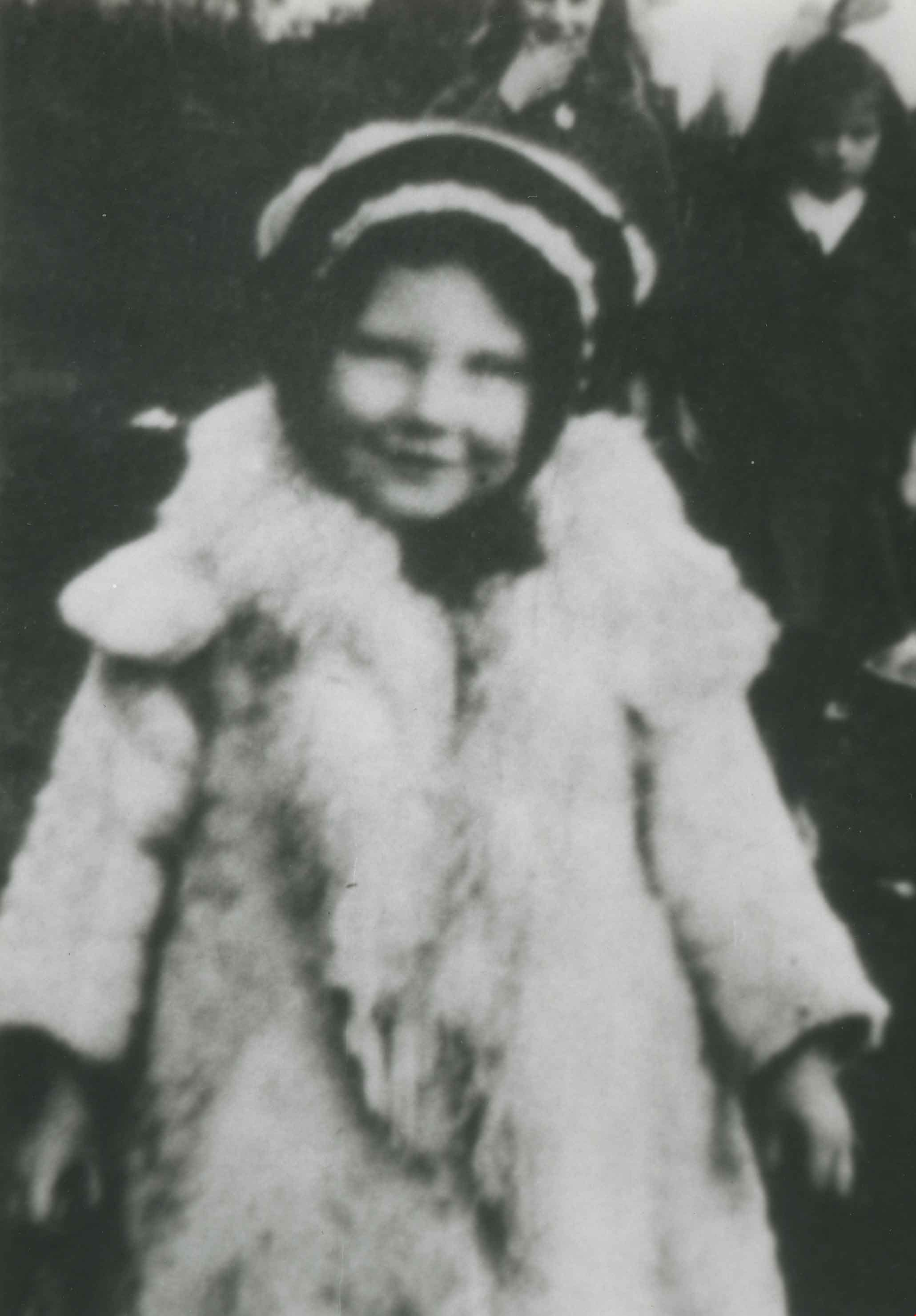
- Photograph of the Spraggon family home and another house on the 3900 block of Union Street (formerly named Barnard Street). There is a child at play in the snow in the foreground.
- Repository
- City of Burnaby Archives
- Date
- [between 1912 and 1915] (date of original), copied 1991
- Collection/Fonds
- Burnaby Historical Society fonds
- Subseries
- Burnaby Image Bank subseries
- Physical Description
- 1 photograph : b&w ; 4.4 x 3.4 cm print on contact sheet 20.6 x 26.5 cm
- Description Level
- Item
- Record No.
- 370-772
- Access Restriction
- No restrictions
- Reproduction Restriction
- No known restrictions
- Accession Number
- BHS1999-03
- Scope and Content
- Photograph of the Spraggon family home and another house on the 3900 block of Union Street (formerly named Barnard Street). There is a child at play in the snow in the foreground.
- Media Type
- Photograph
- Notes
- Title based on contents of photograph
- 1 b&w copy negative accompanying
- Negative has a pink cast
- Geographic Access
- Union Street
- Historic Neighbourhood
- Vancouver Heights (Historic Neighbourhood)
- Planning Study Area
- Willingdon Heights Area
Images
![3900 Block Union Street, [between 1912 and 1915] (date of original), copied 1991 thumbnail](/media/hpo/_Data/_Archives_Images/_Unrestricted/370/370-772.jpg)

Bessie Clark
https://search.heritageburnaby.ca/link/archivedescription36826
- Repository
- City of Burnaby Archives
- Date
- 1916 (date of original), copied 1992
- Collection/Fonds
- Burnaby Historical Society fonds
- Description Level
- Item
- Physical Description
- 1 photograph : b&w ; 8.5 x 12.6 cm print
- Scope and Content
- Photograph of Bessie Clark at 4055 Union Street, her family home.
- Repository
- City of Burnaby Archives
- Date
- 1916 (date of original), copied 1992
- Collection/Fonds
- Burnaby Historical Society fonds
- Subseries
- Burnaby Centennial Anthology subseries
- Physical Description
- 1 photograph : b&w ; 8.5 x 12.6 cm print
- Description Level
- Item
- Record No.
- 315-284
- Access Restriction
- No restrictions
- Reproduction Restriction
- No known restrictions
- Accession Number
- BHS1994-04
- Scope and Content
- Photograph of Bessie Clark at 4055 Union Street, her family home.
- Media Type
- Photograph
- Notes
- Title based on contents of photograph
- Geographic Access
- Union Street
- Street Address
- 4055 Union Street
- Historic Neighbourhood
- Vancouver Heights (Historic Neighbourhood)
- Planning Study Area
- Willingdon Heights Area
Images

Boundary Road and Hastings Street vicinity
https://search.heritageburnaby.ca/link/archivedescription35447
- Repository
- City of Burnaby Archives
- Date
- 1915 (date of original), copied 1986
- Collection/Fonds
- Burnaby Historical Society fonds
- Description Level
- Item
- Physical Description
- 1 photograph : b&w ; 12.7 x 17.8 cm print
- Scope and Content
- Photograph taken in Vancouver on Hastings Street looking east toward Burnaby and Boundary Road. The Hastings Street British Columbia Electric Railway (BCER) cars can be seen labouring up the hill.
- Repository
- City of Burnaby Archives
- Date
- 1915 (date of original), copied 1986
- Collection/Fonds
- Burnaby Historical Society fonds
- Subseries
- Pioneer Tales subseries
- Physical Description
- 1 photograph : b&w ; 12.7 x 17.8 cm print
- Description Level
- Item
- Record No.
- 204-305
- Access Restriction
- No restrictions
- Reproduction Restriction
- No restrictions
- Accession Number
- BHS1988-03
- Scope and Content
- Photograph taken in Vancouver on Hastings Street looking east toward Burnaby and Boundary Road. The Hastings Street British Columbia Electric Railway (BCER) cars can be seen labouring up the hill.
- Media Type
- Photograph
- Photographer
- Eaton, Dr. Carl
- Notes
- Title based on contents of photograph
- Geographic Access
- Boundary Road
- Hastings Street
- Historic Neighbourhood
- Vancouver Heights (Historic Neighbourhood)
- Planning Study Area
- Willingdon Heights Area
Images

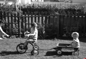
Boys on tricycles
https://search.heritageburnaby.ca/link/archivedescription51382
- Repository
- City of Burnaby Archives
- Date
- 1962
- Collection/Fonds
- Harold H. Johnston fonds
- Description Level
- Item
- Physical Description
- 1 photograph (jpeg) : b&w
- Scope and Content
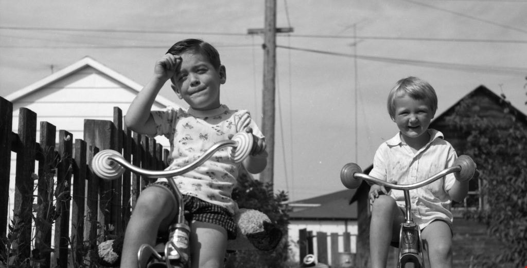
- Photograph of Sean Johnston (left) and an unidentified friend riding tricycles, most likely near the Johnston family home on Venables Street.
- Repository
- City of Burnaby Archives
- Date
- 1962
- Collection/Fonds
- Harold H. Johnston fonds
- Physical Description
- 1 photograph (jpeg) : b&w
- Description Level
- Item
- Record No.
- 483-017
- Access Restriction
- No restrictions
- Reproduction Restriction
- No reproduction permitted
- Accession Number
- 2008-08
- Scope and Content
- Photograph of Sean Johnston (left) and an unidentified friend riding tricycles, most likely near the Johnston family home on Venables Street.
- Subjects
- Transportation - Bicycles
- Names
- Johnston, Dr. Sean
- Media Type
- Photograph
- Photographer
- Johnston, Harold H.
- Notes
- Title based on contents of photograph
- Geographic Access
- Venables Street
- Street Address
- 4447 Venables Street
- Historic Neighbourhood
- Vancouver Heights (Historic Neighbourhood)
- Planning Study Area
- Willingdon Heights Area
Images
![Child on Douglas Road sidewalk, [1915 or 1916] (date of original), copied 1991 thumbnail](/media/hpo/_Data/_Archives_Images/_Unrestricted/370/370-771.jpg?width=280)
Child on Douglas Road sidewalk
https://search.heritageburnaby.ca/link/archivedescription38184
- Repository
- City of Burnaby Archives
- Date
- [1915 or 1916] (date of original), copied 1991
- Collection/Fonds
- Burnaby Historical Society fonds
- Description Level
- Item
- Physical Description
- 1 photograph : b&w ; 4.5 x 3.4 cm print on contact sheet 20.6 x 26.5 cm
- Scope and Content
- Photograph of a child in a baby carriage on a board sidewalk on Douglas Road.
- Repository
- City of Burnaby Archives
- Date
- [1915 or 1916] (date of original), copied 1991
- Collection/Fonds
- Burnaby Historical Society fonds
- Subseries
- Burnaby Image Bank subseries
- Physical Description
- 1 photograph : b&w ; 4.5 x 3.4 cm print on contact sheet 20.6 x 26.5 cm
- Description Level
- Item
- Record No.
- 370-771
- Access Restriction
- No restrictions
- Reproduction Restriction
- No known restrictions
- Accession Number
- BHS1999-03
- Scope and Content
- Photograph of a child in a baby carriage on a board sidewalk on Douglas Road.
- Media Type
- Photograph
- Notes
- Title based on contents of photograph
- 1 b&w copy negative accompanying
- Negative has a pink cast
- Geographic Access
- Douglas Road
- Historic Neighbourhood
- Vancouver Heights (Historic Neighbourhood)
- Planning Study Area
- Willingdon Heights Area
Images
![Child on Douglas Road sidewalk, [1915 or 1916] (date of original), copied 1991 thumbnail](/media/hpo/_Data/_Archives_Images/_Unrestricted/370/370-771.jpg)
Clark family
https://search.heritageburnaby.ca/link/archivedescription36817
- Repository
- City of Burnaby Archives
- Date
- 1914 (date of original), copied 1992
- Collection/Fonds
- Burnaby Historical Society fonds
- Description Level
- Item
- Physical Description
- 1 photograph : b&w ; 8.8 x 12.7 cm print
- Scope and Content
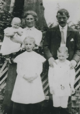
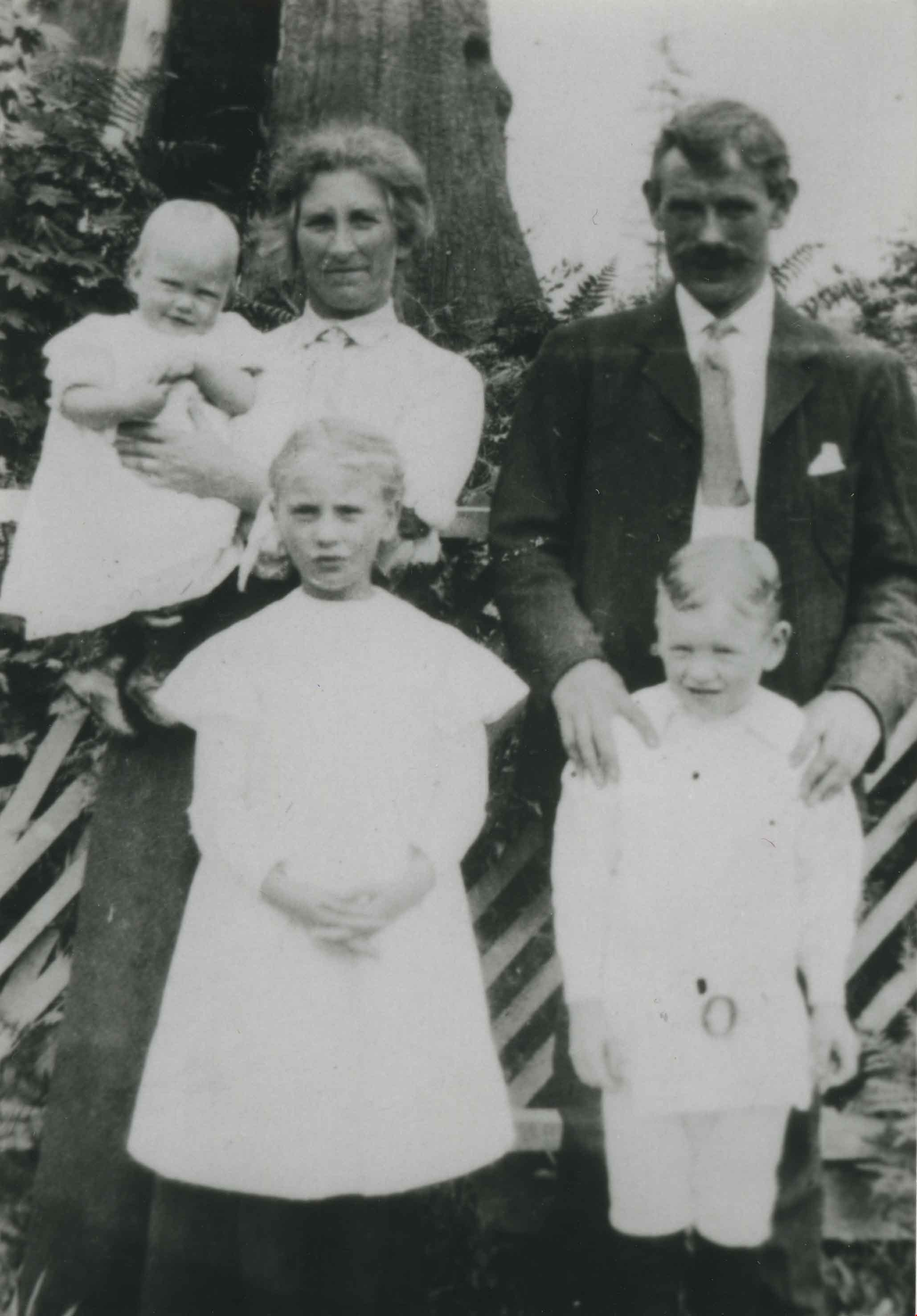
- Photograph of the Clark family at their property at 4055 Union Street. Back, left to right: Baby Bessie, Annie and Robert. Front, left to right: Mary and Robert.
- Repository
- City of Burnaby Archives
- Date
- 1914 (date of original), copied 1992
- Collection/Fonds
- Burnaby Historical Society fonds
- Subseries
- Burnaby Centennial Anthology subseries
- Physical Description
- 1 photograph : b&w ; 8.8 x 12.7 cm print
- Description Level
- Item
- Record No.
- 315-275
- Access Restriction
- No restrictions
- Reproduction Restriction
- No known restrictions
- Accession Number
- BHS1994-04
- Scope and Content
- Photograph of the Clark family at their property at 4055 Union Street. Back, left to right: Baby Bessie, Annie and Robert. Front, left to right: Mary and Robert.
- Names
- Clark, Annie Jamieson
- Clark, Mary
- Clark, Robert Jr.
- Clark, Robert Sr.
- Homewood, Bessie Annie Clark
- Media Type
- Photograph
- Notes
- Title based on contents of photograph
- Geographic Access
- Union Street
- Street Address
- 4055 Union Street
- Historic Neighbourhood
- Vancouver Heights (Historic Neighbourhood)
- Planning Study Area
- Willingdon Heights Area
Images

Clark family and Mrs. King
https://search.heritageburnaby.ca/link/archivedescription36818
- Repository
- City of Burnaby Archives
- Date
- 1912 (date of original), copied 1992
- Collection/Fonds
- Burnaby Historical Society fonds
- Description Level
- Item
- Physical Description
- 1 photograph : b&w ; 8.5 x 12.6 cm print
- Scope and Content
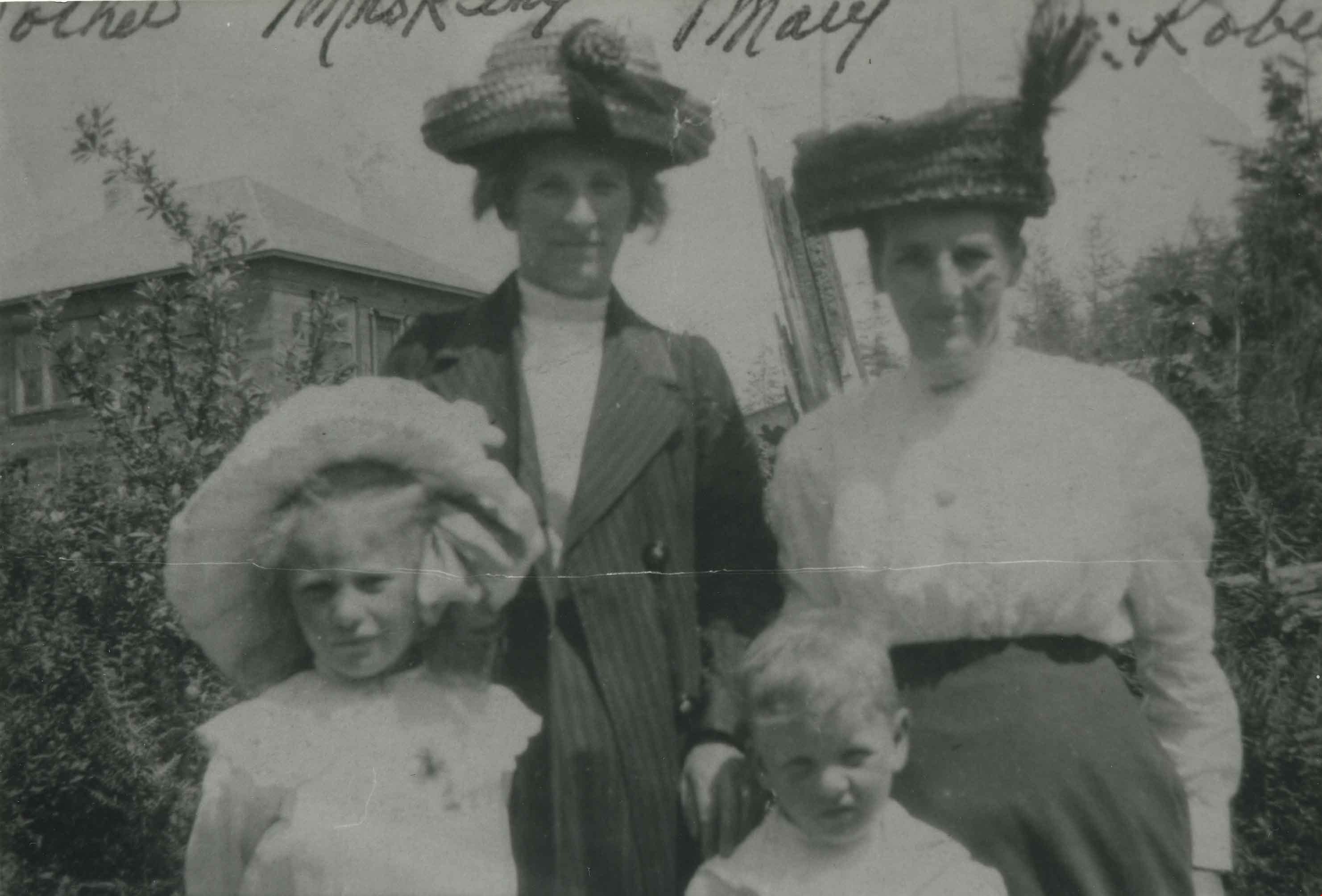
- Photograph of Clark family members and Mrs. King at 3800 Venables Street. Back, left to right: Mrs. Annie Clark and Mrs. King. Front, left to right: Mary and Robert Clark.
- Repository
- City of Burnaby Archives
- Date
- 1912 (date of original), copied 1992
- Collection/Fonds
- Burnaby Historical Society fonds
- Subseries
- Burnaby Centennial Anthology subseries
- Physical Description
- 1 photograph : b&w ; 8.5 x 12.6 cm print
- Description Level
- Item
- Record No.
- 315-276
- Access Restriction
- No restrictions
- Reproduction Restriction
- No known restrictions
- Accession Number
- BHS1994-04
- Scope and Content
- Photograph of Clark family members and Mrs. King at 3800 Venables Street. Back, left to right: Mrs. Annie Clark and Mrs. King. Front, left to right: Mary and Robert Clark.
- Media Type
- Photograph
- Notes
- Title based on contents of photograph
- Geographic Access
- Venables Street
- Street Address
- 3800 Venables Street
- Historic Neighbourhood
- Vancouver Heights (Historic Neighbourhood)
- Planning Study Area
- Willingdon Heights Area
Images

Clark family home
https://search.heritageburnaby.ca/link/archivedescription36824
- Repository
- City of Burnaby Archives
- Date
- 1911 (date of original), copied 1992
- Collection/Fonds
- Burnaby Historical Society fonds
- Description Level
- Item
- Physical Description
- 1 photograph : b&w ; 8.8 x 12.7 cm print
- Scope and Content
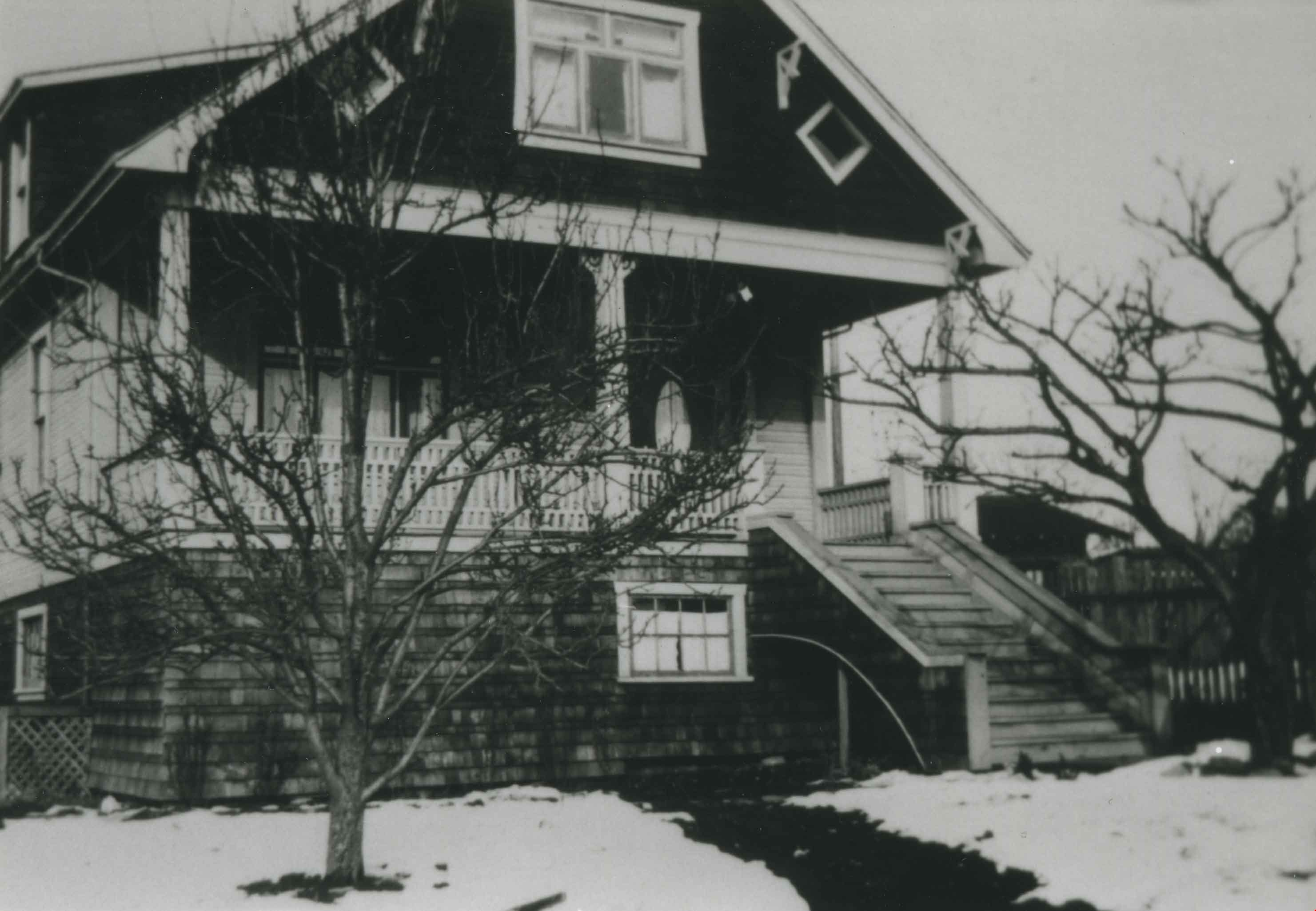
- Photograph of the exterior of the Clark family home at 4055 Union Street.
- Repository
- City of Burnaby Archives
- Date
- 1911 (date of original), copied 1992
- Collection/Fonds
- Burnaby Historical Society fonds
- Subseries
- Burnaby Centennial Anthology subseries
- Physical Description
- 1 photograph : b&w ; 8.8 x 12.7 cm print
- Description Level
- Item
- Record No.
- 315-282
- Access Restriction
- No restrictions
- Reproduction Restriction
- No known restrictions
- Accession Number
- BHS1994-04
- Scope and Content
- Photograph of the exterior of the Clark family home at 4055 Union Street.
- Subjects
- Buildings - Residential - Houses
- Media Type
- Photograph
- Notes
- Title based on contents of photograph
- Geographic Access
- Union Street
- Street Address
- 4055 Union Street
- Historic Neighbourhood
- Vancouver Heights (Historic Neighbourhood)
- Planning Study Area
- Willingdon Heights Area
Images
Clydesdales' Party
https://search.heritageburnaby.ca/link/archivedescription51440
- Repository
- City of Burnaby Archives
- Date
- 1967
- Collection/Fonds
- Harold H. Johnston fonds
- Description Level
- Item
- Physical Description
- 1 photograph (jpeg) : b&w
- Scope and Content
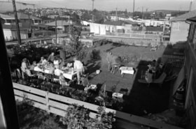
- Photograph of approximately fifteen people in the backyard of a Venables Street home, having a barbeque. Eleven people are seated or standing at a picnic table to the left, three are seated or standing near lawn furniture to the right, and one is at the barbeque grill. The photograph was probably …
- Repository
- City of Burnaby Archives
- Date
- 1967
- Collection/Fonds
- Harold H. Johnston fonds
- Physical Description
- 1 photograph (jpeg) : b&w
- Description Level
- Item
- Record No.
- 483-061
- Access Restriction
- No restrictions
- Reproduction Restriction
- No reproduction permitted
- Accession Number
- 2008-08
- Scope and Content
- Photograph of approximately fifteen people in the backyard of a Venables Street home, having a barbeque. Eleven people are seated or standing at a picnic table to the left, three are seated or standing near lawn furniture to the right, and one is at the barbeque grill. The photograph was probably taken near the Johnston family at 4447 Venables Street.
- Subjects
- Events - Parties
- Media Type
- Photograph
- Photographer
- Johnston, Harold H.
- Geographic Access
- Venables Street
- Street Address
- 4447 Venables Street
- Historic Neighbourhood
- Vancouver Heights (Historic Neighbourhood)
- Planning Study Area
- Willingdon Heights Area
Images

![Esmond and Hastings Vicinity, [1915] (date of original), copied 1986 thumbnail](/media/hpo/_Data/_Archives_Images/_Unrestricted/204/204-306.jpg?width=280)
Esmond and Hastings Vicinity
https://search.heritageburnaby.ca/link/archivedescription35448
- Repository
- City of Burnaby Archives
- Date
- [1915] (date of original), copied 1986
- Collection/Fonds
- Burnaby Historical Society fonds
- Description Level
- Item
- Physical Description
- 1 photograph : b&w ; 12.7 x 17.8 cm print
- Scope and Content
- Photograph of the Arthur Wall Block (right), 3722 Hastings Street, at the corner of Hastings Street and Boundary Road, and the Matheson Block (left), 3730 Hastings Street. The British Columbia Electric Railway (BCER) Hastings car can be seen.
- Repository
- City of Burnaby Archives
- Date
- [1915] (date of original), copied 1986
- Collection/Fonds
- Burnaby Historical Society fonds
- Subseries
- Pioneer Tales subseries
- Physical Description
- 1 photograph : b&w ; 12.7 x 17.8 cm print
- Description Level
- Item
- Record No.
- 204-306
- Access Restriction
- No restrictions
- Reproduction Restriction
- No restrictions
- Accession Number
- BHS1988-03
- Scope and Content
- Photograph of the Arthur Wall Block (right), 3722 Hastings Street, at the corner of Hastings Street and Boundary Road, and the Matheson Block (left), 3730 Hastings Street. The British Columbia Electric Railway (BCER) Hastings car can be seen.
- Media Type
- Photograph
- Photographer
- Eaton, Dr. Carl
- Notes
- Title based on contents of photograph
- Geographic Access
- Hastings Street
- Street Address
- 3722 Hastings Street
- 3730 Hastings Street
- Historic Neighbourhood
- Vancouver Heights (Historic Neighbourhood)
- Planning Study Area
- Willingdon Heights Area
Images
![Esmond and Hastings Vicinity, [1915] (date of original), copied 1986 thumbnail](/media/hpo/_Data/_Archives_Images/_Unrestricted/204/204-306.jpg)

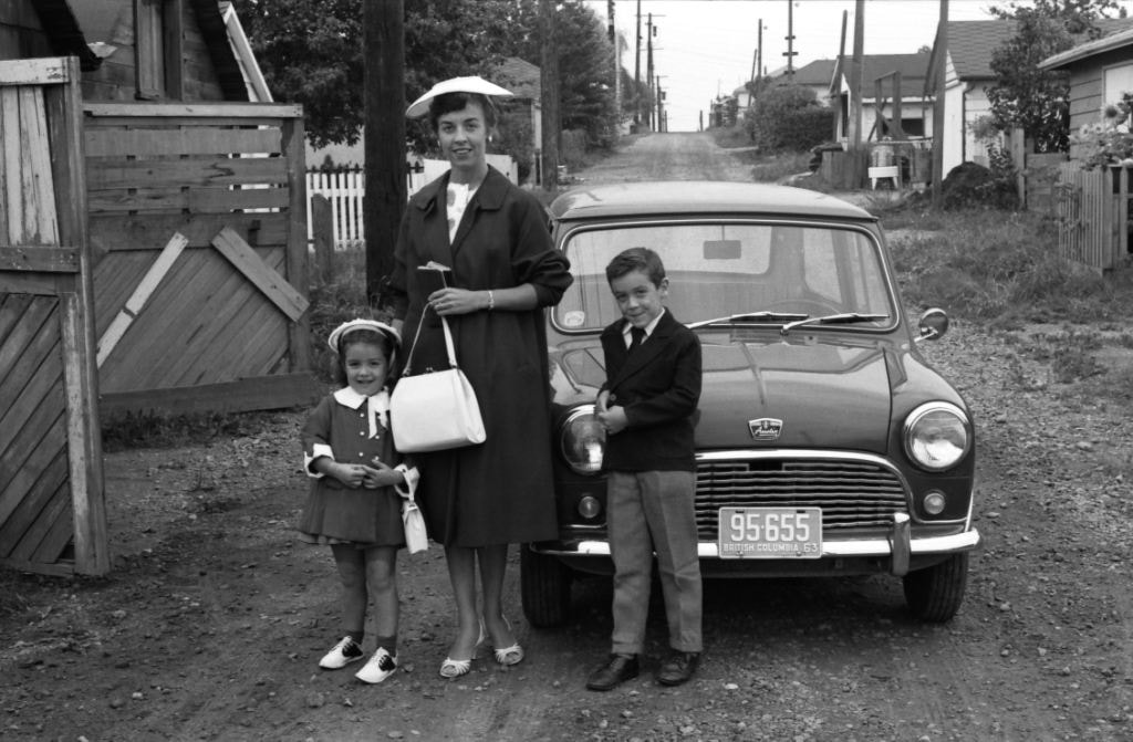
Frances Johnston with her two children, Wendy and Sean
https://search.heritageburnaby.ca/link/archivedescription51389
- Repository
- City of Burnaby Archives
- Date
- 1963
- Collection/Fonds
- Harold H. Johnston fonds
- Description Level
- Item
- Physical Description
- 1 photograph (jpeg) : b&w
- Scope and Content
- Photograph of Frances Johnston with her two children, Wendy and Sean, standing in front of a car in the back lane near the family home in the 4400 block of Venables Street.
- Repository
- City of Burnaby Archives
- Date
- 1963
- Collection/Fonds
- Harold H. Johnston fonds
- Physical Description
- 1 photograph (jpeg) : b&w
- Description Level
- Item
- Record No.
- 483-024
- Access Restriction
- No restrictions
- Reproduction Restriction
- No reproduction permitted
- Accession Number
- 2008-08
- Scope and Content
- Photograph of Frances Johnston with her two children, Wendy and Sean, standing in front of a car in the back lane near the family home in the 4400 block of Venables Street.
- Subjects
- Transportation - Automobiles
- Media Type
- Photograph
- Photographer
- Johnston, Harold H.
- Notes
- Title based on contents of photograph
- Geographic Access
- Venables Street
- Street Address
- 4447 Venables Street
- Historic Neighbourhood
- Vancouver Heights (Historic Neighbourhood)
- Planning Study Area
- Willingdon Heights Area
Images
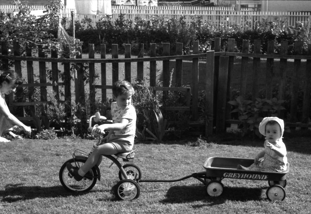
Frances, Sean and Wendy Johnston
https://search.heritageburnaby.ca/link/archivedescription51378
- Repository
- City of Burnaby Archives
- Date
- 1960
- Collection/Fonds
- Harold H. Johnston fonds
- Description Level
- Item
- Physical Description
- 1 photograph (jpeg) : b&w
- Scope and Content
- Photograph of Frances Johnston (at far left) with her two children, Sean and Wendy, outside of the family home on Venables Street. Sean Johnston is riding a tricycle and pulling his sister Wendy in a wagon. The word "Greyhound" is painted on the side of the wagon.
- Repository
- City of Burnaby Archives
- Date
- 1960
- Collection/Fonds
- Harold H. Johnston fonds
- Physical Description
- 1 photograph (jpeg) : b&w
- Description Level
- Item
- Record No.
- 483-013
- Access Restriction
- No restrictions
- Reproduction Restriction
- No reproduction permitted
- Accession Number
- 2008-08
- Scope and Content
- Photograph of Frances Johnston (at far left) with her two children, Sean and Wendy, outside of the family home on Venables Street. Sean Johnston is riding a tricycle and pulling his sister Wendy in a wagon. The word "Greyhound" is painted on the side of the wagon.
- Media Type
- Photograph
- Photographer
- Johnston, Harold H.
- Notes
- Title based on contents of photograph
- Geographic Access
- Venables Street
- Street Address
- 4447 Venables Street
- Historic Neighbourhood
- Vancouver Heights (Historic Neighbourhood)
- Planning Study Area
- Willingdon Heights Area
Images

Gilmour Avenue School site
https://search.heritageburnaby.ca/link/museumdescription11129
- Repository
- Burnaby Village Museum
- Date
- May 27, 1915
- Collection/Fonds
- Ronald G. Scobbie collection
- Description Level
- Item
- Physical Description
- 1 survey plan : blueprint on paper ; 56 x 54 cm
- Scope and Content
- Survey plan of Gilmore Avenue School site. Title on plan reads: "Gilmour Avenue School Site / Burnaby Municipality / Being Lots 1-10 inc. & Lots 27-36 inc. of Block 9 / of Subdivision of a Portion of Lot 187, GP.1 / New Westminster District". "Note. School site is as shown below, the original...am…
- Repository
- Burnaby Village Museum
- Collection/Fonds
- Ronald G. Scobbie collection
- Description Level
- Item
- Physical Description
- 1 survey plan : blueprint on paper ; 56 x 54 cm
- Material Details
- Scale: 40 feet = 1 inch
- Scope and Content
- Survey plan of Gilmore Avenue School site. Title on plan reads: "Gilmour Avenue School Site / Burnaby Municipality / Being Lots 1-10 inc. & Lots 27-36 inc. of Block 9 / of Subdivision of a Portion of Lot 187, GP.1 / New Westminster District". "Note. School site is as shown below, the original...amended" "by cancelling Lots 1-10 & 27-30 inc....order of court filed No.4938".
- History
- The school was named after Hugh B. Gilmour, but an error by a municipal clerk in the Street Naming Bylaw in 1912 (Bylaw Number 135) changed the spelling to "Gilmore" Avenue and the school name was spelled "Gilmore" Avenue School hereafter.
- Creator
- McGugan, Donald Johnston
- Subjects
- Buildings - Schools
- Names
- Gilmore Avenue School
- Responsibility
- Burnett & McGugan, Engineers and Surveyors
- Geographic Access
- Gilmore Avenue
- Accession Code
- BV003.83.8
- Access Restriction
- No restrictions
- Reproduction Restriction
- No known restrictions
- Date
- May 27, 1915
- Media Type
- Cartographic Material
- Historic Neighbourhood
- Vancouver Heights (Historic Neighbourhood)
- Planning Study Area
- Willingdon Heights Area
- Scan Resolution
- 440
- Scan Date
- 22-Dec-2020
- Scale
- 100
- Notes
- Transcribed title taken from plan
- Oath in bottom left corner reads: "I, D.J. McGugan...did superintend the survey", "...completed on the 27th day of May 1915" and noterized by Walter Edmonds" "sworn...29th Day of May 1915"; "Burnett and McGugan. B.C. Land Surveyors Etc. New Westminster. B.C."
- Note in black ink on verso of plan reads: "1782"
Zoomable Images

![Girl Guides on steps of Willingdon Heights United Church, [ca. 1960] thumbnail](/media/hpo/_Data/_BVM_Images/2016/2016_0049_0114_001.jpg?width=280)
Girl Guides on steps of Willingdon Heights United Church
https://search.heritageburnaby.ca/link/museumdescription5221
- Repository
- Burnaby Village Museum
- Date
- [ca. 1960]
- Collection/Fonds
- Burnaby Girl Guides fonds
- Description Level
- Item
- Physical Description
- 1 photograph : b&w ; 10.5 x 12.5 cm
- Scope and Content
- Photograph of a North Burnaby group of Girl Guides and leaders dressed in uniforms standing on the steps of Willingdon Heights United Church.
- Repository
- Burnaby Village Museum
- Collection/Fonds
- Burnaby Girl Guides fonds
- Description Level
- Item
- Physical Description
- 1 photograph : b&w ; 10.5 x 12.5 cm
- Scope and Content
- Photograph of a North Burnaby group of Girl Guides and leaders dressed in uniforms standing on the steps of Willingdon Heights United Church.
- Geographic Access
- Parker Street
- Street Address
- 4304 Parker Street
- Accession Code
- BV016.49.114
- Access Restriction
- No restrictions
- Reproduction Restriction
- May be restricted by third party rights
- Date
- [ca. 1960]
- Media Type
- Photograph
- Historic Neighbourhood
- Vancouver Heights (Historic Neighbourhood)
- Planning Study Area
- Willingdon Heights Area
- Notes
- Title based on content of photograph label
- Notes in pencil on verso of photograph read: "C79 5136 [sic] / cy 8 5170 [sic] / 1 / 96888 [sic] / cy_93046[sic]"
- Stamp on verso of photograph reads: "440"[sic]
- Label under photograph in scrapbook reads: "North Burnaby Division / Church Parade"
Images
![Girl Guides on steps of Willingdon Heights United Church, [ca. 1960] thumbnail](/media/hpo/_Data/_BVM_Images/2016/2016_0049_0114_001.jpg)
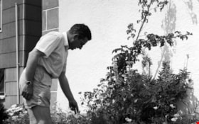
Harold in the garden
https://search.heritageburnaby.ca/link/archivedescription51406
- Repository
- City of Burnaby Archives
- Date
- 1965
- Collection/Fonds
- Harold H. Johnston fonds
- Description Level
- Item
- Physical Description
- 1 photograph (jpeg) : b&w
- Scope and Content
- Photograph of Harold Johnston standing alongside a row of plants, pruning in the garden of the Johnston family's Venables Street home.
- Repository
- City of Burnaby Archives
- Date
- 1965
- Collection/Fonds
- Harold H. Johnston fonds
- Physical Description
- 1 photograph (jpeg) : b&w
- Description Level
- Item
- Record No.
- 483-040
- Access Restriction
- No restrictions
- Reproduction Restriction
- No reproduction permitted
- Accession Number
- 2008-08
- Scope and Content
- Photograph of Harold Johnston standing alongside a row of plants, pruning in the garden of the Johnston family's Venables Street home.
- Subjects
- Geographic Features - Gardens
- Names
- Johnston, Harold H.
- Media Type
- Photograph
- Photographer
- Johnston, Harold H.
- Notes
- Title based on contents of photograph
- Geographic Access
- Venables Street
- Street Address
- 4447 Venables Street
- Historic Neighbourhood
- Vancouver Heights (Historic Neighbourhood)
- Planning Study Area
- Willingdon Heights Area
Images
