Narrow Results By
Creator
- Adams, Albert Egerton 1
- Adams, John Macgregor 1
- Alphonse J. Toebaert 1
- Alter, Ian 1
- Anderson, H. Graeme (Henry Graeme), 1882-1925 1
- Ashmore, Sidney G. (Sidney Gillespie), 1852-1911 1
- Ballentine, Teresa 1
- Bartel, Mario 12
- Bateman, Caroline Mary Wettenhall 1
- Battistoni, Peter 4
- Bird, Elizabeth "Bess" Cross Hart 1
- Blissett, Rebecca 1
Person / Organization
- Adams, John 1
- Air Raid Precautions (A.R.P.) 29
- Allen, Jane 1
- Allen Norman 1
- Ansdell, Elsie Brown-John 4
- Apps, Ed 8
- Army, Navy and Air Force Veterans in Canada, Pompier Unit #314 1
- Baker, Olivia Mary "Bunty" 1
- Banks, Charles Arthur 1
- Barnes, Hannah Victoria "Girlie" Love 1
- Bateman, Edwin W. 1
- Bateman, Marianne May 30
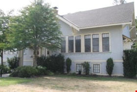
Jacob & Margaret Wysong House
https://search.heritageburnaby.ca/link/landmark507
- Repository
- Burnaby Heritage Planning
- Description
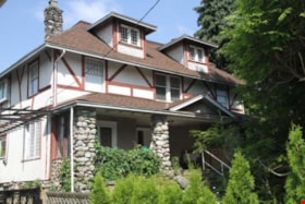
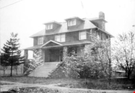
- The Jacob and Margaret Wysong House is a two and one-half storey, wood-frame Arts and Crafts house with a hipped roof and hipped dormers. Symmetrical in massing, it is distinguished by its masonry verandah columns, foundations and chimneys. It is located on a corner lot on Sperling Avenue at Stanle…
- Associated Dates
- 1912
- Formal Recognition
- Heritage Designation, Community Heritage Register
- Street View URL
- Google Maps Street View
- Repository
- Burnaby Heritage Planning
- Geographic Access
- Sperling Avenue
- Associated Dates
- 1912
- Formal Recognition
- Heritage Designation, Community Heritage Register
- Enactment Type
- By-law No. 11978
- Enactment Date
- 17/10/2005
- Description
- The Jacob and Margaret Wysong House is a two and one-half storey, wood-frame Arts and Crafts house with a hipped roof and hipped dormers. Symmetrical in massing, it is distinguished by its masonry verandah columns, foundations and chimneys. It is located on a corner lot on Sperling Avenue at Stanley Street in the Edmonds neighbourhood of South Burnaby.
- Heritage Value
- The Jacob and Margaret Wysong House is significant for illustrating the early development of the Edmonds neighbourhood, a speculative subdivision that was created and marketed during the pre-First World War real estate boom. The area’s proximity to New Westminster, coupled with extensive views and two newly developed streetcar lines, ensured that Edmonds attracted a wave of suburban development. The scale of this house is atypical of the usual suburban lots, and reflects the prominence of this location and its spectacular views. Set on a large lot, the Jacob and Margaret Wysong House is a grand estate home that is one of the earliest, and most prominent, in South Burnaby. This is also an exceptional example of Arts and Crafts architecture, displaying the use of native materials that was a hallmark of the style. The first owners were Jacob Wysong and his wife Margaret. Jacob Wysong, a local contractor, constructed the house in 1912. The stonework is exceptional, and the use of rough-cut granite and fieldstone, with overall shingle cladding, recalls the rustic vernacular common in Western park lodges, and evokes a country lifestyle in harmony with nature. The hipped roof was designed with a flat top that acted as a lookout tower that provided views of the surrounding landscape.
- Defining Elements
- Key elements that define the heritage character of the Jacob and Margaret Wysong House include its: - prominent corner location in the Edmonds neighbourhood of South Burnaby - residential form, scale and massing as expressed by its two and one-half storey plus raised basement height, symmetrical plan, hipped roof with flat top, hipped dormers, and hipped roof over the full open front verandah with a central front gable - masonry elements such as rough-cut granite and fieldstone foundations, verandah columns, stair cheeks, and external and internal chimneys - wooden-frame construction including original cedar shingling on dormers and facing verandah, shingling on remainder of house under later stucco cladding, and surviving original dimensional trim facing verandah and on dormers - Arts and Crafts features such as the use of natural materials, open soffits and angled roof overhang - windows including: double-hung 18-over-1 wooden sash windows; multi-paned casement windows; French doors to verandah; and front door with glazed sidelights - associated landscape features including surrounding mature trees, hedges and perimeter plantings
- Historic Neighbourhood
- Edmonds (Historic Neighbourhood)
- Planning Study Area
- Kingsway-Beresford Area
- Function
- Primary Historic--Single Dwelling
- Primary Current--Single Dwelling
- Community
- Edmonds
- Cadastral Identifier
- P.I.D. 000-497-801
- Boundaries
- The Jacob and Margaret Wysong House is comprised of a single residential lot located at 6325 Sperling Avenue, Burnaby.
- Area
- 1087.62
- Contributing Resource
- Building
- Ownership
- Private
- Documentation
- City of Burnaby Planning and Building Department, Heritage Site Files
- Street Address
- 6325 Sperling Avenue
- Street View URL
- Google Maps Street View
Images
Joseph Clarke House
https://search.heritageburnaby.ca/link/landmark505
- Repository
- Burnaby Heritage Planning
- Description
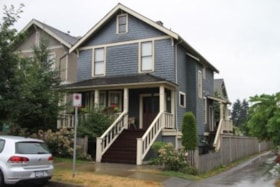
- The Joseph Clarke House is a two and one-half storey, wood-frame house, with shingle siding, a front-gabled roof and a full open front verandah. It is located on Jersey Avenue within the Central Park neighbourhood of Burnaby.
- Associated Dates
- 1909
- Formal Recognition
- Heritage Designation, Community Heritage Register
- Other Names
- Joseph & Ellen Clarke House, Clarke Residence
- Street View URL
- Google Maps Street View
- Repository
- Burnaby Heritage Planning
- Other Names
- Joseph & Ellen Clarke House, Clarke Residence
- Geographic Access
- Jersey Avenue
- Sandell Street
- Associated Dates
- 1909
- Formal Recognition
- Heritage Designation, Community Heritage Register
- Enactment Type
- By-law No. 11930
- Enactment Date
- 29/08/2005
- Description
- The Joseph Clarke House is a two and one-half storey, wood-frame house, with shingle siding, a front-gabled roof and a full open front verandah. It is located on Jersey Avenue within the Central Park neighbourhood of Burnaby.
- Heritage Value
- Built circa 1909 for Central Park farmer Joseph Clarke (1851-1936) and his wife, Ellen (1864-1938), this Edwardian-era farm house is valued for its vernacular design, which demonstrates the utilitarian nature of working-class housing during the boom years prior to the First World War. The Joseph Clarke House is additionally valued for its link with the development of the Central Park neighbourhood during the Edwardian era. The advent of the Central Park interurban rail line in 1892, operated by the B.C. Electric Company, connected the area to Vancouver and led to its suburban development. This is one of the oldest surviving houses in the Central Park neighbourhood. It was designated as a municipal heritage site in 2005 and rehabilitated as part of the adjacent multi-family townhouse and apartment redevelopment.
- Defining Elements
- Key elements that define the heritage character of the Joseph Clarke House include its: - location on Jersey Avenue in the Central Park neighbourhood - residential form, scale and massing as expressed by its two and one-half storey height with rectangular plan, front bay window and front-gabled roof - wood-frame construction - Edwardian era detailing such as the open front verandah, asymmetrical front entrance, glazed front door with sidelights and triangular eave brackets
- Historic Neighbourhood
- Central Park (Historic Neighbourhood)
- Planning Study Area
- Garden Village Area
- Function
- Primary Historic--Single Dwelling
- Primary Current--Single Dwelling
- Community
- Burnaby
- Cadastral Identifier
- P.I.D. 027-101-428
- Boundaries
- The Joseph Clarke House is comprised of a single residential lot located at 5575 Jersey Avenue, Burnaby.
- Area
- 2370
- Contributing Resource
- Building
- Ownership
- Private
- Documentation
- City of Burnaby Planning and Building Department, Heritage Site Files
- Names
- Clarke, Joseph
- Clarke, Ellen
- Street Address
- 5575 Jersey Avenue
- Street View URL
- Google Maps Street View
Images
Joseph & Jane Wintemute House
https://search.heritageburnaby.ca/link/landmark523
- Repository
- Burnaby Heritage Planning
- Description
- The Wintemute House is a large two-storey wood-frame Victorian era country farm house with Victorian Italianate detailing. Designed in a symmetrical Foursquare form, it features a low-pitched hipped roof with deep eaves. Later additions to the rear of the house, and the extensive wraparound veranda…
- Associated Dates
- 1891
- Formal Recognition
- Heritage Designation, Community Heritage Register
- Other Names
- Burnett House
- Street View URL
- Google Maps Street View
- Repository
- Burnaby Heritage Planning
- Other Names
- Burnett House
- Geographic Access
- Berkley Street
- Associated Dates
- 1891
- Formal Recognition
- Heritage Designation, Community Heritage Register
- Enactment Type
- Bylaw No. 6889
- Enactment Date
- 07/03/1977
- Description
- The Wintemute House is a large two-storey wood-frame Victorian era country farm house with Victorian Italianate detailing. Designed in a symmetrical Foursquare form, it features a low-pitched hipped roof with deep eaves. Later additions to the rear of the house, and the extensive wraparound verandah and porte-cochere, were Edwardian era additions. It is located on its original site, in the modern subdivision of Buckingham Heights in southeast Burnaby. The Burnett House is one of the oldest surviving houses in Burnaby.
- Heritage Value
- Built circa 1891, the Joseph and Jane Wintemute House is valued as a representation of the early history of Burnaby and its agricultural origins. Built prior to the civic incorporation of Burnaby in 1892, the house was situated to face Douglas Road (now Canada Way), one of the first roads built to connect the rural farmlands of Burnaby to New Westminster. The original large property has been extensively subdivided and the house is now isolated in a modern subdivision. Designated in 1977, the Wintemute House is also significant as Burnaby's first protected municipal heritage site. The house is valued for its association with Joseph S. Wintemute (1832-1911) and Jane Wintemute (1832-1910), who came to British Columbia from Port Stanley, Ontario in 1865, traveling via the Isthmus of Panama. Joseph Wintemute, a skilled carpenter and contractor by trade, operated the Wintemute Furniture Factory in New Westminster, the first furniture plant established on the mainland of British Columbia. In 1891, he acquired this property, where he set up a cord wood sawmill to supply his factory. Wintemute was likely responsible for the design and construction of this commodious structure, as it was built in an Eastern Canadian style he would have been familiar with. After the lands were cleared of timber, the Wintemutes developed the property into a typical small-scale 'market garden,’ involved in the production of vegetables and fruits, such as strawberries, for sale at the New Westminster City Market. The Wintemute House is additionally significant for its association with the speculative land boom that occurred prior to the First World War, and ongoing suburban subdivision. Charles Gordon, a real estate agent, acquired the Wintemute farm and subdivided the acreage, which he marketed through the People’s Trust Company as 'Montrelynview' and offered this house as a draw prize to lot purchasers. With the collapse of the land boom, the house remained in Gordon’s possession until 1929 when it was purchased by his brother-in-law, Geoffrey Burnett, a local surveyor responsible for many of the original land surveys of Burnaby. David Burnett, Geoffrey's son, requested designation of the house when the family decided to subdivide the remaining 1.4 hectares of property in 1977. Furthermore, the Wintemute House is valued as an excellent example of a Victorian era country farm house, based loosely on the traditional farmhouses seen commonly in nineteenth century Ontario. Designed in a vernacular version of the Victorian Italianate style, the house displays restrained detailing, including several original multi-paned windows notable for their vertical proportions. The house retains many original exterior features, and the original interior layout, although modernized during the Edwardian era, is substantially intact, including finely crafted maple and cedar interior millwork that was produced by the Wintemute Furniture Factory. From 1904 to 1910, Charles Gordon, the second owner, made a number of alterations to the house including the addition of the wrap-around verandah, a porte-cochere and a 7.6 metre by 9 metre billiard room in the Arts and Crafts style, beamed and panelled in Douglas Fir. These later additions and alterations have value in demonstrating the evolution of the house and property and changing tastes at the turn of the nineteenth century.
- Defining Elements
- Key elements that define the heritage character of the Wintemute House include its: - picturesque original setting with views to the North Shore - residential form, scale and massing as expressed by its symmetrical cubic form and two-storey height, with later additions to the rear - Victorian Italianate architectural features such as the vertically-proportioned original windows with vestigial window hoods, low-pitched hipped roof and Classical Revival details such as the corner boards articulated as pilasters - hipped roof with deep boxed eaves - horizontal lapped narrow wooden siding - second storey balcony over front entry - wide wraparound columned verandah with porte-cochere, with square trimmed columns - irregular fenestration: original Victorian era double-hung 6-over-6 wood-sash windows with vertical proportions and segmental arched tops; Edwardian era double-hung 1-over-1 wooden-sash windows; and Edwardian era wooden-sash casement window assemblies with leaded transoms - central front entry with sidelights and transom - multi-paned French doors opening out to verandah - interior features such as its 3.7 metre ceiling height on the main and second floors; the coal grate fireplace with elaborate woodwork and glazed tile surround in the front parlour; five other fireplaces throughout the house; maple and cedar interior millwork; and the Douglas Fir panelled and beamed billiard room with hidden doors, seven-panelled doors, original light fixtures and mouldings - internal red brick chimneys with corbelled caps
- Historic Neighbourhood
- Burnaby Lake (Historic Neighbourhood)
- Planning Study Area
- Morley-Buckingham Area
- Function
- Primary Historic--Single Dwelling
- Primary Current--Single Dwelling
- Community
- Burnaby
- Cadastral Identifier
- 003-297-152
- Boundaries
- The Wintemute House is comprised of a single residential lot located at 7640 Berkley Street, Burnaby.
- Area
- 1566.73
- Contributing Resource
- Building
- Ownership
- Private
- Names
- Wintemute, Joseph
- Street Address
- 7640 Berkley Street
- Street View URL
- Google Maps Street View
Images
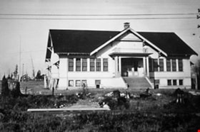
Kingsway East School
https://search.heritageburnaby.ca/link/landmark546
- Repository
- Burnaby Heritage Planning
- Description
- The Kingsway East School is a two-storey wood-frame Arts and Crafts styled building. The school, and the adjacent cenotaph and memorial tennis courts, comprise Burnaby South Memorial Park.
- Associated Dates
- 1913
- Formal Recognition
- Heritage Designation, Community Heritage Register
- Other Names
- Alan Emmott Centre
- Street View URL
- Google Maps Street View
- Repository
- Burnaby Heritage Planning
- Other Names
- Alan Emmott Centre
- Geographic Access
- Southoaks Crescent
- Associated Dates
- 1913
- Formal Recognition
- Heritage Designation, Community Heritage Register
- Enactment Type
- Bylaw No. 9807
- Enactment Date
- 23/11/1992
- Description
- The Kingsway East School is a two-storey wood-frame Arts and Crafts styled building. The school, and the adjacent cenotaph and memorial tennis courts, comprise Burnaby South Memorial Park.
- Heritage Value
- This school structure completed in 1913, the oldest surviving public education building in the city, was intended to be the auditorium and gymnasium for Burnaby’s first high school. However, because of the 1913 recession and the outbreak of the First World War, it was utilized as the Kingsway East Elementary School for the Edmonds District until 1921. Burnaby South High School opened here in 1922, and after it relocated this building was used for a variety of school purposes until it became redundant. The school was rehabilitated for community purposes in 2002-03 and renamed the Alan Emmott Centre to honor a former Mayor of Burnaby. The impressive scale of the Kingsway East School is indicative of the relative size of the community and its growing demand for schooling at the time of construction, illustrating the value that early community residents placed on education. Built to plans of the Burnaby School Board architect, Joseph Henry Bowman (1864-1943), it also indicates the individual values and design control exercised by the school board during this era. It is also significant for its Arts and Crafts style, allied to the typical Craftsman residential vocabulary, which was employed locally for school buildings of the Edwardian era. By using a common architectural vocabulary, this allowed the institution to reflect the values and aspirations of the local community. The Arts and Crafts style also demonstrated an allegiance to British educational antecedents and a demonstration of loyalty to the Mother Country.
- Historic Neighbourhood
- Edmonds (Historic Neighbourhood)
- Planning Study Area
- Kingsway-Beresford Area
- Function
- Primary Historic--Primary School
- Community
- Burnaby
- Cadastral Identifier
- P.I.D. No. 016-367-154 Legal Description: Lot 1, District Lot 96, Group 1 New Westminster District, Plan 86581
- Boundaries
- The Kingsway East School is comprised of a single municipally-owned property located at 6650 Southoaks Crescent, Burnaby.
- Area
- 6,070.00
- Contributing Resource
- Building
- Landscape Feature
- Structure
- Ownership
- Public (local)
- Documentation
- Heritage Site Files: PC77000 20. City of Burnaby Planning and Building Department, 4949 Canada Way, Burnaby, B.C., V5G 1M2
- Street Address
- 6650 Southoaks Crescent
- Street View URL
- Google Maps Street View
Images
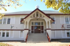
Kitchener Elementary School
https://search.heritageburnaby.ca/link/landmark614
- Repository
- Burnaby Heritage Planning
- Description
- School building.
- Associated Dates
- 1925
- Street View URL
- Google Maps Street View
- Repository
- Burnaby Heritage Planning
- Geographic Access
- Gilmore Avenue
- Associated Dates
- 1925
- Description
- School building.
- Heritage Value
- This landmark school was designed by the architectural firm of Bowman & Cullerne, specialists in the design of educational facilities. After Harold Cullerne (1890-1976) returned from service during the First World War, he joined J.H. Bowman (1864-1943) in a partnership that lasted from 1919 to 1934. The firm’s projects include the Seaforth School (1922, now relocated to Burnaby Village Museum), Burnaby North High School (1923), and the Nelson Avenue School (1927). This was originally designed as a two-storey, four-room building in 1925, with two-storey four-room wings added two years later. The building has been altered with the addition of stucco cladding over the original siding and replacement windows, but has retained its original form and massing, as well as its domed roof ventilator.
- Locality
- Vancouver Heights
- Historic Neighbourhood
- Vancouver Heights (Historic Neighbourhood)
- Planning Study Area
- Willingdon Heights Area
- Architect
- Bowman & Cullerne
- Area
- 20478.11
- Contributing Resource
- Building
- Street Address
- 1351 Gilmore Avenue
- Street View URL
- Google Maps Street View
Images
Lakeview-Mayfield Neighbourhood
https://search.heritageburnaby.ca/link/landmark830
- Repository
- Burnaby Heritage Planning
- Associated Dates
- 1955-2008
- Heritage Value
- Like many other areas of the City, the Lakeview-Mayfield Neighbourhood was subdivided during the 1950s post-war building boom. Pockets of newer homes were built in the 1970s, and the neighbourhood retained its character as a primarily residential area. The neighbourhood is bordered to the east by Robert Burnaby Park.
- Planning Study Area
- Lakeview-Mayfield Area
Images
Lochdale Neighbourhood
https://search.heritageburnaby.ca/link/landmark743
- Repository
- Burnaby Heritage Planning
- Associated Dates
- 1905-1924
- Heritage Value
- "Picturesquely situated on the south-westerly slope of the highest hill on the Burrard Peninsula is a district that in many ways resembles the early pioneer settlements…its centre is at the intersection of east Hastings Street and Sperling Avenue. Only a few years ago a dense forest covered this area and the settlers were few and some distance apart. After the war working men began to enter the Lochdale woods in quest of cheap home-sites. Today there are more than 400 residents in the district who combine to make a happy contented industrious community living on the edge of a big city yet enjoying the life offered by the country...The Community Hall is the centre of all social activities. Dances, concerts and other forms of entertainment are all there...Curtis Street runs from Sperling Avenue up to the hill, locally known as Hastings Grove. From the top on a clear day there is a view for miles around." ~ From the Sunday Province, March 8, 1925.
- Historic Neighbourhood
- Lochdale (Historic Neighbourhood)
- Planning Study Area
- Lochdale Area
Images
Lochdale Neighbourhood
https://search.heritageburnaby.ca/link/landmark790
- Repository
- Burnaby Heritage Planning
- Associated Dates
- 1955-2008
- Heritage Value
- Despite the rapid growth witnessed in Burnaby in the post-war years, the Lochdale Neighbourhood was characterised as a close-knit primarily residential community. Although a commercial zone developed along Sperling and Hastings, single-family, duplex and multi-family homes were the primary buildings in the area. Basement suites and student accommodation also flourished in this neighbourhood after the creation of Simon Fraser University on Burnaby Mountain.
- Historic Neighbourhood
- Lochdale (Historic Neighbourhood)
- Planning Study Area
- Lochdale Area
Images
Louis & Annie Hill Residence
https://search.heritageburnaby.ca/link/landmark504
- Repository
- Burnaby Heritage Planning
- Description
- The Louis and Annie Hill Residence is a modest one-storey, wood-frame, side-gabled Arts and Crafts bungalow with two projecting front gables, that was originally part of the Deer Lake Crescent Subdivision. The lot is heavily treed, and sits near the east end of Deer Lake.
- Associated Dates
- 1925
- Street View URL
- Google Maps Street View
- Repository
- Burnaby Heritage Planning
- Geographic Access
- Deer Lake Avenue
- Associated Dates
- 1925
- Description
- The Louis and Annie Hill Residence is a modest one-storey, wood-frame, side-gabled Arts and Crafts bungalow with two projecting front gables, that was originally part of the Deer Lake Crescent Subdivision. The lot is heavily treed, and sits near the east end of Deer Lake.
- Heritage Value
- The heritage value of the Louis and Annie Hill Residence lies in its association with prominent Burnaby pioneers, Louis Hill (1860-1931) and his wife, Annie Sara Hill (née Kenrick, 1864-1957). Originally from London, England, Louis Hill immigrated to Burnaby circa 1887, and established a small fruit farm on this site in 1891. Hill was elected to the first municipal council in 1892, when Burnaby was incorporated, and was later responsible for the subdivision of Buckingham Estate in the Deer Lake neighbourhood. The Louis and Annie Hill Residence, built as a retirement home in 1925, is further valued as a representation of the continued suburban development of the Deer Lake Crescent Subdivision, that was originally promoted in 1911 as an upper class suburban neighbourhood. Its modest nature illustrates the reduced scale of residential construction during the austere times that followed the end of the First World War. The style of the house demonstrates the late persistence of the Arts and Crafts movement, which remained a strong influence on domestic architecture. In 2006, the Louis and Annie Hill Residence was purchased by the City of Burnaby, and today it is part of the Deer Lake Park Heritage Precinct, Burnaby's most significant collection of historic sites.
- Defining Elements
- Key elements that define the heritage character of the Louis and Annie Hill Residence include its: - location within the Deer Lake Park Heritage Precinct - residential form, scale and massing as expressed by its one-storey height plus crawlspace, side-gabled-roof, front projecting gables, square projecting front bay and open front porch - wood-frame construction with original wood siding intact under a later coat of stucco - modest Arts and Crafts details such as diamond-point triangular eave brackets - windows, including double-hung, 1-over-1 wooden sash windows with horns - associated landscape features, including mature cedars lining the driveway
- Historic Neighbourhood
- Burnaby Lake (Historic Neighbourhood)
- Planning Study Area
- Morley-Buckingham Area
- Function
- Primary Historic--Single Dwelling
- Primary Current--Single Dwelling
- Community
- Deer Lake
- Cadastral Identifier
- P.I.D.012-446-963
- Boundaries
- The Louis and Annie Hill Residence is comprised of a single residential lot located at 6570 Deer Lake Avenue, Burnaby.
- Area
- 1521.75
- Contributing Resource
- Building
- Ownership
- Public (local)
- Documentation
- City of Burnaby Planning and Building Department, Heritage Site Files
- Street Address
- 6570 Deer Lake Avenue
- Street View URL
- Google Maps Street View
Images
Lozells Neighbourhood
https://search.heritageburnaby.ca/link/landmark701
- Repository
- Burnaby Heritage Planning
- Associated Dates
- 1925-1954
- Heritage Value
- Like a lot of residential neighbourhoods in Burnaby during the post-War boom, the Lozells area during the 1925-1954 period was one of new construction and subdivisions. Although more homes were being built, the neighbourhood still retained a somewhat rural characteristic well into the 1950s.
- Historic Neighbourhood
- Lozells (Historic Neighbourhood)
- Planning Study Area
- Government Road Area
Images
Marlborough Elementary School
https://search.heritageburnaby.ca/link/landmark695
- Repository
- Burnaby Heritage Planning
- Geographic Access
- Marlborough Avenue
- Associated Dates
- 1950
- Heritage Value
- Marlborough Elementary School was built in 1950 and was the second elementary school to be built in Burnaby after the start of the World War Two housing boom. Its design helped establish the general plans for future schools built in the city during this period - no basements, second stories or high stairways. Classrooms could easily be added, in line, as the need arose. There were additions made to Marlborough in 1952, 1961, 1967 and 1971.
- Historic Neighbourhood
- Central Park (Historic Neighbourhood)
- Planning Study Area
- Marlborough Area
- Street Address
- 6060 Marlborough Avenue
- Street View URL
- Google Maps Street View
Images
Montague & Marcia Moore Residence
https://search.heritageburnaby.ca/link/landmark499
- Repository
- Burnaby Heritage Planning
- Description
- The Montague and Marcia Moore Residence, situated on Sperling Avenue, is a one and one-half storey wood-frame house with Tudor Revival elements such as half-timbering and diamond-leaded windows. The landscaping includes a large hedge at the front of the property. It is located on a lakefront site w…
- Associated Dates
- 1943
- Street View URL
- Google Maps Street View
- Repository
- Burnaby Heritage Planning
- Geographic Access
- Sperling Avenue
- Associated Dates
- 1943
- Description
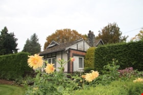
- The Montague and Marcia Moore Residence, situated on Sperling Avenue, is a one and one-half storey wood-frame house with Tudor Revival elements such as half-timbering and diamond-leaded windows. The landscaping includes a large hedge at the front of the property. It is located on a lakefront site within the scenic Deer Lake Park Heritage Precinct.
- Heritage Value
- Located within the historic Deer Lake Park neighbourhood, the Montague and Marcia Moore Residence is valued as an example of the late persistence of the historicist influence on domestic architecture, at a time when it was still considered the height of good taste for a house to be designed in a recognizable period revival style. This is reflected in the rustic Tudor Revival elements such as half-timbering, waney-edged boards in the gables, brick nogging, diamond-leaded windows, and bird houses in the main gable. The cobblestone chimney, the major focal point of the house, was constructed from river stones that were transported from Lynn Canyon. Meticulously retained in its original condition, this was the last home to be constructed by the Moore family before the Second World War construction supply rationing took effect. It was built by Danish contractor, Hans Jorgensen Hau (1878-1944), who had a flair for the construction of homes with a rustic character, and shares a number of design features with Hau’s own house at 5070 Canada Way.
- Defining Elements
- Key elements that define the heritage character of the Montague and Marcia Moore Residence include its: - location on a lakefront site, within the Deer Lake Park Heritage Precinct - residential form, scale and massing as expressed by its one and one-half storey height, rectangular plan and front gabled roof - wood-frame construction - Tudor Revival elements such as stucco and wood half-timbering, diamond-leaded casement windows, scroll-cut brackets, brick nogging on the front façade, bird houses in the main front gable, waney-edged boards at gable peaks, plank front door with strap hinges and a prominent external cobblestone chimney - associated landscape features such as a granite wall, and mature coniferous and deciduous trees
- Historic Neighbourhood
- Burnaby Lake (Historic Neighbourhood)
- Planning Study Area
- Morley-Buckingham Area
- Organization
- Canadian Institute of Mining and Metallurgy
- Builder
- Hans Jorgensen Hau
- Function
- Primary Historic--Single Dwelling
- Primary Current--Single Dwelling
- Community
- Deer Lake
- Cadastral Identifier
- P.I.D.006-082-696
- Boundaries
- The Montague and Marcia Moore Residence is comprised of a single residential lot located at 5165 Sperling Avenue, Burnaby.
- Area
- 4104
- Contributing Resource
- Building
- Ownership
- Public (local)
- Documentation
- City of Burnaby Planning and Building Department, Heritage Site Files
- Street Address
- 5165 Sperling Avenue
- Street View URL
- Google Maps Street View
Images
Morley Elementary School
https://search.heritageburnaby.ca/link/landmark835
- Repository
- Burnaby Heritage Planning
- Geographic Access
- Morley Street
- Associated Dates
- 1955
- Heritage Value
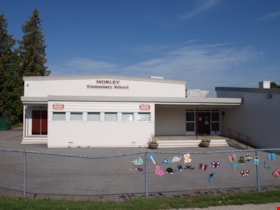
- In 1955 Morley Elementary School opened with 292 pupils, an indication of how quickly the residential areas around the Morley area were growing in the post-war period. Similar to other elementary schools built in Burnaby at the time, Morley was constructed on one level with classrooms in a line that could be added to as the need arose. Additions were made to the school in 1956, 1960 and 1969.
- Historic Neighbourhood
- Burnaby Lake (Historic Neighbourhood)
- Planning Study Area
- Morley-Buckingham Area
- Street Address
- 7355 Morley Street
- Street View URL
- Google Maps Street View
Images
North Pacific Lumber Company Ruins
https://search.heritageburnaby.ca/link/landmark627
- Repository
- Burnaby Heritage Planning
- Geographic Access
- Barnet Road
- Associated Dates
- 1909
- Description
- Industrial building.
- Heritage Value
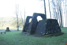
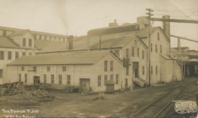
- Located on the shore of Burrard Inlet, these poured concrete piers of the smokestack burner and the former boiler and plant of the North Pacific Lumber Company are among the only remains of the once-thriving industrial site located on the waterfront on the south shore of Burrard Inlet. The sawmill and the Village of Barnet were initiated by David MacLaren, a wealthy lumberman from Buckingham, Quebec, who had previously established the Fraser Mills in Coquitlam in 1889. McLaren gambled that a sawmill on the main line of the C.P.R near Vancouver would serve the Canadian domestic market and be a profitable venture. The North Pacific Lumber Company established itself on this peninsula on Burrard Inlet and was fully operational in 1900. In 1909, the mill was completely burned out by a fire starting in the boiler room. Immediately the plant was rebuilt, modern in every respect and absolutely fireproof, as the entire power plant and boiler room was built of reinforced concrete and steel, of which these ruins are the last remains. The plant closed during the First World War and reopened as the Barnet Lumber Company in 1925 only to close forever in 1931 after a strike during the Great Depression.
- Locality
- Barnet
- Historic Neighbourhood
- Barnet (Historic Neighbourhood)
- Planning Study Area
- Burnaby Mountain Area
Images
Richard & Alice Dunn Residence
https://search.heritageburnaby.ca/link/landmark552
- Repository
- Burnaby Heritage Planning
- Description
- Residential building.
- Associated Dates
- 1939
- Street View URL
- Google Maps Street View
- Repository
- Burnaby Heritage Planning
- Geographic Access
- Jubilee Avenue
- Associated Dates
- 1939
- Description
- Residential building.
- Heritage Value
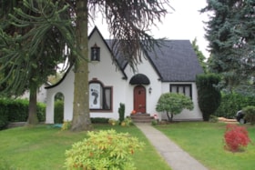
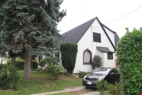
- This house was built for Richard Dunn, a police sergeant with the B.C. Police force and his wife Alice. This house is a notable example of a Storybook Cottage, dating from just prior to the outbreak of the Second World War. Modest houses of the era often assumed a cottage appearance that provided a romantic ideal of traditional domesticity. With its smooth, planar stucco, severely-clipped roof edges, round-arched door and windows, side arch with a catslide roof, cross-leaded glass and brick detailing, this house is an excellent example of this picturesque housing trend. Located on a corner lot, the house was sited at an angle. The large Chilean Pine, or monkey-puzzle tree, entrance is a remarkable specimen.
- Locality
- Alta Vista
- Historic Neighbourhood
- Alta Vista (Historic Neighbourhood)
- Planning Study Area
- Sussex-Nelson Area
- Ownership
- Private
- Street Address
- 7207 Jubilee Avenue
- Street View URL
- Google Maps Street View
Images
Russian Submarines at Barnet
https://search.heritageburnaby.ca/link/landmark748
- Repository
- Burnaby Heritage Planning
- Associated Dates
- 1915-1917
- Heritage Value
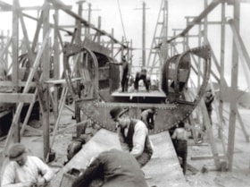
- This site was a top secret site where 460 men worked on the assembly of five submarines for the Russian Navy during World War I. The Seattle contractor was forbidden from doing the work in the US because of American neutrality regulations and he set up the secret plant here without the knowledge of the Canadian Government.
- Historic Neighbourhood
- Barnet (Historic Neighbourhood)
- Planning Study Area
- Burnaby Mountain Area
Images
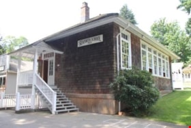
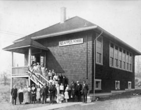
Seaforth Schoolhouse
https://search.heritageburnaby.ca/link/landmark541
- Repository
- Burnaby Heritage Planning
- Description
- The Seaforth Schoolhouse is a one-storey wood-frame rectangular plan building with a projecting entry porch, located in the Burnaby Village Museum.
- Associated Dates
- 1922
- Formal Recognition
- Heritage Designation, Community Heritage Register
- Repository
- Burnaby Heritage Planning
- Geographic Access
- Deer Lake Avenue
- Associated Dates
- 1922
- Formal Recognition
- Heritage Designation, Community Heritage Register
- Enactment Type
- Bylaw No. 8148
- Enactment Date
- 03/01/1984
- Description
- The Seaforth Schoolhouse is a one-storey wood-frame rectangular plan building with a projecting entry porch, located in the Burnaby Village Museum.
- Heritage Value
- The heritage value of the Seaforth Schoolhouse lies in its representation of a one-room school once located in one of the city’s rural districts. The school was constructed due to the demand of increasing population after the First World War, in what was then known as the Lozells District, so isolated at the time that parents were concerned about the danger to their children from wild bears and cougars that roamed the area. The school was named after its sponsor, the Seaforth Chapter of the Imperial Order of Daughters of the Empire. Bowman and Cullerne, the architects for the Burnaby School Board, designed the one room schoolhouse. It was constructed by local contractor, Alphonse J. Toebaert, following the standards of British Columbia public school architecture, which specified the plan and orientation of the building. It indicates the values and the design control of school boards of the time, and the central role of the provincial government in setting educational standards. The heritage value of this school also lies in its interpretive value within the Burnaby Village Museum. The site is an important cultural feature for the interpretation of Burnaby’s heritage to the public, illustrating the changes in the local school system over time. The school was moved to Burnaby Village Museum in 1983, and was opened to the public after extensive restoration in 1987. Both the interior and exterior have been restored and interpreted to the date of original construction. The North Vancouver School Board donated most of the early desks, and the remainder of the interior artifacts are from the museum’s own collection.
- Defining Elements
- Key elements that define the heritage character of the Seaforth Schoolhouse include its: - rectangular plan - hipped roof with cedar shingle cladding - hipped-roof entry porch - typical school fenestration of the era, with a bank of double-hung 6-over-6 wooden-sash windows on one facade - cedar shingle cladding - original and authentic interior elements such as interior mouldings, blackboards and desks
- Locality
- Deer Lake Park
- Historic Neighbourhood
- Burnaby Lake (Historic Neighbourhood)
- Planning Study Area
- Morley-Buckingham Area
- Organization
- Seaforth Chapter of the Imperial Order of Daughters of the Empire
- Burnaby School Board
- Burnaby Village Museum
- Architect
- Bowman and Cullerne
- Builder
- Alphonse J. Toebaert
- Function
- Primary Historic--One-Room School
- Primary Current--Museum
- Community
- Burnaby
- Cadastral Identifier
- P.I.D. No. 011-030-356 Legal Description: Parcel 1, District Lot 79 and District Lot 85, Group 1, New Westminster District, Reference Plan 77594
- Boundaries
- Burnaby Village Museum is comprised of a single municipally-owned property located at 6501 Deer Lake Avenue, Burnaby.
- Area
- 38,488.63
- Contributing Resource
- Building
- Landscape Feature
- Structure
- Ownership
- Public (local)
- Documentation
- Heritage Site Files: PC77000 20. City of Burnaby Planning and Building Department, 4949 Canada Way, Burnaby, B.C., V5G 1M2
- Street Address
- 6501 Deer Lake Avenue
Images
Simon Fraser University
https://search.heritageburnaby.ca/link/landmark639
- Repository
- Burnaby Heritage Planning
- Description
- The planning, design concept, design coordination, site development and landscaping for the original part of the campus were all under the control of Erickson/Massey. The complex was conceived as one building, with future growth occurring at the periphery. Tall buildings would have been out of scal…
- Associated Dates
- 1965
- Street View URL
- Google Maps Street View
- Repository
- Burnaby Heritage Planning
- Geographic Access
- University Drive
- Associated Dates
- 1965
- Description
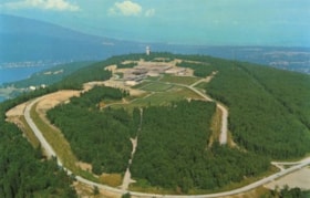
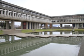
- The planning, design concept, design coordination, site development and landscaping for the original part of the campus were all under the control of Erickson/Massey. The complex was conceived as one building, with future growth occurring at the periphery. Tall buildings would have been out of scale with the massive mountaintop ridge, so a series of horizontal terraced structures were designed that hugged the ridge and dissolve into the landscape. Following the linear peak of the mountain, the scheme organized various parts of the campus along an east/west line. The concept of a central academic quadrangle was conceived within the tradition of Oxford and Cambridge, and to enhance the sense of contemplative quiet, it was designed as a perfect square raised on massive pilotis, allowing stunning views through a landscaped courtyard. The connecting link was a gigantic space frame-developed in conjunction with Jeffrey Lindsay, a one-time associate of Buckminster Fuller-that provided shelter and a gathering-place for the students. Other architects who had placed among the top five in the competition were retained to design the individual components of the original plan: the Academic Quadrangle by Zoltan S. Kiss; the Theatre, Gymnasium & Swimming Pool by Duncan McNab & Associates; the Science Complex by Rhone & Iredale; and the Library by Robert F. Harrison.
- Heritage Value
- Following the end of the Second World War, there was unprecedented growth throughout the Lower Mainland. Many returning veterans had settled on the coast, and the loosening of wartime restrictions led to the creation of many new suburban developments throughout the region. The growing population strained existing facilities, and there was a recognition that new educational facilities had to be constructed to meet these growing demands. For many years, the only university in the province was the University of British Columbia. In the 1960s, new universities were planned for both Victoria and Burnaby to serve the wave of baby boomers just then going through high school. The dramatic site chosen for the Burnaby university was the top of Burnaby Mountain, with expansive views over mountain ranges and water. An architectural competition was held for a campus of 7,000 students that could eventually be expanded to 18,000. Of the many submissions, the judges reached unanimity on the winner, an outstanding scheme submitted by the firm of Erickson/Massey. The judges went even further, and recommended that every effort be made to ensure that the winning design be built as submitted. The new Chancellor, Gordon Shrum, agreed. The realization of this scheme won extensive recognition for the work of Arthur Erickson and Geoffrey Massey, and launched Erickson’s international career. In Erickson’s words: "Unlike any previous university, Simon Fraser is a direct translation into architecture of the expanding fields of knowledge that defy traditional boundaries, of the vital role of the university as both challenger and conservor of human culture, and of the university community as one in constant intellectual, spiritual and social interchange." The new school opened for classes in September 1965, nicknamed the “instant university,” and quickly gained a radical reputation. The startling futuristic architecture and open layout suited the explosive nature of the mid-1960s, when political and social traditions of all types were being questioned and student protests were common. Many of SFU’s programs were considered experimental, even controversial, and unrest and conflict on the campus continued for a number of years. Since this auspicious beginning 40 years ago, SFU has grown to house 25,000 students on three campuses. The core of the original campus, recognized world-wide as a profound work of architecture, remains essentially intact today.
- Locality
- Burnaby Mountain
- Historic Neighbourhood
- Barnet (Historic Neighbourhood)
- Planning Study Area
- Burnaby Mountain Area
- Architect
- Erickson/Massey
- Area
- 1360000.00
- Contributing Resource
- Building
- Ownership
- Private
- Street Address
- 8888 University Drive
- Street View URL
- Google Maps Street View
Images
St. John the Divine Anglican Church
https://search.heritageburnaby.ca/link/landmark514
- Repository
- Burnaby Heritage Planning
- Description
- St. John the Divine Anglican Church is a landmark wood-frame Gothic Revival church, with Gothic windows and spire. It is located on Kingsway, one of Burnaby’s main commercial thoroughfares, near the SkyTrain transit line and across the street from Central Park.
- Associated Dates
- 1905
- Formal Recognition
- Community Heritage Register
- Street View URL
- Google Maps Street View
- Repository
- Burnaby Heritage Planning
- Geographic Access
- Kingsway
- Associated Dates
- 1905
- Formal Recognition
- Community Heritage Register
- Enactment Type
- Council Resolution
- Enactment Date
- 09/06/2003
- Description
- St. John the Divine Anglican Church is a landmark wood-frame Gothic Revival church, with Gothic windows and spire. It is located on Kingsway, one of Burnaby’s main commercial thoroughfares, near the SkyTrain transit line and across the street from Central Park.
- Heritage Value
- St. John the Divine Anglican Church is valued as a symbol of the traditions of early Burnaby pioneers and as the oldest surviving church building in the city. Established in 1899, St. John was the first church in the community and was located at a prominent intersection of the old Vancouver-Westminster Road (now Kingsway) and the British Columbia Electric Railway’s interurban station at Central Park. This prominent intersection of the road and rail developed as the town centre of the Central Park district. The first St. John church was destroyed by fire, and was rebuilt at the same location in 1904-05. This church is additionally significant for its association with prominent local architect Joseph Henry Bowman (1864-1943) who emigrated from England in 1888. Bowman was a member of the parish, and designed both the first church and its subsequent replacement. Bowman’s prolific career embraced many stylistic changes and technological advances, and this church is a surviving example of one of his rare religious commissions. The design of the new church's nave and vestry was based on the Gothic Revival style of Christ Church Anglican in Surrey, B.C., which had been the former church of St. John’s incumbent Rev. William Bell. Evolving over time as the congregation grew, the church received a number of early additions, and in 1953 was substantially renovated and enlarged through a new design by Vancouver architect Ross Lort. The original church nave was separated from the tower and turned to allow for a large addition. The congregation relocated to a new church in 1998, and at that time removed the church's memorial windows, leaving behind a number of the original art glass windows installed in the 1920s. The church building was renovated in 2004-05, and surviving original elements were retained and restored, including of the original church tower and interior chancel ceiling. A valued feature of the building is the original cast iron church bell that remains in the tower. It was purchased by the children of the congregation in 1912, and in 1924 was rededicated on Armistice Day as a memorial to Burnaby resident Lt. James Donald McRae Reid, who died in the First World War.
- Defining Elements
- Key elements that define the heritage character of St. John the Divine Anglican Church include its: - location on the north side of Kingsway, opposite Central Park - ecclesiastical form, scale and massing as expressed by the offset tower and tall, gabled roof - tower with its original horizontal wooden drop siding, bellcast square roof with octagonal drum above and bellcast octagonal spire - cedar shingle roof cladding - metal cross at peak of spire - Gothic Revival details such as: Gothic lancet windows with leaded stained glass panels; Gothic entrance door at the base of the tower; pointed-arch louvers in the tower; and exterior gable end scissor-trusses - interior features such as wooden scissor-trusses with diagonal fir tongue and groove panelling on the ceiling above, fir tongue-and-groove panelling on the wall of the nave, and original cedar and fir pews and altar rails - cast iron bell in tower
- Historic Neighbourhood
- Central Park (Historic Neighbourhood)
- Planning Study Area
- Garden Village Area
- Architect
- Joesph Henry Bowman
- Function
- Primary Historic--Place of Worship
- Primary Current--Place of Worship
- Community
- Burnaby
- Cadastral Identifier
- 003-398-871
- Boundaries
- St. John the Divine Anglican Church is comprised of a single institutional lot located at 3891 Kingway, Burnaby.
- Area
- 3486.66
- Contributing Resource
- Building
- Ownership
- Private
- Street Address
- 3891 Kingsway
- Street View URL
- Google Maps Street View
Images
Stride Hill Neighbourhood
https://search.heritageburnaby.ca/link/landmark846
- Repository
- Burnaby Heritage Planning
- Associated Dates
- 1955-2008
- Heritage Value
- The residential areas that are located within the Stride Hill Neighbourhood were primarily developed in the 1950s during Burnaby's post-war building boom. The area lying to the south of Byrne Creek Ravine Park was used as a municipal garbage dump until the 1960s and as a landfill site for yard waste disposal until the early 1990s at which point the area was incorporated into the Edmonds Town Centre Plan and the land was made into park and open space.
- Historic Neighbourhood
- Edmonds (Historic Neighbourhood)
- Planning Study Area
- Stride Hill Area
