Narrow Results By

basket
https://search.heritageburnaby.ca/link/museumartifact50308
- Repository
- Burnaby Village Museum
- Accession Code
- BV006.24.5
- Description
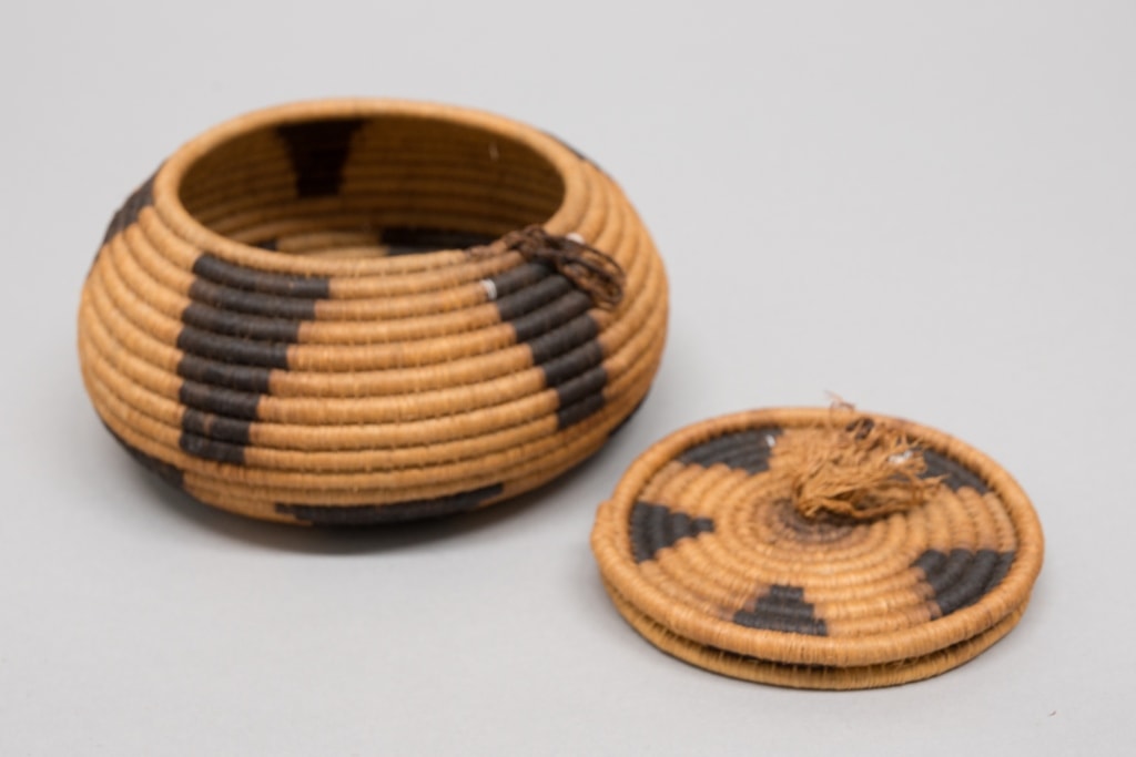
- The basket is round with a lid and has a geometric design in black. Made using the coiled method.
- Object History
- Resembles California and Southwestern style baskets made of willow, dye and grass.
- Country Made
- United States of America
- Province Made
- California
Images
Documents
drawing book
https://search.heritageburnaby.ca/link/museumartifact87479
- Repository
- Burnaby Village Museum
- Accession Code
- BV015.35.89
- Description
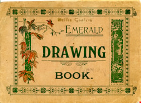
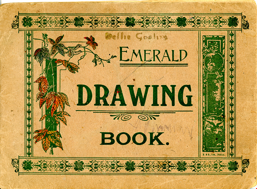
- drawing book; brown paper book of sketches from nature; 27 pages; hand drawn and painted; botanical samples of pressed wildflowers are also adhered to pages inside book and identified; "EMERALD / DRAWING / BOOK." commerically printed on front cover in green ink along with illustrations; "Nellie Gosling" handwritten on front cover in black ink; "Nellie Gosling / 1st Blackrock Company (Ireland) / Naturalists 1916" handwritten inside front cover; hand drawn and coloured flag display "UNITED WE STAND" on last page of book; flags of World War I allies Italy, France, Belgium, Great Britain, the United States of America, Portugal, Russia and Japan.
- Object History
- Drawing book was created by Nellie Gosling, First Blackrock Company, Ireland. The book may have been created to earn a badge. The drawing book was donated with items belonging to Dorothy Pitman, but it is unknown how she acquired it since she doesn't appear to have done the drawings herself. Dorothy Pitman was a Girl Guide in the 1st Burnaby Company. She was known to be involved with guiding from 1919 to 1931. Textual records and photographs of the Pitman family, including one of Dorothy and her sister Gwen, are held by the City of Burnaby Archives. Dorothy and Gwen's parents, Ernest and Jean Pitman, owned McKay Dry Goods and Jubilee Dry Goods.
- Category
- 04.Tools & Equipment for Materials
- Classification
- Painting T&E
- Object Term
- Sketchbook
Images
Documents
![Highways map of British Columbia, Alberta and adjacent states, [1930] thumbnail](/media/hpo/_Data/_BVM_Cartographic_Material/1977/1977_0037_0187_001.jpg?width=280)
Highways map of British Columbia, Alberta and adjacent states
https://search.heritageburnaby.ca/link/museumdescription9668
- Repository
- Burnaby Village Museum
- Date
- [1930]
- Collection/Fonds
- Burnaby Village Museum Map collection
- Description Level
- Item
- Physical Description
- 1 map : col. lithographic print ; both sides ; 89.5 x 58 cm, folded to 11.5 x 20 cm
- Scope and Content
- Double sided road map published by Imperial Oil, Ltd. and featuring the main travelled highway routes of British Columbia, Alberta and the Northwestern-most states of the United States of America. The map is a colour lithograph. The main map is green, with the highways highlighted in red. The litho…
- Repository
- Burnaby Village Museum
- Collection/Fonds
- Burnaby Village Museum Map collection
- Description Level
- Item
- Physical Description
- 1 map : col. lithographic print ; both sides ; 89.5 x 58 cm, folded to 11.5 x 20 cm
- Material Details
- Scale 1 inch = 20 miles
- A.R. THOMSON / CHIEF CARTOGRAPHER
- Scope and Content
- Double sided road map published by Imperial Oil, Ltd. and featuring the main travelled highway routes of British Columbia, Alberta and the Northwestern-most states of the United States of America. The map is a colour lithograph. The main map is green, with the highways highlighted in red. The lithograph was created in Canada by Rolph Clark Stone Ltd in Toronto. The opposite side of the map features inset maps of the following: the Trans-Canada Highway, the highway between Prince Rupert and Prince George, the highway through the Canadian Rockies, and the highway through the Peace River District. Small city plan maps of highways through major cities, as well as advertisements for Imperial Oil products, are also found on the opposite side of the main map. This map is one of four produced by Imperial Oil that covered the most populated areas of Canada from coast to coast and paralleled Imperial Oil's distribution service.
- Creator
- Thomson, A.R.
- Publisher
- Imperial Oil Limited
- Accession Code
- HV977.37.187
- Access Restriction
- No restrictions
- Reproduction Restriction
- No known restrictions
- Date
- [1930]
- Media Type
- Cartographic Material
- Scan Resolution
- 600
- Scan Date
- 2023-11-10
- Notes
- Title based on content of map
![Highways map of British Columbia, Alberta and adjacent states, [1930] thumbnail](/media/hpo/_Data/_BVM_Cartographic_Material/1977/1977_0037_0187_003_seadragon/1977_0037_0187_003.jpg?w=280)
