Narrow Results By
Subject
- Animals - Dogs 2
- Buildings - Commercial 2
- Buildings - Commercial - Grocery Stores 2
- Buildings - Commercial - Stores 1
- Buildings - Religious - Churches 1
- Buildings - Residential - Houses 6
- Buildings - Schools 2
- Business 1
- Documentary Artifacts - Postcards 1
- Education 1
- Geographic Features - Forests 1
- Geographic Features - Roads 1

Alta Vista Neighbourhood
https://search.heritageburnaby.ca/link/landmark766
- Repository
- Burnaby Heritage Planning
- Associated Dates
- 1905-1924
- Heritage Value
- Alta Vista, named for its high views of the Fraser Valley, rapidly grew during the period 1910-1912, seeing its settlement jump from about a dozen buildings in 1910 to about four hundred by the end of 1912. Home-seekers were attracted to its location just a short walk from the B.C.E.R. line at Royal Oak and Highland Park and easily accessible to both New Westminster and Vancouver.
- Historic Neighbourhood
- Alta Vista (Historic Neighbourhood)
- Planning Study Area
- Sussex-Nelson Area
Images


Greenwood Residence
https://search.heritageburnaby.ca/link/landmark555
- Repository
- Burnaby Heritage Planning
- Description
- Residential building.
- Associated Dates
- c.1911
- Other Names
- Albert & Emma Greenwood Residence
- Street View URL
- Google Maps Street View
- Repository
- Burnaby Heritage Planning
- Other Names
- Albert & Emma Greenwood Residence
- Geographic Access
- Victory Street
- Associated Dates
- c.1911
- Description
- Residential building.
- Heritage Value
- Typical of the Arts and Crafts style, this house has a front gabled roof with triangular eave brackets and a front verandah with twinned square columns on tapered piers. It is notable for its stained glass windows and early ‘ripple’ float glass. Asbestos shingles were at one point added over the original siding, but are being removed by the owner, exposing the cedar shingles. The house is believed to have been built and occupied by Albert and Emma Greenwood.
- Locality
- Alta Vista
- Historic Neighbourhood
- Alta Vista (Historic Neighbourhood)
- Planning Study Area
- Sussex-Nelson Area
- Ownership
- Private
- Street Address
- 4569 Victory Street
- Street View URL
- Google Maps Street View
Images


Richard & Ada Neville Residence
https://search.heritageburnaby.ca/link/landmark633
- Repository
- Burnaby Heritage Planning
- Description
- Residential building.
- Associated Dates
- c.1918
- Street View URL
- Google Maps Street View
- Repository
- Burnaby Heritage Planning
- Geographic Access
- Nelson Avenue
- Associated Dates
- c.1918
- Description
- Residential building.
- Heritage Value
- This Craftsman bungalow was built for the Neville family. Richard Neville (1884-1950) served as a Burnaby councillor in 1924 and is remembered as the man who gave the CCF party (now the NDP) land on Maple Avenue on which to build Jubilee Labour Hall. He worked as a tile layer for the O’Neill Company and was married to Ada Neville (née Cook, 1885-1970). Ada Neville still lived in this house at the time of her death. Typical of the Craftsman style, the house has a side gabled roof with large front gable dormer, triangular eave brackets, an open arched front verandah and a textural mix of siding including cedar shingle on the main floor and lapped siding at the foundation.
- Locality
- Alta Vista
- Historic Neighbourhood
- Alta Vista (Historic Neighbourhood)
- Planning Study Area
- Sussex-Nelson Area
- Area
- 936.00
- Contributing Resource
- Building
- Ownership
- Private
- Street Address
- 6935 Nelson Avenue
- Street View URL
- Google Maps Street View
Images


Roy & Catherine Cummins House
https://search.heritageburnaby.ca/link/landmark506
- Repository
- Burnaby Heritage Planning
- Description
- Located on Rumble Street in the Alta Vista neighbourhood, the Roy and Catherine Cummins House is a one and one-half storey, front-gabled rustic Arts and Crafts house, distinguished by the use of log construction and fieldstone verandah columns.
- Associated Dates
- 1912
- Formal Recognition
- Heritage Designation, Community Heritage Register
- Street View URL
- Google Maps Street View
- Repository
- Burnaby Heritage Planning
- Geographic Access
- Rumble Street
- Associated Dates
- 1912
- Formal Recognition
- Heritage Designation, Community Heritage Register
- Enactment Type
- By-law No. 11959
- Enactment Date
- 17/10/2005
- Description
- Located on Rumble Street in the Alta Vista neighbourhood, the Roy and Catherine Cummins House is a one and one-half storey, front-gabled rustic Arts and Crafts house, distinguished by the use of log construction and fieldstone verandah columns.
- Heritage Value
- The Roy and Catherine Cummins House is valued for its association with the early settlement of Burnaby. Its construction is linked to the opening of the Burnaby Lake Interurban line, which ran through the central part of Burnaby, providing access between Vancouver and New Westminster. The accessibility of the area, combined with spectacular views of the Fraser River, made Alta Vista a desirable Edwardian era middle-class neighbourhood. The house was built in 1912 for Roy Franklin Cummins and his wife, Catherine Emma Cummins (née Cook), shortly after their marriage. Roy Cummins was a lineman with the B.C. Electric Railway Company, an economic driving force in Burnaby. The Roy and Catherine Cummins House is a unique and sophisticated local example of a rustic Arts and Crafts structure. Roy Cummins constructed the house from logs cleared for the construction of Rumble Street; the house is also unique for its use of local fieldstone for its verandah columns and chimney. Reminiscent of park lodge architecture, it exemplifies the semi-wild nature of the area as it was being opened for subdivision. It is also an indication of how far Burnaby was removed from the more urban lifestyles and attitudes of Vancouver and New Westminster.
- Defining Elements
- Key elements that define the heritage character of the Roy and Catherine Cummins House include its: - location on a steeply sloping site in the Alta Vista neighbourhood of Burnaby - residential form, scale and massing as expressed by its one and one-half storey height plus full basement, front-gabled roof and shed dormer, full open front verandah and partial rear verandah - peeled log construction including notched corner posts, log verandah roof framing and log balustrades - masonry elements including fieldstone verandah columns and internal chimney, and board-formed concrete foundations with fieldstone aggregate - rustic Arts and Crafts features such as the use of natural materials, tapered columns, front door with sidelights and exposed eave purlins - original windows, including wooden sash casement windows in multiple assembly with continuous transoms - interior features including fir-panelled walls, wooden mouldings and fieldstone fireplace - associated landscape features including terraced stone walls
- Historic Neighbourhood
- Alta Vista (Historic Neighbourhood)
- Planning Study Area
- Sussex-Nelson Area
- Function
- Primary Historic--Single Dwelling
- Primary Current--Single Dwelling
- Community
- Alta Vista
- Cadastral Identifier
- P.I.D.026-635-534
- Boundaries
- The Roy and Catherine Cummins House is comprised of a single residential lot located at 4156 Rumble Street, Burnaby.
- Area
- 718
- Contributing Resource
- Building
- Ownership
- Private
- Documentation
- City of Burnaby Planning and Building Department, Heritage Site Files
- Street Address
- 4156 Rumble Street
- Street View URL
- Google Maps Street View
Images


Sussex Avenue School
https://search.heritageburnaby.ca/link/landmark815
- Repository
- Burnaby Heritage Planning
- Geographic Access
- Irmin Street
- Associated Dates
- 1955-1982
- Heritage Value
- Sussex Avenue school was another school built during the peak expansion years of the 1950s and early 1960s. Burnaby's population was growing at such a fast pace during that decade that 10 new schools were built, and existing schools were expanded. Sussex Avenue School opened with 304 pupils. By the 1970s, student enrolment had slowed considerably from its peak and as a result, a number of schools - including Sussex - were closed.
- Historic Neighbourhood
- Alta Vista (Historic Neighbourhood)
- Planning Study Area
- Sussex-Nelson Area
- Street Address
- 4443 Irmin Street
Images

Sussex-Nelson Neighbourhood
https://search.heritageburnaby.ca/link/landmark838
- Repository
- Burnaby Heritage Planning
- Associated Dates
- 1955-2008
- Heritage Value
- The Sussex-Nelson Neighbourhood is located just south of Metrotown and in 1980 was characterised as the most populated of all of Burnaby's Planning Study areas. The area immediately south of Metrotown was initially developed as post-war 1950s housing stock, while the sector south of Rumble was developed after the 1960s and 1970s as single-family housing.
- Historic Neighbourhood
- Alta Vista (Historic Neighbourhood)
- Planning Study Area
- Sussex-Nelson Area
Images

![All Saints Anglican Church and Parish Hall, [191-] thumbnail](/media/hpo/_Data/_BVM_Images/1977/198000120004.jpg?width=280)
All Saints Anglican Church and Parish Hall
https://search.heritageburnaby.ca/link/museumdescription3032
- Repository
- Burnaby Village Museum
- Date
- [191-]
- Collection/Fonds
- Burnaby Village Museum Photograph collection
- Description Level
- Item
- Physical Description
- 1 photograph : b&w postcard ; 8.8 x 13.9 cm
- Scope and Content
- Photographic postcard of two buildings identified as All Saints Anglican Church and Parish Hall. There are two men in work clothes (cover-alls) standing in between the two buildings. There is a ladder going up to the roof of one building.
- Repository
- Burnaby Village Museum
- Collection/Fonds
- Burnaby Village Museum Photograph collection
- Description Level
- Item
- Physical Description
- 1 photograph : b&w postcard ; 8.8 x 13.9 cm
- Scope and Content
- Photographic postcard of two buildings identified as All Saints Anglican Church and Parish Hall. There are two men in work clothes (cover-alls) standing in between the two buildings. There is a ladder going up to the roof of one building.
- Geographic Access
- Royal Oak Avenue
- Street Address
- 7405 Royal Oak Avenue
- Accession Code
- HV980.12.4
- Access Restriction
- No restrictions
- Reproduction Restriction
- May be restricted by third party rights
- Date
- [191-]
- Media Type
- Photograph
- Historic Neighbourhood
- Alta-Vista (Historic Neighbourhood)
- Planning Study Area
- Sussex-Nelson Area
- Scan Resolution
- 600
- Scan Date
- 2023-09-12
- Notes
- Title based on contents of photograph
Images
![All Saints Anglican Church and Parish Hall, [191-] thumbnail](/media/hpo/_Data/_BVM_Images/1977/198000120004.jpg)
Baker family home
https://search.heritageburnaby.ca/link/archivedescription35748
- Repository
- City of Burnaby Archives
- Date
- 1911 (date of original), copied 1986
- Collection/Fonds
- Burnaby Historical Society fonds
- Description Level
- Item
- Physical Description
- 1 photograph : b&w ; 12.7 x 17.8 cm print
- Scope and Content
- Photograph of the Baker family home, 1643 Arthur Avenue (later renumbered 7666 Arthur Avenue). It was built by George Charles Baker.
- Repository
- City of Burnaby Archives
- Date
- 1911 (date of original), copied 1986
- Collection/Fonds
- Burnaby Historical Society fonds
- Subseries
- Pioneer Tales subseries
- Physical Description
- 1 photograph : b&w ; 12.7 x 17.8 cm print
- Description Level
- Item
- Record No.
- 204-606
- Access Restriction
- No restrictions
- Reproduction Restriction
- No known restrictions
- Accession Number
- BHS1988-03
- Scope and Content
- Photograph of the Baker family home, 1643 Arthur Avenue (later renumbered 7666 Arthur Avenue). It was built by George Charles Baker.
- Subjects
- Buildings - Residential - Houses
- Media Type
- Photograph
- Notes
- Title based on contents of photograph
- Geographic Access
- Arthur Avenue
- Street Address
- 7666 Arthur Avenue
- Historic Neighbourhood
- Alta-Vista (Historic Neighbourhood)
- Planning Study Area
- Sussex-Nelson Area
Images


Bickerton family home
https://search.heritageburnaby.ca/link/archivedescription36800
- Repository
- City of Burnaby Archives
- Date
- 1911 (date of original), copied 1992
- Collection/Fonds
- Burnaby Historical Society fonds
- Description Level
- Item
- Physical Description
- 1 photograph : b&w ; 8.9 x 12.7 cm print
- Scope and Content
- Photograph of the Bickerton family home at 2125 Nelson Avenue (later renumberd 7082 Nelson Avenue) near Victory Street, built in 1905 In front of the home are Edgar and Jane Bickerton, and three of their children: Edward, Nancy and Patricia.
- Repository
- City of Burnaby Archives
- Date
- 1911 (date of original), copied 1992
- Collection/Fonds
- Burnaby Historical Society fonds
- Subseries
- Burnaby Centennial Anthology subseries
- Physical Description
- 1 photograph : b&w ; 8.9 x 12.7 cm print
- Description Level
- Item
- Record No.
- 315-257
- Access Restriction
- No restrictions
- Reproduction Restriction
- No known restrictions
- Accession Number
- BHS1994-04
- Scope and Content
- Photograph of the Bickerton family home at 2125 Nelson Avenue (later renumberd 7082 Nelson Avenue) near Victory Street, built in 1905 In front of the home are Edgar and Jane Bickerton, and three of their children: Edward, Nancy and Patricia.
- Names
- Bickerton, Edgar "Ed"
- Bickerton, Edward "Ed"
- Bickerton, Jane
- Bickerton, Nancy "Nan"
- Bickerton, Patricia "Pat"
- Media Type
- Photograph
- Notes
- Title based on contents of photograph
- Geographic Access
- Nelson Avenue
- Street Address
- 7082 Nelson Avenue
- Historic Neighbourhood
- Alta-Vista (Historic Neighbourhood)
- Planning Study Area
- Sussex-Nelson Area
Images

![Burnaby's first lawn bowlers, [1916] thumbnail](/media/hpo/_Data/_BVM_Images/1974/197600710001.jpg?width=280)
Burnaby's first lawn bowlers
https://search.heritageburnaby.ca/link/museumdescription746
- Repository
- Burnaby Village Museum
- Date
- [1916]
- Collection/Fonds
- Burnaby Village Museum Photograph collection
- Description Level
- Item
- Physical Description
- 1 photograph : sepia ; 19 x 24 cm (sight), in mat 29 x 34 cm + 1 p.
- Scope and Content
- Photograph of lawn bowlers gathered together at the first bowling green in Burnaby, located at Victory Street and Gray Avenue (on Stan Wood's property). Standing in the back row (from left) are; M. Van George, Reverend A.C. Cameron, George Gascarth, Bennett, Oliver Goodacre and John Brown. Sitting …
- Repository
- Burnaby Village Museum
- Collection/Fonds
- Burnaby Village Museum Photograph collection
- Description Level
- Item
- Physical Description
- 1 photograph : sepia ; 19 x 24 cm (sight), in mat 29 x 34 cm + 1 p.
- Scope and Content
- Photograph of lawn bowlers gathered together at the first bowling green in Burnaby, located at Victory Street and Gray Avenue (on Stan Wood's property). Standing in the back row (from left) are; M. Van George, Reverend A.C. Cameron, George Gascarth, Bennett, Oliver Goodacre and John Brown. Sitting in the front row are; J.N. Durrell, Charles Mirren McInnes Harper, A.E.S. "Stan" Wood, William "Will" Taylor, and Edward Lumley Wriglesworth. Most of the men are wearing suit vests and pocket watches.
- Names
- Cameron, Reverend A.C.
- Gasgarth, George
- Goodacre, Oliver
- Brown, John
- Harper, Jack
- Wood, Anthony Ewart Stanley "Stan"
- Taylor, Will
- Harper, Charles Mirren McInnes
- Durrell, J.N.
- Wriglesworth, Edward Lumley
- Geographic Access
- Victory Street
- Gray Avenue
- Accession Code
- HV976.71.1
- Access Restriction
- No restrictions
- Reproduction Restriction
- No known restrictions
- Date
- [1916]
- Media Type
- Photograph
- Historic Neighbourhood
- Alta-Vista (Historic Neighbourhood)
- Planning Study Area
- Sussex-Nelson Area
- Scan Resolution
- 600
- Scan Date
- 1/6/2010
- Scale
- 100
- Photographer
- Rognon, Orville Jackson
- Notes
- Title based on contents of photograph
- Window mat and backing are glued together
- Photographer's writing on recto of photograph reads: "Photo by Rognon"
- 1 page accompanying identifies individuals
Images
![Burnaby's first lawn bowlers, [1916] thumbnail](/media/hpo/_Data/_BVM_Images/1974/197600710001.jpg)

Canadian Food Market
https://search.heritageburnaby.ca/link/archivedescription98666
- Repository
- City of Burnaby Archives
- Date
- 2022
- Collection/Fonds
- Disappearing Burnaby collection
- Description Level
- Item
- Physical Description
- 1 photograph (jpeg) : col.
- Scope and Content
- Photograph of the exterior of the Canadian Food Market, taken from across Imperial Street at night. The grocery store is located at 4378 Imperial Street and the building was constructed in 1962. A large display of plants and flowers stands in front of the store and is illuminated by bright lights.
- Repository
- City of Burnaby Archives
- Date
- 2022
- Collection/Fonds
- Disappearing Burnaby collection
- Physical Description
- 1 photograph (jpeg) : col.
- Description Level
- Item
- Record No.
- 634-013
- Access Restriction
- No restrictions
- Reproduction Restriction
- No restrictions
- Accession Number
- 2022-14
- Scope and Content
- Photograph of the exterior of the Canadian Food Market, taken from across Imperial Street at night. The grocery store is located at 4378 Imperial Street and the building was constructed in 1962. A large display of plants and flowers stands in front of the store and is illuminated by bright lights.
- Media Type
- Photograph
- Photographer
- Cheung, Nakita
- Notes
- Title taken from the associated blog post
- Associated blog post: https://disappearingburnaby.wordpress.com/2022/02/20/imperial-manor-2/
- Geographic Access
- Imperial Street
- Street Address
- 4378 Imperial Street
- Historic Neighbourhood
- Central Park (Historic Neighbourhood)
- Planning Study Area
- Sussex-Nelson Area
Images


Clearing Gough Family Lot
https://search.heritageburnaby.ca/link/archivedescription35486
- Repository
- City of Burnaby Archives
- Date
- 1912 (date of original), copied 1986
- Collection/Fonds
- Burnaby Historical Society fonds
- Description Level
- Item
- Physical Description
- 1 photograph : b&w ; 12.7 x 17.8 cm print
- Scope and Content
- Photograph of the Gough family and relatives clearing the lot for the family home on Nelson Avenue, Alta Vista. Identified in the photo (back row, centre) Donald Gough. Others in picture are aunts and uncles named Evans. Donald was the son of Agnes Gough and her husband William, who settled here…
- Repository
- City of Burnaby Archives
- Date
- 1912 (date of original), copied 1986
- Collection/Fonds
- Burnaby Historical Society fonds
- Subseries
- Pioneer Tales subseries
- Physical Description
- 1 photograph : b&w ; 12.7 x 17.8 cm print
- Description Level
- Item
- Record No.
- 204-344
- Access Restriction
- No restrictions
- Reproduction Restriction
- No known restrictions
- Accession Number
- BHS1988-03
- Scope and Content
- Photograph of the Gough family and relatives clearing the lot for the family home on Nelson Avenue, Alta Vista. Identified in the photo (back row, centre) Donald Gough. Others in picture are aunts and uncles named Evans. Donald was the son of Agnes Gough and her husband William, who settled here at 2119 Nelson Avenue (later 7126 Nelson Avenue).
- Subjects
- Land Clearing
- Names
- Evans Family
- Gough, Donald
- Media Type
- Photograph
- Notes
- Title based on contents of photograph
- Annotation at top of photograph reads, "Nelson & Victory Sts - 1912"
- Geographic Access
- Nelson Avenue
- Street Address
- 7126 Nelson Avenue
- Historic Neighbourhood
- Alta-Vista (Historic Neighbourhood)
- Planning Study Area
- Sussex-Nelson Area
Images

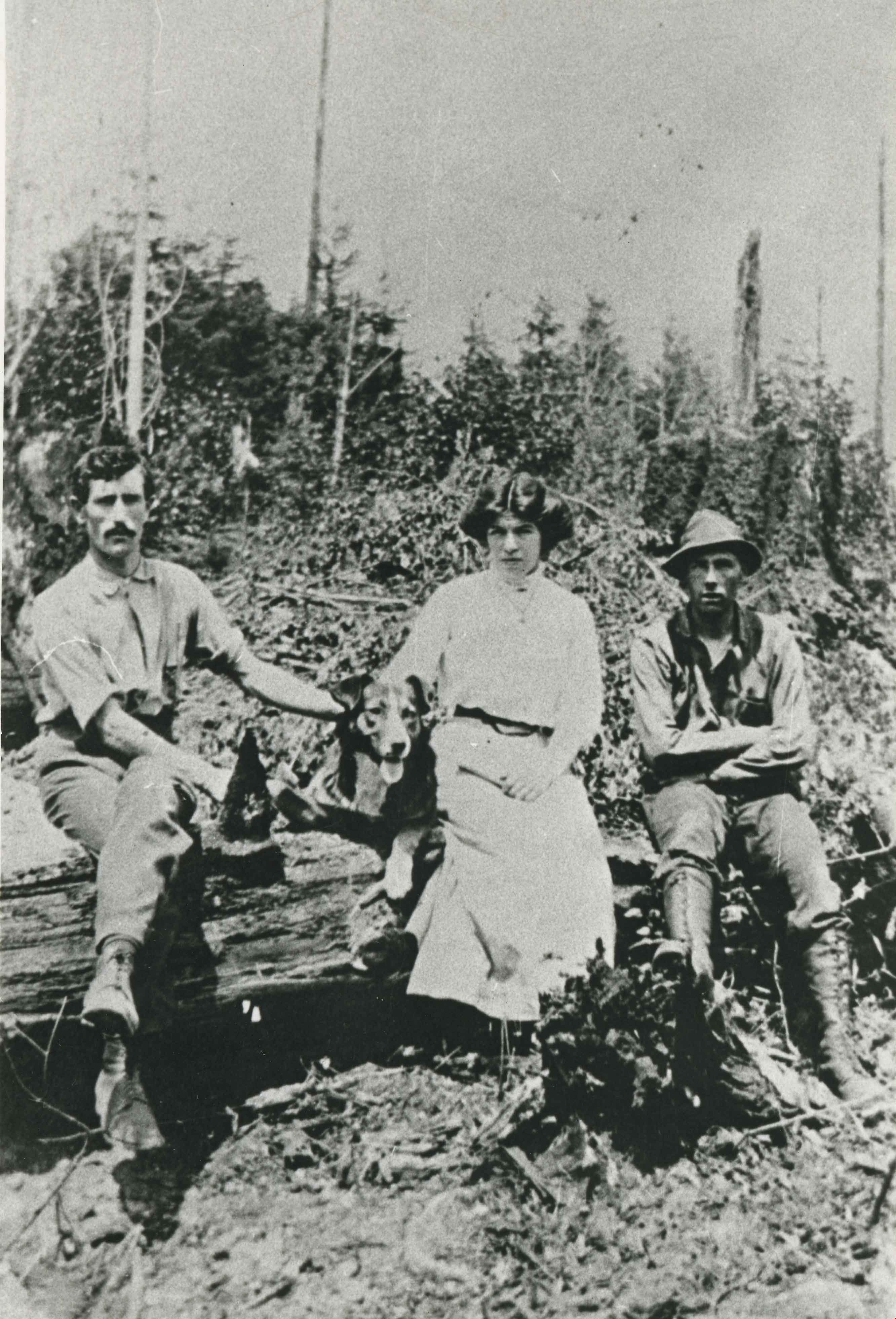
Family at Marlborough Avenue
https://search.heritageburnaby.ca/link/archivedescription35052
- Repository
- City of Burnaby Archives
- Date
- 1913 (date of original), copied 1986
- Collection/Fonds
- Burnaby Historical Society fonds
- Description Level
- Item
- Physical Description
- 1 photograph : b&w ; 8.7 x 12.7 cm print
- Scope and Content
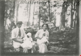
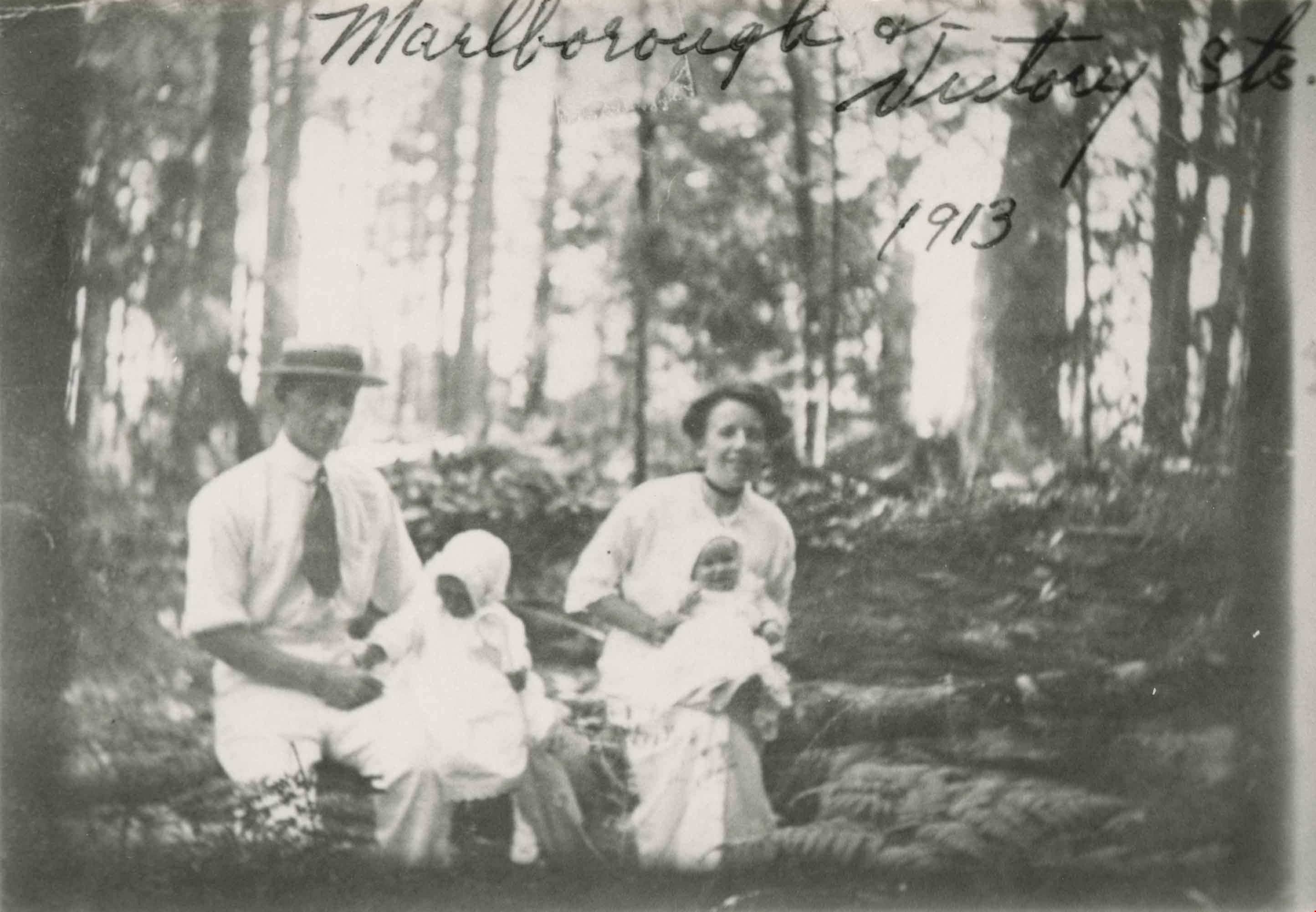
- Photograph of an unidentified family at Marlborough Avenue and Victory Street. A man and woman are seated outside in a forested area holding two small children. An annotation at the top of photograph reads, "Marlborough & Victory Sts. 1913."
- Repository
- City of Burnaby Archives
- Date
- 1913 (date of original), copied 1986
- Collection/Fonds
- Burnaby Historical Society fonds
- Subseries
- Gough family subseries
- Physical Description
- 1 photograph : b&w ; 8.7 x 12.7 cm print
- Description Level
- Item
- Record No.
- 182-006
- Access Restriction
- No restrictions
- Reproduction Restriction
- No known restrictions
- Accession Number
- BHS1986-30
- Scope and Content
- Photograph of an unidentified family at Marlborough Avenue and Victory Street. A man and woman are seated outside in a forested area holding two small children. An annotation at the top of photograph reads, "Marlborough & Victory Sts. 1913."
- Subjects
- Geographic Features - Forests
- Media Type
- Photograph
- Notes
- Title based on contents of photograph
- Geographic Access
- Marlborough Avenue
- Victory Street
- Historic Neighbourhood
- Alta-Vista (Historic Neighbourhood)
- Planning Study Area
- Sussex-Nelson Area
Images
![Family gathering, [191-?] (date of original), copied 1991 thumbnail](/media/hpo/_Data/_Archives_Images/_Unrestricted/370/370-678.jpg?width=280)
Family gathering
https://search.heritageburnaby.ca/link/archivedescription38091
- Repository
- City of Burnaby Archives
- Date
- [191-?] (date of original), copied 1991
- Collection/Fonds
- Burnaby Historical Society fonds
- Description Level
- Item
- Physical Description
- 1 photograph : b&w ; 2.7 x 4.8 cm print on contact sheet 21.5 x 26.8 cm
- Scope and Content
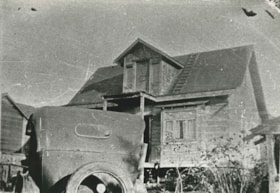
- Photograph of a family gathering at house on Rumble Street. People are standing on the porch and stairs of the house.
- Repository
- City of Burnaby Archives
- Date
- [191-?] (date of original), copied 1991
- Collection/Fonds
- Burnaby Historical Society fonds
- Subseries
- Burnaby Image Bank subseries
- Physical Description
- 1 photograph : b&w ; 2.7 x 4.8 cm print on contact sheet 21.5 x 26.8 cm
- Description Level
- Item
- Record No.
- 370-678
- Access Restriction
- No restrictions
- Reproduction Restriction
- No restrictions
- Accession Number
- BHS1999-03
- Scope and Content
- Photograph of a family gathering at house on Rumble Street. People are standing on the porch and stairs of the house.
- Media Type
- Photograph
- Notes
- Title based on contents of photograph
- 1 b&w copy negative accompanying
- Negative has a pink cast
- Geographic Access
- Rumble Street
- Historic Neighbourhood
- Alta-Vista (Historic Neighbourhood)
- Planning Study Area
- Sussex-Nelson Area
Images
![Family gathering, [191-?] (date of original), copied 1991 thumbnail](/media/hpo/_Data/_Archives_Images/_Unrestricted/370/370-678.jpg)
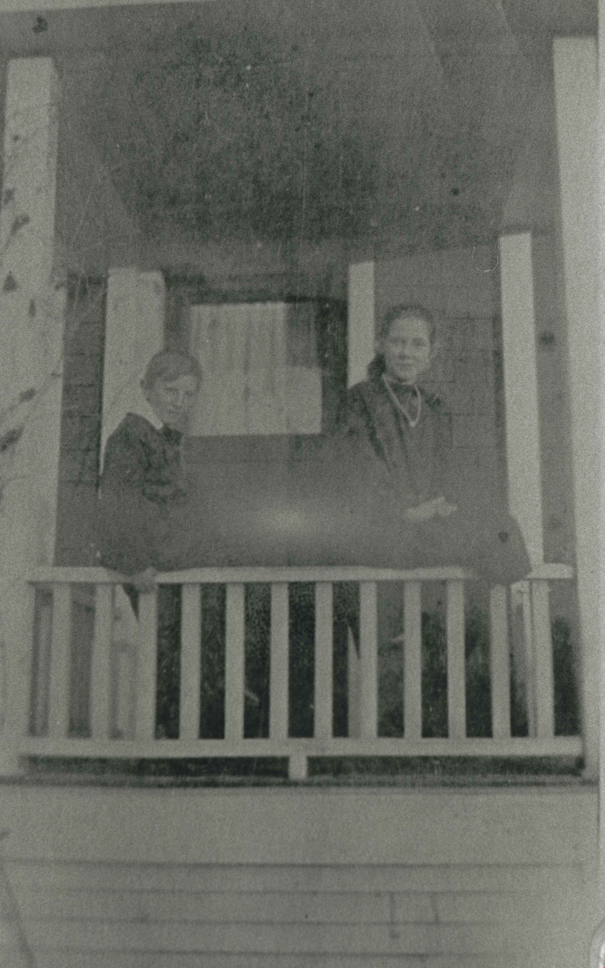
Gough children
https://search.heritageburnaby.ca/link/archivedescription35489
- Repository
- City of Burnaby Archives
- Date
- 1916 (date of original), copied 1986
- Collection/Fonds
- Burnaby Historical Society fonds
- Description Level
- Item
- Physical Description
- 1 photograph : b&w ; 12.7 x 17.8 cm print
- Scope and Content
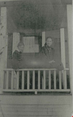
- Photograph of (left) Leslie Gough and (right) Phyllis Gough, children of William and Agnes Gough, on the porch of of 2119 Nelson Avenue (later 7126 Nelson Avenue).
- Repository
- City of Burnaby Archives
- Date
- 1916 (date of original), copied 1986
- Collection/Fonds
- Burnaby Historical Society fonds
- Subseries
- Pioneer Tales subseries
- Physical Description
- 1 photograph : b&w ; 12.7 x 17.8 cm print
- Description Level
- Item
- Record No.
- 204-347
- Access Restriction
- No restrictions
- Reproduction Restriction
- No known restrictions
- Accession Number
- BHS1988-03
- Scope and Content
- Photograph of (left) Leslie Gough and (right) Phyllis Gough, children of William and Agnes Gough, on the porch of of 2119 Nelson Avenue (later 7126 Nelson Avenue).
- Names
- Gough, Leslie
- Gough, Phyllis
- Media Type
- Photograph
- Notes
- Title based on contents of photograph
- Geographic Access
- Nelson Avenue
- Street Address
- 7126 Nelson Avenue
- Historic Neighbourhood
- Alta-Vista (Historic Neighbourhood)
- Planning Study Area
- Sussex-Nelson Area
Images
![Gough family, [1916] (date of original), copied 1986 thumbnail](/media/hpo/_Data/_Archives_Images/_Unrestricted/204/204-017.jpg?width=280)
Gough family
https://search.heritageburnaby.ca/link/archivedescription35160
- Repository
- City of Burnaby Archives
- Date
- [1916] (date of original), copied 1986
- Collection/Fonds
- Burnaby Historical Society fonds
- Description Level
- Item
- Physical Description
- 1 photograph : b&w ; 12.7 x 17.8 cm print
- Scope and Content
- Photograph of the Gough family children in front of their Nelson Avenue home. Left to right: Dorothy Gough Love, Phyllis Gough and Donald Gough. The address on Nelson Avenue was later changed from 2119 to 7126.
- Repository
- City of Burnaby Archives
- Date
- [1916] (date of original), copied 1986
- Collection/Fonds
- Burnaby Historical Society fonds
- Subseries
- Pioneer Tales subseries
- Physical Description
- 1 photograph : b&w ; 12.7 x 17.8 cm print
- Description Level
- Item
- Record No.
- 204-017
- Access Restriction
- No restrictions
- Reproduction Restriction
- No known restrictions
- Accession Number
- BHS1988-03
- Scope and Content
- Photograph of the Gough family children in front of their Nelson Avenue home. Left to right: Dorothy Gough Love, Phyllis Gough and Donald Gough. The address on Nelson Avenue was later changed from 2119 to 7126.
- Media Type
- Photograph
- Notes
- Title based on contents of photograph
- Geographic Access
- Nelson Avenue
- Street Address
- 7126 Nelson Avenue
- Historic Neighbourhood
- Alta-Vista (Historic Neighbourhood)
- Planning Study Area
- Sussex-Nelson Area
Images
![Gough family, [1916] (date of original), copied 1986 thumbnail](/media/hpo/_Data/_Archives_Images/_Unrestricted/204/204-017.jpg)

Gray family clearing land
https://search.heritageburnaby.ca/link/archivedescription35520
- Repository
- City of Burnaby Archives
- Date
- 1911 (date of original), copied 1986
- Collection/Fonds
- Burnaby Historical Society fonds
- Description Level
- Item
- Physical Description
- 1 photograph : b&w ; 12.7 x 17.8 cm print
- Scope and Content
- Photograph of the Gray family clearing a lot for the family home at 4375 Winnifred Street. Clamor Gray (father of William Gray) and Ernie North (uncle, right), both carpenters, built this house and others for relatives nearby.
- Repository
- City of Burnaby Archives
- Date
- 1911 (date of original), copied 1986
- Collection/Fonds
- Burnaby Historical Society fonds
- Subseries
- Pioneer Tales subseries
- Physical Description
- 1 photograph : b&w ; 12.7 x 17.8 cm print
- Description Level
- Item
- Record No.
- 204-378
- Access Restriction
- No restrictions
- Reproduction Restriction
- No known restrictions
- Accession Number
- BHS1988-03
- Scope and Content
- Photograph of the Gray family clearing a lot for the family home at 4375 Winnifred Street. Clamor Gray (father of William Gray) and Ernie North (uncle, right), both carpenters, built this house and others for relatives nearby.
- Subjects
- Land Clearing
- Plants - Trees
- Names
- Gray, Clamor
- Gray, Ernie
- Media Type
- Photograph
- Notes
- Title based on contents of photograph
- Geographic Access
- Winnifred Street
- Street Address
- 4375 Winnifred Street
- Historic Neighbourhood
- Alta-Vista (Historic Neighbourhood)
- Planning Study Area
- Sussex-Nelson Area
Images

Gray Family Clearing Lot
https://search.heritageburnaby.ca/link/archivedescription35523
- Repository
- City of Burnaby Archives
- Date
- 1911 (date of original), copied 1986
- Collection/Fonds
- Burnaby Historical Society fonds
- Description Level
- Item
- Physical Description
- 1 photograph : b&w ; 12.7 x 17.8 cm print
- Scope and Content
- Photograph of the Gray family clearing the lot for their family home at 4375 Winnifred Street. (From left) Clamor Gray (father of William Gray) Emily Gray (mother), and Ernie North (uncle by marriage; he had married Hilda, the sister of Clamor Gray).
- Repository
- City of Burnaby Archives
- Date
- 1911 (date of original), copied 1986
- Collection/Fonds
- Burnaby Historical Society fonds
- Subseries
- Pioneer Tales subseries
- Physical Description
- 1 photograph : b&w ; 12.7 x 17.8 cm print
- Description Level
- Item
- Record No.
- 204-381
- Access Restriction
- No restrictions
- Reproduction Restriction
- No known restrictions
- Accession Number
- BHS1988-03
- Scope and Content
- Photograph of the Gray family clearing the lot for their family home at 4375 Winnifred Street. (From left) Clamor Gray (father of William Gray) Emily Gray (mother), and Ernie North (uncle by marriage; he had married Hilda, the sister of Clamor Gray).
- Subjects
- Animals - Dogs
- Land Clearing
- Media Type
- Photograph
- Notes
- Title based on contents of photograph
- Geographic Access
- Winnifred Street
- Street Address
- 4375 Winnifred Street
- Historic Neighbourhood
- Alta-Vista (Historic Neighbourhood)
- Planning Study Area
- Sussex-Nelson Area
Images
![Gray family tent, [1911] (date of original), copied 1986 thumbnail](/media/hpo/_Data/_Archives_Images/_Unrestricted/204/204-377.jpg?width=280)
Gray family tent
https://search.heritageburnaby.ca/link/archivedescription35519
- Repository
- City of Burnaby Archives
- Date
- [1911] (date of original), copied 1986
- Collection/Fonds
- Burnaby Historical Society fonds
- Description Level
- Item
- Physical Description
- 1 photograph : b&w ; 12.7 x 17.8 cm print
- Scope and Content
- Photograph of the Gray family tent on their 4375 Winnifred Street property. (Inside tent) Clamor Gray (father of William Gray). The Grays lived in the tent while their house was being built by Mr. Gray, a carpenter.
- Repository
- City of Burnaby Archives
- Date
- [1911] (date of original), copied 1986
- Collection/Fonds
- Burnaby Historical Society fonds
- Subseries
- Pioneer Tales subseries
- Physical Description
- 1 photograph : b&w ; 12.7 x 17.8 cm print
- Description Level
- Item
- Record No.
- 204-377
- Access Restriction
- No restrictions
- Reproduction Restriction
- No known restrictions
- Accession Number
- BHS1988-03
- Scope and Content
- Photograph of the Gray family tent on their 4375 Winnifred Street property. (Inside tent) Clamor Gray (father of William Gray). The Grays lived in the tent while their house was being built by Mr. Gray, a carpenter.
- Subjects
- Land Clearing
- Structures - Tents
- Names
- Gray, Clamor
- Media Type
- Photograph
- Notes
- Title based on contents of photograph
- Geographic Access
- Winnifred Street
- Street Address
- 4375 Winnifred Street
- Historic Neighbourhood
- Alta-Vista (Historic Neighbourhood)
- Planning Study Area
- Sussex-Nelson Area
Images
![Gray family tent, [1911] (date of original), copied 1986 thumbnail](/media/hpo/_Data/_Archives_Images/_Unrestricted/204/204-377.jpg)
Interview with Mayor Derek Corrigan by Kathy Bossort January 28, 2016 - Track 1
https://search.heritageburnaby.ca/link/oralhistory679
- Repository
- City of Burnaby Archives
- Date Range
- 1965-1980
- Length
- 0:09:07
- Summary
- This portion of the interview is about Mayor Corrigan talking about his education at UBC as an undergraduate majoring in philosophy and political science and later as a law student, and his early work experience as a prison guard at Oakalla Prison and later articling for Jim Lorimer. He tells about…
- Repository
- City of Burnaby Archives
- Summary
- This portion of the interview is about Mayor Corrigan talking about his education at UBC as an undergraduate majoring in philosophy and political science and later as a law student, and his early work experience as a prison guard at Oakalla Prison and later articling for Jim Lorimer. He tells about how these formative events impacted his life. He also talks about moving to Burnaby in 1977, originally to the Stoney Creek area and then to the South Slope area.
- Date Range
- 1965-1980
- Length
- 0:09:07
- Subjects
- Education
- Occupations
- Planning Study Area
- Lyndhurst Area
- Sussex-Nelson Area
- Interviewer
- Bossort, Kathy
- Interview Date
- January 28, 2016
- Scope and Content
- Recording is of an interview with Mayor Derek Corrigan conducted by Kathy Bossort. Derek Corrigan was one of 23 participants interviewed as part of the Community Heritage Commission’s Burnaby Mountain Oral History Project. The interview is mainly about Mayor Corrigan talking about the history and value of protecting the environment and green space in Burnaby, and the different positions held by the City and SFU about land use and control on Burnaby Mountain between 1964 and 1995. He talks about the increasing awareness that a solution needed to be found that gave certainty to the protection of the conservation area on Burnaby Mountain. Mayor Corrigan also talks about what conservation means to him, the role that the Centennial Pavilion area plays on Burnaby Mountain, and the future for the urban forest on Burnaby Mountain. Other topics include his childhood, education, formative events in his life, and his career in politics.
- Biographical Notes
- Derek Corrigan was born and grew up in Vancouver. He attended a number of elementary schools in East Vancouver, Queen Elizabeth Elementary School (Gr. 4-7) and Sir Charles Tupper High School. He attended UBC, majoring in philosophy and political science, and after travel in Europe, successfully applied to enter law school without completing his bachelors degree. He graduated in 1977, articled with Jim Lorimer in Burnaby and was called to the bar in 1978. In 1977 Derek Corrigan and his wife Kathy moved to Burnaby, first to the Stoney Creek neighborhood and then to a home on the South Slope where they raised their family of four children. Derek Corrigan first ran for Burnaby Council in 1979 with the Burnaby Citizens Association, and after three more tries was elected to council in 1987. He has served Burnaby for 28 years, first as a councillor and then as mayor since 2002. During his career he has served on many committees at the local, regional and national levels.
- Total Tracks
- 9
- Total Length
- 1:31:24
- Interviewee Name
- Corrigan, Derek
- Interview Location
- Mayor’s office at Burnaby City Hall
- Interviewer Bio
- Kathy Bossort is a retired archivist living in Ladner, BC. She worked at the Delta Museum and Archives after graduating from SLAIS (UBC) in 2001 with Masters degrees in library science and archival studies. Kathy grew up in Calgary, Alberta, and, prior to this career change, she lived in the West Kootenays, earning her living as a cook for BC tourist lodges and work camps. She continues to be interested in oral histories as a way to fill the gaps in the written record and bring richer meaning to history.
- Collection/Fonds
- Community Heritage Commission Special Projects fonds
- Media Type
- Sound Recording
Audio Tracks
Track one of interview with Mayor Derek Corrigan
Track one of interview with Mayor Derek Corrigan
https://search.heritageburnaby.ca/media/hpo/_Data/_Archives_Oral_Histories/_Unrestricted/MSS196-018/MSS196-018_Track_1.mp3