Narrow Results By

Stride Hill Neighbourhood
https://search.heritageburnaby.ca/link/landmark846
- Repository
- Burnaby Heritage Planning
- Associated Dates
- 1955-2008
- Heritage Value
- The residential areas that are located within the Stride Hill Neighbourhood were primarily developed in the 1950s during Burnaby's post-war building boom. The area lying to the south of Byrne Creek Ravine Park was used as a municipal garbage dump until the 1960s and as a landfill site for yard waste disposal until the early 1990s at which point the area was incorporated into the Edmonds Town Centre Plan and the land was made into park and open space.
- Historic Neighbourhood
- Edmonds (Historic Neighbourhood)
- Planning Study Area
- Stride Hill Area
Images

![Fraser Arms Interurban station, [1930] (date of original), copied 1986 thumbnail](/media/hpo/_Data/_Archives_Images/_Unrestricted/204/204-368.jpg?width=280)
Fraser Arms Interurban station
https://search.heritageburnaby.ca/link/archivedescription35510
- Repository
- City of Burnaby Archives
- Date
- [1930] (date of original), copied 1986
- Collection/Fonds
- Burnaby Historical Society fonds
- Description Level
- Item
- Physical Description
- 1 photograph : b&w ; 12.7 x 17.8 cm print
- Scope and Content
- Photograph of Fraser Arm Interurban station at Gilley Avenue. Lyle Le Grove became a British Columbia Electric Railway buff because his father worked at the British Columbia Electric Railway New Westminster maintenance depot for many years.
- Repository
- City of Burnaby Archives
- Date
- [1930] (date of original), copied 1986
- Collection/Fonds
- Burnaby Historical Society fonds
- Subseries
- Pioneer Tales subseries
- Physical Description
- 1 photograph : b&w ; 12.7 x 17.8 cm print
- Description Level
- Item
- Record No.
- 204-368
- Access Restriction
- No restrictions
- Reproduction Restriction
- No known restrictions
- Accession Number
- BHS1988-03
- Scope and Content
- Photograph of Fraser Arm Interurban station at Gilley Avenue. Lyle Le Grove became a British Columbia Electric Railway buff because his father worked at the British Columbia Electric Railway New Westminster maintenance depot for many years.
- Media Type
- Photograph
- Notes
- Title based on contents of photograph
- Geographic Access
- Gilley Avenue
- Central Park Interurban line
- Historic Neighbourhood
- Edmonds (Historic Neighbourhood)
- Planning Study Area
- Stride Hill Area
Images
![Fraser Arms Interurban station, [1930] (date of original), copied 1986 thumbnail](/media/hpo/_Data/_Archives_Images/_Unrestricted/204/204-368.jpg)
Ron McLean Park
https://search.heritageburnaby.ca/link/archivedescription79722
- Repository
- City of Burnaby Archives
- Date
- September 16, 1976
- Collection/Fonds
- Burnaby Public Library Contemporary Visual Archive Project
- Description Level
- Item
- Physical Description
- 1 photograph : b&w ; 11 x 16 cm mounted on cardboard
- Scope and Content
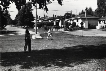
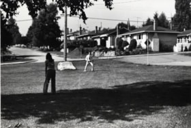
- Photograph shows two people playing with a frisbee in Ron McLean Park near the corner of Hedley Avenue and Clinton Street.
- Repository
- City of Burnaby Archives
- Date
- September 16, 1976
- Collection/Fonds
- Burnaby Public Library Contemporary Visual Archive Project
- Physical Description
- 1 photograph : b&w ; 11 x 16 cm mounted on cardboard
- Description Level
- Item
- Record No.
- 556-402
- Access Restriction
- No restrictions
- Reproduction Restriction
- Reproduce for fair dealing purposes only
- Accession Number
- 2013-13
- Scope and Content
- Photograph shows two people playing with a frisbee in Ron McLean Park near the corner of Hedley Avenue and Clinton Street.
- Media Type
- Photograph
- Photographer
- Ross, Martha
- Notes
- Scope note taken directly from BPL photograph description.
- 1 b&w copy negative : 10 x 12.5 cm accompanying
- Geographic Access
- Hedley Avenue
- Street Address
- 7820 Hedley Avenue
- Planning Study Area
- Stride Hill Area
Images