Narrow Results By

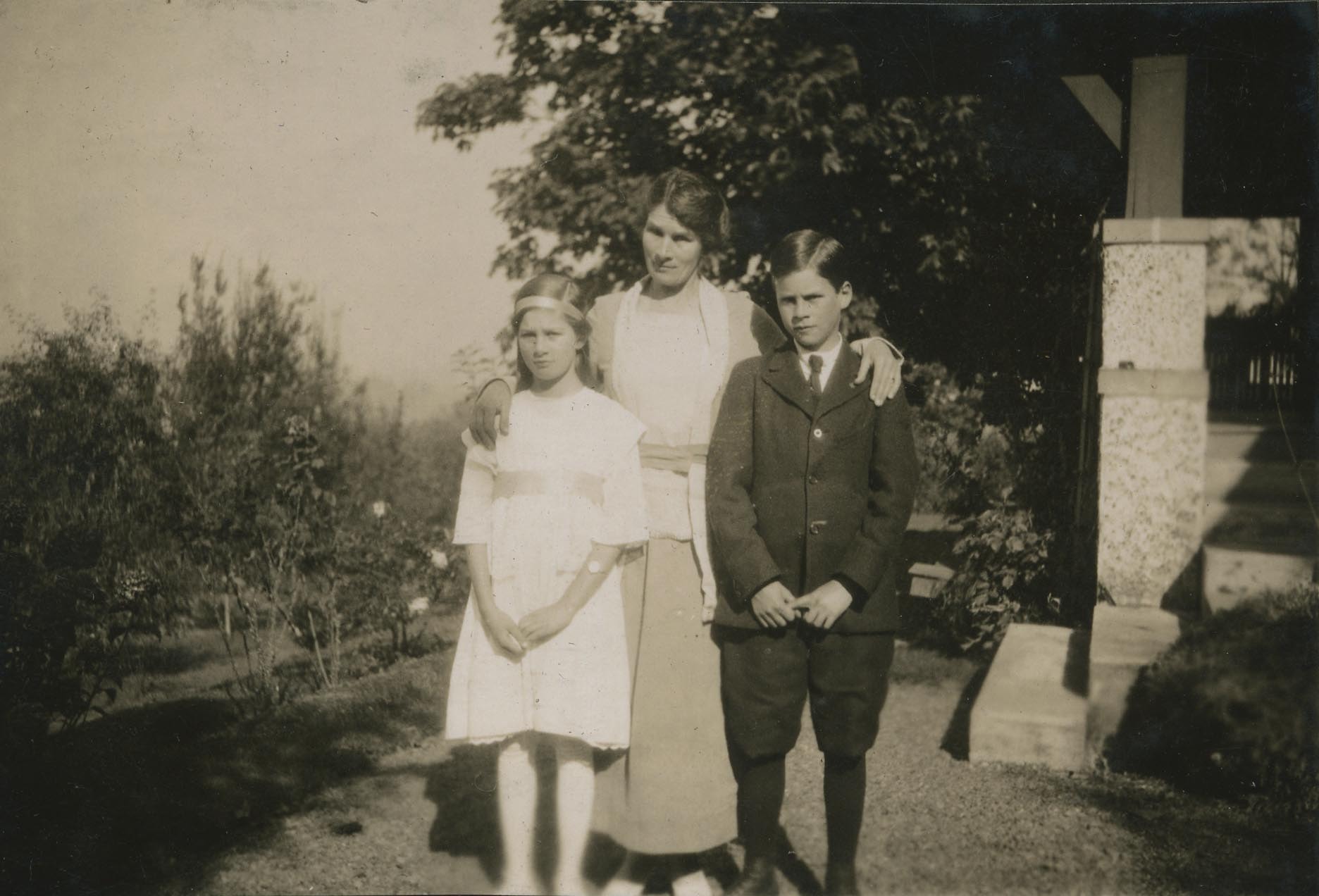
Alice Travers with her children
https://search.heritageburnaby.ca/link/archivedescription39141
- Repository
- City of Burnaby Archives
- Date
- 1921
- Collection/Fonds
- Peers Family and Hill Family fonds
- Description Level
- Item
- Physical Description
- 1 photograph : b&w ; 5 x 8.5 cm on page 24.5 x 32.5 cm (pasted in album)
- Scope and Content
- Photograph of Alice Travers with her two children. The boy is identified as Robbie and the daughter is Maude.
- Repository
- City of Burnaby Archives
- Date
- 1921
- Collection/Fonds
- Peers Family and Hill Family fonds
- Physical Description
- 1 photograph : b&w ; 5 x 8.5 cm on page 24.5 x 32.5 cm (pasted in album)
- Description Level
- Item
- Record No.
- 477-460
- Access Restriction
- No restrictions
- Reproduction Restriction
- No known restrictions
- Accession Number
- 2007-12
- Scope and Content
- Photograph of Alice Travers with her two children. The boy is identified as Robbie and the daughter is Maude.
- Media Type
- Photograph
- Notes
- Title based on caption accompanying photograph
- Geographic Access
- Stanley Street
- Street Address
- 7828 Stanley Street
- Historic Neighbourhood
- Burnaby Lake (Historic Neighbourhood)
- Planning Study Area
- Lakeview-Mayfield Area
Images

Arthur Long Residence
https://search.heritageburnaby.ca/link/landmark560
- Repository
- Burnaby Heritage Planning
- Description
- Residential building.
- Associated Dates
- 1912
- Street View URL
- Google Maps Street View
- Repository
- Burnaby Heritage Planning
- Geographic Access
- Stanley Street
- Associated Dates
- 1912
- Description
- Residential building.
- Heritage Value
- Arthur Long, of the Water Rights Office of Victoria, purchased this land from neighbour Henry Ramsay, and built this beautiful Arts and Crafts styled home. The house appears to have many similarities to the neighbouring Ramsay House, which was designed by Vancouver architect R. Mackay Fripp. The house has retained its original complex gabled roof, triangular eave brackets and horizontal siding.
- Locality
- Burnaby Lake
- Historic Neighbourhood
- Burnaby Lake (Historic Neighbourhood)
- Planning Study Area
- Lakeview-Mayfield Area
- Ownership
- Private
- Street Address
- 7828 Stanley Street
- Street View URL
- Google Maps Street View
Images


![Douglas Road, [1897] (date of original), copied 1978 thumbnail](/media/hpo/_Data/_BVM_Images/1978/1978_0001_0001_001.jpg?width=280)
Douglas Road
https://search.heritageburnaby.ca/link/museumdescription447
- Repository
- Burnaby Village Museum
- Date
- [1897] (date of original), copied 1978
- Collection/Fonds
- Burnaby Village Museum Photograph collection
- Description Level
- Item
- Physical Description
- 1 photograph : b&w ; 20.2 x 25.2 cm print
- Scope and Content
- Photograph of Douglas Road (later renamed in part Canada Way), near Stanley Street. To the right is the Sprott family property, where a few wooden buildings are visible in the cleared area. Charles Sprott, head of the Sprott family, was an important Burnaby politician who was continuously elected t…
- Repository
- Burnaby Village Museum
- Collection/Fonds
- Burnaby Village Museum Photograph collection
- Description Level
- Item
- Physical Description
- 1 photograph : b&w ; 20.2 x 25.2 cm print
- Scope and Content
- Photograph of Douglas Road (later renamed in part Canada Way), near Stanley Street. To the right is the Sprott family property, where a few wooden buildings are visible in the cleared area. Charles Sprott, head of the Sprott family, was an important Burnaby politician who was continuously elected to serve in the municiality as councillor from 1895 to 1903 and as Reeve from 1904 to 1905.
- Subjects
- Geographic Features - Roads
- Land Clearing
- Geographic Access
- Douglas Road
- Canada Way
- Stanley Street
- Accession Code
- HV978.1.1
- Access Restriction
- No restrictions
- Reproduction Restriction
- No known restrictions
- Date
- [1897] (date of original), copied 1978
- Media Type
- Photograph
- Historic Neighbourhood
- Burnaby Lake (Historic Neighbourhood)
- Planning Study Area
- Lakeview-Mayfield Area
- Scan Resolution
- 600
- Scan Date
- 2023-07-25
- Notes
- Title based on contents of photograph
Images
![Douglas Road, [1897] (date of original), copied 1978 thumbnail](/media/hpo/_Data/_BVM_Images/1978/1978_0001_0001_001.jpg)
![Douglas Road, Burnaby, [1908] thumbnail](/media/hpo/_Data/_Archives_Images/_Unrestricted/371/449-009.jpg?width=280)
Douglas Road, Burnaby
https://search.heritageburnaby.ca/link/archivedescription38514
- Repository
- City of Burnaby Archives
- Date
- [1908]
- Collection/Fonds
- Burnaby Historical Society fonds
- Description Level
- Item
- Physical Description
- 1 photograph : sepia postcard ; 8.8 x 14 cm
- Scope and Content
- Photographic postcard taken looking northwest along Douglas Road (now Canada Way) near Stanley Street. Two unidentified people are standing next to a wooden fence running alongside the road (above Lubbock's Creek) and a number of houses (including the Sprott house) are visible in the background. To…
- Repository
- City of Burnaby Archives
- Date
- [1908]
- Collection/Fonds
- Burnaby Historical Society fonds
- Subseries
- Photographs subseries
- Physical Description
- 1 photograph : sepia postcard ; 8.8 x 14 cm
- Description Level
- Item
- Record No.
- 449-009
- Access Restriction
- No restrictions
- Reproduction Restriction
- No known restrictions
- Accession Number
- BHS2007-04
- Scope and Content
- Photographic postcard taken looking northwest along Douglas Road (now Canada Way) near Stanley Street. Two unidentified people are standing next to a wooden fence running alongside the road (above Lubbock's Creek) and a number of houses (including the Sprott house) are visible in the background. To the right is Burnaby Lake. Stamped at the top of the postcard is "Douglas Road, Burnaby / New Westminster BC."
- Subjects
- Geographic Features - Lakes and Ponds
- Documentary Artifacts - Postcards
- Geographic Features - Roads
- Media Type
- Photograph
- Geographic Access
- Douglas Road
- Stanley Street
- Canada Way
- Deer Lake
- Historic Neighbourhood
- Burnaby Lake (Historic Neighbourhood)
- Planning Study Area
- Lakeview-Mayfield Area
Images
![Douglas Road, Burnaby, [1908] thumbnail](/media/hpo/_Data/_Archives_Images/_Unrestricted/371/449-009.jpg)

Henry & Elsa Ramsay Residence
https://search.heritageburnaby.ca/link/landmark592
- Repository
- Burnaby Heritage Planning
- Description
- Residential building.
- Associated Dates
- 1912
- Street View URL
- Google Maps Street View
- Repository
- Burnaby Heritage Planning
- Geographic Access
- Stanley Street
- Associated Dates
- 1912
- Description
- Residential building.
- Heritage Value
- This house was built for Henry Ramsay and his wife, Elsa Kirby (née Burnett), who were married at Holy Trinity Cathedral in New Westminster in 1910. Henry was a real estate agent, originally from Newcastle-on-Tyne, England. Beautifully designed in the Arts and Crafts style, it follows the ideals of the movement in the use of native materials. The wooden construction includes timber porch and roof brackets. The roofline is of a notably low pitch. English-born architect Robert Mackay Fripp (1858-1917) had a varied career working at various times in England, New Zealand and Los Angeles. Fripp found the opportunity in British Columbia to promote his passion for British Arts and Crafts aesthetics through a series of residential and institutional commissions. The Ramsay Residence was built at the height of the Arts and Crafts movement, and Fripp’s output during this period was prolific; his residential designs ranged from modest California bungalows to stately Tudor Revival homes in Shaughnessy, Point Grey and Kerrisdale. This elegant house was built by contractor C.G. Bowden.
- Locality
- Burnaby Lake
- Historic Neighbourhood
- Burnaby Lake (Historic Neighbourhood)
- Planning Study Area
- Lakeview-Mayfield Area
- Architect
- Robert Mackay Fripp
- Area
- 1211.15
- Contributing Resource
- Building
- Ownership
- Private
- Street Address
- 7864 Stanley Street
- Street View URL
- Google Maps Street View
Images


Jacob & Margaret Wysong House
https://search.heritageburnaby.ca/link/landmark507
- Repository
- Burnaby Heritage Planning
- Description
- The Jacob and Margaret Wysong House is a two and one-half storey, wood-frame Arts and Crafts house with a hipped roof and hipped dormers. Symmetrical in massing, it is distinguished by its masonry verandah columns, foundations and chimneys. It is located on a corner lot on Sperling Avenue at Stanle…
- Associated Dates
- 1912
- Formal Recognition
- Heritage Designation, Community Heritage Register
- Street View URL
- Google Maps Street View
- Repository
- Burnaby Heritage Planning
- Geographic Access
- Sperling Avenue
- Associated Dates
- 1912
- Formal Recognition
- Heritage Designation, Community Heritage Register
- Enactment Type
- By-law No. 11978
- Enactment Date
- 17/10/2005
- Description
- The Jacob and Margaret Wysong House is a two and one-half storey, wood-frame Arts and Crafts house with a hipped roof and hipped dormers. Symmetrical in massing, it is distinguished by its masonry verandah columns, foundations and chimneys. It is located on a corner lot on Sperling Avenue at Stanley Street in the Edmonds neighbourhood of South Burnaby.
- Heritage Value
- The Jacob and Margaret Wysong House is significant for illustrating the early development of the Edmonds neighbourhood, a speculative subdivision that was created and marketed during the pre-First World War real estate boom. The area’s proximity to New Westminster, coupled with extensive views and two newly developed streetcar lines, ensured that Edmonds attracted a wave of suburban development. The scale of this house is atypical of the usual suburban lots, and reflects the prominence of this location and its spectacular views. Set on a large lot, the Jacob and Margaret Wysong House is a grand estate home that is one of the earliest, and most prominent, in South Burnaby. This is also an exceptional example of Arts and Crafts architecture, displaying the use of native materials that was a hallmark of the style. The first owners were Jacob Wysong and his wife Margaret. Jacob Wysong, a local contractor, constructed the house in 1912. The stonework is exceptional, and the use of rough-cut granite and fieldstone, with overall shingle cladding, recalls the rustic vernacular common in Western park lodges, and evokes a country lifestyle in harmony with nature. The hipped roof was designed with a flat top that acted as a lookout tower that provided views of the surrounding landscape.
- Defining Elements
- Key elements that define the heritage character of the Jacob and Margaret Wysong House include its: - prominent corner location in the Edmonds neighbourhood of South Burnaby - residential form, scale and massing as expressed by its two and one-half storey plus raised basement height, symmetrical plan, hipped roof with flat top, hipped dormers, and hipped roof over the full open front verandah with a central front gable - masonry elements such as rough-cut granite and fieldstone foundations, verandah columns, stair cheeks, and external and internal chimneys - wooden-frame construction including original cedar shingling on dormers and facing verandah, shingling on remainder of house under later stucco cladding, and surviving original dimensional trim facing verandah and on dormers - Arts and Crafts features such as the use of natural materials, open soffits and angled roof overhang - windows including: double-hung 18-over-1 wooden sash windows; multi-paned casement windows; French doors to verandah; and front door with glazed sidelights - associated landscape features including surrounding mature trees, hedges and perimeter plantings
- Historic Neighbourhood
- Edmonds (Historic Neighbourhood)
- Planning Study Area
- Kingsway-Beresford Area
- Function
- Primary Historic--Single Dwelling
- Primary Current--Single Dwelling
- Community
- Edmonds
- Cadastral Identifier
- P.I.D. 000-497-801
- Boundaries
- The Jacob and Margaret Wysong House is comprised of a single residential lot located at 6325 Sperling Avenue, Burnaby.
- Area
- 1087.62
- Contributing Resource
- Building
- Ownership
- Private
- Documentation
- City of Burnaby Planning and Building Department, Heritage Site Files
- Street Address
- 6325 Sperling Avenue
- Street View URL
- Google Maps Street View
Images


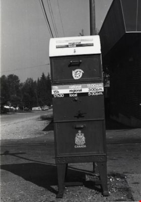
Mailbox
https://search.heritageburnaby.ca/link/archivedescription79933
- Repository
- City of Burnaby Archives
- Date
- September 24, 1976
- Collection/Fonds
- Burnaby Public Library Contemporary Visual Archive Project
- Description Level
- Item
- Physical Description
- 1 photograph : b&w ; 11 x 16 cm mounted on cardboard
- Scope and Content
- Photograph shows mailbox at Stanley Street and Walker Avenue.
- Repository
- City of Burnaby Archives
- Date
- September 24, 1976
- Collection/Fonds
- Burnaby Public Library Contemporary Visual Archive Project
- Physical Description
- 1 photograph : b&w ; 11 x 16 cm mounted on cardboard
- Description Level
- Item
- Record No.
- 556-504
- Access Restriction
- No restrictions
- Reproduction Restriction
- Reproduce for fair dealing purposes only
- Accession Number
- 2013-13
- Scope and Content
- Photograph shows mailbox at Stanley Street and Walker Avenue.
- Media Type
- Photograph
- Photographer
- Born, A. J.
- Notes
- Scope note taken directly from BPL photograph description.
- 1 b&w copy negative : 10 x 12.5 cm accompanying
- Geographic Access
- Stanley Street
- Walker Avenue
- Historic Neighbourhood
- Burnaby Lake (Historic Neighbourhood)
- Planning Study Area
- Morley-Buckingham Area
Images

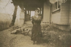
Mam Tabs in front of House of Travers
https://search.heritageburnaby.ca/link/archivedescription39140
- Repository
- City of Burnaby Archives
- Date
- 1921
- Collection/Fonds
- Peers Family and Hill Family fonds
- Description Level
- Item
- Physical Description
- 1 photograph : b&w ; 5.5 x 8 cm on page 24.5 x 32.5 cm (pasted in album)
- Scope and Content
- Photograph of Alice Travers (also know as "Mam Tabs") standing outside the Travers family home on Stanley Street.
- Repository
- City of Burnaby Archives
- Date
- 1921
- Collection/Fonds
- Peers Family and Hill Family fonds
- Physical Description
- 1 photograph : b&w ; 5.5 x 8 cm on page 24.5 x 32.5 cm (pasted in album)
- Description Level
- Item
- Record No.
- 477-459
- Access Restriction
- No restrictions
- Reproduction Restriction
- No known restrictions
- Accession Number
- 2007-12
- Scope and Content
- Photograph of Alice Travers (also know as "Mam Tabs") standing outside the Travers family home on Stanley Street.
- Names
- Travers, Alice
- Media Type
- Photograph
- Notes
- Title based on caption accompanying photograph
- Geographic Access
- Stanley Street
- Street Address
- 7828 Stanley Street
- Historic Neighbourhood
- Burnaby Lake (Historic Neighbourhood)
- Planning Study Area
- Lakeview-Mayfield Area
Images
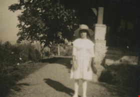
Maude Travers
https://search.heritageburnaby.ca/link/archivedescription39143
- Repository
- City of Burnaby Archives
- Date
- 1921
- Collection/Fonds
- Peers Family and Hill Family fonds
- Description Level
- Item
- Physical Description
- 1 photograph : b&w ; 5.5 x 7.8 cm on page 24.5 x 32.5 cm (pasted in album)
- Scope and Content
- Photograph of Maude Travers, the daughter of Alice Travers standing outside the Travers family home.
- Repository
- City of Burnaby Archives
- Date
- 1921
- Collection/Fonds
- Peers Family and Hill Family fonds
- Physical Description
- 1 photograph : b&w ; 5.5 x 7.8 cm on page 24.5 x 32.5 cm (pasted in album)
- Description Level
- Item
- Record No.
- 477-462
- Access Restriction
- No restrictions
- Reproduction Restriction
- No known restrictions
- Accession Number
- 2007-12
- Scope and Content
- Photograph of Maude Travers, the daughter of Alice Travers standing outside the Travers family home.
- Names
- Travers, Maude
- Media Type
- Photograph
- Notes
- Title based on caption accompanying photograph
- Geographic Access
- Stanley Street
- Street Address
- 7828 Stanley Street
- Historic Neighbourhood
- Burnaby Lake (Historic Neighbourhood)
- Planning Study Area
- Lakeview-Mayfield Area
Images

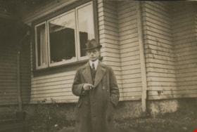
R.D. Travers
https://search.heritageburnaby.ca/link/archivedescription39142
- Repository
- City of Burnaby Archives
- Date
- 1921
- Collection/Fonds
- Peers Family and Hill Family fonds
- Description Level
- Item
- Physical Description
- 1 photograph : b&w ; 5.5 x 8 cm on page 24.5 x 32.5 cm (pasted in album)
- Scope and Content
- Photograph of R.D. Travers outside the Travers family home.
- Repository
- City of Burnaby Archives
- Date
- 1921
- Collection/Fonds
- Peers Family and Hill Family fonds
- Physical Description
- 1 photograph : b&w ; 5.5 x 8 cm on page 24.5 x 32.5 cm (pasted in album)
- Description Level
- Item
- Record No.
- 477-461
- Access Restriction
- No restrictions
- Reproduction Restriction
- No known restrictions
- Accession Number
- 2007-12
- Scope and Content
- Photograph of R.D. Travers outside the Travers family home.
- Names
- Travers, Robert
- Media Type
- Photograph
- Notes
- Title based on caption accompanying photograph
- Geographic Access
- Stanley Street
- Street Address
- 7828 Stanley Street
- Historic Neighbourhood
- Burnaby Lake (Historic Neighbourhood)
- Planning Study Area
- Lakeview-Mayfield Area
Images

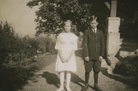
Robbie and Maude Travers
https://search.heritageburnaby.ca/link/archivedescription39144
- Repository
- City of Burnaby Archives
- Date
- 1921
- Collection/Fonds
- Peers Family and Hill Family fonds
- Description Level
- Item
- Physical Description
- 1 photograph : b&w ; 5.5 x 8 cm on page 24.5 x 32.5 cm (pasted in album)
- Scope and Content
- Photograph of the Travers children, Robbie and his sister, Maude. The photograph was taken outside the Travers home.
- Repository
- City of Burnaby Archives
- Date
- 1921
- Collection/Fonds
- Peers Family and Hill Family fonds
- Physical Description
- 1 photograph : b&w ; 5.5 x 8 cm on page 24.5 x 32.5 cm (pasted in album)
- Description Level
- Item
- Record No.
- 477-463
- Access Restriction
- No restrictions
- Reproduction Restriction
- No known restrictions
- Accession Number
- 2007-12
- Scope and Content
- Photograph of the Travers children, Robbie and his sister, Maude. The photograph was taken outside the Travers home.
- Media Type
- Photograph
- Notes
- Title based on caption accompanying photograph
- Geographic Access
- Stanley Street
- Street Address
- 7828 Stanley Street
- Historic Neighbourhood
- Burnaby Lake (Historic Neighbourhood)
- Planning Study Area
- Lakeview-Mayfield Area
Images


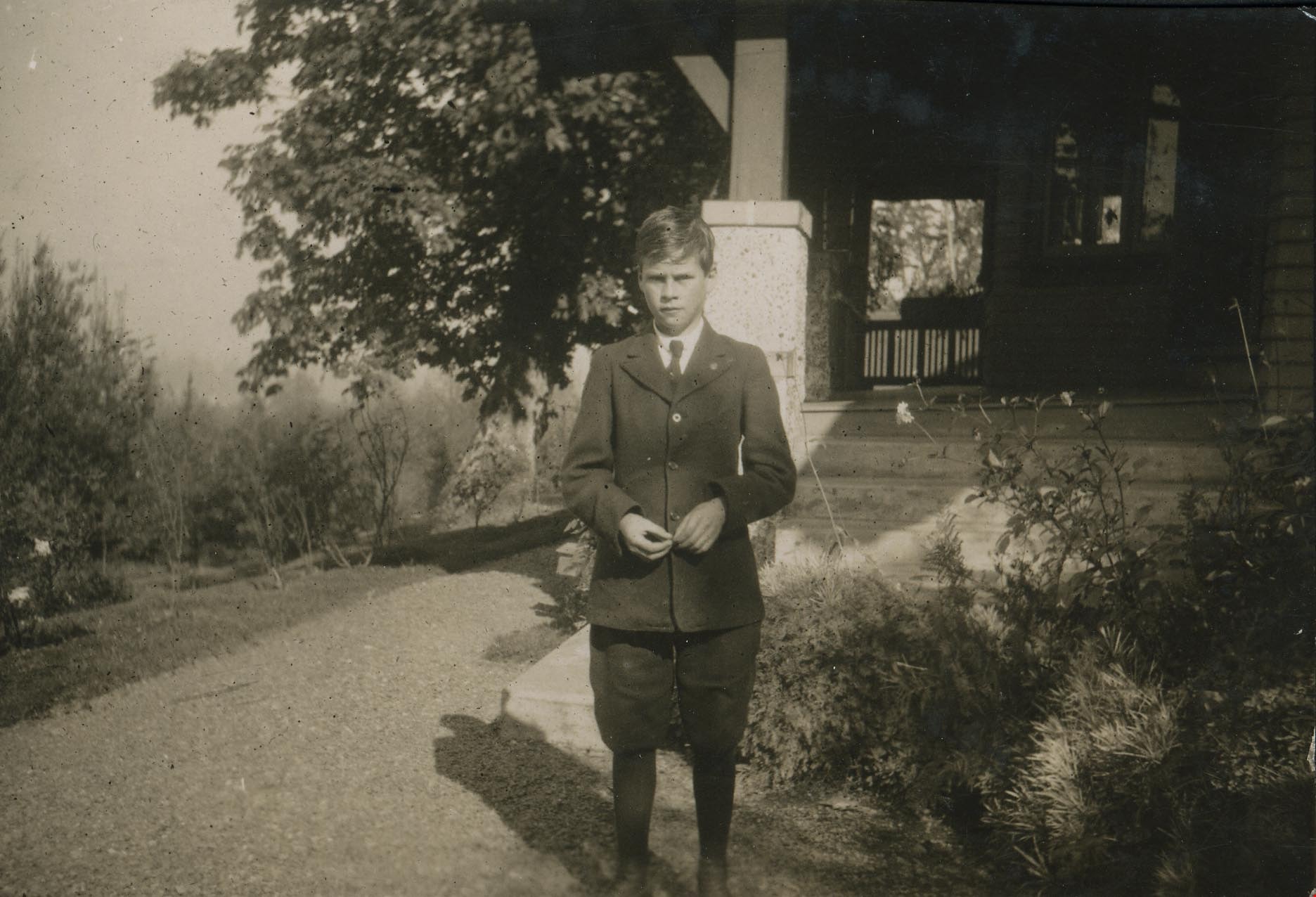
Robbie Travers
https://search.heritageburnaby.ca/link/archivedescription39145
- Repository
- City of Burnaby Archives
- Date
- 1921
- Collection/Fonds
- Peers Family and Hill Family fonds
- Description Level
- Item
- Physical Description
- 1 photograph : b&w ; 5.5 x 8 cm on page 24.5 x 32.5 cm (pasted in album)
- Scope and Content
- Photograph of Robbie Travers outside the Travers family home.
- Repository
- City of Burnaby Archives
- Date
- 1921
- Collection/Fonds
- Peers Family and Hill Family fonds
- Physical Description
- 1 photograph : b&w ; 5.5 x 8 cm on page 24.5 x 32.5 cm (pasted in album)
- Description Level
- Item
- Record No.
- 477-464
- Access Restriction
- No restrictions
- Reproduction Restriction
- No known restrictions
- Accession Number
- 2007-12
- Scope and Content
- Photograph of Robbie Travers outside the Travers family home.
- Names
- Travers, Robbie
- Media Type
- Photograph
- Notes
- Title based on caption accompanying photograph
- Geographic Access
- Stanley Street
- Street Address
- 7828 Stanley Street
- Historic Neighbourhood
- Burnaby Lake (Historic Neighbourhood)
- Planning Study Area
- Lakeview-Mayfield Area
Images
![Wysong House and windmill, [1920] thumbnail](/media/hpo/_Data/_Archives_Images/_Unrestricted/251/294-003.jpg?width=280)
Wysong House and windmill
https://search.heritageburnaby.ca/link/archivedescription36549
- Repository
- City of Burnaby Archives
- Date
- [1920]
- Collection/Fonds
- Burnaby Historical Society fonds
- Description Level
- Item
- Physical Description
- 1 photograph : b&w ; 12.5 x 17.5 cm print
- Scope and Content
- Photograph of the side of the Wysong house taken from Stanley Street. The edge of the windmill is just visible on the left.
- Repository
- City of Burnaby Archives
- Date
- [1920]
- Collection/Fonds
- Burnaby Historical Society fonds
- Subseries
- Wysong family subseries
- Physical Description
- 1 photograph : b&w ; 12.5 x 17.5 cm print
- Description Level
- Item
- Record No.
- 294-003
- Access Restriction
- No restrictions
- Reproduction Restriction
- No known restrictions
- Accession Number
- BHS1992-32
- Scope and Content
- Photograph of the side of the Wysong house taken from Stanley Street. The edge of the windmill is just visible on the left.
- Media Type
- Photograph
- Notes
- Title based on contents of photograph
- Geographic Access
- Sperling Avenue
- Street Address
- 6325 Sperling Avenue
- Historic Neighbourhood
- Edmonds (Historic Neighbourhood)
- Planning Study Area
- Kingsway-Beresford Area
Images
![Wysong House and windmill, [1920] thumbnail](/media/hpo/_Data/_Archives_Images/_Unrestricted/251/294-003.jpg)