Narrow Results By
Subject
- Accidents 1
- Accidents - Automobile Accidents 3
- Advertising Medium - Signs and Signboards 1
- Aerial Photographs 8
- Agricultural Tools and Equipment 3
- Agricultural Tools and Equipment - Gardening Equipment 1
- Agriculture 5
- Agriculture - Crops 4
- Agriculture - Dairy 1
- Agriculture - Farms 7
- Agriculture - Fruit and Berries 2
- Animals - Bears 1
Bylaw Number: 4656 - Town Planning Bylaw 1948, Amendment No 17, 1964
https://search.heritageburnaby.ca/link/bylaw19713
- Repository
- Legislative Services
- Bylaw Number
- 4656
- Format
- Bylaws - Repealed
- Collection/Fonds
- City Council and Office of the City Clerk fonds
- Repository
- Legislative Services
- Bylaw Number
- 4656
- Format
- Bylaws - Repealed
- Collection/Fonds
- City Council and Office of the City Clerk fonds
Documents

Hans & Anna Hau Residence
https://search.heritageburnaby.ca/link/landmark588
- Repository
- Burnaby Heritage Planning
- Description
- Residential building.
- Associated Dates
- c.1935
- Street View URL
- Google Maps Street View
- Repository
- Burnaby Heritage Planning
- Geographic Access
- Canada Way
- Associated Dates
- c.1935
- Description
- Residential building.
- Heritage Value
- Danish builder Hans Jorgensen Hau (1878-1944) and his wife Anna (née Sorenson, 1874-1956), constructed this highly-distinctive Tudor Revival residence circa 1935. This was a time of entrenched traditionalism, and most domestic architecture reflected period revival styles. Tudor elements have been compressed here into a cottage form, including a distinctive front façade with half timbering and brick noggin; on the sides the nogging is rock-dash stucco. Casement windows contribute to the cottage appearance. The rear façade is clad with more utilitarian shingles. A prominent brick chimney exhibits angled and corbelled brickwork. Hau worked as a bricklayer and stonemason, and this house has common elements with the Moore Residence at 5165 Sperling Avenue, which Hau designed and constructed in 1943.
- Locality
- Burnaby Lake
- Historic Neighbourhood
- Burnaby Lake (Historic Neighbourhood)
- Planning Study Area
- Morley-Buckingham Area
- Area
- 2010.52
- Contributing Resource
- Building
- Ownership
- Private
- Street Address
- 5070 Canada Way
- Street View URL
- Google Maps Street View
Images


Lochdale Neighbourhood
https://search.heritageburnaby.ca/link/landmark668
- Repository
- Burnaby Heritage Planning
- Associated Dates
- 1925-1954
- Heritage Value
- In the 1931 "Burnaby Year Book" the Lochdale neighbourhood is described as follows: "Lochdale…is situated at the intersection of the Hastings-Barnet road at the point where Sperling Avenue crosses…Situated at the intersection…there are an up to date service station and a general store, at which the Lochdale Post Office is situated. Immediately north of this is the seventy acres on which the Shell Oil Co. are to build an up-to-date refinery...On going south on Sperling Avenue can be found some lovely homes of the residents, all of which possess the most beautiful flower gardens, some of which are hobbies, and some being in the nature of a business. Others are engaged in chicken farming...while others find employment at the Barnet Mill about two miles east on the Hastings-Barnet Road."
- Historic Neighbourhood
- Lochdale (Historic Neighbourhood)
- Planning Study Area
- Lochdale Area
Images


Lochdale Neighbourhood
https://search.heritageburnaby.ca/link/landmark743
- Repository
- Burnaby Heritage Planning
- Associated Dates
- 1905-1924
- Heritage Value
- "Picturesquely situated on the south-westerly slope of the highest hill on the Burrard Peninsula is a district that in many ways resembles the early pioneer settlements…its centre is at the intersection of east Hastings Street and Sperling Avenue. Only a few years ago a dense forest covered this area and the settlers were few and some distance apart. After the war working men began to enter the Lochdale woods in quest of cheap home-sites. Today there are more than 400 residents in the district who combine to make a happy contented industrious community living on the edge of a big city yet enjoying the life offered by the country...The Community Hall is the centre of all social activities. Dances, concerts and other forms of entertainment are all there...Curtis Street runs from Sperling Avenue up to the hill, locally known as Hastings Grove. From the top on a clear day there is a view for miles around." ~ From the Sunday Province, March 8, 1925.
- Historic Neighbourhood
- Lochdale (Historic Neighbourhood)
- Planning Study Area
- Lochdale Area
Images


Hastings Grove Neighbourhood
https://search.heritageburnaby.ca/link/landmark746
- Repository
- Burnaby Heritage Planning
- Associated Dates
- 1905-1924
- Heritage Value
- During the height of the real estate boom between 1909 and 1913, Vancouver developer Frederick Munson plotted the subdivision of more than 150 acres of land on Curtis Street east of Sperling Avenue, on the newly logged slopes of remote Burnaby Mountain. Burnaby opened up Curtis Street to facilitate access to Hastings Grove and Munson agreed to pay one-third of the cost but never did. He also paid only $1000.00 down on the agreed price of the land. When he failed to make further payments, the mortgage holders foreclosed and re-sold the properties. People who had bought lots from Munson lost not only the land they though they owned, but also the money they had paid for it. Hastings Grove was a disaster. The converted automobile - which served as the bus - stopped running. The few houses and most of the lots reverted to the Municipality because of non-payment of taxes and are now part of Burnaby Mountain Park. The only remaining building is the old Hastings Grove Store which still stands as an apartment building.
- Historic Neighbourhood
- Lochdale (Historic Neighbourhood)
- Planning Study Area
- Lochdale Area
Images


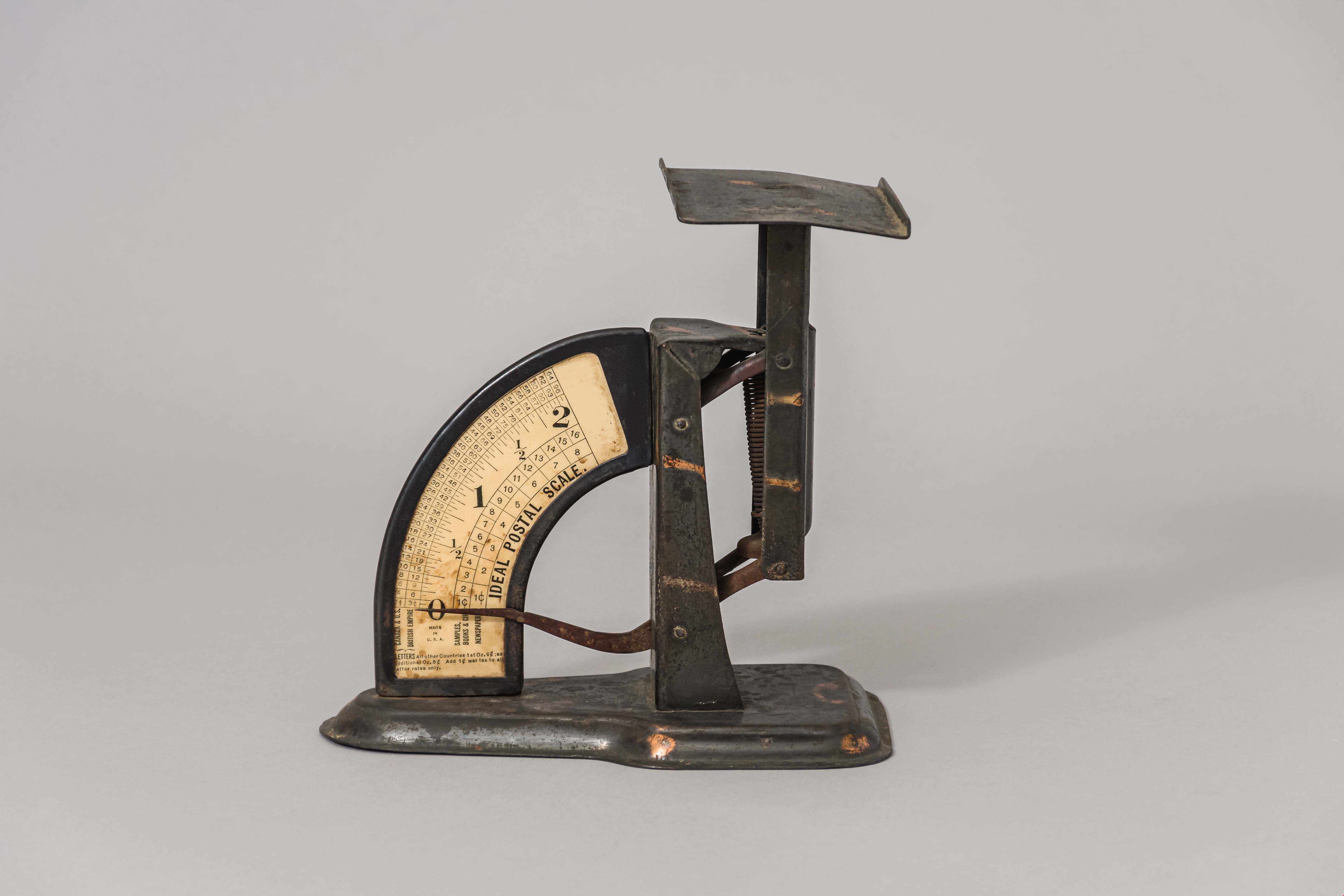
postal scale
https://search.heritageburnaby.ca/link/museumartifact15965
- Repository
- Burnaby Village Museum
- Accession Code
- HV983.61.3
- Description
- Postal scale, "IDEAL POSTAL SCALE"
- Object History
- Postal scale used by Harriet Woodward at the Burnaby Lake Post Office. The Burnaby Lake Post Office was run out of the Woodward cottage, owned by Harriet and Maude Woodward. The cottage was a prefabricated cottage erected in 1904. Harriet also began a small private school in the cottage, the first in Burnaby Lake. The cottage was enlarged with several additions until 1912 when the Woodwards built a new house.
- Classification
- Weights and Measurements Tools and Equipment - Scales
- Object Term
- Scale, Postal
- Geographic Access
- Sperling Avenue
- Street Address
- 5141 Sperling Avenue
- Historic Neighbourhood
- Burnaby Lake (Historic Neighbourhood)
- Planning Study Area
- Morley-Buckingham Area
Images
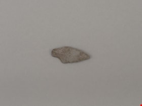
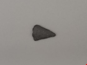
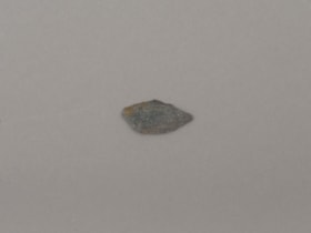
projectile point
https://search.heritageburnaby.ca/link/museumartifact19193
- Repository
- Burnaby Village Museum
- Accession Code
- BV002.57.6
- Description
- Projectile point, stone; rounded end. Bifacially flaked – stone removed on both sides of the point; basalt and lead shaped
- Object History
- The donor inherited this artifact from his mother, Katherine Maude (Kitty) Peers, who inherited them from her father, Louis Claude Hill. The artifacts were found on his farm, Brookfield Farm, at Douglas Road and Sperling Avenue (now site of Burnaby Village Museum).
- Culture Phase: Possibly Locarno Beach phase (3520 -2200 Before Present)
- Historic Neighbourhood
- Burnaby Lake (Historic Neighbourhood)
Images
Documents
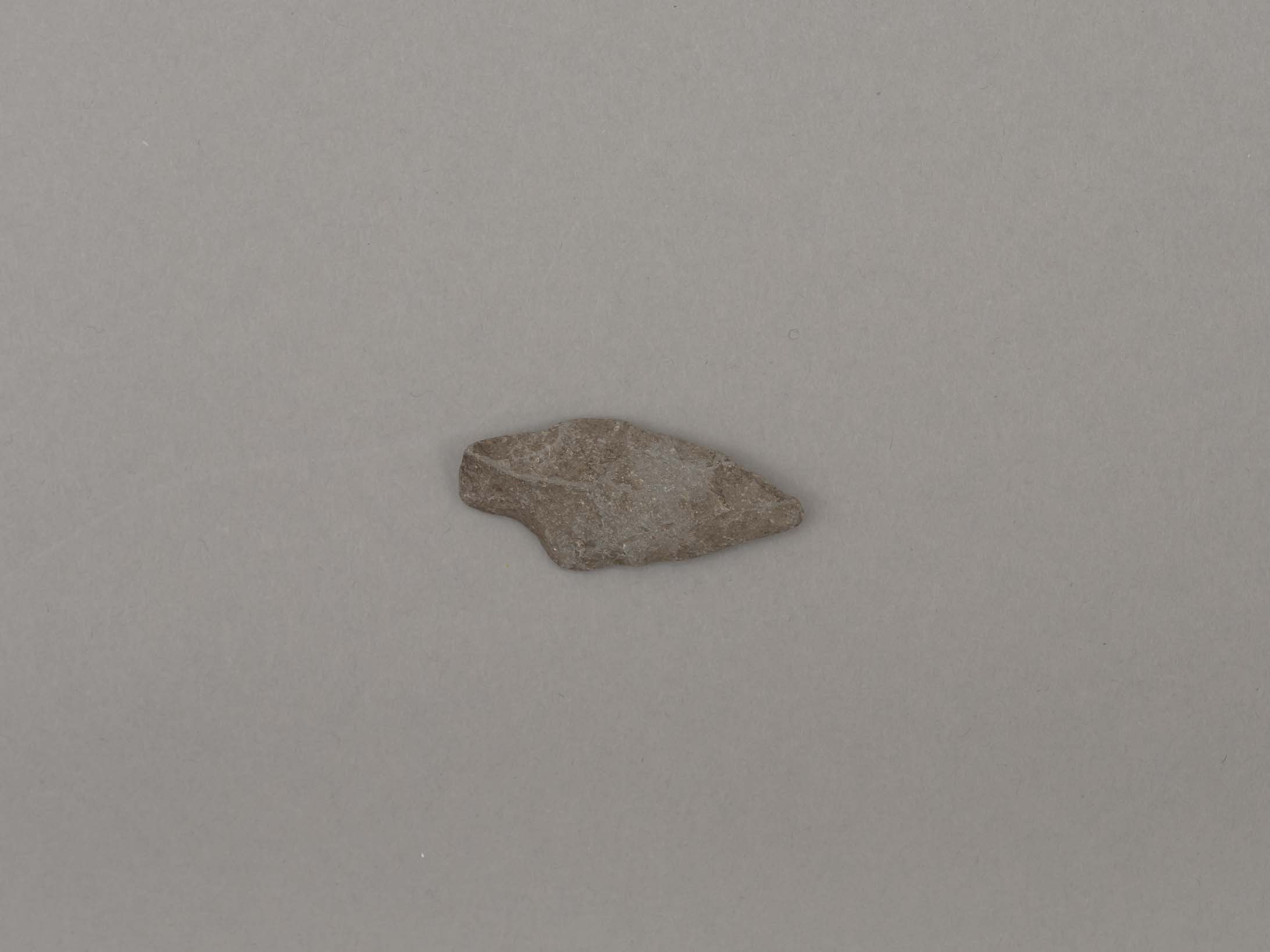
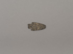
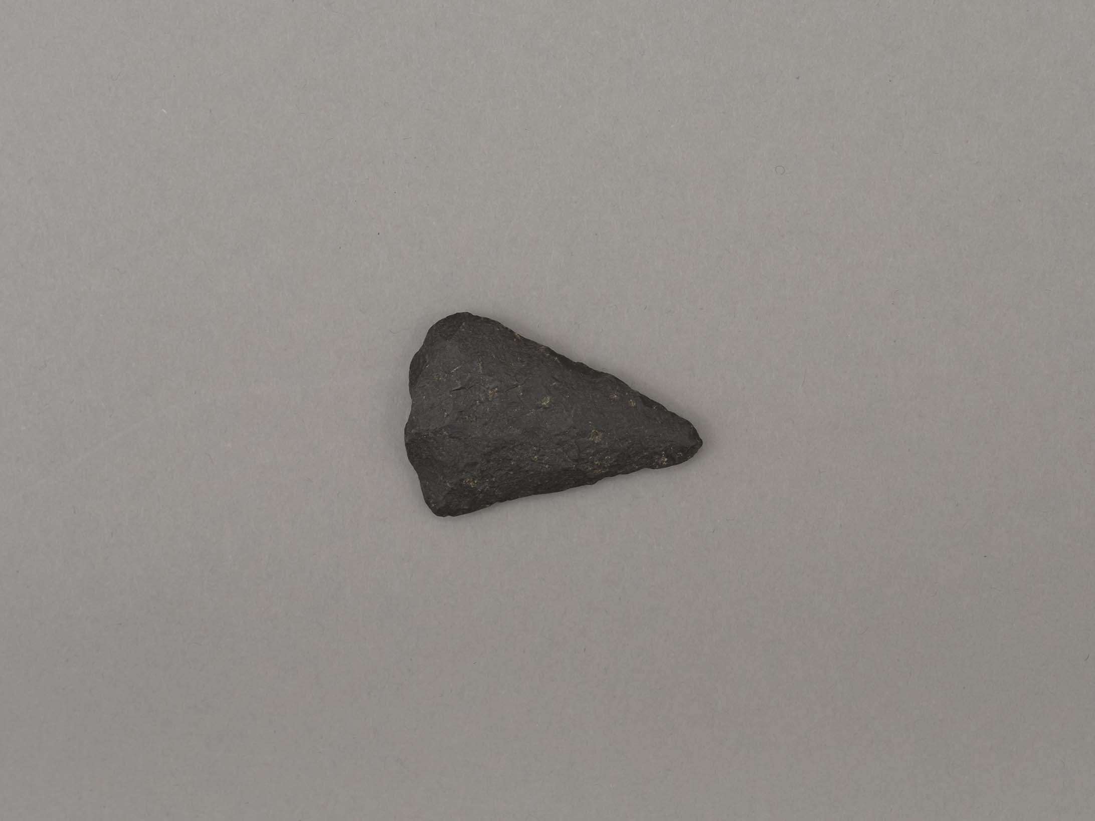
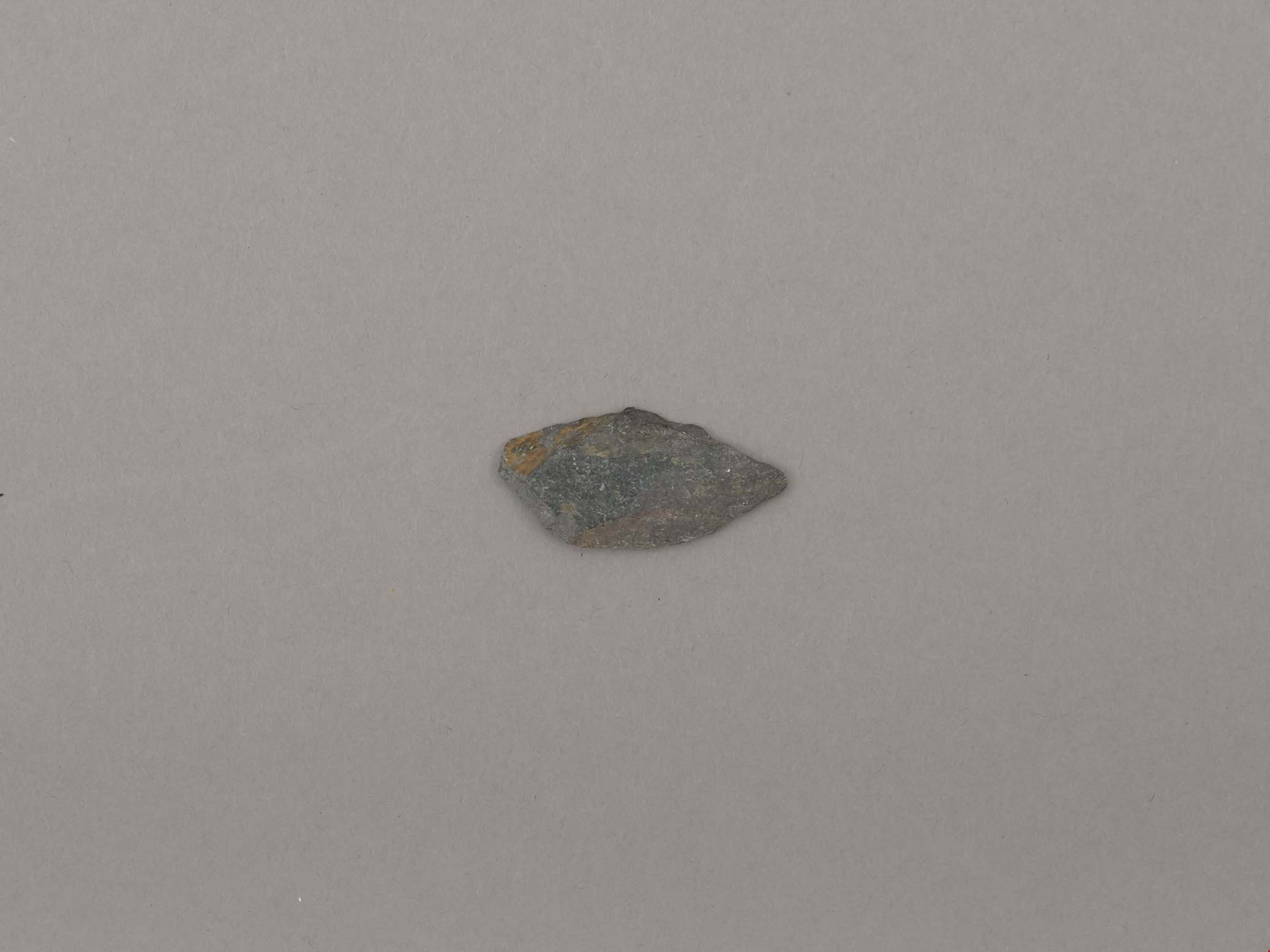
projectile point
https://search.heritageburnaby.ca/link/museumartifact19194
- Repository
- Burnaby Village Museum
- Accession Code
- BV002.57.7
- Description
- Projectile point, stone; indented on one side. Triangular stemmed projectile point
- Object History
- The donor inherited this artifact from his mother, Katherine Maude (Kitty) Peers, who inherited them from her father, Louis Claude Hill. The artifacts were found on his farm, Brookfield Farm, at Douglas Road and Sperling Avenue (now site of Burnaby Village Museum).
- Culture Phase: Possibly Locarno Beach phase (3520 -2200 Before Present)
- Geographic Access
- Deer Lake Avenue
- Historic Neighbourhood
- Burnaby Lake (Historic Neighbourhood)
- Planning Study Area
- Burnaby Lake Area
Images
Documents
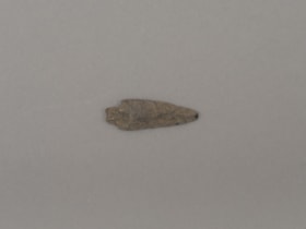
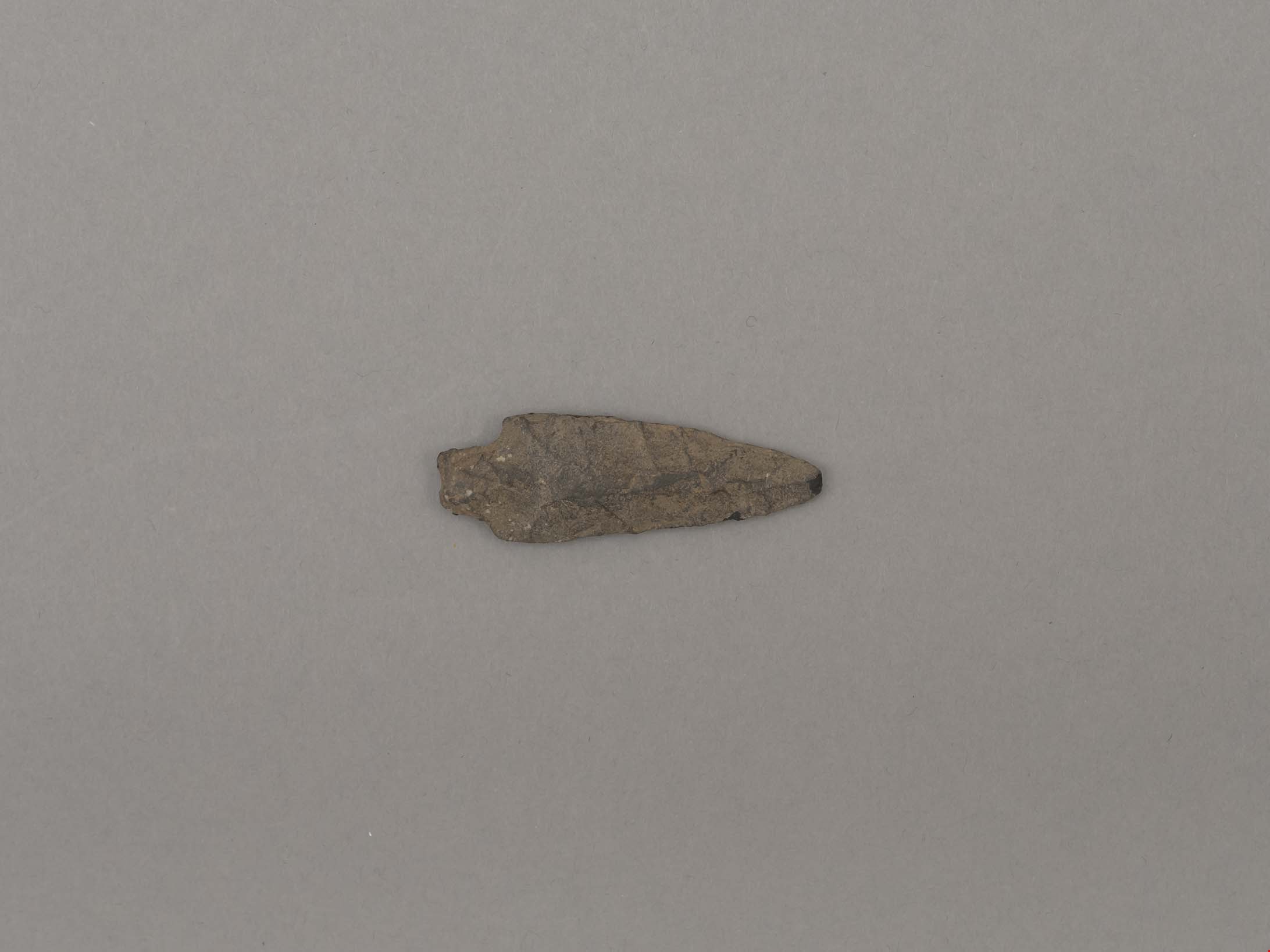
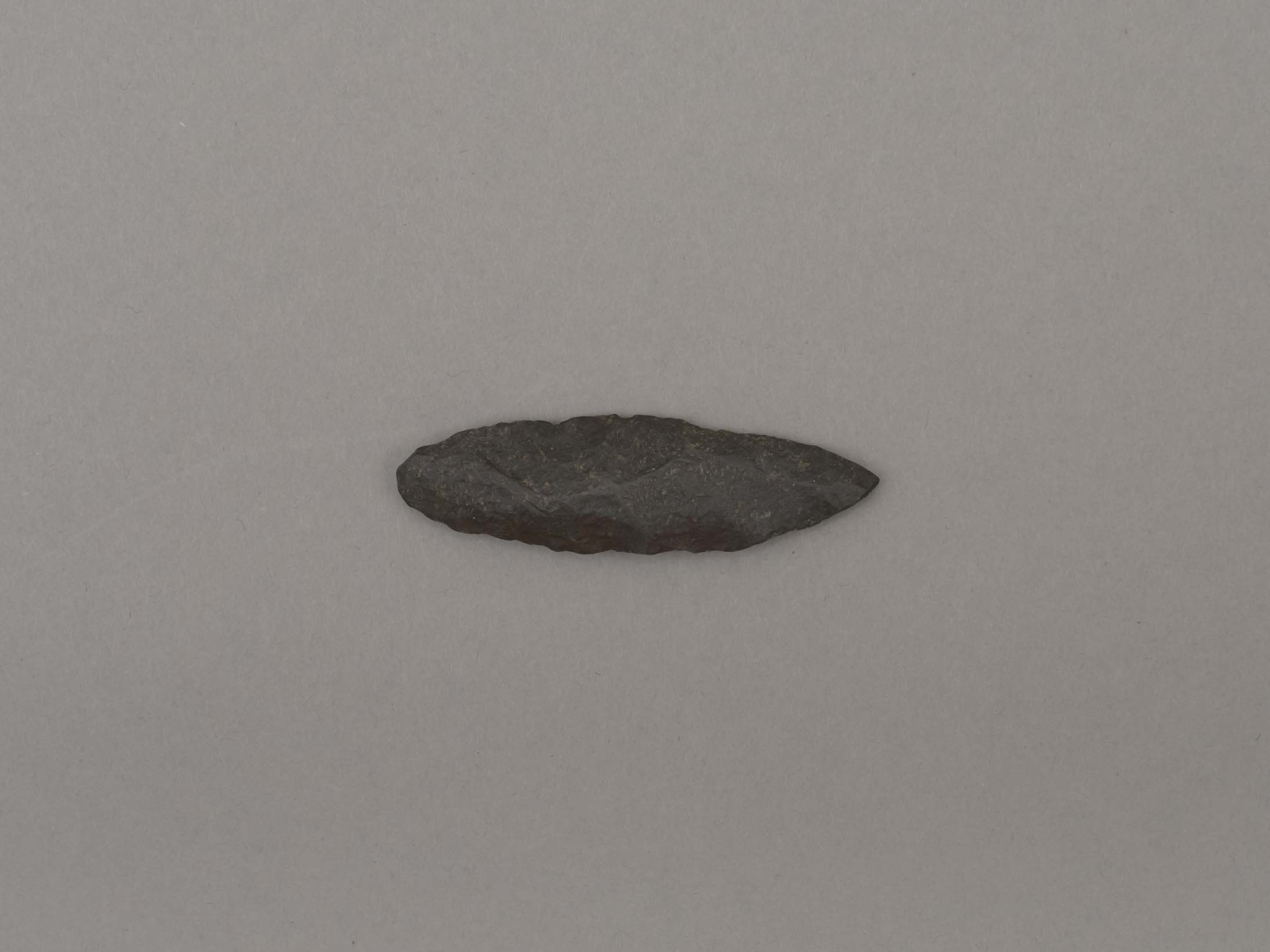
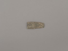
projectile point
https://search.heritageburnaby.ca/link/museumartifact19195
- Repository
- Burnaby Village Museum
- Accession Code
- BV002.57.8
- Description
- Projectile point, stone. Lancelot, parallel stemmed – stem has straight sides (squared off appearance).
- Object History
- The donor inherited this artifact from his mother, Katherine Maude (Kitty) Peers, who inherited them from her father, Louis Claude Hill. The artifacts were found on his farm, Brookfield Farm, at Douglas Road and Sperling Avenue (now site of Burnaby Village Museum).
- Longer points like this were used on spears; sometimes in combination with a tool called an atl atl (spear thrower).
- Culture Phase: Possibly Locarno Beach phase (3520 -2200 Before Present)
- Historic Neighbourhood
- Burnaby Lake (Historic Neighbourhood)
Images
Documents

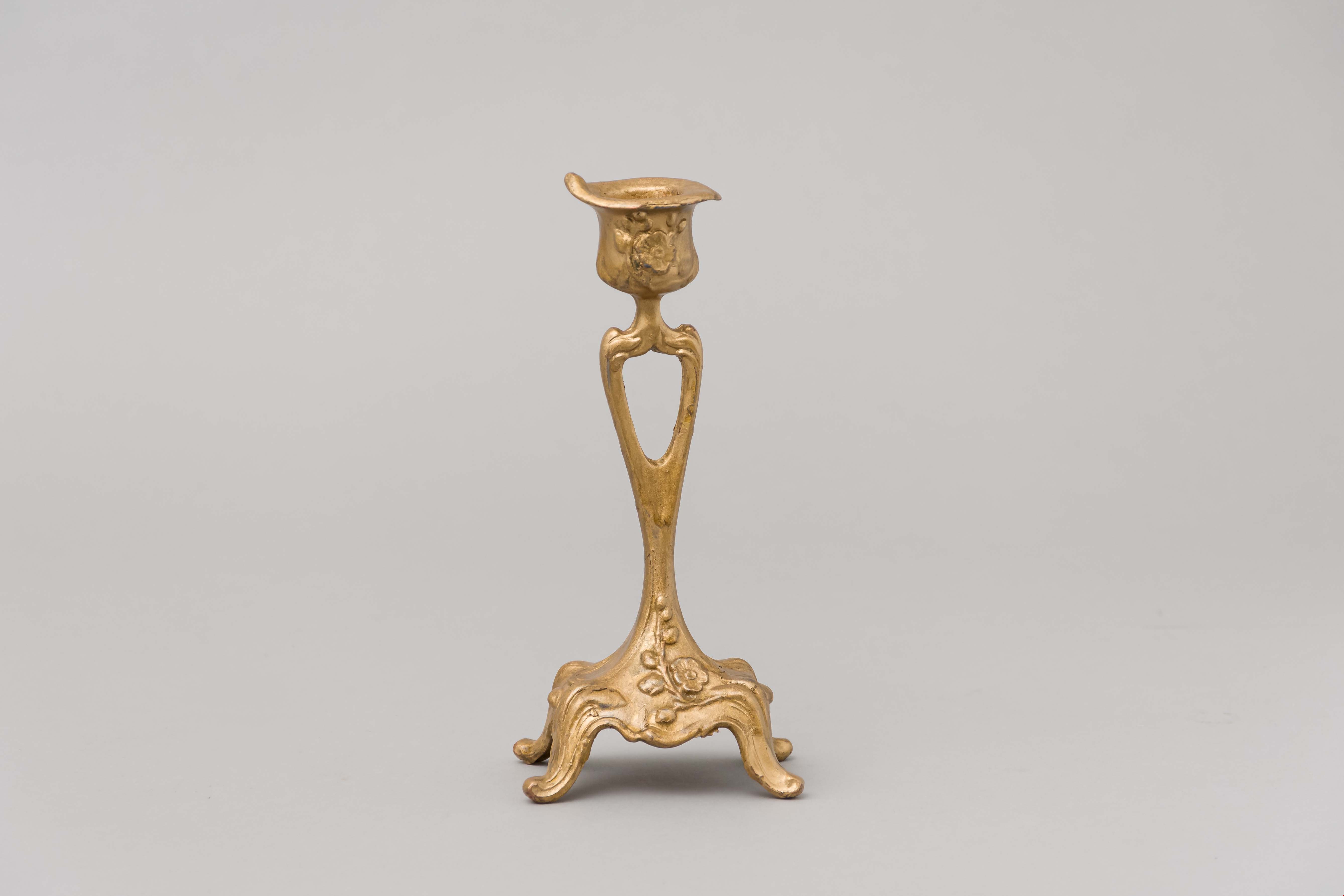
candlestick
https://search.heritageburnaby.ca/link/museumartifact23057
- Repository
- Burnaby Village Museum
- Accession Code
- HV976.178.8
- Description
- Candlestick
- Object History
- This item belonged to a family who lived on Sperling Avenue in Burnaby in the 1950s.
- Category
- 02. Furnishings
- Classification
- Lighting Equipment - - Lighting Devices
- Object Term
- Candle
- Subjects
- Lighting Devices
Images

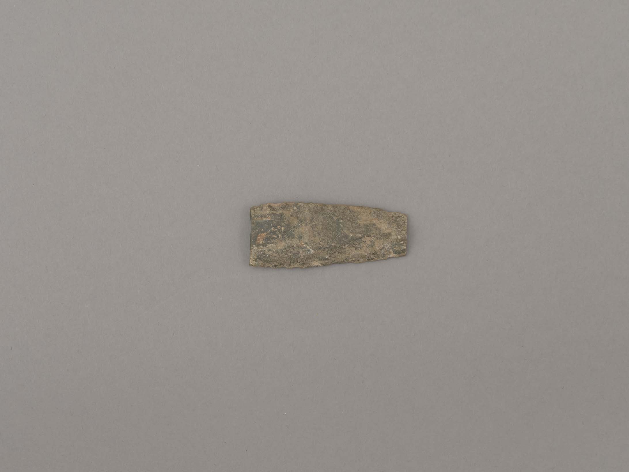
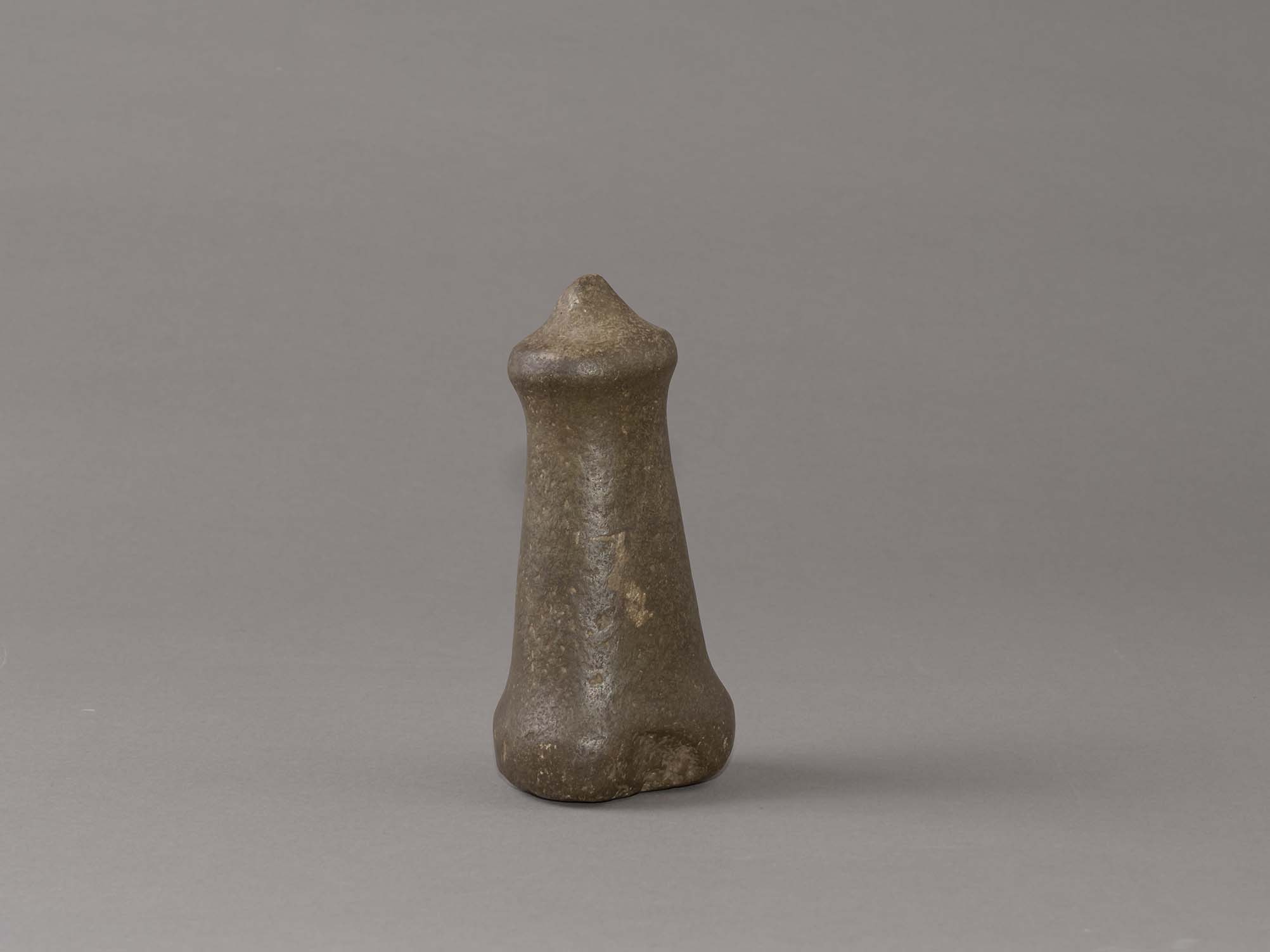
hand maul
https://search.heritageburnaby.ca/link/museumartifact44853
- Repository
- Burnaby Village Museum
- Accession Code
- BV002.57.1
- Description
- Nipple topped stone maul. It has a pointed tip and a slight indentation on side of base. There is adhesive residue on bottom of base.
- Object History
- The donor inherited this artifact from his mother, Katherine Maude (Kitty) Peers, who inherited them from her father, Louis Claude Hill. The artifacts were found on his farm, Brookfield Farm, at Douglas Road and Sperling Avenue (now site of Burnaby Village Museum). In general, hand mauls are used in woodworking todrive antler wedges or spreading sticks into logs and split planks. They were also used in combination with chisels for detail work. Their presence at an archeological site is viewed as evidence of long term habitations. They are associated with house building, canoe building, housepost and welcome figure carving. Nipple top hand mauls are identified as Marpole Culture (400 BC - 400 AD).
- Subjects
- Persons
- Indigenous peoples - British Columbia
- Woodworking Tools and Equipment
- Woodworking Tools and Equipment - Maul
- Archeological Specimen
- Historic Neighbourhood
- Burnaby Lake (Historic Neighbourhood)
Images
Documents
hand maul
https://search.heritageburnaby.ca/link/museumartifact44854
- Repository
- Burnaby Village Museum
- Accession Code
- BV002.57.2
- Description
- Conical topped stone maul; damaged by a plow.
- Object History
- The donor inherited this artifact from his mother, Katherine Maude (Kitty) Peers, who inherited them from her father, Louis Claude Hill. The artifacts were found on his farm, Brookfield Farm, at Douglas Road and Sperling Avenue (now site of Burnaby Village Museum).
- In general, hand mauls are used in woodworking todrive antler wedges or spreading sticks into logs and split planks. They were also used in combination with chisels for detail work. Their presence at an archeological site is viewed as evidence of long term habitations. They are associated with house building, canoe building, housepost and welcome figure carving. Flat and conical topped hand mauls are identified as Gulf of Georgia Culture (400 AD - 1800).
- Subjects
- Persons
- Indigenous peoples - British Columbia
- Woodworking Tools and Equipment
- Woodworking Tools and Equipment - Maul
- Archeological Specimen
- Historic Neighbourhood
- Burnaby Lake (Historic Neighbourhood)
Images

Documents

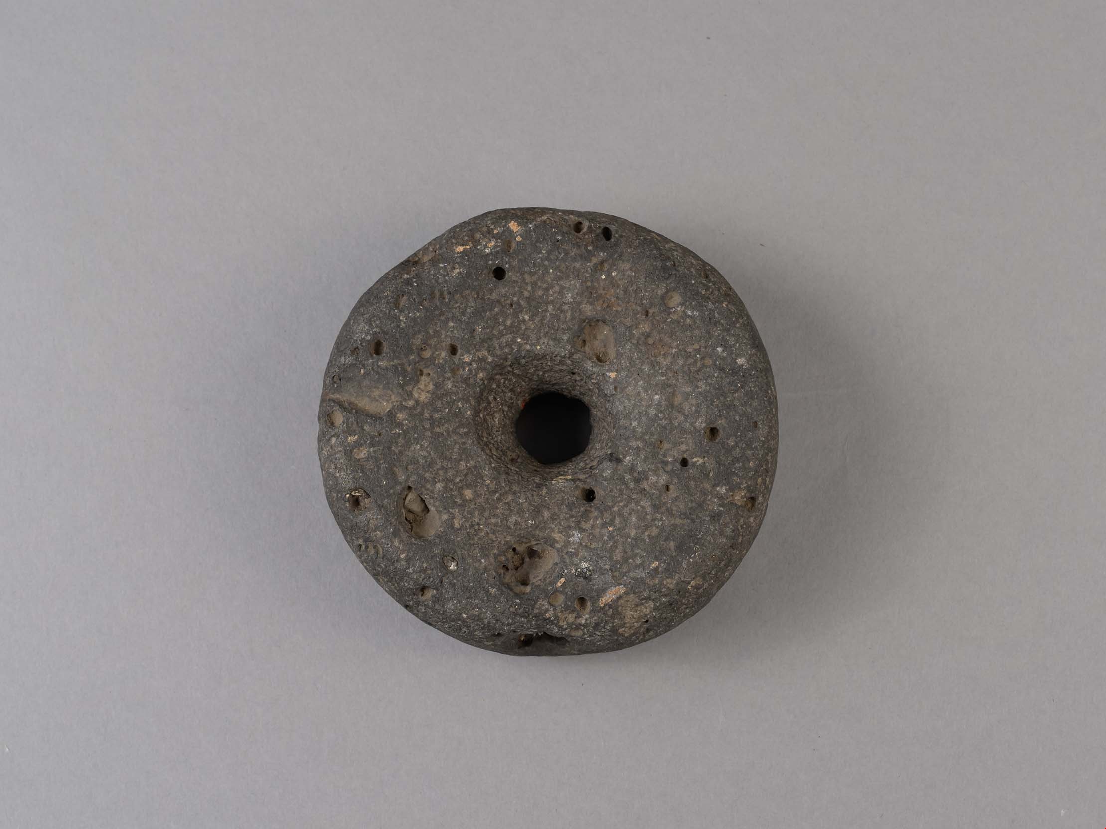
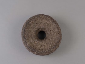
weight
https://search.heritageburnaby.ca/link/museumartifact44855
- Repository
- Burnaby Village Museum
- Accession Code
- BV002.57.3
- Description
- Net weight, round, stone, doughnut-shaped with hole in the middle.
- Object History
- The donor inherited this artifact from his mother, Katherine Maude (Kitty) Peers, who inherited them from her father, Louis Claude Hill. The artifacts were found on his farm, Brookfield Farm, at Douglas Road and Sperling Avenue (now site of Burnaby Village Museum).
- Subjects
- Persons
- Indigenous peoples - British Columbia
- Weights and Measurements Tools and Equipment
- Archeological Specimen
- Historic Neighbourhood
- Burnaby Lake (Historic Neighbourhood)
Images
Documents
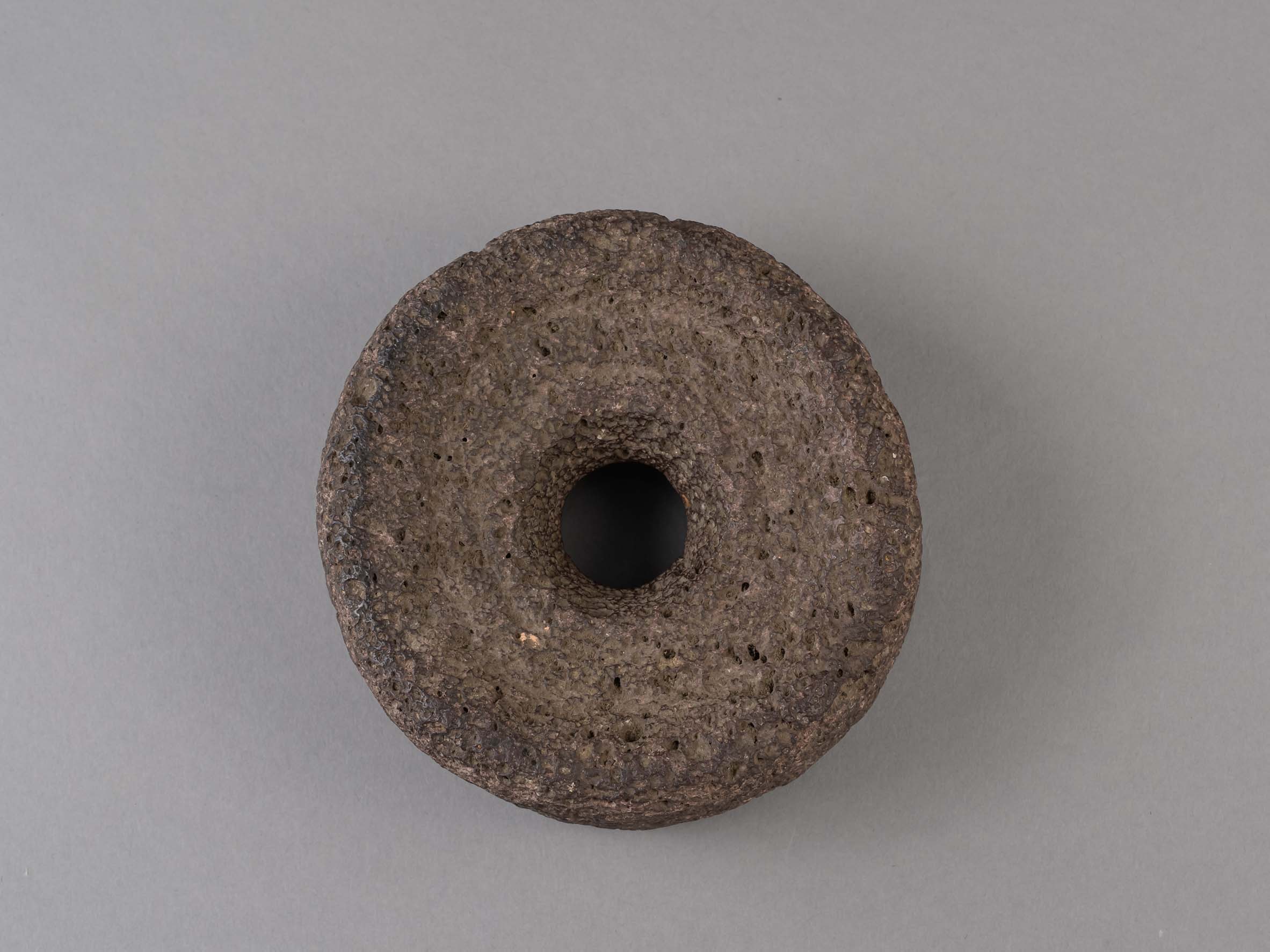
weight
https://search.heritageburnaby.ca/link/museumartifact44856
- Repository
- Burnaby Village Museum
- Accession Code
- BV002.57.4
- Description
- Net weight, round, stone, doughnut-shaped with hole in the middle. Made of volcanic stone.
- Object History
- The donor inherited this artifact from his mother, Katherine Maude (Kitty) Peers, who inherited them from her father, Louis Claude Hill. The artifacts were found on his farm, Brookfield Farm, at Douglas Road and Sperling Avenue (now site of Burnaby Village Museum).
- Subjects
- Persons
- Indigenous peoples - British Columbia
- Weights and Measurements Tools and Equipment
- Archeological Specimen
- Historic Neighbourhood
- Burnaby Lake (Historic Neighbourhood)
Images
Documents

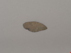
projectile point
https://search.heritageburnaby.ca/link/museumartifact44857
- Repository
- Burnaby Village Museum
- Accession Code
- BV002.57.5
- Description
- Projectile point, stone; both sides slightly indented towards end. Side notched with expanding stem Notches are wear hafting to an arrow or spear shaft would occur.
- Object History
- The donor inherited this artifact from his mother, Katherine Maude (Kitty) Peers, who inherited them from her father, Louis Claude Hill. The artifacts were found on his farm, Brookfield Farm, at Douglas Road and Sperling Avenue (now site of Burnaby Village Museum).
- Culture Phase: Marpole. Marpole Culture type dates from 400BC - 400AD
- Historic Neighbourhood
- Burnaby Lake (Historic Neighbourhood)
Images
Documents
projectile point
https://search.heritageburnaby.ca/link/museumartifact44858
- Repository
- Burnaby Village Museum
- Accession Code
- BV002.57.9
- Description
- Corner notched, stemmed projectile point
- Object History
- The donor inherited this artifact from his mother, Katherine Maude (Kitty) Peers, who inherited them from her father, Louis Claude Hill. The artifacts were found on his farm, Brookfield Farm, at Douglas Road and Sperling Avenue (now site of Burnaby Village Museum).
- Culture Phase: Marpole. Marpole Culture type dates from 400BC - 400AD
- Historic Neighbourhood
- Burnaby Lake (Historic Neighbourhood)
Images

Documents
projectile point
https://search.heritageburnaby.ca/link/museumartifact44859
- Repository
- Burnaby Village Museum
- Accession Code
- BV002.57.10
- Description
- Triangular shaped tip of projectile point; flaked not ground
- Object History
- The donor inherited this artifact from his mother, Katherine Maude (Kitty) Peers, who inherited them from her father, Louis Claude Hill. The artifacts were found on his farm, Brookfield Farm, at Douglas Road and Sperling Avenue (now site of Burnaby Village Museum).
- Culture Phase: Marpole. Marpole Culture type dates from 400BC - 400AD
- Historic Neighbourhood
- Burnaby Lake (Historic Neighbourhood)
Images
Documents
projectile point
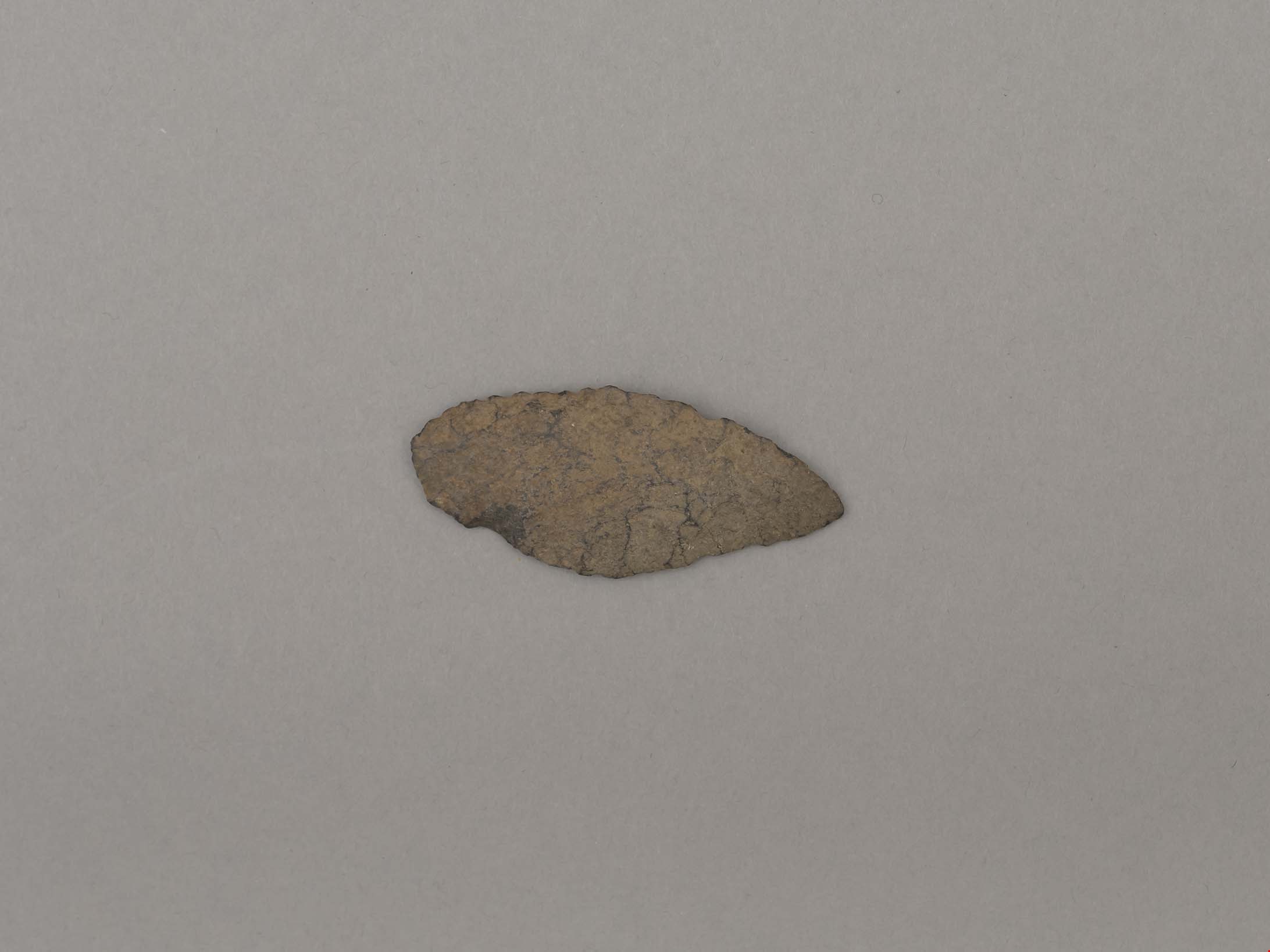
https://search.heritageburnaby.ca/link/museumartifact44860
- Repository
- Burnaby Village Museum
- Accession Code
- BV002.57.11
- Description
- Projectile point, stone; one rounded end. Leaf shaped, bifacially worked points, appear in both Locarno Beach and Marpole assemblages.
- Object History
- The donor inherited this artifact from his mother, Katherine Maude (Kitty) Peers, who inherited them from her father, Louis Claude Hill. The artifacts were found on his farm, Brookfield Farm, at Douglas Road and Sperling Avenue (now site of Burnaby Village Museum).
- Culture Phase: Possibly Locarno Beach phase (3520 -2200 Before Present)
- Historic Neighbourhood
- Burnaby Lake (Historic Neighbourhood)
Images
Documents
projectile point
https://search.heritageburnaby.ca/link/museumartifact44861
- Repository
- Burnaby Village Museum
- Accession Code
- BV002.57.12
- Description
- Debitage? (Waste material from flint knapping)
- Object History
- The donor inherited this artifact from his mother, Katherine Maude (Kitty) Peers, who inherited them from her father, Louis Claude Hill. The artifacts were found on his farm, Brookfield Farm, at Douglas Road and Sperling Avenue (now site of Burnaby Village Museum).
- Historic Neighbourhood
- Burnaby Lake (Historic Neighbourhood)
Images
Documents
projectile point
https://search.heritageburnaby.ca/link/museumartifact44862
- Repository
- Burnaby Village Museum
- Accession Code
- BV002.57.13
- Description
- Projectile point, stone, broken. Mid-section of lancelot shaped biface
- Object History
- The donor inherited this artifact from his mother, Katherine Maude (Kitty) Peers, who inherited them from her father, Louis Claude Hill. The artifacts were found on his farm, Brookfield Farm, at Douglas Road and Sperling Avenue (now site of Burnaby Village Museum).
- Possibly from eastern Burrard Inlet (andesite)
- Historic Neighbourhood
- Burnaby Lake (Historic Neighbourhood)
Images