Narrow Results By
Decade
- 2020s 254
- 2010s 536
- 2000s 756
- 1990s 1075
- 1980s 1276
- 1970s 2063
- 1960s 1519
- 1950s 600
- 1940s 288
- 1930s 230
- 1920s
- 1910s 427
- 1900s 137
- 1890s 46
- 1880s
- 1870s 4
- 1860s 5
- 1850s 3
- 1840s 2
- 1830s 2
- 1820s 2
- 1810s 2
- 1800s 2
- 1790s 2
- 1780s 2
- 1770s 2
- 1760s 2
- 1750s 2
- 1740s 2
- 1730s 2
- 1720s 2
- 1710s 2
- 1700s 2
- 1690s 2
- 1680s 2
- 1670s 1
- 1660s 1
- 1650s 1
- 1640s 1
- 1630s 1
- 1620s 1
- 1610s 1
- 1600s 1
Subject
- Buildings - Commercial - Grocery Stores 3
- Buildings - Industrial - Factories 1
- Buildings - Industrial - Saw Mills 2
- Buildings - Religious - Churches 3
- Clothing 1
- Crafts 1
- Documentary Artifacts - Magazines 1
- Education 1
- Employment 2
- Geographic Features - Parks 3
- Industries - Logging/lumber 1
- Migration 2
Creator
- Alphonse J. Toebaert 1
- Bell, David Charles, 1817-1901 1
- Bowman and Cullerne 1
- British Columbia Underwriters' Association 13
- Burnaby Village Museum 2
- Burnett, David H. 1
- Burnett & McGugan, Engineers and Surveyors 3
- City of Burnaby 3
- Draper, William Nelson 1
- Eagles, Dr. Blythe 1
- Eagles, Dr. Violet 1
- Eckley, Edmund R. 1
Person / Organization
- Barnet Mountain Park 2
- Belhouse, Jack 1
- Bolton, Richard 1
- Bossort, Kathy 3
- Bradbury, Dr. Bettina 5
- Burnaby Mountain Centennial Park 1
- Burnaby Mountain Centennial Rose Garden 1
- Burnaby Mountain Conservation Area 1
- Burnaby Mountain Park 1
- Burnaby Planning and Building Department 1
- Burnaby School Board 1
- Burnaby Village Museum 1
Disney Family collection
https://search.heritageburnaby.ca/link/archivedescription97178
- Repository
- City of Burnaby Archives
- Date
- [1914-1963]
- Collection/Fonds
- Disney Family collection
- Description Level
- Fonds
- Physical Description
- 6 architectural drawings : pencil and ink on paper ; 52 cm x 77 cm and smaller + 1 p. of textual records (40 cm. x 31 cm.) + 1 plan : col. ; 55 cm x 75 cm folded to 28 cm x 10 cm + 1 map : diazo print ; 39 cm x 28 cm.
- Scope and Content
- Fonds consists of maps and plans created and collected by Jack Disney.
- Repository
- City of Burnaby Archives
- Date
- [1914-1963]
- Collection/Fonds
- Disney Family collection
- Physical Description
- 6 architectural drawings : pencil and ink on paper ; 52 cm x 77 cm and smaller + 1 p. of textual records (40 cm. x 31 cm.) + 1 plan : col. ; 55 cm x 75 cm folded to 28 cm x 10 cm + 1 map : diazo print ; 39 cm x 28 cm.
- Description Level
- Fonds
- Access Restriction
- No restrictions
- Reproduction Restriction
- May be restricted by third party rights
- Accession Number
- 2016-03
- Scope and Content
- Fonds consists of maps and plans created and collected by Jack Disney.
- History
- John Howard "Jack" Disney served as Burnaby Surveyor from 1911 to 1919.
- Media Type
- Photograph
- Notes
- Title based on contents of collection
- MSS199

Mortimer-Lamb House
https://search.heritageburnaby.ca/link/landmark494
- Repository
- Burnaby Heritage Planning
- Description
- The Mortimer-Lamb House is a one and one half-storey, Arts and Crafts-style residence with a steeply pitched, side-gabled roof. The original cottage form has been enlarged with a later addition on the west side of the house. Located next to the Burnaby Lake Regional Park Wildlife Rescue Care Centre…
- Associated Dates
- c.1922
- Formal Recognition
- Community Heritage Register
- Other Names
- Harold & Katherine Mortimer-Lamb Residence
- Street View URL
- Google Maps Street View
- Repository
- Burnaby Heritage Planning
- Other Names
- Harold & Katherine Mortimer-Lamb Residence
- Geographic Access
- Glencarin Drive
- Associated Dates
- c.1922
- Formal Recognition
- Community Heritage Register
- Enactment Type
- Council Resolution
- Enactment Date
- 26/05/2003
- Description
- The Mortimer-Lamb House is a one and one half-storey, Arts and Crafts-style residence with a steeply pitched, side-gabled roof. The original cottage form has been enlarged with a later addition on the west side of the house. Located next to the Burnaby Lake Regional Park Wildlife Rescue Care Centre, the house has picturesque views of Burnaby Lake.
- Heritage Value
- Built circa 1922, the Mortimer-Lamb House is valued for its association with first owners, Harold Mortimer-Lamb (1872-1970), and his wife, Katherine Mary Mortimer-Lamb (1873-1939). Born in Leatherhead, Surrey, England, Harold Mortimer-Lamb immigrated to Canada in 1889. Seven years later in Vancouver, he married Katherine Mary Lindsay, a native of Winnipeg. Mortimer-Lamb was a key figure in the B.C. mining industry, serving as Secretary of the Mining Association of B.C. between 1900 and 1945, and also as the Secretary of the Canadian Institute of Mining and Metallurgy. In addition to his professional life, Mortimer-Lamb was a pioneer art photographer and was among Canada's leading art critics, and this house served as a central gathering place for renowned Canadian artists of the day. Mortimer-Lamb’s daughter, Molly Lamb Bobak (born 1922), became a renowned watercolourist, and was the only woman ever hired as an official Canadian war artist. The Mortimer-Lamb House is a significant example of the work of noted architect, Samuel Maclure (1860-1929) and his partner, Ross Lort (1889-1969). Maclure, who was a close friend of the Mortimer-Lamb family, was British Columbia's leading residential architect, and was renowned for his high quality designs for prominent citizens in both Vancouver and Victoria. Maclure was a leading exponent of the Art and Crafts design movement in B.C., and established a sophisticated local variation of residential architecture. The Mortimer-Lamb House was designed at the time when Maclure was in partnership with Ross Lort. In 1907, Lort began working for Maclure's firm as a draftsman, and by 1920 was in charge of Maclure's Vancouver office. Lort's architectural career spanned some sixty-years, and he designed some of the province's most familiar houses, apartments, institutions and places of worship. The Mortimer-Lamb House is also a significant local example of the Arts and Crafts style, and incorporates elements such as board-and-batten siding on the ground floor, shingled gables and leaded casement windows. It is a testament to the domestic architecture built outside of established suburbs during the post-First World War era, typically modest in scale and representative of middle-class residential ideals.
- Defining Elements
- Key elements that define the heritage character of the Mortimer-Lamb House include its: - treed setting with views of Burnaby Lake - residential form, scale and massing as expressed by its one and one-half storey height, rectangular plan and steeply pitched side-gabled roof - wood-frame construction - Arts and Crafts elements such as board-and-batten siding on the ground floor, cedar shingles in the gables and open soffits - original straight-leaded casement windows in single and multiple-assembly - internal red-brick chimney with corbelled cap
- Historic Neighbourhood
- Burnaby Lake (Historic Neighbourhood)
- Planning Study Area
- Burnaby Lake Area
- Organization
- Mining Association of B.C.
- G.F. and J. Galt Limited
- Architect
- Samuel Maclure
- Ross Lort
- Function
- Primary Historic--Single Dwelling
- Primary Current--Single Dwelling
- Community
- Burnaby Lake
- Cadastral Identifier
- P.I.D.002-977-788
- Boundaries
- The Mortimer-Lamb House is comprised of a single residential lot located at 5180 Glencairn Drive, Burnaby.
- Area
- 5652.78
- Contributing Resource
- Building
- Ownership
- Private
- Documentation
- City of Burnaby Planning and Building Department, Heritage Site Files
- Street Address
- 5180 Glencarin Drive
- Street View URL
- Google Maps Street View
Images


François & Cezarie Comeau Residence
https://search.heritageburnaby.ca/link/landmark580
- Repository
- Burnaby Heritage Planning
- Description
- Residential building.
- Associated Dates
- c.1925
- Street View URL
- Google Maps Street View
- Repository
- Burnaby Heritage Planning
- Geographic Access
- Esmond Avenue
- Associated Dates
- c.1925
- Description
- Residential building.
- Heritage Value
- This home was built for Francois Xavier “Frank” Comeau (1863-1943), a blacksmith who moved from Quebec to Vancouver in about 1890, and his wife Cezarie Marie (née Fortin, 1860-1950), also from Quebec, whom he married in 1903. Featuring a front gabled roof with decorative triangular eave brackets, this comfortable Craftsman bungalow displays other characteristics typical of the style such as lapped siding at the foundation, a shingle-clad main floor, casement windows and stained glass transoms on the front elevation. The most notable feature of the plan is the inset verandah with subtle segmental-arched openings and tapered square columns.
- Locality
- Vancouver Heights
- Historic Neighbourhood
- Vancouver Heights (Historic Neighbourhood)
- Planning Study Area
- Burnaby Heights Area
- Area
- 566.71
- Contributing Resource
- Building
- Ownership
- Private
- Street Address
- 306 Esmond Avenue
- Street View URL
- Google Maps Street View
Images


John & Jessie MacLean Residence
https://search.heritageburnaby.ca/link/landmark608
- Repository
- Burnaby Heritage Planning
- Description
- Residential building.
- Associated Dates
- c.1926
- Street View URL
- Google Maps Street View
- Repository
- Burnaby Heritage Planning
- Geographic Access
- Pandora Street
- Associated Dates
- c.1926
- Description
- Residential building.
- Heritage Value
- This cottage illustrates the traditionalism of the interwar years, when domestic ideals were expressed through modest homes displaying period revival influences. Reflecting the influence of the British Arts and Crafts movement, it features a symmetrical plan, a side jerkin-headed roof, a gabled front dormer and twin-coursed shingle siding, and retains its original wooden-sash windows with unusual multi-paned upper sash. It was built for John R. and Jessie MacLean. The house was recently restored by the owners.
- Locality
- Vancouver Heights
- Historic Neighbourhood
- Vancouver Heights (Historic Neighbourhood)
- Planning Study Area
- Burnaby Heights Area
- Area
- 566.71
- Contributing Resource
- Building
- Ownership
- Private
- Street Address
- 3827 Pandora Street
- Street View URL
- Google Maps Street View
Images


Brentwood Neighbourhood
https://search.heritageburnaby.ca/link/landmark669
- Repository
- Burnaby Heritage Planning
- Associated Dates
- 1925-1954
- Heritage Value
- In July, 1953, Burnaby's Municipal Council gave approval for the construction of a $12,000,000 residential and shopping development to be called Brentwood Park, located on the northeast corner of Lougheed and Willingdon. Plans called for about 400 homes and a 30-acre shopping centre to be built in this new subdivision - the first large residential subdivision in Burnaby to be developed with sewers and paved streets as well as other services.
- Planning Study Area
- Brentwood Area
Images


Willingdon Heights Neighbourhood
https://search.heritageburnaby.ca/link/landmark670
- Repository
- Burnaby Heritage Planning
- Associated Dates
- 1925-1954
- Heritage Value
- Willingdon Heights was another new subdivision developed in Burnaby during the post-World War Two building boom. A brochure about the development published in 1948 proclaimed "the Willingdon Heights 500 home development project in Burnaby fulfills its promise to provide a self-contained community for former members of the armed services and their families...the largest single veteran housing project in Canada as far as homes for individual ownership is concerned, Willingdon Heights development was planned by the Central Mortgage and Housing Corporation...At this date the earlier built rows of homes have passable roads and the owners are improving lawns and gardens in spare time...eventually additional stores and professional services will be installed and recreational projects will add to the amenities of a community of congenial residents..."
- Planning Study Area
- Willingdon Heights Area
Images


Parkcrest Neighbourhood
https://search.heritageburnaby.ca/link/landmark671
- Repository
- Burnaby Heritage Planning
- Associated Dates
- 1925-1954
- Heritage Value
- On May 10, 1951, the Burnaby News-Courier reported on the new Parkcrest subdivision, saying: "Central Burnaby is the scenic locale of a successful attempt to produce modern houses economically and yet avoid the mass production effect common to other housing developments. That is one of the many highlights peculiar to the new Parkcrest development of 275 homes...By giving home purchasers a wide choice of finishes, extras and colours, hundreds of variations are possible on the six basic floor plans...Travelling time by car to Hastings and Granville from Parkcrest has been clocked at 15 minutes...Both primary and junior high schools are within walking distance. A modern shopping centre is planned for the future...Several streets are laid out in a straight but irregular manner, thus eliminating the prosaic side by side appearance block by block, as in other housing developments."
- Planning Study Area
- Parkcrest-Aubrey Area
Images


Westridge Neighbourhood
https://search.heritageburnaby.ca/link/landmark680
- Repository
- Burnaby Heritage Planning
- Associated Dates
- 1925-1954
- Heritage Value
- The Westridge Neighbourhood of Burnaby was created as a new subdivision during the post-World War Two housing boom in Burnaby. Developed by the C.B. Riley Company, it was laid out in a plan contoured to the shapes of the land and was situated to allow residents easy access to main transportation routes.
- Historic Neighbourhood
- Lochdale (Historic Neighbourhood)
- Planning Study Area
- Westridge Area
Images


Central Park Neighbourhood
https://search.heritageburnaby.ca/link/landmark688
- Repository
- Burnaby Heritage Planning
- Associated Dates
- 1925-1954
- Heritage Value
- Although still largely a rural area during the 1920s, subdivisions began appearing in the Central Park neighbourhood at this time. Development was slowed by the Great Depression of the 1930s but the influx of commercial buildings and new housing initiatives in the post-war boom led to a period of rapid growth especially in the Garden Village subdivision which was undertaken in 1953 with the plan to build 500 modern homes in the 140-acre site. Despite the closure of the interurban line in 1953, the neighbourhood remained an active commercial and residential centre.
- Historic Neighbourhood
- Central Park (Historic Neighbourhood)
- Planning Study Area
- Maywood Area
Images


Buena Vista Neighbourhood
https://search.heritageburnaby.ca/link/landmark759
- Repository
- Burnaby Heritage Planning
- Associated Dates
- 1905-1924
- Heritage Value
- The Buena Vista neighbourhood (so named for its wonderful views) grew out of its proximity to Edmonds and New Westminster and was developed in the period 1911-1912. By the 1950s, the area had been further subdivided and in 1986, Burnaby Municipal Council adopted the Cariboo Hills Development Plan for the neighbourhood to maintain its character as a residential area of the city.
- Historic Neighbourhood
- East Burnaby (Historic Neighbourhood)
- Planning Study Area
- Cariboo-Armstrong Area
Images

Boy craft : containing plans and working drawings with clear and concise descriptions of useful articles, toys, and games : for boys of 10 to 16 years to construct.
https://search.heritageburnaby.ca/link/museumlibrary1035
- Repository
- Burnaby Village Museum
- Collection
- Reference Collection
- Material Type
- Book
- Call Number
- 745.59 BOY
- Place of Publication
- Racine, Wis.
- Publisher
- Whitman Publishing Company
- Publication Date
- c1928
- Physical Description
- 208 p. : ill. ; 20 cm.
- Library Subject (LOC)
- Handicraft
- Toys
- Notes
- "The material in this book... collected almost entirely from the pages of 'The junior home magazine', the well known children's publication." -- title page.
Studies in the scriptures, series 1 : the plan of the ages
https://search.heritageburnaby.ca/link/museumlibrary1598
- Repository
- Burnaby Village Museum
- Edition
- 2,875,000 ed.
- Publication Date
- 1909
- c1886
- Call Number
- 289.92 RUS v.1
- Repository
- Burnaby Village Museum
- Collection
- Special Collection
- Material Type
- Book
- Accession Code
- BV985.3917.1
- Call Number
- 289.92 RUS v.1
- Edition
- 2,875,000 ed.
- Place of Publication
- Brooklyn, N.Y.
- Publisher
- Watch Tower Bible & Tract Society
- Publication Date
- 1909
- c1886
- Physical Description
- 356 p., 14 p. ; 19 cm.
- Library Subject (LOC)
- Jehovah's Witnesses
- Notes
- Volume 1 of 2
Studies in the scriptures : the plan of the ages
https://search.heritageburnaby.ca/link/museumlibrary2802
- Repository
- Burnaby Village Museum
- Edition
- 5,382,000 ed.
- Publication Date
- 1920
- c1886
- Call Number
- 289.92 RUS
- Repository
- Burnaby Village Museum
- Collection
- Special Collection
- Material Type
- Book
- Accession Code
- HV973.29.87
- Call Number
- 289.92 RUS
- Edition
- 5,382,000 ed.
- Place of Publication
- Brooklyn
- Publisher
- International Bible Students Association
- Publication Date
- 1920
- c1886
- Series
- 1
- Physical Description
- 356 p. :17 cm.
- Library Subject (LOC)
- Jehovah's Witnesses
- Notes
- Author's full given name and dates: Russell, C. T. (Charles Taze), 1852-1916
- Includes index
Studies in the scriptures : series 1 : the plan of the ages : a vindication of the divine character and government: showing, by a recognition and harmonizing of all the scriptures, that the permission of evil, past and present, is educational and preparatory to the userhing of mankind into the golden age of prophecy in which all the families of the earth will be blessed with a full knowledge of God and a full opportunity for attaining everlasing life through the redeemer, who then will be the great restorer and life-giver.
https://search.heritageburnaby.ca/link/museumlibrary3697
- Repository
- Burnaby Village Museum
- Collection
- Special Collection
- Material Type
- Book
- Accession Code
- BV001.1.32
- Call Number
- 230.9 WAT
- Place of Publication
- London
- Publisher
- Watch Tower Bible & Tract Society
- Publication Date
- 1910
- c1886
- Physical Description
- 356, 14 p. : 1 folded chart ; 19 cm.
- Library Subject (LOC)
- Jehovah's Witnesses
- Bible
- Notes
- Includes "A criticism of millennial hopes examined"
- Includes index.
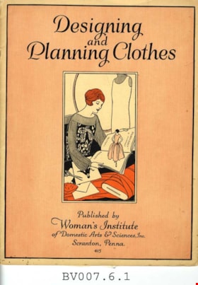
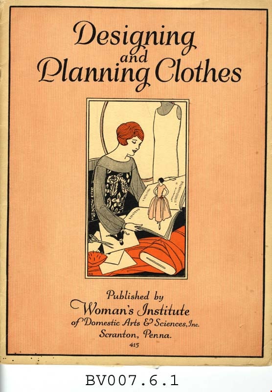
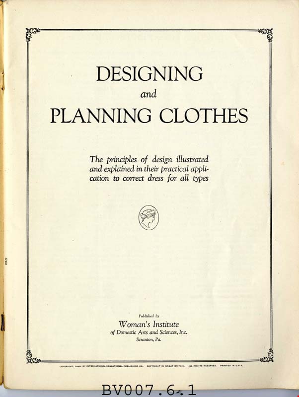
Designing and planning clothes : the principles of design illustrated and explained in their practical application to correct dress for all types
https://search.heritageburnaby.ca/link/museumlibrary4987
- Repository
- Burnaby Village Museum
- Collection
- Special Collection
- Material Type
- Textual Record
- Accession Code
- BV007.6.1
- Call Number
- 646 WOM
- Place of Publication
- Scranton, Pa.
- Publisher
- Woman's Institute of Domestic Arts and Sciences
- Publication Date
- c1925
- Physical Description
- 55 p. : ill. : 30 cm.
- Library Subject (LOC)
- Dressmaking--Study and teaching
- Dressmaking
- Dresses
- Fashion design
- Subjects
- Documentary Artifacts - Magazines
- Object History
- Home sewing course used by Burnaby residents in the 1920's
- Notes
- "415" -- Cover
Images
Subdivision Plan of Portion of Block 14, DL 28 C
https://search.heritageburnaby.ca/link/councilreport65913
- Repository
- City of Burnaby Archives
- Report ID
- 58125
- Meeting Date
- 30-Dec-1929
- Format
- Council - Committee Report
- Collection/Fonds
- City Council and Office of the City Clerk fonds
- Repository
- City of Burnaby Archives
- Report ID
- 58125
- Meeting Date
- 30-Dec-1929
- Format
- Council - Committee Report
- Collection/Fonds
- City Council and Office of the City Clerk fonds
Subdivision Plans (a) N 61 Feet Lots 1 and 2, Block 25, DL 186 (b) S 61 Feet Lots 1 and 2, Block 25, DL 186
https://search.heritageburnaby.ca/link/councilreport65900
- Repository
- City of Burnaby Archives
- Report ID
- 58112
- Meeting Date
- 16-Dec-1929
- Format
- Council - Mayor/Councillor/Staff Report
- Collection/Fonds
- City Council and Office of the City Clerk fonds
- Repository
- City of Burnaby Archives
- Report ID
- 58112
- Meeting Date
- 16-Dec-1929
- Format
- Council - Mayor/Councillor/Staff Report
- Collection/Fonds
- City Council and Office of the City Clerk fonds
Documents
Subdivision Plans for Block 11, DL 29 and Portion of Block 14, DL 28, Central
https://search.heritageburnaby.ca/link/councilreport65868
- Repository
- City of Burnaby Archives
- Report ID
- 57980
- Meeting Date
- 2-Dec-1929
- Format
- Council - Mayor/Councillor/Staff Report
- Collection/Fonds
- City Council and Office of the City Clerk fonds
- Repository
- City of Burnaby Archives
- Report ID
- 57980
- Meeting Date
- 2-Dec-1929
- Format
- Council - Mayor/Councillor/Staff Report
- Collection/Fonds
- City Council and Office of the City Clerk fonds
Documents
Auto Camp Plan Blocks 1 and 1A, DL 80
https://search.heritageburnaby.ca/link/councilreport65822
- Repository
- City of Burnaby Archives
- Report ID
- 57934
- Meeting Date
- 18-Nov-1929
- Format
- Council - Committee Report
- Collection/Fonds
- City Council and Office of the City Clerk fonds
- Repository
- City of Burnaby Archives
- Report ID
- 57934
- Meeting Date
- 18-Nov-1929
- Format
- Council - Committee Report
- Collection/Fonds
- City Council and Office of the City Clerk fonds
Subdivision Plan of Lot "A", Block 8, DL 87
https://search.heritageburnaby.ca/link/councilreport65839
- Repository
- City of Burnaby Archives
- Report ID
- 57951
- Meeting Date
- 18-Nov-1929
- Format
- Council - Mayor/Councillor/Staff Report
- Collection/Fonds
- City Council and Office of the City Clerk fonds
- Repository
- City of Burnaby Archives
- Report ID
- 57951
- Meeting Date
- 18-Nov-1929
- Format
- Council - Mayor/Councillor/Staff Report
- Collection/Fonds
- City Council and Office of the City Clerk fonds