Narrow Results By
Subject
- Advertising Medium 1
- Advertising Medium - Signs and Signboards 3
- Agriculture 2
- Agriculture - Farms 2
- Arts 1
- Buildings - Civic - City Halls 1
- Buildings - Civic - Hospitals 1
- Buildings - Civic - Libraries 2
- Buildings - Civic - Museums 12
- Buildings - Commercial - Banks 1
- Buildings - Commercial - Grocery Stores 2
- Buildings - Commercial - Malls 2
Creator
- Bailey, Charles 1
- Bartel, Mario 36
- Battistoni, Peter 4
- Brandson, Lloyd S. 1
- Broadbridge Commercial Photo Company 1
- Burnaby Centennial '71 Committee 1
- Burnaby Lake Men’s Community Service Club 1
- Capitol Hill Community Association 1
- Cheung, Nakita 1
- City of Burnaby 2
- Code, Norah 1
- Copan, Donald Angus "Don" 1

Burnaby Heights "panhandling meter"
https://search.heritageburnaby.ca/link/archivedescription97994
- Repository
- City of Burnaby Archives
- Date
- [2000]
- Collection/Fonds
- Burnaby NewsLeader photograph collection
- Description Level
- File
- Physical Description
- 2 photographs (tiff) : col.
- Scope and Content
- File contains photographs of Mark, a panhandler, on Hastings Street by a "panhandling meter" installed by the City of Burnaby. The meter reads: "This is not a parking meter / Spare change for social change."
- Repository
- City of Burnaby Archives
- Date
- [2000]
- Collection/Fonds
- Burnaby NewsLeader photograph collection
- Physical Description
- 2 photographs (tiff) : col.
- Description Level
- File
- Record No.
- 535-3098
- Access Restriction
- No restrictions
- Reproduction Restriction
- No restrictions
- Accession Number
- 2018-12
- Scope and Content
- File contains photographs of Mark, a panhandler, on Hastings Street by a "panhandling meter" installed by the City of Burnaby. The meter reads: "This is not a parking meter / Spare change for social change."
- Media Type
- Photograph
- Photographer
- Bartel, Mario
- Notes
- Title based on caption
- Collected by editorial for use in a February 2000 issue of the Burnaby NewsLeader
- Caption from metadata for 535-3098-1: "Mark says he panhandles along Hastings St. when he's hungry and can't afford food. He says the new meters haven't affected his take."
- Caption from metadata for 535-3098-2: "The new spare change meters haven't disuaded panhandlers, like Mark, from setting up shop along Hastings St. He says he panhandles when he needs money for food."
- Geographic Access
- Hastings Street
- Carleton Avenue
- Historic Neighbourhood
- Vancouver Heights (Historic Neighbourhood)
- Planning Study Area
- Burnaby Heights Area
Images

![Burnaby Mountain community consultation, [2000] thumbnail](/media/hpo/_Data/_Archives_Images/_Unrestricted/535/535-2539.jpg?width=280)
Burnaby Mountain community consultation
https://search.heritageburnaby.ca/link/archivedescription97007
- Repository
- City of Burnaby Archives
- Date
- [2000]
- Collection/Fonds
- Burnaby NewsLeader photograph collection
- Description Level
- Item
- Physical Description
- 1 photograph (tiff) : col.
- Scope and Content
- Photograph of Burnaby resident John Unger filing out a comment form at a open house and community consultation event about development plans for Burnaby Mountain, held at the Copeland Arena. Posters outlining the development plans are visible behind Unger.
- Repository
- City of Burnaby Archives
- Date
- [2000]
- Collection/Fonds
- Burnaby NewsLeader photograph collection
- Physical Description
- 1 photograph (tiff) : col.
- Description Level
- Item
- Record No.
- 535-2539
- Access Restriction
- No restrictions
- Reproduction Restriction
- No restrictions
- Accession Number
- 2018-12
- Scope and Content
- Photograph of Burnaby resident John Unger filing out a comment form at a open house and community consultation event about development plans for Burnaby Mountain, held at the Copeland Arena. Posters outlining the development plans are visible behind Unger.
- Media Type
- Photograph
- Photographer
- Bartel, Mario
- Notes
- Title based on caption
- Collected by editorial for use in a July 2000 issue of the Burnaby NewsLeader
- Caption from metadata: "Burnaby residents, like John Unger, take the opportunity to fill out comment forms at an open house at Copeland Arena to unveil development plans for Burnaby Mountain."
- Geographic Access
- Burnaby Lake Sports Complex
- Kensington Avenue
- Street Address
- 3676 Kensington Avenue
- Historic Neighbourhood
- Burnaby Lake (Historic Neighbourhood)
- Planning Study Area
- Ardingley-Sprott Area
Images
![Burnaby Mountain community consultation, [2000] thumbnail](/media/hpo/_Data/_Archives_Images/_Unrestricted/535/535-2539.jpg)
![Caila Anderson with traffic signs, [2000] thumbnail](/media/hpo/_Data/_Archives_Images/_Unrestricted/535/535-2547.jpg?width=280)
Caila Anderson with traffic signs
https://search.heritageburnaby.ca/link/archivedescription97015
- Repository
- City of Burnaby Archives
- Date
- [2000]
- Collection/Fonds
- Burnaby NewsLeader photograph collection
- Description Level
- Item
- Physical Description
- 1 photograph (tiff) : col.
- Scope and Content
- Photograph of Caila Anderson, an employee of International SPFX, standing with her arms crossed next to two traffic signs on Greenwood Street.
- Repository
- City of Burnaby Archives
- Date
- [2000]
- Collection/Fonds
- Burnaby NewsLeader photograph collection
- Physical Description
- 1 photograph (tiff) : col.
- Description Level
- Item
- Record No.
- 535-2547
- Access Restriction
- No restrictions
- Reproduction Restriction
- No restrictions
- Accession Number
- 2018-12
- Scope and Content
- Photograph of Caila Anderson, an employee of International SPFX, standing with her arms crossed next to two traffic signs on Greenwood Street.
- Subjects
- Planning - City Planning
- Advertising Medium - Signs and Signboards
- Geographic Features - Roads
- Media Type
- Photograph
- Photographer
- Bartel, Mario
- Notes
- Title based on caption
- Collected by editorial for use in a July 2000 issue of the Burnaby NewsLeader
- Caption from metadata: "Caila Anderson, of International SPFX, says new traffic regulations on Greenwood St. have made it really inconvenient for employees at the movie special effects company to get to and from their production offices. Residents on the street say the regulations haven't gone far enough."
- Geographic Access
- Greenwood Street
- Historic Neighbourhood
- Lozells (Historic Neighbourhood)
- Planning Study Area
- Government Road Area
Images
![Caila Anderson with traffic signs, [2000] thumbnail](/media/hpo/_Data/_Archives_Images/_Unrestricted/535/535-2547.jpg)
![Margaret Manifold and the Community Asset Mapping System, [2005] thumbnail](/media/hpo/_Data/_Archives_Images/_Unrestricted/535/535-1927-1.jpg?width=280)
Margaret Manifold and the Community Asset Mapping System
https://search.heritageburnaby.ca/link/archivedescription96243
- Repository
- City of Burnaby Archives
- Date
- [2005]
- Collection/Fonds
- Burnaby NewsLeader photograph collection
- Description Level
- File
- Physical Description
- 2 photographs (tiff) : col.
- Scope and Content
- File contains photographs of Margaret Manifold, of the City of Burnaby Planning Department, posing with print-outs of maps that will form the online Community Asset Mapping System. A large aerial photograph of Burnaby and the Lower Mainland is on the wall behind Manifold.
- Repository
- City of Burnaby Archives
- Date
- [2005]
- Collection/Fonds
- Burnaby NewsLeader photograph collection
- Physical Description
- 2 photographs (tiff) : col.
- Description Level
- File
- Record No.
- 535-1927
- Access Restriction
- No restrictions
- Reproduction Restriction
- No restrictions
- Accession Number
- 2018-12
- Scope and Content
- File contains photographs of Margaret Manifold, of the City of Burnaby Planning Department, posing with print-outs of maps that will form the online Community Asset Mapping System. A large aerial photograph of Burnaby and the Lower Mainland is on the wall behind Manifold.
- Media Type
- Photograph
- Photographer
- Medig, Kari
- Notes
- Title based on caption
- Collected by editorial for use in a February 2005 issue of the Burnaby NewsLeader
- Caption from metadata: "Margaret Manifold of the City of Burnaby's planning department poses with some hard copies of the online Community Assett Mapping System, which will soon be on the city's website."
Images
![Margaret Manifold and the Community Asset Mapping System, [2005] thumbnail](/media/hpo/_Data/_Archives_Images/_Unrestricted/535/535-1927-1.jpg)
![SFU Geography class with maps, [2000] thumbnail](/media/hpo/_Data/_Archives_Images/_Unrestricted/535/535-2626.jpg?width=280)
SFU Geography class with maps
https://search.heritageburnaby.ca/link/archivedescription97099
- Repository
- City of Burnaby Archives
- Date
- [2000]
- Collection/Fonds
- Burnaby NewsLeader photograph collection
- Description Level
- Item
- Physical Description
- 1 photograph (tiff) : col.
- Scope and Content
- Photograph of Mike Carr and Simon Fraser University Geography students Dallas Arcangel, Dave Crossley, Caoimhe Kehler and Peter Schaub with maps of "Salmonopolis." They are standing on the roof of an SFU building with forest and mountains visible in the background.
- Repository
- City of Burnaby Archives
- Date
- [2000]
- Collection/Fonds
- Burnaby NewsLeader photograph collection
- Physical Description
- 1 photograph (tiff) : col.
- Description Level
- Item
- Record No.
- 535-2626
- Access Restriction
- No restrictions
- Reproduction Restriction
- No restrictions
- Accession Number
- 2018-12
- Scope and Content
- Photograph of Mike Carr and Simon Fraser University Geography students Dallas Arcangel, Dave Crossley, Caoimhe Kehler and Peter Schaub with maps of "Salmonopolis." They are standing on the roof of an SFU building with forest and mountains visible in the background.
- Names
- Simon Fraser University
- Media Type
- Photograph
- Photographer
- Bartel, Mario
- Notes
- Title based on caption
- Collected by editorial for use in a July 2000 issue of the Burnaby NewsLeader
- Caption from metadata: "SFU geography instructor Mike Carr, and his team of students (front to back), Dallas Arcangel, Dave Crossley, Caoimhe Kehler and Peter Schaub, examine the maps of "Salmonopolis" they've created as part of a plan to create a sustainable region."
- Geographic Access
- Burnaby Mountain Conservation Area
- University Drive
- Street Address
- 8888 University Drive
- Planning Study Area
- Burnaby Mountain Area
Images
![SFU Geography class with maps, [2000] thumbnail](/media/hpo/_Data/_Archives_Images/_Unrestricted/535/535-2626.jpg)
![SkyTrain consultation, [1999] thumbnail](/media/hpo/_Data/_Archives_Images/_Unrestricted/535/535-3127.jpg?width=280)
SkyTrain consultation
https://search.heritageburnaby.ca/link/archivedescription98047
- Repository
- City of Burnaby Archives
- Date
- [1999]
- Collection/Fonds
- Burnaby NewsLeader photograph collection
- Description Level
- Item
- Physical Description
- 1 photograph (tiff) : col.
- Scope and Content
- Photograph of two unidentified people at a public consultation. They are viewing maps and aerial photographs related to the SkyTrain line.
- Repository
- City of Burnaby Archives
- Date
- [1999]
- Collection/Fonds
- Burnaby NewsLeader photograph collection
- Physical Description
- 1 photograph (tiff) : col.
- Description Level
- Item
- Record No.
- 535-3127
- Access Restriction
- No restrictions
- Reproduction Restriction
- No restrictions
- Accession Number
- 2018-12
- Scope and Content
- Photograph of two unidentified people at a public consultation. They are viewing maps and aerial photographs related to the SkyTrain line.
- Media Type
- Photograph
- Notes
- Title based on contents of photograph
- Collected by editorial for use in a February 1999 issue of the Burnaby NewsLeader
Images
![SkyTrain consultation, [1999] thumbnail](/media/hpo/_Data/_Archives_Images/_Unrestricted/535/535-3127.jpg)

Sussex Villa
https://search.heritageburnaby.ca/link/archivedescription98659
- Repository
- City of Burnaby Archives
- Date
- 2022
- Collection/Fonds
- Disappearing Burnaby collection
- Description Level
- Item
- Physical Description
- 1 photograph (jpeg) : col.
- Scope and Content
- Photograph of part of the exterior and front lawn of Sussex Villa, an apartment complex located at 6620-6630 Sussex Avenue, at night. The building was constructed in 1965 and is set to be developed into a high-rise tower by Keltic Canada Development. A light is on inside one of the apartment window…
- Repository
- City of Burnaby Archives
- Date
- 2022
- Collection/Fonds
- Disappearing Burnaby collection
- Physical Description
- 1 photograph (jpeg) : col.
- Description Level
- Item
- Record No.
- 634-006
- Access Restriction
- No restrictions
- Reproduction Restriction
- No restrictions
- Accession Number
- 2022-14
- Scope and Content
- Photograph of part of the exterior and front lawn of Sussex Villa, an apartment complex located at 6620-6630 Sussex Avenue, at night. The building was constructed in 1965 and is set to be developed into a high-rise tower by Keltic Canada Development. A light is on inside one of the apartment windows and a sign for the "Metrotown - Regional Town Centre Notification of Area Plan" stands on the lawn.
- Subjects
- Buildings - Residential - Apartments
- Buildings - Residential
- Advertising Medium - Signs and Signboards
- Planning - City Planning
- Media Type
- Photograph
- Photographer
- Cheung, Nakita
- Notes
- Title taken from the associated blog post
- Associated blog post: https://disappearingburnaby.wordpress.com/2022/01/29/sussex-villa-2/
- Geographic Access
- Sussex Avenue
- Street Address
- 6620 Sussex Avenue
- 6630 Sussex Avenue
- Historic Neighbourhood
- Central Park (Historic Neighbourhood)
- Planning Study Area
- Maywood Area
Images


2007 Advisory Planning Commission portrait
https://search.heritageburnaby.ca/link/archivedescription90391
- Repository
- City of Burnaby Archives
- Date
- 2007
- Collection/Fonds
- City Council and Office of the City Clerk fonds
- Description Level
- Item
- Physical Description
- 1 photograph : col. ; 12.5 x 19 cm
- Scope and Content
- Photograph of the 2007 Advisory Planning Commission. Commission members left to right are: Rana Dhatt, Joanne Tseng, Tony Coccia, David Pereira, Gurmukh Bhogal, and Kwangyoung Conn. Photograph is a studio portrait.
- Repository
- City of Burnaby Archives
- Date
- 2007
- Collection/Fonds
- City Council and Office of the City Clerk fonds
- Series
- Council Committee series
- Subseries
- Advisory Planning Commission subseries
- Physical Description
- 1 photograph : col. ; 12.5 x 19 cm
- Description Level
- Item
- Record No.
- 527-002
- Reproduction Restriction
- No restrictions
- Accession Number
- 2011-07
- Scope and Content
- Photograph of the 2007 Advisory Planning Commission. Commission members left to right are: Rana Dhatt, Joanne Tseng, Tony Coccia, David Pereira, Gurmukh Bhogal, and Kwangyoung Conn. Photograph is a studio portrait.
- Subjects
- Documentary Artifacts - Portraits
- Officials - Alderman and Councillors
- Officials - Commissioners
- Media Type
- Photograph
- Notes
- Title based on contents of photograph
Images

Advisory Planning Commission subseries
https://search.heritageburnaby.ca/link/archivedescription96030
- Repository
- City of Burnaby Archives
- Date
- [1960]-2012
- Collection/Fonds
- City Council and Office of the City Clerk fonds
- Description Level
- Subseries
- Physical Description
- 40 folders of textual records + 1 photograph
- Scope and Content
- Subseries consists of commission records for the Advisory Planning Commission including agendas, minutes, reports, and correspondence and a Commission portrait.
- Repository
- City of Burnaby Archives
- Date
- [1960]-2012
- Collection/Fonds
- City Council and Office of the City Clerk fonds
- Series
- Council Committee series
- Subseries
- Advisory Planning Commission subseries
- Physical Description
- 40 folders of textual records + 1 photograph
- Description Level
- Subseries
- Scope and Content
- Subseries consists of commission records for the Advisory Planning Commission including agendas, minutes, reports, and correspondence and a Commission portrait.
- History
- The Advisory Planning Commission was established in July of 1963. The Advisory Planning Commission was the successor to the Town Planning Commission. The Commission was responsible for advising Council on land use matters and reviewing all zoning bylaw amendments before being forwarded to public hearing. The Commission was disbanded on February 20, 2017.
- Media Type
- Textual Record
- Photograph
- Graphic Material
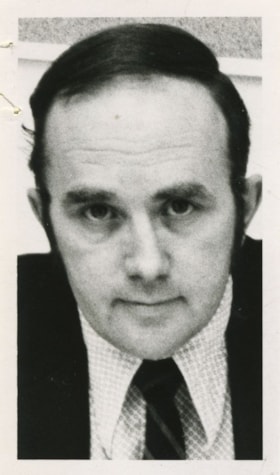
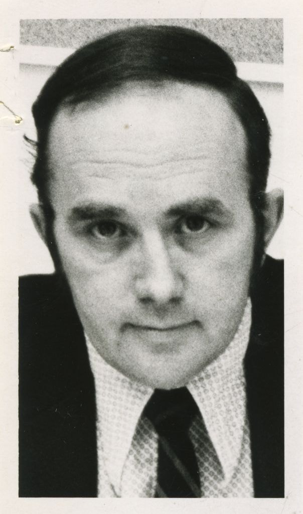
Armstrong, Lyle - Burnaby Planning Director
https://search.heritageburnaby.ca/link/archivedescription58828
- Repository
- City of Burnaby Archives
- Date
- 1973
- Collection/Fonds
- Columbian Newspaper collection
- Description Level
- Item
- Physical Description
- 1 photograph : b&w ; 8 x 5 cm
- Scope and Content
- Photograph of Lyle Armstrong, Burnaby Planning Director.
- Repository
- City of Burnaby Archives
- Date
- 1973
- Collection/Fonds
- Columbian Newspaper collection
- Physical Description
- 1 photograph : b&w ; 8 x 5 cm
- Description Level
- Item
- Record No.
- 480-1289
- Access Restriction
- No restrictions
- Reproduction Restriction
- Reproduce for fair dealing purposes only
- Accession Number
- 2009-01
- Scope and Content
- Photograph of Lyle Armstrong, Burnaby Planning Director.
- Names
- Armstrong, Lyle
- Media Type
- Photograph
- Notes
- Title based on contents of photograph
Images
Planning Department fonds
https://search.heritageburnaby.ca/link/archivedescription102
- Repository
- City of Burnaby Archives
- Date
- 1940-2016
- Collection/Fonds
- Planning Department fonds
- Description Level
- Fonds
- Physical Description
- 80 m of textual records and other material
- Scope and Content
- Fonds consists of those records created during the regular conduct of business by the Planning Department and its predecessor agencies according to their mandate of providing professional and technical advice to Council on the current and future uses of City land and resources.
- Repository
- City of Burnaby Archives
- Date
- 1940-2016
- Collection/Fonds
- Planning Department fonds
- Physical Description
- 80 m of textual records and other material
- Description Level
- Fonds
- File Class
- 71000 10 (add. 2020)
- 71000 20 (add. 2020)
- 71000 30 (add. 2020)
- 71000 40 (add. 2020)
- Access Restriction
- Subject to FOIPPA
- Reproduction Restriction
- Reproductions subject to FOIPPA.
- Scope and Content
- Fonds consists of those records created during the regular conduct of business by the Planning Department and its predecessor agencies according to their mandate of providing professional and technical advice to Council on the current and future uses of City land and resources.
- History
- The City of Burnaby Planning Department was established on October 9, 1956, when the City Council unanimously carried the motion to create a distinct department to deal with planning issues within the City and appointed Mr. William John Blakely as its head. This decision followed a report and recommendation made by the City’s Chief Administrative Officer which indicated that the role of the Planning Engineer and his staff had quickly expanded to become a separate division within the Engineering Department and that they were functioning as an independent unit in all but name. The proposed separation of the Engineering and Planning departments had been in the works since the early part of 1956 when staff changes and restructuring within the Engineering Department’s Planning Division illustrated the undermanned condition of the Planning Engineer’s office. As a result, Council asked the Chief Administrative Officer to undertake a study examining the feasibility of creating a distinct Planning Department. This report was delivered to Council on July 3, 1956, but was laid over until a Committee of the Council had the opportunity to study the functions of the Planning department to determine the necessity of the proposal. The Committee’s findings were in line with the initial report and the Planning Department was established with a staff of nine (the head Planning Engineer, an Administrative Planner, three Research Planning Assistants, a Draughtsman, a Subdivision Control Clerk, a department Clerk and a Clerk Stenographer). This new department was to offer advice and carry out the work intensive in matters such as zoning and rezoning applications, subdivision control, traffic and transportation planning, and general City planning schemes. Prior to the creation of the Planning Department, a number of bodies within the City had been responsible for fulfilling the functions carried out by this new unit. In the earliest years of the City, the members of Council were responsible for matters of planning and were assisted in their job by the City’s Engineer or any number of hired consultants (e.g. surveyors, cartographers). By 1906, however, the provincial laws surrounding the subdivision process had changed, and local governments were charged with the task of approving all private subdivision plans in their respective Municipalities. In Burnaby, the City Council passed a bylaw decreeing that all subdivision plans were to be submitted to Council for review and the City Engineer was responsible for ensuring compliance with the law. After the first Town Planning Bylaw in 1924 which restricted the type and size of construction that could occur in certain City areas, the Engineering and Building departments were to work together to oversee the enforcement of the Bylaw and the development of City plans. The scope and competence required to carry out this work grew as Burnaby’s population expanded, and in 1930 Council passed the Town Planning Commission Bylaw (No. 1028) that saw the creation of a permanent body – the Town Planning Commission – which was to serve as an advisory body to help direct the planning activities in the City while the actual work continued to be carried out by the Engineering Department. This body was comprised of the Reeve, the Chairman of the School Board, the Chairman of the Park Committee (later, the Board of Parks Commissioners), and six appointed citizens who served three-year terms. Council referred all matters of subdivisions, transportation planning, and rezoning to this Commission, which was later supported in its work by several other special or standing committees such as the Subdivision Committee, the Apartment Committee, the Transportation Committee or the Town Planning Board of Appeal. By 1953, it had become apparent that the advisory committees that were dedicated to these planning issues needed a permanent staff to carry out the work intensive, so a restructuring of the Engineering department resulted in a permanent Planning Engineer’s office being created. The Town Planning Commission continued in its advisory capacity even after the determination came in 1956 to create a separate Planning Department. When Bylaw No. 4473 was passed in 1963, the Town Planning Commission was disbanded in favour of a new Advisory Planning Commission that would turn over all routine matters such as subdivision and rezoning applications to the Planning Department but would offer advice and community input into the more complex planning schemes within the City and act as an intermediary in cases where Council and Planning staff were in disagreement. A new Advisory Planning Commission Bylaw (No. 7600) was adopted in 1980 which allowed for even greater community participation in the planning process. The Planning Department was initially responsible to report directly to Council, but in 1957, the administrative structure of Municipal staff changed with the introduction of the Burnaby Municipal Manager Bylaw (No. 3859) and from that point on, the head of the Planning Department held a direct reporting relationship to the Municipal Manager, who in turn was responsible for reporting the activities of the Department to the City Council. Over the years, the internal structure and the scope of responsibilities of the Department have changed during periods of staff reorganizations. Under the larger umbrella of the Planning and Building Department, Planning has come to be comprised of two divisions: the Current Planning Division and the Long Range Planning Division. The functions of the Current Planning Division include rezoning, subdivision, development plan areas, preliminary plan approvals, urban design, heritage planning, and urban trails and bicycle routes. The Long Range Planning Division is responsible for environmental planning concerns, transportation planning, housing, neighbourhood area planning, social planning and planning information services. In 2022, the Planning and Building Department was reorganized to better align functions with delivery of services. The Climate Action and Engery Division moved from Corporate Services to the Planning and Building Department, while Indigenous Relations and Facilities Management moved to Corporate Services and Lands and Facilities, respectively. The position of Director of Planning and Building was changed to General Manager, Planning and Development. The following individuals have served as Planning Engineer and/or Director of the Planning Department and/or General Manager, Planning and Development for the City of Burnaby: William John Blakely 1954-1956 (as Planning Engineer) 1956-1963 (as Head of the Department) Anthony P. Parr 1964-1993 Don G. Stenson 1993-2001 Jack S. Belhouse 2001-2006 Basil Luksun 2006-2012 Lou Pelletier 2012-2019 Edward Kozak 2019-present
- Formats
- Microforms exist for some records. See series descriptions.
- Media Type
- Textual Record
- Photograph
- Moving Images
- Creator
- City of Burnaby
- Notes
- Title based on contents of fonds
Planning photograph series
https://search.heritageburnaby.ca/link/archivedescription178
- Repository
- City of Burnaby Archives
- Date
- 1910-2005
- Collection/Fonds
- Planning Department fonds
- Description Level
- Series
- Physical Description
- ca. 6000 photographs
- Scope and Content
- Series consists of photographs created, and/or used by the Planning Department in the course of preparing reports, studies, publications, or displays. Subjects of the photographs vary, but include street scenes, prominent buildings, aerial views of Burnaby and Simon Fraser University, and photogra…
- Repository
- City of Burnaby Archives
- Date
- 1910-2005
- Collection/Fonds
- Planning Department fonds
- Series
- Planning photograph series
- Physical Description
- ca. 6000 photographs
- Description Level
- Series
- Accession Number
- 2001-02
- 2002-03
- 2002-06
- 2003-15
- 2004-16
- 2010-09
- 2012-15
- 2016-09
- Scope and Content
- Series consists of photographs created, and/or used by the Planning Department in the course of preparing reports, studies, publications, or displays. Subjects of the photographs vary, but include street scenes, prominent buildings, aerial views of Burnaby and Simon Fraser University, and photographs taken at certain Burnaby events.
- Media Type
- Photograph
- Notes
- Photo catalogue 502
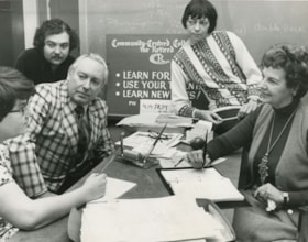
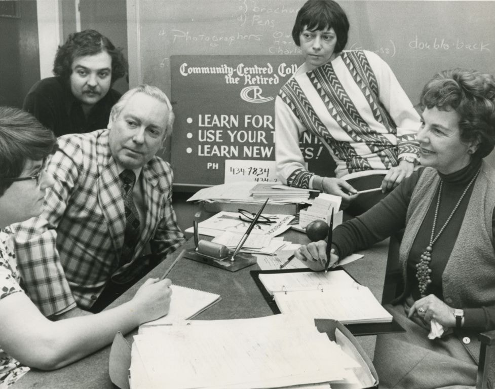
Planning the opening of the Community Centred College for the Retired
https://search.heritageburnaby.ca/link/archivedescription45231
- Repository
- City of Burnaby Archives
- Date
- 1979, published January 11, 1979
- Collection/Fonds
- Columbian Newspaper collection
- Description Level
- Item
- Physical Description
- 1 photograph : b&w ; 15 x 19.5 cm
- Scope and Content
- Photograph of the planning group for the official opening of the Community Centred College for the Retired. Seated around the table are; registrar Joanne Du Brall, consultant Darryl Adam, finance coordinator Owen Sheffield, resource coordinator Marion Haden and founder Mabel Dunham.
- Repository
- City of Burnaby Archives
- Date
- 1979, published January 11, 1979
- Collection/Fonds
- Columbian Newspaper collection
- Physical Description
- 1 photograph : b&w ; 15 x 19.5 cm
- Description Level
- Item
- Record No.
- 480-127
- Access Restriction
- No restrictions
- Reproduction Restriction
- Reproduce for fair dealing purposes only
- Accession Number
- 2003-02
- Scope and Content
- Photograph of the planning group for the official opening of the Community Centred College for the Retired. Seated around the table are; registrar Joanne Du Brall, consultant Darryl Adam, finance coordinator Owen Sheffield, resource coordinator Marion Haden and founder Mabel Dunham.
- Names
- Du Brall, Joanne
- Adam, Darryl
- Sheffield, Owen
- Haden, Marion
- Dunham, Mabel
- Community Centred College for the Retired
- Media Type
- Photograph
- Notes
- Title based on contents of photograph
- Newspaper clipping attached to verso of photograph reads: "College official opening planned by registrar Joanne Du Brall, consultant Darryl Adam, finance co-ordinator Owen Sheffield, resource co-ordinator Marion Haden and founder Mabel Dunham. More than 500 seniors take advantage of non-profit institution."
Images
![SFU development model, [2001] thumbnail](/media/hpo/_Data/_Archives_Images/_Unrestricted/535/535-2256.jpg?width=280)
SFU development model
https://search.heritageburnaby.ca/link/archivedescription96634
- Repository
- City of Burnaby Archives
- Date
- [2001]
- Collection/Fonds
- Burnaby NewsLeader photograph collection
- Description Level
- Item
- Physical Description
- 1 photograph (tiff) : col.
- Scope and Content
- Photograph of Eric Emery, the project manager of a Simon Fraser University development project, standing over a 3D model of the proposal. Maps and other photographs related to the proposal are visible in the background.
- Repository
- City of Burnaby Archives
- Date
- [2001]
- Collection/Fonds
- Burnaby NewsLeader photograph collection
- Physical Description
- 1 photograph (tiff) : col.
- Description Level
- Item
- Record No.
- 535-2256
- Access Restriction
- No restrictions
- Reproduction Restriction
- No restrictions
- Accession Number
- 2018-12
- Scope and Content
- Photograph of Eric Emery, the project manager of a Simon Fraser University development project, standing over a 3D model of the proposal. Maps and other photographs related to the proposal are visible in the background.
- Names
- Simon Fraser University
- Media Type
- Photograph
- Photographer
- Bartel, Mario
- Notes
- Title based on caption
- Collected by editorial for use in an April 2001 issue of the Burnaby NewsLeader
- Caption from metadata: "Eric Emery, the project manager of the SFU development project, looks over a 3-D model of the proposal."
Images
![SFU development model, [2001] thumbnail](/media/hpo/_Data/_Archives_Images/_Unrestricted/535/535-2256.jpg)
![Bill Blakely, [between 1954 and 1956] thumbnail](/media/Hpo/_Data/_Archives_Images/_Unrestricted/480/480-1555.jpg?width=280)
Bill Blakely
https://search.heritageburnaby.ca/link/archivedescription64828
- Repository
- City of Burnaby Archives
- Date
- [between 1954 and 1956]
- Collection/Fonds
- Columbian Newspaper collection
- Description Level
- Item
- Physical Description
- 1 photograph : b&w ; 15 x 9.5 cm
- Scope and Content
- Photograph of Burnaby Planning Engineer, William (Bill) Blakely.
- Repository
- City of Burnaby Archives
- Date
- [between 1954 and 1956]
- Collection/Fonds
- Columbian Newspaper collection
- Physical Description
- 1 photograph : b&w ; 15 x 9.5 cm
- Description Level
- Item
- Record No.
- 480-1555
- Access Restriction
- No restrictions
- Reproduction Restriction
- Reproduce for fair dealing purposes only
- Accession Number
- 2003-02
- Scope and Content
- Photograph of Burnaby Planning Engineer, William (Bill) Blakely.
- Names
- Blakely, William "Bill"
- Media Type
- Photograph
- Notes
- Title based on contents of photograph
- Note on verso reads: "Bill Blakely / Burnaby / planning engineer"
Images
![Bill Blakely, [between 1954 and 1956] thumbnail](/media/Hpo/_Data/_Archives_Images/_Unrestricted/480/480-1555.jpg)
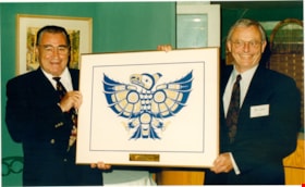
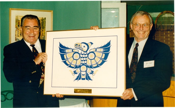
Bill Copeland with Jon Grant
https://search.heritageburnaby.ca/link/archivedescription79309
- Repository
- City of Burnaby Archives
- Date
- July 3, 1996
- Collection/Fonds
- Burnaby NewsLeader photograph collection
- Description Level
- Item
- Physical Description
- 1 photograph : col. ; 11 x 17.5 cm
- Scope and Content
- Photograph of Burnaby mayor Bill Copeland presenting Chairman of Canada Lands Company Jon Grant with the City of Burnaby's Inaugural Environment Award for Planning and Development for their Glenlyon Business Park Development Plan.
- Repository
- City of Burnaby Archives
- Date
- July 3, 1996
- Collection/Fonds
- Burnaby NewsLeader photograph collection
- Physical Description
- 1 photograph : col. ; 11 x 17.5 cm
- Description Level
- Item
- Record No.
- 535-0337
- Access Restriction
- No restrictions
- Reproduction Restriction
- No reproduction permitted
- Accession Number
- 2012-11
- Scope and Content
- Photograph of Burnaby mayor Bill Copeland presenting Chairman of Canada Lands Company Jon Grant with the City of Burnaby's Inaugural Environment Award for Planning and Development for their Glenlyon Business Park Development Plan.
- Subjects
- Officials - Mayors and Reeves
- Media Type
- Photograph
- Notes
- Title based on contents of photograph
- Note in black ink on verso of photograph reads: "Vancouver, June 1996 - Canada Lands Company Receives the City of Burnaby's Inaugural Environment Award for Planning and Development for their Glenlyon Business Park Development Plan. Mayor Bill Copeland (left) from the City of Burnaby presents the award to Mr. Jon Grant, (right) Chairman of Canada Lands Company. "
- Scan is cropped
Images
Social Issues Committee subseries
https://search.heritageburnaby.ca/link/archivedescription96472
- Repository
- City of Burnaby Archives
- Date
- 2003-2012
- Collection/Fonds
- City Council and Office of the City Clerk fonds
- Description Level
- Subseries
- Physical Description
- 35 folders of textual records + 1 photograph
- Scope and Content
- Subseries consists of committee records for the Social Issues Committee including agendas, minutes, committee reports, and a commissioned portrait.
- Repository
- City of Burnaby Archives
- Date
- 2003-2012
- Collection/Fonds
- City Council and Office of the City Clerk fonds
- Series
- Council Committee series
- Subseries
- Social Issues Committee subseries
- Physical Description
- 35 folders of textual records + 1 photograph
- Description Level
- Subseries
- Scope and Content
- Subseries consists of committee records for the Social Issues Committee including agendas, minutes, committee reports, and a commissioned portrait.
- History
- The Social Issues Committee was established January 13, 2003 to replace the Community Issues and Social Planning Committee. The Social Issues Committee advised on a variety of social issues including crime prevention, leasing space at Burnaby’s Community Resource Centres, and the needs of seniors, youth, families, ethnic groups and persons with disabilities. On January 26, 2015, the Social Issues Committee changed its name to the Social Planning Committee.
- Media Type
- Textual Record
- Photograph
- Graphic Material

Barnet mill
https://search.heritageburnaby.ca/link/museumdescription15219
- Repository
- Burnaby Village Museum
- Date
- 1934 (date of original), copied 2004
- Collection/Fonds
- In the Shadow by the Sea collection
- Description Level
- Item
- Physical Description
- 1 photograph (tiff) : 300 dpi
- Scope and Content
- Photograph of the Barnet Mill on the shore of Burrard Inlet. Mill buildings including lodgings are visible.
- Repository
- Burnaby Village Museum
- Collection/Fonds
- In the Shadow by the Sea collection
- Description Level
- Item
- Physical Description
- 1 photograph (tiff) : 300 dpi
- Scope and Content
- Photograph of the Barnet Mill on the shore of Burrard Inlet. Mill buildings including lodgings are visible.
- Names
- Barnet Mill
- Geographic Access
- Burrard Inlet
- Accession Code
- BV019.32.39
- Access Restriction
- No restrictions
- Reproduction Restriction
- No known restrictions
- Date
- 1934 (date of original), copied 2004
- Media Type
- Photograph
- Historic Neighbourhood
- Barnet (Historic Neighbourhood)
- Planning Study Area
- Burnaby Mountain Area
- Notes
- Title based on contents of photograph
- Historical information provided by Burnaby Heritage Planning - Barnet Neighbourhood
Images


Barnet mill burner
https://search.heritageburnaby.ca/link/museumdescription15221
- Repository
- Burnaby Village Museum
- Date
- 1937 (date of original), copied 2004
- Collection/Fonds
- In the Shadow by the Sea collection
- Description Level
- Item
- Physical Description
- 1 photograph (tiff) : 300 dpi
- Scope and Content
- Photograph of the site of the old Barnet Mill burner along the shore of Burrard Inlet. Pilings and rail tracks are visible along the shore. B.C. Electric transmisson towers are visible at the top of the site. Photograph is taken from the water looking south.
- Repository
- Burnaby Village Museum
- Collection/Fonds
- In the Shadow by the Sea collection
- Description Level
- Item
- Physical Description
- 1 photograph (tiff) : 300 dpi
- Scope and Content
- Photograph of the site of the old Barnet Mill burner along the shore of Burrard Inlet. Pilings and rail tracks are visible along the shore. B.C. Electric transmisson towers are visible at the top of the site. Photograph is taken from the water looking south.
- Names
- Barnet Mill
- Geographic Access
- Burrard Inlet
- Accession Code
- BV019.32.41
- Access Restriction
- No restrictions
- Reproduction Restriction
- No known restrictions
- Date
- 1937 (date of original), copied 2004
- Media Type
- Photograph
- Historic Neighbourhood
- Barnet (Historic Neighbourhood)
- Planning Study Area
- Burnaby Mountain Area
- Notes
- Title based on contents of photograph
- Historical information provided by Burnaby Heritage Planning - Barnet Neighbourhood
Images

![Bill Blakely, [between 1954 and 1956] thumbnail](/media/Hpo/_Data/_Archives_Images/_Unrestricted/480/480-1554.jpg?width=280)
Bill Blakely
https://search.heritageburnaby.ca/link/archivedescription64827
- Repository
- City of Burnaby Archives
- Date
- [between 1954 and 1956]
- Collection/Fonds
- Columbian Newspaper collection
- Description Level
- Item
- Physical Description
- 1 photograph : b&w ; 8 x 5.5 cm
- Scope and Content
- Photograph of Burnaby Planning Engineer, William (Bill) Blakely.
- Repository
- City of Burnaby Archives
- Date
- [between 1954 and 1956]
- Collection/Fonds
- Columbian Newspaper collection
- Physical Description
- 1 photograph : b&w ; 8 x 5.5 cm
- Description Level
- Item
- Record No.
- 480-1554
- Access Restriction
- No restrictions
- Reproduction Restriction
- Reproduce for fair dealing purposes only
- Accession Number
- 2003-02
- Scope and Content
- Photograph of Burnaby Planning Engineer, William (Bill) Blakely.
- Names
- Blakely, William "Bill"
- Media Type
- Photograph
- Notes
- Title based on contents of photograph
- Note on verso reads: "W. "Bill" Blakeley / Burnaby"
Images
![Bill Blakely, [between 1954 and 1956] thumbnail](/media/Hpo/_Data/_Archives_Images/_Unrestricted/480/480-1554.jpg)