Narrow Results By
Subject
- Buildings 1
- Buildings - Commercial 1
- Buildings - Heritage 2
- Buildings - Residential - Houses 3
- Clothing 1
- Clothing - Costumes 1
- Clothing - Outerwear 1
- First Nations reserves - British Columbia 1
- Geographic Features - Roads 1
- Geographic Features - Sidewalks 1
- Indigenous peoples - Indian Territory 1
- Transportation 1
Request re Abatement of Nuisance at 3895 Oxford Street
https://search.heritageburnaby.ca/link/councilreport70139
- Repository
- City of Burnaby Archives
- Report ID
- 75088
- Meeting Date
- 12-Oct-1925
- Format
- Council - Committee Report
- Collection/Fonds
- City Council and Office of the City Clerk fonds
- Repository
- City of Burnaby Archives
- Report ID
- 75088
- Meeting Date
- 12-Oct-1925
- Format
- Council - Committee Report
- Collection/Fonds
- City Council and Office of the City Clerk fonds
Documents
Sale by Tender of 4385 MacDonald Avenue and 4407 Oxford Street
https://search.heritageburnaby.ca/link/councilreport44881
- Repository
- City of Burnaby Archives
- Report ID
- 44202
- Meeting Date
- 18-Apr-1955
- Format
- Council - Mayor/Councillor/Staff Report
- Collection/Fonds
- City Council and Office of the City Clerk fonds
- Repository
- City of Burnaby Archives
- Report ID
- 44202
- Meeting Date
- 18-Apr-1955
- Format
- Council - Mayor/Councillor/Staff Report
- Collection/Fonds
- City Council and Office of the City Clerk fonds
Documents
School Patrol Intersection of Oxford Street and Gilmore Avenue
https://search.heritageburnaby.ca/link/councilreport18114
- Repository
- City of Burnaby Archives
- Report ID
- 2902
- Meeting Date
- 1-Nov-1982
- Format
- Council - Committee Report
- Collection/Fonds
- City Council and Office of the City Clerk fonds
- Repository
- City of Burnaby Archives
- Report ID
- 2902
- Meeting Date
- 1-Nov-1982
- Format
- Council - Committee Report
- Collection/Fonds
- City Council and Office of the City Clerk fonds
Documents
Sewer in Lane Between Oxford Street and Cambridge Street
https://search.heritageburnaby.ca/link/councilreport56984
- Repository
- City of Burnaby Archives
- Report ID
- 71755
- Meeting Date
- 8-Nov-1933
- Format
- Council - Mayor/Councillor/Staff Report
- Collection/Fonds
- City Council and Office of the City Clerk fonds
- Repository
- City of Burnaby Archives
- Report ID
- 71755
- Meeting Date
- 8-Nov-1933
- Format
- Council - Mayor/Councillor/Staff Report
- Collection/Fonds
- City Council and Office of the City Clerk fonds
Documents
Sewer in Lane North of Oxford Street
https://search.heritageburnaby.ca/link/councilreport56994
- Repository
- City of Burnaby Archives
- Report ID
- 71766
- Meeting Date
- 22-Nov-1933
- Format
- Council - Mayor/Councillor/Staff Report
- Collection/Fonds
- City Council and Office of the City Clerk fonds
- Repository
- City of Burnaby Archives
- Report ID
- 71766
- Meeting Date
- 22-Nov-1933
- Format
- Council - Mayor/Councillor/Staff Report
- Collection/Fonds
- City Council and Office of the City Clerk fonds
Documents
Stop signs - (a) Oxford Street - Boundary Road to Willingdon Avenue; (b) Albert Street - Boundary Road to Willingdon Avenue
https://search.heritageburnaby.ca/link/councilreport17839
- Repository
- City of Burnaby Archives
- Report ID
- 195
- Meeting Date
- 21-Mar-1983
- Format
- Council - Manager's Report
- Manager's Report No.
- 21
- Item No.
- 12
- Collection/Fonds
- City Council and Office of the City Clerk fonds
- Repository
- City of Burnaby Archives
- Report ID
- 195
- Meeting Date
- 21-Mar-1983
- Format
- Council - Manager's Report
- Manager's Report No.
- 21
- Item No.
- 12
- Collection/Fonds
- City Council and Office of the City Clerk fonds
Documents
![Survey and Subdivision plans in New Westminster District Group 1 & Group 2 - Port Moody, Surrey
, [1898-1910] thumbnail](/media/hpo/_Data/_BVM_Cartographic_Material/1977/1977_0093_0073_001.jpg?width=280)
Survey and Subdivision plans in New Westminster District Group 1 & Group 2 - Port Moody, Surrey
https://search.heritageburnaby.ca/link/museumdescription7042
- Repository
- Burnaby Village Museum
- Date
- [1898-1910]
- Collection/Fonds
- Burnaby Village Museum Map collection
- Description Level
- File
- Physical Description
- 10 plans : graphite and ink on paper and linen; various sizes mounted on 2 sides of cardboard 76 x 102 cm
- Scope and Content
- File consists of a large board with four plans in New Westminster District mounted on one side and six plans mounted on the other side. Side A: 1. Plan : black ink and graphite on paper ; 46.5 x 37.5 cm. Title reads: "Bon Accord Hatchery / Sec 6 B5N R1W". Signed by Albert J. Hill P.L.S. August 1…
- Repository
- Burnaby Village Museum
- Collection/Fonds
- Burnaby Village Museum Map collection
- Description Level
- File
- Physical Description
- 10 plans : graphite and ink on paper and linen; various sizes mounted on 2 sides of cardboard 76 x 102 cm
- Material Details
- Scales vary (One chain equals 792 inches)
- Indexed number on tape on edge of board reads "73"
- Scope and Content
- File consists of a large board with four plans in New Westminster District mounted on one side and six plans mounted on the other side. Side A: 1. Plan : black ink and graphite on paper ; 46.5 x 37.5 cm. Title reads: "Bon Accord Hatchery / Sec 6 B5N R1W". Signed by Albert J. Hill P.L.S. August 12, 1903. Plan covers land identified as Section 6, Section 7, Located along the south shore of the Fraser River in Port Mann (Geographic location: Surrey). 2. Plan : black ink and graphite on paper ; 36 x 31 cm. Title reads: "Survey of Portions of Sec. 20 B5N R2W". Plan is stamped in red ink: "Albert J. Hill, Civil Engineer". Scale 4 chains = 1 inch. 3. Plan : black ink on linen ; 14 x 23 cm. Title reads:"Port Moody". Plan covers sections in Lot 191 (District Lot 191) bordered by Burrard Inlet to the west and Lot 235 and Lot 233 to the south. Streets identified include Water Street, Beauregard Street, Yonge Street, Clinton Street and Oxford Street. 4. Plan: graphite and ink on paper ; 43.5 x 64.5 cm. Title reads: "Sketch Plan Approved by Council [sic] / _[sic]1898". (No identifying geographic landmarks provided) Side B: 1. Plan : graphite on paper ; 53.5 x 31 cm. Title reads: "Plan of Lot 13, Gr. II, N.W. Dist". Sketch plan covers area along the Fraser River in District Lot 13, New Westminster District, Group 2. District Lot 13 is bordered by District Lot 14 (to the west) and Lot 12 (to the east). Natural geographic features within District Lot 13 are noted as "dense brush and fallen timber / sallal / rough spruce and cedar / swamp / fine alder / sallal / fine alder bottom land / fine brook". Scale: 3 chains = 1 inch (Geographic location: Surrey) 2. Plan : black ink on paper ; 50.5 x 34.5 cm. Title reads: "Indian Reserve / Opposite / New Westminster". Plan covers area on the south shore of the Fraser River in New Westminster District Group 2 in an area known as Brownsville. Lots are identified as District Lots 1, 2, 3, 4, 18, 17 and 8 and Sections A and B. Two areas of land are noted as "Indian Reserve"; one 6.3 acre parcel and one 104.25 acre parcel, both within District Lot 1. Note on plan reads: "N.B. this plan shows reserves and adjacent properties as they are on the ground". (Geographic location: Surrey) 3. Plan : black and col. ink on paper ; 19.5 x 31.5 cm. Title reads: "Bon Accord Road". Plan shows elevation. "Average section 10 feet = 1 inch". Plan is stamped in red ink: "Albert J. Hill, Civil Engineer and Provincial Land Surveyor, New Westminster, B.C." (Geographic location: Surrey) 4. Plan : black and col. ink on linen ; 16.5 x 25.5 cm. (no formal title) Plan covers area of Section 35, south of Yale Wagon Road and east of Quible Road. Plan is signed by "Albert J. Hill / B.C.L.S." (Geographic location: Surrey) 5. Plan: black and col. ink on linen ; 22.5 x 22.5 cm. (no formal title) Plan covers area between Yale Road and Townline Road in Surrey. Scale: 4 chains = 1 inch. Plan is signed by Albert J. Hill B.C.L.S. [190-] (Geographic location: Surrey) 6. Plan : graphite on paper ; 24 x 54 cm. (no formal title) Plan covers sectioned areas along Bon Accord Road. Sections are identified as " Sec. 8 / T.F. Patterson"; "Sec. 9 / Russell"; "Elliott_Burnett_Crean / Sec. 16"; "Dom. Govt. / Sec. 17". (Geographic location: Surrey, beneath the Port Mann bridge)
- Names
- ʷməθkʷəy̓əm (Musqueam)
- Accession Code
- HV977.93.73
- Access Restriction
- No restrictions
- Reproduction Restriction
- No known restrictions
- Date
- [1898-1910]
- Media Type
- Cartographic Material
- Scan Resolution
- 600
- Scan Date
- 2023-06-26
- Notes
- Title based on contents of file
- Note re plan 2B: The sight of Brownsville was also the former site of the Qayqayt First Nation and one of the main summer villages of the Kwantlen and ʷməθkʷəy̓əm (Musqueam) peoples
Zoomable Images
![Survey and Subdivision plans in New Westminster District Group 1 & Group 2 - Port Moody, Surrey
, [1898-1910] thumbnail](/media/hpo/_Data/_BVM_Cartographic_Material/1977/1977_0093_0073_003_seadragon/1977_0093_0073_003.jpg?w=280)
Survey and Subdivision plans in New Westminster District Group 1 & Group 2 - Port Moody, Surrey , [1898-1910]
Zoom into Image
Temporary Road Opening on Oxford Street
https://search.heritageburnaby.ca/link/councilreport76106
- Repository
- City of Burnaby Archives
- Report ID
- 76077
- Meeting Date
- 18-Sep-1911
- Format
- Council - Committee Report
- Collection/Fonds
- City Council and Office of the City Clerk fonds
- Repository
- City of Burnaby Archives
- Report ID
- 76077
- Meeting Date
- 18-Sep-1911
- Format
- Council - Committee Report
- Collection/Fonds
- City Council and Office of the City Clerk fonds
Documents
Temporary Wagon Road on Oxford Street
https://search.heritageburnaby.ca/link/councilreport75213
- Repository
- City of Burnaby Archives
- Report ID
- 74711
- Meeting Date
- 29-May-1911
- Format
- Council - Committee Report
- Collection/Fonds
- City Council and Office of the City Clerk fonds
- Repository
- City of Burnaby Archives
- Report ID
- 74711
- Meeting Date
- 29-May-1911
- Format
- Council - Committee Report
- Collection/Fonds
- City Council and Office of the City Clerk fonds
Documents
Tenders for Tax Sale Properties on Newcombe Street, Oxford Street, McDonald Avenue, Fir Street and Barker Street
https://search.heritageburnaby.ca/link/councilreport44845
- Repository
- City of Burnaby Archives
- Report ID
- 44289
- Meeting Date
- 2-May-1955
- Format
- Council - Mayor/Councillor/Staff Report
- Collection/Fonds
- City Council and Office of the City Clerk fonds
- Repository
- City of Burnaby Archives
- Report ID
- 44289
- Meeting Date
- 2-May-1955
- Format
- Council - Mayor/Councillor/Staff Report
- Collection/Fonds
- City Council and Office of the City Clerk fonds
Documents
Traffic Barricades - Oxford Street
https://search.heritageburnaby.ca/link/councilreport18068
- Repository
- City of Burnaby Archives
- Report ID
- 2946
- Meeting Date
- 22-Nov-1982
- Format
- Council - Committee Report
- Collection/Fonds
- City Council and Office of the City Clerk fonds
- Repository
- City of Burnaby Archives
- Report ID
- 2946
- Meeting Date
- 22-Nov-1982
- Format
- Council - Committee Report
- Collection/Fonds
- City Council and Office of the City Clerk fonds
Documents
Traffic Barricades - Oxford Street
https://search.heritageburnaby.ca/link/councilreport18125
- Repository
- City of Burnaby Archives
- Report ID
- 2917
- Meeting Date
- 1-Nov-1982
- Format
- Council - Manager's Report
- Manager's Report No.
- 61
- Item No.
- 10
- Collection/Fonds
- City Council and Office of the City Clerk fonds
- Repository
- City of Burnaby Archives
- Report ID
- 2917
- Meeting Date
- 1-Nov-1982
- Format
- Council - Manager's Report
- Manager's Report No.
- 61
- Item No.
- 10
- Collection/Fonds
- City Council and Office of the City Clerk fonds
Documents
Traffic on Oxford Street
https://search.heritageburnaby.ca/link/councilreport8913
- Repository
- City of Burnaby Archives
- Report ID
- 12999
- Meeting Date
- 21-Mar-1994
- Format
- Council - Committee Report
- Collection/Fonds
- City Council and Office of the City Clerk fonds
- Repository
- City of Burnaby Archives
- Report ID
- 12999
- Meeting Date
- 21-Mar-1994
- Format
- Council - Committee Report
- Collection/Fonds
- City Council and Office of the City Clerk fonds
Documents
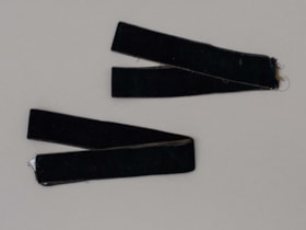
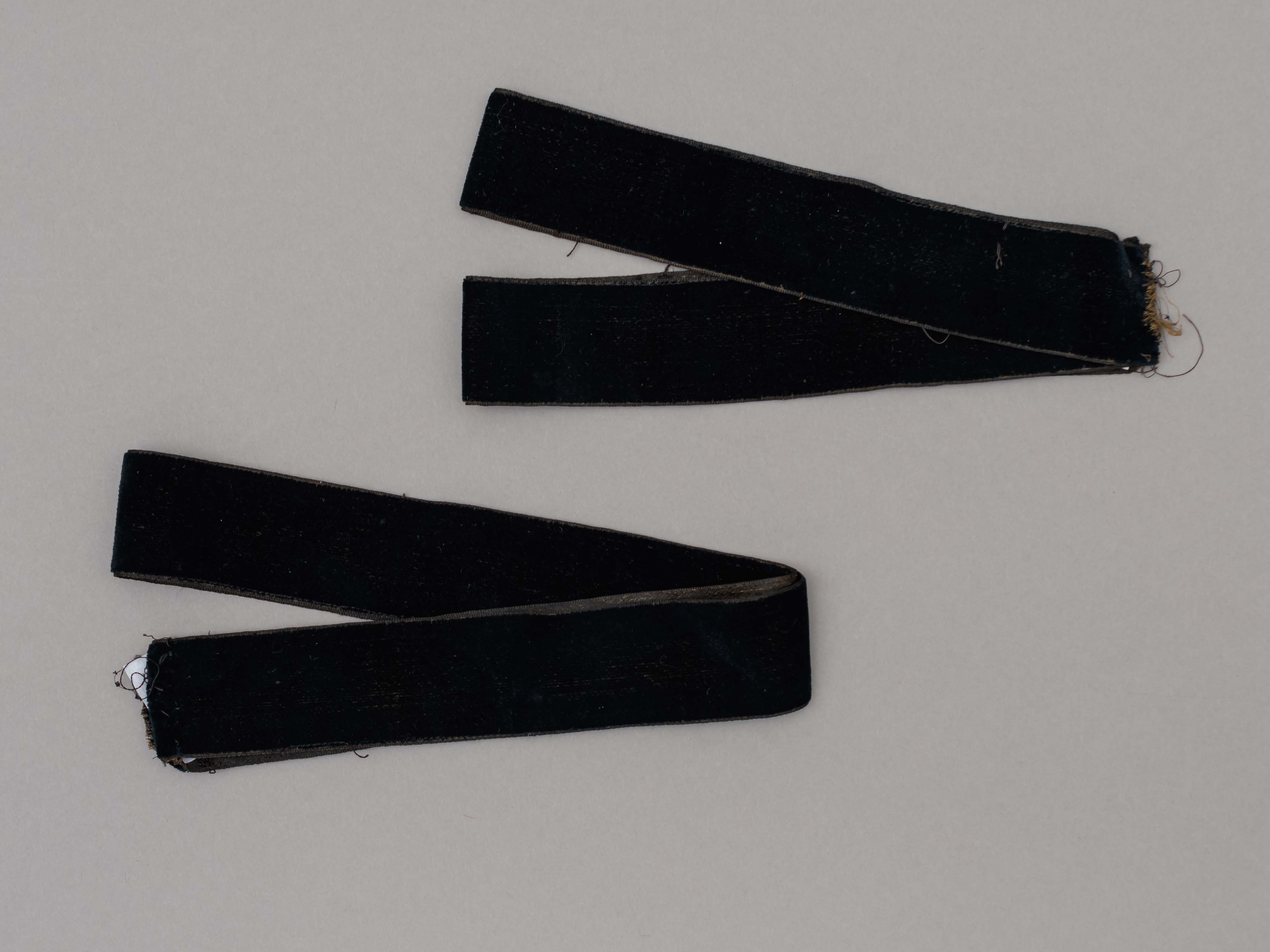
velvet trim
https://search.heritageburnaby.ca/link/museumartifact80966
- Repository
- Burnaby Village Museum
- Accession Code
- BV007.16.7
- Description
- Two pieces of black velvet trim both 1 inch in width and 33 inches in length.
- Object History
- Found in the 1950s when donor moved to 3814 Oxford Street, the former home of Burnaby Councillor Angus MacDonald (1854-1943). Presumed to be from his family and could have belonged to his spouse Margaret I. Thompson MacDonald (1862-1939).
Images
Volume of Traffic on Oxford Street
https://search.heritageburnaby.ca/link/councilreport21178
- Repository
- City of Burnaby Archives
- Report ID
- 13575
- Meeting Date
- 26-Feb-1979
- Format
- Council - Committee Report
- Collection/Fonds
- City Council and Office of the City Clerk fonds
- Repository
- City of Burnaby Archives
- Report ID
- 13575
- Meeting Date
- 26-Feb-1979
- Format
- Council - Committee Report
- Collection/Fonds
- City Council and Office of the City Clerk fonds