Narrow Results By
Subject
- Advertising Medium 1
- Agricultural Tools and Equipment 1
- Agriculture - Crops 1
- Agriculture - Farms 3
- Agriculture - Fruit and Berries 2
- Animals - Cows 1
- Animals - Goats 1
- Animals - Horses 2
- Buildings 2
- Buildings - Civic - Museums 1
- Buildings - Commercial 2
- Buildings - Commercial - Department Stores 18
Creator
- Brown, William Thomas 1
- Burlin, Mauritz 1
- Burnett, Geoffrey K. 4
- Burnett & McGugan, Engineers and Surveyors 9
- Columbian Photo Limited 5
- Cooksley, William Thomas 5
- Croton Studio Limited 1
- Draper, William Nelson 1
- Grant-Mann Lithographers Limited 1
- Hill, Albert James 12
- Hill & Burnett 1
- Hoyer Studios 1
Person / Organization
- Armstrong Avenue School 1
- Baehr, G. A. 1
- Bank of Nova Scotia 1
- Barnet School 1
- Boy Scouts of Canada 1
- Brackman-Ker Milling Company 1
- British Columbia Provincial Police 1
- Burnaby Historical Society 2
- Burnaby Mountain Centennial Park 1
- Burnaby Village Museum 1
- Burton, Charles Luther 3
- Burton, Edgar G. 3
statement
https://search.heritageburnaby.ca/link/museumartifact3858
- Repository
- Burnaby Village Museum
- Accession Code
- BV988.33.13
- Description
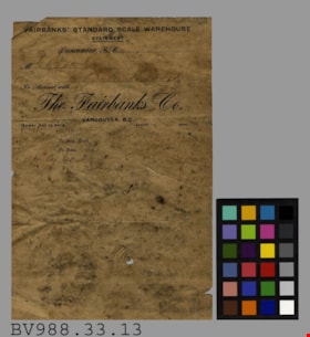
- Fairbanks' Standard Scale Warehouse - Statement -- [190-?]. Bill statement from Fairbanks' Standard Scale Warehouse for G.R. Love Esq. of New Westminster B.C. There is faint writing on the page with the only really legible writing being "By Cash". The statement measures 13.5cm x 20.5cm.
- Object History
- object was found in the Jesse Love farmhouse when moved to the Museum.
- Names
- Love, George Richard
Images


B C driver's licence
https://search.heritageburnaby.ca/link/museumartifact18261
- Repository
- Burnaby Village Museum
- Accession Code
- HV978.57.5
- Description
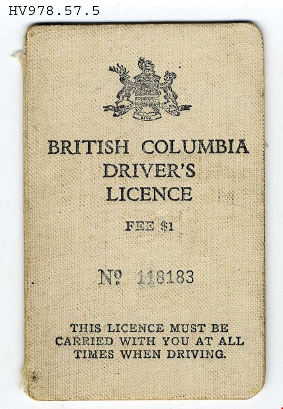
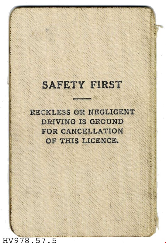
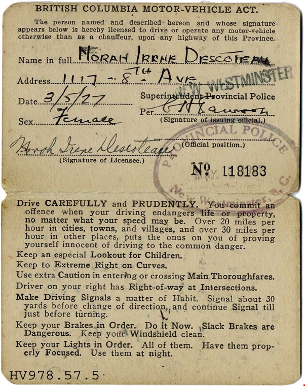
- British Columbia Driver's Licence -(License) -- [1927]. Driver's Licence issued to Norah Irene Descoteau in 1927. The front cover has the Provincial Coat of Arms and the issue number for the licence "No. 118183". It states that "The Licence Must Be Carried With You At All Times When Driving". Inside provides detailed infromation about Norah and rules and regulations to driving. The license has been stamped by the Provincial Police in New Westminster, B.C.
- Object History
- From the estate of Norah Byrne, daughter of Peter Byrne and Priscilla Amelia Rowling Rowling. She married William Napoleon Descoteau on May 28th 1924 in New Westminster. William worked as a steam engineer on the railroad.
Images
certificate
https://search.heritageburnaby.ca/link/museumartifact34753
- Repository
- Burnaby Village Museum
- Accession Code
- BV992.45.1
- Description
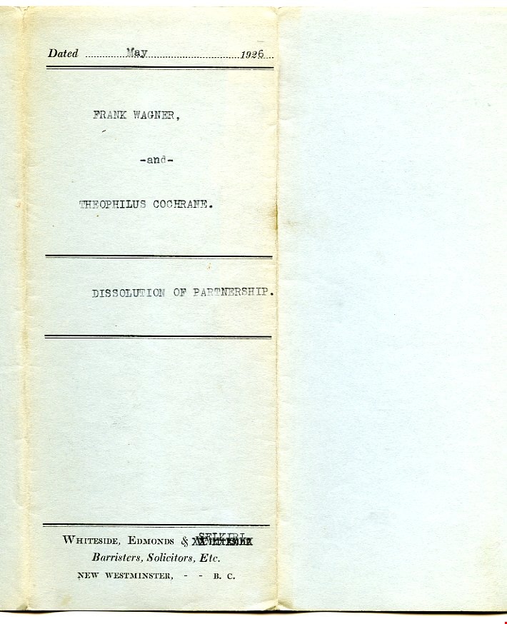
- Dissolution of Partnership - Certificate -- [1926]. Certificate, four typed pages in blue paper cover, folded twice; typed on cover to show when folded, "FRANK WAGNER," "-and-" "THEOPHILUS COCHRANE." "DISSOLUTION OF PARTNERSHIP."; preprinted with borders top and bottom; above upper border, "Dated" and dotted line, "19" at right, has been typed in as May, 1926; two borders at middle, title has been typed between; below bottom border, "WHITESIDE, EDMONDS & WHITESIDE" "Barristers, Solicitors, Etc." "NEW WESTMINSTER, - - B.C."; 2nd 'Whiteside' is 'X'ed out by typewriter, "SELKIRL"? typed above it; form begins "THIS INDENTURE made the", then handwritten "Tenth", then typed "day of May,..."; signed by both parties, red seals; witnessed by John Murray, broker, 4009 Kingsway, Burnaby; paper is very thin, blue margin at left, watermark "MAPLE LEAF" and U and T
- Category
- 08. Communication Artifacts
- Classification
- Documentary Artifacts - - Legal Documents
- Colour
- Blue
- Names
- Wagner, Frank
Images


envelope
https://search.heritageburnaby.ca/link/museumartifact34770
- Repository
- Burnaby Village Museum
- Accession Code
- BV992.45.19
- Description
- Wagner Bumper & Spring Works - Envelope. Business envelope for Wagner Bumper and Spring Works at 4236 Kingsway, New Westminster, B.C. The envelope measures 16.5cm x 9cm.
- Object History
- Mr. Wagner patented his Triple Spring Bumper for automobiles and attempted to interest one of the major automobile manufacturers in purchasing his patent. He manufactured some bumpers and sold them locally.
- Colour
- Beige
- Names
- Wagner, Frank
Images


envelope
https://search.heritageburnaby.ca/link/museumartifact34773
- Repository
- Burnaby Village Museum
- Accession Code
- BV992.45.22
- Description
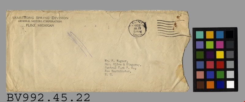
- Armstrong Spring Division - Envelope -- [1925]. Envelope, buff paper; preprinted return address in black at upper left, "ARMSTRONG SPRING DIVISION" "GENERAL MOTORS CORPORATION" "FLINT, MICHIGAN"; typewritten address in black "Mr F. Wagner," "Cor. Olive & Kingsway," "Central Park P.O.," "New Westminster," "B.C."; partial brown stamp at upper right, torn off; postmark "FLINT MICH." "1925" "JUL 29" "530 PM" and seven wavy lines; right end torn off; no contents, some tears, stains, and discolouration, scribble in blue ink between sender's and recipients' addresses
- Object History
- Mr. Wagner patented his Triple Spring Bumper for automobiles and attempted to interest one of the major automobile manufacturers in purchasing his patent. He manufactured some bumpers and sold them locally.
- Colour
- Beige
Images
certificate and envelope
https://search.heritageburnaby.ca/link/museumartifact38387
- Repository
- Burnaby Village Museum
- Accession Code
- BV997.21.8
- Description
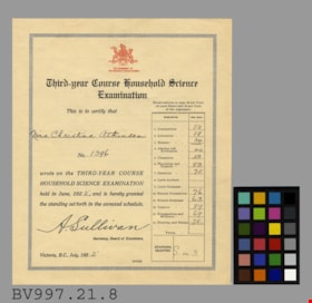
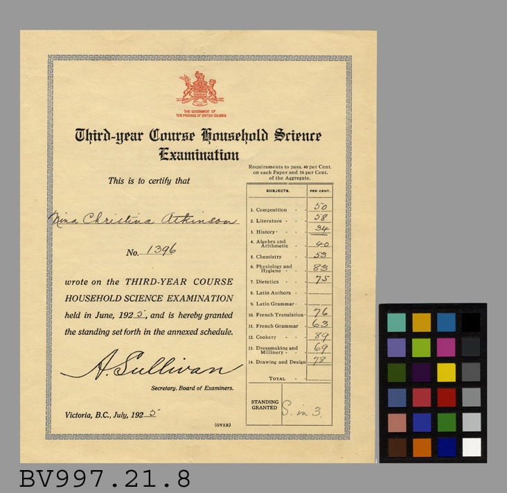
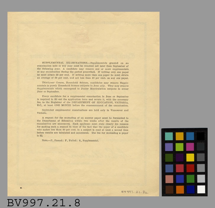
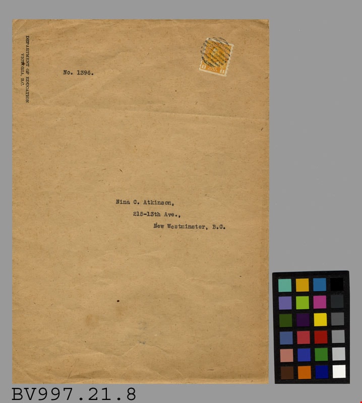
- Third Year Course Household Science Examination - Certificate and Envelope -- [1925]. Third Year Course Household Science Examination Certificate for Nina Christina Atkinson, No. 1396. The examination was held in June 1925. Nina was tested in Composition, Literature, History, Algebra and Arithmetic, Chemistry, Physiology and Hygiene, Dietetics, French Translation, French Grammar, Cookery, Dressmaking and Millinery, and finally Drawing and Design. In red at the top of the certificate is the Coat of Arms for British Columbia and written below is "The Government of the Province of British Columbia. On the reverse side is information on supplement examinations. The certificate measures 18cm x 22cm. The envelope is brown paper addressed to Nina C. Atkinson, at 215-13th Ave., New Westminster, B.C.. The envelope has an orange King George V stamp on the top right corner and "Department of Education/ Victoria, B.C." written on the top left corner. The envelope has a butterfly enclosure and measures 19cm x 27cm.
- Colour
- Beige
Images
certificate and envelope
https://search.heritageburnaby.ca/link/museumartifact38395
- Repository
- Burnaby Village Museum
- Accession Code
- BV997.21.9
- Description
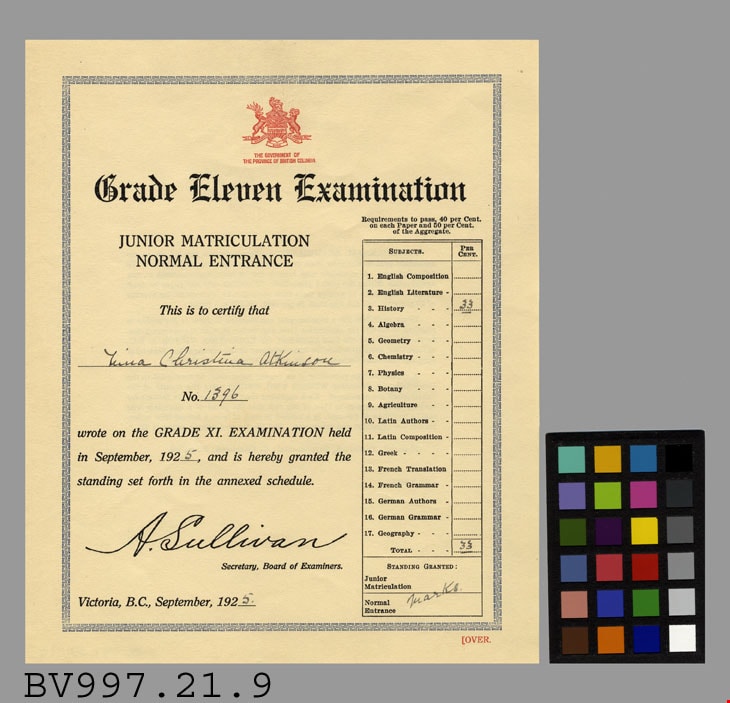
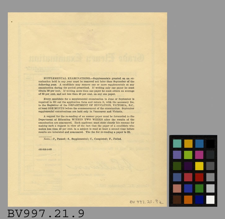
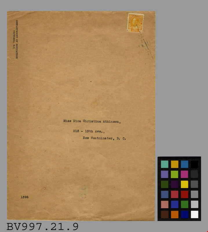
- Grade Eleven Examination - Certificate and Envelope -- [1925]. Grade Eleven Examination for Junior Matriculation Normal Entrance for Nina Christina Atkinson, No. 1396. The exam was taken in September of 1925. The only subject that Nina wrote on was History. In red at the top of the certificate is the Coat of Arms for the Province of British Columbia. Below the coat of arms is "The Government of the Province of British Columbia". On the reverse side of the certificate is information on supplemental examinations. The certificate measures 18.5cm x 22.5cm. The envelope is brown paper and was addressed to Miss Nina Christina Atkinson, 215 - 13th Ave., New Westminster, B.C.. The envelope was from the Department of Education in Victoria, B.C. and has an orange King George V stamp on the top right corner. The envelope has a butterfly enclosure and measures 19cm x 27cm.
- Object History
- Artifact 9a was received in artifact 9b
- Colour
- Beige
Images
card
https://search.heritageburnaby.ca/link/museumartifact39322
- Repository
- Burnaby Village Museum
- Accession Code
- BV998.58.1
- Description
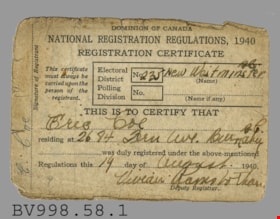
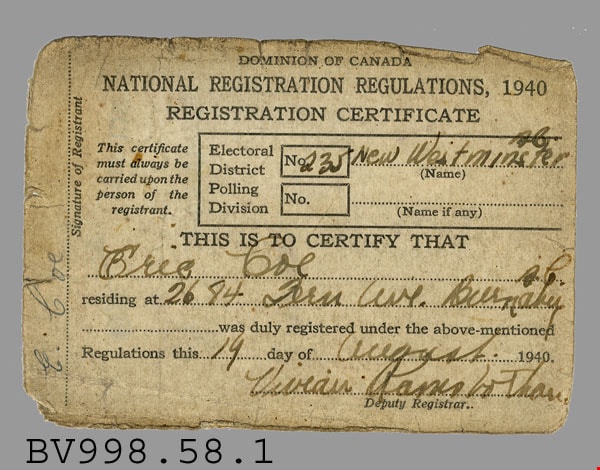
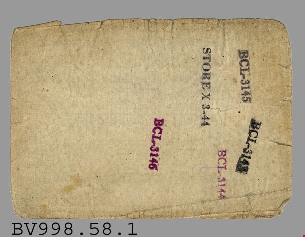
- National Registration Regulations - Card -- [1940]. Dominion of Canada National Registration Card for Eric Coe of 2684 Fern Avenue, Burnaby. Eric Coe was Part of the Electoral District Number 235 New Westminster, B.C. The registration card was signed on August 19th, 1940 and was signed by Deputy Registrar Vivean Ramsbothan (?). On the back of the card are several ink stamps "BCL-3143", "BCL-3144", "BCL-3145", "BCL 3146" and "STORE X 3-44". The card measures 10cm x 7cm.
- Colour
- White
- Names
- Coe, Eric
Images
postcard
https://search.heritageburnaby.ca/link/museumartifact44127
- Repository
- Burnaby Village Museum
- Accession Code
- BV002.3.1
- Description
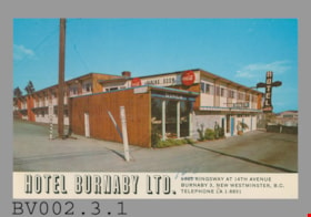
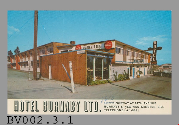
- Postcard: colour photo, glossy; horizontal; hotel; white bar across bottom with black-shaded white "HOTEL BURNABY LTD.", black "1385 KINGSWAY AT 14th AVENUE" "BURNABY 3, NEW WESTMINSTER, B.C." "TELEPHONE LA 1-8891"; '1385' crossed out, '7610' written above in pen; shows two-storey building with wood trim, white plaster; totem-pole shaped neon sign, vertical "HOTEL" on black ground, "VACANCY" and "PARKING" below; "DINER" on blue awning of nearest part of building, single-storey; black "DINING ROOM" on white sign on side of higher building, red "Coca-Cola" bottlecap sign either side; New Westminster Hog Fuel? building visible in background; on reverse in blue, "HOTEL BURNABY" "Located between new Simpson-Sears and new Woodwards shopping centres. You will remember HOTEL BURNABY for the REST of your life."; up centre, "MADE IN CANADA BY GRANT-MANN LITHOGRAPHERS LTD. "COLOR CARD" DIVISION, VANCOUVER, BRITISH COLUMBIA."; at bottom, "C-50"; at top, "POST CARD" "ADDRESS"; outline of rectangle at upper right, "STAMP"; c. late 1950s; unused; pencilled "1-" at top; lightly soiled; corners worn
- Classification
- Written Communication T&E - - Writing Media
- Object Term
- Postcard
- Country Made
- Canada
- Province Made
- British Columbia
- Site/City Made
- Vancouver
- Title
- Hotel Burnaby Ltd. C-50
- Subjects
- Souvenirs
Images
postcard
https://search.heritageburnaby.ca/link/museumartifact45030
- Repository
- Burnaby Village Museum
- Accession Code
- BV002.61.3
- Description
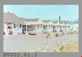
- Postcard: colour photo, glossy; horizontal; row of single-storey white bungalows with red trim, cars, people sitting in folding chairs, driveway, stone wall and coloured flower planters mounted on wall with metal supports; on reverse in blue "Open all Year" "De VALL'S AUTO VILLAS & MOTEL" "4361, Kingsway, S.B.1" "VANCOUVER, B.C., CANADA" "Phone HE-3-0033" and promotional copy; at bottom left, "Photo Stamp Distributors, 809 21st. St. New Westminster, B.C."; up centre is "Published by Alex Wilson Publications Ltd., Dryden, Ontario"; at bottom, "Spectrome COLOR" "WILSON DRYDEN ONT." "MADE IN CANADA", lion logo, 'Spectrome' has 'R' in circle beside it; at upper right, "POST CARD" "ADDRESS ONLY", outline of rectangle with "This Card is a 100% Canadian Product"; at bottom right, "3421R"; pencilled at top centre, "2-"; slight peeling of upper left corner; unused
- Classification
- Written Communication T&E - - Writing Media
- Object Term
- Postcard
- Country Made
- Canada
- Province Made
- Ontario
- Site/City Made
- Dryden
- Title
- De Vall's Auto Villas & Motel 3421R
- Subjects
- Documentary Artifacts
- Documentary Artifacts - Postcards
- Documentary Artifacts - Photographs
- Buildings
- Buildings - Commercial
- Buildings - Commercial - Hotels and Motels
Images

postcard
https://search.heritageburnaby.ca/link/museumartifact47179
- Repository
- Burnaby Village Museum
- Accession Code
- BV004.44.1
- Description
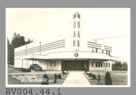
- Postcard, black and white photo; horizontal; white Art Deco building with corner entrance, car under canopy at left; in white at lower left, "THE OAK THEATRE" "ROYAL OAK, BURNABY," "NEW WESTMINSTER, B.C."; clock at front of canopy shows 6:43; glossy, white border; ca.1940s; on reverse in grey, "POST CARD" "MADE IN CANADA" "CORRESPONDENCE" "ADDRESS"; at upper right, outline of rectangle formed by "AZO" printed four times, squares at corners; finger? smudge, brownish marks at right; gloss worn? at some places along edges on front; unused
- Classification
- Written Communication T&E - - Writing Media
- Object Term
- Postcard
- Marks/Labels
- The Oak Theatre / Royal Oak / Burnaby / New Westminster, B.C.
- Colour
- Black
- White
- Country Made
- Canada
- Title
- The Oak Theatre Royal Oak, Burnaby, New Westminster, B.C.
- Subjects
- Documentary Artifacts
- Documentary Artifacts - Postcards
- Documentary Artifacts - Photographs
- Buildings
- Buildings - Commercial
- Buildings - Commercial - Theatres
Images


postcard
https://search.heritageburnaby.ca/link/museumartifact48137
- Repository
- Burnaby Village Museum
- Accession Code
- BV004.113.1
- Description
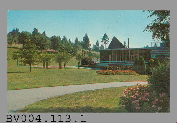
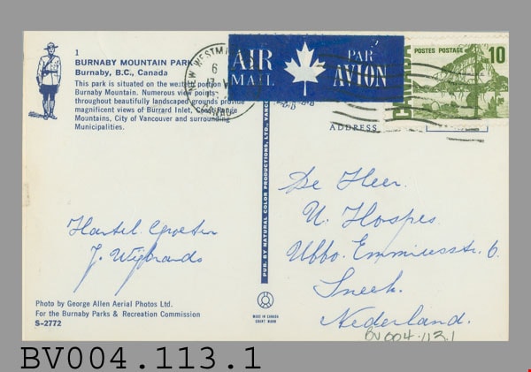
- Postcard: colour photograph of Burnaby Mountain Park including Centennial Pavilion; horizontal; on reverse in blue: "1" "BURNABY MOUNTAIN PARK" "Burnaby, B.C., Canada" "This park...", drawing of R.C.M.P. officer at left; photo by "George Allen Aerial Photos Ltd. For the Burnaby Parks & Recreation Commission" "S-2772"; blue bar up centre with "PUB. BY NATURAL COLOR PRODUCTIONS, LTD. VANC.-", rest covered; at bottom "MADE IN CANADA" "GRANT-MANN"; green 10 cent stamp at upper right; blue and white "AIR MAIL PAR AVION" label top centre; postmarked "NEW WESTMINSTER B.C. CANADA" "6 -" "17 -" "19--"; cancelled with 7 wavy lines; under "ADDRESS" at right side, in blue pen, "De Heer" "U. Hospes." "Uffo. Emmiresstr. 6." "Sneet"? "Nederland."; message "Hantel Cproetin"? "J. Wisbrands"?; corners slightly worn
- Classification
- Written Communication T&E - - Writing Media
- Object Term
- Postcard
- Marks/Labels
- Burnaby Mountain Park / Burnaby, B.C., Canada / George Allen Aerial Photos Ltd. / Burnaby Parks and Recreation Commission / S-2772
- Country Made
- Canada
- Province Made
- British Columbia
- Site/City Made
- Vancouver
- Title
- Burnaby Mountain Park 1 S-2772
- Publication Date
- [ca. 1970]
- Subjects
- Documentary Artifacts
- Documentary Artifacts - Postcards
- Documentary Artifacts - Photographs
- Geographic Features
- Geographic Features - Parks
Images
sheet music
https://search.heritageburnaby.ca/link/museumartifact49051
- Repository
- Burnaby Village Museum
- Accession Code
- HV972.122.159
- Description
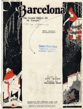
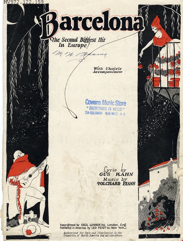
- Barcelona - Sheet Music -- [1926]. The cover is stamped by Cowans Music Store, 714 Columbia, New Westminster, B.C.,
- Lyrics by Gus Kahn, music by Tolchard Evans
- Maker
- Leo. Feist Incorporated
- Country Made
- England
- Site/City Made
- London
- Patent Date
- Copyright 1926
Images

company seal with box
https://search.heritageburnaby.ca/link/museumartifact81963
- Repository
- Burnaby Village Museum
- Accession Code
- BV012.14.36
- Description
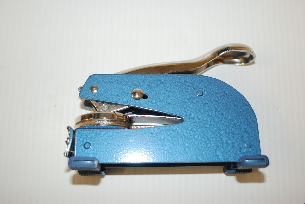
- A steel seal stamp machine with a blue painted body and silver lever. The seal is circular in shape. Four rubber feet are present. A name plate holding a card printed with "JOHN YANKO TILE CO. LTD." is attached at the front of the stamp. The cardboard box is white with "SEALS & EMBOSSERS OFFICIAL" printed continuously over it. The name "JOHN" is printed in handwritten ink. Markings on the lever: "OFFICIAL LONG REACH PAT.2,706 448" A sticker on the underside reads: "Westamp TELEPHONE 521-4448 or 521-1722 35 - 8th Ave, New Westminster, B.C. V3L 1X6" The stamp imprints along the perimeter of the circle: "JOHN YANKO TILE CO. LTD." with a 5 pointed star. In the middle "SEAL".
- Object History
- Hand tools used by John Yanko in his business as a tile setter. Annie D. Basiuk (later Yanko) was born on February 25, 1902 in Sheho, Saskatchewan (formerly Sheho, North West Territories). Daniel "Dan" Yanko was born in Kobilnicha, Ukraine in 1887 and immigrated to Canada in May or June of 1905. Daniel Yanko married Annie D. Basiuk and had thirteen children together. Their son, John Ivan Yanko was born on the family farm, near Kelliher, Saskatchewan, on June 27, 1923. In grade six, John was pulled out of school to help support the family. Eugenia “Jenny” Haresomovych (later Carman) was born August 8, 1904 in Galecia, Austria. She came to Canada in 1928, when her parents sent her to live with the Austrian consular in Halifax. A year later, she was in The Pas with Albert Edward Carman, with whom she would have three children. Their daughter, Leida Doria "Lillian Doris" Carman was born in The Pas, Manitoba March 24, 1929. Eugenia “Jenny” (Haresomovych) Carman later re-married Joseph Nagy who was born in Hungary in October 3, 1900. Jenny, Joseph and the children moved to Nelson, British Columbia, where Joseph worked for the Canadian Pacific Railway. At the age of twenty, John Yanko met his future wife Lillian Doris Carman while visiting relatives in Burnaby. Lillian received a rail pass because of her dad’s employment with the CPR and at fourteen had gone to visit her Godmother in Burnaby. John Ivan Yanko and Leida Doria "Lillian Doris" Carman were married October 16, 1948 in Nelson, British Columbia and moved into the basement of John’s sister’s house on Union Street. Lillian began working at the downtown Woodward’s store as a cashier in 1948. In 1950, the young couple bought property at 7385 (later renumbered 7391) Broadway in Burnaby and began constructing a house as they could afford it. Knowing she’d be let go if she was pregnant, when Lillian was expecting her first child, Jenny sewed her several versions of the same outfit; they all used the same material, but each was a little bit larger than the last to accommodate her expanding girth. Rhonda, born in 1953 and Charmaine, born in 1955, grew up in the Broadway home. They attended school at Sperling Elementary, and later at Burnaby North high school. Lillian left her job to be a stay-at-home mom when Rhonda was born, but that changed in 1963 when John and Charmaine were in a car accident that left John temporarily unable to work. Joseph Nagy died April 20, 1962; his wife Eugenia “Jenny” (Haresomovych) (Carman) Nagy passed away August 14, 1985. Daniel "Dan" Yanko died in 1976; his wife Annie D. (Basiuk) Yanko died in 1997. John Yanko later returned to work, establishing his own tile setting business and working until age eighty-two. John and Lillian lived out the rest of their married lives on the Broadway property. John Ivan Yanko passed away in 2010; his wife Leida Doria "Lillian Doris" Carman (Carman) Yanko passed away in 2011.
- Measurements
- Overall measurements: Length: 14.5 cm Width: 5.4 cm Height (handle open: 18.7 cm)
- Names
- Yanko, John Ivan
- Yanko Family
Images
![Survey and Subdivision plans in New Westminster District Group 1 – Burnaby
, [1861]-[1910] thumbnail](/media/hpo/_Data/_BVM_Cartographic_Material/1977/1977_0093_0019a_001.jpg?width=280)
Survey and Subdivision plans in New Westminster District Group 1 – Burnaby
https://search.heritageburnaby.ca/link/museumdescription6988
- Repository
- Burnaby Village Museum
- Date
- [1861]-[1910]
- Collection/Fonds
- Burnaby Village Museum Map collection
- Description Level
- File
- Physical Description
- 14 plans : 3 plans : black ink on paper hand col. + 7 plans : black ink on paper + 4 plans : graphite on paper mounted on 2 sides of cardboard 76 x 102 cm
- Scope and Content
- Item consists of a large board of four New Westminster District Gp 1 - subdivision plans mounted on one side and ten New Westminster District Gp 1 - subdivision plans mounted on the other side. Side A: 1. "Plan /of / Lots 166A, 166 and 167 /, Gr.1, N.W.D. / Showing Misconstructed Roads in Gree…
- Repository
- Burnaby Village Museum
- Collection/Fonds
- Burnaby Village Museum Map collection
- Description Level
- File
- Physical Description
- 14 plans : 3 plans : black ink on paper hand col. + 7 plans : black ink on paper + 4 plans : graphite on paper mounted on 2 sides of cardboard 76 x 102 cm
- Material Details
- Scales [between 1:2376 and 1:7920]
- Index number on edge of board reads: "19"
- Scope and Content
- Item consists of a large board of four New Westminster District Gp 1 - subdivision plans mounted on one side and ten New Westminster District Gp 1 - subdivision plans mounted on the other side. Side A: 1. "Plan /of / Lots 166A, 166 and 167 /, Gr.1, N.W.D. / Showing Misconstructed Roads in Green / 5 chs = 1 in.". (plan is drawn in black ink and hand coloured in red, green and orange ink). A section in the centre of the plan is coloured in red ink and identified as "C.S. Richmond" running from the North Arm of Fraser River to Wiggins Road and divided by "New Wiggins Rd. (as gazetted)" (coloured in orange ink) and two"Constructed Road(s)" (coloured in green ink). Plan is initialed by: "RB" [sic] (in blue pencil crayon) 2. Plan of / Subdivision of / Lot 166 / Group One / New Westminster District / Scale 4 chs = 1 in. / Map No 524". Plan is drawn in graphite and signed by "Surrig [sic] Welhams [sic] / P.L.S." Plan is initialed by: "RB" [sic] (in blue pencil crayon) 3. Plan of "Survey / of Highway / For / Burnaby Council / in / Lots 13 _14 / Group One / Scale 4 chs = 1 in." Signed by "Albert J. Hill, P.L.S." Caribou Street and Caribou Road run through the centre of the plan. Plan is stamped: "Albert J. Hill, Civil Engineer / and / Provincial Land Surveyor, / New Westminster, / B.C.". Plan is initialed by: "RB" [sic] (in blue pencil crayon) 4. A Plan of Lots 166A, 166 and 167, Group One, New Westminster District (drawn in graphite). A section in the centre of the plan is identified as "C.S. Richmond" running from the North Arm of Fraser River and divided by "New Wiggins Rd. (as gazetted)" and two "Constructed Road(s)". Plan is initialed by: "RB" [sic] (in blue pencil crayon) Side B: 1. Small plan drawn in black ink (no title) identifying lots north of the "North Arm" of the Fraser River. Lots identified include: Lot 99, Lot 98, Lot 157, Lot 158, Lot 163, Lot 162, Lot 159, Lot 163, Lot 162, Lot 165, Lot 166A, Lot 155B, Lot 155A and Lot 159. "Scale 40 chains to one inch" . Plan is initialed by: "RB" [sic] (in blue pencil crayon) (Geographic location: Burnaby) 2. Small plan drawn in black ink (no title) identifying lots north of the North Arm of the Fraser River as "Lots 155, 155A, 155B, 155C, 162, 163, 164, 165, 166A and 167". Plan is initialed by: "RB" [sic] (in blue pencil crayon) (Geographic location: Burnaby) 3. Small plan drawn in black ink (no title) which identifies "Lot 151 / Reserve/ for / Race Course"; "Reserve / 64 A / L. 152 G.1"; and other Lots: 32, 33, 34, 35, 36, 38, 39. The plan is signed "Surveyor G.Turn [sic] July / 61 / from Vol 40 R.L. notes [sic]" Plan is stamped: "Albert J. Hill, Civil Engineer / and / Provincial Land Surveyor, / New Westminster, / B.C." Plan is initialed by: "RB" [sic] (in blue pencil crayon) (Geographic location: Burnaby) 4. Small plan drawn in black in with faded red colouring on centre lot identified as "Lot 34" running north from "Vancouver Road" . Plan is stamped: "Albert J. Hill, Civil Engineer / and / Provincial Land Surveyor, / New Westminster, / B.C." Plan is initialed by: "RB" [sic] (in blue pencil crayon) (Geographic location: Burnaby) 5. Plan drawn in graphite and identified as "Lot 98, Gr.1," along with the intials "RB" [sic] (both are handwritten in blue crayon pencil on top of plan) The B.C.E.Railway is identified running through the plan along with Jubilee Road and Royal Oak Road. The plan is signed with the name "Wm. Murray" and the Plan is stamped: "Albert J. Hill, Civil Engineer / and / Provincial Land Surveyor, / New Westminster, / B.C.". (Geographic location: Burnaby) 6. Plan drawn in graphite identified as "Port Lot 13, Gr.1" along with the intials "RB" [sic] (both are handwritten in blue crayon pencil on top of plan) Plan is stamped: "Albert J. Hill, Civil Engineer / and / Provincial Land Surveyor, / New Westminster, / B.C.". (Geographic location: Burnaby) 7.Plan drawn in black ink and identified as "Lot 98 G.1" along with the intials "RB" [sic] (both are handwritten in blue crayon pencil on top of plan). A "Road Reservation" is identified running north between "Electric Tramway" and connecting with "Royal Oak Road". Plan is stamped: "Albert J. Hill, Civil Engineer / and / Provincial Land Surveyor, / New Westminster, / B.C." (Geographic location: Burnaby) 8. Plan drawn in black ink and divided into two sections, the upper plan is identified as "Portion / Lots 100 / area / 101, Gr.1" and the lower plan is identified as "Portion L. 3 G. 1" along with the intials "RB" [sic] (these identifiers are handwritten in blue crayon pencil on top of the plan). Portions of Lot 100 and Lot 101 are each divided into 6 sections and the Portion of Lot 3 plan is divided into 24 sections. The plan includes a note in black ink that reads: " Received from Wm Fromme [sic] / from Wm. Trapp / Nov. 28, 1895 / A. J. T...[sic]". (Geographic location: Burnaby) 9. Plan drawn in black ink (no title) identifying soil, buildings and geographic features in southern Burnaby. The plan is bordered by "New Westminster City" (Tenth Avenue and DL 172) to the south east and DL 173 to the south, DL 158 to the west and the B.C.E. Tramway to the north. Plan includes District Lots: 155A, 158, 159, 171, 160, 53 and 95 and identifies soil, marshland and ravines throughout. Plan identifies the following features: a "Team Road" running through Lots 158 and 159 along with "Fair Orchard Soil / Even Surface Throughout / No Ravines", "Gravel and Shingle" (bottom of Lot 158), "North Arm Road" crossing "Byrne Road" and connecting with "Power House Road" which runs north to connect with "Highland Park Station" and the B.C.E. Tramway, "Power Ho" in the northeast corner of DL 160, a "Brook" connected with a "Deep Ravine" running between DL 53, DL 95 and DL 160 along with "Good Soil" and "Fair Orchard Soil" identified nearby in DL 95. Scale is identified as "10 chs = 1 in." Plan is stamped: "Albert J. Hill, Civil Engineer / and / Provincial Land Surveyor, / New Westminster, / B.C." Plan is initialed by: "RB" [sic] (in blue pencil crayon) (Geographic location: Burnaby) 10. Plan drawn in black ink (no title) with Burnaby Lake and Deer Lake at the centre. The plan is bordered by the following District Lots identified as: 117, 118 and 68 to the west, Lots 80, 79 and 85 to the southwest, Lots 11, 13, and 1 (City of New Westminster) to the south east, the North Road boundary to the east and Lots 8, 56, 57, 59, and 136 to the North. The lower right hand corner of the plan has a small inset which reads: "Burnaby Lake" and "Page 19 R.B. Notes". Plan is initialed by: "RB" [sic] (in blue pencil crayon) (Geographic location: Burnaby)
- Creator
- Hill, Albert James
- Accession Code
- HV977.93.19
- Access Restriction
- No restrictions
- Reproduction Restriction
- No known restrictions
- Date
- [1861]-[1910]
- Media Type
- Cartographic Material
- Scan Resolution
- 300
- Scale
- 72
- Notes
- Title based on contents of file
- Scale is measured in chains. (One chain equals 792 inches)
- The term "Lot" can also refer to a "District Lot”
- Some plans are stamped: "Albert J. Hill, Civil Engineer / and / Provincial Land Surveyor, / New Westminster, / B.C." and intialed: "RB" [sic]
Images
![Survey and Subdivision plans in New Westminster District Group 1 – Burnaby
, [1861]-[1910] thumbnail](/media/hpo/_Data/_BVM_Cartographic_Material/1977/1977_0093_0019a_001.jpg)

![Survey and Subdivision plans in New Westminster District Group 1 – Burnaby, Port Moody, [1862-1908] thumbnail](/media/hpo/_Data/_BVM_Cartographic_Material/1977/1977_0093_0026a_001.jpg?width=280)
Survey and Subdivision plans in New Westminster District Group 1 – Burnaby, Port Moody
https://search.heritageburnaby.ca/link/museumdescription6995
- Repository
- Burnaby Village Museum
- Date
- [1862-1908]
- Collection/Fonds
- Burnaby Village Museum Map collection
- Description Level
- File
- Physical Description
- 9 plans : 6 plans : black ink on paper ; 57 x 36.5 cm or smaller + 1 plan : black ink and grahite on paper ; 46.5 x 49 cm + 1 plan : blueprint on paper ; 15.5 x 19.5 cm + cm + 1 plan : graphite on paper ; 25 x 17 cm ; mounted on both sides of board 76 x 102 cm
- Scope and Content
- Item consists of a large board of four New Westminster District subdivision plans mounted on one side and five New Westminster District subdivision plans mounted on the other side. Side A: 1. "Plan / of Subdivision / of a Portion / of / Lot 87 / Group One / New Westminster District / Scale 4 chs…
- Repository
- Burnaby Village Museum
- Collection/Fonds
- Burnaby Village Museum Map collection
- Description Level
- File
- Physical Description
- 9 plans : 6 plans : black ink on paper ; 57 x 36.5 cm or smaller + 1 plan : black ink and grahite on paper ; 46.5 x 49 cm + 1 plan : blueprint on paper ; 15.5 x 19.5 cm + cm + 1 plan : graphite on paper ; 25 x 17 cm ; mounted on both sides of board 76 x 102 cm
- Material Details
- Scales [between 1:792 and 1:3600]
- Index number on edge of board reads: "26"
- Scope and Content
- Item consists of a large board of four New Westminster District subdivision plans mounted on one side and five New Westminster District subdivision plans mounted on the other side. Side A: 1. "Plan / of Subdivision / of a Portion / of / Lot 87 / Group One / New Westminster District / Scale 4 chs = 1 in". Plan is stamped: "Albert J. Hill, Civil Engineer / and / Provincial Land Surveyor, / New Westminster, / B.C." and intialed by: "RB" [sic] (in blue pencil crayon). Names two of the subdivisons of District Lot 87 are identified as, "L.E. Sprott" and "John Ledger". (Geographic location: Burnaby) 2. "Plan of Subdivision / of / Portions of / Lot 136, 131 and Lots 44 and 78 Gr.1 / New Westminster District / Scale 300 ft = 1 inch". Annotation above title reads: "No. 901 / Deposited in Land Registry Office / New Westminster / Aug. 19th 1905 / Charles S. Keith D. Reg." Annotations and signatures at bottom of plan read: "I, William Nelson Draper, / W.H.R. Collister / Charles E. Perkins / E.B. Morgan / make / Surveys / correct / representation / upon / the / Land Registry Act / (sgd) W.N. Draper, P.L.S.". Plan includes a handwritten title: "Lots 136, 131, 44 & 78" and is initialed: "RB" [sic] (in blue pencil crayon) (Geographic location: Burnaby) 3. "Survey / of / a Portion / of / Lot 95, Gr.1 / Scale 1 ch = 1in." Plan is stamped: "Albert J. Hill, Civil Engineer / and / Provincial Land Surveyor, / New Westminster, / B.C." and is initialed : "RB" [sic] (in blue pencil crayon) (Geographic location: Burnaby) 4. Blueprint plan of "Lot 396. Group One." with Scale : 3 chs = 1 in. A two acre portion of District Lot 396 is filled in with red ink." Plan is signed by "Albert J. Hill / B.C.L.S." (Geographic location: Port Moody) Side B: 1. Plan titled "District Lot 92 / Burnaby / Municipality / for sale by / Mahon / McFarland & / Mahon Ltd. / Vancouver, B.C. / Scale : 4 chains to one inch". District Lot 92 is subdivided into 161 lots and identifies roads: Norwich Road, Pole Line Road, Oakland Road, Stanley Road, Burford Road, Dalhousie Road, Brantford Road, Colborne Road, Roberts Road, Vancouver & Westminster Road, B.C. Electric Railway, Gilley Stn. and Burnaby (Power House). The bottom of the plan reads: "G.S. Dawson, P.LS. Vancouver, B.C." (Geographic location: Burnaby) 2. "Plan / of Subdivision / of a Portion / of / Lot 29 / Group 1 / New Westminster District / Scale 2 chs = 1 in". Plan is stamped: "Albert J. Hill, Civil Engineer / and / Provincial Land Surveyor, / New Westminster, / B.C." and is initialed by: "RB" [sic] (in blue pencil crayon) (Geographic location: Burnaby) 3. Small handrawn plan (no title) identifying "Lot 84 / Hydes, Claim" at the centre surrounded by lots and features identified as: "Lot 85", "Lot 93", "Lot 94", "Lot 32", "Lot 82", "Lot 83", "Lot 79", "swamp" and a "Small Lake" (Burnaby Lake). Identifying marks in the right corner of the plan read: "Page 13 / Surveyed by G. Turner / May 62". Plan also includes surveyor's bearing measurements and trails to "Small Lake" (Burnaby Lake). (Geographic location: Burnaby) 4. Untitled plan showing District Lots west of North Road and north of Burnaby Lake including: Lots 2, 4, 6, 8, 15, 10, 56, 148, 57, 58, 40. and Lots 3, 5, 7 east of North Road (Coquitlam). Lots in Burnaby are identifed for timber including: "Heavily Timbered" (Lot 57), " "Some Fir and Cedar" (Lot 40), "Splendid Fir and Cedar" (Lot 143), "Heavy Fir etc" (Lots 143 and 148), " "Fine Cedar" (Lot 15), "Rough Light Timber" (Lot 56). Other features identified at the lower portion of the plan include "Burnaby Lake" and "Brunette River". (Geographic location: Burnaby) 5. Untitled plan drawn in graphite showing sections of District Lot 85 south of Burnaby Lake and north of Hazsard Road. Plan is signed: "Albert J. Hill / B.C.L.S." and dated "12/26/08". Plan is initialed by: "RB" [sic] (in blue pencil crayon) (Geographic location: Burnaby)
- Publisher
- Mahon, McFarland & Mahon Ltd
- Accession Code
- HV977.93.26
- Access Restriction
- No restrictions
- Reproduction Restriction
- No known restrictions
- Date
- [1862-1908]
- Media Type
- Cartographic Material
- Historic Neighbourhood
- Burnaby Lake (Historic Neighbourhood)
- Burquitlam (Historic Neighbourhood)
- Planning Study Area
- Burnaby Lake Area
- Scan Resolution
- 300
- Scale
- 72
- Notes
- Title based on contents of file
- Scale is measured in chains and feet. (One chain equals 792 inches)
- The term "Lot" can also refer to a "District Lot”
Images
![Survey and Subdivision plans in New Westminster District Group 1 – Burnaby, Port Moody, [1862-1908] thumbnail](/media/hpo/_Data/_BVM_Cartographic_Material/1977/1977_0093_0026a_001.jpg)


![Family album, [between 1880 and 1900] thumbnail](/media/hpo/_Data/_Archives_Images/_Unrestricted/316/335-018-1.jpg?width=280)
Family album
https://search.heritageburnaby.ca/link/archivedescription37214
- Repository
- City of Burnaby Archives
- Date
- [between 1880 and 1900]
- Collection/Fonds
- Burnaby Historical Society fonds
- Description Level
- Item
- Physical Description
- 1 album (43 photographs : b&w ; 17 x 10 cm or smaller) ; 28 x 20 cm
- Scope and Content
- Photograph album consisting of photographs that are likely of members of the Johnson family. Photographs are primarily studio portraits of unidentified individuals, taken in various locations including: Helena, MT; Toronto; Montreal; New Westminster; Fredrikshald, Norway; and Chicago and Roseland, …
- Repository
- City of Burnaby Archives
- Date
- [between 1880 and 1900]
- Collection/Fonds
- Burnaby Historical Society fonds
- Subseries
- Andrew Johnson subseries
- Physical Description
- 1 album (43 photographs : b&w ; 17 x 10 cm or smaller) ; 28 x 20 cm
- Description Level
- Item
- Record No.
- 335-018
- Access Restriction
- No restrictions
- Reproduction Restriction
- No known restrictions
- Accession Number
- BHS1997-16
- Scope and Content
- Photograph album consisting of photographs that are likely of members of the Johnson family. Photographs are primarily studio portraits of unidentified individuals, taken in various locations including: Helena, MT; Toronto; Montreal; New Westminster; Fredrikshald, Norway; and Chicago and Roseland, IL. Photographs depict a group of maids, individuals, children alone or with their parents, and families.
- Subjects
- Documentary Artifacts - Portraits
- Media Type
- Photograph
- Notes
- Title based on contents of item
- Photographer's stamp on recto of 335-018-2 reads: "Wadds Bros / Vancouver & Nelson B.C."
- Photographer's stamp on verso of 335-018-3 reads: "J.H. Lemaitre & Co."
- Photographer's stamp on recto of 335-018-4 reads: "Gagen & Fraser / Toronto"
- Photographer's stamp on recto of 335-018-5 reads: "Perkins / Toronto"
- Photographer's stamp on recto of 335-018-6 reads: "Ahlborn / Chicago"
- Photographer's stamp on verso of 335-018-7 reads: "From the studio of J. B. Cook / ... Toronto"
- Photographer's stamp on recto of 335-018-8 reads: "Wadds Bros / Vancouver, B.C."
- Photographer's stamp on verso of 335-018-9 reads: "Eldridge Stanton / ... Toronto"
- Photographer's stamp on recto of 335-018-10 reads: "Dixon / ... Toronto"
- Photographer's stamp on recto of 335-018-11 reads: "Perkins / Toronto"
- Photographer's stamp on recto of 335-018-12 reads: "Wadds Bros / Vancouver, B.C."
- 335-018-12 is mounted on a sheet of cardboard
- Photographer's stamp on recto of 335-018-14 reads: "Perkins / Toronto"
- Photographer's stamp on verso of 335-018-15 reads: "Eldridge Stanton / ... Toronto"
- Photographer's stamp on recto of 335-018-16 reads: "J.T. Lambly, / ... Montreal"
- Photographer's stamp on recto of 335-018-17 reads: "Buchanan"
- Photographer's stamp on verso of 335-018-18 reads: "Topley" and features an elaborate design
- Photographer's stamp on verso of 335-018-19 reads: "Notman & Fraser" and "Toronto" and features an elaborate design
- Photographer's stamp on recto of 335-018-20 reads: "Farmer Brothers Photographers / Hamilton, Ont"
- Handwritten note on verso of 335-018-20 reads: "I wish you a Merry Christmas"
- Photographer's stamp on recto of 335-018-21 reads: "Perkins / Toronto"
- Photographer's stamp on recto of 335-018-22 reads: "Perkins / Toronto"
- Photographer's stamp on recto of 335-018-23 reads: "Dixon / ... Toronto"
- Photographer's stamp on recto of 335-018-24 reads: "Simpson Bros / ... Toronto"
- Caption on recto of 335-018-25 reads: "Toronto Photo Gallery"
- Photographer's stamp on recto of 335-018-26 reads: "Simpson Bros / ... Toronto"
- Photographer's stamp on recto of 335-018-28 reads: "H.R. Kiopman / Roseland, Ills."
- Photographer's stamp on recto of 335-018-29 reads: "J.G. Parks, Photo. Montreal"
- Photographer's stamp on verso of 335-018-30 reads: "J.G. Parks / ... Montreal"
- Photographer's stamp on recto of 335-018-32 reads: "S. J. Thompson, New Westminster B.C."
- Handwritten note onv erso of 335-018-32 reads: "Yours truly - J. M. McLeod" and "1/18/96"
- Photographer's stamp on verso of 335-018-33 reads: "From Burman's Photographic Rooms / ... Melbourne"
- Caption on recto of 335-018-35 reads: "Sunbeam"
- Photographer's stamp on recto of 335-018-36 reads: "Lemaitre ... Toronto"
- Photographer's stamp on verso of 335-018-37 reads: "Olaf M. Madsen / ... Fredrikshald"
- Date stamp on verso of 335-018-38 reads: "1883/4"
- Photographer's stamp on verso of 335-018-38 reads: "Spencer & Hastings / ... Victoria, B.C"
- Photographer's stamp on recto of 335-018-49 reads: "Olaf M. Madsen / Fredrikshald"
- Photographer's stamp on recto of 335-018-40 reads: "Olaf M. Madsen / Fredrikshald"
- Caption on recto of 335-018-41 reads: "Sunbeam"
- Photographer's stamp on verso of 335-018-42 reads: "Mrs. R. Maynard, / ... Victoria, B.C."
- Photographer's stamp on recto of 335-018-43 reads: "Sunbeam, Galen Block, Helena, M.T."
Images
![Family album, [between 1880 and 1900] thumbnail](/media/hpo/_Data/_Archives_Images/_Unrestricted/316/335-018-1.jpg)

Love family correspondence
https://search.heritageburnaby.ca/link/museumdescription10087
- Repository
- Burnaby Village Museum
- Date
- 1880-1911
- Collection/Fonds
- Love family fonds
- Description Level
- File
- Physical Description
- 1 folder of textual records
- Scope and Content
- File consists of a series of personal letters from family members in England to Jesse and Martha Love., including; Sept 22, 1880- to Jesse and Martha Love from Jesse's mother Elizabeth Love; June 7th, 1880- to Jesse from his mother Elizabeth Love; June 9th, 1880- Letter to Jesse Love from his moth…
- Repository
- Burnaby Village Museum
- Collection/Fonds
- Love family fonds
- Description Level
- File
- Physical Description
- 1 folder of textual records
- Scope and Content
- File consists of a series of personal letters from family members in England to Jesse and Martha Love., including; Sept 22, 1880- to Jesse and Martha Love from Jesse's mother Elizabeth Love; June 7th, 1880- to Jesse from his mother Elizabeth Love; June 9th, 1880- Letter to Jesse Love from his mother Elizabeth Love; April 26, 1880 - to Jesse and Martha Love from Jesse's mother Elizabeth Love; May 21, 1881 -To Jesse Love from one of his sisters regarding his mother's death; Jan 18, 1892 - Swindon - to Jesse from his sister, informing him of his father's death; 8th Jan 1906 - to Jesse from his sister,Torie Love; 28 Oct 1910 - to Martha Love from Jesse's sister Torie Love; 27th, (month?) 1910 - to Jesse Love and one of his sisters from Jesse's sister Torie; 14th July 1911 - Letter to Jesse and Martha Love from Jesse's sister Torie; an envelope - addressed to "Mr. Jesse Love / East Burnaby, New Westminster / B.C." postmarked "Jan __ 05 / SWINDON STATION" (does not appear to relate to any of the dates of the letters) and a small evelope addressed to : "Mrs Love / Burnaby".
- History
- See extensive history of Love Family and Love farmhouse located at Burnaby Village Museum.
- Accession Code
- BV012.31.19
- Access Restriction
- No restrictions
- Reproduction Restriction
- No known restrictions
- Date
- 1880-1911
- Media Type
- Textual Record
- Scan Resolution
- 300
- Scan Date
- Feb-02-2012
- Scale
- 96
- Notes
- Title based on content of file
Images

![Survey and Subdivision plans in New Westminster District Group 1 – Burnaby
, [1892-1908] thumbnail](/media/hpo/_Data/_BVM_Cartographic_Material/1977/1977_0093_0020a_001.jpg?width=280)
Survey and Subdivision plans in New Westminster District Group 1 – Burnaby
https://search.heritageburnaby.ca/link/museumdescription6989
- Repository
- Burnaby Village Museum
- Date
- [1892-1908]
- Collection/Fonds
- Burnaby Village Museum Map collection
- Description Level
- File
- Physical Description
- 12 plans : 6 plans : black ink on paper + 6 plans : graphite on paper mounted on 2 sides of cardboard 76 x 102 cm
- Scope and Content
- Item consists of a large board of six New Westminster District Gp 1 - subdivision plans mounted on one side and three New Westminster District Gp 1 - subdivision plans mounted on the other side. Side A: 1. Plan drawn in graphite with markings "Plan 535" "Scale 3 chs = 1 in." Plan appears to ext…
- Repository
- Burnaby Village Museum
- Collection/Fonds
- Burnaby Village Museum Map collection
- Description Level
- File
- Physical Description
- 12 plans : 6 plans : black ink on paper + 6 plans : graphite on paper mounted on 2 sides of cardboard 76 x 102 cm
- Material Details
- Scales [between 1:240 and 1:7920]
- Index number on edge of board reads: "20"
- Scope and Content
- Item consists of a large board of six New Westminster District Gp 1 - subdivision plans mounted on one side and three New Westminster District Gp 1 - subdivision plans mounted on the other side. Side A: 1. Plan drawn in graphite with markings "Plan 535" "Scale 3 chs = 1 in." Plan appears to extend onto another piece of paper with a title "Lo [sic] 506" ans "Scale 2 chs = 1 in." Plan is stamped: "Albert J. Hill, Civil Engineer / and / Provincial Land Surveyor, / New Westminster, / B.C." (Geographic location: Burnaby) 2. Plan of "Douglas Road" (written at top in blue pencil) and "Plan 642 / Reg. Apr. 8 1892 / ....Lots / 3 & 4 Bl. I...[sic]" (written in graphite). Road runs through Lots 29, 28, 30, 90 and 91. Note in red ink at bottom of plan reads: "Sketch plans as sent to Council / Aug. 28_1893 / ..." Plan is stamped: "Albert J. Hill, Civil Engineer / and / Provincial Land Surveyor, / New Westminster, / B.C." (Geographic location: Burnaby) 3. Plan drawn in graphite identified with markings "L.9 in / L. 88" "Scale 3 chs = 1 in. / Albert J. Hill / B.C.L.S. / 11/3/08" (Geographic location: Burnaby) 4. Plan in black ink identified as "No.2" / Lot 101 & 100 / Gr.1" / Lot 3 Gr. 1" (handwritten in blue pencil) with "Scale : 2 Inches = 1 Mile". Plan is stamped: "Albert J. Hill, Civil Engineer / and / Provincial Land Surveyor, / New Westminster, / B.C." (Geographic location: Burnaby) 5. Plan in black ink identified as "Sub. L. 28 and 29 of / Lot 35, G - 1" (handwritten in blue pencil) "Scale 100' = 1 in." (Geographic location: Burnaby) 6. Plan drawn in graphite with markings "Lot 165 Gr.1" (handwritten in blue pencil) "Scale 10 chs = 1 in. / Albert J. Hill / B.C.L.S." (Geographic location: Burnaby) 7. "Plan / of Subdivision / of / Subdivision of Lot 10 [sic] / of Lot 53 / Group One / New Westminster Dist. / Scale 1 chs = 1 inc." (drawn and written in graphite) Plan is stamped: "Albert J. Hill, Civil Engineer / and / Provincial Land Surveyor, / New Westminster, / B.C." (Geographic location: Burnaby) Side B: 1. "Plan / of Subdivision / of / Lots 10 and 11, / in the Subdivision / of / Lot 156 Gr.1 / New Westminster District / Scale 100' = 1 "" (drawn and written in graphite) (Geographic location: Burnaby) 2. "Plan / of Subdivision / of a Portion / of / Lot 95 / Group One / New Westminster District / Scale 3 chs = 1 in." (drawn in graphite and black ink) Plan is stamped: "Albert J. Hill, Civil Engineer / and / Provincial Land Surveyor, / New Westminster, / B.C." (Geographic location: Burnaby) 3. Plan drawn in graphite and identified as "Lot 98, Gr.1" (handwritten in blue pencil). Plan identifies a "Road Reservation", "Royal Oak Road" and "Electric Tramway" and "Lot 94" to the north of "Lot 98" (Geographic location: Burnaby) 4. Plan drawn in graphite and identified as "Lot 25, Gr.1" (handwritten in blue pencil) Lot 25 is identified as "Love" "Scale 7 chs = 1 in. / Albert J. Hill B.C.L.S." Plan is dated "24/7/07" Plan is stamped: "Albert J. Hill, Civil Engineer / and / Provincial Land Surveyor, / New Westminster, / B.C." (Geographic location: Burnaby) 5. Profile plan in black ink with marking "Douglas Road" and intials "RGS" [sic] (handwritten in blue pencil) "City Boundary / Hastings Road / Scale Hor 200' = 1" / Vert 20' = 1"" Plan is also marked in red pencil and reads: "Please / See other side". Plan is stamped: "Albert J. Hill, Civil Engineer / and / Provincial Land Surveyor, / New Westminster, / B.C." (Geographic location: Burnaby) 6. Plan of "Profile / on Tramway Track / New Vancouver Road / Scales Hor 200 ft = 1 inch / Vert 20 ft = 1 inch" (Geographic location: Burnaby)
- Creator
- Hill, Albert James
- Accession Code
- HV977.93.20
- Access Restriction
- No restrictions
- Reproduction Restriction
- No known restrictions
- Date
- [1892-1908]
- Media Type
- Cartographic Material
- Scan Resolution
- 300
- Scale
- 72
- Notes
- Title based on contents of file
- Scale is measured in chains and feet. (One chain equals 792 inches)
- The term "Lot" can also refer to a "District Lot”
Images
![Survey and Subdivision plans in New Westminster District Group 1 – Burnaby
, [1892-1908] thumbnail](/media/hpo/_Data/_BVM_Cartographic_Material/1977/1977_0093_0020a_001.jpg)

![Survey and Subdivision plans in New Westminster District Group 1 & Group 2 - Port Moody, Surrey
, [1898-1910] thumbnail](/media/hpo/_Data/_BVM_Cartographic_Material/1977/1977_0093_0073_001.jpg?width=280)
Survey and Subdivision plans in New Westminster District Group 1 & Group 2 - Port Moody, Surrey
https://search.heritageburnaby.ca/link/museumdescription7042
- Repository
- Burnaby Village Museum
- Date
- [1898-1910]
- Collection/Fonds
- Burnaby Village Museum Map collection
- Description Level
- File
- Physical Description
- 10 plans : graphite and ink on paper and linen; various sizes mounted on 2 sides of cardboard 76 x 102 cm
- Scope and Content
- File consists of a large board with four plans in New Westminster District mounted on one side and six plans mounted on the other side. Side A: 1. Plan : black ink and graphite on paper ; 46.5 x 37.5 cm. Title reads: "Bon Accord Hatchery / Sec 6 B5N R1W". Signed by Albert J. Hill P.L.S. August 1…
- Repository
- Burnaby Village Museum
- Collection/Fonds
- Burnaby Village Museum Map collection
- Description Level
- File
- Physical Description
- 10 plans : graphite and ink on paper and linen; various sizes mounted on 2 sides of cardboard 76 x 102 cm
- Material Details
- Scales vary (One chain equals 792 inches)
- Indexed number on tape on edge of board reads "73"
- Scope and Content
- File consists of a large board with four plans in New Westminster District mounted on one side and six plans mounted on the other side. Side A: 1. Plan : black ink and graphite on paper ; 46.5 x 37.5 cm. Title reads: "Bon Accord Hatchery / Sec 6 B5N R1W". Signed by Albert J. Hill P.L.S. August 12, 1903. Plan covers land identified as Section 6, Section 7, Located along the south shore of the Fraser River in Port Mann (Geographic location: Surrey). 2. Plan : black ink and graphite on paper ; 36 x 31 cm. Title reads: "Survey of Portions of Sec. 20 B5N R2W". Plan is stamped in red ink: "Albert J. Hill, Civil Engineer". Scale 4 chains = 1 inch. 3. Plan : black ink on linen ; 14 x 23 cm. Title reads:"Port Moody". Plan covers sections in Lot 191 (District Lot 191) bordered by Burrard Inlet to the west and Lot 235 and Lot 233 to the south. Streets identified include Water Street, Beauregard Street, Yonge Street, Clinton Street and Oxford Street. 4. Plan: graphite and ink on paper ; 43.5 x 64.5 cm. Title reads: "Sketch Plan Approved by Council [sic] / _[sic]1898". (No identifying geographic landmarks provided) Side B: 1. Plan : graphite on paper ; 53.5 x 31 cm. Title reads: "Plan of Lot 13, Gr. II, N.W. Dist". Sketch plan covers area along the Fraser River in District Lot 13, New Westminster District, Group 2. District Lot 13 is bordered by District Lot 14 (to the west) and Lot 12 (to the east). Natural geographic features within District Lot 13 are noted as "dense brush and fallen timber / sallal / rough spruce and cedar / swamp / fine alder / sallal / fine alder bottom land / fine brook". Scale: 3 chains = 1 inch (Geographic location: Surrey) 2. Plan : black ink on paper ; 50.5 x 34.5 cm. Title reads: "Indian Reserve / Opposite / New Westminster". Plan covers area on the south shore of the Fraser River in New Westminster District Group 2 in an area known as Brownsville. Lots are identified as District Lots 1, 2, 3, 4, 18, 17 and 8 and Sections A and B. Two areas of land are noted as "Indian Reserve"; one 6.3 acre parcel and one 104.25 acre parcel, both within District Lot 1. Note on plan reads: "N.B. this plan shows reserves and adjacent properties as they are on the ground". (Geographic location: Surrey) 3. Plan : black and col. ink on paper ; 19.5 x 31.5 cm. Title reads: "Bon Accord Road". Plan shows elevation. "Average section 10 feet = 1 inch". Plan is stamped in red ink: "Albert J. Hill, Civil Engineer and Provincial Land Surveyor, New Westminster, B.C." (Geographic location: Surrey) 4. Plan : black and col. ink on linen ; 16.5 x 25.5 cm. (no formal title) Plan covers area of Section 35, south of Yale Wagon Road and east of Quible Road. Plan is signed by "Albert J. Hill / B.C.L.S." (Geographic location: Surrey) 5. Plan: black and col. ink on linen ; 22.5 x 22.5 cm. (no formal title) Plan covers area between Yale Road and Townline Road in Surrey. Scale: 4 chains = 1 inch. Plan is signed by Albert J. Hill B.C.L.S. [190-] (Geographic location: Surrey) 6. Plan : graphite on paper ; 24 x 54 cm. (no formal title) Plan covers sectioned areas along Bon Accord Road. Sections are identified as " Sec. 8 / T.F. Patterson"; "Sec. 9 / Russell"; "Elliott_Burnett_Crean / Sec. 16"; "Dom. Govt. / Sec. 17". (Geographic location: Surrey, beneath the Port Mann bridge)
- Names
- ʷməθkʷəy̓əm (Musqueam)
- Accession Code
- HV977.93.73
- Access Restriction
- No restrictions
- Reproduction Restriction
- No known restrictions
- Date
- [1898-1910]
- Media Type
- Cartographic Material
- Scan Resolution
- 600
- Scan Date
- 2023-06-26
- Notes
- Title based on contents of file
- Note re plan 2B: The sight of Brownsville was also the former site of the Qayqayt First Nation and one of the main summer villages of the Kwantlen and ʷməθkʷəy̓əm (Musqueam) peoples
Zoomable Images
![Survey and Subdivision plans in New Westminster District Group 1 & Group 2 - Port Moody, Surrey
, [1898-1910] thumbnail](/media/hpo/_Data/_BVM_Cartographic_Material/1977/1977_0093_0073_003_seadragon/1977_0093_0073_003.jpg?w=280)
Survey and Subdivision plans in New Westminster District Group 1 & Group 2 - Port Moody, Surrey , [1898-1910]
Zoom into Image