Narrow Results By
Subject
- Buildings - Civic - City Halls 1
- Buildings - Judicial - Courthouses 1
- Buildings - Residential - Houses 1
- Buildings - Schools 3
- Buildings - Schools - Universities and Colleges 1
- Ceremonies 3
- Ceremonies - Graduations 1
- Clothing - Costumes 1
- Clothing - Uniforms 1
- Documentary Artifacts 4
- Documentary Artifacts - Books 2
- Documentary Artifacts - Forms 1
Ellenor Murray's brother
https://search.heritageburnaby.ca/link/archivedescription80585
- Repository
- City of Burnaby Archives
- Collection/Fonds
- Murray family fonds
- Description Level
- Item
- Physical Description
- 1 photograph : sepia (cabinet card) ; 9 x 6 cm, mounted on card 10 x 6 cm
- Scope and Content
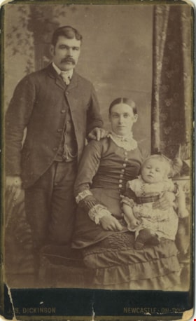
- Photograph of a family of three taken at a photographic studio in Newcastle-On-Tyne. Either the man or the child in the photograph has been identified as Ellenor Murray's brother.
- Repository
- City of Burnaby Archives
- Collection/Fonds
- Murray family fonds
- Physical Description
- 1 photograph : sepia (cabinet card) ; 9 x 6 cm, mounted on card 10 x 6 cm
- Description Level
- Item
- Record No.
- 548-002
- Access Restriction
- No restrictions
- Reproduction Restriction
- No known restrictions
- Accession Number
- 2012-31
- Scope and Content
- Photograph of a family of three taken at a photographic studio in Newcastle-On-Tyne. Either the man or the child in the photograph has been identified as Ellenor Murray's brother.
- Media Type
- Photograph
- Photographer
- Dickson, Jas.
- Notes
- Title based on contents of photograph
- Note in pencil on verso of photograph reads: "Mother's Brother"
- Photographer's studio markings on recto of cabinet card read: "Jas. Dickinson / Newcastle-On-Tyne"
- Photographers studio markings on verso of cabinet card read: "The Portrait / City Gallery / Photographic Artist / Jas Dickinson / Grainger Street Newcastle-On-Tyne / Negatives Kept / Additional Copies Can Always Be Obtained / Portraits of Every Description Enlarged / Portrait Clubs."
Images

![Brothers Earl and Norman Wild, [1925] - 1990 thumbnail](/media/hpo/_Data/_Archives_Images/_Unrestricted/540/548-003.jpg?width=280)
Brothers Earl and Norman Wild
https://search.heritageburnaby.ca/link/archivedescription80586
- Repository
- City of Burnaby Archives
- Date
- [1925] - 1990
- Collection/Fonds
- Murray family fonds
- Description Level
- Item
- Physical Description
- 1 photograph : b&w ; 7 x 7 cm
- Scope and Content
- Photograph of brothers Earl and Norman Wild in Idaho, in the United States of America (USA). Norman is holding an unidentified toddler on one arm, and has his other arm around his brother.
- Repository
- City of Burnaby Archives
- Date
- [1925] - 1990
- Collection/Fonds
- Murray family fonds
- Physical Description
- 1 photograph : b&w ; 7 x 7 cm
- Description Level
- Item
- Record No.
- 548-003
- Access Restriction
- No restrictions
- Reproduction Restriction
- No restrictions
- Accession Number
- 2012-31
- Scope and Content
- Photograph of brothers Earl and Norman Wild in Idaho, in the United States of America (USA). Norman is holding an unidentified toddler on one arm, and has his other arm around his brother.
- Names
- Wild, Norman
- Wild, Earl
- Media Type
- Photograph
- Notes
- Title based on contents of photograph
- Note in blue ink on verso of photograph reads: "Norman's brother Earl + Norman. Idaho USA"
Images
![Brothers Earl and Norman Wild, [1925] - 1990 thumbnail](/media/hpo/_Data/_Archives_Images/_Unrestricted/540/548-003.jpg)
Earl Wild's property
https://search.heritageburnaby.ca/link/archivedescription80587
- Repository
- City of Burnaby Archives
- Collection/Fonds
- Murray family fonds
- Description Level
- Item
- Physical Description
- 1 photograph : b&w ; 7 x 7 cm
- Scope and Content
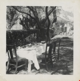
- Photograph of a table set outdoors on Earl Wild's property in Idaho, in the United States of America. The table is set for six people.
- Repository
- City of Burnaby Archives
- Collection/Fonds
- Murray family fonds
- Physical Description
- 1 photograph : b&w ; 7 x 7 cm
- Description Level
- Item
- Record No.
- 548-004
- Access Restriction
- No restrictions
- Reproduction Restriction
- No known restrictions
- Accession Number
- 2012-31
- Scope and Content
- Photograph of a table set outdoors on Earl Wild's property in Idaho, in the United States of America. The table is set for six people.
- Subjects
- Furniture
- Media Type
- Photograph
- Notes
- Title based on contents of photograph
- Note in blue ink on verso of photograph reads: "Wild / Earls USA"
Images

Felled trees
https://search.heritageburnaby.ca/link/archivedescription80591
- Repository
- City of Burnaby Archives
- Collection/Fonds
- Murray family fonds
- Description Level
- Item
- Physical Description
- 1 photograph : b&w ; 6 x 10.5 cm
- Scope and Content
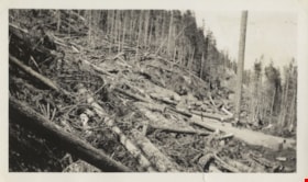
- Photograph of felled trees and partially cleared land at an unidentified location. Five people are visible on the logging road between the felled trees.
- Repository
- City of Burnaby Archives
- Collection/Fonds
- Murray family fonds
- Physical Description
- 1 photograph : b&w ; 6 x 10.5 cm
- Description Level
- Item
- Record No.
- 548-008
- Access Restriction
- No restrictions
- Reproduction Restriction
- No known restrictions
- Accession Number
- 2012-31
- Scope and Content
- Photograph of felled trees and partially cleared land at an unidentified location. Five people are visible on the logging road between the felled trees.
- Subjects
- Land Clearing
- Media Type
- Photograph
- Photographer
- Adams, Gladstone
- Notes
- Title based on contents of photograph
Images

envelope and form
https://search.heritageburnaby.ca/link/museumartifact34074
- Repository
- Burnaby Village Museum
- Accession Code
- BV991.34.1
- Description
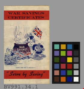
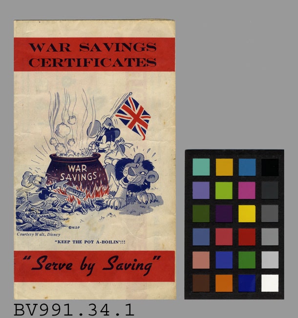
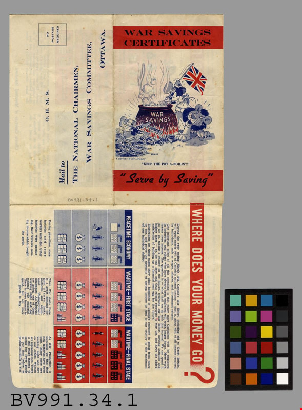
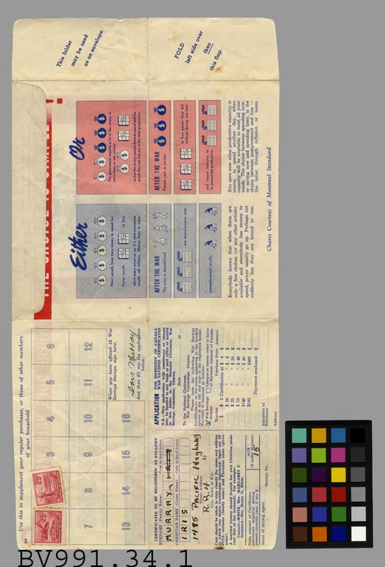
- War Savings Certificates - Envelope, Form -- [1942]. Form that folds into an envelope for Canadian War Saving Certificates. The form was filled out by Iris Murray who was 15 when the form was completed. The front cover of the form has an illustration of Mickey Mouse, Donald Duck and a Lion with a boiling pot labelled War Savings, over a fire. Mickey Mouse is stirring the post with a flag pole that has the Union Jack on the top. Donald Duck is fueling the fire with logs labelled Loans. There is a caption under the illustration "KEEP THE POT A-BOILIN'!!!". The illustration was provided courtesy of Walt. Disney. Below the illustration is "Serve by Saving". The envelope is pre addressed to The National Chairmen of the War Savings Committee in Ottawa. Inside the form there are illustrated charts describing the economic situation. The form provides space to affix Saving Stamps where Iris has two stamps placed. The form measures 34.5cm x 17.5cm when folded out.
- Subjects
- Documentary Artifacts
- Documentary Artifacts - Forms
- Documentary Artifacts - Letters and Envelopes
- Wars
- Wars - World War, 1939-1945
- Exchange Medium
- Exchange Medium - Victory Bonds
Images
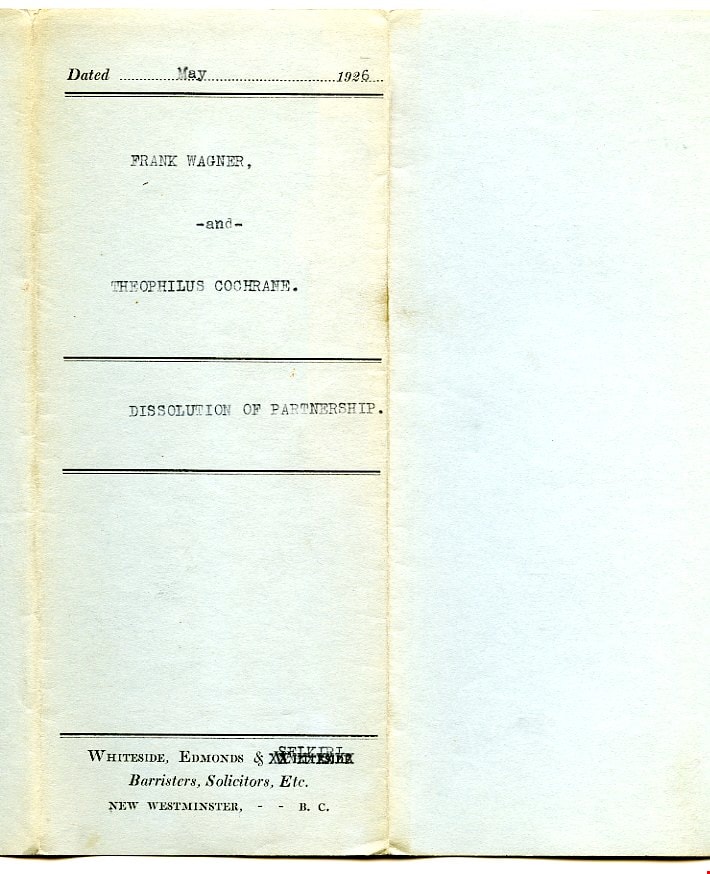
certificate
https://search.heritageburnaby.ca/link/museumartifact34753
- Repository
- Burnaby Village Museum
- Accession Code
- BV992.45.1
- Description
- Dissolution of Partnership - Certificate -- [1926]. Certificate, four typed pages in blue paper cover, folded twice; typed on cover to show when folded, "FRANK WAGNER," "-and-" "THEOPHILUS COCHRANE." "DISSOLUTION OF PARTNERSHIP."; preprinted with borders top and bottom; above upper border, "Dated" and dotted line, "19" at right, has been typed in as May, 1926; two borders at middle, title has been typed between; below bottom border, "WHITESIDE, EDMONDS & WHITESIDE" "Barristers, Solicitors, Etc." "NEW WESTMINSTER, - - B.C."; 2nd 'Whiteside' is 'X'ed out by typewriter, "SELKIRL"? typed above it; form begins "THIS INDENTURE made the", then handwritten "Tenth", then typed "day of May,..."; signed by both parties, red seals; witnessed by John Murray, broker, 4009 Kingsway, Burnaby; paper is very thin, blue margin at left, watermark "MAPLE LEAF" and U and T
- Category
- 08. Communication Artifacts
- Classification
- Documentary Artifacts - - Legal Documents
- Colour
- Blue
- Names
- Wagner, Frank
Images

In the shadow by the sea : recollections of Burnaby's Barnet Village
https://search.heritageburnaby.ca/link/museumlibrary5173
- Repository
- Burnaby Village Museum
- Collection
- Digital Reference Collection
- Reference Collection
- Material Type
- Book
- ISBN
- 0969282885
- Call Number
- 971.133 PRI Copy 2
- Contributor
- Wolf, Jim
- Pride, Harry, 1925-
- Place of Publication
- Burnaby, B.C.
- Publisher
- City of Burnaby
- Publication Date
- c2004
- Physical Description
- 246 p. : ill., maps, ports. ; 28 cm.
- Library Subject (LOC)
- Burnaby (B.C.)--History
- Industries--British Columbia--Burnaby--History
- Barnet Marine Park--Burnaby, B.C.
- Geographic Access
- Barnet Road
- Burrard Inlet
- Notes
- Includes bibliographical references (p. 246) and index.
- "edited by Harry Pride and Jim Wolf"
- Copy 2 of 2
Digital Books
Land of promise : Robert Burnaby's letters from colonial British Columbia, 1858-1863
https://search.heritageburnaby.ca/link/museumlibrary5465
- Repository
- Burnaby Village Museum
- Collection
- Reference Collection
- Digital Reference Collection
- Material Type
- Book
- ISBN
- 0969282850
- 9780969282853
- Call Number
- 971.1 BUR COPY 3
- Place of Publication
- Burnaby, B.C.
- Publisher
- City of Burnaby
- Publication Date
- c2002
- Physical Description
- 199 p. : ill. ; 23 cm.
- Library Subject (LOC)
- Burnaby, Robert--Correspondence
- Merchants--British Columbia--Correspondence
- British Columbia--History--1849-1871
- Burnaby (B.C.)
- Biography
- Notes
- Includes bibliographical references (p. 190) and index.
- 3 copies held: copy 3.
Digital Books

Pioneer tales of Burnaby
https://search.heritageburnaby.ca/link/museumlibrary5860
- Repository
- Burnaby Village Museum
- Collection
- Digital Reference Collection
- Reference Collection
- Material Type
- Book
- ISBN
- 096928280x
- Call Number
- 971.133 SON COPY 4
- Contributor
- Sone, Michael
- Place of Publication
- Burnaby, B.C.
- Publisher
- Corporation of the District of Burnaby
- Publication Date
- c1987
- Physical Description
- 495 p. : ill. ; 31 cm.
- Inscription
- "TR687 - Bryburgh" / handprinted in pencil on frontend page
- Library Subject (LOC)
- Pioneers--British Columbia--Burnaby
- Frontier and pioneer life
- Biography
- Object History
- Early Burnaby as recalled by the settlers themselves who arrived from every corner of the world between 1888 and 1930, some witnessing incorporation of the district in 1892, all seeking a better life for themselves and especially for their children, all helping transform the wilderness into the modern municipality of today.
- Notes
- "Editor Michael Sone".
- Includes index.
- 4 copies held: copy 4
Images

Digital Books
Burnaby Address Re-Numbering 1958-1961|House re-numbering
https://search.heritageburnaby.ca/link/museumlibrary7645
- Repository
- Burnaby Village Museum
- Collection
- Digital Reference Collection
- Material Type
- Digital Resource
- Contributor
- City of Burnaby
- Place of Publication
- Burnaby, BC
- Publisher
- City of Burnaby
- Publication Date
- [1961]
- Notes
- In 1958, the Corporation of the District of Burnaby embarked on an address re-numbering project. Burnaby's new address system was a numerical continuation of the Vancouver system. The project included East Burnaby which had previously worked off of the New Westminster address system. This was problematic due to the diagonal grid system that New Westminster and East Burnaby was based off of.
- The project was completed in two phases: From 1958 to 1959, and 1960 to 1961.
Digital Books

The Model T Ford owner
https://search.heritageburnaby.ca/link/museumlibrary915
- Repository
- Burnaby Village Museum
- Collection
- Reference Collection
- Material Type
- Book
- ISBN
- 091116023X
- 9780911160239
- Call Number
- 629.2 FAN
- Place of Publication
- Arcadia, CA
- Publisher
- Post-Era Books
- Publication Date
- c1983
- Physical Description
- 519 p. : ill. ; 24 cm.
- Library Subject (LOC)
- Ford Model T automobile
- Notes
- Includes index.
The whiskies of Scotland
https://search.heritageburnaby.ca/link/museumlibrary950
- Repository
- Burnaby Village Museum
- Collection
- Reference Collection
- Material Type
- Book
- Call Number
- 663 MCD
- Place of Publication
- London
- Publisher
- John Murray
- Publication Date
- c1967
- Physical Description
- vii, 164 p. : ill. ; 21 cm.
- Library Subject (LOC)
- Whiskey--Scotland
- Notes
- Includes bibliographical references (p. 159-160) and index.
The Victorian Order of Nurses for Canada; 50th anniversary, 1897-1947
https://search.heritageburnaby.ca/link/museumlibrary1205
- Repository
- Burnaby Village Museum
- Collection
- Reference Collection
- Material Type
- Book
- Call Number
- 610.73 VIC
- Contributor
- Sotham Press
- Place of Publication
- [Montreal]
- Publication Date
- c1947
- Physical Description
- 124 p. : ill. ; 24 cm.
- Inscription
- "With the Compliments / of the / Victorian Order of Nurses for Canada / NATIONAL OFFICE / OTTAWA, ONTARIO", printed on card attached to cover page.
- "EX LIBRIS / Ruby E. Good", printed and handwritten in ink on bookplate attached to cover page.
- Library Subject (LOC)
- Victorian Order of Nurses for Canada
- Community health nursing--Canada
- Nursing--Canada
- Public health--Canada
First steps in English for use in Canadian schools
https://search.heritageburnaby.ca/link/museumlibrary2749
- Repository
- Burnaby Village Museum
- Collection
- Special Collection
- Material Type
- Book
- Accession Code
- HV974.121.7
- Call Number
- 428 EDU Copy 1
- Place of Publication
- Toronto, Ont.
- Publisher
- The Educational Book Co., Limited
- Publication Date
- c1911
- Series
- Twentieth Century Series
- Physical Description
- 172 p. : ill. (some col.) ; 20 cm.
- Inscription
- "Free Text-book the property of ~~ by order of the Education department of B.C." -- stickered on endpaper (front). "Murray Hockridge" -- handwritten in pen on sticker. "Charles Dickens School / Division III" -- stamped on sticker. "AD 1911" -- handwritten in pen on endpaper (front). "15 / Jan / 1917" - handwritten in pencil on sticker.
- Library Subject (LOC)
- English language--Composition and exercises
- Object History
- Donor inscribed his name inside book.
- Notes
- Includes index.
- "Authorized for use in the schools of British Columbia."
- Copy 1 of 4
Britannia history reader : introductory book : stories from British and Canadian history
https://search.heritageburnaby.ca/link/museumlibrary2769
- Repository
- Burnaby Village Museum
- Edition
- 1st ed.
- Publication Date
- c1909
- Call Number
- 909.0971241 COP
- Repository
- Burnaby Village Museum
- Collection
- Special Collection
- Material Type
- Book
- Accession Code
- HV974.121.29
- Call Number
- 909.0971241 COP
- Edition
- 1st ed.
- Place of Publication
- Toronto
- Publisher
- The Copp, Clark Company, Limited
- Publication Date
- c1909
- Physical Description
- 261 p., [1] leaf of plates : ill., ports. ; 19 cm.
- Inscription
- "Murray Hockridge / 2079 - West 46"--stamped on front past board "Murray Hockridge / 1339, 19th Ave East / Vancouver / B.C. / G, N,?"--inscribed in pencil and ink on verso of leaf of plates. Study notes in pencil on back paste board.
- Library Subject (LOC)
- Canada--History
- Great Britain--History
- Object History
- Donor inscribed his name and address inside book.
Masterman Ready
https://search.heritageburnaby.ca/link/museumlibrary2596
- Repository
- Burnaby Village Museum
- Collection
- Special Collection
- Material Type
- Book
- Accession Code
- HV975.140.9
- Call Number
- 823.7 MAR
- Place of Publication
- London
- Publisher
- Thomas Nelson and Sons
- Publication Date
- 1842
- Physical Description
- 60 p. : ill.
- Inscription
- "To / Murray Hockridge / Christmas 1914 / From mother and dad. / Luella and Charles", handwritten in black pen inside front cover
- Library Subject (LOC)
- Fiction--19th century
![Survey and Subdivision plans in New Westminster District Group 1 – Burnaby
, [1861]-[1910] thumbnail](/media/hpo/_Data/_BVM_Cartographic_Material/1977/1977_0093_0019a_001.jpg?width=280)
Survey and Subdivision plans in New Westminster District Group 1 – Burnaby
https://search.heritageburnaby.ca/link/museumdescription6988
- Repository
- Burnaby Village Museum
- Date
- [1861]-[1910]
- Collection/Fonds
- Burnaby Village Museum Map collection
- Description Level
- File
- Physical Description
- 14 plans : 3 plans : black ink on paper hand col. + 7 plans : black ink on paper + 4 plans : graphite on paper mounted on 2 sides of cardboard 76 x 102 cm
- Scope and Content
- Item consists of a large board of four New Westminster District Gp 1 - subdivision plans mounted on one side and ten New Westminster District Gp 1 - subdivision plans mounted on the other side. Side A: 1. "Plan /of / Lots 166A, 166 and 167 /, Gr.1, N.W.D. / Showing Misconstructed Roads in Gree…
- Repository
- Burnaby Village Museum
- Collection/Fonds
- Burnaby Village Museum Map collection
- Description Level
- File
- Physical Description
- 14 plans : 3 plans : black ink on paper hand col. + 7 plans : black ink on paper + 4 plans : graphite on paper mounted on 2 sides of cardboard 76 x 102 cm
- Material Details
- Scales [between 1:2376 and 1:7920]
- Index number on edge of board reads: "19"
- Scope and Content
- Item consists of a large board of four New Westminster District Gp 1 - subdivision plans mounted on one side and ten New Westminster District Gp 1 - subdivision plans mounted on the other side. Side A: 1. "Plan /of / Lots 166A, 166 and 167 /, Gr.1, N.W.D. / Showing Misconstructed Roads in Green / 5 chs = 1 in.". (plan is drawn in black ink and hand coloured in red, green and orange ink). A section in the centre of the plan is coloured in red ink and identified as "C.S. Richmond" running from the North Arm of Fraser River to Wiggins Road and divided by "New Wiggins Rd. (as gazetted)" (coloured in orange ink) and two"Constructed Road(s)" (coloured in green ink). Plan is initialed by: "RB" [sic] (in blue pencil crayon) 2. Plan of / Subdivision of / Lot 166 / Group One / New Westminster District / Scale 4 chs = 1 in. / Map No 524". Plan is drawn in graphite and signed by "Surrig [sic] Welhams [sic] / P.L.S." Plan is initialed by: "RB" [sic] (in blue pencil crayon) 3. Plan of "Survey / of Highway / For / Burnaby Council / in / Lots 13 _14 / Group One / Scale 4 chs = 1 in." Signed by "Albert J. Hill, P.L.S." Caribou Street and Caribou Road run through the centre of the plan. Plan is stamped: "Albert J. Hill, Civil Engineer / and / Provincial Land Surveyor, / New Westminster, / B.C.". Plan is initialed by: "RB" [sic] (in blue pencil crayon) 4. A Plan of Lots 166A, 166 and 167, Group One, New Westminster District (drawn in graphite). A section in the centre of the plan is identified as "C.S. Richmond" running from the North Arm of Fraser River and divided by "New Wiggins Rd. (as gazetted)" and two "Constructed Road(s)". Plan is initialed by: "RB" [sic] (in blue pencil crayon) Side B: 1. Small plan drawn in black ink (no title) identifying lots north of the "North Arm" of the Fraser River. Lots identified include: Lot 99, Lot 98, Lot 157, Lot 158, Lot 163, Lot 162, Lot 159, Lot 163, Lot 162, Lot 165, Lot 166A, Lot 155B, Lot 155A and Lot 159. "Scale 40 chains to one inch" . Plan is initialed by: "RB" [sic] (in blue pencil crayon) (Geographic location: Burnaby) 2. Small plan drawn in black ink (no title) identifying lots north of the North Arm of the Fraser River as "Lots 155, 155A, 155B, 155C, 162, 163, 164, 165, 166A and 167". Plan is initialed by: "RB" [sic] (in blue pencil crayon) (Geographic location: Burnaby) 3. Small plan drawn in black ink (no title) which identifies "Lot 151 / Reserve/ for / Race Course"; "Reserve / 64 A / L. 152 G.1"; and other Lots: 32, 33, 34, 35, 36, 38, 39. The plan is signed "Surveyor G.Turn [sic] July / 61 / from Vol 40 R.L. notes [sic]" Plan is stamped: "Albert J. Hill, Civil Engineer / and / Provincial Land Surveyor, / New Westminster, / B.C." Plan is initialed by: "RB" [sic] (in blue pencil crayon) (Geographic location: Burnaby) 4. Small plan drawn in black in with faded red colouring on centre lot identified as "Lot 34" running north from "Vancouver Road" . Plan is stamped: "Albert J. Hill, Civil Engineer / and / Provincial Land Surveyor, / New Westminster, / B.C." Plan is initialed by: "RB" [sic] (in blue pencil crayon) (Geographic location: Burnaby) 5. Plan drawn in graphite and identified as "Lot 98, Gr.1," along with the intials "RB" [sic] (both are handwritten in blue crayon pencil on top of plan) The B.C.E.Railway is identified running through the plan along with Jubilee Road and Royal Oak Road. The plan is signed with the name "Wm. Murray" and the Plan is stamped: "Albert J. Hill, Civil Engineer / and / Provincial Land Surveyor, / New Westminster, / B.C.". (Geographic location: Burnaby) 6. Plan drawn in graphite identified as "Port Lot 13, Gr.1" along with the intials "RB" [sic] (both are handwritten in blue crayon pencil on top of plan) Plan is stamped: "Albert J. Hill, Civil Engineer / and / Provincial Land Surveyor, / New Westminster, / B.C.". (Geographic location: Burnaby) 7.Plan drawn in black ink and identified as "Lot 98 G.1" along with the intials "RB" [sic] (both are handwritten in blue crayon pencil on top of plan). A "Road Reservation" is identified running north between "Electric Tramway" and connecting with "Royal Oak Road". Plan is stamped: "Albert J. Hill, Civil Engineer / and / Provincial Land Surveyor, / New Westminster, / B.C." (Geographic location: Burnaby) 8. Plan drawn in black ink and divided into two sections, the upper plan is identified as "Portion / Lots 100 / area / 101, Gr.1" and the lower plan is identified as "Portion L. 3 G. 1" along with the intials "RB" [sic] (these identifiers are handwritten in blue crayon pencil on top of the plan). Portions of Lot 100 and Lot 101 are each divided into 6 sections and the Portion of Lot 3 plan is divided into 24 sections. The plan includes a note in black ink that reads: " Received from Wm Fromme [sic] / from Wm. Trapp / Nov. 28, 1895 / A. J. T...[sic]". (Geographic location: Burnaby) 9. Plan drawn in black ink (no title) identifying soil, buildings and geographic features in southern Burnaby. The plan is bordered by "New Westminster City" (Tenth Avenue and DL 172) to the south east and DL 173 to the south, DL 158 to the west and the B.C.E. Tramway to the north. Plan includes District Lots: 155A, 158, 159, 171, 160, 53 and 95 and identifies soil, marshland and ravines throughout. Plan identifies the following features: a "Team Road" running through Lots 158 and 159 along with "Fair Orchard Soil / Even Surface Throughout / No Ravines", "Gravel and Shingle" (bottom of Lot 158), "North Arm Road" crossing "Byrne Road" and connecting with "Power House Road" which runs north to connect with "Highland Park Station" and the B.C.E. Tramway, "Power Ho" in the northeast corner of DL 160, a "Brook" connected with a "Deep Ravine" running between DL 53, DL 95 and DL 160 along with "Good Soil" and "Fair Orchard Soil" identified nearby in DL 95. Scale is identified as "10 chs = 1 in." Plan is stamped: "Albert J. Hill, Civil Engineer / and / Provincial Land Surveyor, / New Westminster, / B.C." Plan is initialed by: "RB" [sic] (in blue pencil crayon) (Geographic location: Burnaby) 10. Plan drawn in black ink (no title) with Burnaby Lake and Deer Lake at the centre. The plan is bordered by the following District Lots identified as: 117, 118 and 68 to the west, Lots 80, 79 and 85 to the southwest, Lots 11, 13, and 1 (City of New Westminster) to the south east, the North Road boundary to the east and Lots 8, 56, 57, 59, and 136 to the North. The lower right hand corner of the plan has a small inset which reads: "Burnaby Lake" and "Page 19 R.B. Notes". Plan is initialed by: "RB" [sic] (in blue pencil crayon) (Geographic location: Burnaby)
- Creator
- Hill, Albert James
- Accession Code
- HV977.93.19
- Access Restriction
- No restrictions
- Reproduction Restriction
- No known restrictions
- Date
- [1861]-[1910]
- Media Type
- Cartographic Material
- Scan Resolution
- 300
- Scale
- 72
- Notes
- Title based on contents of file
- Scale is measured in chains. (One chain equals 792 inches)
- The term "Lot" can also refer to a "District Lot”
- Some plans are stamped: "Albert J. Hill, Civil Engineer / and / Provincial Land Surveyor, / New Westminster, / B.C." and intialed: "RB" [sic]
Images
![Survey and Subdivision plans in New Westminster District Group 1 – Burnaby
, [1861]-[1910] thumbnail](/media/hpo/_Data/_BVM_Cartographic_Material/1977/1977_0093_0019a_001.jpg)

New Canadian readers : second reader
https://search.heritageburnaby.ca/link/museumlibrary2753
- Repository
- Burnaby Village Museum
- Edition
- 20th Century ed.
- Publication Date
- 1901
- Call Number
- 428.2 NEW
- Repository
- Burnaby Village Museum
- Collection
- Special Collection
- Material Type
- Book
- Accession Code
- HV974.121.11
- Call Number
- 428.2 NEW
- Edition
- 20th Century ed.
- Place of Publication
- Toronto
- Publisher
- Educational Book Co., Ltd.
- Publication Date
- 1901
- Series
- New Canadian readers
- Physical Description
- vii, 10-222 p. : ill. ; 20 cm.
- Inscription
- "Charles Dickens School" [stamped in purple ink on front pastedown] "Free Text-Book The Property of" [printed label on front pastedown with the following filled in] "Murray Hackridge" [handwritten in black ink] "School Charles Dickens" [name handwritten in black ink] "Number of Book 9" [number handwritten in black ink] "A.D. 1901" [handwritten in black ink on t.p. verso]
- Library Subject (LOC)
- Readers (Elementary)
- Object History
- Donor inscribed his name inside book.
- Notes
- "Prescribed for use in the Schools of British Columbia" --title page.
- "Authorized for use in the Schools of Quebec" --title page.
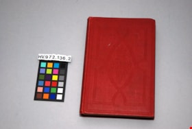
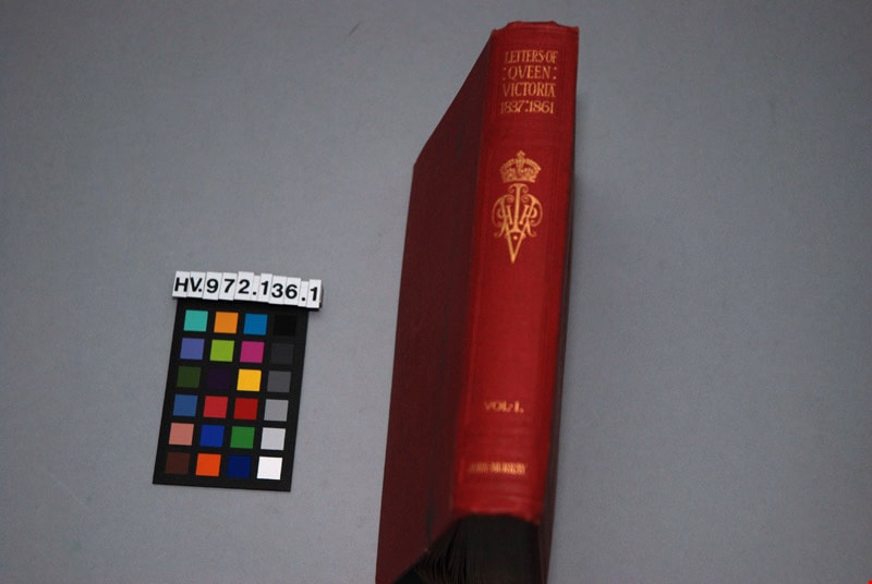
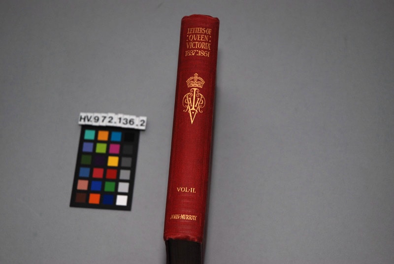
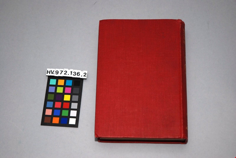
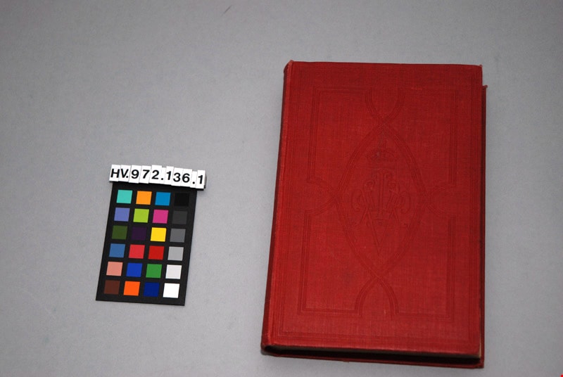
The letters of Queen Victoria : a selection from her Makesty's correspondence between the years 1837 and 1861, published by the authority of His Majesty the King, vol. ii, 1844-1853
https://search.heritageburnaby.ca/link/museumlibrary4908
- Repository
- Burnaby Village Museum
- Author
- Murray, John, 1808-1892
- Publication Date
- 1902
- Call Number
- 942.08 MUR
- Repository
- Burnaby Village Museum
- Collection
- Special Collection
- Material Type
- Book
- Accession Code
- HV972.136.2
- Call Number
- 942.08 MUR
- Author
- Murray, John, 1808-1892
- Place of Publication
- London
- Publisher
- John Murray
- Publication Date
- 1902
- Physical Description
- xi, 472 p. : ill. ; 20 cm.
- Inscription
- "Mrs. J. A. Elliott" [handwritten in black ink on front endpapers]
- Library Subject (LOC)
- Victoria, Queen of Great Britain,--1819-1901
- Great Britain--History--Victoria, 1837-1901
- Great Britain--Politics and government--1837-1901
- Subjects
- Persons - Royalty
- Souvenirs
- Souvenirs - Royalty
- Documentary Artifacts
- Documentary Artifacts - Books
Images


Survey and Subdivision plans in New Westminster District Group 1 – Burnaby
https://search.heritageburnaby.ca/link/museumdescription6971
- Repository
- Burnaby Village Museum
- Date
- 1904-1908
- Collection/Fonds
- Burnaby Village Museum Map collection
- Description Level
- File
- Physical Description
- 7 plans : blueprint ink on paper mounted on 2 sides of cardboard 76 cm x 101.5 cm
- Scope and Content
- Item consists of a large board of four New Westminster District Gp 1 -subdivision plans mounted on one side and three New Westminster District Gp 1 - subdivision plans mounted on the other side. Side A: 1. Blueprint "Plan / of Subdivision of / Lot 28A / in Subdivision of / Lot 97, Group 1 / Ne…
- Repository
- Burnaby Village Museum
- Collection/Fonds
- Burnaby Village Museum Map collection
- Description Level
- File
- Physical Description
- 7 plans : blueprint ink on paper mounted on 2 sides of cardboard 76 cm x 101.5 cm
- Material Details
- Scales [between1:120 and 1:3960]
- Index number on edge of board reads: "3"
- Scope and Content
- Item consists of a large board of four New Westminster District Gp 1 -subdivision plans mounted on one side and three New Westminster District Gp 1 - subdivision plans mounted on the other side. Side A: 1. Blueprint "Plan / of Subdivision of / Lot 28A / in Subdivision of / Lot 97, Group 1 / New Westminster District". The B.C.E.R. is identified running through the subdivision of XXVIIIA (Lot 28A). Plan is dated "Sept. 21st, 08" (Geographic location: Burnaby) 2. Blueprint "Measurements / of Discharge / in Ditches / Lots 155A, G.One" / "Scale, Twentieths. / 17/12/04" (Geographic location: Burnaby) 3. Blueprint "Plan / of Subdivision / of a portion of / Lot 95 / Group One / New Westminster District" B.C. Electric Railway runs through the top of the plan. The plan is dated May 23, 1906. (Geographic location: Burnaby) 4. Blueprint " Profile / on Water Surface / in / Holland Road Ditch / Woollard's Ditch / Dec. 3rd 1904 / Scales Hor. 200'=1" / Vert. 10'=1"" (Geographic location: Burnaby) Side B: 1. Blueprint " "Sunnyside Park" / plan of Subdivision / of / the East Half / of / Lot 39, GR.One, / New Westminster District / Scale 100'=1" (Geographic location: Burnaby) 2. Blueprint " "Sunnyside Park"/ plan of Subdivi..n / of / Lot 39, Gr.1. / New Westminster District" Index in upper left corner of plan shows location of Lot 39 in relation to Central Park and surrounding Lots. (Geographic location: Burnaby) 3. Blueprint "Plan / of Subdivision / of / Lot 163 and 165 / Group One / New Westminster District / Scale 5 chs=1 in." Streets within subdivision plan are identified as; North Arm Road, Ingram Street, Blair Street, Kennedy Street, Murray Street, Wiggins Road, Byrne Road, South Road along with North Arm Fraser River and B.C. Electric Railway. (Geographic location: Burnaby)
- Geographic Access
- Central Park
- Accession Code
- HV977.93.3
- Access Restriction
- No restrictions
- Reproduction Restriction
- No known restrictions
- Date
- 1904-1908
- Media Type
- Cartographic Material
- Historic Neighbourhood
- Central Park (Historic Neighbourhood)
- Scan Resolution
- 300
- Scale
- 72
- Notes
- Title based on contents of file
- Scale is measured in chains and feet. (One chain equals 792 inches)
- The term "Lot" can also refer to a "District Lot”
Images

