Narrow Results By
Creator
- Barrowclough, George Alfred 4
- Bridgman's Studio Limited 2
- British Columbia Underwriters' Association
- Brown, William Thomas 4
- Bryce, Henry G. 1
- Burnaby Village Museum 2
- Burnett and McGugan B.C. Land Surveyors, New Westminster 1
- Burnett & McGugan, Engineers and Surveyors 1
- Cantlon, Harry 8
- Diack, George 5
- Digney, Andy 12
- Digney, Ernest Frank "Dig"
![Digney film 1 - Playing badminton, [1960] (date of original), copied 2019 thumbnail](/media/hpo/_Data/_BVM_Moving_Images/2019_0018_0003_012.jpg?width=280)
Digney film 1 - Playing badminton
https://search.heritageburnaby.ca/link/museumdescription10615
- Repository
- Burnaby Village Museum
- Date
- [1960] (date of original), copied 2019
- Collection/Fonds
- Digney Family fonds
- Description Level
- Item
- Physical Description
- 1 video recording (mp4) (53 sec.) : digital, 23 fps, col., si.
- Scope and Content
- Film segment taken from the front yard of Digney home at 6521 Bonsor Street. Joyce Digney is in the front yard playing badminton with her son Bruce while son Paul Digney is holding a hose and filling a pool in the driveway. Bonsor Park can be seen across the road along with houses.
- Repository
- Burnaby Village Museum
- Collection/Fonds
- Digney Family fonds
- Description Level
- Item
- Physical Description
- 1 video recording (mp4) (53 sec.) : digital, 23 fps, col., si.
- Scope and Content
- Film segment taken from the front yard of Digney home at 6521 Bonsor Street. Joyce Digney is in the front yard playing badminton with her son Bruce while son Paul Digney is holding a hose and filling a pool in the driveway. Bonsor Park can be seen across the road along with houses.
- Creator
- Digney, Andy
- Subjects
- Sports - Badminton
- Geographic Access
- Bonsor Avenue
- Street Address
- 6521 Bonsor Avenue
- Accession Code
- BV019.18.3.12
- Access Restriction
- No restrictions
- Reproduction Restriction
- No known restrictions
- Date
- [1960] (date of original), copied 2019
- Media Type
- Moving Images
- Historic Neighbourhood
- Central Park (Historic Neighbourhood)
- Planning Study Area
- Maywood Area
- Photographer
- Digney, Ernest Frank "Dig"
- Notes
- Title based on contents of film segment
- Film segment originates from digitized version of original 8 mm film (See BV019.18.3)
Images
![Digney film 1 - Playing badminton, [1960] (date of original), copied 2019 thumbnail](/media/hpo/_Data/_BVM_Moving_Images/2019_0018_0003_012.jpg)
Video
Digney film 1 - Playing badminton, [1960] (date of original), copied 2019
Digney film 1 - Playing badminton, [1960] (date of original), copied 2019
https://search.heritageburnaby.ca/media/hpo/_Data/_BVM_Moving_Images/2019_0018_0003_012.mp4![Digney film 1 - Playing with Tawny, [1960] (date of original), copied 2019 thumbnail](/media/hpo/_Data/_BVM_Moving_Images/2019_0018_0003_013.jpg?width=280)
Digney film 1 - Playing with Tawny
https://search.heritageburnaby.ca/link/museumdescription10616
- Repository
- Burnaby Village Museum
- Date
- [1960] (date of original), copied 2019
- Collection/Fonds
- Digney Family fonds
- Description Level
- Item
- Physical Description
- 1 video recording (mp4) (1 min., 22 sec.) : digital, 23 fps, col., si.
- Scope and Content
- Film segment taken from the front yard of Digney home at 6521 Bonsor Street. The Digney family dog named Tawny is playing with a sprinkler in the yard, barking at the camera man who is probably Dig Digney. Film continues with Joyce Digney throwing a piece of wood for the dog while Bruce Digney look…
- Repository
- Burnaby Village Museum
- Collection/Fonds
- Digney Family fonds
- Description Level
- Item
- Physical Description
- 1 video recording (mp4) (1 min., 22 sec.) : digital, 23 fps, col., si.
- Scope and Content
- Film segment taken from the front yard of Digney home at 6521 Bonsor Street. The Digney family dog named Tawny is playing with a sprinkler in the yard, barking at the camera man who is probably Dig Digney. Film continues with Joyce Digney throwing a piece of wood for the dog while Bruce Digney looks on.
- Creator
- Digney, Andy
- Subjects
- Animals - Dogs
- Names
- Digney, Bruce
- Digney, Joyce
- Geographic Access
- Bonsor Avenue
- Street Address
- 6521 Bonsor Avenue
- Accession Code
- BV019.18.3.13
- Access Restriction
- No restrictions
- Reproduction Restriction
- No known restrictions
- Date
- [1960] (date of original), copied 2019
- Media Type
- Moving Images
- Historic Neighbourhood
- Central Park (Historic Neighbourhood)
- Planning Study Area
- Maywood Area
- Photographer
- Digney, Ernest Frank "Dig"
- Notes
- Title based on contents of film segment
- Film segment originates from digitized version of original 8 mm film (See BV019.18.3)
Images
![Digney film 1 - Playing with Tawny, [1960] (date of original), copied 2019 thumbnail](/media/hpo/_Data/_BVM_Moving_Images/2019_0018_0003_013.jpg)
Video
Digney film 1 - Playing with Tawny, [1960] (date of original), copied 2019
Digney film 1 - Playing with Tawny, [1960] (date of original), copied 2019
https://search.heritageburnaby.ca/media/hpo/_Data/_BVM_Moving_Images/2019_0018_0003_013.mp4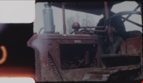
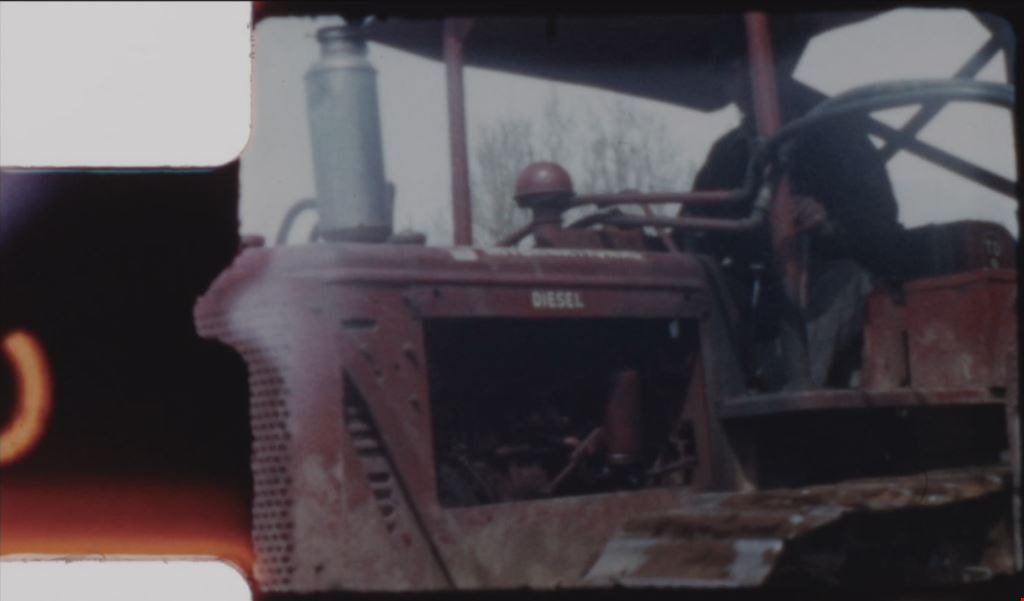
Digney Film 3 - Construction of Digney Bowling Alley
https://search.heritageburnaby.ca/link/museumdescription10648
- Repository
- Burnaby Village Museum
- Date
- 1955 (date of original), copied 2019
- Collection/Fonds
- Digney Family fonds
- Description Level
- Item
- Physical Description
- 1 video recording (mp4) (8 min., 40 sec.) : digital, 23 fps, col., si.
- Scope and Content
- Film segment documenting the construction of the Digney Bowling Alley in Burnaby. The bowling alley was built on the west side of the Digney family home located at 2698 Bonsor Avenue (address became 6521 Bonsor Avenue after 1958). The film documents Ozzie Cavello using his bulldozer to clear the la…
- Repository
- Burnaby Village Museum
- Collection/Fonds
- Digney Family fonds
- Description Level
- Item
- Physical Description
- 1 video recording (mp4) (8 min., 40 sec.) : digital, 23 fps, col., si.
- Scope and Content
- Film segment documenting the construction of the Digney Bowling Alley in Burnaby. The bowling alley was built on the west side of the Digney family home located at 2698 Bonsor Avenue (address became 6521 Bonsor Avenue after 1958). The film documents Ozzie Cavello using his bulldozer to clear the land followed by construction workers laying cinder block walls, a large crane helping to lay steel girders and lumber for the roof. The opening footage is taken from the parking lot of the Simpsons-Sears store on Kingsway. The Film segment closes with large flower arrangements gathered around the entrance of the Digney Bowling Alley in honour of the grand opening with Andy Digney and his brother in law Sydney Swan at the entrance.
- Creator
- Digney, Andy
- Geographic Access
- Bonsor Avenue
- Street Address
- 6521 Bonsor Avenue
- Accession Code
- BV019.18.5.1
- Access Restriction
- No restrictions
- Reproduction Restriction
- No known restrictions
- Date
- 1955 (date of original), copied 2019
- Media Type
- Moving Images
- Historic Neighbourhood
- Central Park (Historic Neighbourhood)
- Planning Study Area
- Maywood Area
- Photographer
- Digney, Andy
- Digney, Ernest Frank "Dig"
- Notes
- Title based on contents of film segment
- Film segment originates from digitized version of original 8 mm film (See BV019.18.5)
Images
Video
Digney Film 3 - Construction of Digney Bowling Alley, 1955 (date of original), copied 2019
Digney Film 3 - Construction of Digney Bowling Alley, 1955 (date of original), copied 2019
https://search.heritageburnaby.ca/media/hpo/_Data/_BVM_Moving_Images/2019_0018_0005_001.mp4![Digney Film 3 - Visit to Vancouver Zoo in Stanley Park, [1967] (date of original), copied 2019 thumbnail](/media/hpo/_Data/_BVM_Moving_Images/2019_0018_0005_004.jpg?width=280)
Digney Film 3 - Visit to Vancouver Zoo in Stanley Park
https://search.heritageburnaby.ca/link/museumdescription18881
- Repository
- Burnaby Village Museum
- Date
- [1967] (date of original), copied 2019
- Collection/Fonds
- Digney Family fonds
- Description Level
- Item
- Physical Description
- 1 video recording (mp4) (1 min., 15 sec.) : digital, 23 fps, col., si.
- Scope and Content
- Film footage of Joyce Digney, her mother, Dorothy Brookes and her young son Drew Digney visiting the Vancouver Zoo located in Stanley Park in Vancouver. Film clip documents them watching pelicans feeding and swimming in a pond and walking along the pathways within the park.
- Repository
- Burnaby Village Museum
- Collection/Fonds
- Digney Family fonds
- Description Level
- Item
- Physical Description
- 1 video recording (mp4) (1 min., 15 sec.) : digital, 23 fps, col., si.
- Scope and Content
- Film footage of Joyce Digney, her mother, Dorothy Brookes and her young son Drew Digney visiting the Vancouver Zoo located in Stanley Park in Vancouver. Film clip documents them watching pelicans feeding and swimming in a pond and walking along the pathways within the park.
- Creator
- Digney, Ernest Frank "Dig"
- Subjects
- Exhibitions - Zoos
- Animals
- Animals - Birds
- Names
- Digney, Joyce
- Digney, Drew
- Geographic Access
- Vancouver
- Accession Code
- BV019.18.5.4
- Access Restriction
- No restrictions
- Reproduction Restriction
- No known restrictions
- Date
- [1967] (date of original), copied 2019
- Media Type
- Moving Images
- Planning Study Area
- Maywood Area
- Photographer
- Digney, Ernest Frank "Dig"
- Notes
- Title based on contents of film segment
- Film segment originates from digitized version of original 8 mm film (See BV019.18.5)
Images
![Digney Film 3 - Visit to Vancouver Zoo in Stanley Park, [1967] (date of original), copied 2019 thumbnail](/media/hpo/_Data/_BVM_Moving_Images/2019_0018_0005_004.jpg)
Video
Digney Film 3 - Visit to Vancouver Zoo in Stanley Park, [1967] (date of original), copied 2019
Digney Film 3 - Visit to Vancouver Zoo in Stanley Park, [1967] (date of original), copied 2019
https://search.heritageburnaby.ca/media/hpo/_Data/_BVM_Moving_Images/2019_0018_0005_004.mp4![Digney Film 4 - Lawn bowling at Central Park, [196-] (date of original), copied 2019 thumbnail](/media/hpo/_Data/_BVM_Moving_Images/2019_0018_0006_007.jpg?width=280)
Digney Film 4 - Lawn bowling at Central Park
https://search.heritageburnaby.ca/link/museumdescription10659
- Repository
- Burnaby Village Museum
- Date
- [196-] (date of original), copied 2019
- Collection/Fonds
- Digney Family fonds
- Description Level
- Item
- Physical Description
- 1 video recording (mp4) (3 min., 22 sec.) : digital, 23 fps, col., si.
- Scope and Content
- Film segment of women and men lawn bowling at Central Park in Burnaby. Buildings along Kingsway and Boundary Road are visible in the background. Sydney Swan (wearing glasses and vest) is identified as one of the bowlers.
- Repository
- Burnaby Village Museum
- Collection/Fonds
- Digney Family fonds
- Description Level
- Item
- Physical Description
- 1 video recording (mp4) (3 min., 22 sec.) : digital, 23 fps, col., si.
- Scope and Content
- Film segment of women and men lawn bowling at Central Park in Burnaby. Buildings along Kingsway and Boundary Road are visible in the background. Sydney Swan (wearing glasses and vest) is identified as one of the bowlers.
- Creator
- Digney, Andy
- Subjects
- Sports - Lawn Bowling
- Names
- Swan, Sydney
- Geographic Access
- Central Park
- Boundary Road
- Kingsway
- Accession Code
- BV019.18.6.7
- Access Restriction
- No restrictions
- Reproduction Restriction
- No known restrictions
- Date
- [196-] (date of original), copied 2019
- Media Type
- Moving Images
- Historic Neighbourhood
- Central Park (Historic Neighbourhood)
- Planning Study Area
- Maywood Area
- Photographer
- Digney, Ernest Frank "Dig"
- Notes
- Title based on contents of film segment
- Film segment originates from digitized version of original 8 mm film (See BV019.18.6)
- Similar footage of lawn bowling - see BV019.18.6.8
Images
![Digney Film 4 - Lawn bowling at Central Park, [196-] (date of original), copied 2019 thumbnail](/media/hpo/_Data/_BVM_Moving_Images/2019_0018_0006_007.jpg)
Video
Digney Film 4 - Lawn bowling at Central Park, [196-] (date of original), copied 2019
Digney Film 4 - Lawn bowling at Central Park, [196-] (date of original), copied 2019
https://search.heritageburnaby.ca/media/hpo/_Data/_BVM_Moving_Images/2019_0018_0006_007.mp4Digney Film 4 - Seattle World Fair, Lawn Bowling and visit to Stanley Park Zoo
https://search.heritageburnaby.ca/link/museumdescription10679
- Repository
- Burnaby Village Museum
- Date
- [between 1962 and 1969] (date of original), copied 2019
- Collection/Fonds
- Digney Family fonds
- Description Level
- File
- Physical Description
- 1 video recording (mp4) (27 min., 15 sec.) : digital, 23 fps, col., si.
- Scope and Content
- Item consists of a film compliation created by Ernest "Dig" Digney. The film footage is a combination of eight short segments taken at different times in various locations. The film footage documents Joyce, Ernest "Dig", Paul and Bruce Digney's visit to the Seattle World Fair in 1962 as well as law…
- Repository
- Burnaby Village Museum
- Collection/Fonds
- Digney Family fonds
- Description Level
- File
- Physical Description
- 1 video recording (mp4) (27 min., 15 sec.) : digital, 23 fps, col., si.
- Scope and Content
- Item consists of a film compliation created by Ernest "Dig" Digney. The film footage is a combination of eight short segments taken at different times in various locations. The film footage documents Joyce, Ernest "Dig", Paul and Bruce Digney's visit to the Seattle World Fair in 1962 as well as lawn bowling at Stanley Park and Central Park in Burnaby and a visit to the Vancouver Zoo at Stanley Park.
- Creator
- Digney, Ernest Frank "Dig"
- Names
- Digney, Paul
- Digney, Joyce
- Digney, Ernest Frank "Dig"
- Digney, Bruce
- Central Park Lawn Bowling Club
- Swan, Sydney
- Geographic Access
- Central Park
- Vancouver
- Accession Code
- BV019.18.6
- Access Restriction
- No restrictions
- Reproduction Restriction
- No known restrictions
- Date
- [between 1962 and 1969] (date of original), copied 2019
- Media Type
- Moving Images
- Historic Neighbourhood
- Central Park (Historic Neighbourhood)
- Planning Study Area
- Maywood Area
- Photographer
- Digney, Ernest Frank "Dig"
- Notes
- Title based on contents of film segment
- A selection of film segments from this compilation are described at item level and available for viewing on Heritage Burnaby. Contact Burnaby Village Museum to view full content.

Municipality of Burnaby - Volume XV and Volume XVIII
https://search.heritageburnaby.ca/link/museumdescription8680
- Repository
- Burnaby Village Museum
- Date
- May 1927
- Collection/Fonds
- Burnaby Village Museum Map collection
- Description Level
- File
- Physical Description
- 4 plans on 4 sheets : col. lithographic prints ; 63.5 x 53.5 cm folded to 53 x 31.5 cm
- Scope and Content
- File consists of four pages of plans removed from a bound book containing a series of fire insurance plans of the Municipality of Burnaby. The first two pages are numbered "A" and "B" and are key plans from "GREATER VANCOUVER B.C. / VOLUME XV / Surveyed _ May 1927 / MUNICIPALITY OF / BURNABY", "PLA…
- Repository
- Burnaby Village Museum
- Collection/Fonds
- Burnaby Village Museum Map collection
- Description Level
- File
- Physical Description
- 4 plans on 4 sheets : col. lithographic prints ; 63.5 x 53.5 cm folded to 53 x 31.5 cm
- Material Details
- Scales [1:1200] and [1:6000]
- Scope and Content
- File consists of four pages of plans removed from a bound book containing a series of fire insurance plans of the Municipality of Burnaby. The first two pages are numbered "A" and "B" and are key plans from "GREATER VANCOUVER B.C. / VOLUME XV / Surveyed _ May 1927 / MUNICIPALITY OF / BURNABY", "PLAN DEPT. FIRE BRANCH _ B.C. INSURANCE UNDERWRITERS ASSN.". Key Plan "B" covers plans: 1505; 1506; 1512 to 1516; 1540 to 1544; 1550 to 1557 and District Lots: 129 to 132; 135 to 138; 205 to 208 and 215 to 218. Key Plan "A" covers plans: 1501 to 1504; 1507 to 1511; 1517 to 1525; 1531 to 1539; 1545 to 1550 and District Lots: 116 to 127 and 186 to 189. Plan "1806" is part of "GREATER VANCOUVER B.C. / VOLUME XVIII / Municipality of Burnaby / May, 1927" and covers District Lot 153. Plan "1807" is from "GREATER VANCOUVER B.C. / VOLUME XVIII / Municipality of Burnaby / May, 1927" and covers District Lots: 99,149 and 152.
- Responsibility
- British Columbia Underwriters' Association
- Accession Code
- HV972.111.2
- Access Restriction
- No restrictions
- Reproduction Restriction
- May be restricted by third party rights
- Date
- May 1927
- Media Type
- Cartographic Material
- Historic Neighbourhood
- Vancouver Heights (Historic Neighbourhood)
- Lochdale (Historic Neighbourhood)
- Capitol Hill (Historic Neighbourhood)
- Central Park (Historic Neighbourhood)
- Alta Vista (Historic Neighbourhood)
- Planning Study Area
- Burnaby Heights Area
- Sperling-Broadway Area
- Lochdale Area
- Parkcrest-Aubrey Area
- Westridge Area
- Willingdon Heights Area
- Capitol Hill Area
- Maywood Area
- Marlborough Area
- Scan Resolution
- 400
- Scan Date
- 2021-11-18
- Notes
- Title based on content of plans
- Scales are measured 1 inch = 100 feet and 1 inch = 500 feet
- See also BV987.1.70d for revised versions of plans
Zoomable Images


Municipality of Burnaby - Volume XV and Volume XVIII
https://search.heritageburnaby.ca/link/museumdescription8681
- Repository
- Burnaby Village Museum
- Date
- May 1927
- Collection/Fonds
- Burnaby Village Museum Map collection
- Description Level
- File
- Physical Description
- 4 plans on 4 sheets : col. lithographic prints, ms. annotations in blue ink ; 63.5 x 53.5 cm folded to 53 x 31.5 cm
- Scope and Content
- File consists of four pages of plans removed from a bound book containing a series of fire insurance plans of the Municipality of Burnaby. Plan "1507" and plan "1517" are from "GREATER VANCOUVER B.C. / VOLUME XV / Municipality of Burnaby / May, 1927". Plan "1507" covers District Lot 186 and plan "1…
- Repository
- Burnaby Village Museum
- Collection/Fonds
- Burnaby Village Museum Map collection
- Description Level
- File
- Physical Description
- 4 plans on 4 sheets : col. lithographic prints, ms. annotations in blue ink ; 63.5 x 53.5 cm folded to 53 x 31.5 cm
- Material Details
- Scale [1:600] and [1:1200]
- Scope and Content
- File consists of four pages of plans removed from a bound book containing a series of fire insurance plans of the Municipality of Burnaby. Plan "1507" and plan "1517" are from "GREATER VANCOUVER B.C. / VOLUME XV / Municipality of Burnaby / May, 1927". Plan "1507" covers District Lot 186 and plan "1517" covers District Lot 116. Plan "1804" and plan "1805" are from "GREATER VANCOUVER B.C. / VOLUME XVIII / Municipality of Burnaby / May, 1927". Plans "1804" and "1805" cover District Lot 153.
- Responsibility
- British Columbia Underwriters' Association
- Accession Code
- HV972.111.3
- Access Restriction
- No restrictions
- Reproduction Restriction
- May be restricted by third party rights
- Date
- May 1927
- Media Type
- Cartographic Material
- Historic Neighbourhood
- Central Park (Historic Neighbourhood)
- Vancouver Heights (Historic Neighbourhood)
- Planning Study Area
- Maywood Area
- Willingdon Heights Area
- Scan Resolution
- 400
- Scan Date
- 2021-11-18
- Notes
- Title based on content of plans
- See also BV987.1.70d for revised versions of plans
- Scale is measured 1 inch = 100 feet
Images


Municipality of Burnaby - Volume XV, Volume XVI, Volume XVII, Volume XVIII
https://search.heritageburnaby.ca/link/museumdescription8685
- Repository
- Burnaby Village Museum
- Date
- May 1927
- Collection/Fonds
- Burnaby Village Museum Map collection
- Description Level
- File
- Physical Description
- 4 plans on 4 sheets : col. lithographic prints ; 63.5 x 53.5 cm folded to 53 x 31.5 cm
- Scope and Content
- File consists of four pages of plans removed from a bound book containing a series of fire insurance plans of the Municipality of Burnaby. Plan "1531" is part of "GREATER VANCOUVER B.C. / VOLUME XV / Municipality of Burnaby / May 1927" and covers District Lots: 116 and 117. Key Plan "C" is part of …
- Repository
- Burnaby Village Museum
- Collection/Fonds
- Burnaby Village Museum Map collection
- Description Level
- File
- Physical Description
- 4 plans on 4 sheets : col. lithographic prints ; 63.5 x 53.5 cm folded to 53 x 31.5 cm
- Material Details
- Scale [1:600] and [1:1200]
- Scope and Content
- File consists of four pages of plans removed from a bound book containing a series of fire insurance plans of the Municipality of Burnaby. Plan "1531" is part of "GREATER VANCOUVER B.C. / VOLUME XV / Municipality of Burnaby / May 1927" and covers District Lots: 116 and 117. Key Plan "C" is part of "GREATER VANCOUVER B.C. / VOLUME XVI / Municipality of Burnaby / May 1927" and covers plans 1623 to 1651 and District Lots: 1 and 2; 4; 6; 8; 10 to 14; 25; 27; 40; 56 to 58; 88 and 89. Plan "1738" is part of "GREATER VANCOUVER B.C. / VOLUME XVII / Municipality of Burnaby / May 1927" and covers District Lots: 34 and 35. Key plan "G" is part of "GREATER VANCOUVER B.C. / VOLUME XVIII / Municipality of Burnaby / May 1927" and covers plans: 1801 to 1813; 1823; 1824; 1833 to 1838; 1841 to 1853 and District Lots: 32; 93; 94; 97 to 99; 149; 150; 152; 155 to 159; 161 to 164.
- Responsibility
- British Columbia Underwriters' Association
- Accession Code
- HV972.111.7
- Access Restriction
- No restrictions
- Reproduction Restriction
- May be restricted by third party rights
- Date
- May 1927
- Media Type
- Cartographic Material
- Historic Neighbourhood
- Central Park (Historic Neighbourhood)
- Fraser Arm (Historic Neighbourhood)
- Alta Vista (Historic Neighbourhood)
- Broadview (Historic Neighbourhood)
- Vancouver Heights (Historic Neighbourhood)
- Burquitlam (Historic Neighbourhood)
- East Burnaby (Historic Neighbourhood)
- Edmonds (Historic Neighbourhood)
- Lozells (Historic Neighbourhood)
- Planning Study Area
- Clinton-Glenwood Area
- Marlborough Area
- Maywood Area
- Windsor Area
- Big Bend Area
- Garden Village Area
- Willingdon Heights Area
- West Central Valley Area
- Cariboo-Armstrong Area
- Lyndhurst Area
- Cameron Area
- Lake City Area
- Edmonds Area
- Second Street Area
- Sperling-Broadway Area
- Lakeview-Mayfield Area
- Scan Resolution
- 400
- Scan Date
- 2021-11-18
- Notes
- Title based on content of plans
- See also BV987.1.70d for revised versions of plans
- Scale is measured 1 inch = 500 feet
Zoomable Images

Municipality of Burnaby - Volume XV, Volume XVI, Volume XVII, Volume XVIII, May 1927
Zoom into Image