Narrow Results By
Creator
- Bureau of Post War Rehabilitation and Reconstruction Regional Planning Division 1
- Burnett and McGugan B.C. Land Surveyors, New Westminster 5
- Burnett, David H. 1
- Burnett, Geoffrey K. 6
- Burnett & McGugan, Engineers and Surveyors 9
- City of Burnaby 1
- Draper, William Nelson 1
- Garden, Hermon and Burwell 3
- Garden, Hermon & Burwell 1
- Gauvreau, Narcisse B. 1
- Geoffrey K. Burnett 1
- Government of British Columbia - Department of Lands and Works 1
Edmonds Street School site
https://search.heritageburnaby.ca/link/museumdescription11125
- Repository
- Burnaby Village Museum
- Date
- March 8, 1915
- Collection/Fonds
- Ronald G. Scobbie collection
- Description Level
- Item
- Physical Description
- 1 survey plan : blueprint on paper ; 56 x 54 cm
- Scope and Content
- Survey plan of "Edmonds Street School Site" "Burnaby Municipality" "Being Lots 28 and 29 of the Subdivision of Lot 30, Group 1, New Westminster District";
- Repository
- Burnaby Village Museum
- Collection/Fonds
- Ronald G. Scobbie collection
- Description Level
- Item
- Physical Description
- 1 survey plan : blueprint on paper ; 56 x 54 cm
- Material Details
- Scale: 4 feet = 1 inch
- Scope and Content
- Survey plan of "Edmonds Street School Site" "Burnaby Municipality" "Being Lots 28 and 29 of the Subdivision of Lot 30, Group 1, New Westminster District";
- Subjects
- Buildings - Schools
- Names
- Edmonds Community School
- Responsibility
- Burnett and McGugan B.C. Land Surveyors, New Westminster
- Geographic Access
- Edmonds Street
- Street Address
- 7641 Edmonds Street
- Accession Code
- BV003.83.5
- Access Restriction
- No restrictions
- Reproduction Restriction
- No known restrictions
- Date
- March 8, 1915
- Media Type
- Cartographic Material
- Historic Neighbourhood
- Edmonds (Historic Neighbourhood)
- Planning Study Area
- Edmonds Area
- Scan Resolution
- 440
- Scan Date
- 22-Dec-2020
- Scale
- 100
- Notes
- Title based on contents of plan
- Oath in bottom left corner reads: "I, D.J. McGugan...and did personally superintend the survey..." "...completed on the 8th day of March 1915"; signed "D.J. McGugan", notarized by "S.F. Mark" "sworn...12th Day of April 1915"
- handwritten on back, "1756"
Zoomable Images
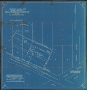
Howard Avenue School site
https://search.heritageburnaby.ca/link/museumdescription11124
- Repository
- Burnaby Village Museum
- Date
- March 24, 1915
- Collection/Fonds
- Ronald G. Scobbie collection
- Description Level
- Item
- Physical Description
- 1 survey plan : blueprint on paper ; 56 x 54 cm
- Scope and Content
- Survey plan of "Howard Avenue School Site" "Burnaby Municipality", "Being Lots 1-5 and 14-18 Inc. Block 5 of the Subd. of Easterly 3/4 of Lot 127. Group 1, New Westminster District";
- Repository
- Burnaby Village Museum
- Collection/Fonds
- Ronald G. Scobbie collection
- Description Level
- Item
- Physical Description
- 1 survey plan : blueprint on paper ; 56 x 54 cm
- Material Details
- Scale: 40 feet = 1 inch
- Scope and Content
- Survey plan of "Howard Avenue School Site" "Burnaby Municipality", "Being Lots 1-5 and 14-18 Inc. Block 5 of the Subd. of Easterly 3/4 of Lot 127. Group 1, New Westminster District";
- Creator
- McGugan, Donald Johnston
- Subjects
- Buildings - Schools
- Names
- Howard Avenue School
- Responsibility
- Burnett and McGugan B.C. Land Surveyors, New Westminster
- Geographic Access
- Howard Avenue
- Georgia Street
- Accession Code
- BV003.83.4
- Access Restriction
- No restrictions
- Reproduction Restriction
- No known restrictions
- Date
- March 24, 1915
- Media Type
- Cartographic Material
- Historic Neighbourhood
- Capitol Hill (Historic Neighbourhood)
- Planning Study Area
- Capitol Hill Area
- Scan Resolution
- 440
- Scan Date
- 22-Dec-2020
- Scale
- 100
- Notes
- Title based on contents of plan
- Oath in bottom left corner reads: "I, D.J. McGugan...and did personally superintend the survey..." "...completed on the 24th day of March 1915"; signed "D.J. McGugan", notarized on April 12th, 1915 by "R. Chapman"
- handwritten on back, "1754"
Zoomable Images
Kingsway West School site
https://search.heritageburnaby.ca/link/museumdescription11122
- Repository
- Burnaby Village Museum
- Date
- March 16, 1915
- Collection/Fonds
- Ronald G. Scobbie collection
- Description Level
- Item
- Physical Description
- 1 survey plan : blueprint on paper with pencil notations ; 56 x 54 cm
- Scope and Content
- Survey plan of "Kingsway West School Site" "Burnaby Municipality" "being Lot 1, D.L.32, Lot 1 of Lot 21, Portion of Lot 21 and Portion of Lot 20, of subdivision of D.L.152, 153 & Portion of Lot 151, Group 1, New Westminster District". Notations in pencil extend along the south boundary line of Dist…
- Repository
- Burnaby Village Museum
- Collection/Fonds
- Ronald G. Scobbie collection
- Description Level
- Item
- Physical Description
- 1 survey plan : blueprint on paper with pencil notations ; 56 x 54 cm
- Material Details
- Scale: 40 feet = 1 inch
- Scope and Content
- Survey plan of "Kingsway West School Site" "Burnaby Municipality" "being Lot 1, D.L.32, Lot 1 of Lot 21, Portion of Lot 21 and Portion of Lot 20, of subdivision of D.L.152, 153 & Portion of Lot 151, Group 1, New Westminster District". Notations in pencil extend along the south boundary line of District Lot 32.
- Creator
- McGugan, Donald Johnston
- Subjects
- Buildings - Schools
- Names
- Kingsway West School
- Responsibility
- Burnett and McGugan B.C. Land Surveyors, New Westminster
- Geographic Access
- Kingsway
- Sussex Avenue
- Accession Code
- BV003.83.2
- Access Restriction
- No restrictions
- Reproduction Restriction
- No known restrictions
- Date
- March 16, 1915
- Media Type
- Cartographic Material
- Historic Neighbourhood
- Central Park (Historic Neighbourhood)
- Planning Study Area
- Maywood Area
- Scan Resolution
- 440
- Scan Date
- 22-Dec-2020
- Scale
- 100
- Notes
- Transcribed title
- Oath in bottom left corner reads: "I, D.J. McGugan...did personally superintend the survey ..." "...completed on the 16th day of March 1915", signed "D.J. McGugan" and is notarized on March 19th, 1915 by "S.F. Frank" with a seal
- handwritten on back, "1753";
- See also BV003.83.9 - duplicate blueprint plan without annotations
- See also BV003.83.3 for original plan on waxed linen
Zoomable Images
Map of Burnaby Municipality
https://search.heritageburnaby.ca/link/museumdescription8693
- Repository
- Burnaby Village Museum
- Date
- [between 1914 and 1921]
- Collection/Fonds
- Burnaby Village Museum Map collection
- Description Level
- Item
- Physical Description
- 1 map : lithographic print, ms. annotations and hand col. on linen ; 83.5 x 57.5 cm
- Scope and Content
- Map of "BURNABY / MUNICIPALITY". "COMPILED & PUBLISHED / BY / DOMINION BLUEPRINT & MAP CO. / 576 SEYMOUR STREET / PHONE SEY. 4670 / VANCOUVER, B.C." The map also includes a handwritten title in ink above which reads: "Townplanning Maps in T.135." District lots, subdivisions, wards, blocks, schools…
- Repository
- Burnaby Village Museum
- Collection/Fonds
- Burnaby Village Museum Map collection
- Description Level
- Item
- Physical Description
- 1 map : lithographic print, ms. annotations and hand col. on linen ; 83.5 x 57.5 cm
- Material Details
- Scale [1:1666]
- Scope and Content
- Map of "BURNABY / MUNICIPALITY". "COMPILED & PUBLISHED / BY / DOMINION BLUEPRINT & MAP CO. / 576 SEYMOUR STREET / PHONE SEY. 4670 / VANCOUVER, B.C." The map also includes a handwritten title in ink above which reads: "Townplanning Maps in T.135." District lots, subdivisions, wards, blocks, schools, names, roads, railways are identified in black ink along with water ways and municipal borders. Additions have been added on top of original map print which include: red dashed lines in ink; green, blue, red lines in pencil crayon; purple, brown and red watercolour on some lots along with a bridge across the Fraser R. in red ink; pencilled Standard, Shell and Union Oil properties; pencilled numbers, arrows, natural features, notes; one line is "Gas 1930", "April 1924" next to a lot notation.
- Publisher
- Compiled and Published by Dominion Blueprint & Map Co.
- Responsibility
- Hill and Barnett Land Surveyors
- Accession Code
- BV994.34.1
- Access Restriction
- No restrictions
- Reproduction Restriction
- No known restrictions
- Date
- [between 1914 and 1921]
- Media Type
- Cartographic Material
- Notes
- Transcribed title
- Scale is measured in inches to feet
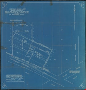
Riverway School site
https://search.heritageburnaby.ca/link/museumdescription11134
- Repository
- Burnaby Village Museum
- Date
- April 16, 1915
- Collection/Fonds
- Ronald G. Scobbie collection
- Description Level
- Item
- Physical Description
- 1 survey plan : blueprint on paper ; 56 x 54 cm
- Scope and Content
- Survey plan of "Riverway School Site / Burnaby Municipality" "Being a 1 acre portion of Lot 159 Group 1, and Lots 30 & 31 of subd. of Bks. 1, 1a, 2, 3, 4 & 5 of Lot 159, Group 1, New Westminster District".
- Repository
- Burnaby Village Museum
- Collection/Fonds
- Ronald G. Scobbie collection
- Description Level
- Item
- Physical Description
- 1 survey plan : blueprint on paper ; 56 x 54 cm
- Material Details
- Scale 40 feet = 1 inch
- Scope and Content
- Survey plan of "Riverway School Site / Burnaby Municipality" "Being a 1 acre portion of Lot 159 Group 1, and Lots 30 & 31 of subd. of Bks. 1, 1a, 2, 3, 4 & 5 of Lot 159, Group 1, New Westminster District".
- Creator
- Geoffrey K. Burnett
- Subjects
- Buildings - Schools
- Names
- Riverway East School
- Responsibility
- Burnett and McGugan B.C. Land Surveyors, New Westminster
- Geographic Access
- Gilley Avenue
- Marine Drive
- Street Address
- 5787 Marine Drive
- Accession Code
- BV003.83.13
- Access Restriction
- No restrictions
- Reproduction Restriction
- No known restrictions
- Date
- April 16, 1915
- Media Type
- Cartographic Material
- Historic Neighbourhood
- Alta Vista (Historic Neighbourhood)
- Planning Study Area
- Clinton-Glenwood Area
- Scan Resolution
- 440
- Scan Date
- 22-Dec-2020
- Scale
- 100
- Notes
- Title based on contents of plan
- Note in black ink on verso of plan reads: "1744" / "Riverway School"
- Oath on plan reads: "I, Geoffrey K. Burnett...and did personally superintend the survey..." "...completed on the 16th day of April 1915"; signed by Geoffrey K. Burnett and notarized by "K.A. Eastman", sworn "...19th day of April 1915"
Zoomable Images
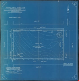
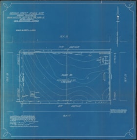
Second Street School site
https://search.heritageburnaby.ca/link/museumdescription11920
- Repository
- Burnaby Village Museum
- Date
- May 29, 1915
- Collection/Fonds
- Ronald G. Scobbie collection
- Description Level
- Item
- Physical Description
- 1 survey plan : blueprint on paper ; 56 x 54 cm
- Scope and Content
- Survey plan of "Second Street School Site" "Burnaby Municipality" "Being Lots 1 & 2 , Block 20 of the Subd of / Lot 27. Group 1 / New Westminster District".
- Repository
- Burnaby Village Museum
- Collection/Fonds
- Ronald G. Scobbie collection
- Description Level
- Item
- Physical Description
- 1 survey plan : blueprint on paper ; 56 x 54 cm
- Material Details
- Scale: 40 feet = 1 inch
- Scope and Content
- Survey plan of "Second Street School Site" "Burnaby Municipality" "Being Lots 1 & 2 , Block 20 of the Subd of / Lot 27. Group 1 / New Westminster District".
- Creator
- McGugan, Donald Johnston
- Subjects
- Buildings - Schools
- Names
- Edmonds Community School
- Responsibility
- Burnett and McGugan B.C. Land Surveyors, New Westminster
- Geographic Access
- Edmonds Street
- Street Address
- 7641 Edmonds Street
- Accession Code
- BV003.83.6
- Access Restriction
- No restrictions
- Reproduction Restriction
- No known restrictions
- Date
- May 29, 1915
- Media Type
- Cartographic Material
- Historic Neighbourhood
- Edmonds (Historic Neighbourhood)
- Planning Study Area
- Edmonds Area
- Scan Resolution
- 440
- Scan Date
- 22-Dec-2020
- Scale
- 100
- Notes
- Title based on contents of plan
- Oath in bottom left corner reads: "I, D.J. McGugan...and did personally superintend the survey..." "...completed on the 8th day of March 1915"; signed "D.J. McGugan / BCLS / sworn...29 day / of May 1915"
- handwritten on back, "1733"
Zoomable Images
Agreement for sale of land between Joseph C. Armstrong and Jesse Love re District Lot 25
https://search.heritageburnaby.ca/link/museumdescription18788
- Repository
- Burnaby Village Museum
- Date
- 6 Oct. 1893
- Collection/Fonds
- Love family fonds
- Description Level
- Item
- Physical Description
- 1 p. of textual records + 1 plan : red and black ink on linen ; 16 x 8.5 cm
- Scope and Content
- Item consists of an Agreement for Sale of Land dated October 6, 1893 between Joseph C. Armstrong and Jesse Love for District Lot 25, Group one, New Westminster District and a small hand drawn plan showing District Lot 25, Cumberland Road and location of building. Land Agreement was registered Febru…
- Repository
- Burnaby Village Museum
- Collection/Fonds
- Love family fonds
- Description Level
- Item
- Physical Description
- 1 p. of textual records + 1 plan : red and black ink on linen ; 16 x 8.5 cm
- Scope and Content
- Item consists of an Agreement for Sale of Land dated October 6, 1893 between Joseph C. Armstrong and Jesse Love for District Lot 25, Group one, New Westminster District and a small hand drawn plan showing District Lot 25, Cumberland Road and location of building. Land Agreement was registered February 13, 1894.
- Accession Code
- BV992.26.8
- Access Restriction
- No restrictions
- Reproduction Restriction
- No known restrictions
- Date
- 6 Oct. 1893
- Media Type
- Textual Record
- Cartographic Material
- Notes
- Title based on contents of item
- Document dated Oct 6 1893; "ARTICLES OF AGREEMENT" between Joseph C. Armstrong and Jesse Love; one page, folded on buff, legal-sized paper with pink borders; black print; handwritten in faded brown ink; for a parcel of land in the New Westminster District, all that portion of Lot 25, Group I, from a point on the Easterly side 20 chains from the South Easterly corner, then from the South Easterly corner, then northerly and parallel with the Cumberland Road for 10 chains and 52 links, then southerly 10 chains, then Easterly 14 chains and 52 links, total 14 acres and 52/100; for $1161 in 17 instalments at 6% interest; signed by Jesse Love and J.C. Armstrong, witnessed by H.A. Eastman; two seals are missing, pink stains on paper; addition May 1900 signed by Jesse Love and H.A. Eastman; folds twice; when folded, panel showing is "AGREEMENT for Sale of Land." "on Cumberland road in Lot 25 Group I"; handwritten "H.A. Eastman" over printed "E.H. PORT & CO.", "REAL ESTATE BROKERS" "NEW WESTMINSTER BRITISH COLUMBIA"; back panel has blue stamping and pink additions, giving No. 546C, registered February 13, 1894, Charge Book Vol. 13, Folio 51, signed C.S. Corrigan? District Registrar; with hand-drawn plan on stained linen, pink ink with black additions, shows Cumberland Road and city limits.
Bylaw Number: 249 - Arthur E Rand Land Sale Bylaw 1919
https://search.heritageburnaby.ca/link/bylaw23199
- Repository
- Legislative Services
- Bylaw Number
- 249
- Final Adoption
- 1919 Jun 09
- Format
- Bylaws - Adopted
- Collection/Fonds
- City Council and Office of the City Clerk fonds
- Repository
- Legislative Services
- Bylaw Number
- 249
- Final Adoption
- 1919 Jun 09
- Format
- Bylaws - Adopted
- Collection/Fonds
- City Council and Office of the City Clerk fonds
Documents
Bylaw Number: 251 - Land Sale Bylaw No 1, 1919
https://search.heritageburnaby.ca/link/bylaw23197
- Repository
- Legislative Services
- Bylaw Number
- 251
- Final Adoption
- 1919 Jul 28
- Format
- Bylaws - Adopted
- Collection/Fonds
- City Council and Office of the City Clerk fonds
- Repository
- Legislative Services
- Bylaw Number
- 251
- Final Adoption
- 1919 Jul 28
- Format
- Bylaws - Adopted
- Collection/Fonds
- City Council and Office of the City Clerk fonds
Documents
Bylaw Number: 252 - Land Sale Bylaw No 2, 1919
https://search.heritageburnaby.ca/link/bylaw23196
- Repository
- Legislative Services
- Bylaw Number
- 252
- Final Adoption
- 1919 Jul 28
- Format
- Bylaws - Adopted
- Collection/Fonds
- City Council and Office of the City Clerk fonds
- Repository
- Legislative Services
- Bylaw Number
- 252
- Final Adoption
- 1919 Jul 28
- Format
- Bylaws - Adopted
- Collection/Fonds
- City Council and Office of the City Clerk fonds
Documents
Bylaw Number: 256 - Land Sale Bylaw No 3, 1919
https://search.heritageburnaby.ca/link/bylaw23192
- Repository
- Legislative Services
- Bylaw Number
- 256
- Final Adoption
- 1919 Nov 03
- Format
- Bylaws - Adopted
- Collection/Fonds
- City Council and Office of the City Clerk fonds
- Repository
- Legislative Services
- Bylaw Number
- 256
- Final Adoption
- 1919 Nov 03
- Format
- Bylaws - Adopted
- Collection/Fonds
- City Council and Office of the City Clerk fonds
Documents
Bylaw Number: 257 - Land Sale Bylaw No 4, 1919
https://search.heritageburnaby.ca/link/bylaw23191
- Repository
- Legislative Services
- Bylaw Number
- 257
- Final Adoption
- 1919 Nov 03
- Format
- Bylaws - Adopted
- Collection/Fonds
- City Council and Office of the City Clerk fonds
- Repository
- Legislative Services
- Bylaw Number
- 257
- Final Adoption
- 1919 Nov 03
- Format
- Bylaws - Adopted
- Collection/Fonds
- City Council and Office of the City Clerk fonds
Documents
Bylaw Number: 259 - Land Sale Bylaw No 1, 1920
https://search.heritageburnaby.ca/link/bylaw23189
- Repository
- Legislative Services
- Bylaw Number
- 259
- Final Adoption
- 1920 Feb 02
- Format
- Bylaws - Adopted
- Collection/Fonds
- City Council and Office of the City Clerk fonds
- Repository
- Legislative Services
- Bylaw Number
- 259
- Final Adoption
- 1920 Feb 02
- Format
- Bylaws - Adopted
- Collection/Fonds
- City Council and Office of the City Clerk fonds
Documents
Bylaw Number: 260 - Land Sale Bylaw No 2, 1920
https://search.heritageburnaby.ca/link/bylaw23188
- Repository
- Legislative Services
- Bylaw Number
- 260
- Final Adoption
- 1920 Feb 02
- Format
- Bylaws - Adopted
- Collection/Fonds
- City Council and Office of the City Clerk fonds
- Repository
- Legislative Services
- Bylaw Number
- 260
- Final Adoption
- 1920 Feb 02
- Format
- Bylaws - Adopted
- Collection/Fonds
- City Council and Office of the City Clerk fonds
Documents
Bylaw Number: 261 - Land Sale Bylaw No 3, 1920
https://search.heritageburnaby.ca/link/bylaw23187
- Repository
- Legislative Services
- Bylaw Number
- 261
- Final Adoption
- 1920 Feb 02
- Format
- Bylaws - Adopted
- Collection/Fonds
- City Council and Office of the City Clerk fonds
- Repository
- Legislative Services
- Bylaw Number
- 261
- Final Adoption
- 1920 Feb 02
- Format
- Bylaws - Adopted
- Collection/Fonds
- City Council and Office of the City Clerk fonds
Documents
Bylaw Number: 263 - Land Sale Bylaw No 4, 1920
https://search.heritageburnaby.ca/link/bylaw23185
- Repository
- Legislative Services
- Bylaw Number
- 263
- Final Adoption
- 1920 Mar 08
- Format
- Bylaws - Adopted
- Collection/Fonds
- City Council and Office of the City Clerk fonds
- Repository
- Legislative Services
- Bylaw Number
- 263
- Final Adoption
- 1920 Mar 08
- Format
- Bylaws - Adopted
- Collection/Fonds
- City Council and Office of the City Clerk fonds
Documents
Bylaw Number: 264 - Land Sale Bylaw No 5, 1920
https://search.heritageburnaby.ca/link/bylaw23184
- Repository
- Legislative Services
- Bylaw Number
- 264
- Final Adoption
- 1920 Mar 08
- Format
- Bylaws - Adopted
- Collection/Fonds
- City Council and Office of the City Clerk fonds
- Repository
- Legislative Services
- Bylaw Number
- 264
- Final Adoption
- 1920 Mar 08
- Format
- Bylaws - Adopted
- Collection/Fonds
- City Council and Office of the City Clerk fonds
Documents
Bylaw Number: 265 - Land Sale Bylaw No 6, 1920
https://search.heritageburnaby.ca/link/bylaw23183
- Repository
- Legislative Services
- Bylaw Number
- 265
- Final Adoption
- 1920 Mar 08
- Format
- Bylaws - Adopted
- Collection/Fonds
- City Council and Office of the City Clerk fonds
- Repository
- Legislative Services
- Bylaw Number
- 265
- Final Adoption
- 1920 Mar 08
- Format
- Bylaws - Adopted
- Collection/Fonds
- City Council and Office of the City Clerk fonds
Documents
Bylaw Number: 272 - Land Sale Bylaw No 7, 1920
https://search.heritageburnaby.ca/link/bylaw23176
- Repository
- Legislative Services
- Bylaw Number
- 272
- Final Adoption
- 1920 May 03
- Format
- Bylaws - Adopted
- Collection/Fonds
- City Council and Office of the City Clerk fonds
- Repository
- Legislative Services
- Bylaw Number
- 272
- Final Adoption
- 1920 May 03
- Format
- Bylaws - Adopted
- Collection/Fonds
- City Council and Office of the City Clerk fonds
Documents
Bylaw Number: 273 - Land Sale Bylaw No 8, 1920
https://search.heritageburnaby.ca/link/bylaw23175
- Repository
- Legislative Services
- Bylaw Number
- 273
- Final Adoption
- 1920 May 03
- Format
- Bylaws - Adopted
- Collection/Fonds
- City Council and Office of the City Clerk fonds
- Repository
- Legislative Services
- Bylaw Number
- 273
- Final Adoption
- 1920 May 03
- Format
- Bylaws - Adopted
- Collection/Fonds
- City Council and Office of the City Clerk fonds


