Narrow Results By
Decade
- 2020s 27
- 2010s 13
- 2000s 18
- 1990s 17
- 1980s 21
- 1970s 44
- 1960s 29
- 1950s 37
- 1940s 62
- 1930s 30
- 1920s 119
- 1910s 85
- 1900s 60
- 1890s 30
- 1880s 7
- 1870s 5
- 1860s 9
- 1850s 4
- 1840s 2
- 1830s 1
- 1820s 1
- 1810s 1
- 1800s 1
- 1790s 2
- 1780s 1
- 1770s 1
- 1760s 1
- 1750s 1
- 1740s 1
- 1730s 1
- 1720s 1
- 1710s 1
- 1700s 1
- 1690s 1
- 1680s 1
- 1670s 1
- 1660s 1
- 1650s 1
- 1640s 1
- 1630s 1
- 1620s 1
- 1610s 1
- 1600s 1
Creator
- Akrigg, G. P. V., 1913- 1
- Akrigg, Helen B., 1921- 1
- Anger, Harry D. (Harry Dell), 1888-1953 1
- Anger, William Henry 1
- B.C. Tree Fruits Limited 1
- Birrell, A. J. 1
- Bobic, Janice 1
- British Columbia. Ministry of Environment, Lands, and Parks 1
- Burnaby (B.C.). Planning Department 1
- Burnaby Community Heritage Commission 1
- Burnaby, Robert, 1828-1878 1
- Burnaby Village Museum 23

Edmonds Street School site
https://search.heritageburnaby.ca/link/museumdescription11125
- Repository
- Burnaby Village Museum
- Date
- March 8, 1915
- Collection/Fonds
- Ronald G. Scobbie collection
- Description Level
- Item
- Physical Description
- 1 survey plan : blueprint on paper ; 56 x 54 cm
- Scope and Content
- Survey plan of "Edmonds Street School Site" "Burnaby Municipality" "Being Lots 28 and 29 of the Subdivision of Lot 30, Group 1, New Westminster District";
- Repository
- Burnaby Village Museum
- Collection/Fonds
- Ronald G. Scobbie collection
- Description Level
- Item
- Physical Description
- 1 survey plan : blueprint on paper ; 56 x 54 cm
- Material Details
- Scale: 4 feet = 1 inch
- Scope and Content
- Survey plan of "Edmonds Street School Site" "Burnaby Municipality" "Being Lots 28 and 29 of the Subdivision of Lot 30, Group 1, New Westminster District";
- Subjects
- Buildings - Schools
- Names
- Edmonds Community School
- Responsibility
- Burnett and McGugan B.C. Land Surveyors, New Westminster
- Geographic Access
- Edmonds Street
- Street Address
- 7641 Edmonds Street
- Accession Code
- BV003.83.5
- Access Restriction
- No restrictions
- Reproduction Restriction
- No known restrictions
- Date
- March 8, 1915
- Media Type
- Cartographic Material
- Historic Neighbourhood
- Edmonds (Historic Neighbourhood)
- Planning Study Area
- Edmonds Area
- Scan Resolution
- 440
- Scan Date
- 22-Dec-2020
- Scale
- 100
- Notes
- Title based on contents of plan
- Oath in bottom left corner reads: "I, D.J. McGugan...and did personally superintend the survey..." "...completed on the 8th day of March 1915"; signed "D.J. McGugan", notarized by "S.F. Mark" "sworn...12th Day of April 1915"
- handwritten on back, "1756"
Zoomable Images

Heritage Legacy Fund of British Columbia : the first five years
https://search.heritageburnaby.ca/link/museumlibrary6730
- Repository
- Burnaby Village Museum
- Author
- Heritage Legacy Fund B.C.
- Publication Date
- 2010
- Call Number
- 971.1005 HER
- Repository
- Burnaby Village Museum
- Collection
- Reference Collection
- Material Type
- Textual Record
- Call Number
- 971.1005 HER
- Author
- Heritage Legacy Fund B.C.
- Contributor
- Heritage BC
- Land Conservancy of British Columbia
- Heritage Legacy Fund of British Columbia Society
- Place of Publication
- Victoria, B.C.
- Publisher
- Heritage Legacy Fund
- Publication Date
- 2010
- Physical Description
- [12] p. : ill. (chiefly col.) ; 22 x 28 cm
- Library Subject (LOC)
- Historic buildings--British Columbia--Conservation and restoration
- Notes
- The Heritage Legacy Fund is an initiative of Heritage BC and the Land Conservancy. Programs are administered by the Heritage Legacy Fund of British Columbia Society. -- summary

Howard Avenue School site
https://search.heritageburnaby.ca/link/museumdescription11124
- Repository
- Burnaby Village Museum
- Date
- March 24, 1915
- Collection/Fonds
- Ronald G. Scobbie collection
- Description Level
- Item
- Physical Description
- 1 survey plan : blueprint on paper ; 56 x 54 cm
- Scope and Content
- Survey plan of "Howard Avenue School Site" "Burnaby Municipality", "Being Lots 1-5 and 14-18 Inc. Block 5 of the Subd. of Easterly 3/4 of Lot 127. Group 1, New Westminster District";
- Repository
- Burnaby Village Museum
- Collection/Fonds
- Ronald G. Scobbie collection
- Description Level
- Item
- Physical Description
- 1 survey plan : blueprint on paper ; 56 x 54 cm
- Material Details
- Scale: 40 feet = 1 inch
- Scope and Content
- Survey plan of "Howard Avenue School Site" "Burnaby Municipality", "Being Lots 1-5 and 14-18 Inc. Block 5 of the Subd. of Easterly 3/4 of Lot 127. Group 1, New Westminster District";
- Creator
- McGugan, Donald Johnston
- Subjects
- Buildings - Schools
- Names
- Howard Avenue School
- Responsibility
- Burnett and McGugan B.C. Land Surveyors, New Westminster
- Geographic Access
- Howard Avenue
- Georgia Street
- Accession Code
- BV003.83.4
- Access Restriction
- No restrictions
- Reproduction Restriction
- No known restrictions
- Date
- March 24, 1915
- Media Type
- Cartographic Material
- Historic Neighbourhood
- Capitol Hill (Historic Neighbourhood)
- Planning Study Area
- Capitol Hill Area
- Scan Resolution
- 440
- Scan Date
- 22-Dec-2020
- Scale
- 100
- Notes
- Title based on contents of plan
- Oath in bottom left corner reads: "I, D.J. McGugan...and did personally superintend the survey..." "...completed on the 24th day of March 1915"; signed "D.J. McGugan", notarized on April 12th, 1915 by "R. Chapman"
- handwritten on back, "1754"
Zoomable Images


Kingsway West School site
https://search.heritageburnaby.ca/link/museumdescription11122
- Repository
- Burnaby Village Museum
- Date
- March 16, 1915
- Collection/Fonds
- Ronald G. Scobbie collection
- Description Level
- Item
- Physical Description
- 1 survey plan : blueprint on paper with pencil notations ; 56 x 54 cm
- Scope and Content
- Survey plan of "Kingsway West School Site" "Burnaby Municipality" "being Lot 1, D.L.32, Lot 1 of Lot 21, Portion of Lot 21 and Portion of Lot 20, of subdivision of D.L.152, 153 & Portion of Lot 151, Group 1, New Westminster District". Notations in pencil extend along the south boundary line of Dist…
- Repository
- Burnaby Village Museum
- Collection/Fonds
- Ronald G. Scobbie collection
- Description Level
- Item
- Physical Description
- 1 survey plan : blueprint on paper with pencil notations ; 56 x 54 cm
- Material Details
- Scale: 40 feet = 1 inch
- Scope and Content
- Survey plan of "Kingsway West School Site" "Burnaby Municipality" "being Lot 1, D.L.32, Lot 1 of Lot 21, Portion of Lot 21 and Portion of Lot 20, of subdivision of D.L.152, 153 & Portion of Lot 151, Group 1, New Westminster District". Notations in pencil extend along the south boundary line of District Lot 32.
- Creator
- McGugan, Donald Johnston
- Subjects
- Buildings - Schools
- Names
- Kingsway West School
- Responsibility
- Burnett and McGugan B.C. Land Surveyors, New Westminster
- Geographic Access
- Kingsway
- Sussex Avenue
- Accession Code
- BV003.83.2
- Access Restriction
- No restrictions
- Reproduction Restriction
- No known restrictions
- Date
- March 16, 1915
- Media Type
- Cartographic Material
- Historic Neighbourhood
- Central Park (Historic Neighbourhood)
- Planning Study Area
- Maywood Area
- Scan Resolution
- 440
- Scan Date
- 22-Dec-2020
- Scale
- 100
- Notes
- Transcribed title
- Oath in bottom left corner reads: "I, D.J. McGugan...did personally superintend the survey ..." "...completed on the 16th day of March 1915", signed "D.J. McGugan" and is notarized on March 19th, 1915 by "S.F. Frank" with a seal
- handwritten on back, "1753";
- See also BV003.83.9 - duplicate blueprint plan without annotations
- See also BV003.83.3 for original plan on waxed linen
Zoomable Images

Map of Burnaby Municipality
https://search.heritageburnaby.ca/link/museumdescription8693
- Repository
- Burnaby Village Museum
- Date
- [between 1914 and 1921]
- Collection/Fonds
- Burnaby Village Museum Map collection
- Description Level
- Item
- Physical Description
- 1 map : lithographic print, ms. annotations and hand col. on linen ; 83.5 x 57.5 cm
- Scope and Content
- Map of "BURNABY / MUNICIPALITY". "COMPILED & PUBLISHED / BY / DOMINION BLUEPRINT & MAP CO. / 576 SEYMOUR STREET / PHONE SEY. 4670 / VANCOUVER, B.C." The map also includes a handwritten title in ink above which reads: "Townplanning Maps in T.135." District lots, subdivisions, wards, blocks, schools…
- Repository
- Burnaby Village Museum
- Collection/Fonds
- Burnaby Village Museum Map collection
- Description Level
- Item
- Physical Description
- 1 map : lithographic print, ms. annotations and hand col. on linen ; 83.5 x 57.5 cm
- Material Details
- Scale [1:1666]
- Scope and Content
- Map of "BURNABY / MUNICIPALITY". "COMPILED & PUBLISHED / BY / DOMINION BLUEPRINT & MAP CO. / 576 SEYMOUR STREET / PHONE SEY. 4670 / VANCOUVER, B.C." The map also includes a handwritten title in ink above which reads: "Townplanning Maps in T.135." District lots, subdivisions, wards, blocks, schools, names, roads, railways are identified in black ink along with water ways and municipal borders. Additions have been added on top of original map print which include: red dashed lines in ink; green, blue, red lines in pencil crayon; purple, brown and red watercolour on some lots along with a bridge across the Fraser R. in red ink; pencilled Standard, Shell and Union Oil properties; pencilled numbers, arrows, natural features, notes; one line is "Gas 1930", "April 1924" next to a lot notation.
- Publisher
- Compiled and Published by Dominion Blueprint & Map Co.
- Responsibility
- Hill and Barnett Land Surveyors
- Accession Code
- BV994.34.1
- Access Restriction
- No restrictions
- Reproduction Restriction
- No known restrictions
- Date
- [between 1914 and 1921]
- Media Type
- Cartographic Material
- Notes
- Transcribed title
- Scale is measured in inches to feet

Riverway School site
https://search.heritageburnaby.ca/link/museumdescription11134
- Repository
- Burnaby Village Museum
- Date
- April 16, 1915
- Collection/Fonds
- Ronald G. Scobbie collection
- Description Level
- Item
- Physical Description
- 1 survey plan : blueprint on paper ; 56 x 54 cm
- Scope and Content
- Survey plan of "Riverway School Site / Burnaby Municipality" "Being a 1 acre portion of Lot 159 Group 1, and Lots 30 & 31 of subd. of Bks. 1, 1a, 2, 3, 4 & 5 of Lot 159, Group 1, New Westminster District".
- Repository
- Burnaby Village Museum
- Collection/Fonds
- Ronald G. Scobbie collection
- Description Level
- Item
- Physical Description
- 1 survey plan : blueprint on paper ; 56 x 54 cm
- Material Details
- Scale 40 feet = 1 inch
- Scope and Content
- Survey plan of "Riverway School Site / Burnaby Municipality" "Being a 1 acre portion of Lot 159 Group 1, and Lots 30 & 31 of subd. of Bks. 1, 1a, 2, 3, 4 & 5 of Lot 159, Group 1, New Westminster District".
- Creator
- Geoffrey K. Burnett
- Subjects
- Buildings - Schools
- Names
- Riverway East School
- Responsibility
- Burnett and McGugan B.C. Land Surveyors, New Westminster
- Geographic Access
- Gilley Avenue
- Marine Drive
- Street Address
- 5787 Marine Drive
- Accession Code
- BV003.83.13
- Access Restriction
- No restrictions
- Reproduction Restriction
- No known restrictions
- Date
- April 16, 1915
- Media Type
- Cartographic Material
- Historic Neighbourhood
- Alta Vista (Historic Neighbourhood)
- Planning Study Area
- Clinton-Glenwood Area
- Scan Resolution
- 440
- Scan Date
- 22-Dec-2020
- Scale
- 100
- Notes
- Title based on contents of plan
- Note in black ink on verso of plan reads: "1744" / "Riverway School"
- Oath on plan reads: "I, Geoffrey K. Burnett...and did personally superintend the survey..." "...completed on the 16th day of April 1915"; signed by Geoffrey K. Burnett and notarized by "K.A. Eastman", sworn "...19th day of April 1915"
Zoomable Images


Second Street School site
https://search.heritageburnaby.ca/link/museumdescription11920
- Repository
- Burnaby Village Museum
- Date
- May 29, 1915
- Collection/Fonds
- Ronald G. Scobbie collection
- Description Level
- Item
- Physical Description
- 1 survey plan : blueprint on paper ; 56 x 54 cm
- Scope and Content
- Survey plan of "Second Street School Site" "Burnaby Municipality" "Being Lots 1 & 2 , Block 20 of the Subd of / Lot 27. Group 1 / New Westminster District".
- Repository
- Burnaby Village Museum
- Collection/Fonds
- Ronald G. Scobbie collection
- Description Level
- Item
- Physical Description
- 1 survey plan : blueprint on paper ; 56 x 54 cm
- Material Details
- Scale: 40 feet = 1 inch
- Scope and Content
- Survey plan of "Second Street School Site" "Burnaby Municipality" "Being Lots 1 & 2 , Block 20 of the Subd of / Lot 27. Group 1 / New Westminster District".
- Creator
- McGugan, Donald Johnston
- Subjects
- Buildings - Schools
- Names
- Edmonds Community School
- Responsibility
- Burnett and McGugan B.C. Land Surveyors, New Westminster
- Geographic Access
- Edmonds Street
- Street Address
- 7641 Edmonds Street
- Accession Code
- BV003.83.6
- Access Restriction
- No restrictions
- Reproduction Restriction
- No known restrictions
- Date
- May 29, 1915
- Media Type
- Cartographic Material
- Historic Neighbourhood
- Edmonds (Historic Neighbourhood)
- Planning Study Area
- Edmonds Area
- Scan Resolution
- 440
- Scan Date
- 22-Dec-2020
- Scale
- 100
- Notes
- Title based on contents of plan
- Oath in bottom left corner reads: "I, D.J. McGugan...and did personally superintend the survey..." "...completed on the 8th day of March 1915"; signed "D.J. McGugan / BCLS / sworn...29 day / of May 1915"
- handwritten on back, "1733"
Zoomable Images


Burnaby property tax assessment ledger no date - pre 1898
https://search.heritageburnaby.ca/link/museumlibrary1118
- Repository
- Burnaby Village Museum
- Collection
- Reference Collection
- Material Type
- Textual Record
- Call Number
- 971.1 BUR
- Author
- J.D.B.
- Place of Publication
- Burnaby
- Publication Date
- 1977
- Physical Description
- 96 p. (typewritten) + title page
- Library Subject (LOC)
- Land titles
- Subjects
- Land - Land Surveying
- Taxes
- Object History
- Compiled July-August 1977, Heritage Village Archives
- Notes
- Unpublished research document: "Burnaby Property Tax Assessment Ledger / No Date --- Pre 1898 / Compiled July-August 1977 / Heritage Village Archives / Original Document No. / Copy #1 / J.D.B./77" -- title page
Images

Documents

Ink
https://search.heritageburnaby.ca/link/museumartifact90812
- Repository
- Burnaby Village Museum
- Accession Code
- BV020.40.3
- Description
- Glass bottle of black ink, with a plastic textured lid. The front label is yellow with a gold border, and a blue band along the bottom of the label. It has a black ink stain down the front. The back label is smaller and lighter colour with a yellow stain that reaches to the middle of the label.
- Object History
- This ink came along with a lettering guide used in the City of Burnaby's Planning Department, in the late 1950s. See also BV020.40.2
- Classification
- Written Communication T&E - - Writing Accessories
- Object Term
- Ink
- Marks/Labels
- Chin-Chin waterproof Liquid PearlInk / Sole Canadian Distributors / Made in Germany / Protect from Freezing
- Colour
- Black
- Yellow
- Blue
- Measurements
- 30cm high
- Maker
- PearlInk
- Subjects
- Documentary Artifacts - Architectural Drawings
- Government - Local Government
- Land - Land Surveying
- Occupations - Civic Workers
- Planning - City Planning
- Historic Neighbourhood
- Burnaby Lake (Historic Neighbourhood)
- Planning Study Area
- Douglas-Gilpin Area
Images


Lettering Guide
https://search.heritageburnaby.ca/link/museumartifact90811
- Repository
- Burnaby Village Museum
- Accession Code
- BV020.40.2
- Description
- Wooden box with a hinged lid and base with slats for rules and holes for lettering tips. The box contains lettering materials, including white rulers,ink pens in green cardboard cylindrical tubes, guiding stencils for lettering in different fonts, metal tool to hold ink nibs.
- Object History
- This lettering guide was used in the City of Burnaby's Planning Department, in the late 1950s. A lettering guide template is a special type of template used to write uniform characters. It consists of a sheet of plastic or other material with cut-outs of letters, numbers, and other shapes used especially for creating technical drawings. For decades they have been essential for lettering a drawing nameplate so text and other designs could be made quickly and uniformly. Although they have been superseded by the use of computers, during the greater part of the last century they were used to relatively ease the lettering process in the creation of technical drawings. They were an indispensable tool for architects and technical illustrators.
- Classification
- Written Communication T&E - - Writing Devices
- Object Term
- Guide, Lettering
- Marks/Labels
- WRICO LETTERING PEN
- Maker
- WRICO
- Subjects
- Construction Tools and Equipment
- Documentary Artifacts - Architectural Drawings
- Government - Local Government
- Land - Land Surveying
- Occupations - Civic Workers
- Historic Neighbourhood
- Burnaby Lake (Historic Neighbourhood)
- Planning Study Area
- Douglas-Gilpin Area
Images

![Surveying for the construction of a log cabin, [1976] thumbnail](/media/hpo/_Data/_BVM_Images/2020/2020_0005_0888_001.jpg?width=280)
Surveying for the construction of a log cabin
https://search.heritageburnaby.ca/link/museumdescription13696
- Repository
- Burnaby Village Museum
- Date
- [1976]
- Collection/Fonds
- Century Park Museum Association fonds
- Description Level
- Item
- Physical Description
- 1 photograph : col. slide ; 35 mm
- Scope and Content
- Photograph of a group of men surveying for the construction of a log cabin. The man in the centre of the photogaph is using a level. In the summer of 1976, Heritage Village Museum offered a two day log cabin building course under the expert instruction of Earl Carter.
- Repository
- Burnaby Village Museum
- Collection/Fonds
- Century Park Museum Association fonds
- Description Level
- Item
- Physical Description
- 1 photograph : col. slide ; 35 mm
- Scope and Content
- Photograph of a group of men surveying for the construction of a log cabin. The man in the centre of the photogaph is using a level. In the summer of 1976, Heritage Village Museum offered a two day log cabin building course under the expert instruction of Earl Carter.
- Accession Code
- BV020.5.888
- Access Restriction
- No restrictions
- Reproduction Restriction
- No known restrictions
- Date
- [1976]
- Media Type
- Photograph
- Scan Resolution
- 2400
- Scan Date
- September 1, 2020
- Scale
- 100
- Notes
- Title based on contents of photograph
- See also BV020.5.709 for documentary film titled "Cabin" directed and produced by James (Jim) Bizzochi - documenting the construction of the log cabin in Heritage Village
Images
![Surveying for the construction of a log cabin, [1976] thumbnail](/media/hpo/_Data/_BVM_Images/2020/2020_0005_0888_001.jpg)
The Acadian exiles : a chronicle of the land of Evangeline, v.9
https://search.heritageburnaby.ca/link/museumlibrary5140
- Repository
- Burnaby Village Museum
- Collection
- Special Collection
- Material Type
- Book
- Accession Code
- BV004.106.32
- Call Number
- 971 CHR v.9
- Place of Publication
- Toronto
- Publisher
- Glasgow, Brook & Company
- Publication Date
- 1916
- Series
- Chronicles of Canada, 9
- Printer
- T. and A. Constable
- Physical Description
- xi, 178 p. : col. ill., col. maps, col. port. ; 19 cm.
- Library Subject (LOC)
- Acadia
- Canada--History
- Nova Scotia--History
- Notes
- "Edited by George M. Wrong and H.H. Langton"
- "In thirty-two volumes"
- "Part III The English Invasion"
- Includes bibliographic references and index.
- Author's given names and dates: Doughty, Arthur G. (Arthur George), Sir, 1860-1936
- Editor's given names and dates: Wrong, George McKinnon, 1860-1948
- Editor's given names and dates: Langton, H.H. (Hugh Hornby), 1862-1953
Agreement for sale of land between Joseph C. Armstrong and Jesse Love re District Lot 25
https://search.heritageburnaby.ca/link/museumdescription18788
- Repository
- Burnaby Village Museum
- Date
- 6 Oct. 1893
- Collection/Fonds
- Love family fonds
- Description Level
- Item
- Physical Description
- 1 p. of textual records + 1 plan : red and black ink on linen ; 16 x 8.5 cm
- Scope and Content
- Item consists of an Agreement for Sale of Land dated October 6, 1893 between Joseph C. Armstrong and Jesse Love for District Lot 25, Group one, New Westminster District and a small hand drawn plan showing District Lot 25, Cumberland Road and location of building. Land Agreement was registered Febru…
- Repository
- Burnaby Village Museum
- Collection/Fonds
- Love family fonds
- Description Level
- Item
- Physical Description
- 1 p. of textual records + 1 plan : red and black ink on linen ; 16 x 8.5 cm
- Scope and Content
- Item consists of an Agreement for Sale of Land dated October 6, 1893 between Joseph C. Armstrong and Jesse Love for District Lot 25, Group one, New Westminster District and a small hand drawn plan showing District Lot 25, Cumberland Road and location of building. Land Agreement was registered February 13, 1894.
- Accession Code
- BV992.26.8
- Access Restriction
- No restrictions
- Reproduction Restriction
- No known restrictions
- Date
- 6 Oct. 1893
- Media Type
- Textual Record
- Cartographic Material
- Notes
- Title based on contents of item
- Document dated Oct 6 1893; "ARTICLES OF AGREEMENT" between Joseph C. Armstrong and Jesse Love; one page, folded on buff, legal-sized paper with pink borders; black print; handwritten in faded brown ink; for a parcel of land in the New Westminster District, all that portion of Lot 25, Group I, from a point on the Easterly side 20 chains from the South Easterly corner, then from the South Easterly corner, then northerly and parallel with the Cumberland Road for 10 chains and 52 links, then southerly 10 chains, then Easterly 14 chains and 52 links, total 14 acres and 52/100; for $1161 in 17 instalments at 6% interest; signed by Jesse Love and J.C. Armstrong, witnessed by H.A. Eastman; two seals are missing, pink stains on paper; addition May 1900 signed by Jesse Love and H.A. Eastman; folds twice; when folded, panel showing is "AGREEMENT for Sale of Land." "on Cumberland road in Lot 25 Group I"; handwritten "H.A. Eastman" over printed "E.H. PORT & CO.", "REAL ESTATE BROKERS" "NEW WESTMINSTER BRITISH COLUMBIA"; back panel has blue stamping and pink additions, giving No. 546C, registered February 13, 1894, Charge Book Vol. 13, Folio 51, signed C.S. Corrigan? District Registrar; with hand-drawn plan on stained linen, pink ink with black additions, shows Cumberland Road and city limits.
Agreement for sale of land - George Richard Love and William and Sarah Parker
https://search.heritageburnaby.ca/link/museumdescription10078
- Repository
- Burnaby Village Museum
- Date
- Oct. 31, 1928
- Collection/Fonds
- Love family fonds
- Description Level
- Item
- Physical Description
- 1 p. of textual records
- Scope and Content
- Document consists of a Land title transfer agreement between George Richard Love (No. 1365 Newcombe Street, Burnaby) and William Michael Parker and Sarah Maria Parker in relation to a portion of the southerly 12.687 acres of Block 1, of the easterly portion of District Lot 25, according to Map No. …
- Repository
- Burnaby Village Museum
- Collection/Fonds
- Love family fonds
- Description Level
- Item
- Physical Description
- 1 p. of textual records
- Material Details
- "This agreement, made in duplicate this Thirty-first / day of October in the year of Our Lord one thousand nine hundred and twenty eight / Between / George Richard Love . . . . . / AND / WILLIAM MICHAEL PARKER . . ./ And SARA MARIA PARKER . . . " printed and typed on the top of the first page.
- Scope and Content
- Document consists of a Land title transfer agreement between George Richard Love (No. 1365 Newcombe Street, Burnaby) and William Michael Parker and Sarah Maria Parker in relation to a portion of the southerly 12.687 acres of Block 1, of the easterly portion of District Lot 25, according to Map No. 813.
- History
- See extensive history of Love Family and Love farmhouse located at Burnaby Village Museum.
- Accession Code
- BV012.31.10
- Access Restriction
- No restrictions
- Reproduction Restriction
- No known restrictions
- Date
- Oct. 31, 1928
- Media Type
- Textual Record
- Notes
- Title based on content of file
Agreement for sale of land - George Richard Love and William and Sarah Parker
https://search.heritageburnaby.ca/link/museumdescription10079
- Repository
- Burnaby Village Museum
- Date
- 1928
- Collection/Fonds
- Love family fonds
- Description Level
- Item
- Physical Description
- 1 p. of textual records
- Scope and Content
- Item consists of a Land title transfer agreement between George Richard Love (No. 1365 Newcombe Street, Burnaby) and William Michael Parker and Sarah Maria Parker in relation to a portion of the southerly 12.687 acres of Block 1, of the easterly portion of District Lot 25, according to Map No. 813.…
- Repository
- Burnaby Village Museum
- Collection/Fonds
- Love family fonds
- Description Level
- Item
- Physical Description
- 1 p. of textual records
- Material Details
- "This agreement, made in duplicate this Thirty-first / day of October in the year of Our Lord one thousand nine hundred and twenty eight / Between / George Richard Love . . . . . / AND / WILLIAM MICHAEL PARKER . . ./ And SARA MARIA PARKER . . . " printed and typed on the top of the first page.
- Scope and Content
- Item consists of a Land title transfer agreement between George Richard Love (No. 1365 Newcombe Street, Burnaby) and William Michael Parker and Sarah Maria Parker in relation to a portion of the southerly 12.687 acres of Block 1, of the easterly portion of District Lot 25, according to Map No. 813.This document is a copy in blue ink of the the original document (BV012.31.10) but is notarized with J.J. Johnston's seal under the bottom section "FOR MAKER (INCLUDING MARRIED WOMAN)" and signed on November 7, 1928.
- History
- See extensive history of Love Family and Love farmhouse located at Burnaby Village Museum.
- Accession Code
- BV012.31.11
- Access Restriction
- No restrictions
- Reproduction Restriction
- No known restrictions
- Date
- 1928
- Media Type
- Textual Record
- Notes
- Title based on content of file
Agreement for sale of land - Jesse Love and Duncan McLennan
https://search.heritageburnaby.ca/link/museumdescription10073
- Repository
- Burnaby Village Museum
- Date
- Aug. 3, 1911
- Collection/Fonds
- Love family fonds
- Description Level
- Item
- Physical Description
- 1 p. of textual records, folded
- Scope and Content
- Item consists of a Land Sale Agreement of Block "B" of District Lot 25, between Jesse Love and Duncan G. McLennan (Trustee).
- Repository
- Burnaby Village Museum
- Collection/Fonds
- Love family fonds
- Description Level
- Item
- Physical Description
- 1 p. of textual records, folded
- Scope and Content
- Item consists of a Land Sale Agreement of Block "B" of District Lot 25, between Jesse Love and Duncan G. McLennan (Trustee).
- History
- See extensive history of Love Family and Love farmhouse located at Burnaby Village Museum.
- Accession Code
- BV012.31.5
- Access Restriction
- No restrictions
- Reproduction Restriction
- No known restrictions
- Date
- Aug. 3, 1911
- Media Type
- Textual Record
- Notes
- Title based on content of file

Bringing Visibility to the Land: A Tsleil-Waututh Perspective on Community Building
https://search.heritageburnaby.ca/link/museumdescription15665
- Repository
- Burnaby Village Museum
- Date
- 27 Apr. 2021
- Collection/Fonds
- Burnaby Village Museum fonds
- Description Level
- Item
- Physical Description
- 1 video recording (mp4) (47 min., 39 sec.) : digital, col., sd., stereo ; 29 fps
- Scope and Content
- Item consists of a video recording of a live Zoom webinar hosted by Burnaby Village Museum Curator, Jane Lemke. The webinar is titled "Bringing Visibility to the Land: A Tsleil-Waututh Perspective on Community Building" and is presented by Michelle George, Tsleil-Waututh Nation Cultural and Technic…
- Repository
- Burnaby Village Museum
- Collection/Fonds
- Burnaby Village Museum fonds
- Description Level
- Item
- Physical Description
- 1 video recording (mp4) (47 min., 39 sec.) : digital, col., sd., stereo ; 29 fps
- Material Details
- Presenters: Michelle George
- Host: Jane Lemke
- Date of Presentation: Tuesday, April 27, 7:00 pm - 8:00 pm
- Total Number of tracks: 1
- Total Length of all tracks: 47 min., 39 sec.
- Recording Device: Zoom video communication platform
- Recording Note: Film was edited from it's original recorded version (63 min., 29 sec.) to edited version (47 min., 39 sec.) for public viewing on Heritage Burnaby
- Scope and Content
- Item consists of a video recording of a live Zoom webinar hosted by Burnaby Village Museum Curator, Jane Lemke. The webinar is titled "Bringing Visibility to the Land: A Tsleil-Waututh Perspective on Community Building" and is presented by Michelle George, Tsleil-Waututh Nation Cultural and Technical Specialist. The Zoom webinar is the first in a series of six "Neighbourhood Speaker series" webinars exploring a range of topics shared by Indigenous speakers and knowledge keepers that were presented and made available to the public between April 27 and May 12, 2021. The live webinar was also made available on the Burnaby Village Museum's facebook page. Community members were invited to participate by bringing questions during the interactive online sessions. In this webinar, Michelle George explores the importance of bringing Tsleil-Waututh ways of knowing/knowledge of the land to Burnaby. She grounds her talk with her experience of working with the Burnaby Village Museum on producing the Indigenous History of Burnaby Resource Guide, an award-winning illustrated educational guide. Michelle also speaks to some of the devastating experiences that the Tsleil-Waututh Nation and Indigenous Peoples have suffered since Colonial Settlement and how her Nation has begun to grow in a changing environment. In segments of her talk, Michelle refers to a map titled "Tsleil-Waututh Nation Consultation Area". Following the presentation, Michelle George answers questions from the audience that are moderated by the host, Jane Lemke.
- History
- Michelle George is a member of the Tsleil-Waututh Nation (TWN) and currently works as a Tsleil-Waututh Nation Cultural and Technical Specialist for the Treaty, Lands and Resources (TLR) Department. She participates in various projects for the TWN government and community, focusing on Tsleil-Waututh Governance and Community. The goals that she carries in her work are to make sure Tsleil-Waututh culture is included and considered in these Nation-level projects, as well as within the reviews done on external projects within the TWN Consultation area. She has been a member of both the Tsleil-Waututh Land Code Committee and Land Use Planning group. Michelle is also a First Nations Health Authority Traditional Knowledge Keeper, and a past-Elected Councilor for Tsleil-Waututh Nation. Michelle also provides guest lectures at Simon Fraser University, Langara College, and the BC Institute of Technology.
- Creator
- Burnaby Village Museum
- Subjects
- Indigenous peoples - British Columbia
- Indigenous peoples - Canada - Government relations
- Indigenous peoples - British Columbia - Languages
- Indigenous peoples - Canada - , Treatment of
- Indigenous peoples - British Columbia - First contact with Europeans
- Names
- Burnaby Village Museum
- Burnaby Public Library
- George, Michelle
- Tsleil-Waututh Nation
- George, Chief Daniel "Dan"
- Responsibility
- Lemke, Jane
- Geographic Access
- Burrard Inlet
- Accession Code
- BV021.17.1
- Access Restriction
- No restrictions
- Reproduction Restriction
- No known restrictions
- Date
- 27 Apr. 2021
- Media Type
- Moving Images
- Notes
- Title based on contents of video recording
Images

Video
Bringing Visibility to the Land: A Tsleil-Waututh Perspective on Community Building, 27 Apr. 2021
Bringing Visibility to the Land: A Tsleil-Waututh Perspective on Community Building, 27 Apr. 2021
https://search.heritageburnaby.ca/media/hpo/_Data/_BVM_Moving_Images/2021_0017_0001_002.mp4
British Columbia chronicle, 1788-1846 : adventures by sea and land
https://search.heritageburnaby.ca/link/museumlibrary1106
- Repository
- Burnaby Village Museum
- Collection
- Reference Collection
- Material Type
- Book
- ISBN
- 0919624022
- 9780919624023
- Call Number
- 971.1 AKR
- Place of Publication
- [Vancouver]
- Publisher
- Discovery Press
- Publication Date
- 1975
- Physical Description
- xv, 429 p., [12] leaves of plates : ill. ; 23 cm.
- Library Subject (LOC)
- British Columbia--History
- Notes
- Includes bibliographical references (p. 407-416) and index.
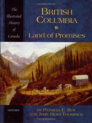
British Columbia : land of promises
https://search.heritageburnaby.ca/link/museumlibrary1422
- Repository
- Burnaby Village Museum
- Collection
- Reference Collection
- Material Type
- Book
- ISBN
- 0195410483
- Call Number
- 971.1 ROY
- Place of Publication
- Toronto
- Publisher
- Oxford University Press
- Publication Date
- 2005
- Physical Description
- 216 p., [10] p. of plates : ill. (some col.), maps (some col.), ports. (some col.) ; 24 cm.
- Library Subject (LOC)
- British Columbia--History
- British Columbia--History--Pictorial works
- Notes
- Includes bibliographical references (p. [206]-211) and index.
, copied 1978 thumbnail](/media/hpo/_Data/_BVM_Images/1977/197800010016.jpg?width=280)
Cleared land
https://search.heritageburnaby.ca/link/museumdescription462
- Repository
- Burnaby Village Museum
- Date
- [190-](date of original), copied 1978
- Collection/Fonds
- Burnaby Village Museum Photograph collection
- Description Level
- Item
- Physical Description
- 1 photograph : b&w ; 20.2 x 25.2 cm print
- Scope and Content
- Photograph of the cleared land which appears to be the Sprott family property. There are stumps and felled trees on the lot. Across a small dirt road and behind a wooden fence, the Haszard house is visible to the extreme right of the photograph.
- Repository
- Burnaby Village Museum
- Collection/Fonds
- Burnaby Village Museum Photograph collection
- Description Level
- Item
- Physical Description
- 1 photograph : b&w ; 20.2 x 25.2 cm print
- Scope and Content
- Photograph of the cleared land which appears to be the Sprott family property. There are stumps and felled trees on the lot. Across a small dirt road and behind a wooden fence, the Haszard house is visible to the extreme right of the photograph.
- Subjects
- Land Clearing
- Plants - Trees
- Geographic Access
- Canada Way
- Accession Code
- HV978.1.16
- Access Restriction
- No restrictions
- Reproduction Restriction
- No known restrictions
- Date
- [190-](date of original), copied 1978
- Media Type
- Photograph
- Historic Neighbourhood
- Burnaby Lake (Historic Neighbourhood)
- Scan Resolution
- 600
- Scan Date
- 2023-08-01
- Notes
- Title based on contents of photograph
Images
, copied 1978 thumbnail](/media/hpo/_Data/_BVM_Images/1977/197800010016.jpg)