Narrow Results By
Subject
- Advertising Medium - Signs and Signboards 2
- Aerial Photographs 2
- Agricultural Tools and Equipment 1
- Animals - Cats 1
- Animals - Dogs 3
- Animals - Oxen 1
- Buildings - Commercial 8
- Buildings - Commercial - Automobile Dealerships 1
- Buildings - Heritage 1
- Buildings - Industrial 1
- Buildings - Industrial - Mills 1
- Buildings - Residences - Houses 1
Capitol Hill
https://search.heritageburnaby.ca/link/archivedescription35080
- Repository
- City of Burnaby Archives
- Date
- [193-] (date of original), copied 1986
- Collection/Fonds
- Burnaby Historical Society fonds
- Description Level
- Item
- Physical Description
- 1 photograph : b&w ; 10.0 x 15.2 cm print
- Scope and Content
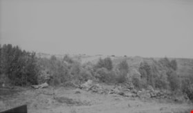
- Photograph of a logging road on the north face of Capitol Hill. Burrard Inlet can be seen in the background. An annotation in the photograph register describes it as a "road cut to take timber on side hill for destitute family's heat and cooking."
- Repository
- City of Burnaby Archives
- Date
- [193-] (date of original), copied 1986
- Collection/Fonds
- Burnaby Historical Society fonds
- Subseries
- Marjorie Coe subseries
- Physical Description
- 1 photograph : b&w ; 10.0 x 15.2 cm print
- Description Level
- Item
- Record No.
- 189-001
- Access Restriction
- No restrictions
- Reproduction Restriction
- No known restrictions
- Accession Number
- BHS1986-40
- Scope and Content
- Photograph of a logging road on the north face of Capitol Hill. Burrard Inlet can be seen in the background. An annotation in the photograph register describes it as a "road cut to take timber on side hill for destitute family's heat and cooking."
- Subjects
- Geographic Features - Roads
- Land Clearing
- Media Type
- Photograph
- Notes
- Title based on contents of photograph
- Historic Neighbourhood
- Capitol Hill (Historic Neighbourhood)
- Planning Study Area
- Capitol Hill Area
Images
Charles Street
https://search.heritageburnaby.ca/link/archivedescription34174
- Repository
- City of Burnaby Archives
- Date
- May 9, 1947
- Collection/Fonds
- Burnaby Historical Society fonds
- Description Level
- Item
- Physical Description
- 1 photograph : b&w negative ; 6.8 x 11.5 cm
- Scope and Content
- Photograph of cleared land and brush at the 4200 block of Charles Street. This is part of the Willingdon Heights subdivision site.
- Repository
- City of Burnaby Archives
- Date
- May 9, 1947
- Collection/Fonds
- Burnaby Historical Society fonds
- Subseries
- Alfred Bingham subseries
- Physical Description
- 1 photograph : b&w negative ; 6.8 x 11.5 cm
- Description Level
- Item
- Record No.
- 010-091
- Access Restriction
- No restrictions
- Reproduction Restriction
- No known restrictions
- Accession Number
- BHS2007-04
- Scope and Content
- Photograph of cleared land and brush at the 4200 block of Charles Street. This is part of the Willingdon Heights subdivision site.
- Subjects
- Land Clearing
- Media Type
- Photograph
- Photographer
- Bingham, Alfred "Alf"
- Notes
- Title based on contents of photograph
- Geographic Access
- Charles Street
Images
Claude Hill beside a large felled tree
https://search.heritageburnaby.ca/link/archivedescription39517
- Repository
- City of Burnaby Archives
- Date
- 1900
- Collection/Fonds
- Peers Family and Hill Family fonds
- Description Level
- Item
- Physical Description
- 1 photograph : b&w ; 10.5 x 15 cm on page 21.5 x 28 cm (pasted in album)
- Scope and Content
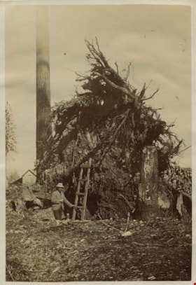
- Photograph of Louis Claude Hill standing by a ladder placed in a ditch. The ladder is leaning against a giant tree upturned by the roots. The ditch appears to be created from uprooting the tree. There is a pile of firewood visible to the right, and a barn to the left in the distance.
- Repository
- City of Burnaby Archives
- Date
- 1900
- Collection/Fonds
- Peers Family and Hill Family fonds
- Physical Description
- 1 photograph : b&w ; 10.5 x 15 cm on page 21.5 x 28 cm (pasted in album)
- Description Level
- Item
- Record No.
- 477-836
- Access Restriction
- No restrictions
- Reproduction Restriction
- No known restrictions
- Accession Number
- 2007-12
- Scope and Content
- Photograph of Louis Claude Hill standing by a ladder placed in a ditch. The ladder is leaning against a giant tree upturned by the roots. The ditch appears to be created from uprooting the tree. There is a pile of firewood visible to the right, and a barn to the left in the distance.
- Subjects
- Land Clearing
- Plants - Trees
- Media Type
- Photograph
- Notes
- Title based on contents of photograph
- Geographic Access
- Deer Lake Avenue
- Historic Neighbourhood
- Burnaby Lake (Historic Neighbourhood)
Images
Cleared land
https://search.heritageburnaby.ca/link/archivedescription34216
- Repository
- City of Burnaby Archives
- Date
- June 29, 1947
- Collection/Fonds
- Burnaby Historical Society fonds
- Description Level
- Item
- Physical Description
- 1 photograph : b&w negative ; 6.8 x 11.3 cm
- Scope and Content
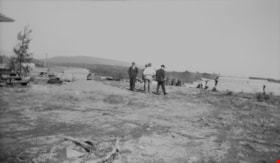
- Photograph of four men standing on a piece of cleared land with piles of lumber on either side of them. This is part of the Willingdon Heights subdivision site.
- Repository
- City of Burnaby Archives
- Date
- June 29, 1947
- Collection/Fonds
- Burnaby Historical Society fonds
- Subseries
- Alfred Bingham subseries
- Physical Description
- 1 photograph : b&w negative ; 6.8 x 11.3 cm
- Description Level
- Item
- Record No.
- 010-132
- Access Restriction
- No restrictions
- Reproduction Restriction
- Reproduce for fair dealing purposes only
- Accession Number
- BHS2007-04
- Scope and Content
- Photograph of four men standing on a piece of cleared land with piles of lumber on either side of them. This is part of the Willingdon Heights subdivision site.
- Subjects
- Industries - Construction
- Land Clearing
- Media Type
- Photograph
- Photographer
- Bingham, Alfred "Alf"
- Notes
- Title based on contents of photograph
Images
Cleared land
https://search.heritageburnaby.ca/link/museumdescription462
- Repository
- Burnaby Village Museum
- Date
- [190-](date of original), copied 1978
- Collection/Fonds
- Burnaby Village Museum Photograph collection
- Description Level
- Item
- Physical Description
- 1 photograph : b&w ; 20.2 x 25.2 cm print
- Scope and Content
- Photograph of the cleared land which appears to be the Sprott family property. There are stumps and felled trees on the lot. Across a small dirt road and behind a wooden fence, the Haszard house is visible to the extreme right of the photograph.
- Repository
- Burnaby Village Museum
- Collection/Fonds
- Burnaby Village Museum Photograph collection
- Description Level
- Item
- Physical Description
- 1 photograph : b&w ; 20.2 x 25.2 cm print
- Scope and Content
- Photograph of the cleared land which appears to be the Sprott family property. There are stumps and felled trees on the lot. Across a small dirt road and behind a wooden fence, the Haszard house is visible to the extreme right of the photograph.
- Subjects
- Land Clearing
- Plants - Trees
- Geographic Access
- Canada Way
- Accession Code
- HV978.1.16
- Access Restriction
- No restrictions
- Reproduction Restriction
- No known restrictions
- Date
- [190-](date of original), copied 1978
- Media Type
- Photograph
- Historic Neighbourhood
- Burnaby Lake (Historic Neighbourhood)
- Scan Resolution
- 600
- Scan Date
- 2023-08-01
- Notes
- Title based on contents of photograph
Images
Cleared lot
https://search.heritageburnaby.ca/link/museumdescription17
- Repository
- Burnaby Village Museum
- Date
- [1948]
- Collection/Fonds
- Burnaby Village Museum Photograph collection
- Description Level
- Item
- Physical Description
- 1 photograph : b&w ; 6.8 x 11.3 cm
- Scope and Content
- Photograph of a large cleared lot with two houses built apart from each other. Catalogue information from 1976 indicates that the photograph depicts the development of one of Burnaby's streets, ca. 1948. This may be the site of the Willingdon Heights subdivision. Stamped on back of photo: "657X."
- Repository
- Burnaby Village Museum
- Collection/Fonds
- Burnaby Village Museum Photograph collection
- Description Level
- Item
- Physical Description
- 1 photograph : b&w ; 6.8 x 11.3 cm
- Scope and Content
- Photograph of a large cleared lot with two houses built apart from each other. Catalogue information from 1976 indicates that the photograph depicts the development of one of Burnaby's streets, ca. 1948. This may be the site of the Willingdon Heights subdivision. Stamped on back of photo: "657X."
- Subjects
- Land Clearing
- Names
- Bingham, Alfred "Alf"
- Accession Code
- HV971.12.85
- Access Restriction
- No restrictions
- Reproduction Restriction
- No known restrictions
- Date
- [1948]
- Media Type
- Photograph
- Historic Neighbourhood
- Vancouver Heights (Historic Neighbourhood)
- Planning Study Area
- Willingdon Heights Area
- Scan Resolution
- 600
- Scan Date
- 2023-03-21
- Notes
- Title based on contents of photograph
Images
Clearing Deer Lake frontage
https://search.heritageburnaby.ca/link/archivedescription39523
- Repository
- City of Burnaby Archives
- Date
- [1891]
- Collection/Fonds
- Peers Family and Hill Family fonds
- Description Level
- Item
- Physical Description
- 1 photograph : b&w ; 9.5 x 14.3 cm on page 21.5 x 8 cm (pasted in album)
- Scope and Content
- Photograph of a man and his dog sitting on a large felled tree along the shore of Deer Lake. The man is most likely Claude Hill, and early resident of the Deer Lake area.
- Repository
- City of Burnaby Archives
- Date
- [1891]
- Collection/Fonds
- Peers Family and Hill Family fonds
- Physical Description
- 1 photograph : b&w ; 9.5 x 14.3 cm on page 21.5 x 8 cm (pasted in album)
- Description Level
- Item
- Record No.
- 477-842
- Access Restriction
- No restrictions
- Reproduction Restriction
- No known restrictions
- Accession Number
- 2007-12
- Scope and Content
- Photograph of a man and his dog sitting on a large felled tree along the shore of Deer Lake. The man is most likely Claude Hill, and early resident of the Deer Lake area.
- Media Type
- Photograph
- Notes
- Title based on caption accompanying photograph
- Geographic Access
- Deer Lake
- Historic Neighbourhood
- Burnaby Lake (Historic Neighbourhood)
Images
Clearing for shopping centre
https://search.heritageburnaby.ca/link/archivedescription85130
- Repository
- City of Burnaby Archives
- Date
- [1958]
- Collection/Fonds
- Ben Bradley collection
- Description Level
- Item
- Physical Description
- 1 photograph : b&w ; 8.2 x 11.5 cm
- Scope and Content
- Photograph of land being cleared for the Brentwood Mall with Burnaby mountain in the background.
- Repository
- City of Burnaby Archives
- Date
- [1958]
- Collection/Fonds
- Ben Bradley collection
- Physical Description
- 1 photograph : b&w ; 8.2 x 11.5 cm
- Description Level
- Item
- Record No.
- 564-002
- Access Restriction
- No restrictions
- Reproduction Restriction
- Reproduce for fair dealing purposes only
- Accession Number
- 2013-30
- Scope and Content
- Photograph of land being cleared for the Brentwood Mall with Burnaby mountain in the background.
- Subjects
- Buildings - Commercial
- Land Clearing
- Media Type
- Photograph
- Notes
- Transcribed title
- Note on verso reads: "Clearing for shopping centre"
- Street Address
- 4567 Lougheed Highway
- Planning Study Area
- Brentwood Area
Images
Clearing for shopping centre
https://search.heritageburnaby.ca/link/archivedescription85131
- Repository
- City of Burnaby Archives
- Date
- [1958]
- Collection/Fonds
- Ben Bradley collection
- Description Level
- Item
- Physical Description
- 1 photograph : b&w ; 8.2 x 11.5 cm
- Scope and Content
- Photograph with tree stumps, rocks and dirt of land being cleared for the Brentwood Mall.
- Repository
- City of Burnaby Archives
- Date
- [1958]
- Collection/Fonds
- Ben Bradley collection
- Physical Description
- 1 photograph : b&w ; 8.2 x 11.5 cm
- Description Level
- Item
- Record No.
- 564-003
- Access Restriction
- No restrictions
- Reproduction Restriction
- Reproduce for fair dealing purposes only
- Accession Number
- 2013-30
- Scope and Content
- Photograph with tree stumps, rocks and dirt of land being cleared for the Brentwood Mall.
- Subjects
- Buildings - Commercial
- Land Clearing
- Media Type
- Photograph
- Notes
- Title based on contents of photograph
- Street Address
- 4567 Lougheed Highway
- Planning Study Area
- Brentwood Area
Images
Clearing for shopping centre
https://search.heritageburnaby.ca/link/archivedescription85133
- Repository
- City of Burnaby Archives
- Date
- [1958]
- Collection/Fonds
- Ben Bradley collection
- Description Level
- Item
- Physical Description
- 1 photograph : b&w ; 8.2 x 11.5 cm
- Scope and Content
- Photograph with tree stumps, rocks and dirt of land being cleared for the Brentwood Mall.
- Repository
- City of Burnaby Archives
- Date
- [1958]
- Collection/Fonds
- Ben Bradley collection
- Physical Description
- 1 photograph : b&w ; 8.2 x 11.5 cm
- Description Level
- Item
- Record No.
- 564-005
- Access Restriction
- No restrictions
- Reproduction Restriction
- Reproduce for fair dealing purposes only
- Accession Number
- 2013-30
- Scope and Content
- Photograph with tree stumps, rocks and dirt of land being cleared for the Brentwood Mall.
- Subjects
- Buildings - Commercial
- Land Clearing
- Media Type
- Photograph
- Notes
- Transcribed title
- Note on verso reads: "Clearing for shopping centre"
- Street Address
- 4567 Lougheed Highway
- Planning Study Area
- Brentwood Area
Images
Clearing for the shopping centre
https://search.heritageburnaby.ca/link/archivedescription85125
- Repository
- City of Burnaby Archives
- Date
- [1958]
- Collection/Fonds
- Ben Bradley collection
- Description Level
- Item
- Physical Description
- 1 photograph : b&w ; 8.2 x 11.5 cm
- Scope and Content
- Photograph of children climbing on a large tree stump on land being cleared for the Brentwood Mall.
- Repository
- City of Burnaby Archives
- Date
- [1958]
- Collection/Fonds
- Ben Bradley collection
- Physical Description
- 1 photograph : b&w ; 8.2 x 11.5 cm
- Description Level
- Item
- Record No.
- 564-001
- Access Restriction
- No restrictions
- Reproduction Restriction
- Reproduce for fair dealing purposes only
- Accession Number
- 2013-30
- Scope and Content
- Photograph of children climbing on a large tree stump on land being cleared for the Brentwood Mall.
- Subjects
- Buildings - Commercial
- Land Clearing
- Media Type
- Photograph
- Notes
- Transcribed title
- Note on verso reads: "Clearing for shopping centre"
- Street Address
- 4567 Lougheed Highway
- Planning Study Area
- Brentwood Area
Images
Clearing Gough Family Lot
https://search.heritageburnaby.ca/link/archivedescription35486
- Repository
- City of Burnaby Archives
- Date
- 1912 (date of original), copied 1986
- Collection/Fonds
- Burnaby Historical Society fonds
- Description Level
- Item
- Physical Description
- 1 photograph : b&w ; 12.7 x 17.8 cm print
- Scope and Content
- Photograph of the Gough family and relatives clearing the lot for the family home on Nelson Avenue, Alta Vista. Identified in the photo (back row, centre) Donald Gough. Others in picture are aunts and uncles named Evans. Donald was the son of Agnes Gough and her husband William, who settled here…
- Repository
- City of Burnaby Archives
- Date
- 1912 (date of original), copied 1986
- Collection/Fonds
- Burnaby Historical Society fonds
- Subseries
- Pioneer Tales subseries
- Physical Description
- 1 photograph : b&w ; 12.7 x 17.8 cm print
- Description Level
- Item
- Record No.
- 204-344
- Access Restriction
- No restrictions
- Reproduction Restriction
- No known restrictions
- Accession Number
- BHS1988-03
- Scope and Content
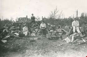
- Photograph of the Gough family and relatives clearing the lot for the family home on Nelson Avenue, Alta Vista. Identified in the photo (back row, centre) Donald Gough. Others in picture are aunts and uncles named Evans. Donald was the son of Agnes Gough and her husband William, who settled here at 2119 Nelson Avenue (later 7126 Nelson Avenue).
- Subjects
- Land Clearing
- Names
- Evans Family
- Gough, Donald
- Media Type
- Photograph
- Notes
- Title based on contents of photograph
- Annotation at top of photograph reads, "Nelson & Victory Sts - 1912"
- Geographic Access
- Nelson Avenue
- Street Address
- 7126 Nelson Avenue
- Historic Neighbourhood
- Alta-Vista (Historic Neighbourhood)
- Planning Study Area
- Sussex-Nelson Area
Images
Clearing land
https://search.heritageburnaby.ca/link/archivedescription65900
- Repository
- City of Burnaby Archives
- Date
- [1910 or 1911]
- Collection/Fonds
- J.W. Phillips fonds
- Description Level
- Item
- Physical Description
- 1 photograph : b&w glass negative ; 15.5 x 11 cm
- Scope and Content
- Photograph of three men clearing land (most likely) on the Phillips family property. John George "George" Phillips and his father William James Phillips appear to be standing on running boards at the base of a large felled tree. The third man, sitting at the base of the stump, is unidentified.
- Repository
- City of Burnaby Archives
- Date
- [1910 or 1911]
- Collection/Fonds
- J.W. Phillips fonds
- Physical Description
- 1 photograph : b&w glass negative ; 15.5 x 11 cm
- Material Details
- Emulsion measures 15.5 x 11 cm on the glass; entire glass plate measures 16 x 12 cm
- Description Level
- Item
- Record No.
- 487-038
- Access Restriction
- No restrictions
- Reproduction Restriction
- No known restrictions
- Accession Number
- 2008-18
- Scope and Content
- Photograph of three men clearing land (most likely) on the Phillips family property. John George "George" Phillips and his father William James Phillips appear to be standing on running boards at the base of a large felled tree. The third man, sitting at the base of the stump, is unidentified.
- Subjects
- Land Clearing
- Media Type
- Photograph
- Photographer
- Phillips, James William "Jim"
- Notes
- Title based on contents of photograph
- Geographic Access
- Ellesmere Avenue
- Historic Neighbourhood
- Capitol Hill (Historic Neighbourhood)
- Planning Study Area
- Capitol Hill Area
Images
Clearing Land at Point Grey
https://search.heritageburnaby.ca/link/archivedescription38351
- Repository
- City of Burnaby Archives
- Date
- [1911 or 1912]
- Collection/Fonds
- Burnaby Historical Society fonds
- Description Level
- Item
- Physical Description
- 1 photograph : sepia ; 18.8 x 23.5 cm on 30.4 x 34.5 cm backing
- Scope and Content
- Photograph of eight men seated on a log in front of a large pile of trees and cleared debris in Vancouver, BC. A small shack is seen to the left and another man can be seen leaning against the doorway. A note indicates that T. Townley and W. Townley are two of the men pictured, but it does not ide…
- Repository
- City of Burnaby Archives
- Date
- [1911 or 1912]
- Collection/Fonds
- Burnaby Historical Society fonds
- Subseries
- Anne Sievenpiper subseries
- Physical Description
- 1 photograph : sepia ; 18.8 x 23.5 cm on 30.4 x 34.5 cm backing
- Description Level
- Item
- Record No.
- 413-001
- Access Restriction
- No restrictions
- Reproduction Restriction
- No known restrictions
- Accession Number
- BHS2001-02
- Scope and Content
- Photograph of eight men seated on a log in front of a large pile of trees and cleared debris in Vancouver, BC. A small shack is seen to the left and another man can be seen leaning against the doorway. A note indicates that T. Townley and W. Townley are two of the men pictured, but it does not identify specifically where they are seated nor the names of any of the other men.
- Names
- Townley, T.
- Townley, W.
- Media Type
- Photograph
- Photographer
- Bullen & Lamb
- Notes
- Title based on contents of photograph
Images
Clearing Land for Oakalla Prison Farm
https://search.heritageburnaby.ca/link/archivedescription39574
- Repository
- City of Burnaby Archives
- Date
- 1910
- Collection/Fonds
- Peers Family and Hill Family fonds
- Description Level
- Item
- Physical Description
- 1 photograph : b&w ; 7.7 x 10.3 cm on page 21.5 x 28 cm (pasted in album)
- Scope and Content
- Photograph of the Oakalla Prison Farm site being cleared in the Deer Lake area. Claude Hill is to the far right but the other man is unidentified.
- Repository
- City of Burnaby Archives
- Date
- 1910
- Collection/Fonds
- Peers Family and Hill Family fonds
- Physical Description
- 1 photograph : b&w ; 7.7 x 10.3 cm on page 21.5 x 28 cm (pasted in album)
- Description Level
- Item
- Record No.
- 477-893
- Access Restriction
- No restrictions
- Reproduction Restriction
- No known restrictions
- Accession Number
- 2007-12
- Scope and Content
- Photograph of the Oakalla Prison Farm site being cleared in the Deer Lake area. Claude Hill is to the far right but the other man is unidentified.
- Subjects
- Land Clearing
- Media Type
- Photograph
- Notes
- Title based on contents of photograph
- Geographic Access
- Oakmount Crescent
- Street Address
- 5220 Oakmount Crescent
- Historic Neighbourhood
- Burnaby Lake (Historic Neighbourhood)
- Planning Study Area
- Oakalla Area
Images
Clearing land with a team of oxen
https://search.heritageburnaby.ca/link/archivedescription39524
- Repository
- City of Burnaby Archives
- Date
- 1890
- Collection/Fonds
- Peers Family and Hill Family fonds
- Description Level
- Item
- Physical Description
- 1 photograph : sepia ; 15.6 x 23.8 cm on page 21.5 x 28 cm (pasted in album)
- Scope and Content
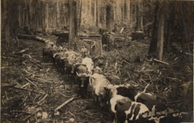
- Photograph of a team of oxen being used to clear land and haul logs on skid road. Five unidentified lumberjacks can be seen standing alongside the animals.
- Repository
- City of Burnaby Archives
- Date
- 1890
- Collection/Fonds
- Peers Family and Hill Family fonds
- Physical Description
- 1 photograph : sepia ; 15.6 x 23.8 cm on page 21.5 x 28 cm (pasted in album)
- Description Level
- Item
- Record No.
- 477-843
- Access Restriction
- No restrictions
- Reproduction Restriction
- No known restrictions
- Accession Number
- 2007-12
- Scope and Content
- Photograph of a team of oxen being used to clear land and haul logs on skid road. Five unidentified lumberjacks can be seen standing alongside the animals.
- Subjects
- Woodworking Tools and Equipment - Logging Machinery
- Industries - Forestry
- Animals - Oxen
- Occupations - Lumberjacks
- Land Clearing
- Industries - Logging/lumber
- Media Type
- Photograph
- Notes
- Title based on contents of photograph
Images
Construction at the Oakalla Site
https://search.heritageburnaby.ca/link/archivedescription39580
- Repository
- City of Burnaby Archives
- Date
- 1910
- Collection/Fonds
- Peers Family and Hill Family fonds
- Description Level
- Item
- Physical Description
- 1 photograph : b&w ; 7.8 x 10 cm on page 21.5 x 28 cm (pasted in album)
- Scope and Content
- Photograph of construction work and land clearing at the site of the Oakalla Prison farm in the Deer Lake area. Three unidentified men can be seen standing in the background to the left.
- Repository
- City of Burnaby Archives
- Date
- 1910
- Collection/Fonds
- Peers Family and Hill Family fonds
- Physical Description
- 1 photograph : b&w ; 7.8 x 10 cm on page 21.5 x 28 cm (pasted in album)
- Description Level
- Item
- Record No.
- 477-899
- Access Restriction
- No restrictions
- Reproduction Restriction
- No known restrictions
- Accession Number
- 2007-12
- Scope and Content
- Photograph of construction work and land clearing at the site of the Oakalla Prison farm in the Deer Lake area. Three unidentified men can be seen standing in the background to the left.
- Subjects
- Construction
- Land Clearing
- Names
- Oakalla Prison Farm
- Media Type
- Photograph
- Notes
- Title based on contents of photograph
- Geographic Access
- Oakmount Crescent
- Street Address
- 5220 Oakmount Crescent
- Historic Neighbourhood
- Burnaby Lake (Historic Neighbourhood)
- Planning Study Area
- Oakalla Area
Images
Copies of photographs from Esther (Love) Stanley albums
https://search.heritageburnaby.ca/link/museumdescription10003
- Repository
- Burnaby Village Museum
- Date
- [1915-1950] (date of originals), copied 1989
- Collection/Fonds
- Burnaby Village Museum fonds
- Description Level
- File
- Physical Description
- 36 photographs : b&w negatives ; 35 mm
- Scope and Content
- Photographs copied from various photograph albums including; Albert Paker, George Love, Gordon Love and Esther (Love) Stanley. Content includes: Love family in front of the piano inside parlour; Love family members with musical instruments inside parlour; Ben Brandrith and Robert Love in uniforms; …
- Repository
- Burnaby Village Museum
- Collection/Fonds
- Burnaby Village Museum fonds
- Series
- Jesse Love farmhouse series
- Subseries
- Love family photographs subseries
- Description Level
- File
- Physical Description
- 36 photographs : b&w negatives ; 35 mm
- Scope and Content
- Photographs copied from various photograph albums including; Albert Paker, George Love, Gordon Love and Esther (Love) Stanley. Content includes: Love family in front of the piano inside parlour; Love family members with musical instruments inside parlour; Ben Brandrith and Robert Love in uniforms; unidentified Asian man in field with hoe and young trees behind him; wedding cake from Frank Charles Stanley and Esther Love's wedding; land clearing for Love farmhouse; Jesse Love feeding chickens; Jesse and Hannah (Girlie) Love in hats outside on Love farm; large picnic on grass; four generations of Love family members; gatherings of Love family members outside; Love family posed in a car inside a studio (Will, Sarah, George, Phoebe and Martha); Leonard Love dressed as a boy scout; Martha (Dot) with children; Love family members celebrate centennial; Jesse Love and Martha (Dot) Love outside Love farmhouse; Love farmhouse with porch and garden; swing at Love farmhouse; Parker family in living room and view of the Love farmhouse from the front.
- Geographic Access
- Cumberland Street
- Street Address
- 7651 Cumberland Street
- Accession Code
- BV018.41.184
- Access Restriction
- No restrictions
- Reproduction Restriction
- May be restricted by third party rights
- Date
- [1915-1950] (date of originals), copied 1989
- Media Type
- Photograph
- Historic Neighbourhood
- East Burnaby (Historic Neighbourhood)
- Planning Study Area
- Cariboo-Armstrong Area
- Scan Date
- 4-Mar-2019
- Notes
- Title based on contents of photograph
- 36 b&w copy prints accompanying
Debris mound
https://search.heritageburnaby.ca/link/archivedescription88874
- Repository
- City of Burnaby Archives
- Date
- [between 1911 and 1912]
- Collection/Fonds
- Burnaby Historical Society fonds
- Description Level
- Item
- Physical Description
- 1 photograph : sepia ; 19 x 24 cm on 30 x 34.5 cm backing
- Scope and Content
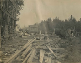
- Photograph of T. and W. Townley's debris mound of trees and stumps after clearing land at an unidentified location in Burnaby.
- Repository
- City of Burnaby Archives
- Date
- [between 1911 and 1912]
- Collection/Fonds
- Burnaby Historical Society fonds
- Subseries
- Anne Sievenpiper subseries
- Physical Description
- 1 photograph : sepia ; 19 x 24 cm on 30 x 34.5 cm backing
- Description Level
- Item
- Record No.
- 413-003
- Access Restriction
- No restrictions
- Reproduction Restriction
- No known restrictions
- Accession Number
- BHS2001-02
- Scope and Content
- Photograph of T. and W. Townley's debris mound of trees and stumps after clearing land at an unidentified location in Burnaby.
- Subjects
- Land Clearing
- Names
- Townley, T.
- Townley, W.
- Media Type
- Photograph
- Photographer
- Addington, H.E.
- Notes
- Title based on contents of photograph
- Note in handwritten script in blue ink on verso of photograph reads: " 1911-12/ "[scrap]"
Images
Deer Lake Park : heritage resource inventory
https://search.heritageburnaby.ca/link/museumlibrary5468
- Repository
- Burnaby Village Museum
- Author
- Wolf, Jim
- Publication Date
- c1998
- Call Number
- 971.133 WOL COPY 2
, the
Townley Family were encouraged to be part of
Burnaby's Shaughnessy in 1911. When they
purchased their 40 acre parcel adjacent to "Fai-
racres" they were faced with land clearing as no
market garden had been developed there. The
Townley's immediately began to clear all of the
dense forest from their lands
- Repository
- Burnaby Village Museum
- Collection
- Reference Collection
- Digital Reference Collection
- Material Type
- Book
- ISBN
- 0969282834
- 9780969282839
- Call Number
- 971.133 WOL COPY 2
- Author
- Wolf, Jim
- Place of Publication
- Burnaby, B.C.
- Publisher
- City of Burnaby, Community Heritage Commission
- Publication Date
- c1998
- Physical Description
- 47 p. : ill. ; 28 cm.
- Library Subject (LOC)
- Deer Lake Park (Burnaby, B.C.)--History
- Historic buildings--British Columbia--Burnaby
- Burnaby (B.C.)--Buildings, structures, etc.
- Notes
- 2 copies held : copy 2.
![Capitol Hill, [193-] (date of original), copied 1986 thumbnail](/media/hpo/_Data/_Archives_Images/_Unrestricted/126/189-001.jpg?width=280)
, copied 1978 thumbnail](/media/hpo/_Data/_BVM_Images/1977/197800010016.jpg?width=280)
![Cleared lot, [1948] thumbnail](/media/hpo/_Data/_BVM_Images/1971/197100120085.jpg?width=280)
![Clearing Deer Lake frontage, [1891] thumbnail](/media/hpo/_Data/_Archives_Images/_Unrestricted/477/477-842.jpg?width=280)
![Clearing for shopping centre, [1958] thumbnail](/media/hpo/_Data/_Archives_Images/_Unrestricted/559/564-002.jpg?width=280)
![Clearing for shopping centre, [1958] thumbnail](/media/hpo/_Data/_Archives_Images/_Unrestricted/559/564-003.jpg?width=280)
![Clearing for shopping centre, [1958] thumbnail](/media/hpo/_Data/_Archives_Images/_Unrestricted/559/564-005.jpg?width=280)
![Clearing for the shopping centre, [1958] thumbnail](/media/hpo/_Data/_Archives_Images/_Unrestricted/559/564-001.jpg?width=280)
![Clearing land, [1910 or 1911] thumbnail](/media/hpo/_Data/_Archives_Images/_Unrestricted/487/487-038.jpg?width=280)
![Clearing Land at Point Grey, [1911 or 1912] thumbnail](/media/hpo/_Data/_Archives_Images/_Unrestricted/371/413-001.jpg?width=280)
![Debris mound, [between 1911 and 1912] thumbnail](/media/hpo/_Data/_Archives_Images/_Unrestricted/371/413-003.jpg?width=280)