Narrow Results By
![Dawn Samson with graffiti, [2000] thumbnail](/media/hpo/_Data/_Archives_Images/_Unrestricted/535/535-2865-1.jpg?width=280)
Dawn Samson with graffiti
https://search.heritageburnaby.ca/link/archivedescription97526
- Repository
- City of Burnaby Archives
- Date
- [2000]
- Collection/Fonds
- Burnaby NewsLeader photograph collection
- Description Level
- File
- Physical Description
- 2 photographs (tiff) : col.
- Scope and Content
- File contains photographs of Dawn Samson recording and reporting instances of graffiti in North Burnaby. Photographs depict Samson next to graffitied wall with a clipboard and in her car.
- Repository
- City of Burnaby Archives
- Date
- [2000]
- Collection/Fonds
- Burnaby NewsLeader photograph collection
- Physical Description
- 2 photographs (tiff) : col.
- Description Level
- File
- Record No.
- 535-2865
- Access Restriction
- No restrictions
- Reproduction Restriction
- No restrictions
- Accession Number
- 2018-12
- Scope and Content
- File contains photographs of Dawn Samson recording and reporting instances of graffiti in North Burnaby. Photographs depict Samson next to graffitied wall with a clipboard and in her car.
- Subjects
- Arts
- Geographic Features - Neighbourhoods
- Media Type
- Photograph
- Photographer
- Bartel, Mario
- Notes
- Title based on caption
- Collected by editorial for use in an October 2000 issue of the Burnaby NewsLeader
- Caption from metadata for 535-2865-1: "Dawn Samson takes note of grafitti on the wall of a plaza at Hastings and Holdom."
- Caption from metadata for 535-2865-2: "Dawn Samson has made it her mission to drive around North Burnaby, spotting grafitti and informing property owners and caretakers of the problem."
- Geographic Access
- Hastings Street
- Holdom Avenue
- Historic Neighbourhood
- Capitol Hill (Historic Neighbourhood)
- Planning Study Area
- Capitol Hill Area
Images
![Dawn Samson with graffiti, [2000] thumbnail](/media/hpo/_Data/_Archives_Images/_Unrestricted/535/535-2865-1.jpg)

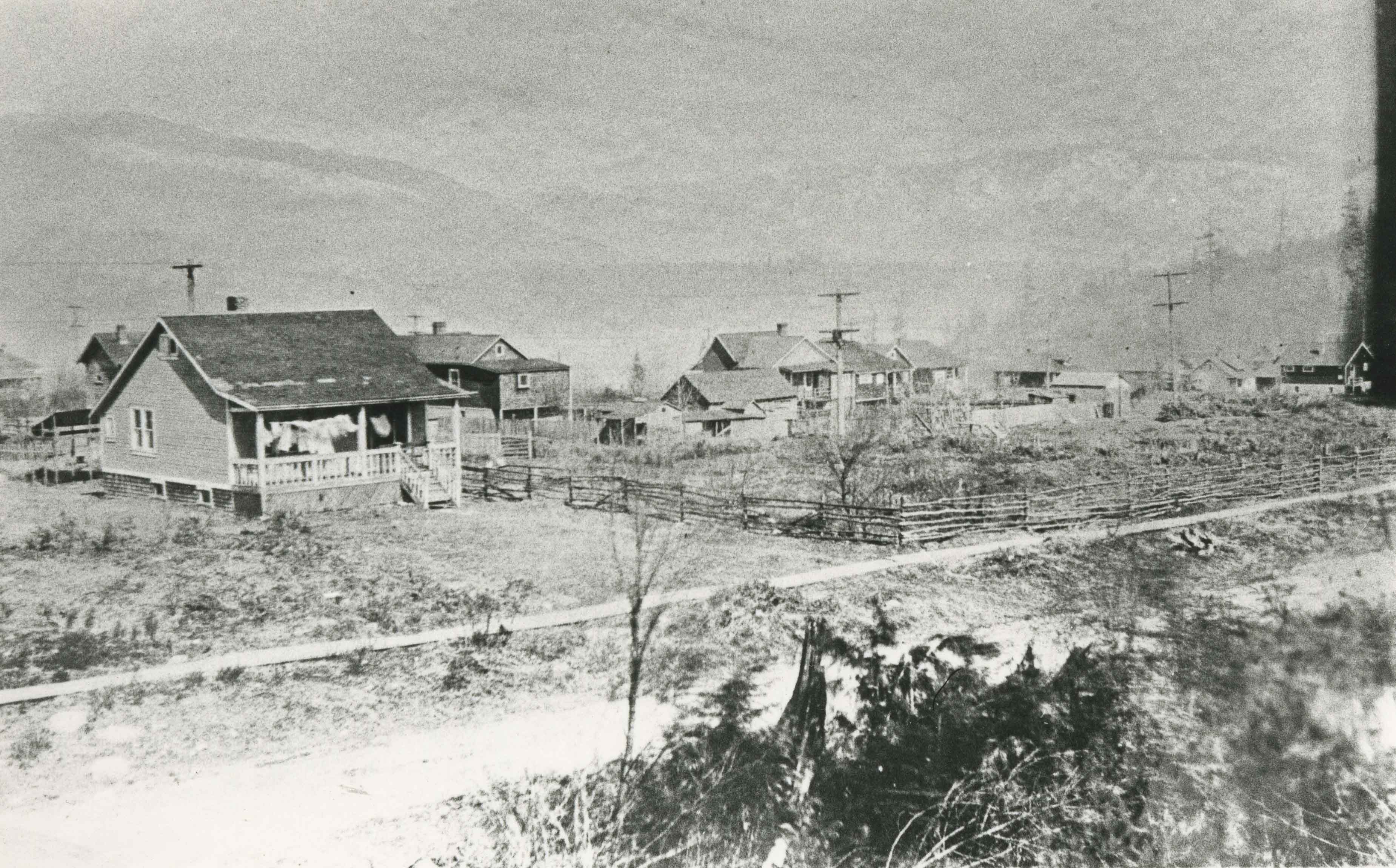
Vancouver Heights area
https://search.heritageburnaby.ca/link/archivedescription35267
- Repository
- City of Burnaby Archives
- Date
- 1911 (date of original), copied 1986
- Collection/Fonds
- Burnaby Historical Society fonds
- Description Level
- Item
- Physical Description
- 1 photograph : b&w ; 12.7 x 17.8 cm print
- Scope and Content
- Photograph taken from the corner of Carleton Avenue and McGill Street, looking northeast. This later became the site of McGill Park.
- Repository
- City of Burnaby Archives
- Date
- 1911 (date of original), copied 1986
- Collection/Fonds
- Burnaby Historical Society fonds
- Subseries
- Pioneer Tales subseries
- Physical Description
- 1 photograph : b&w ; 12.7 x 17.8 cm print
- Description Level
- Item
- Record No.
- 204-124
- Access Restriction
- No restrictions
- Reproduction Restriction
- No known restrictions
- Accession Number
- BHS1988-03
- Scope and Content
- Photograph taken from the corner of Carleton Avenue and McGill Street, looking northeast. This later became the site of McGill Park.
- Subjects
- Geographic Features - Neighbourhoods
- Media Type
- Photograph
- Photographer
- Sutcliffe, Arthur
- Notes
- Title based on contents of photograph
- Geographic Access
- Carleton Avenue North
- McGill Park
- McGill Street
- Historic Neighbourhood
- Vancouver Heights (Historic Neighbourhood)
- Planning Study Area
- Burnaby Heights Area
Images