Narrow Results By
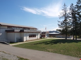
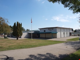
Burnaby South High School
https://search.heritageburnaby.ca/link/landmark770
- Repository
- Burnaby Heritage Planning
- Associated Dates
- 1922-1988
- Street View URL
- Google Maps Street View
- Repository
- Burnaby Heritage Planning
- Geographic Access
- Southoaks Crescent
- Associated Dates
- 1922-1988
- Heritage Value
- Burnaby South and Burnaby North were Burnaby's first high schools. The first rooms of the school were built in 1922 on the same grounds as the Kingsway East Elementary School. In 1940, a two-storey building was erected and additions were made in 1963, 1967 and 1972. Kingsway East closed in 1925 and its buildings were used by the high school for Industrial Arts and Home Economics. In the early 1990s, a new "urban education centre" (Burnaby South/B.C. School for the Deaf) was opened, replacing the old Burnaby South High School.
- Historic Neighbourhood
- Edmonds (Historic Neighbourhood)
- Planning Study Area
- Kingsway-Beresford Area
- Street Address
- 6650 Southoaks Crescent
- Street View URL
- Google Maps Street View
Images
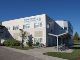
Byrne Creek Secondary School
https://search.heritageburnaby.ca/link/landmark849
- Repository
- Burnaby Heritage Planning
- Geographic Access
- 18th Street
- Associated Dates
- 2005
- Heritage Value
- Byrne Creek School opened in 2005 and accommodates students from grades 8 through 12. When built, the school was created to house as many as 1200 students, but by 2009, plans have been prepared to increase that capacity to 1500.
- Historic Neighbourhood
- Edmonds (Historic Neighbourhood)
- Planning Study Area
- Stride Avenue Area
- Street Address
- 7777 18th Street
- Street View URL
- Google Maps Street View
Images
East Burnaby Neighbourhood
https://search.heritageburnaby.ca/link/landmark712
- Repository
- Burnaby Heritage Planning
- Associated Dates
- 1925-1954
- Heritage Value
- After a lull in construction during the World War I period, East Burnaby Neighbourhood's growth resumed during the 1920s when many homes and businesses were constructed. The post-World War Two period also saw rapid construction and the creation of new housing developments in response to a population boom. The neighbourhood remained a primarily single-family residential area.
- Historic Neighbourhood
- Edmonds (Historic Neighbourhood)
- Planning Study Area
- Stride Avenue Area
Images
Edmonds Neighbourhood
https://search.heritageburnaby.ca/link/landmark704
- Repository
- Burnaby Heritage Planning
- Associated Dates
- 1925-1954
- Heritage Value
- The historic growth of Edmonds as a neighbourhood was based on its strategic location on the early interurban line between Vancouver and New Westminster. Even by 1980 when a survey of the residential neighbourhoods was conducted, a full 25% of homes in the area predated 1930. The 1950s was a period of strong housing development, with both single-family and multi-family units being constructed. Although Burnaby's City Hall was moved from Kingsway and Edmonds in the early 1950s, Edmonds remained an important centre in the community.
- Historic Neighbourhood
- Edmonds (Historic Neighbourhood)
- Planning Study Area
- Stride Avenue Area
Images
Edmonds Street Neighbourhood
https://search.heritageburnaby.ca/link/landmark827
- Repository
- Burnaby Heritage Planning
- Associated Dates
- 1955-2008
- Heritage Value
- The Edmonds Street Neighbourhood is part of the larger Edmonds Town Centre - one of four Town Centres in Burnaby. This neighbourhood is considered to be primarily residential, but a strong local commercial component developed along Edmonds and Kingsway.
- Historic Neighbourhood
- Edmonds (Historic Neighbourhood)
- Planning Study Area
- Edmonds Area
Images
Kingsway-Beresford Neighbourhood
https://search.heritageburnaby.ca/link/landmark805
- Repository
- Burnaby Heritage Planning
- Associated Dates
- 1955-2008
- Heritage Value
- Since the building boom of the 1950s, the Kingsway-Beresford Neighbourhood has maintained a residential character with the exception of the Kingsway corridor, which has become a primary commercial and light industrial sector.
- Historic Neighbourhood
- Edmonds (Historic Neighbourhood)
- Planning Study Area
- Kingsway-Beresford Area
Images
Richmond Park Neighbourhood
https://search.heritageburnaby.ca/link/landmark828
- Repository
- Burnaby Heritage Planning
- Associated Dates
- 1955-2008
- Heritage Value
- The Richmond Park Neighbourhood is part of the larger Edmonds Town Centre - one of four official Town Centres in the City. Richmond Park contains a residential subdivision that developed during the 1950s as well as a strong commercial and retail centre along Edmonds and Kingsway.
- Historic Neighbourhood
- Edmonds (Historic Neighbourhood)
- Planning Study Area
- Richmond Park Area
Images
Stride Avenue Neighbourhood
https://search.heritageburnaby.ca/link/landmark845
- Repository
- Burnaby Heritage Planning
- Associated Dates
- 1955-2008
- Heritage Value
- The interurban link between New Westminster and Vancouver stimulated the early settlement of Stride Avenue. Infilling of the area took place in the early 1950s and the pace of development had slowed considerably by 1970. Duplexes became a popular feature in the decade between 1970 and 1980 and in the late 1980s, the neighbourhood was incorporated into the Edmonds Town Centre South plan.
- Historic Neighbourhood
- Edmonds (Historic Neighbourhood)
- Planning Study Area
- Stride Avenue Area
Images
Stride Hill Neighbourhood
https://search.heritageburnaby.ca/link/landmark846
- Repository
- Burnaby Heritage Planning
- Associated Dates
- 1955-2008
- Heritage Value
- The residential areas that are located within the Stride Hill Neighbourhood were primarily developed in the 1950s during Burnaby's post-war building boom. The area lying to the south of Byrne Creek Ravine Park was used as a municipal garbage dump until the 1960s and as a landfill site for yard waste disposal until the early 1990s at which point the area was incorporated into the Edmonds Town Centre Plan and the land was made into park and open space.
- Historic Neighbourhood
- Edmonds (Historic Neighbourhood)
- Planning Study Area
- Stride Hill Area
Images
Taylor Park Elementary School
https://search.heritageburnaby.ca/link/landmark847
- Repository
- Burnaby Heritage Planning
- Geographic Access
- Mission Avenue
- Associated Dates
- 2004
- Heritage Value
- Taylor Park Elementary School was opened in 2004 with 240 students from kindergarten to grade three (with older students attending Stride Avenue Community School). By 2006, Taylor Park had been designated as its own school and extended its classes from kindergarten through grade six.
- Historic Neighbourhood
- Edmonds (Historic Neighbourhood)
- Planning Study Area
- Stride Hill Area
- Street Address
- 7590 Mission Avenue
- Street View URL
- Google Maps Street View
Images
Twelfth Avenue Elementary School
https://search.heritageburnaby.ca/link/landmark848
- Repository
- Burnaby Heritage Planning
- Geographic Access
- 12th Avenue
- Associated Dates
- 1958
- Heritage Value
- Twelfth Avenue School was one of two schools built to relieve the overcrowding at Edmonds School resulting from the housing boom in Burnaby during the 1950s - Lakeview was the other. Built in 1958, the building was added to in 1962, 1964, 1967, 1969 and 1974.
- Historic Neighbourhood
- Edmonds (Historic Neighbourhood)
- Planning Study Area
- Edmonds Area
- Street Address
- 7622 12th Avenue
- Street View URL
- Google Maps Street View

