Narrow Results By
map
https://search.heritageburnaby.ca/link/museumartifact83653
- Repository
- Burnaby Village Museum
- Accession Code
- BV007.34.1
- Description
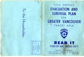
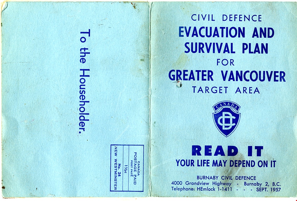
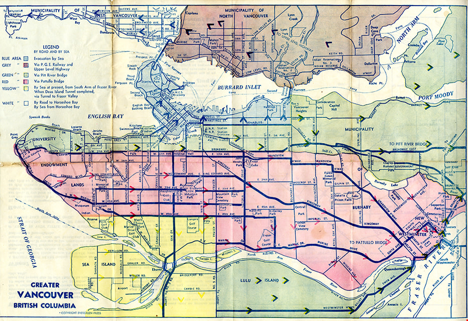
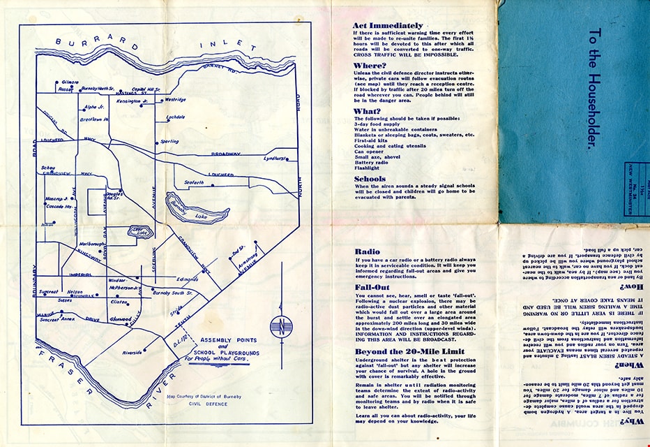
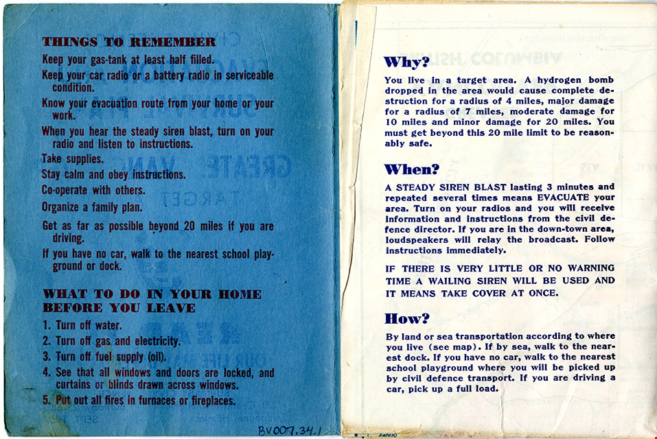
- Folded col. map within blue cover; printed both sides; Civil Defence Evacuation and Survival Plan - Map -- [1957] produced by Burnaby Civil Defence; title on front cover reads "CIVIL DEFENCE / EVACUATION AND SURVIVAL PLAN /FOR / GREATER VANCOUVER / TARGET AREA / READ IT / YOUR LIFE MAY DEPEND ON IT". Colour map inside is titled "GREATER / VANCOUVER / BRITISH COLUMBIA" and includes a legend with various evacuation routes by road and by sea; copyright Evergreen Press. Verso of map includes a map of Burnaby courtesy of District of Burnaby Civil Defence titled "ASSEMBLY POINTS / and / SCHOOL PLAYGROUNDS / for People without Cars" and detailed information about things to remember during an emergency evacuation.
- Object History
- Map was made available to citizens of Burnaby and was produced by Burnaby Civil Defence, 4000 Grandview Highway, Burnaby B.C.
- Category
- 08. Communication Artifacts
- Classification
- Documentary Artifacts - - Graphic Documents
- Object Term
- Cartograph, Map
- Colour
- Blue
- Measurements
- 30.5 x 34 cm folded to 15 x 11.5 cm
- Maker
- Evergreen Press Limited
- Country Made
- Canada
- Province Made
- British Columbia
- Publication Date
- Sept. 1957
- Names
- Burnaby Civil Defence
Images
![SFU Geography class with maps, [2000] thumbnail](/media/hpo/_Data/_Archives_Images/_Unrestricted/535/535-2626.jpg?width=280)
SFU Geography class with maps
https://search.heritageburnaby.ca/link/archivedescription97099
- Repository
- City of Burnaby Archives
- Date
- [2000]
- Collection/Fonds
- Burnaby NewsLeader photograph collection
- Description Level
- Item
- Physical Description
- 1 photograph (tiff) : col.
- Scope and Content
- Photograph of Mike Carr and Simon Fraser University Geography students Dallas Arcangel, Dave Crossley, Caoimhe Kehler and Peter Schaub with maps of "Salmonopolis." They are standing on the roof of an SFU building with forest and mountains visible in the background.
- Repository
- City of Burnaby Archives
- Date
- [2000]
- Collection/Fonds
- Burnaby NewsLeader photograph collection
- Physical Description
- 1 photograph (tiff) : col.
- Description Level
- Item
- Record No.
- 535-2626
- Access Restriction
- No restrictions
- Reproduction Restriction
- No restrictions
- Accession Number
- 2018-12
- Scope and Content
- Photograph of Mike Carr and Simon Fraser University Geography students Dallas Arcangel, Dave Crossley, Caoimhe Kehler and Peter Schaub with maps of "Salmonopolis." They are standing on the roof of an SFU building with forest and mountains visible in the background.
- Names
- Simon Fraser University
- Media Type
- Photograph
- Photographer
- Bartel, Mario
- Notes
- Title based on caption
- Collected by editorial for use in a July 2000 issue of the Burnaby NewsLeader
- Caption from metadata: "SFU geography instructor Mike Carr, and his team of students (front to back), Dallas Arcangel, Dave Crossley, Caoimhe Kehler and Peter Schaub, examine the maps of "Salmonopolis" they've created as part of a plan to create a sustainable region."
- Geographic Access
- Burnaby Mountain Conservation Area
- University Drive
- Street Address
- 8888 University Drive
- Planning Study Area
- Burnaby Mountain Area
Images
![SFU Geography class with maps, [2000] thumbnail](/media/hpo/_Data/_Archives_Images/_Unrestricted/535/535-2626.jpg)