Narrow Results By
Subject
- Aerial Photographs 1
- Agriculture - Farms 4
- Agriculture - Fruit and Berries 1
- Agriculture - Orchards 1
- Animals - Cows 2
- Animals - Dogs 1
- Animals - Poultry 2
- Building Components 2
- Buildings - Civic - Hospitals 11
- Buildings - Commercial - Train Stations 1
- Buildings - Heritage 111
- Buildings - Residential - Houses 24
Person / Organization
- A & H Plastering and Stucco 1
- Barnes, Hannah Victoria "Girlie" Love 6
- Brandrith, Benjamin Jefferson "Ben" 1
- Brandrith, Martha Dorothy “Dot” Love 7
- British Columbia Electric Railway Company 3
- Brownlee, James Harrison 1
- Burnaby Fire Department 1
- Burnaby Village Museum 1
- Burnett, Geoffrey K. 2
- Chamberlain, Annie McKenzie 2
- Clayton, Edith Annie Whiting 2
- Deacon, Charles 1
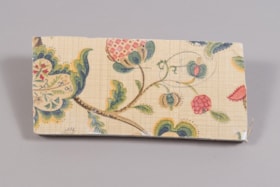
wall section
https://search.heritageburnaby.ca/link/museumartifact81703
- Repository
- Burnaby Village Museum
- Accession Code
- BV988.33.108
- Description
- A section of wall board and plaster with a flower motif wallpaper on the top surface.
- Object History
- This item was taken from Love farmhouse. It is unknown what room the fragment is from.
- Measurements
- 13 cm. X 28.5 cm X 2.5 cm thick. ( plaster 1.5 cm and wallboard 1 cm)
- Geographic Access
- Cumberland Street
- Historic Neighbourhood
- East Burnaby (Historic Neighbourhood)
Images
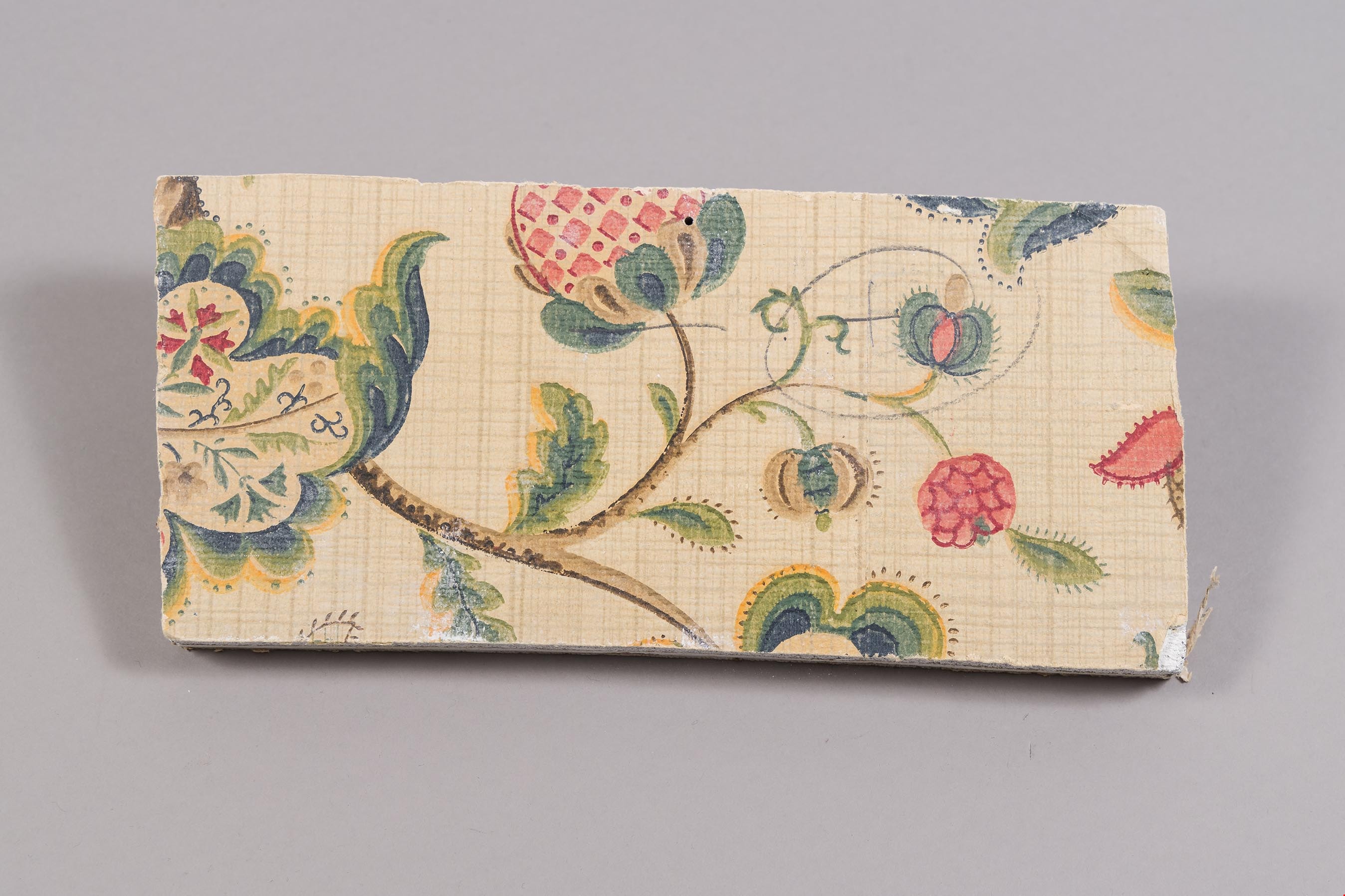
West elevation of kitchen
https://search.heritageburnaby.ca/link/museumdescription10804
- Repository
- Burnaby Village Museum
- Date
- April 8, 1988
- Collection/Fonds
- Burnaby Village Museum fonds
- Description Level
- Item
- Physical Description
- 1 photograph : col. negative ; 35 mm
- Scope and Content
- Photograph of the west elevation of the kitchen of the Love farmhouse while it was located at 7651 Cumberland Street (the corner of 14th Avenue and Cumberland Street). The photograph was taken of the house once it was saved and acquired by the Burnaby Village Museum
- Repository
- Burnaby Village Museum
- Collection/Fonds
- Burnaby Village Museum fonds
- Series
- Jesse Love farmhouse series
- Description Level
- Item
- Physical Description
- 1 photograph : col. negative ; 35 mm
- Material Details
- Photograph is part of Film roll "F" - 23 colour photographs that are a part of a collection described as BV018.41.82
- Scope and Content
- Photograph of the west elevation of the kitchen of the Love farmhouse while it was located at 7651 Cumberland Street (the corner of 14th Avenue and Cumberland Street). The photograph was taken of the house once it was saved and acquired by the Burnaby Village Museum
- Subjects
- Buildings - Heritage
- Geographic Access
- Cumberland Street
- Street Address
- 7651 Cumberland Street
- Accession Code
- BV018.41.326
- Access Restriction
- No restrictions
- Reproduction Restriction
- No known restrictions
- Date
- April 8, 1988
- Media Type
- Photograph
- Historic Neighbourhood
- East Burnaby (Historic Neighbourhood)
- Planning Study Area
- Cariboo-Armstrong Area
- Related Material
- See BV018.41.82 for File Level Description
- Scan Resolution
- 2400
- Scan Date
- 13-May-19
- Scale
- 100
- Photographer
- Wolf, Jim
- Notes
- Title based on contents of photograph
- Photograph is a part of file level description "Photographic documentation of changes and move" BV018.41.82
Images

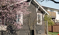
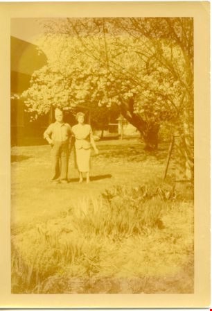
William Parker and Sarah Love Parker in garden at Love farmhouse on Cumberland Avenue
https://search.heritageburnaby.ca/link/museumdescription10320
- Repository
- Burnaby Village Museum
- Date
- 1953
- Collection/Fonds
- Love family fonds
- Description Level
- Item
- Physical Description
- 1 photograph : b&w ; copy print ; 12.5 x 8.8 cm
- Scope and Content
- Photograph of couple, William Parker and Sarah Love Parker, in the garden at the Love farmhouse on Cumberland Avenue. The couple stand to the left and there is a tree in bloom to the right. There is a house in the background.
- Repository
- Burnaby Village Museum
- Collection/Fonds
- Love family fonds
- Description Level
- Item
- Physical Description
- 1 photograph : b&w ; copy print ; 12.5 x 8.8 cm
- Material Details
- Written on the verso in black ink: "Gramps William Parker / & Grams Sarah [ditto]." Stamped on the verso in black ink: "THIS IS A / KODACOLOR PRINT / MADE BY / EASTMAN KODAK COMPANY / T.M. REGIS. U.S. PAT. OFF. / Week of September 7, 1953 / IV"
- Scope and Content
- Photograph of couple, William Parker and Sarah Love Parker, in the garden at the Love farmhouse on Cumberland Avenue. The couple stand to the left and there is a tree in bloom to the right. There is a house in the background.
- History
- Photograph is from the Love farmhouse. The house was lived in by generations of the Love family. Jesse and Martha Love's daughter, Sarah Love married William Parker and their daughter, Elsie (later Hughes) is the donor's mother. The objects were in the house when the donor lived in the house.
- Geographic Access
- Cumberland Street
- Street Address
- 7651 Cumberland Street
- Accession Code
- BV019.8.6
- Access Restriction
- No restrictions
- Reproduction Restriction
- No known restrictions
- Date
- 1953
- Media Type
- Photograph
- Historic Neighbourhood
- East Burnaby (Historic Neighbourhood)
- Planning Study Area
- Cariboo-Armstrong Area
- Scan Resolution
- 600
- Scan Date
- 18-Mar-19
- Scale
- 96
- Notes
- Title based on contents of photograph
Images
![William Parker with shovel, [between 1930 and 1940] (date of original), copied 1998 thumbnail](/media/hpo/_Data/_BVM_Images/2018/2018_0041_0169_001.jpg?width=280)
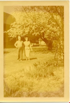
William Parker with shovel
https://search.heritageburnaby.ca/link/museumdescription9983
- Repository
- Burnaby Village Museum
- Date
- [between 1930 and 1940] (date of original), copied 1998
- Collection/Fonds
- Burnaby Village Museum fonds
- Description Level
- Item
- Physical Description
- 1 photograph : sepia print ; 13 x 9.5 cm
- Scope and Content
- Photograph of William Parker digging with a shovel on the grounds of the Love farmhouse. There is a barn and tree behind him. In 1928 after Sarah Parker's father, Jesse Love died, William and Sarah (nee Love) Parker purchased the Love farmhouse located at 1390 Cumberland Road. They lived there unt…
- Repository
- Burnaby Village Museum
- Collection/Fonds
- Burnaby Village Museum fonds
- Series
- Jesse Love farmhouse series
- Subseries
- Love family photographs subseries
- Description Level
- Item
- Physical Description
- 1 photograph : sepia print ; 13 x 9.5 cm
- Scope and Content
- Photograph of William Parker digging with a shovel on the grounds of the Love farmhouse. There is a barn and tree behind him. In 1928 after Sarah Parker's father, Jesse Love died, William and Sarah (nee Love) Parker purchased the Love farmhouse located at 1390 Cumberland Road. They lived there until 1961, with their three children; Albert, Bill and Elsie.
- Subjects
- Buildings - Heritage
- Geographic Access
- Cumberland Street
- Street Address
- 7651 Cumberland Street
- Accession Code
- BV018.41.169
- Access Restriction
- No restrictions
- Reproduction Restriction
- May be restricted by third party rights
- Date
- [between 1930 and 1940] (date of original), copied 1998
- Media Type
- Photograph
- Historic Neighbourhood
- East Burnaby (Historic Neighbourhood)
- Planning Study Area
- Cariboo-Armstrong Area
- Scan Resolution
- 600
- Scan Date
- 25-Feb-2019
- Scale
- 100
- Notes
- Title based on contents of photograph
- Photograph was copied from the Albert Parker photograph album in 1998
Images
![William Parker with shovel, [between 1930 and 1940] (date of original), copied 1998 thumbnail](/media/hpo/_Data/_BVM_Images/2018/2018_0041_0169_001.jpg)
![William Parker with shovel, [194-] thumbnail](/media/hpo/_Data/_BVM_Images/2019/2019_0008_0004_001.jpg?width=280)
William Parker with shovel
https://search.heritageburnaby.ca/link/museumdescription18826
- Repository
- Burnaby Village Museum
- Date
- [194-]
- Collection/Fonds
- Love family fonds
- Description Level
- Item
- Physical Description
- 1 photograph : sepia ; 12 x 7.5 cm
- Scope and Content
- Photograph of William Parker standing and holding a shovel in the garden of the Love farmhouse. He is standing next to a trellis for sweet peas and there is a barn and trees behind him.
- Repository
- Burnaby Village Museum
- Collection/Fonds
- Love family fonds
- Description Level
- Item
- Physical Description
- 1 photograph : sepia ; 12 x 7.5 cm
- Scope and Content
- Photograph of William Parker standing and holding a shovel in the garden of the Love farmhouse. He is standing next to a trellis for sweet peas and there is a barn and trees behind him.
- Geographic Access
- Cumberland Street
- Street Address
- 7651 Cumberland Street
- Accession Code
- BV019.8.4
- Access Restriction
- No restrictions
- Reproduction Restriction
- No known restrictions
- Date
- [194-]
- Media Type
- Photograph
- Historic Neighbourhood
- East Burnaby (Historic Neighbourhood)
- Planning Study Area
- Cariboo-Armstrong Area
- Scan Resolution
- 600
- Scan Date
- 2022-07-07
- Notes
- Title based on contents of photograph
Images
![William Parker with shovel, [194-] thumbnail](/media/hpo/_Data/_BVM_Images/2019/2019_0008_0004_001.jpg)