Narrow Results By
Subject
- Accidents 1
- Accidents - Automobile Accidents 1
- Advertising Medium 3
- Advertising Medium - Signs and Signboards 69
- Aerial Photographs 10
- Agricultural Tools and Equipment - Gardening Equipment 1
- Agricultural Tools and Equipment - Plows 1
- Agriculture - Crops 4
- Agriculture - Farms 11
- Agriculture - Fruit and Berries 4
- Agriculture - Orchards 1
- Agriculture - Poultry 3
Kingsway
https://search.heritageburnaby.ca/link/landmark775
- Repository
- Burnaby Heritage Planning
- Associated Dates
- 1913
- Heritage Value
- The years 1911-1912 saw great expansion and settlement in Burnaby and large public works projects were undertaken to service the growing community. One project that was determined to be a necessity was the construction of a proper highway between New Westminster and Vancouver. The Province and the Municipality agreed to share the costs of construction (with Burnaby paying 25% and the Province 75%) and so Kingsway was built to improve the current Vancouver Road. The road was named after the famous King's Way in London, England.
- Historic Neighbourhood
- Central Park (Historic Neighbourhood)
- Edmonds (Historic Neighbourhood)
- Planning Study Area
- Maywood Area
- Marlborough Area
- Windsor Area
- Kingsway-Beresford Area
- Stride Avenue Area
- Edmonds Area
Images
Marlborough Elementary School
https://search.heritageburnaby.ca/link/landmark695
- Repository
- Burnaby Heritage Planning
- Geographic Access
- Marlborough Avenue
- Associated Dates
- 1950
- Heritage Value
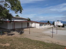
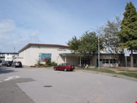
- Marlborough Elementary School was built in 1950 and was the second elementary school to be built in Burnaby after the start of the World War Two housing boom. Its design helped establish the general plans for future schools built in the city during this period - no basements, second stories or high stairways. Classrooms could easily be added, in line, as the need arose. There were additions made to Marlborough in 1952, 1961, 1967 and 1971.
- Historic Neighbourhood
- Central Park (Historic Neighbourhood)
- Planning Study Area
- Marlborough Area
- Street Address
- 6060 Marlborough Avenue
- Street View URL
- Google Maps Street View
Images
Marlborough Neighbourhood
https://search.heritageburnaby.ca/link/landmark802
- Repository
- Burnaby Heritage Planning
- Associated Dates
- 1955-2008
- Heritage Value
- The Marlborough Neighbourhood is another residential area that was witness to rapid growth and subdivision during the 1950s and 1960s, creating primarily single-family housing stock. In the 1970s and 1980s, as the commercial district around Kingsway grew, so too did higher density housing projects such as townhomes and condominiums.
- Historic Neighbourhood
- Central Park (Historic Neighbourhood)
- Planning Study Area
- Marlborough Area
Images
Maywood Elementary School
https://search.heritageburnaby.ca/link/landmark812
- Repository
- Burnaby Heritage Planning
- Geographic Access
- Imperial Street
- Associated Dates
- 1962
- Heritage Value
- Located between Nelson and Suncrest Schools, Maywood Elementary School was built in 1962 and helped eased the increasing enrolments at these other schools. Like other schools of this period, Maywood was built on one level with no basement and no high stairs. The classrooms were built in a line which could be easily added to as required. Additions to the original structure were completed in 1964, 1966, 1967, 1971, 1972. Fires at the school in 1979 and 1989 caused extensive damage and required partial reconstruction of the building.
- Historic Neighbourhood
- Central Park (Historic Neighbourhood)
- Planning Study Area
- Maywood Area
- Street Address
- 4567 Imperial Street
- Street View URL
- Google Maps Street View
Images
Maywood Neighbourhood
https://search.heritageburnaby.ca/link/landmark801
- Repository
- Burnaby Heritage Planning
- Associated Dates
- 1955-2008
- Heritage Value
- Burnaby's Maywood Neighbourhood consists of the Metrotown Town Centre - one of four Town Centres in the City. Metrotown is one of the region's most developed and fastest growing centres. It is served by the first SkyTrain line developed in the mid-1980s and anchored by B.C.'s largest shopping and entertainment complex. As an older centre that has progressively added new developments over the years, Metrotown offers a range of housing types and tenures from three-storey walk-up apartments to modern residential towers.
- Historic Neighbourhood
- Central Park (Historic Neighbourhood)
- Planning Study Area
- Maywood Area
Images
Metrotown
https://search.heritageburnaby.ca/link/landmark817
- Repository
- Burnaby Heritage Planning
- Geographic Access
- Kingsway
- Associated Dates
- 1986
- Heritage Value
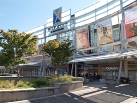
- Although the idea for Metrotown was first expressed in the 1970s, the building itself opened in 1986 and was soon served by the Expo Line of the new SkyTrain system. In the ensuing twenty years, the complex developed into three distinct but adjoining malls - Metropolis at Metrotown, Metrotown Centre, and Station Square. Today, Metrotown serves as the city’s commercial and retail anchor. The mall also includes two large office towers, which by 2001 were home to the head offices for Shaw Cable and TransLink.
- Historic Neighbourhood
- Central Park (Historic Neighbourhood)
- Planning Study Area
- Maywood Area
- Street Address
- 4700 Kingsway
- Street View URL
- Google Maps Street View
Images
Newhoven Residence
https://search.heritageburnaby.ca/link/landmark626
- Repository
- Burnaby Heritage Planning
- Description
- Residential building.
- Associated Dates
- 1923
- Street View URL
- Google Maps Street View
- Repository
- Burnaby Heritage Planning
- Geographic Access
- Smith Avenue
- Associated Dates
- 1923
- Description
- Residential building.
- Heritage Value
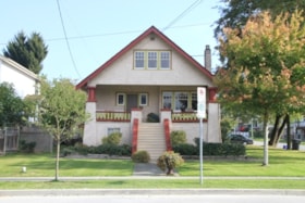
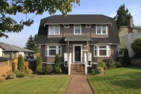
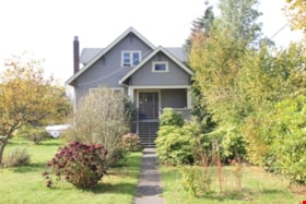
- This large house was built in 1923 and first owned by Casper Newhoven, who managed the Empire Transfer & Storage Co. from this address. It would appear his parents, Cornelius (1879-1959), a barber at Joe’s Place on Granville Street, and Catherina (1883-1981) and his brother Martin (1905-1935), a taxi driver for Main Taxis, also lived here. It is a well-maintained example of a Late Craftsman bungalow, and typical of the style it features a gabled roof, tapered verandah piers, multi-paned windows and stained glass sidelights. The round verandah columns are an unusual feature. The Newhovens had left this address by the time of Martin’s death in 1935.
- Locality
- Central Park
- Historic Neighbourhood
- Central Park (Historic Neighbourhood)
- Planning Study Area
- Garden Village Area
- Area
- 675.80
- Contributing Resource
- Building
- Ownership
- Private
- Street Address
- 5488 Smith Avenue
- Street View URL
- Google Maps Street View
Images
Oakalla Neighbourhood
https://search.heritageburnaby.ca/link/landmark804
- Repository
- Burnaby Heritage Planning
- Associated Dates
- 1955-2008
- Heritage Value
- The phasing out and demolition of the Oakalla Prison farm allowed for the planned development of the Oakalla Neighbourhood in the 1980s. By 1991, the City of Burnaby had adopted the Oakalla Development Plan which called for the transfer of land to the Deer Lake Park reserve as well as the creation of a new residential area consisting of multi-family housing types.
- Historic Neighbourhood
- Central Park (Historic Neighbourhood)
- Planning Study Area
- Oakalla Area
Images
Oak Theatre
https://search.heritageburnaby.ca/link/landmark699
- Repository
- Burnaby Heritage Planning
- Geographic Access
- Kingsway
- Associated Dates
- 1937
- Heritage Value
- After starting the first Oak Theatre in Brandon, Manitoba when talking pictures came along, Andy Digney and his family moved to Burnaby in 1936 and chose the site of their new theatre at the corner of Kingsway and Marlborough. In 1945, Digney sold the theatre but it remained in operation until 1968 when competition forced its closure and demolition. The Oak Theatre - which had opened on August 4, 1937 - was hailed as an artistic masterpiece for its ultra modern white stucco exterior, floodlights and pink-and-green neon marquee. The interior featured a mirrored ceiling, fireplace, and aquarium and had a colour scheme of orchid, royal blue, silver and black.
- Historic Neighbourhood
- Central Park (Historic Neighbourhood)
- Planning Study Area
- Marlborough Area
- Street Address
- 5000 Kingsway
Images
Rev. James Black Residence
https://search.heritageburnaby.ca/link/landmark632
- Repository
- Burnaby Heritage Planning
- Description
- Residential building.
- Associated Dates
- 1925
- Street View URL
- Google Maps Street View
- Repository
- Burnaby Heritage Planning
- Geographic Access
- Sussex Avenue
- Associated Dates
- 1925
- Description
- Residential building.
- Heritage Value
- This home was built as a retirement home for Baptist Missionary Reverend James Black and his family in 1925; the Black family resided in the home until the early 1970s. The Black Residence is a good example of the Period Revival movement that occurred between the two World Wars. At the time, it was considered good taste for a house to have an identifiable historical style. The Black Residence was likely designed by a local architect or built by a contractor using a pattern book plan, and the British Arts and Crafts influence was typical of many middle class homes of the period built in Burnaby. The house was originally located facing Sardis Street with a beautiful garden landscape that was lost when the house was relocated in 2005.
- Locality
- Central Park
- Historic Neighbourhood
- Central Park (Historic Neighbourhood)
- Planning Study Area
- Marlborough Area
- Area
- 639.00
- Contributing Resource
- Building
- Ownership
- Private
- Street Address
- 5688 Sussex Avenue
- Street View URL
- Google Maps Street View
Images
Royal Oak Hotel
https://search.heritageburnaby.ca/link/landmark726
- Repository
- Burnaby Heritage Planning
- Geographic Access
- Kingsway
- Associated Dates
- 1891
- Heritage Value
- One of the most notorious landmarks in Burnaby was the Royal Oak Hotel, constructed around 1891 at the present-day northeast corner of Kingsway and Royal Oak. Levis Morrison built the hotel, then sold out to Charles Cridland, whose poor hotel reputation prompted Burnaby council to hire its second police constable. The hotel continued to operate until 1973 when it was demolished to build a Safeway store.
- Historic Neighbourhood
- Central Park (Historic Neighbourhood)
- Planning Study Area
- Marlborough Area
- Street View URL
- Google Maps Street View
Images
Simpson-Sears
https://search.heritageburnaby.ca/link/landmark696
- Repository
- Burnaby Heritage Planning
- Geographic Access
- Kingsway
- Associated Dates
- 1954
- Heritage Value
- The Simpson-Sears store on Kingsway opened in 1954 and was the second Simpson-Sears to be located in British Columbia. The store helped to solidify the neighbourhood's growing reputation as a major commercial centre in the Lower Mainland and became a prototype for the company's large format stores across Canada.
- Historic Neighbourhood
- Central Park (Historic Neighbourhood)
- Planning Study Area
- Maywood Area
- Street Address
- 4700 Kingsway
Images
South Burnaby Cenotaph
https://search.heritageburnaby.ca/link/landmark860
- Repository
- Burnaby Heritage Planning
- Description
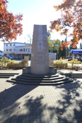
- The South Burnaby Cenotaph is located in Bonsor Park at the corner of Nelson Avenue and Imperial Street. The cenotaph commemorates those lost in the First World War, Second World War and the Korean War.
- Associated Dates
- 1988
- Other Names
- Bonsor Park Cenotaph
- Street View URL
- Google Maps Street View
- Repository
- Burnaby Heritage Planning
- Other Names
- Bonsor Park Cenotaph
- Geographic Access
- Nelson Avenue
- Associated Dates
- 1988
- Description
- The South Burnaby Cenotaph is located in Bonsor Park at the corner of Nelson Avenue and Imperial Street. The cenotaph commemorates those lost in the First World War, Second World War and the Korean War.
- Historic Neighbourhood
- Central Park (Historic Neighbourhood)
- Planning Study Area
- Marlborough Area
- Community
- Burnaby
- Cadastral Identifier
- P.I.D. No. 027-719-375
- Boundaries
- The property (Bonsor Park) is comprised of a single municipally-owned property located at 6749 Nelson Avenue.
- Area
- 3570.00
- Contributing Resource
- Landscape Feature
- Structure
- Ownership
- Public (local)
- Street Address
- 6749 Nelson Avenue
- Street View URL
- Google Maps Street View
Images
St. John the Divine Anglican Church
https://search.heritageburnaby.ca/link/landmark514
- Repository
- Burnaby Heritage Planning
- Description
- St. John the Divine Anglican Church is a landmark wood-frame Gothic Revival church, with Gothic windows and spire. It is located on Kingsway, one of Burnaby’s main commercial thoroughfares, near the SkyTrain transit line and across the street from Central Park.
- Associated Dates
- 1905
- Formal Recognition
- Community Heritage Register
- Street View URL
- Google Maps Street View
- Repository
- Burnaby Heritage Planning
- Geographic Access
- Kingsway
- Associated Dates
- 1905
- Formal Recognition
- Community Heritage Register
- Enactment Type
- Council Resolution
- Enactment Date
- 09/06/2003
- Description
- St. John the Divine Anglican Church is a landmark wood-frame Gothic Revival church, with Gothic windows and spire. It is located on Kingsway, one of Burnaby’s main commercial thoroughfares, near the SkyTrain transit line and across the street from Central Park.
- Heritage Value
- St. John the Divine Anglican Church is valued as a symbol of the traditions of early Burnaby pioneers and as the oldest surviving church building in the city. Established in 1899, St. John was the first church in the community and was located at a prominent intersection of the old Vancouver-Westminster Road (now Kingsway) and the British Columbia Electric Railway’s interurban station at Central Park. This prominent intersection of the road and rail developed as the town centre of the Central Park district. The first St. John church was destroyed by fire, and was rebuilt at the same location in 1904-05. This church is additionally significant for its association with prominent local architect Joseph Henry Bowman (1864-1943) who emigrated from England in 1888. Bowman was a member of the parish, and designed both the first church and its subsequent replacement. Bowman’s prolific career embraced many stylistic changes and technological advances, and this church is a surviving example of one of his rare religious commissions. The design of the new church's nave and vestry was based on the Gothic Revival style of Christ Church Anglican in Surrey, B.C., which had been the former church of St. John’s incumbent Rev. William Bell. Evolving over time as the congregation grew, the church received a number of early additions, and in 1953 was substantially renovated and enlarged through a new design by Vancouver architect Ross Lort. The original church nave was separated from the tower and turned to allow for a large addition. The congregation relocated to a new church in 1998, and at that time removed the church's memorial windows, leaving behind a number of the original art glass windows installed in the 1920s. The church building was renovated in 2004-05, and surviving original elements were retained and restored, including of the original church tower and interior chancel ceiling. A valued feature of the building is the original cast iron church bell that remains in the tower. It was purchased by the children of the congregation in 1912, and in 1924 was rededicated on Armistice Day as a memorial to Burnaby resident Lt. James Donald McRae Reid, who died in the First World War.
- Defining Elements
- Key elements that define the heritage character of St. John the Divine Anglican Church include its: - location on the north side of Kingsway, opposite Central Park - ecclesiastical form, scale and massing as expressed by the offset tower and tall, gabled roof - tower with its original horizontal wooden drop siding, bellcast square roof with octagonal drum above and bellcast octagonal spire - cedar shingle roof cladding - metal cross at peak of spire - Gothic Revival details such as: Gothic lancet windows with leaded stained glass panels; Gothic entrance door at the base of the tower; pointed-arch louvers in the tower; and exterior gable end scissor-trusses - interior features such as wooden scissor-trusses with diagonal fir tongue and groove panelling on the ceiling above, fir tongue-and-groove panelling on the wall of the nave, and original cedar and fir pews and altar rails - cast iron bell in tower
- Historic Neighbourhood
- Central Park (Historic Neighbourhood)
- Planning Study Area
- Garden Village Area
- Architect
- Joesph Henry Bowman
- Function
- Primary Historic--Place of Worship
- Primary Current--Place of Worship
- Community
- Burnaby
- Cadastral Identifier
- 003-398-871
- Boundaries
- St. John the Divine Anglican Church is comprised of a single institutional lot located at 3891 Kingway, Burnaby.
- Area
- 3486.66
- Contributing Resource
- Building
- Ownership
- Private
- Street Address
- 3891 Kingsway
- Street View URL
- Google Maps Street View
Images
Swangard Stadium
https://search.heritageburnaby.ca/link/landmark818
- Repository
- Burnaby Heritage Planning
- Geographic Access
- Imperial Street
- Associated Dates
- 1969
- Heritage Value
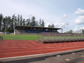
- On 26 April 1969 Swangard Stadium held its official opening. Named after Vancouver Sun former Managing Editor, Erwin Swangard, the stadium was funded entirely from private donations and civic and provincial grants.
- Historic Neighbourhood
- Central Park (Historic Neighbourhood)
- Planning Study Area
- Maywood Area
- Street Address
- 3883 Imperial Street
Images
Thomas & Ellen Sanderson Residence
https://search.heritageburnaby.ca/link/landmark644
- Repository
- Burnaby Heritage Planning
- Description
- Residential building.
- Associated Dates
- 1905
- Street View URL
- Google Maps Street View
- Repository
- Burnaby Heritage Planning
- Geographic Access
- Inman Avenue
- Associated Dates
- 1905
- Description
- Residential building.
- Heritage Value
- The Sandersons were pioneer settlers in the Central Park area, arriving in Burnaby in 1904. Thomas Sanderson (1878-1936) was born in Morningside, Scotland and immigrated to British Columbia in 1899. In Vancouver in 1903, he married Ellen Jane Garvin (1883-1965), a native of Sherbrooke, Quebec. Thomas was chief of the Accounting Department at Hastings Mill, and served as Reeve of Burnaby in 1919 and 1920. One of his sons, Thomas, was a long-time teacher in Burnaby. The Sandersons’ house was built in 1905 as a small Edwardian bungalow but was extensively remodelled in the 1920s and is a fine example of the Craftsman style and today remains in good condition. Typical of the Late Craftsman style, the house has a front gabled roof, triangular eave brackets, tapered window surrounds and a mix of textural finishes, including shingles and lapped siding.
- Locality
- Central Park
- Historic Neighbourhood
- Central Park (Historic Neighbourhood)
- Planning Study Area
- Garden Village Area
- Area
- 884.53
- Contributing Resource
- Building
- Ownership
- Private
- Street Address
- 5457 Inman Avenue
- Street View URL
- Google Maps Street View
Images
Vancouver Road (Kingsway)
https://search.heritageburnaby.ca/link/landmark729
- Repository
- Burnaby Heritage Planning
- Associated Dates
- 1860
- Heritage Value
- The street we know as Kingsway is one of the legacies of the Royal Engineers' military defences for New Westminster. The fear of an American attack prompted the construction of the False Creek trail - later known as Vancouver Road and now Kingsway - in 1860 to connect the capital city to the ice-free salt water harbour at English Bay.
- Historic Neighbourhood
- Central Park (Historic Neighbourhood)
- Edmonds (Historic Neighbourhood)
- Planning Study Area
- Maywood Area
- Marlborough Area
- Windsor Area
- Kingsway-Beresford Area
- Stride Avenue Area
- Edmonds Area
Images
West Burnaby School (aka Kingsway West School)
https://search.heritageburnaby.ca/link/landmark727
- Repository
- Burnaby Heritage Planning
- Geographic Access
- Kingsway
- Associated Dates
- 1896
- Heritage Value
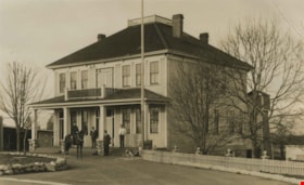
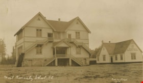
- West Burnaby School was to be Burnaby's second public school and it served the children who lived along the tram line and Vancouver Road (Kingsway).
- Historic Neighbourhood
- Central Park (Historic Neighbourhood)
- Planning Study Area
- Maywood Area
- Street View URL
- Google Maps Street View
Images
William Wilson House
https://search.heritageburnaby.ca/link/landmark512
- Repository
- Burnaby Heritage Planning
- Description
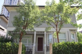
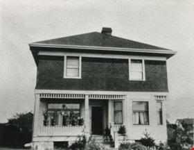
- The William Wilson House is a vernacular two-storey wood-frame Foursquare house with a hipped roof. It is situated at the corner of Wilson Avenue and Central Boulevard in the Metrotown area of Burnaby, adjacent to the SkyTrain line, and is now part of a multi-family residential complex.
- Associated Dates
- 1913
- Formal Recognition
- Heritage Designation, Community Heritage Register
- Other Names
- William & Annie Wilson House
- Street View URL
- Google Maps Street View
- Repository
- Burnaby Heritage Planning
- Other Names
- William & Annie Wilson House
- Geographic Access
- Wilson Avenue
- Associated Dates
- 1913
- Formal Recognition
- Heritage Designation, Community Heritage Register
- Enactment Type
- Bylaw No. 10350
- Enactment Date
- 22/04/1996
- Description
- The William Wilson House is a vernacular two-storey wood-frame Foursquare house with a hipped roof. It is situated at the corner of Wilson Avenue and Central Boulevard in the Metrotown area of Burnaby, adjacent to the SkyTrain line, and is now part of a multi-family residential complex.
- Heritage Value
- The house is valued as the residence of William Wilson (1860-1935) and Annie Wilson (1868-1966) and demonstrates the development of Burnaby from a rural, farming community to an early commuter suburb, and is one of the few remaining early houses in the Metrotown area of Burnaby. Reflecting the area's early history, it was constructed on a subdivided piece of the Wilson’s 3.2 hectare farm that once bordered Kingsway, the primary road linking New Westminster to Vancouver. To develop his subdivided property, Wilson constructed a bisecting street, named it for himself and situated his new home on a large parcel adjacent to the interurban tramline. Constructed in 1913, the William Wilson House is additionally valued as a modest vernacular example of an Edwardian era Foursquare house. Although simple in form, it is distinguished by an inset front verandah, front bay window and clipped ground level corner. Once commonly found in Burnaby, this is a rare surviving example of the homes typically constructed for the working-class families enticed to Burnaby as a consequence of the interurban tramline.
- Defining Elements
- Key elements that define the heritage character of William Wilson House include its: - corner location, adjacent to the old interurban alignment - vernacular Foursquare style as exemplified by its symmetrical form, square floor plan and cubic massing with pyramidal roof - cladding, with narrow lapped wooden siding on the first storey and cedar shingles on the second storey - recessed front verandah, with square columns and ground floor cut-away bay window - regular fenestration, including double-hung 1-over-1 wooden-sash windows, and casement and transom assembly feature window in the living room
- Historic Neighbourhood
- Central Park (Historic Neighbourhood)
- Planning Study Area
- Maywood Area
- Function
- Primary Historic--Single Dwelling
- Primary Current--Single Dwelling
- Community
- Burnaby
- Cadastral Identifier
- 023-352-701
- Boundaries
- The William Wilson House is comprised of a single residential lot located at 6088 Wilson Avenue, Burnaby.
- Area
- 2824.9
- Contributing Resource
- Building
- Ownership
- Private
- Street Address
- 6088 Wilson Avenue
- Street View URL
- Google Maps Street View
Images
1st Div 1907 West Burnaby School
https://search.heritageburnaby.ca/link/museumdescription2939
- Repository
- Burnaby Village Museum
- Date
- [1907]
- Collection/Fonds
- Burnaby Village Museum Photograph collection
- Description Level
- Item
- Physical Description
- 1 photograph : b&w ; 13 x 8.2 cm
- Scope and Content
- Photograph of the First Division class for 1907 at West Burnaby School (later renamed Kingsway West School). There are two rows of students standing and one row of seated students. there is a male teacher standing on the left side of the group just beside a bicycle that is leaning against the build…
- Repository
- Burnaby Village Museum
- Collection/Fonds
- Burnaby Village Museum Photograph collection
- Description Level
- Item
- Physical Description
- 1 photograph : b&w ; 13 x 8.2 cm
- Material Details
- Handwritten in the photograph is "1st Div 1907 / West Burnaby School". The reverse side of the photograph is printed in a postcard format.
- Scope and Content
- Photograph of the First Division class for 1907 at West Burnaby School (later renamed Kingsway West School). There are two rows of students standing and one row of seated students. there is a male teacher standing on the left side of the group just beside a bicycle that is leaning against the building.
- Subjects
- Occupations - Teachers
- Persons - Students
- Names
- Kingsway West School
- Geographic Access
- Kingsway
- Street Address
- 4800 Kingsway
- Accession Code
- BV012.20.2
- Access Restriction
- No restrictions
- Reproduction Restriction
- No known restrictions
- Date
- [1907]
- Media Type
- Photograph
- Historic Neighbourhood
- Central Park (Historic Neighbourhood)
- Planning Study Area
- Maywood Area
- Scan Resolution
- 600
- Scan Date
- 13-Mar-2018
- Notes
- Title based on contents of photograph







![Gilley Brothers Logging team, [1895]. . thumbnail](/media/hpo/_Data/_Archives_Images/_Unrestricted/371/461-003.jpg?width=280)
![1st Div 1907 West Burnaby School, [1907] thumbnail](/media/hpo/_Data/_BVM_Images/2012/2012_0020_0002_001.jpg?width=280)